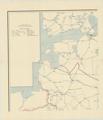
4821. Karta Evropejszkoj Roszszii. [B XI c 2]
Institute and Museum of Military History •
B XI c
•
B XI Oroszország
•
B I–XV. Európa
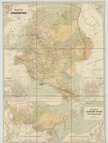
| Title | Karta Evropejszkoj Roszszii. |
| Main title | 3 mt.: 1. Plan Sz. Peterburga. (Szentpétervár, Leningrád.) 2. Plan Moszkvü. (Moszkva) 3. Karta Azijatszkoj Roszszii i Roszszijszko–Amerikanszkih vladenij. (Ázsiai Oroszország, orosz–amerikai területek.)Az Európai Oroszország általános térképe 1868-ban. |
4822. Karta zseleznüh dorog Evropejszkoj Roszszii. [B XI c 3]
Institute and Museum of Military History •
B XI c
•
B XI Oroszország
•
B I–XV. Európa
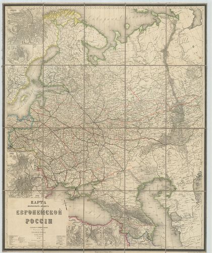
| Title | Karta zseleznüh dorog Evropejszkoj Roszszii. |
| Main title | 7 mt.: 1. Sz. Peterburg. (Szentpétervár-Leningrád). 2. Odessza. 3. Varsava (Varsó). 4. Moszkva. 5. Riga. 6. Gelszingforsz (Helsinki). 7. Kiev (Kijev.) |
| Subject | Európai Oroszország vasúttérképe 1871-ben. |
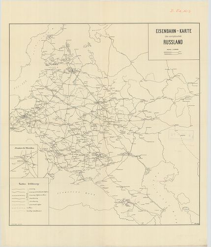
4823. Eisenbahn-Karte des europäischen Russland. [B XI c 4]
Institute and Museum of Military History •
B XI c
•
B XI Oroszország
•
B I–XV. Európa
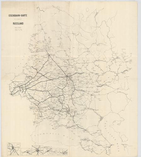
| Title | Eisenbahn-Karte des europäischen Russland. |
| Main title | 6 mt.: [vasúti csomópontokról.] 1. Szent-Pétervár. (Leningrád). 2. Riga. 3. Moszkva. 4. Varsó. 5. Novgorod. 6. Kattowitz (Katowice környéke.)Az Európai Oroszország vasúttérképe 1910 körül. |
4824. Russland. [B XI c 5]
Institute and Museum of Military History •
B XI c
•
B XI Oroszország
•
B I–XV. Európa
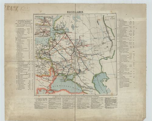
| Title | Russland. |
| Main title | 2 mt.: 1. Umgegend v. St. Petersburg (Szentpétervár - Leningrád és környéke). 2. Umgegend von Moskau. (Moszkva környéke.)Oroszország földrajzi áttekintése, valamint a vasútvonalak hossza 1872-ben. |
4825. Karta zseleznüh dorog pocst, telegrafovi parahodnüh szoobscs... [B XI c 6]
Institute and Museum of Military History •
B XI c
•
B XI Oroszország
•
B I–XV. Európa
| Title | Karta zseleznüh dorog pocst, telegrafovi parahodnüh szoobscsenij Roszszijszkoj Imperii. |
| Main title | 4 mt.: 1. Gubernii carsztva Polszkago. (Cári Lengyelország kormányzóság) 2. Okresznoszti Moszkvü (Moszkva környéke.) 3. Okresznoszti Sz. Peterburga. (Szentpétervár - Leningrád környéke.) 4. Azijatszkaja Roszszija Szibir i Turkesztanszkij kraj. (Ázsiai Oroszország, Szibéria és Turkesztán.)Az Orosz Birodalom közlekedési, posta, telefon, hajózási térképe 1874-ben. |
4826. Die Eisenbahnen des Europäischen Russland… Les chemins de fe... [B XI c 7]
Institute and Museum of Military History •
B XI c
•
B XI Oroszország
•
B I–XV. Európa
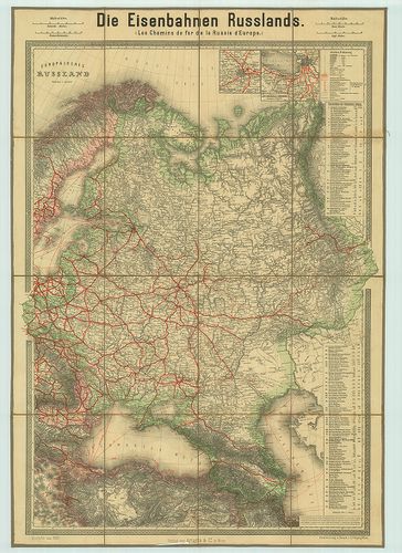
| Title | Die Eisenbahnen des Europäischen Russland… Les chemins de fer de la Russie d’Europe… Europäisches Russland. |
| Main title | 2 mt.: 1. Moskau m. Umgebung. (Moszkva környéke.) 2. S. Petersburg mit Umgebung. (Szentpétervár - Leningrád környéke.) táblázat a vasútvonalak hosszáról.Európai Oroszország vasúthálózat-térképe 1887-ben. |
4827. Die Eisenbahnen des europäisches Russland. [B XI c 8]
Institute and Museum of Military History •
B XI c
•
B XI Oroszország
•
B I–XV. Európa

| Title | Die Eisenbahnen des europäisches Russland. |
| Main title | Mt.: Militär Geographie Nord-östlicher Krigsschauplatz. (Az Észak-keleti hadszíntér katonaföldrajza.) |
| Subject | Európai Oroszország vasúttérképe 1912–13-ban. |
4828. Die Eisenbahnen des europäischen Russland… Les chemins de fe... [B XI c 10]
Institute and Museum of Military History •
B XI c
•
B XI Oroszország
•
B I–XV. Európa

| Title | Die Eisenbahnen des europäischen Russland… Les chemins de fer de la Russie d’Europe… Europäisches Russland. |
| Main title | 2 mt.: 1. S. Peterburg m. Umgebung. (Szentpétervár - Leningrád környéke.) 2. Moskau m. Umgebung (Moszkva környéke). Táblázat a vasútvonalak megkeresésére. |
| Subject | Az Európai Oroszország vasúthálózata 1913-ban. |
4829. Karta zseleznüh soszszejnüh i vodnüh putej szoobscsenija evr... [B XI c 11]
Institute and Museum of Military History •
B XI c
•
B XI Oroszország
•
B I–XV. Európa
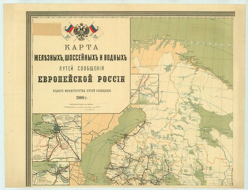
| Title | Karta zseleznüh soszszejnüh i vodnüh putej szoobscsenija evropejszkoj Roszszii. |
| Main title | 10 mt.: 1. [Szentpétervár (Leningrád)]. 2. [Riga.] 3. [Novgorod.] 4. [Lengelország vasúthálózata.] 5. [Bendin.] 6. [Varsó.] 7. [Taganrog környékének vízi és vasútvonalai.] 8. Karta Azijatszkoj Roszszii. (Ázsiai Oroszország térképe.) 9. Csaszt Ob-Eniszejszkago vodnago puti. (Egy rész az Ob-Jeniszej vízi útjairól.) 10. [Moszkva vasútállomásai.]Európai Oroszország közlekedési térképe a vasútvonalak, országutak és víziutak feltüntetésével. |
4830. Eisenbahn-Karte von Russland. [B XI c 12/3]
Institute and Museum of Military History •
B XI c
•
B XI Oroszország
•
B I–XV. Európa
| Title | Eisenbahn-Karte von Russland. |
| Main title | Európai Oroszország (SzU) nyugati része vasútvonalainak térképe 1895-ben. |
4831. [Európai Oroszország vasútvonalai.] [B XI c 13/1]
Institute and Museum of Military History •
B XI c
•
B XI Oroszország
•
B I–XV. Európa
| Title | [Európai Oroszország vasútvonalai.] |
| Main title | Mt.: Kaukasus. |
4832. Eisenbahn-Karte des europäischen Russland. [B XI c 14/3]
Institute and Museum of Military History •
B XI c
•
B XI Oroszország
•
B I–XV. Európa
| Title | Eisenbahn-Karte des europäischen Russland. |
| Main title | Mt.: Situation bei Warschau. (Varsó vasútvonalai)Európai Oroszország vasúti térképe 1910 körül. |
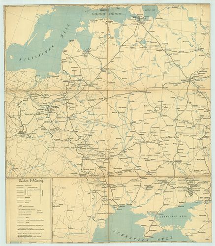
4833. Generalkarte von West-Russland und den angrenzenden Ländern ... [B XI c 15]
Institute and Museum of Military History •
B XI c
•
B XI Oroszország
•
B I–XV. Európa
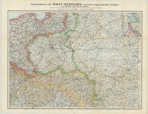
| Title | Generalkarte von West-Russland und den angrenzenden Ländern bis Wien und Budapest mit besonderer Berücksichtigung der Eisenbahnen und mit Angabe der russischen Stationen. |
| Main title | Mt.: St. Petersburg. (Szentpétervár-Leningrád.)Oroszország nyugati részének és a szomszédos országok vasúthálózata. |
4834. Voenno-dorozsnaja karta csaszti Roszszii i pogranicsnüh zeme... [B XI c 16]
Institute and Museum of Military History •
B XI c
•
B XI Oroszország
•
B I–XV. Európa
| Title | Voenno-dorozsnaja karta csaszti Roszszii i pogranicsnüh zemel. |
| Main title | Oroszország katonai, úti és közigazgatási térképe és határai 1844-ben. |
| Subject | Kriegsstrassen Karte eines Theiles von Russland und der Angraenzenden Laender. |
4835. Karte des Europäischen Russlands und der Angrenzenden Länder... [B XI c 20]
Institute and Museum of Military History •
B XI c
•
B XI Oroszország
•
B I–XV. Európa
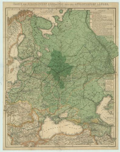
| Title | Karte des Europäischen Russlands und der Angrenzenden Länder mit genauer bezeihnung der Strassen und angabe einiger Historisch-Physikalisch-Geographischen Hauptmomente. |
| Main title | Európai Oroszország történelmi és hegyvízrajzi térképe a fontosabb útvonalak feltüntetésével. |
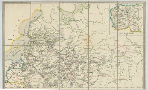
4836. Dorozsnaja karta gubernij Carsztva Polszkago. [B XI c 22]
Institute and Museum of Military History •
B XI c
•
B XI Oroszország
•
B I–XV. Európa
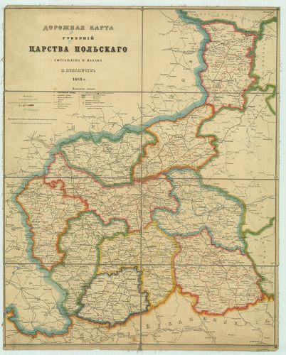
| Title | Dorozsnaja karta gubernij Carsztva Polszkago. |
| Main title | A cári lengyel kormányzóság útitérképe a közigazgatási határok feltüntetésével 1868-ban. |
4837. Voenno-dorozsnaja karta Evropejszkoj Roszszii. [B XI c 23]
Institute and Museum of Military History •
B XI c
•
B XI Oroszország
•
B I–XV. Európa
| Title | Voenno-dorozsnaja karta Evropejszkoj Roszszii. |
| Main title | Mt.: Voenno dorozsnaja karta Sz. Peterburgszkago raiona. (Hadiutak Szentpétervártól).Európai Oroszország hadi útvonalai 1867-ben. |
4838. Voenno-dorozsnaja karta Evropejszkoj Roszszii. [B XI c 23/13]
Institute and Museum of Military History •
B XI c
•
B XI Oroszország
•
B I–XV. Európa
| Title | Voenno-dorozsnaja karta Evropejszkoj Roszszii. |
| Main title | Európai Oroszország hadi útvonalai 1888-ban. |
4839. Post Karte von der Halbinsel Taurien oder Krim. [B XI c 26]
Institute and Museum of Military History •
B XI c
•
B XI Oroszország
•
B I–XV. Európa
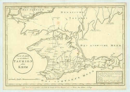
| Title | Post Karte von der Halbinsel Taurien oder Krim. |
| Main title | A Krím-félsziget postaúttérképe 1800 körül. |
4840. Carte de la partie européenne de l’Empire de Russie… [B XI c 27]
Institute and Museum of Military History •
B XI c
•
B XI Oroszország
•
B I–XV. Európa
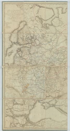
| Title | Carte de la partie européenne de l’Empire de Russie… |
| Main title | Európai Oroszország kormányzósági, járási és vámhatárai 1809-ben. |