4841. Ravensteins Kriegskarte. No 6. Russisches Grenzgebiet gegen ... [B XI c 77]
Institute and Museum of Military History •
B XI c
•
B XI Oroszország
•
B I–XV. Európa

| Title | Ravensteins Kriegskarte. No 6. Russisches Grenzgebiet gegen Ost-Preussen. |
| Main title | Kelet-Poroszországgal szomszédos orosz határvidék térképe. |
4842. Karte der Deutsch-Russischen Grenzlande. [B XI c 78]
Institute and Museum of Military History •
B XI c
•
B XI Oroszország
•
B I–XV. Európa
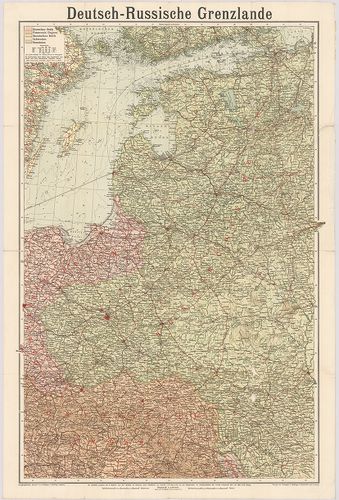
| Title | Karte der Deutsch-Russischen Grenzlande. |
| Main title | A német–orosz határvidék közigazgatási térképe. |
4843. Deutsch–Österreichisch–Russische Grenzlande. [B XI c 78/1]
Institute and Museum of Military History •
B XI c
•
B XI Oroszország
•
B I–XV. Európa

| Title | Deutsch–Österreichisch–Russische Grenzlande. |
| Main title | Mt.: [Lengyelország három felosztása 1772, 1793, 1795.]A német–osztrák–orosz határvidék közigazgatási térképe. |
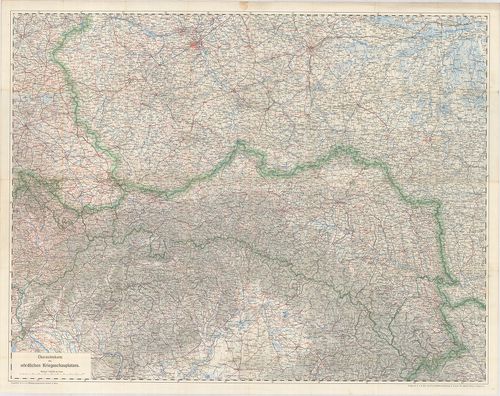
4844. Übersichtskarte des russischen Kriegsschauplatzes. [B XI c 80]
Institute and Museum of Military History •
B XI c
•
B XI Oroszország
•
B I–XV. Európa

| Title | Übersichtskarte des russischen Kriegsschauplatzes. |
| Main title | Az orosz hadszíntér áttekintő térképe. |
4845. Oberkommando Grenzschutz Nord. [B XI c 81]
Institute and Museum of Military History •
B XI c
•
B XI Oroszország
•
B I–XV. Európa
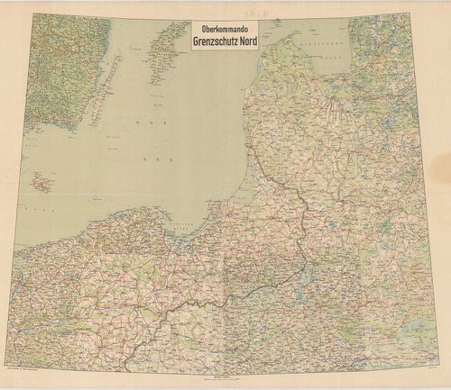
| Title | Oberkommando Grenzschutz Nord. |
| Main title | A Keleti-tenger partvidékének térképe 1919-ben. |
4846. Neue Generalkarte des österr,–ungar,–russischen Kriegsschaup... [B XI c 82]
Institute and Museum of Military History •
B XI c
•
B XI Oroszország
•
B I–XV. Európa
| Title | Neue Generalkarte des österr,–ungar,–russischen Kriegsschauplatzes Bessarabien. Lechners Kriegskarten XXI. |
| Main title | Kelet-Galícia és Besszarábia általános térképe 1916-ban. |
4847. Neue Generalkarte des österr,–ungar,–russischen Kriegsschaup... [B XI c 83]
Institute and Museum of Military History •
B XI c
•
B XI Oroszország
•
B I–XV. Európa

| Title | Neue Generalkarte des österr,–ungar,–russischen Kriegsschauplatzes Wolhynien. Lechners Kriegskarten XXII. |
| Main title | A volhíniai hadszíntér részletes térképe 1916-ban. |
4848. G. Freytags Karte des Westrussischen Kriegsschauplätze. [B XI c 85]
Institute and Museum of Military History •
B XI c
•
B XI Oroszország
•
B I–XV. Európa

| Title | G. Freytags Karte des Westrussischen Kriegsschauplätze. |
| Main title | A Nyugat-Oroszországi hadszíntér térképe. |
4849. [Lengyelország, Galícia tágabb környékének térképe.] [B XI c 85/1]
Institute and Museum of Military History •
B XI c
•
B XI Oroszország
•
B I–XV. Európa

| Title | [Lengyelország, Galícia tágabb környékének térképe.] |
4850. Übersichtskarte des österr,–ungar,–russischen Kriegsschaupla... [B XI c 85/2]
Institute and Museum of Military History •
B XI c
•
B XI Oroszország
•
B I–XV. Európa
| Title | Übersichtskarte des österr,–ungar,–russischen Kriegsschauplatzes. Lechners Kriegskarten III. – Übersichtskarte des nördlichen Kriegsschauplatzes. |
| Main title | Az osztrák–magyar–orosz északi hadszíntér részletes térképe. |
4851. Das Russische Kriegsgebiet zwischen Ostsee und Schwarzem Mee... [B XI c 86]
Institute and Museum of Military History •
B XI c
•
B XI Oroszország
•
B I–XV. Európa

| Title | Das Russische Kriegsgebiet zwischen Ostsee und Schwarzem Meer. Flemmings Kriegskarte. Nr. 17. |
| Main title | Az oroszországi hadszíntér a Fekete-tenger és Keleti-tenger közötti része az első világháború idején, Lengyelország 3. felosztásának feltüntetésével. |
4852. Übersichtskarte des russischen Kriegsschauplatzes. Westliche... [B XI c 87]
Institute and Museum of Military History •
B XI c
•
B XI Oroszország
•
B I–XV. Európa

| Title | Übersichtskarte des russischen Kriegsschauplatzes. Westliches Blatt. |
| Main title | Az orosz hadszíntér nyugati részének áttekintő térképe 1914-ben. |
4853. Übersichtskarte des russischen Kriegsschauplatzes. Östliches... [B XI c 87/1]
Institute and Museum of Military History •
B XI c
•
B XI Oroszország
•
B I–XV. Európa

| Title | Übersichtskarte des russischen Kriegsschauplatzes. Östliches Blatt. |
| Main title | Lechner’s Kriegskarte V. |
| Subject | Az orosz hadszíntér keleti részének áttekintő térképe 1914-ben. |
4854. Kriegskarte für das Westliche Russland mit den angrenzenden ... [B XI c 89]
Institute and Museum of Military History •
B XI c
•
B XI Oroszország
•
B I–XV. Európa

| Title | Kriegskarte für das Westliche Russland mit den angrenzenden Teilen von Deutschland und Österreich–Ungarn. |
| Main title | Nyugat-Oroszország és a szomszédos Németország és Ausztria–Magyarország területének politikai térképe 1910 körül. |
4855. Az orosz háború térképe. [B XI c 90]
Institute and Museum of Military History •
B XI c
•
B XI Oroszország
•
B I–XV. Európa
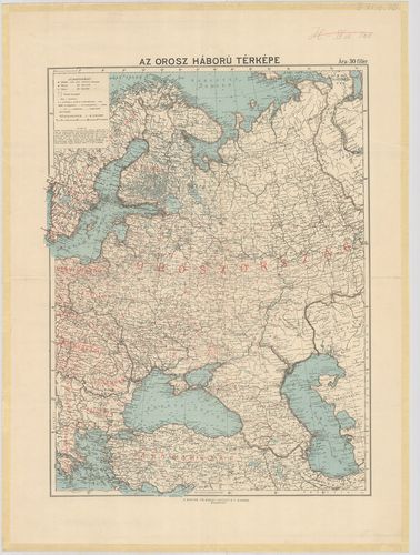
| Title | Az orosz háború térképe. |
4856. Tula. B 5. [B XI c 92]
Institute and Museum of Military History •
B XI c
•
B XI Oroszország
•
B I–XV. Európa
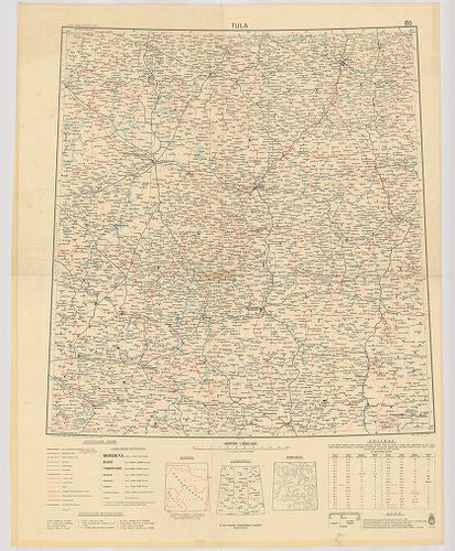
| Title | Tula. B 5. |
| Main title | Tula és környékének térképe 1942-ben. |
4857. Voronyezs. B 6. [B XI c 93]
Institute and Museum of Military History •
B XI c
•
B XI Oroszország
•
B I–XV. Európa

| Title | Voronyezs. B 6. |
| Main title | Voronyezs és környékének térképe 1942-ben. |
4858. Kujbisev és környékének térképe 1943-ban. [B XI c 94]
Institute and Museum of Military History •
B XI c
•
B XI Oroszország
•
B I–XV. Európa

| Title | Kujbisev és környékének térképe 1943-ban. |
4859. Rosztov. C. 6. [B XI c 95]
Institute and Museum of Military History •
B XI c
•
B XI Oroszország
•
B I–XV. Európa

| Title | Rosztov. C. 6. |
| Main title | Rosztov és környékének térképe 1942-ben. |
4860. Kamisin. C 7. [B XI c 96]
Institute and Museum of Military History •
B XI c
•
B XI Oroszország
•
B I–XV. Európa

| Title | Kamisin. C 7. |
| Main title | Kamisin és környékének térképe 1943-ban. |