4941. Ucsebnaja Karta. [B XI c 326]
Institute and Museum of Military History •
B XI c
•
B XI Oroszország
•
B I–XV. Európa
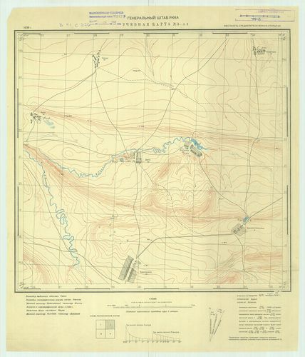
| Title | Ucsebnaja Karta. |
| Main title | Oktatótérkép. |
4942. Krím úthálózati térkép. [54.sz.] [B XI c 332]
Institute and Museum of Military History •
B XI c
•
B XI Oroszország
•
B I–XV. Európa
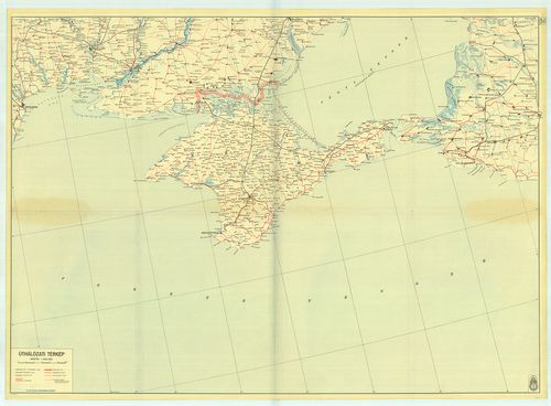
| Title | Krím úthálózati térkép. [54.sz.] |
4943. Dislokation der russischen Armee april 1903. [B XI c 337]
Institute and Museum of Military History •
B XI c
•
B XI Oroszország
•
B I–XV. Európa
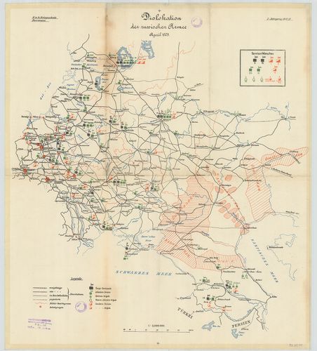
| Title | Dislokation der russischen Armee april 1903. |
| Main title | Az európai orosz haderő diszlokációja 1903-ban. |
4944. [Az orosz, lengyel sereg ideiglenes határral.](Ideiglenes ha... [B XI c 338]
Institute and Museum of Military History •
B XI c
•
B XI Oroszország
•
B I–XV. Európa
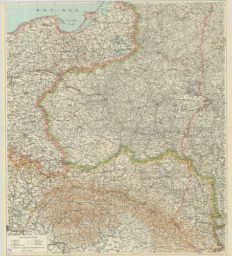
| Title | [Az orosz, lengyel sereg ideiglenes határral.](Ideiglenes határelképzelés rányomtatva). |
4945. Operationen auf dem Polisch-Ukrainischen Kriegschauplatz. [B XI c 339]
Institute and Museum of Military History •
B XI c
•
B XI Oroszország
•
B I–XV. Európa
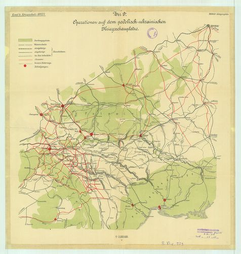
| Title | Operationen auf dem Polisch-Ukrainischen Kriegschauplatz. |
| Main title | A lengyel-ukrán hadszíntér. |
4946. Operationen aus Nordost-Galizien nach Wolhgnien. [B XI c 340]
Institute and Museum of Military History •
B XI c
•
B XI Oroszország
•
B I–XV. Európa
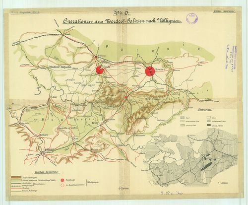
| Title | Operationen aus Nordost-Galizien nach Wolhgnien. |
| Main title | ÉK-Galicia és Volkinia katonaföldrajzi vázlata |
4947. Europaischen Russland mit Angabe der Internierungsorte und D... [B XI c 343]
Institute and Museum of Military History •
B XI c
•
B XI Oroszország
•
B I–XV. Európa
| Title | Europaischen Russland mit Angabe der Internierungsorte und Durchzugsstationen der Kriegsgefangennen. |
| Main title | Az Európai Oroszország elosztótáborai település szerint. |
4948. Asiatischen Rußland. [B XI c 345]
Institute and Museum of Military History •
B XI c
•
B XI Oroszország
•
B I–XV. Európa
| Title | Asiatischen Rußland. |
| Main title | Melléktérkép: Hadifogolytáborok és elosztóállomások Nyugat-Szibériában, Méretarány-érzékeltető térképrészlet: Monarchia/Deutsches Reich. Oroszország ázsiai része. |
4949. Brest-Litowsk. Gürtelfestung und doppelter Brückenkopf. [B XI c 347]
Institute and Museum of Military History •
B XI c
•
B XI Oroszország
•
B I–XV. Európa
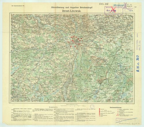
| Title | Brest-Litowsk. Gürtelfestung und doppelter Brückenkopf. |
| Main title | Breszt-Litowsk. Erődöv és kettős hídfő. |
4950. Wolhynische Befestigungsgruppe. [B XI c 348]
Institute and Museum of Military History •
B XI c
•
B XI Oroszország
•
B I–XV. Európa
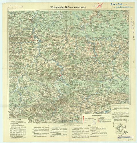
| Title | Wolhynische Befestigungsgruppe. |
| Main title | A Wolhynia-i erődcsoport. |
4951. Befestigter Raum von Warschau. [B XI c 349]
Institute and Museum of Military History •
B XI c
•
B XI Oroszország
•
B I–XV. Európa
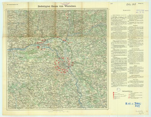
| Title | Befestigter Raum von Warschau. |
| Main title | Erődítések Varsó térségében. |
4952. Kijew. Depotfestung. [B XI c 350]
Institute and Museum of Military History •
B XI c
•
B XI Oroszország
•
B I–XV. Európa
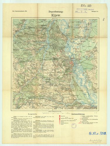
| Title | Kijew. Depotfestung. |
| Main title | Kijev. Raktárerőd. |
4953. Iwangorod. Gürtelfestung und doppelter Brückenkopf. [B XI c 351]
Institute and Museum of Military History •
B XI c
•
B XI Oroszország
•
B I–XV. Európa
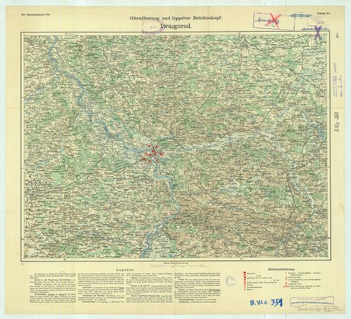
| Title | Iwangorod. Gürtelfestung und doppelter Brückenkopf. |
| Main title | Iwangorod. Erődöv és kettős hídfő. |
4954. Provisorische Operationskarte. [B XI c 352]
Institute and Museum of Military History •
B XI c
•
B XI Oroszország
•
B I–XV. Európa
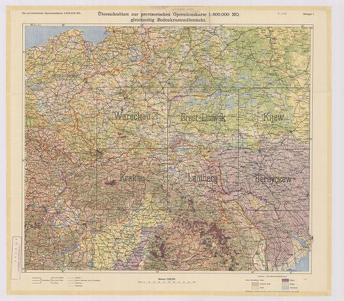
| Title | Provisorische Operationskarte. |
| Main title | 1. Warschau. 2. Brest-Litowsk. 3. Kijew. 4. Krakau. 5. Lemberg. 6. Berdyczew. |
| Subject | Oroszország és Lengyelország hadműveleti térképe, a városok körüli védelmi vonalak, erődítések jelölésével. Az áttekintő szelvényen a talajokat ábrázolják. |
4955. Észak-keleti hadszíntér. [B XI c 353]
Institute and Museum of Military History •
B XI c
•
B XI Oroszország
•
B I–XV. Európa
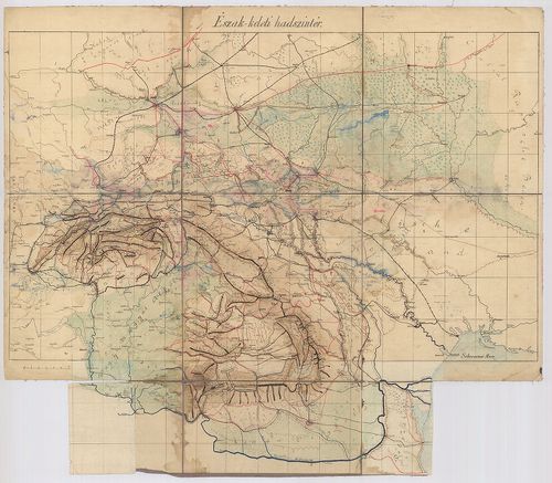
| Title | Észak-keleti hadszíntér. |
4956. Csonka-Magyarország közigazgatási térképe. [B XV a 1]
Institute and Museum of Military History •
B XV a
•
B XV Magyarország (1920 után)
•
B I–XV. Európa
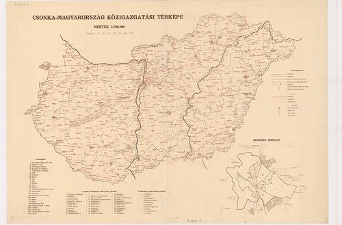
| Title | Csonka-Magyarország közigazgatási térképe. |
| Main title | Mt. Budapest területe, megye- és járáshatárokkal. |
4957. Csonkamagyarország közigazgatási térképe. [B XV a 2]
Institute and Museum of Military History •
B XV a
•
B XV Magyarország (1920 után)
•
B I–XV. Európa
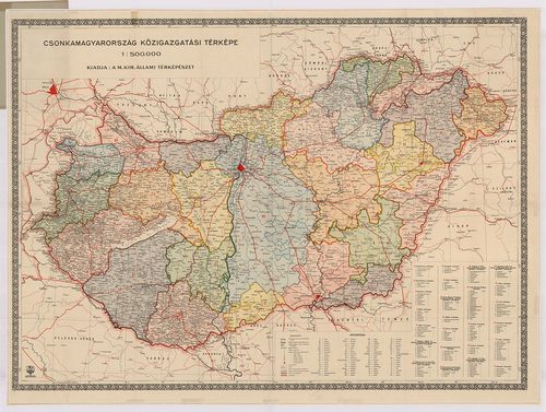
| Title | Csonkamagyarország közigazgatási térképe. |
4958. Csonka-Magyarország közigazgatási térképe. [B XV a 2/1]
Institute and Museum of Military History •
B XV a
•
B XV Magyarország (1920 után)
•
B I–XV. Európa
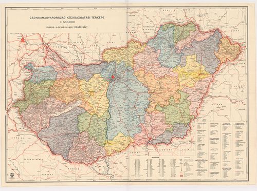
| Title | Csonka-Magyarország közigazgatási térképe. |
4959. Csonka-Magyarország közigazgatási térképe. [B XV a 3]
Institute and Museum of Military History •
B XV a
•
B XV Magyarország (1920 után)
•
B I–XV. Európa
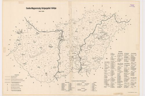
| Title | Csonka-Magyarország közigazgatási térképe. |
4960. Csonkamagyarország közigazgatási térképe. [B XV a 4]
Institute and Museum of Military History •
B XV a
•
B XV Magyarország (1920 után)
•
B I–XV. Európa
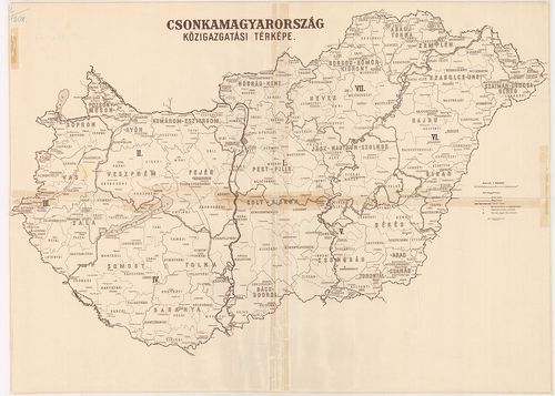
| Title | Csonkamagyarország közigazgatási térképe. |