1101. Coloniensis Archiepiscopatus. [B IV a 56/1]
Institute and Museum of Military History •
B IV a
•
B IV Német birodalom
•
B I–XV. Európa
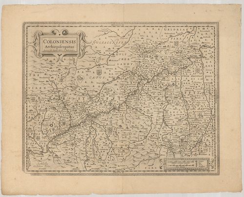
| Title | Coloniensis Archiepiscopatus. |
| Main title | A Kölni Érsekség térképe. |
1102. Landgraviat Thuringiae Tabula Generalis… [B IV a 56/2]
Institute and Museum of Military History •
B IV a
•
B IV Német birodalom
•
B I–XV. Európa
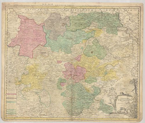
| Title | Landgraviat Thuringiae Tabula Generalis… |
| Main title | Thüringia áttekintő térképe 1729-ben. |
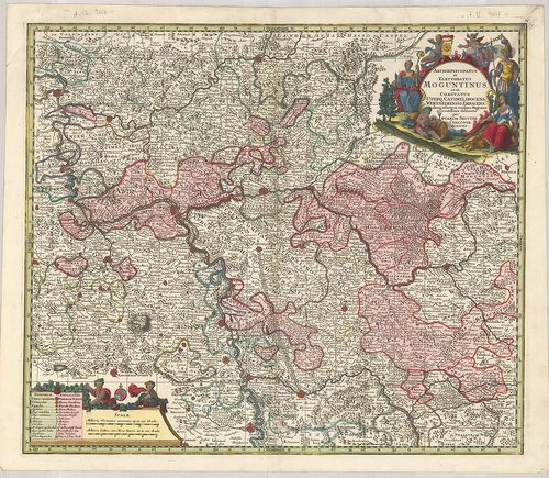
1103. Electoratus Moguntinus ut et Palatin: Infer. Hassiae… [B IV a 56/3]
Institute and Museum of Military History •
B IV a
•
B IV Német birodalom
•
B I–XV. Európa
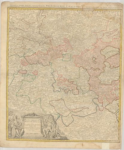
| Title | Electoratus Moguntinus ut et Palatin: Infer. Hassiae… |
| Main title | A Mainzi Választófejedelemség térképe. |
1104. Waldecciae ac Finitimorum Dominiorum Itterani et Cansteinian... [B IV a 56/4]
Institute and Museum of Military History •
B IV a
•
B IV Német birodalom
•
B I–XV. Európa
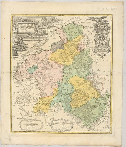
| Title | Waldecciae ac Finitimorum Dominiorum Itterani et Cansteiniani nec non infertae Dioeces is Eimelrodensis accurata Tabula. |
| Main title | A Waldecki Fejedelemség térképe 1733-ban. |
1105. Nouvelle Carte de l’Empire divisé selon ses differents Etats... [B IV a 56/5]
Institute and Museum of Military History •
B IV a
•
B IV Német birodalom
•
B I–XV. Európa
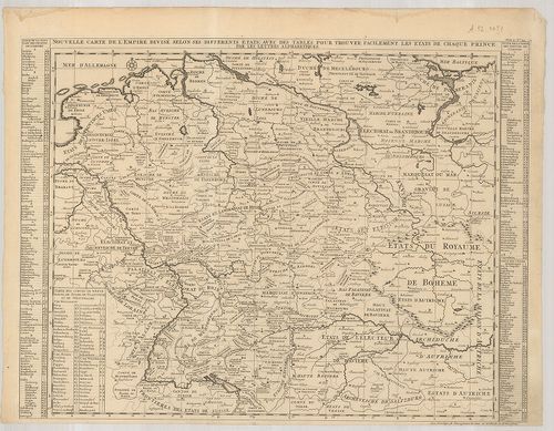
| Title | Nouvelle Carte de l’Empire divisé selon ses differents Etats: … |
| Main title | A Német Birodalom térképe. |
1106. Archiepiscopatus et Electoratus Moguntinus ut et Comitatus U... [B IV a 56/6]
Institute and Museum of Military History •
B IV a
•
B IV Német birodalom
•
B I–XV. Európa
| Title | Archiepiscopatus et Electoratus Moguntinus ut et Comitatus Uterq Catimelibocens… |
| Main title | A Mainzi Érsekség általános térképe 1726-ban. |
1107. Trevirensis Archi-Episcopatus et Electoratus juxta omnes sua... [B IV a 56/7]
Institute and Museum of Military History •
B IV a
•
B IV Német birodalom
•
B I–XV. Európa
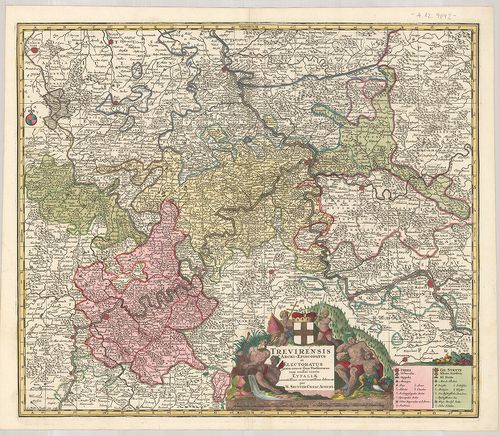
| Title | Trevirensis Archi-Episcopatus et Electoratus juxta omnes suas Praefecturas cum confini tractu Eyfaliae… |
| Main title | A Trieri Érsekség térképe. |
1108. Partie Occidentale du Temporel de l’Archevesché et Eslectora... [B IV a 56/8]
Institute and Museum of Military History •
B IV a
•
B IV Német birodalom
•
B I–XV. Európa
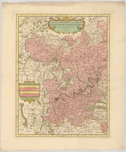
| Title | Partie Occidentale du Temporel de l’Archevesché et Eslectorat, de Treves. |
| Main title | A Trieri Érsekség NY-i részénektérképe. |
1109. Partie Orientale du Temporel, de l’Archevesché et Eslectorat... [B IV a 56/9]
Institute and Museum of Military History •
B IV a
•
B IV Német birodalom
•
B I–XV. Európa

| Title | Partie Orientale du Temporel, de l’Archevesché et Eslectorat de Treves. |
| Main title | A Trieri Érsekség K-i részének általános térképe. |
1110. Ducatus Luneburgici in suas Praefecturas et Vogteyas ad Stat... [B IV a 56/12]
Institute and Museum of Military History •
B IV a
•
B IV Német birodalom
•
B I–XV. Európa
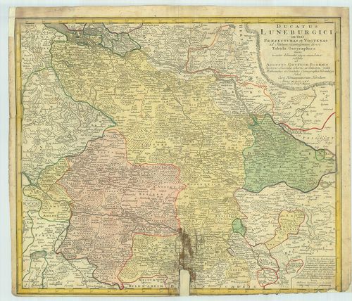
| Title | Ducatus Luneburgici in suas Praefecturas et Vogteyas ad Statum recentissinum divisi Tabula Geographica. |
| Main title | A Lüneburgi Fejedelemség (Lüneburger Heide) térképe 1765-ben. |
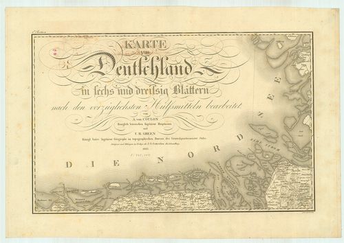
1111. Karte von Deutschland. [B IV a 57]
Institute and Museum of Military History •
B IV a
•
B IV Német birodalom
•
B I–XV. Európa
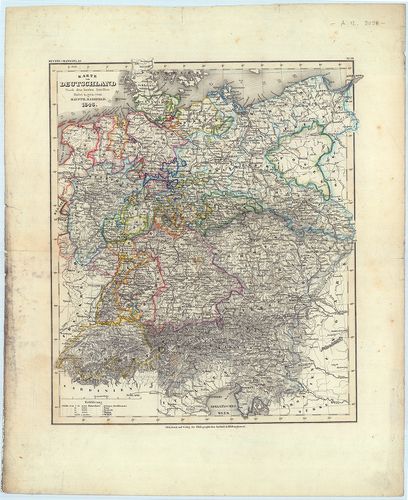
| Title | Karte von Deutschland. |
| Main title | Németország térképe 1848-ban. |
1112. Partie Orientale du Temporal de l’Archevesché et Eslectorat ... [B IV a 57/2]
Institute and Museum of Military History •
B IV a
•
B IV Német birodalom
•
B I–XV. Európa
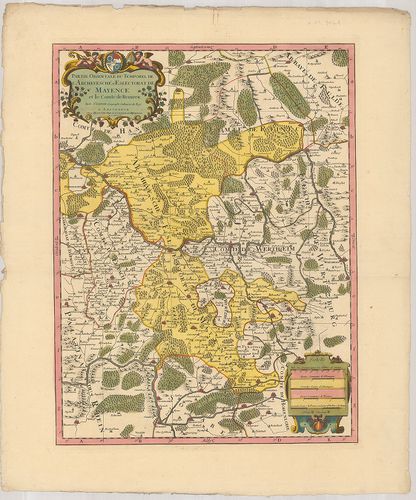
| Title | Partie Orientale du Temporal de l’Archevesché et Eslectorat de Mayence et le Comté de Reineck. |
| Main title | A Mainzi Érsekség keleti részének térképe az 1694-ben. |
1113. Partie Occidentale du Temporel de l’Archevesché et Eslectora... [B IV a 57/3]
Institute and Museum of Military History •
B IV a
•
B IV Német birodalom
•
B I–XV. Európa
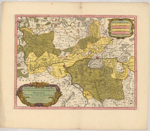
| Title | Partie Occidentale du Temporel de l’Archevesché et Eslectorat de Mayence et le Haut et Bas Comté de Catzenellenboge. |
| Main title | A Mainzi Érsekség nyugati részének térképe 1694-ben. |
1114. Charte das Deutsche Reich… [B IV a 58]
Institute and Museum of Military History •
B IV a
•
B IV Német birodalom
•
B I–XV. Európa
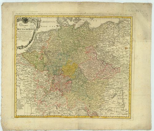
| Title | Charte das Deutsche Reich… |
| Main title | A Német Birodalom térképe 1789-ben. |
1115. Deutsche Nordseeküste. [B IV a 59]
Institute and Museum of Military History •
B IV a
•
B IV Német birodalom
•
B I–XV. Európa
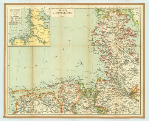
| Title | Deutsche Nordseeküste. |
| Main title | Mt.: Leuchtfeuer an der deutschen Nordseeküste. |
| Subject | (A Német északi-tengeri part világító tornyainak térképe.)A német északi-tengerpart térkép. |
1116. Karte von Deutschland. [B IV a 60]
Institute and Museum of Military History •
B IV a
•
B IV Német birodalom
•
B I–XV. Európa
| Title | Karte von Deutschland. |
| Main title | Németország térképe 1823-ban. |
1117. Karte des Deutschen Reichs. [B IV a 60/1]
Institute and Museum of Military History •
B IV a
•
B IV Német birodalom
•
B I–XV. Európa
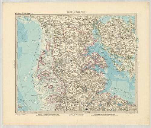
| Title | Karte des Deutschen Reichs. |
| Main title | 1. Titelblatt mit Schrift u. Zeichen Erklärung. |
| Subject | (Cím- és áttek. 1. jelm.) 2. Übersichtsblatt und Zeichener-klärung. (Szelvényhálózat.) |
1118. Deutschland, England und die Nordsee. England: [B IV a 60/2]
Institute and Museum of Military History •
B IV a
•
B IV Német birodalom
•
B I–XV. Európa
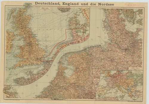
| Title | Deutschland, England und die Nordsee. England: |
| Main title | Deutschland: |
| Subject | Mt.: [Európa úthálózati térképe.] |
1119. Deutsches Reich nebst Deutsch-Österreich und Schweiz. [B IV a 60/4]
Institute and Museum of Military History •
B IV a
•
B IV Német birodalom
•
B I–XV. Európa
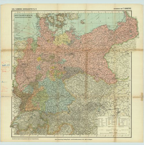
| Title | Deutsches Reich nebst Deutsch-Österreich und Schweiz. |
| Main title | A Német Birodalom, Ausztria, Svájc térképe. |
1120. Allgeimeine Uebersichtskarte für die Beispiele aus der Thäti... [B IV a 63]
Institute and Museum of Military History •
B IV a
•
B IV Német birodalom
•
B I–XV. Európa
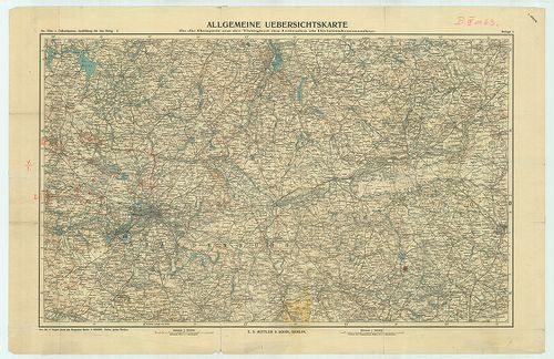
| Title | Allgeimeine Uebersichtskarte für die Beispiele aus der Thätigkeit des Leitenden als Divisionskommandeur. |
| Main title | Németország térképe. |