1181. Nordost-Deutschland. [B IV a 128]
Institute and Museum of Military History •
B IV a
•
B IV Német birodalom
•
B I–XV. Európa
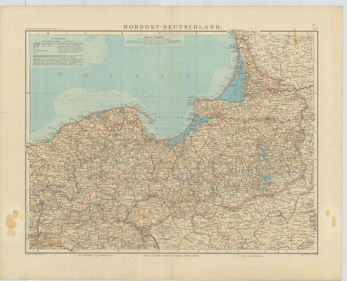
| Title | Nordost-Deutschland. |
| Main title | Németország ÉK-i részének általános térképe 1912-ben. |
1182. Karte von Ost-Preussen nebst Preussich Litthauen und West-Pr... [B IV a 132]
Institute and Museum of Military History •
B IV a
•
B IV Német birodalom
•
B I–XV. Európa
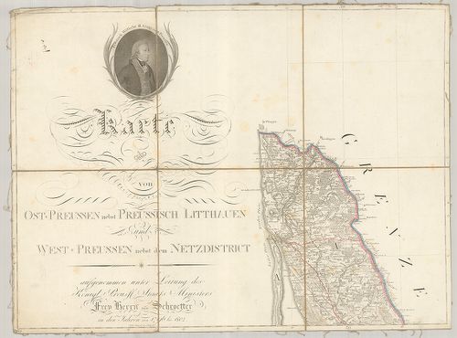
| Title | Karte von Ost-Preussen nebst Preussich Litthauen und West-Preussen nebst dem Netzdistrict. |
| Main title | 3 mt.: 1. Grundriss der Stadt Danzig. (Gdansk várostérk.) 2. Grundriss der Haupt und Residenz Stadt Königsberg. (Kalinyingrad várostérk.) 3. General Tableau zur Karte von Alt Ost und Westpreussen nebst dem aufgenommen Trigonometrischen Netz. (Poroszország trigonometriai hálózata.)Poroszország K-i és NY-i része, Litvánia térképe 1809-ben. |
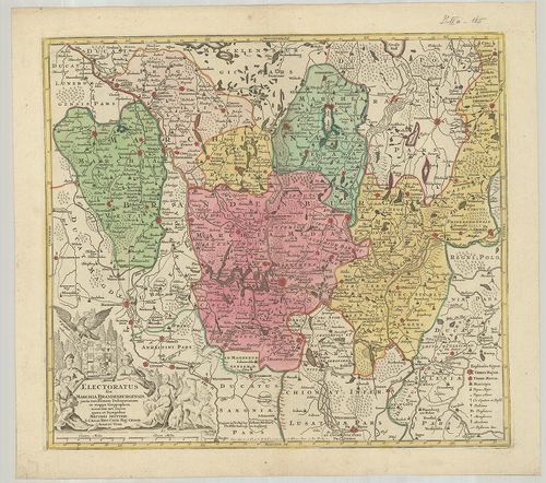
1183. Tabula Marchionatus Brandenburgici et Ducatus Pomeraniae que... [B IV a 139]
Institute and Museum of Military History •
B IV a
•
B IV Német birodalom
•
B I–XV. Európa
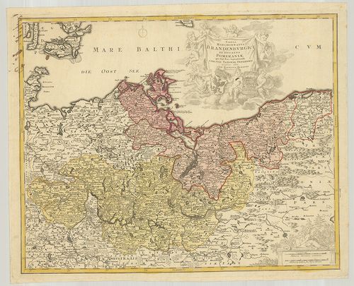
| Title | Tabula Marchionatus Brandenburgici et Ducatus Pomeraniae que siuit Pars Septentrionalis Circuli Saxoniae Superioris. |
| Main title | A Brandenburg-i grófság és Pomeránia-i hercegség térképe. |
1184. Geographische Delineation des zu denen Kur Sächsischen Lande... [B IV a 146]
Institute and Museum of Military History •
B IV a
•
B IV Német birodalom
•
B I–XV. Európa
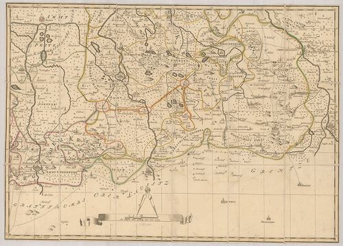
| Title | Geographische Delineation des zu denen Kur Sächsischen Landen gehörigen Marggraffthums Nieder Lausitz… |
| Main title | A szász tartomány általános térképe Alsó-Lausitz őrgrófság területével együtt 1757-ben. |
1185. Charte von der Neumarck. [B IV a 152]
Institute and Museum of Military History •
B IV a
•
B IV Német birodalom
•
B I–XV. Európa
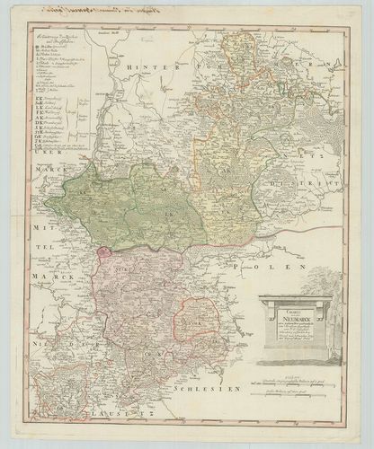
| Title | Charte von der Neumarck. |
| Main title | Neumark porosz terület térképe 1789-ben. |
1186. Special Karte von der Ukermark. [B IV a 155]
Institute and Museum of Military History •
B IV a
•
B IV Német birodalom
•
B I–XV. Európa
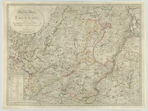
| Title | Special Karte von der Ukermark. |
| Main title | Uckermark porosz terület részletes térképe 1796-ban. |
1187. Special Karte von der Neumark und den angrenzenden Ländern. [B IV a 161]
Institute and Museum of Military History •
B IV a
•
B IV Német birodalom
•
B I–XV. Európa
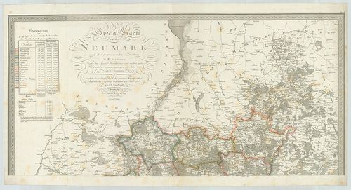
| Title | Special Karte von der Neumark und den angrenzenden Ländern. |
| Main title | Neumark porosz terület részletes térképe a szomszédos tartományok egy részével 1818-ban. |
1188. Electoratus sive Marchia Brandenburgensis juxta novissimam D... [B IV a 165]
Institute and Museum of Military History •
B IV a
•
B IV Német birodalom
•
B I–XV. Európa
| Title | Electoratus sive Marchia Brandenburgensis juxta novissimam Delineationem in mappa geographica. |
| Main title | A Brandenburg-i grófság térképe. |
1189. Brandenburg. [B IV a 166]
Institute and Museum of Military History •
B IV a
•
B IV Német birodalom
•
B I–XV. Európa
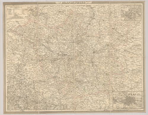
| Title | Brandenburg. |
| Main title | 2 mt.: 1. Die nächste Umgebung von Potsdam. (Potsdam és környéke.) 2. Die nächste Umgebung von Berlin. (Berlin és környéke.) |
| Subject | Brandenburg tartomány térképe. |
1190. Topographische Karte der Provinz Brandenburg. [B IV a 170]
Institute and Museum of Military History •
B IV a
•
B IV Német birodalom
•
B I–XV. Európa
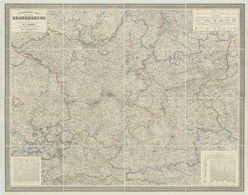
| Title | Topographische Karte der Provinz Brandenburg. |
| Main title | Brandenburg tartomány térképe 1861-ben. |
1191. S. R. Imp. Comitatus Hanau proprie sic dictus, cum singulis ... [B IV a 177]
Institute and Museum of Military History •
B IV a
•
B IV Német birodalom
•
B I–XV. Európa
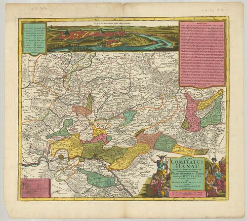
| Title | S. R. Imp. Comitatus Hanau proprie sic dictus, cum singulis suis Praefecturis, ut et Comitatus Solms. Budingen et Nidda cumrelique Wetteravia et vicinis Regionibus. |
| Main title | A Hanau-i grófság térképe 1728-ban. |
1192. Episcopatus Hildesiensis… [B IV a 178]
Institute and Museum of Military History •
B IV a
•
B IV Német birodalom
•
B I–XV. Európa
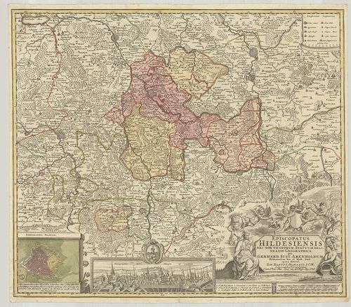
| Title | Episcopatus Hildesiensis… |
| Main title | Mt.: Ichnographia Hildesiae. (Hildesheim város térképe és látképe.)A Hildesheim-i püspökség térképe. |
1193. Territorium Seculare Episcopatus Monasterii Munster Germanis... [B IV a 182]
Institute and Museum of Military History •
B IV a
•
B IV Német birodalom
•
B I–XV. Európa
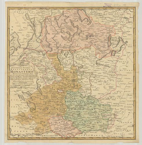
| Title | Territorium Seculare Episcopatus Monasterii Munster Germanis dicti. |
| Main title | A Münster-i püspökség térképe. |
1194. Territorii Episcopatus Osnabrugensis Tabula geographica. [B IV a 183]
Institute and Museum of Military History •
B IV a
•
B IV Német birodalom
•
B I–XV. Európa
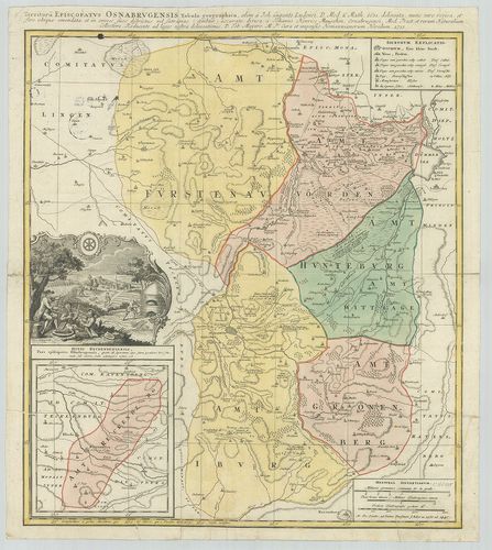
| Title | Territorii Episcopatus Osnabrugensis Tabula geographica. |
| Main title | Mt.: Ditio Reckenbergensis. (Reckenberg tartomány.)Az Osnabrück-i püspökség földrajzi térképe 1631-ben. |
1195. Special Karte vom Fürstenthum Hildesheim. [B IV a 184]
Institute and Museum of Military History •
B IV a
•
B IV Német birodalom
•
B I–XV. Európa
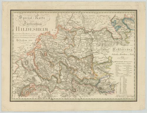
| Title | Special Karte vom Fürstenthum Hildesheim. |
| Main title | A Hildesheim-i hercegség részletes térképe 1803-ban. |
1196. Topographische Karte des Fürstenthums Hildesheim. [B IV a 191]
Institute and Museum of Military History •
B IV a
•
B IV Német birodalom
•
B I–XV. Európa
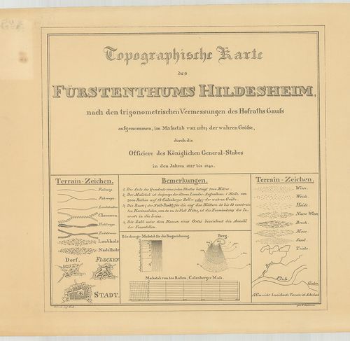
| Title | Topographische Karte des Fürstenthums Hildesheim. |
| Main title | A Hildesheim hercegség topográfiai térképe 1840-ben. |
1197. Das Königreich Hannover nebst dem Grossherzogthume Holstein-... [B IV a 193]
Institute and Museum of Military History •
B IV a
•
B IV Német birodalom
•
B I–XV. Európa
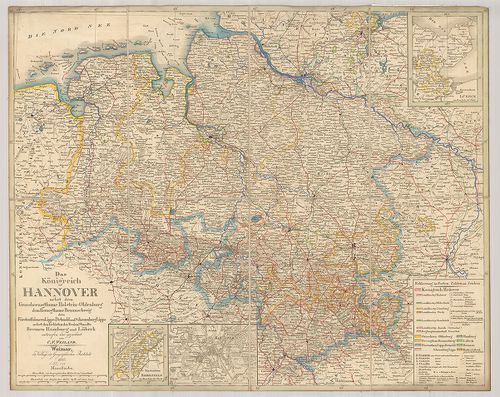
| Title | Das Königreich Hannover nebst dem Grossherzogthume Holstein-Oldenburg dem Herzogthume Braunschweig den Fürstenthümern Lippe-Detmold und Schauenburg Lippe nebst Gebieten der Freien Staedte Bremen Hamburg und Lübeck. |
| Main title | 3 mt.: 1. Fürstenthum Lübeck. 2. Fürstenthum Birkenfeld. 3. Hannover |
| Subject | Hannover és környező hercegi tartományok térképe a határos szabad Bréma, Hamburg és Lübeck városokkal 1845-ben. |
1198. Topographische Karte des Amtes Hunnesrück. [B IV a 194]
Institute and Museum of Military History •
B IV a
•
B IV Német birodalom
•
B I–XV. Európa
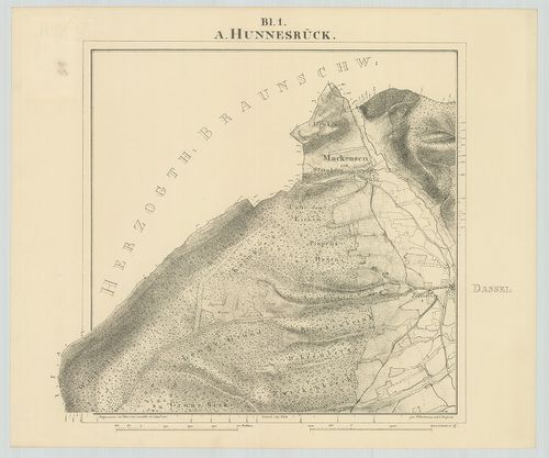
| Title | Topographische Karte des Amtes Hunnesrück. |
| Main title | A Hunsrück-hegyvidék topográfiai térképe 1841-ben. |
1199. Topographische Karte der Herrschaft Plesse, der Gerichte Alt... [B IV a 195]
Institute and Museum of Military History •
B IV a
•
B IV Német birodalom
•
B I–XV. Európa
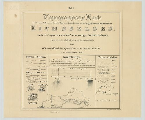
| Title | Topographische Karte der Herrschaft Plesse, der Gerichte Alten- und Neuen Gleichen und des Königlich Hannoverschen Antheils des Eichfeldes. |
| Main title | Az Eichsfeld-i hegyvidék topográfiai térképe 1842-ben. |
1200. Topographische Karte der Vogtei Auburg Amt Diepholz. [B IV a 197]
Institute and Museum of Military History •
B IV a
•
B IV Német birodalom
•
B I–XV. Európa
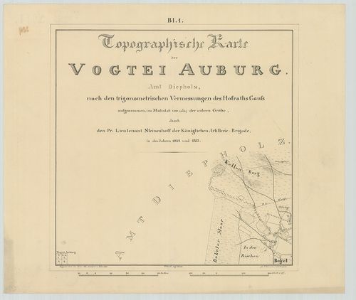
| Title | Topographische Karte der Vogtei Auburg Amt Diepholz. |
| Main title | Diepholz környékének topográfiai térképe 1846-ban. |