1641. Eisenbahn Karte von Deutschland und Nachbarländern. [B IV c 403]
Institute and Museum of Military History •
B IV c
•
B IV Német birodalom
•
B I–XV. Európa
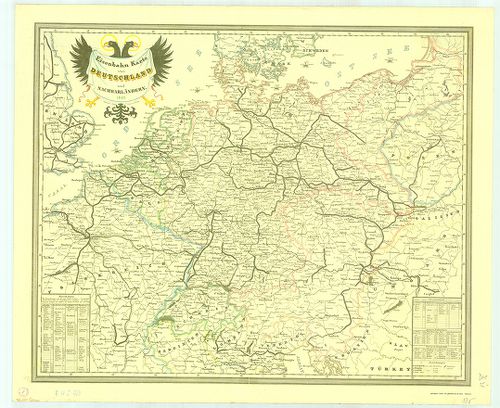
| Title | Eisenbahn Karte von Deutschland und Nachbarländern. |
| Main title | Németország és a környező területek vasúttérképe 1849-ből. |
1642. Neuste-Reise-Karte von Deutschland und der angrenzenden Länd... [B IV c 404]
Institute and Museum of Military History •
B IV c
•
B IV Német birodalom
•
B I–XV. Európa
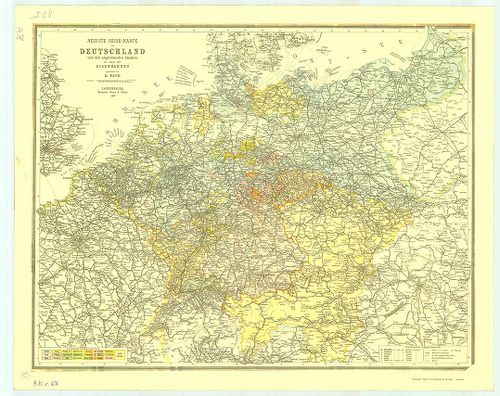
| Title | Neuste-Reise-Karte von Deutschland und der angrenzenden Ländern mit Angabe aller Eisenbahnen. |
| Main title | Németország és a környező országok útitérképe, valamennyi vasútvonal feltüntetésével 1899-ből. |
1643. Die Verwaltungsbezirke des Deutschehn Reichs nach dem Stand ... [B IV c 405]
Institute and Museum of Military History •
B IV c
•
B IV Német birodalom
•
B I–XV. Európa
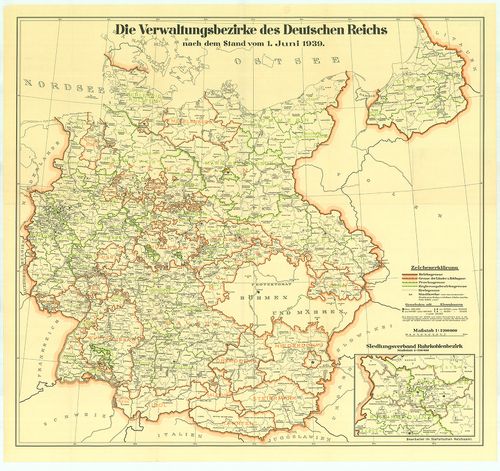
| Title | Die Verwaltungsbezirke des Deutschehn Reichs nach dem Stand vom 1. Juni 1939. |
| Main title | Németország közigazgatási beosztása 1939. jún. 1-jétől. |
1644. Luftverkehrkarte des Deutschen Reiches. [B IV c 406]
Institute and Museum of Military History •
B IV c
•
B IV Német birodalom
•
B I–XV. Európa
| Title | Luftverkehrkarte des Deutschen Reiches. |
| Main title | A Német Birodalom légiforgalmi térképe. |
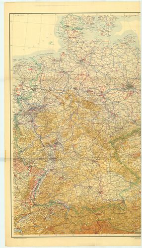
1645. Deutschland-Karte. [B IV c 407]
Institute and Museum of Military History •
B IV c
•
B IV Német birodalom
•
B I–XV. Európa
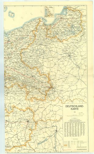
| Title | Deutschland-Karte. |
| Main title | 1 mt.: Memel vidéke. |
| Subject | Németország térképe 1939-ből. A kész és a tervezett autópályákkal. (Alaptérkép 1935. Helyesbítése 1939. január.) |
1646. Militair Charte über den Schwartzwald. [B IV c 411]
Institute and Museum of Military History •
B IV c
•
B IV Német birodalom
•
B I–XV. Európa
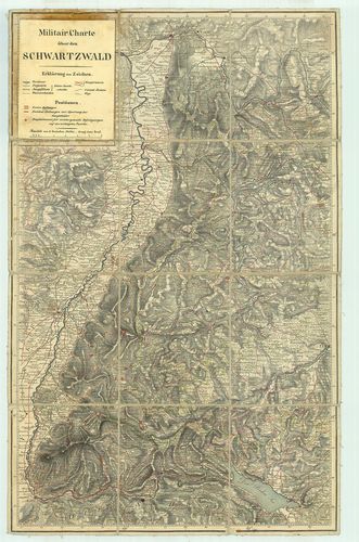
| Title | Militair Charte über den Schwartzwald. |
| Main title | A Fekete-erdő környékének katonai térképe. |
1647. [Németország megszállási zónáinak térképe] [B IV c 423]
Institute and Museum of Military History •
B IV c
•
B IV Német birodalom
•
B I–XV. Európa
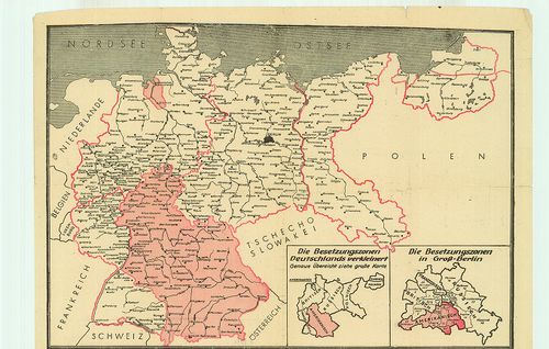
| Title | [Németország megszállási zónáinak térképe] |
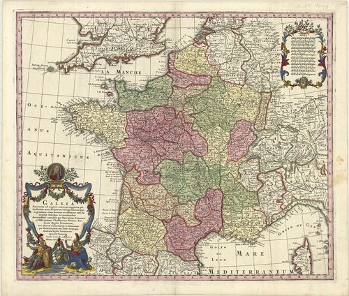
1648. Gallia Benedictina seu Abbatiae et Prioratus tam Monachorum ... [B V a 2]
Institute and Museum of Military History •
B V a
•
B V Franciaország
•
B I–XV. Európa
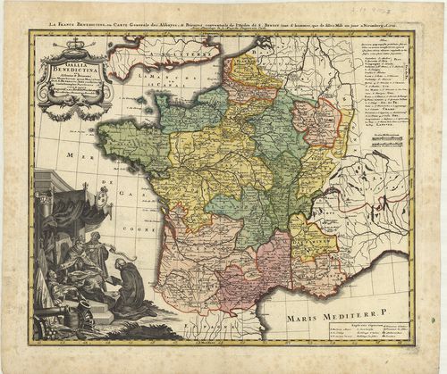
| Title | Gallia Benedictina seu Abbatiae et Prioratus tam Monachorum quam Monialium Ord. S. Benedicti ibide existetes iuxta Exemplar Parisiense. |
| Main title | Franciaország Szt. Benedek-rend apátságainak térképe 1738-ban. |
1649. Gallia. [B V a 3]
Institute and Museum of Military History •
B V a
•
B V Franciaország
•
B I–XV. Európa
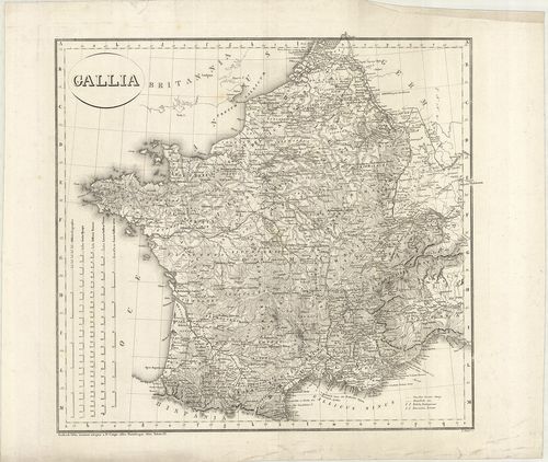
| Title | Gallia. |
| Main title | Franciaország térképe 1820-ban. |
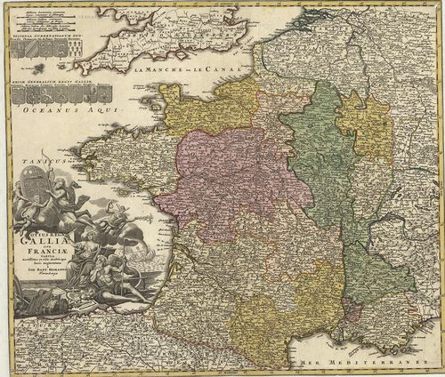
1650. Gallia Augustiniana in suas Provinzias divisa… [B V a 4]
Institute and Museum of Military History •
B V a
•
B V Franciaország
•
B I–XV. Európa

| Title | Gallia Augustiniana in suas Provinzias divisa… |
| Main title | Franciaország Ágostonrendi szerzetesi rendtartományai a 18. században. |
1651. Gallia Concinnata ad magnum numerum mapparum particularium m... [B V a 5]
Institute and Museum of Military History •
B V a
•
B V Franciaország
•
B I–XV. Európa
| Title | Gallia Concinnata ad magnum numerum mapparum particularium manu seriptarum vel impressarum juxta genuium situm locorum et collatarum cum Itineraiis veteribus et recentioribus… |
| Main title | Franciaország térképe kerületi beosztással 1726-ban. |
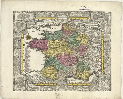
1652. Totius Regni Galliae sive Franciae Tabula… [B V a 7]
Institute and Museum of Military History •
B V a
•
B V Franciaország
•
B I–XV. Európa
| Title | Totius Regni Galliae sive Franciae Tabula… |
| Main title | A Francia Királyság térképe a 18. században tartományi beosztással. |
1653. Le Royaume de France et Les Conquétes de Louis le Grand. [B V a 8]
Institute and Museum of Military History •
B V a
•
B V Franciaország
•
B I–XV. Európa
| Title | Le Royaume de France et Les Conquétes de Louis le Grand. |
| Main title | A Francia Királyság térképe. |
1654. Carte de la France Divisée en ses LXXXIII Départements… [B V a 8/1]
Institute and Museum of Military History •
B V a
•
B V Franciaország
•
B I–XV. Európa
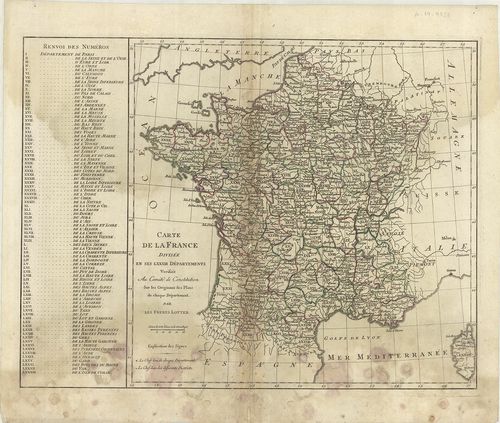
| Title | Carte de la France Divisée en ses LXXXIII Départements… |
| Main title | Franciaország közigazgatási térképe. |
1655. Regni Galliae seu Franciae et Navarrae… – Carte de France… [B V a 9]
Institute and Museum of Military History •
B V a
•
B V Franciaország
•
B I–XV. Európa
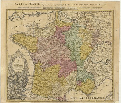
| Title | Regni Galliae seu Franciae et Navarrae… – Carte de France… |
| Main title | Franciaország térképe 1741-ben. |
1656. Carte De France dressée pour l’Usage du Roy en Avril 1721. [B V a 9/2]
Institute and Museum of Military History •
B V a
•
B V Franciaország
•
B I–XV. Európa
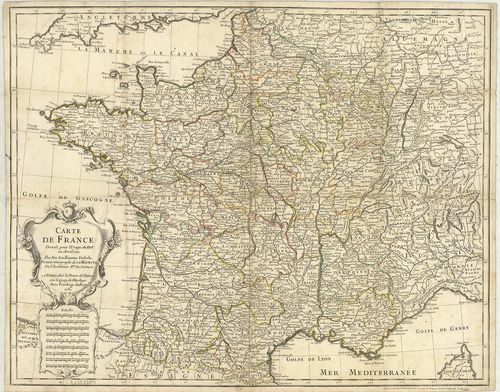
| Title | Carte De France dressée pour l’Usage du Roy en Avril 1721. |
| Main title | Franciaország térképe tartományi beosztással 1721-ben. |
1657. Carte Administrative de la France. [B V a 10]
Institute and Museum of Military History •
B V a
•
B V Franciaország
•
B I–XV. Európa
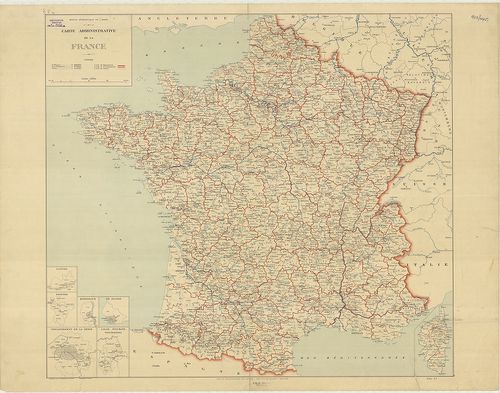
| Title | Carte Administrative de la France. |
| Main title | 6 mt.: 1. Nantes, 2. Rennes, 3. Bordeaux, 4. Le Havre, 5. Département de la Seine, 6. Lille, Roubaix, Tourcoing kerületek térképei. |
| Subject | Franciaország közigazgatási térképe. |
1658. Tableau Général de la France… [B V a 16]
Institute and Museum of Military History •
B V a
•
B V Franciaország
•
B I–XV. Európa

| Title | Tableau Général de la France… |
| Main title | Franciaország általános térképe 1777-ben. |
1659. Le Royaume de France divisé par Gouvernements… [B V a 17]
Institute and Museum of Military History •
B V a
•
B V Franciaország
•
B I–XV. Európa

| Title | Le Royaume de France divisé par Gouvernements… |
| Main title | A Francia Királyság térképe tartományi beosztással 1780-ban. |
1660. Nouvelle Topographie Premier dégré de détail. La France en s... [B V a 17/2]
Institute and Museum of Military History •
B V a
•
B V Franciaország
•
B I–XV. Európa
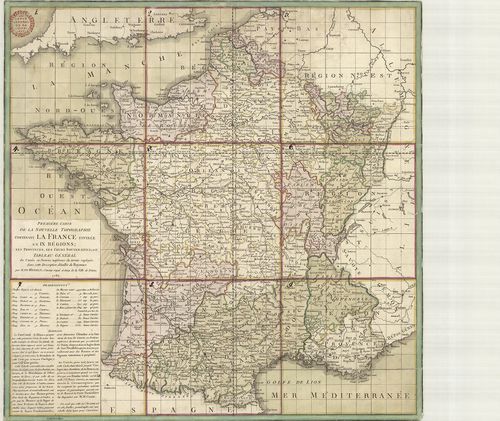
| Title | Nouvelle Topographie Premier dégré de détail. La France en ses neuf Régions… |
| Main title | Franciaország topográfiai térképe 1784-ben. |