1961. G. Freytags Karte des Österreichisch-Italienischen Grenzgebi... [B VII a 50]
Institute and Museum of Military History •
B VII a
•
B VII Olaszország
•
B I–XV. Európa
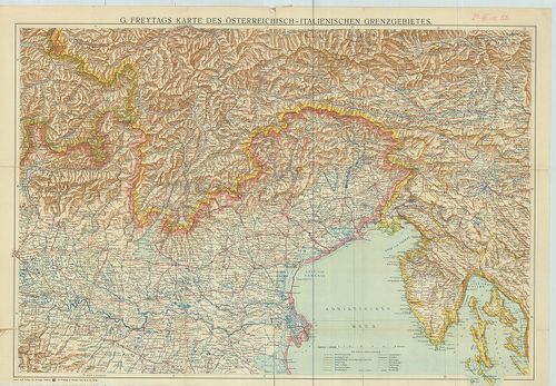
| Title | G. Freytags Karte des Österreichisch-Italienischen Grenzgebietes. |
| Main title | Az osztrák–olasz határvidék általános térképe 1910 körül. |
1962. Cursus Fluminis Padi vel Po per Longobardiam… [B VII a 51]
Institute and Museum of Military History •
B VII a
•
B VII Olaszország
•
B I–XV. Európa
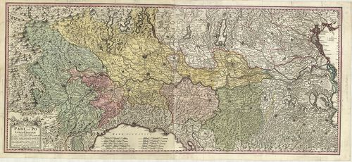
| Title | Cursus Fluminis Padi vel Po per Longobardiam… |
| Main title | Lombardia: a Pó völgyének általános térképe 1735-ben. |
1963. La Lombardia e stati ad essa circonvicini. [B VII a 52]
Institute and Museum of Military History •
B VII a
•
B VII Olaszország
•
B I–XV. Európa
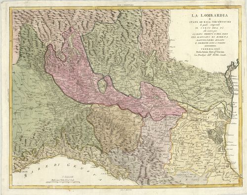
| Title | La Lombardia e stati ad essa circonvicini. |
| Main title | Lombardia térképe 1796-ban. |
1964. Nuova Carta della Lombardia e delle sue regioni Aggiacenti… [B VII a 53]
Institute and Museum of Military History •
B VII a
•
B VII Olaszország
•
B I–XV. Európa
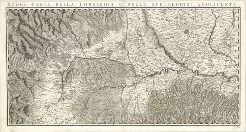
| Title | Nuova Carta della Lombardia e delle sue regioni Aggiacenti… |
| Main title | Lombardia térképe 1795-ben. |
1965. Carta Geografica del Teatro della Guerra in Italia. No. 2. [B VII a 54]
Institute and Museum of Military History •
B VII a
•
B VII Olaszország
•
B I–XV. Európa
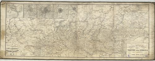
| Title | Carta Geografica del Teatro della Guerra in Italia. No. 2. |
| Main title | 5 mt.: 1. Peschiera, 2. Mantova, 3. Verona. 4. Palmanova. 5. Legnano várostérk. |
| Subject | Észak-Olaszország földrajzi térképe 1848-ban. |
1966. Carta Corografica delle Provincie Lombarde Rappresentante i ... [B VII a 55]
Institute and Museum of Military History •
B VII a
•
B VII Olaszország
•
B I–XV. Európa
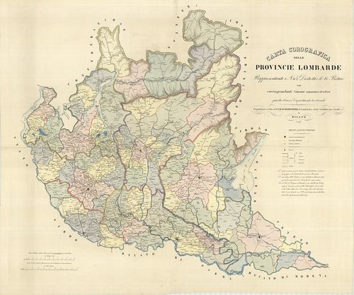
| Title | Carta Corografica delle Provincie Lombarde Rappresentante i N. 102 Distretti e le 80 Preture… |
| Main title | Lombardia térképe a 19. században. |
1967. [Verona és Villafranca környékének térképe.] [B VII a 56]
Institute and Museum of Military History •
B VII a
•
B VII Olaszország
•
B I–XV. Európa
| Title | [Verona és Villafranca környékének térképe.] |
1968. Lombardisch, Venetianisches Königreich. [B VII a 57/1]
Institute and Museum of Military History •
B VII a
•
B VII Olaszország
•
B I–XV. Európa
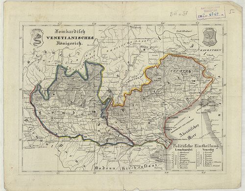
| Title | Lombardisch, Venetianisches Königreich. |
| Main title | A Lombard-Velencei Királyság térképe a 19. században. |
1969. Charte des Lombardisch-Venetianischen Koenigreichs. 20. [B VII a 57/2]
Institute and Museum of Military History •
B VII a
•
B VII Olaszország
•
B I–XV. Európa
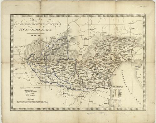
| Title | Charte des Lombardisch-Venetianischen Koenigreichs. 20. |
| Main title | A Lombard-Velencei Királyság térképe a 19. században. |
1970. Provincia di Principato Ulteriore. [B VII a 59]
Institute and Museum of Military History •
B VII a
•
B VII Olaszország
•
B I–XV. Európa
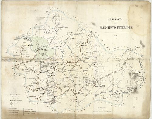
| Title | Provincia di Principato Ulteriore. |
| Main title | Dél-Olaszország: Benevento–Avellino–Calitri–Ariano közötti terület térképe 1847-ben. |
1971. État de la Maison d’Autriche en Italie … [B VII a 60]
Institute and Museum of Military History •
B VII a
•
B VII Olaszország
•
B I–XV. Európa
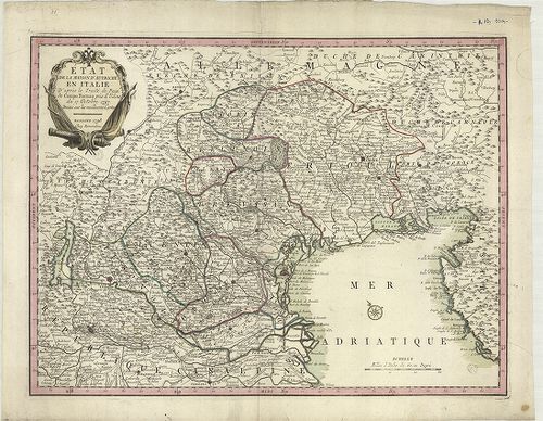
| Title | État de la Maison d’Autriche en Italie … |
| Main title | Észak-Olaszország: Udine és környékének térképe 1798-ban. (Ausztria tartományai a Campo Formioban kötött békeszerződés alapján 1797. október 17-én.) |
1972. Carte du territoire de Bresce… [B VII a 62]
Institute and Museum of Military History •
B VII a
•
B VII Olaszország
•
B I–XV. Európa
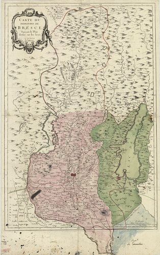
| Title | Carte du territoire de Bresce… |
| Main title | Brescia környékének térképe 1777-ben. |
1973. Carta topografica della provincia di Como. [B VII a 66]
Institute and Museum of Military History •
B VII a
•
B VII Olaszország
•
B I–XV. Európa
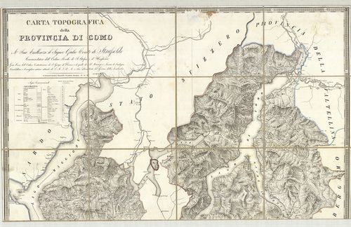
| Title | Carta topografica della provincia di Como. |
| Main title | Mt. Pianta della R-a Citta di Como (Como várostérkép). |
| Subject | Como tartomány topográfiai térképe 1816-ban. |
1974. Nouvelle Carte du terrotoire de Créme. [B VII a 67/1]
Institute and Museum of Military History •
B VII a
•
B VII Olaszország
•
B I–XV. Európa
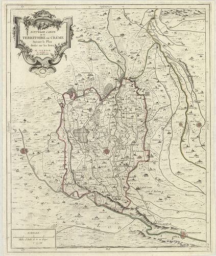
| Title | Nouvelle Carte du terrotoire de Créme. |
| Main title | Crema környékének térképe 1779-ben. |
1975. [A Milanoi Hercegség, Pavia Fejedelemség térképe a környező ... [B VII a 78]
Institute and Museum of Military History •
B VII a
•
B VII Olaszország
•
B I–XV. Európa
| Title | [A Milanoi Hercegség, Pavia Fejedelemség térképe a környező városokhoz tartozó vidékek határaival.] |
1976. Carta del Dipartimento dell’ Adige e di una parte dei Dip.-t... [B VII a 80]
Institute and Museum of Military History •
B VII a
•
B VII Olaszország
•
B I–XV. Európa
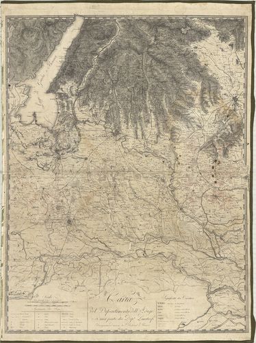
| Title | Carta del Dipartimento dell’ Adige e di una parte dei Dip.-ti Limitrofi. |
| Main title | Adige megye térképe 1812-ben. |
1977. Carta Topografica del Milanese e Mantovano… [B VII a 90]
Institute and Museum of Military History •
B VII a
•
B VII Olaszország
•
B I–XV. Európa
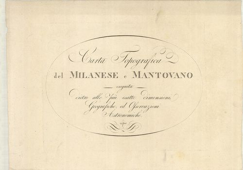
| Title | Carta Topografica del Milanese e Mantovano… |
| Main title | Milano és Mantova tartományok térképe a 18. század második felében. |
1978. Il Corso del Po dal Mantovano fino al Mare… [B VII a 91/1]
Institute and Museum of Military History •
B VII a
•
B VII Olaszország
•
B I–XV. Európa
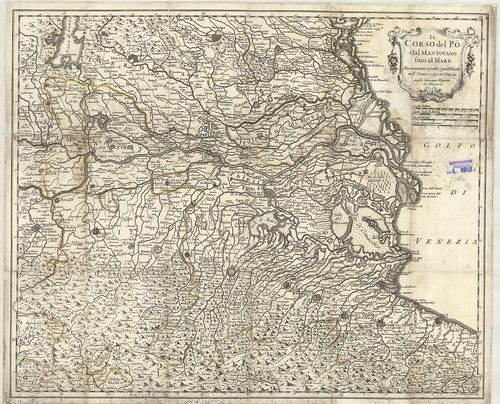
| Title | Il Corso del Po dal Mantovano fino al Mare… |
| Main title | Mantova tartomány és a Pó torkolat környékének térképe 1792-ben. |
1979. Il Milanese con parte de’ Paesi… [B VII a 91/2]
Institute and Museum of Military History •
B VII a
•
B VII Olaszország
•
B I–XV. Európa
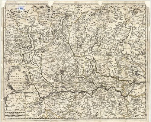
| Title | Il Milanese con parte de’ Paesi… |
| Main title | Milano tartomány és a Pó környékének általános térképe 1792-ben. |
1980. Ducatus Mantuani. [B VII a 99/4]
Institute and Museum of Military History •
B VII a
•
B VII Olaszország
•
B I–XV. Európa
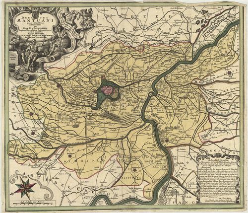
| Title | Ducatus Mantuani. |
| Main title | Mantova hercegség térképe 1740 körül. |