561. [Görögország és Törökország Ny-i részének térképe.] [B III c 132]
Institute and Museum of Military History •
B III c
•
B III Balkán-félsziget
•
B I–XV. Európa
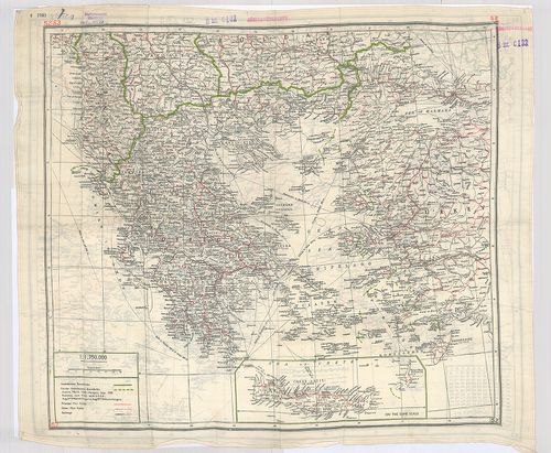
| Title | [Görögország és Törökország Ny-i részének térképe.] |
| Main title | Mt.: Crete. (Kréta.) |
| Subject | Hátoldalán: [Olaszország, Balkán-félsziget, Magyarország és Románia egy részének térképe.] |
562. Übersicht über die Kirchen u. Klöster. [B III c 140]
Institute and Museum of Military History •
B III c
•
B III Balkán-félsziget
•
B I–XV. Európa
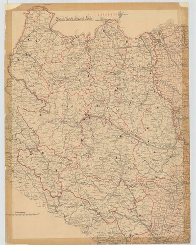
| Title | Übersicht über die Kirchen u. Klöster. |
| Main title | Ny-Szerbia térképe a templomok és kolostorok jelölésével 1910 körül. |
563. Slovenska Krajina. [B III c 144]
Institute and Museum of Military History •
B III c
•
B III Balkán-félsziget
•
B I–XV. Európa
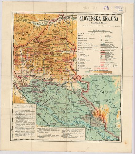
| Title | Slovenska Krajina. |
| Main title | A Murától ÉK-re eső szlovén terület térképe. |
564. Karta Isztorijszkog razvitka Kraljevine Szrba, Hrvata i Szlo... [B III c 145]
Institute and Museum of Military History •
B III c
•
B III Balkán-félsziget
•
B I–XV. Európa
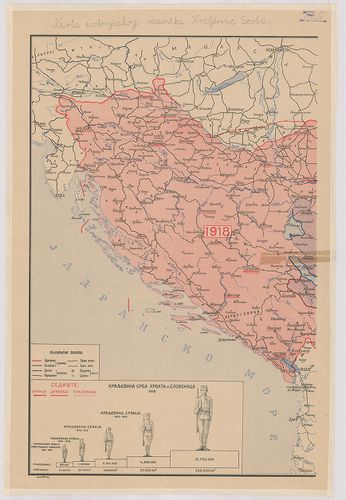
| Title | Karta Isztorijszkog razvitka Kraljevine Szrba, Hrvata i Szlovenaca 1804–1918. |
| Main title | Szerbia, Horvátország és Szlovénia területi kialakulása 1804–1918 között. Történelmi térkép. |
565. Kraljevine Jugoslavija. – Borítócím: Jugoslavia Carte Routié... [B III c 146]
Institute and Museum of Military History •
B III c
•
B III Balkán-félsziget
•
B I–XV. Európa
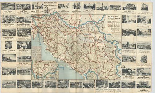
| Title | Kraljevine Jugoslavija. – Borítócím: Jugoslavia Carte Routiére. – Road-Map. – Strassen-Karte. |
| Main title | Jugoszlávia autótérképe 1933-ban. |
566. Karta Automobilskih Puteva Kraljevine Jugoslavije. [B III c 148]
Institute and Museum of Military History •
B III c
•
B III Balkán-félsziget
•
B I–XV. Európa
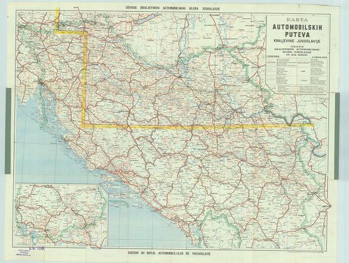
| Title | Karta Automobilskih Puteva Kraljevine Jugoslavije. |
| Main title | Jugoszlávia autótérképe 1939-ben. |
567. Jugoszlávia vasúttérképe. [B III c 150]
Institute and Museum of Military History •
B III c
•
B III Balkán-félsziget
•
B I–XV. Európa
| Title | Jugoszlávia vasúttérképe. |
568. B. Z.-Karte Laibach, Klagenfurt, (Villach) Görz. 73 Laibach.... [B III c 154]
Institute and Museum of Military History •
B III c
•
B III Balkán-félsziget
•
B I–XV. Európa
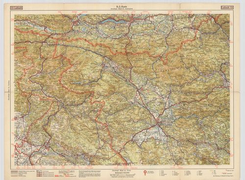
| Title | B. Z.-Karte Laibach, Klagenfurt, (Villach) Görz. 73 Laibach. Blatt 67. |
| Main title | 5 mt.: 1. Görz. (Gorozia, Ol.) 2. Klagenfurt. 3. Krainburg, (Kranj) 4. Laibach (Ljubljana) 5. Villach. (Városok áthajtási térképe.)Ljubljana, Klagenfurt, Villach, Gorizia vidékének úthálózati térképe 1930 körül. |
569. Östlicher Theil des illyrischen Berglandes. I. Abschnitt zu ... [B III c 161/2]
Institute and Museum of Military History •
B III c
•
B III Balkán-félsziget
•
B I–XV. Európa
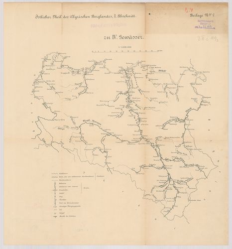
| Title | Östlicher Theil des illyrischen Berglandes. I. Abschnitt zu IV. Gewässer. |
| Main title | Szerbia vízi-közlekedési térképe 1893 körül. |
570. Östlicher Theil des illyrischen Berglandes I. Abschnitt zu V... [B III c 161/3]
Institute and Museum of Military History •
B III c
•
B III Balkán-félsziget
•
B I–XV. Európa
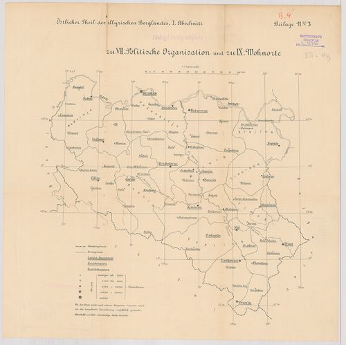
| Title | Östlicher Theil des illyrischen Berglandes I. Abschnitt zu VII. Politische Organization und zu IX. Wohnorte. |
| Main title | Szerbia közigazgatási térképe 1893-ban. |
571. Östlicher Theil des illyrischen Berglandes. I. Abteilung zu ... [B III c 161/4]
Institute and Museum of Military History •
B III c
•
B III Balkán-félsziget
•
B I–XV. Európa
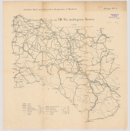
| Title | Östlicher Theil des illyrischen Berglandes. I. Abteilung zu VIII. die wichtigsten Routen. |
| Main title | Szerbia fontosabb útvonalainak térképe 1893-ban. |
572. Östlicher Theil des illyrischen Berglandes. I. Abschnitt zu ... [B III c 161/5]
Institute and Museum of Military History •
B III c
•
B III Balkán-félsziget
•
B I–XV. Európa
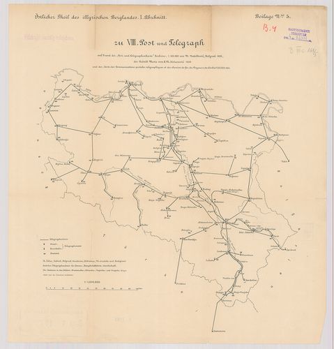
| Title | Östlicher Theil des illyrischen Berglandes. I. Abschnitt zu VIII. Post und Telegraph. |
| Main title | Szerbia posta és távíróhálózatának térképe 1892-ben. |
573. Kommunikationskarte von Serbien. [B III c 162/1]
Institute and Museum of Military History •
B III c
•
B III Balkán-félsziget
•
B I–XV. Európa
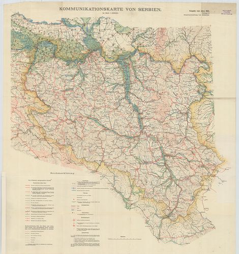
| Title | Kommunikationskarte von Serbien. |
| Main title | 1. Routenskelett für den Raum A. West-Serbien und die Šumadija. (É-Szerbia fontosabb útvonalai 1909-ben.) |
| Subject | 2. Routenskelett. |
574. Gangbarkeit, Kommunikationen, Befestigungen. [B III c 162/2]
Institute and Museum of Military History •
B III c
•
B III Balkán-félsziget
•
B I–XV. Európa
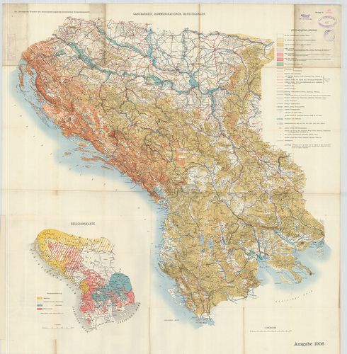
| Title | Gangbarkeit, Kommunikationen, Befestigungen. |
| Main title | Mt.: Religionskarte. (Felekezeti térkép.) |
| Subject | Nationalkarte. (Nemzetiségi térkép.) |
575. „Jugoszlávia katonaföldrajzi leírása”. [B III c 170]
Institute and Museum of Military History •
B III c
•
B III Balkán-félsziget
•
B I–XV. Európa
| Title | „Jugoszlávia katonaföldrajzi leírása”. |
576. Territorialeinteilung von Montenegro mit 1. April 1910. [B III c 253/a]
Institute and Museum of Military History •
B III c
•
B III Balkán-félsziget
•
B I–XV. Európa
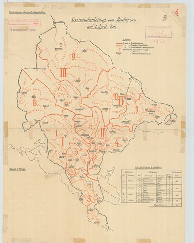
| Title | Territorialeinteilung von Montenegro mit 1. April 1910. |
| Main title | Montenegró katonai kerületi térképe 1910. ápr. 1-jén. |
577. Territorialeinteilung von Montenegro. [B III c 253/b]
Institute and Museum of Military History •
B III c
•
B III Balkán-félsziget
•
B I–XV. Európa
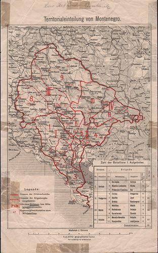
| Title | Territorialeinteilung von Montenegro. |
| Main title | Montenegró katonai kerületi térképe. |
578. Karte des Türkischen Kriegsschauplatzes. G. Freytags Karte. [B III c 254]
Institute and Museum of Military History •
B III c
•
B III Balkán-félsziget
•
B I–XV. Európa
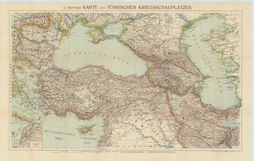
| Title | Karte des Türkischen Kriegsschauplatzes. G. Freytags Karte. |
| Main title | 2 mt.: 1. Die Dardanellen 2. Der Bosporus. |
| Subject | Térkép a törökországi harctérről. |
579. Serbisch-Österreichisch-Ungarische Grenzländer. [B III c 255]
Institute and Museum of Military History •
B III c
•
B III Balkán-félsziget
•
B I–XV. Európa
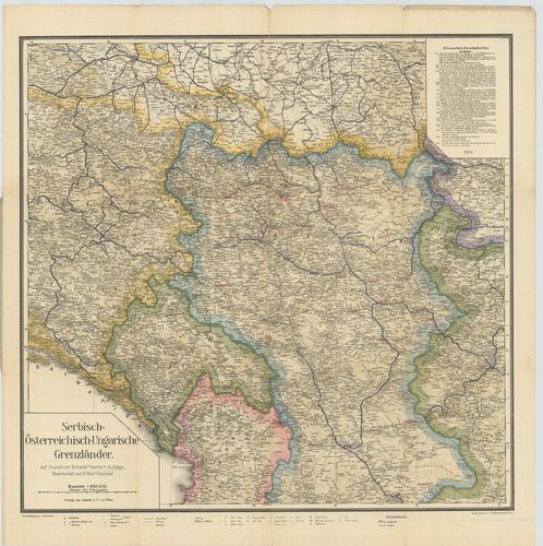
| Title | Serbisch-Österreichisch-Ungarische Grenzländer. |
| Main title | Szerbia, Ausztria, Magyarország határvidéke 1914-ben. |
580. Jugoszlávia béke-erődítési helyzete 1941. II. 15-én. [B III c 257]
Institute and Museum of Military History •
B III c
•
B III Balkán-félsziget
•
B I–XV. Európa
| Title | Jugoszlávia béke-erődítési helyzete 1941. II. 15-én. |
| Main title | A sorozat áttekintője szerint. |