81. Karte vom Türkischen Reiche in Europa nebst den angrenzenden... [B III a 43/2]
Institute and Museum of Military History •
B III a
•
B III Balkán-félsziget
•
B I–XV. Európa
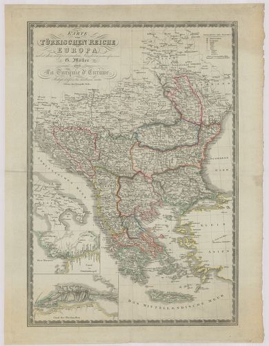
| Title | Karte vom Türkischen Reiche in Europa nebst den angrenzenden Ländern. – La Turquie d’Europe. |
| Main title | 2 mt. 1. Canal von Constantinople. (Istanbul-i csatorna.) 2. Canal der Dardanellen. (Dardanellai csatorna.)Az európai Török Birodalom és a határos területek térképe 1828-ban. |
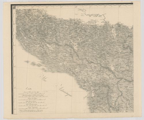
82. Charte von der Europaeischen Türkey, Kleinasien, einem Theil... [B III a 44]
Institute and Museum of Military History •
B III a
•
B III Balkán-félsziget
•
B I–XV. Európa
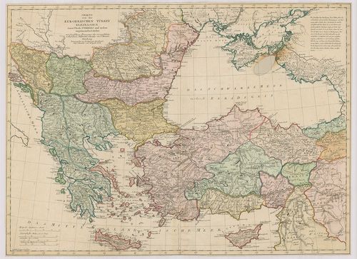
| Title | Charte von der Europaeischen Türkey, Kleinasien, einem Theile Syriens und andern angränzenden Ländern. |
| Main title | Az európai Török Birodalom, Kisázsia és Szíria egy részének és a környező területek térképe 1804-ben. |
83. Chartes tes Europaikes Turkias palai men Ellados para… – Car... [B III a 47]
Institute and Museum of Military History •
B III a
•
B III Balkán-félsziget
•
B I–XV. Európa
| Title | Chartes tes Europaikes Turkias palai men Ellados para… – Carte de la plus Grande Partie de la Turquie d’Europe… |
| Main title | Az európai Török Birodalom térképe 1811-ben. |
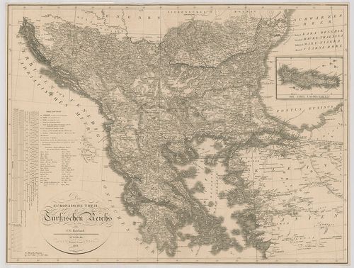
84. Das Osmanische Reich in Europa. – L’Empire Ottoman en Europe... [B III a 49]
Institute and Museum of Military History •
B III a
•
B III Balkán-félsziget
•
B I–XV. Európa
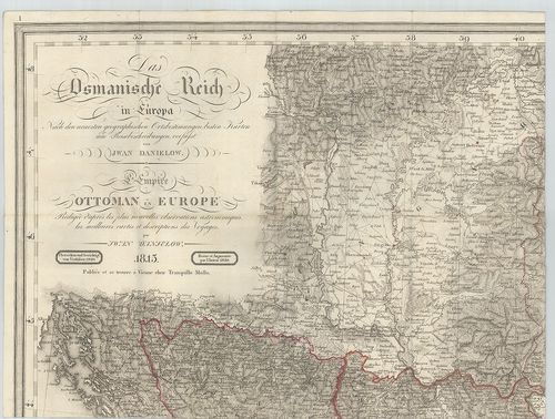
| Title | Das Osmanische Reich in Europa. – L’Empire Ottoman en Europe. |
| Main title | Az európai Török Birodalom térképe 1820-ban. |
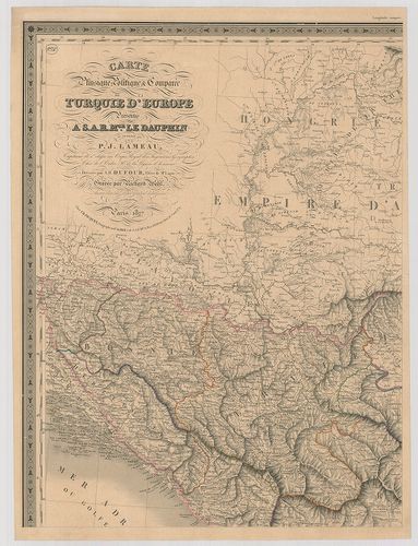
85. Carte de la Turquie d’Europe… [B III a 50]
Institute and Museum of Military History •
B III a
•
B III Balkán-félsziget
•
B I–XV. Európa
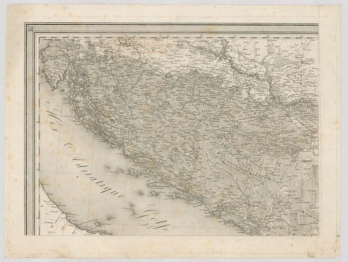
| Title | Carte de la Turquie d’Europe… |
| Main title | Az európai Törökország térképe 1816-ban. |
86. Der Europäische Theil des Türkischen Reichs. [B III a 51]
Institute and Museum of Military History •
B III a
•
B III Balkán-félsziget
•
B I–XV. Európa
| Title | Der Europäische Theil des Türkischen Reichs. |
| Main title | Mt.: Die Insel Candia (Creta.) (Kréta.) |
| Subject | Az európai Törökország térképe 1821-ben. |
87. Carte Generalé de la Turquie d’Europe a la droite du Danube ... [B III a 52]
Institute and Museum of Military History •
B III a
•
B III Balkán-félsziget
•
B I–XV. Európa
| Title | Carte Generalé de la Turquie d’Europe a la droite du Danube ou des Beglerbegliks de Roumili, Bosna et Moree. |
| Main title | 4 mt. 1. Environs de Constantinopel. (Istanbul és környéke.) 2. Carte du Canal des Dardanelles. (Dardanellák.) 3. Carte de Thermopiles. (Termopilei-szoros) 4. [Volosz-Zeitoun és környéke. |
| Subject | Az európai Török Birodalom térképe 1818-ban. |
88. Carte générale de la Turquie d’Europe en 15 feuilles. [B III a 53]
Institute and Museum of Military History •
B III a
•
B III Balkán-félsziget
•
B I–XV. Európa
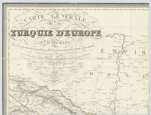
| Title | Carte générale de la Turquie d’Europe en 15 feuilles. |
| Main title | 4 mt. 1. Carte des Dardanelles. |
| Subject | (Dardanellák) 2. Carte des Environs de Constantinople. |
89. Karte der europäischen Türkei und des Gebietes des schwarzen... [B III a 54]
Institute and Museum of Military History •
B III a
•
B III Balkán-félsziget
•
B I–XV. Európa

| Title | Karte der europäischen Türkei und des Gebietes des schwarzen Meeres. |
| Main title | Az európai Török Birodalom és a Fekete-tenger környékének térképe. |
90. Carte phisique, politique et Comparée de la Turquie d’Europe... [B III a 55]
Institute and Museum of Military History •
B III a
•
B III Balkán-félsziget
•
B I–XV. Európa
| Title | Carte phisique, politique et Comparée de la Turquie d’Europe. |
| Main title | Európai Törökország természetföldrajzi és politikai térképe 1827-ben. |
91. Európai Török birodalom és Görög királyság földképe mellyet ... [B III a 56]
Institute and Museum of Military History •
B III a
•
B III Balkán-félsziget
•
B I–XV. Európa
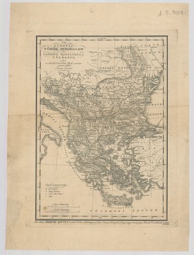
| Title | Európai Török birodalom és Görög királyság földképe mellyet az alsóbb Oskolabeli Ifjak számára metszett és kiadott Karacs Ferenc. |
92. Die Europaeische Türkei, Griechenland und die Ionischen Inse... [B III a 57]
Institute and Museum of Military History •
B III a
•
B III Balkán-félsziget
•
B I–XV. Európa
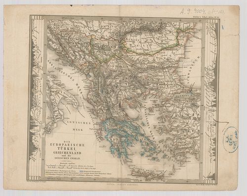
| Title | Die Europaeische Türkei, Griechenland und die Ionischen Inseln. |
| Main title | Az európai Török Birodalom, Görögország és a Jón-szigetek térképe. |
93. Europäische Türkei. Nordöstlicher Theil. [B III a 57/1]
Institute and Museum of Military History •
B III a
•
B III Balkán-félsziget
•
B I–XV. Európa
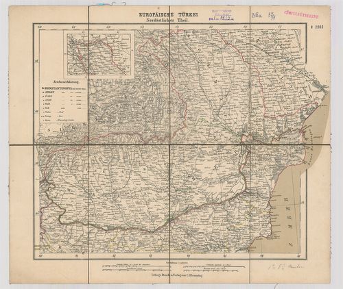
| Title | Europäische Türkei. Nordöstlicher Theil. |
| Main title | Az európai Török Birodalom ÉK-i részének (Moldva és Havasalföld) térképe. |
94. La Turchia d’Europa. [B III a 57/2]
Institute and Museum of Military History •
B III a
•
B III Balkán-félsziget
•
B I–XV. Európa
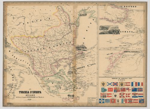
| Title | La Turchia d’Europa. |
| Main title | 3 mt. 1. [Boszporusz.] 2. [Dardanellák.] 3. [Európai zászlók.]Az európai Török Birodalom térképe. |
95. Dietrich Reimer’s Generalkarte des Türkischen Kriegsschaupla... [B III a 57/3]
Institute and Museum of Military History •
B III a
•
B III Balkán-félsziget
•
B I–XV. Európa
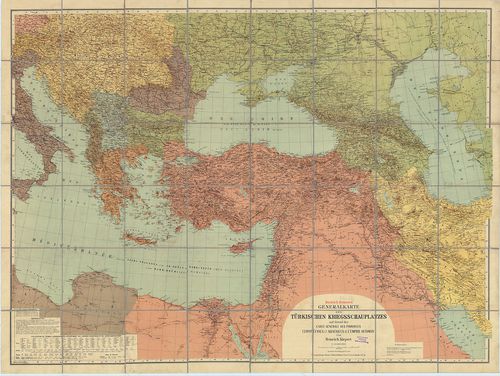
| Title | Dietrich Reimer’s Generalkarte des Türkischen Kriegsschauplatzes auf Grund der Carte générale des Provinces Européennes et Asiatiques de l’Empire Ottoman. |
| Main title | A Török Bbirodalom európai és ázsiai területén a török hadszínterek általános térképe. |
96. Gea-Karte der Europäischen Türkei und Nachbargebiete. [B III a 57/4]
Institute and Museum of Military History •
B III a
•
B III Balkán-félsziget
•
B I–XV. Európa

| Title | Gea-Karte der Europäischen Türkei und Nachbargebiete. |
| Main title | Mt.: Constantinopel und der Bosporus. (Istanbul és a Boszporusz.)Európai Törökország és a szomszédos területek. |
97. General-Uebersichts-Karte des gesammten Russisch–Türkischen ... [B III a 57/5]
Institute and Museum of Military History •
B III a
•
B III Balkán-félsziget
•
B I–XV. Európa
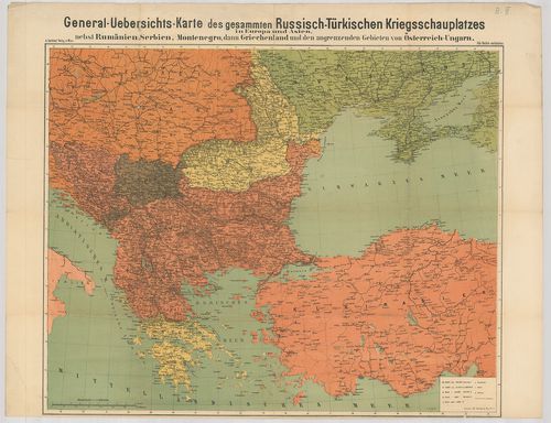
| Title | General-Uebersichts-Karte des gesammten Russisch–Türkischen Kriegsschauplatzes in Europa und in Asien, nebst Rumänien, Serbien Montenegro, dann Griechenland und den angrenzenden Gebieten von Österreich–Ungarn. |
| Main title | A Balkán-félsziget térképe az orosz–török hadszíntérről 1878–1879 körül. |
98. [Adrianopel.] (Drinápoly, Edirne.) [B III a 57/6]
Institute and Museum of Military History •
B III a
•
B III Balkán-félsziget
•
B I–XV. Európa
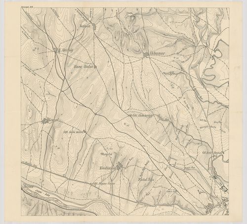
| Title | [Adrianopel.] (Drinápoly, Edirne.) |
| Main title | Törökország: Edirne környékének domborzati és közlekedési térképe. |
99. Carte der Europaeischen Türkey nebst einem Theile von Kleina... [B III a 58]
Institute and Museum of Military History •
B III a
•
B III Balkán-félsziget
•
B I–XV. Európa
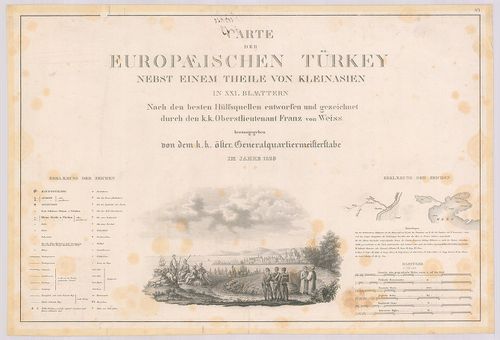
| Title | Carte der Europaeischen Türkey nebst einem Theile von Kleinasien. |
| Main title | 8 mt.: 1. Plan von Belgrad. 2. Plan bon Butrinto. (Butrint, Alb.) 3. Plan von Prevesa. (Gör.) 4. Plan von Dardanellen von Leponto. (Dardanellák) 5. Plan von des Isthums von Korint. (Korinthosz-szoros) 6. Plan des Hafen von Navarin. (Pylosz, Gör.) 7. Plan der Rodos. (Rodosz, Gör.) 8. Plan von Smyrna. (Izmir)Európai Törökország és Kisázsiai egy részének térképe 1829-ben. |
100. Das osmanische Europa oder die Europäische Türkey nebst dem ... [B III a 58/1]
Institute and Museum of Military History •
B III a
•
B III Balkán-félsziget
•
B I–XV. Európa
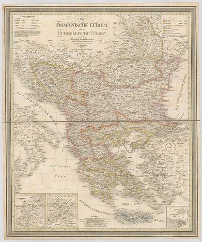
| Title | Das osmanische Europa oder die Europäische Türkey nebst dem Koenigr. Griechenland und dem Jonischen Inseln. |
| Main title | 3 mt. 1. Die Dardanellen. (Dardanellák) 2. Constantinopel. (Istanbul.) 3. Corfu. (Kerkyra.)Az európai Török Birodalom, Görögország és a Jóni-szigetek térképe 1832-ben. |