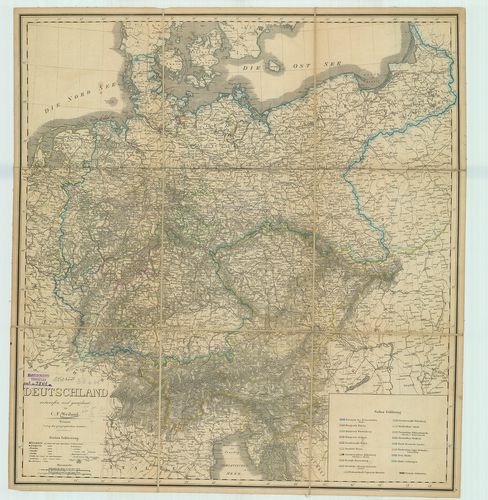
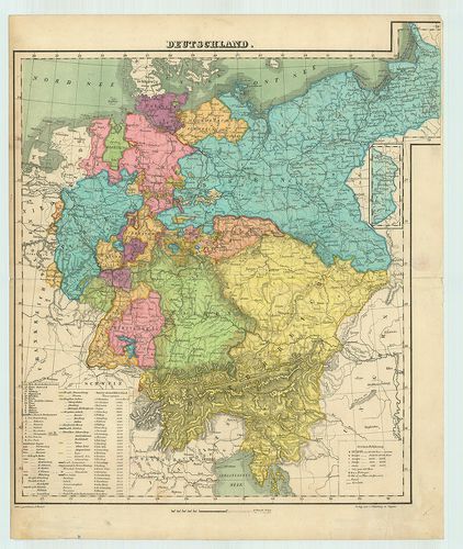
21. Deutschland. [B IV a 38/2]
Institute and Museum of Military History •
B IV a
•
B IV Német birodalom
•
B I–XV. Európa
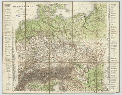
| Title | Deutschland. |
| Main title | Németország térképe. |
22. Special-Karte von Deutschland… [B IV a 40/a]
Institute and Museum of Military History •
B IV a
•
B IV Német birodalom
•
B I–XV. Európa
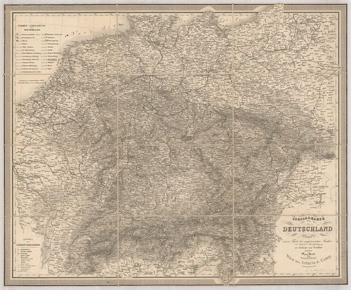
| Title | Special-Karte von Deutschland… |
| Main title | Németország térképe vasúthálózattal 1853-ban. |
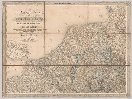
23. General-Karte der Deutschen Staaten von Belgien, den Niederl... [B IV a 40/1]
Institute and Museum of Military History •
B IV a
•
B IV Német birodalom
•
B I–XV. Európa
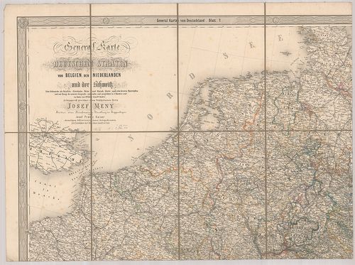
| Title | General-Karte der Deutschen Staaten von Belgien, den Niederlanden und der Schweitz. |
| Main title | A német államok, Belgium, Hollandia és Svájc általános térképe út-vasútálózattal. |
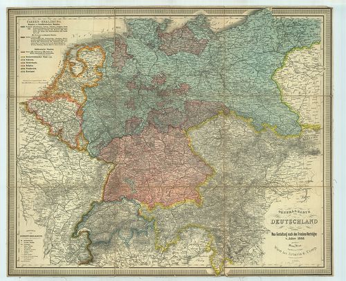
24. General-Karte von Deutschland… [B IV a 40/b]
Institute and Museum of Military History •
B IV a
•
B IV Német birodalom
•
B I–XV. Európa
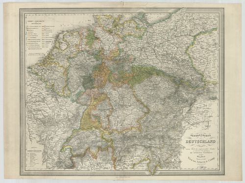
| Title | General-Karte von Deutschland… |
| Main title | Németország általános térképe vasúthálózattal 1866-ban. |
25. General-Karte den Deutschen Staaten von Belgien, den Niederl... [B IV a 40/2]
Institute and Museum of Military History •
B IV a
•
B IV Német birodalom
•
B I–XV. Európa
| Title | General-Karte den Deutschen Staaten von Belgien, den Niederlanden und der Schweitz. |
| Main title | A német-államok, Belgium, Hollandia és Svájc általános térképe út-vasúthálózattal. |
26. Deutschland. [B IV a 41]
Institute and Museum of Military History •
B IV a
•
B IV Német birodalom
•
B I–XV. Európa
| Title | Deutschland. |
| Main title | Németország térképe. |
27. General-Karte von Deutschland nebst der Schweiz. [B IV a 42]
Institute and Museum of Military History •
B IV a
•
B IV Német birodalom
•
B I–XV. Európa
| Title | General-Karte von Deutschland nebst der Schweiz. |
| Main title | Németország és Svájc általános térképe 1864-ben. |
28. General-Karte von Deutschland in seiner Neu-Gestaltung nach ... [B IV a 43]
Institute and Museum of Military History •
B IV a
•
B IV Német birodalom
•
B I–XV. Európa
| Title | General-Karte von Deutschland in seiner Neu-Gestaltung nach den Friedens-Verträgen v. Jahre 1866. |
| Main title | Németország általános térképe 1866. évi békeszerződés után, vasúthálózattal. |
29. General Karte von dem Preussischen Staaten, in seiner jetzig... [B IV a 44]
Institute and Museum of Military History •
B IV a
•
B IV Német birodalom
•
B I–XV. Európa
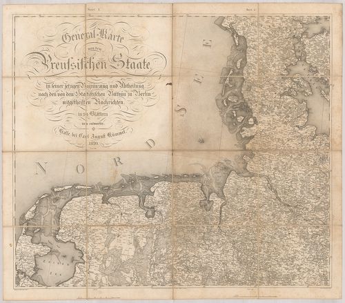
| Title | General Karte von dem Preussischen Staaten, in seiner jetzigen Begraenzung und Abtheilung, nach den von dem Statistischen Bureau zu Berlin Mitgetheilten Nachrichten in 24 Blättern. |
| Main title | Mt.: Fürstenth: Neuchatel. (Neuchateli fejedelemség.)A porosz államok általános térképe a berlini statisztikai hivatal felosztása szerint 1820-ban. |
30. A Német Szövetség közönséges földtérképe. [B IV a 45]
Institute and Museum of Military History •
B IV a
•
B IV Német birodalom
•
B I–XV. Európa
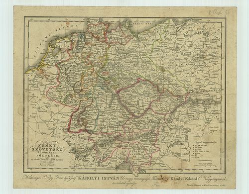
| Title | A Német Szövetség közönséges földtérképe. |
31. General-Karte vom Süd-Westlichen Deutschland. [B IV a 46]
Institute and Museum of Military History •
B IV a
•
B IV Német birodalom
•
B I–XV. Európa
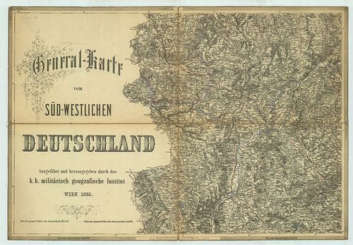
| Title | General-Karte vom Süd-Westlichen Deutschland. |
| Main title | Németország délnyugati részének általános térképe 1865-ben. |
32. Special-karte von Deutschland, der Schweiz und Benachbarten ... [B IV a 47/1]
Institute and Museum of Military History •
B IV a
•
B IV Német birodalom
•
B I–XV. Európa
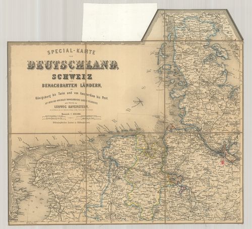
| Title | Special-karte von Deutschland, der Schweiz und Benachbarten Ländern, von Königsberg bis Turin und von Amsterdam bis Pest. |
| Main title | Németország és Svájc általános térképe 1868 körül. |
33. Wandkarte von Deutschland in seiner Neugestaltung zum Schul ... [B IV a 48]
Institute and Museum of Military History •
B IV a
•
B IV Német birodalom
•
B I–XV. Európa
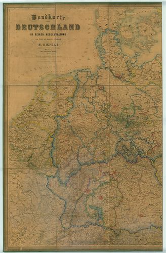
| Title | Wandkarte von Deutschland in seiner Neugestaltung zum Schul und Comptoir-Gebrauch. |
| Main title | Németország iskolai falitérképe 1869-ben. |
34. Deutschland. [B IV a 49]
Institute and Museum of Military History •
B IV a
•
B IV Német birodalom
•
B I–XV. Európa
| Title | Deutschland. |
| Main title | Németország általános térképe. |
35. Das Deutsche Reich. [B IV a 54]
Institute and Museum of Military History •
B IV a
•
B IV Német birodalom
•
B I–XV. Európa
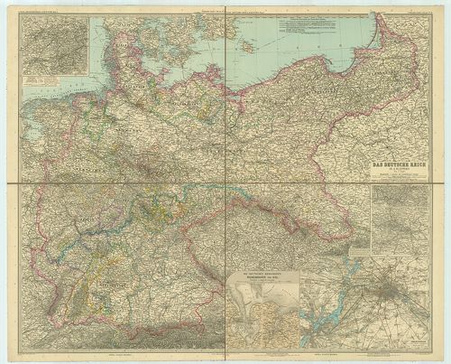
| Title | Das Deutsche Reich. |
| Main title | 6 mt.: 1. Das Ruhrkohlen Gebiet. (A Ruhrvidék szénterülete.) |
| Subject | 2. Das Saarbrücker Kohlenrevier. |
36. [Neuburg by Danubius.] [B IV a 56]
Institute and Museum of Military History •
B IV a
•
B IV Német birodalom
•
B I–XV. Európa
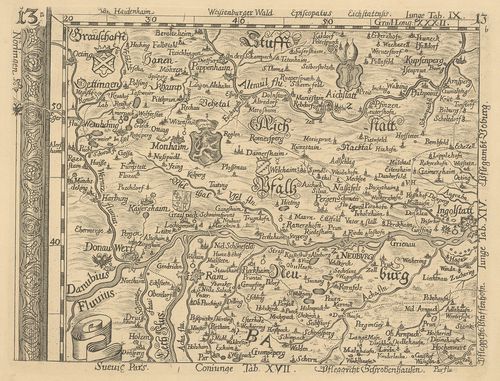
| Title | [Neuburg by Danubius.] |
| Main title | Neuburg an der Donau környékének térképe. |
37. Coloniensis Archiepiscopatus. [B IV a 56/1]
Institute and Museum of Military History •
B IV a
•
B IV Német birodalom
•
B I–XV. Európa
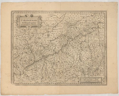
| Title | Coloniensis Archiepiscopatus. |
| Main title | A Kölni Érsekség térképe. |
38. Landgraviat Thuringiae Tabula Generalis… [B IV a 56/2]
Institute and Museum of Military History •
B IV a
•
B IV Német birodalom
•
B I–XV. Európa
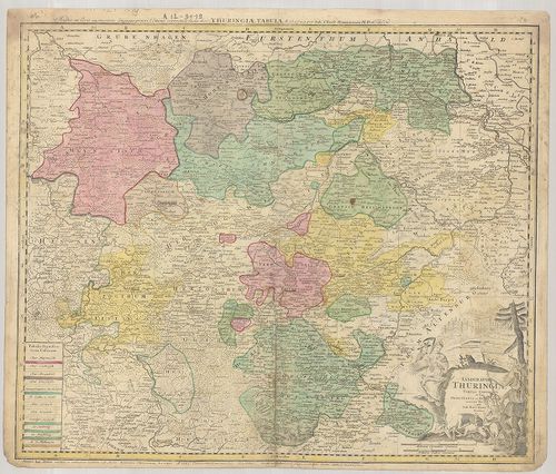
| Title | Landgraviat Thuringiae Tabula Generalis… |
| Main title | Thüringia áttekintő térképe 1729-ben. |
39. Electoratus Moguntinus ut et Palatin: Infer. Hassiae… [B IV a 56/3]
Institute and Museum of Military History •
B IV a
•
B IV Német birodalom
•
B I–XV. Európa
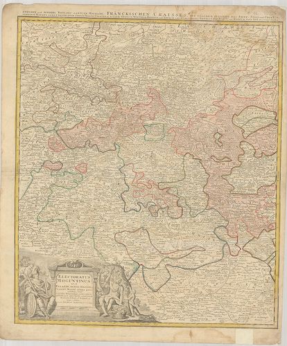
| Title | Electoratus Moguntinus ut et Palatin: Infer. Hassiae… |
| Main title | A Mainzi Választófejedelemség térképe. |
40. Waldecciae ac Finitimorum Dominiorum Itterani et Cansteinian... [B IV a 56/4]
Institute and Museum of Military History •
B IV a
•
B IV Német birodalom
•
B I–XV. Európa
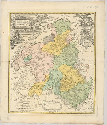
| Title | Waldecciae ac Finitimorum Dominiorum Itterani et Cansteiniani nec non infertae Dioeces is Eimelrodensis accurata Tabula. |
| Main title | A Waldecki Fejedelemség térképe 1733-ban. |