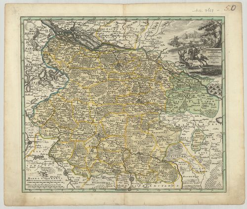
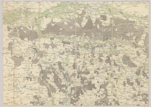
101. Wetteravia cum omnibus inclusis Principatibus Comitatibus Do... [B IV a 103/1]
Institute and Museum of Military History •
B IV a
•
B IV Német birodalom
•
B I–XV. Európa
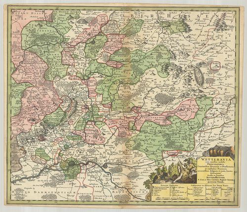
| Title | Wetteravia cum omnibus inclusis Principatibus Comitatibus Dominiis et Prefekturis, et confinibus Provinciis accuratissime designata et juxta limites determinata. |
| Main title | Wetterau általános térképe a 18. században. (A Rajna–Majna–Lahn közötti vidék.) |
102. West Deutschland und Ost Frankreich Niederlande und Belgien. [B IV a 104/1]
Institute and Museum of Military History •
B IV a
•
B IV Német birodalom
•
B I–XV. Európa
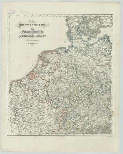
| Title | West Deutschland und Ost Frankreich Niederlande und Belgien. |
| Main title | Nyugat-Németország Kelet-Franciaország, Hollandia és Belgium térképe úthálózattal. |
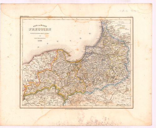
103. Regnum Borussiae. [B IV a 105]
Institute and Museum of Military History •
B IV a
•
B IV Német birodalom
•
B I–XV. Európa
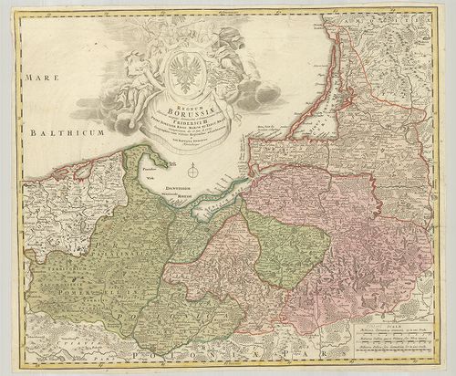
| Title | Regnum Borussiae. |
| Main title | Poroszország általános térképe 1701-ben. |
104. Plan der Festung Mainz und Castel nebst der Umliegenden Gege... [B IV a 108]
Institute and Museum of Military History •
B IV a
•
B IV Német birodalom
•
B I–XV. Európa
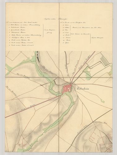
| Title | Plan der Festung Mainz und Castel nebst der Umliegenden Gegend. |
| Main title | Mainz vára és környékének térképe 1835-ben. |
105. [Poroszország.] [B IV a 109]
Institute and Museum of Military History •
B IV a
•
B IV Német birodalom
•
B I–XV. Európa
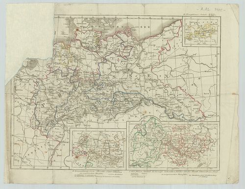
| Title | [Poroszország.] |
| Main title | 3 mt.: I. Kur Hessen, Waldeck, die Herzogl: Sächsischen Länder mit den Fürstth: Schwarzburg und Reuss. II. Braunschweig und die Fürstth: Lippe. III. Herzogthümer Anhalt. |
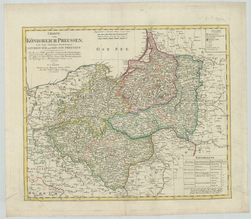
106. General Karte von den Koenig: Preussischen Staaten nach den ... [B IV a 110]
Institute and Museum of Military History •
B IV a
•
B IV Német birodalom
•
B I–XV. Európa
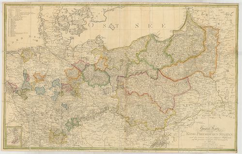
| Title | General Karte von den Koenig: Preussischen Staaten nach den neuesten und zuverlässigsten Hülfsmitteln auf das genauste entworfen und herausgegeben in Jahre 1799. |
| Main title | Mt.: Neufchatel und Valangin. (Sv.) (Neuchatel és Valangin környéke.)A Porosz Királyság térképe 1799-ben. |
107. Karte von dem Koenigreiche Preussen. [B IV a 111]
Institute and Museum of Military History •
B IV a
•
B IV Német birodalom
•
B I–XV. Európa
| Title | Karte von dem Koenigreiche Preussen. |
| Main title | A Porosz Királyság térképe 1796-ban. |
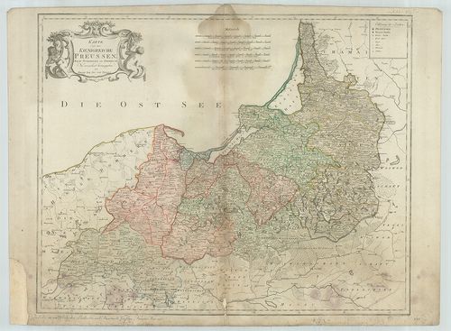
108. Nassoviae Principatus… [B IV a 112]
Institute and Museum of Military History •
B IV a
•
B IV Német birodalom
•
B I–XV. Európa
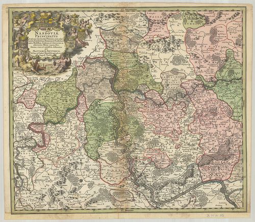
| Title | Nassoviae Principatus… |
| Main title | A Nassau-i hercegség térképe. |
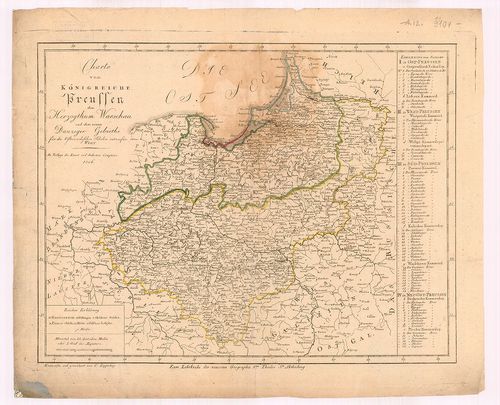
109. Carte du Royaume de Prusse et de la partie Septentrionale du... [B IV a 113]
Institute and Museum of Military History •
B IV a
•
B IV Német birodalom
•
B I–XV. Európa
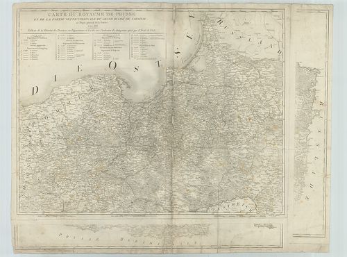
| Title | Carte du Royaume de Prusse et de la partie Septentrionale du Grand Duché de Varsovie. |
| Main title | A Porosz Királyság és a Varsói hercegség térképe 1808-ban. |
110. Nova Tabula Totius Frisiae Orientalis… [B IV a 114]
Institute and Museum of Military History •
B IV a
•
B IV Német birodalom
•
B I–XV. Európa
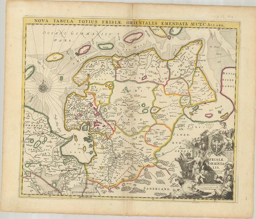
| Title | Nova Tabula Totius Frisiae Orientalis… |
| Main title | A Frízföld keleti részének térképe. |
111. Karte vom Preussischen Staate mit angrenzenden Ländern Nord-... [B IV a 117]
Institute and Museum of Military History •
B IV a
•
B IV Német birodalom
•
B I–XV. Európa
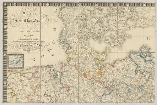
| Title | Karte vom Preussischen Staate mit angrenzenden Ländern Nord-Teutschlands. |
| Main title | Mt.: Das Fürstenthum Neuchatel. (Sv.) (Neuchatel hercegség.)A porosz államok térképe. |
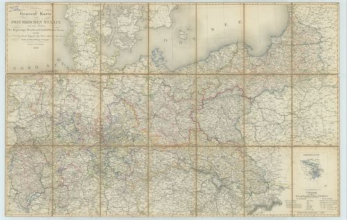
112. General Karte vom Preussischen Staate mit den Gränzen der Re... [B IV a 118]
Institute and Museum of Military History •
B IV a
•
B IV Német birodalom
•
B I–XV. Európa
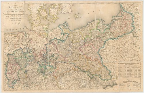
| Title | General Karte vom Preussischen Staate mit den Gränzen der Regierungs-Bezirke und landräthlichen Kreise. |
| Main title | A porosz államok általáns térképe kerületi beosztással 1839-ben. |
113. General-Karte von Preussen. [B IV a 119]
Institute and Museum of Military History •
B IV a
•
B IV Német birodalom
•
B I–XV. Európa
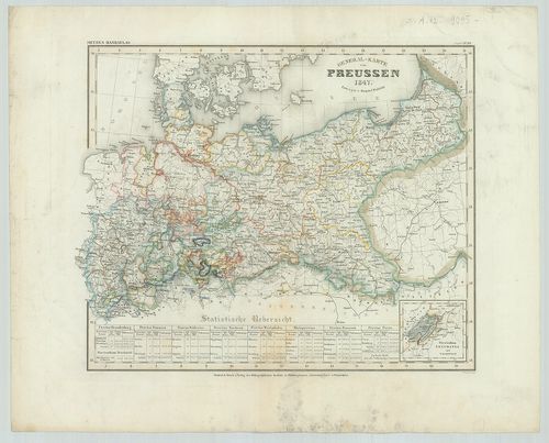
| Title | General-Karte von Preussen. |
| Main title | Mt.: Fürstenthum Neuchatel und Valengin. (Neuchatel Hercegség.) (Sv.) A „Meyers Handatlas No. 114.” lapja.Poroszország általános térképe 1847-ben. |
114. General Karte von dem Preussischen Staate. [B IV a 124]
Institute and Museum of Military History •
B IV a
•
B IV Német birodalom
•
B I–XV. Európa
| Title | General Karte von dem Preussischen Staate. |
| Main title | Mt.: Fürstenthum Neuchatel. (Neuchatel hercegség.) (Sv.) Vv.A porosz államok általános térképe 1849-ben. |
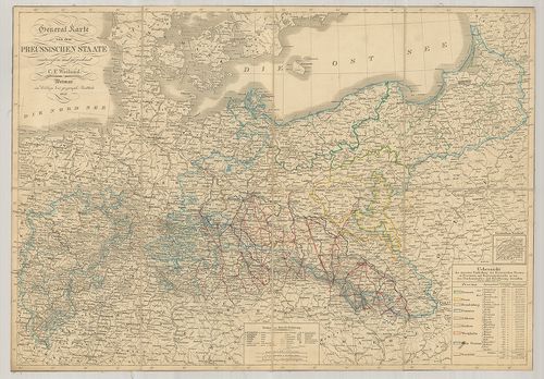
115. General Karte vom Preussischen Staate mit den Gränzen der Re... [B IV a 125]
Institute and Museum of Military History •
B IV a
•
B IV Német birodalom
•
B I–XV. Európa
| Title | General Karte vom Preussischen Staate mit den Gränzen der Regierungs-Bezirke und landrätlichen Kreise. |
| Main title | Mt.: Hohenzollern.A porosz államok általános térképe 1866-ban kerületi beosztással. |
116. Karte von Preussischen Staate mit Besonderer berücksichtigun... [B IV a 127]
Institute and Museum of Military History •
B IV a
•
B IV Német birodalom
•
B I–XV. Európa
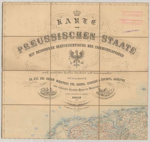
| Title | Karte von Preussischen Staate mit Besonderer berücksichtigung der Communationen |
| Main title | A porosz államok térképe vasúthálózattal 1860-ban. |
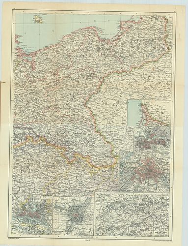
117. Nordost-Deutschland. [B IV a 128]
Institute and Museum of Military History •
B IV a
•
B IV Német birodalom
•
B I–XV. Európa
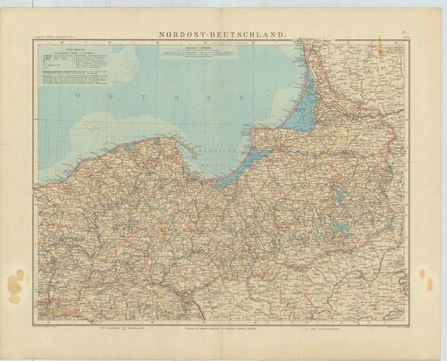
| Title | Nordost-Deutschland. |
| Main title | Németország ÉK-i részének általános térképe 1912-ben. |
118. Karte von Ost-Preussen nebst Preussich Litthauen und West-Pr... [B IV a 132]
Institute and Museum of Military History •
B IV a
•
B IV Német birodalom
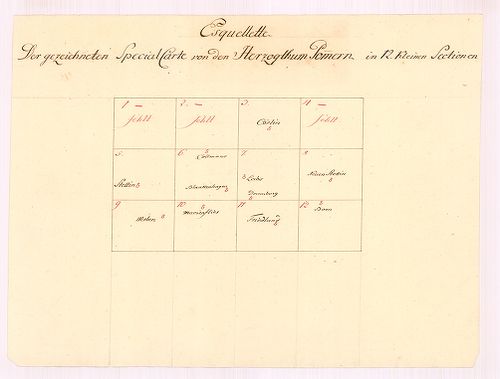
•
B I–XV. Európa
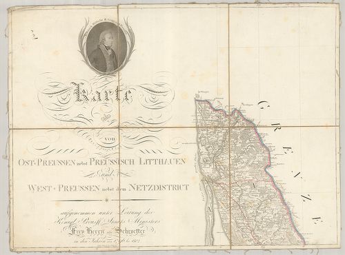
| Title | Karte von Ost-Preussen nebst Preussich Litthauen und West-Preussen nebst dem Netzdistrict. |
| Main title | 3 mt.: 1. Grundriss der Stadt Danzig. (Gdansk várostérk.) 2. Grundriss der Haupt und Residenz Stadt Königsberg. (Kalinyingrad várostérk.) 3. General Tableau zur Karte von Alt Ost und Westpreussen nebst dem aufgenommen Trigonometrischen Netz. (Poroszország trigonometriai hálózata.)Poroszország K-i és NY-i része, Litvánia térképe 1809-ben. |
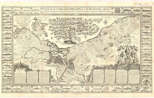
119. Tabula Marchionatus Brandenburgici et Ducatus Pomeraniae que... [B IV a 139]
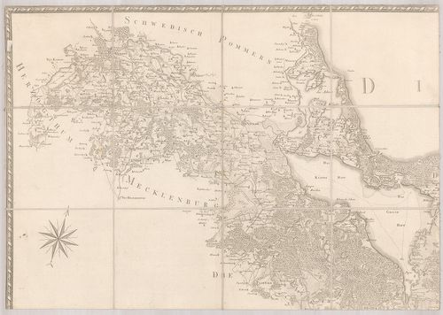
Institute and Museum of Military History •
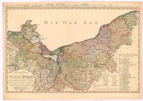
B IV a
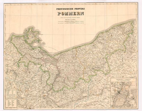
•
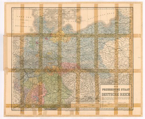
B IV Német birodalom
•
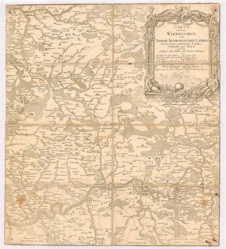
B I–XV. Európa
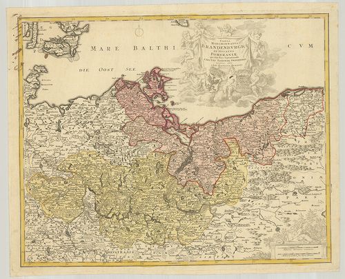
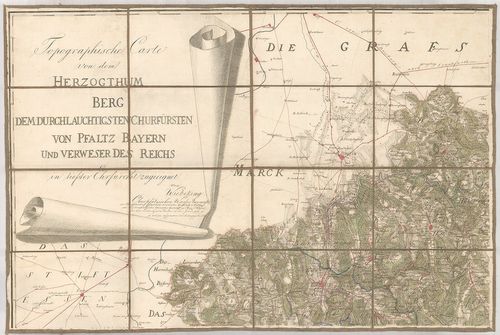
| Title | Tabula Marchionatus Brandenburgici et Ducatus Pomeraniae que siuit Pars Septentrionalis Circuli Saxoniae Superioris. |
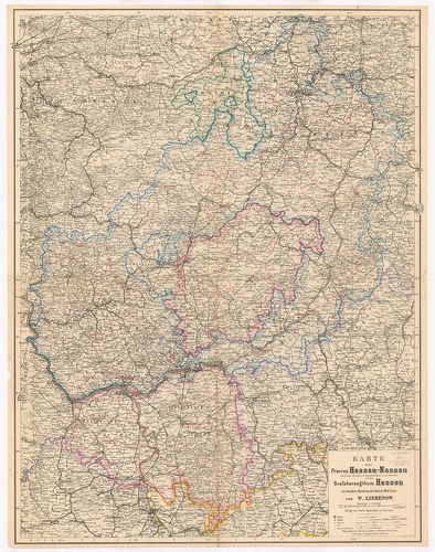
| Main title | A Brandenburg-i grófság és Pomeránia-i hercegség térképe. |
120. Geographische Delineation des zu denen Kur Sächsischen Lande... [B IV a 146]
Institute and Museum of Military History •
B IV a
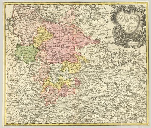
•
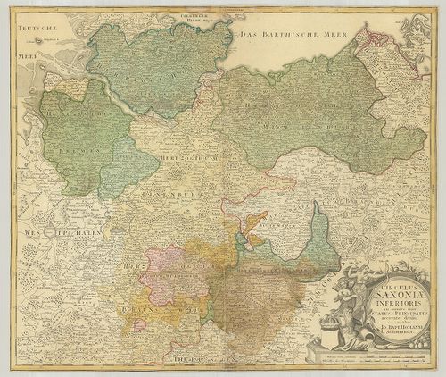
B IV Német birodalom
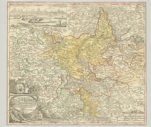
•
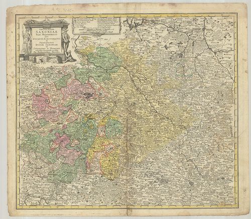
B I–XV. Európa
| Title | Geographische Delineation des zu denen Kur Sächsischen Landen gehörigen Marggraffthums Nieder Lausitz… |
| Main title | A szász tartomány általános térképe Alsó-Lausitz őrgrófság területével együtt 1757-ben. |
121. Charte von der Neumarck. [B IV a 152]
Institute and Museum of Military History •
B IV a
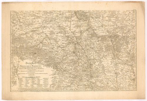
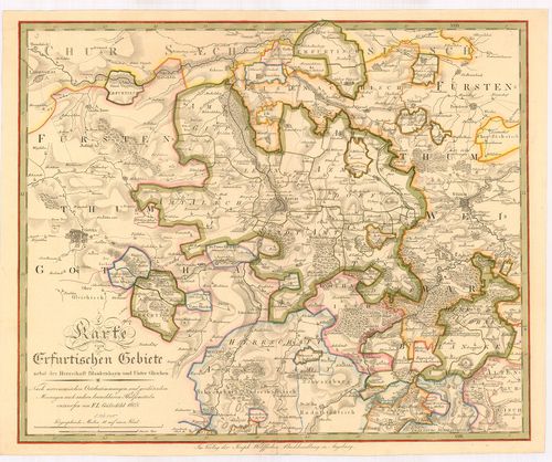
•
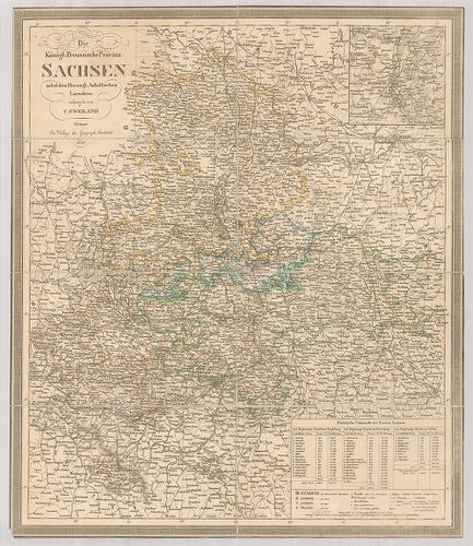
B IV Német birodalom
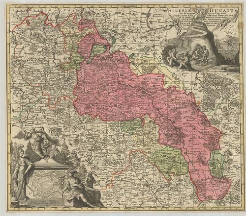
•
B I–XV. Európa
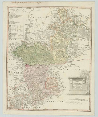
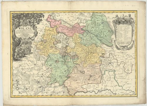
| Title | Charte von der Neumarck. |
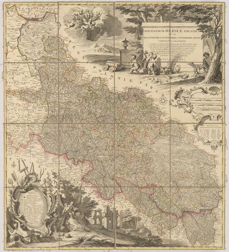
| Main title | Neumark porosz terület térképe 1789-ben. |
122. Special Karte von der Ukermark. [B IV a 155]
Institute and Museum of Military History •
B IV a
•
B IV Német birodalom
•
B I–XV. Európa
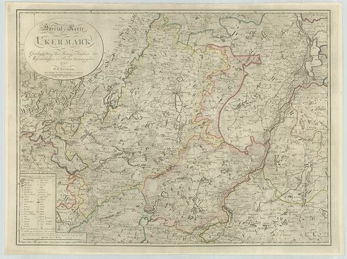
| Title | Special Karte von der Ukermark. |
| Main title | Uckermark porosz terület részletes térképe 1796-ban. |
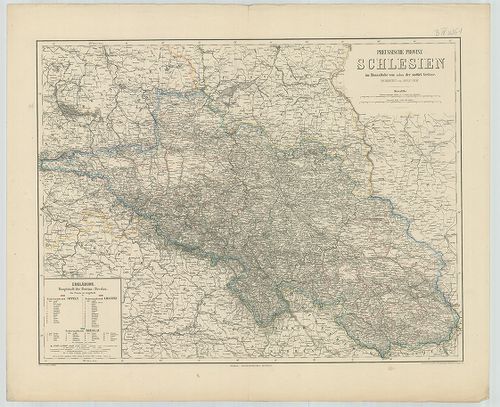
123. Special Karte von der Neumark und den angrenzenden Ländern. [B IV a 161]
Institute and Museum of Military History •
B IV a
•
B IV Német birodalom
•
B I–XV. Európa
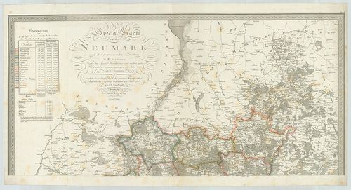
| Title | Special Karte von der Neumark und den angrenzenden Ländern. |
| Main title | Neumark porosz terület részletes térképe a szomszédos tartományok egy részével 1818-ban. |
124. Electoratus sive Marchia Brandenburgensis juxta novissimam D... [B IV a 165]
Institute and Museum of Military History •
B IV a
•
B IV Német birodalom
•
B I–XV. Európa
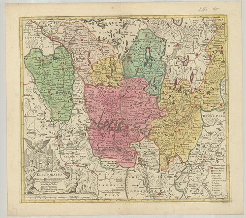
| Title | Electoratus sive Marchia Brandenburgensis juxta novissimam Delineationem in mappa geographica. |
| Main title | A Brandenburg-i grófság térképe. |
125. Brandenburg. [B IV a 166]
Institute and Museum of Military History •
B IV a
•
B IV Német birodalom
•
B I–XV. Európa
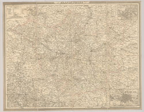
| Title | Brandenburg. |
| Main title | 2 mt.: 1. Die nächste Umgebung von Potsdam. (Potsdam és környéke.) 2. Die nächste Umgebung von Berlin. (Berlin és környéke.) |
| Subject | Brandenburg tartomány térképe. |
126. Topographische Karte der Provinz Brandenburg. [B IV a 170]
Institute and Museum of Military History •
B IV a
•
B IV Német birodalom
•
B I–XV. Európa
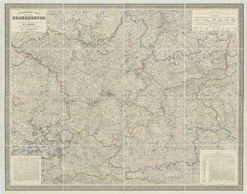
| Title | Topographische Karte der Provinz Brandenburg. |
| Main title | Brandenburg tartomány térképe 1861-ben. |
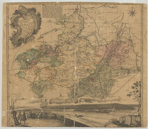
127. S. R. Imp. Comitatus Hanau proprie sic dictus, cum singulis ... [B IV a 177]
Institute and Museum of Military History •
B IV a
•
B IV Német birodalom
•
B I–XV. Európa
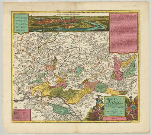
| Title | S. R. Imp. Comitatus Hanau proprie sic dictus, cum singulis suis Praefecturis, ut et Comitatus Solms. Budingen et Nidda cumrelique Wetteravia et vicinis Regionibus. |
| Main title | A Hanau-i grófság térképe 1728-ban. |
128. Episcopatus Hildesiensis… [B IV a 178]
Institute and Museum of Military History •
B IV a
•
B IV Német birodalom
•
B I–XV. Európa
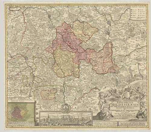
| Title | Episcopatus Hildesiensis… |
| Main title | Mt.: Ichnographia Hildesiae. (Hildesheim város térképe és látképe.)A Hildesheim-i püspökség térképe. |
129. Territorium Seculare Episcopatus Monasterii Munster Germanis... [B IV a 182]
Institute and Museum of Military History •
B IV a
•
B IV Német birodalom
•
B I–XV. Európa
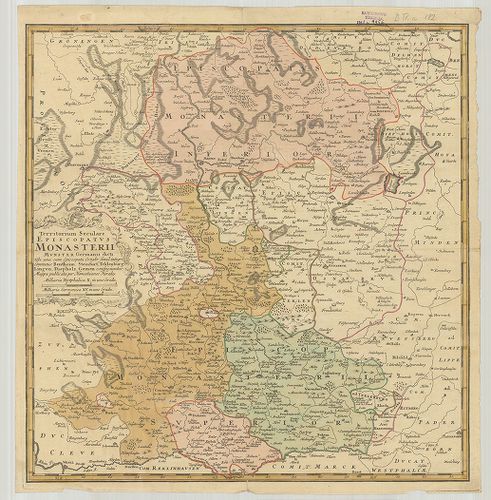
| Title | Territorium Seculare Episcopatus Monasterii Munster Germanis dicti. |
| Main title | A Münster-i püspökség térképe. |
130. Territorii Episcopatus Osnabrugensis Tabula geographica. [B IV a 183]
Institute and Museum of Military History •
B IV a
•
B IV Német birodalom
•
B I–XV. Európa
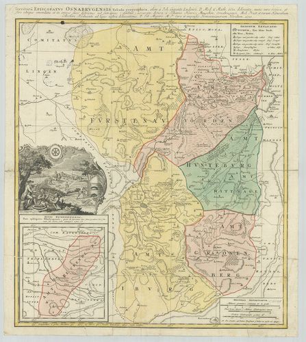
| Title | Territorii Episcopatus Osnabrugensis Tabula geographica. |
| Main title | Mt.: Ditio Reckenbergensis. (Reckenberg tartomány.)Az Osnabrück-i püspökség földrajzi térképe 1631-ben. |
131. Special Karte vom Fürstenthum Hildesheim. [B IV a 184]
Institute and Museum of Military History •
B IV a
•
B IV Német birodalom
•
B I–XV. Európa
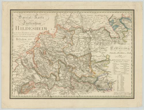
| Title | Special Karte vom Fürstenthum Hildesheim. |
| Main title | A Hildesheim-i hercegség részletes térképe 1803-ban. |
132. Topographische Karte des Fürstenthums Hildesheim. [B IV a 191]
Institute and Museum of Military History •
B IV a
•
B IV Német birodalom
•
B I–XV. Európa
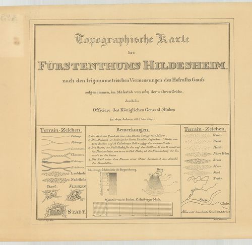
| Title | Topographische Karte des Fürstenthums Hildesheim. |
| Main title | A Hildesheim hercegség topográfiai térképe 1840-ben. |
133. Das Königreich Hannover nebst dem Grossherzogthume Holstein-... [B IV a 193]
Institute and Museum of Military History •
B IV a
•
B IV Német birodalom
•
B I–XV. Európa
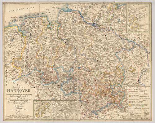
| Title | Das Königreich Hannover nebst dem Grossherzogthume Holstein-Oldenburg dem Herzogthume Braunschweig den Fürstenthümern Lippe-Detmold und Schauenburg Lippe nebst Gebieten der Freien Staedte Bremen Hamburg und Lübeck. |
| Main title | 3 mt.: 1. Fürstenthum Lübeck. 2. Fürstenthum Birkenfeld. 3. Hannover |
| Subject | Hannover és környező hercegi tartományok térképe a határos szabad Bréma, Hamburg és Lübeck városokkal 1845-ben. |
134. Topographische Karte des Amtes Hunnesrück. [B IV a 194]
Institute and Museum of Military History •
B IV a
•
B IV Német birodalom
•
B I–XV. Európa
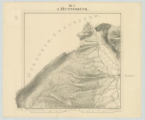
| Title | Topographische Karte des Amtes Hunnesrück. |
| Main title | A Hunsrück-hegyvidék topográfiai térképe 1841-ben. |
135. Topographische Karte der Herrschaft Plesse, der Gerichte Alt... [B IV a 195]
Institute and Museum of Military History •
B IV a
•
B IV Német birodalom
•
B I–XV. Európa
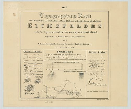
| Title | Topographische Karte der Herrschaft Plesse, der Gerichte Alten- und Neuen Gleichen und des Königlich Hannoverschen Antheils des Eichfeldes. |
| Main title | Az Eichsfeld-i hegyvidék topográfiai térképe 1842-ben. |
136. Topographische Karte der Vogtei Auburg Amt Diepholz. [B IV a 197]
Institute and Museum of Military History •
B IV a
•
B IV Német birodalom
•
B I–XV. Európa
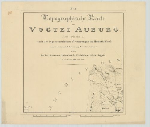
| Title | Topographische Karte der Vogtei Auburg Amt Diepholz. |
| Main title | Diepholz környékének topográfiai térképe 1846-ban. |
137. Topographische Karte des Amtes Uchte. [B IV a 198]
Institute and Museum of Military History •
B IV a
•
B IV Német birodalom
•
B I–XV. Európa
| Title | Topographische Karte des Amtes Uchte. |
| Main title | Uchte környékének topográfiai térképe 1846-ban. |
138. Hannover Braunschweig Oldenburg und die Hansestädte. [B IV a 200]
Institute and Museum of Military History •
B IV a
•
B IV Német birodalom
•
B I–XV. Európa
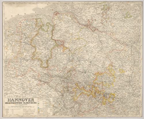
| Title | Hannover Braunschweig Oldenburg und die Hansestädte. |
| Main title | Mt.: Holstein. (A szabad Lübeck várossal.) |
| Subject | A Hanza-szövetséghez tartozó városok és Hannover, Braunschweig, Oldenburg térképe. |
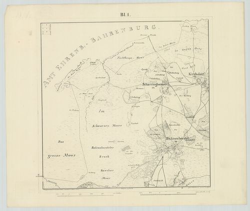
139. Topographische Karte der Landrostei Osnabrück. [B IV a 201]
Institute and Museum of Military History •
B IV a
•
B IV Német birodalom
•
B I–XV. Európa
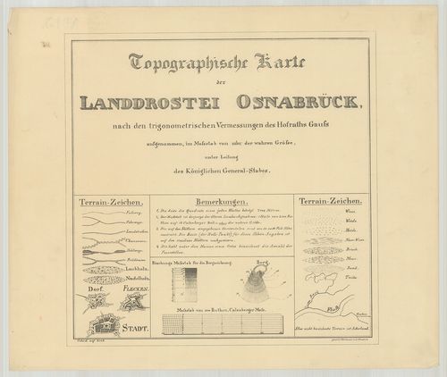
| Title | Topographische Karte der Landrostei Osnabrück. |
| Main title | Az Osnabrück-i porosz kerület topográfiai térképe 1852-ben. |
140. [Lingen, Bentheim grófság és Arenberg-Meppen hercegség topog... [B IV a 202]
Institute and Museum of Military History •
B IV a
•
B IV Német birodalom
•
B I–XV. Európa
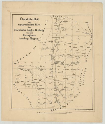
| Title | [Lingen, Bentheim grófság és Arenberg-Meppen hercegség topográfiai térképe.] |
141. Ducatus Luneburgensis et Comitatus Dannebergensis nova tabul... [B IV a 203]
Institute and Museum of Military History •
B IV a
•
B IV Német birodalom
•
B I–XV. Európa
| Title | Ducatus Luneburgensis et Comitatus Dannebergensis nova tabula. |
| Main title | A Lüneburg-i hercegség és a Dannenberg-i grófság térképe. |
142. Le comté de la Marck, Les Seigneuries des Abbayes de Werden,... [B IV a 204]
Institute and Museum of Military History •
B IV a
•
B IV Német birodalom
•
B I–XV. Európa
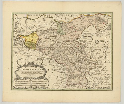
| Title | Le comté de la Marck, Les Seigneuries des Abbayes de Werden, d’Essen, et la Ville Imperiale de Dortmund. |
| Main title | Németország: Mark grófság, Werden, Essen grófság és apátságok és Dortmund császári város térképe. |
143. Potentissimo Borussorum Regi Friderico Wilhelmo Majestate, F... [B IV a 205]
Institute and Museum of Military History •
B IV a
•
B IV Német birodalom
•
B I–XV. Európa
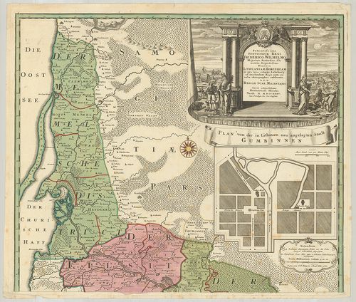
| Title | Potentissimo Borussorum Regi Friderico Wilhelmo Majestate, Fortitudine Clementia Augustissimo Hancce Lithuaniam Borussicam in qua loca colonijs Salisburg. |
| Main title | Mt.: Plan von der in Litthauen neu angelegten Stadt Gumbinnen. (Guszev város térképe.)Porosz-Litvánia térképe 1733-ban. |
144. General Karte von Ost-West-Süd und Neu-Ostpreussen. [B IV a 210]
Institute and Museum of Military History •
B IV a
•
B IV Német birodalom
•
B I–XV. Európa
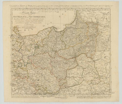
| Title | General Karte von Ost-West-Süd und Neu-Ostpreussen. |
| Main title | A Porosz Királyság általános térképe 1796-ban. |
145. [Dél-Poroszország általános térképe.] [B IV a 211]
Institute and Museum of Military History •
B IV a
•
B IV Német birodalom
•
B I–XV. Európa
| Title | [Dél-Poroszország általános térképe.] |
146. Karte von Ost-Preussen, Litthauen, West-Preussen und dem Net... [B IV a 212]
Institute and Museum of Military History •
B IV a
•
B IV Német birodalom
•
B I–XV. Európa

| Title | Karte von Ost-Preussen, Litthauen, West-Preussen und dem Netz-Distrikte, enthaltend die Regierungs-Bezirke: Koenigsberg, Gumbinnen, Danzig, Marienwerder und Bromberg. |
| Main title | Poroszország, Litvánia általános térképe 1848-ban. |
147. Kétold. térk. I. Deutschland. [B IV a 213]
Institute and Museum of Military History •
B IV a
•
B IV Német birodalom
•
B I–XV. Európa
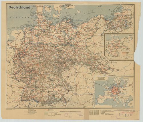
| Title | Kétold. térk. I. Deutschland. |
| Main title | 2 mt.: 1. Reichsautobahnen. (Az ország autótérképe.) 2. Streckennetz der deutschen Verkehrsflugzeuge. (Légiúthálózat.)Németország út-vasúttérképe 1937-ben. |
| Subject | II. Kurmark Brandenburg |
148. Preussische Provinz Sachsen. [B IV a 214]
Institute and Museum of Military History •
B IV a
•
B IV Német birodalom
•
B I–XV. Európa
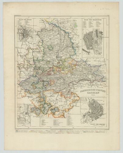
| Title | Preussische Provinz Sachsen. |
| Main title | 4 mt.: 1. Plan von Halle. 2. Plan von Magdeburg. 3. Torgau. 4. Plan von Erfurt. |
| Subject | A szász tartományok általános térképe 1852-ben. |
149. Provinz Ostpreussen. [B IV a 215]
Institute and Museum of Military History •
B IV a
•
B IV Német birodalom
•
B I–XV. Európa
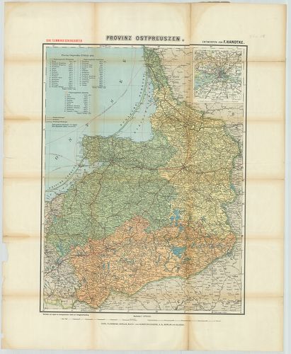
| Title | Provinz Ostpreussen. |
| Main title | Mt.: [Königsberg (Kalinyingrád) és környéke.] |
| Subject | Kelet-Poroszország tartományainak térképe. |
150. Charte vom Königreich Preussen, nach seiner dermaligen Einth... [B IV a 215/1]
Institute and Museum of Military History •
B IV a
•
B IV Német birodalom
•
B I–XV. Európa
| Title | Charte vom Königreich Preussen, nach seiner dermaligen Eintheilung in Ost-West-Süd und Neu-Ost-Preussen. |
| Main title | A Porosz Királyság térképe 1805-ben. |
151. Kétold. térk. I. Ostpreussen und Litauen. II. Kurland und Li... [B IV a 216]
Institute and Museum of Military History •
B IV a
•
B IV Német birodalom
•
B I–XV. Európa
| Title | Kétold. térk. I. Ostpreussen und Litauen. II. Kurland und Livland. |
| Main title | 2 mt.: Warschau und Umgebung. (Varsó és környéke.) 2. Brest-Litowsk und Umgebung. (Breszt és környéke.) |
| Subject | I. Kelet-Poroszország és Litvánia. II. Kurföld és Livonija térképe. |
152. Tabula Geographica Totam Borussiam ut et Districtum Notecens... [B IV a 216/1]
Institute and Museum of Military History •
B IV a
•
B IV Német birodalom
•
B I–XV. Európa
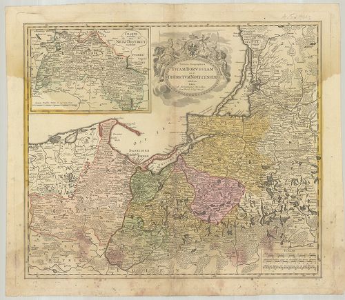
| Title | Tabula Geographica Totam Borussiam ut et Districtum Notecensem. |
| Main title | Mt.: Charte welche den Netz District vorstellet. (Kujawy terület térképe.)Poroszország térképe kerületi beosztással. |
153. Karte von den Königl. Preussischen Provinzen Preussen und Po... [B IV a 217]
Institute and Museum of Military History •
B IV a
•
B IV Német birodalom
•
B I–XV. Európa
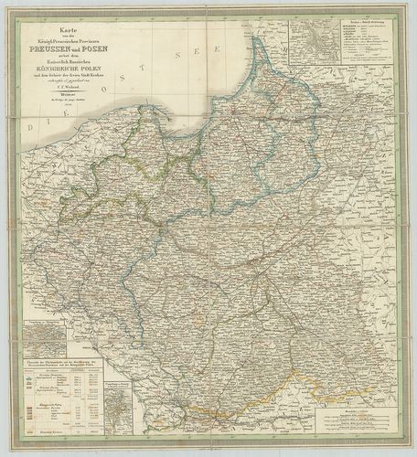
| Title | Karte von den Königl. Preussischen Provinzen Preussen und Posen nebst dem Kaiserlich Russischen Königreiche Polen. |
| Main title | 3 mt.: Umgebung von Königsberg. (Kalinyingrád és környéke.) 2. Umgebung von Danzig. (Gdansk és környéke.) 3. Umgebung von Warschau. (Varsó és környéke.)A Porosz Királyság tartományai és Lengyelország térképe 1847-ben. |
154. Ost- und West-Preussen. [B IV a 218]
Institute and Museum of Military History •
B IV a
•
B IV Német birodalom
•
B I–XV. Európa
| Title | Ost- und West-Preussen. |
| Main title | Kelet-és Nyugat-Poroszország térképe 1847-ben. |
155. Provinz Brandenburg. [B IV a 219]
Institute and Museum of Military History •
B IV a
•
B IV Német birodalom
•
B I–XV. Európa
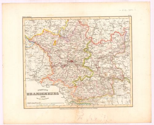
| Title | Provinz Brandenburg. |
| Main title | Brandenburg tartomány térképe 1846-ban. |
156. Provinz Posen. [B IV a 220]
Institute and Museum of Military History •
B IV a
•
B IV Német birodalom
•
B I–XV. Európa
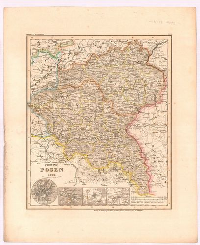
| Title | Provinz Posen. |
| Main title | 4 mt.: 1. Posen (Poznan) 2. Bromberg, (Bydgoszcz) 3. Lissa, (Leszno) 4. Fraustadt, (Wschowa) Várostérk. |
| Subject | Posen tartomány térképe 1844-ben. |
157. Provinz Pommern. [B IV a 221]
Institute and Museum of Military History •
B IV a
•
B IV Német birodalom
•
B I–XV. Európa
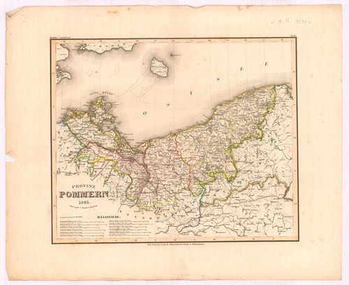
| Title | Provinz Pommern. |
| Main title | Pomerániai tartomány térképe 1845-ben. |
158. [A Pomeránia-i hercegség térképe.] [B IV a 225]
Institute and Museum of Military History •
B IV a
•
B IV Német birodalom
•
B I–XV. Európa
| Title | [A Pomeránia-i hercegség térképe.] |
159. Special Karte des Deutschen Reiches. [B IV a 226]
Institute and Museum of Military History •
B IV a
•
B IV Német birodalom
•
B I–XV. Európa
| Title | Special Karte des Deutschen Reiches. |
| Main title | 5 mt.: 1. Hamburg u. Umgebung. (Hamburg és környéke.) 2. München u. Umgebung. (München és környéke.) 3. Industrie-Bezirk zwischen Rhein, Ruhr u. Wupper. (A Ruhr-vidék.) 4. Dresden u. Umgebung. (Drezda és környéke.) 5. Berlin u. Umgebung (Berlin és környéke.)Németország keleti részének térképe. |
160. Charte vom Königreiche Preussen dem Herzogthum Warschau und ... [B IV a 232]
Institute and Museum of Military History •
B IV a
•
B IV Német birodalom
•
B I–XV. Európa
| Title | Charte vom Königreiche Preussen dem Herzogthum Warschau und dem neuen Danziger Gebiethe für die Österreichischen Schulen. |
| Main title | A Porosz Királyság, a Varsói hercegség és Gdansk térképe 1806-ban. |
161. Pomerania Utraque cum insertis vicinisqus distionibus. [B IV a 233]
Institute and Museum of Military History •
B IV a
•
B IV Német birodalom
•
B I–XV. Európa
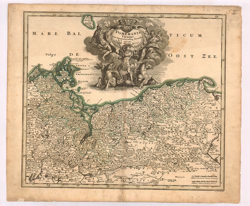
| Title | Pomerania Utraque cum insertis vicinisqus distionibus. |
| Main title | Pomeránia térképe. |
162. Nova Illustrissimi Principatus Pomeraniae des Criptio cum ad... [B IV a 234]
Institute and Museum of Military History •
B IV a
•
B IV Német birodalom
•
B I–XV. Európa
| Title | Nova Illustrissimi Principatus Pomeraniae des Criptio cum adjuncta Principum Genealogia et Principum veris et potiorum Urbium imaginibus et Nobilium Insignibus. |
| Main title | A Pomeránia hercegség térképe. |
163. Karte des Königl. Preuss. Herzogthums Vor- und Hinter Pommer... [B IV a 235]
Institute and Museum of Military History •
B IV a
•
B IV Német birodalom
•
B I–XV. Európa
| Title | Karte des Königl. Preuss. Herzogthums Vor- und Hinter Pommern. |
| Main title | A Pomeránia hercegség térképe 1789-ben. |
164. Special Charte vom Herzogthum Pommern... [B IV a 236]
Institute and Museum of Military History •
B IV a
•
B IV Német birodalom
•
B I–XV. Európa
| Title | Special Charte vom Herzogthum Pommern... |
| Main title | A Pomerániai hercegség általános térképe 1804-ben. |
165. Preussische Provinz Pommern. [B IV a 240]
Institute and Museum of Military History •
B IV a
•
B IV Német birodalom
•
B I–XV. Európa
| Title | Preussische Provinz Pommern. |
| Main title | Mt.: Umgebung von Stettin. (Szczecin és környéke.) |
| Subject | A pomeránia porosz tartomány térképe. |
166. Der Preussische Staat und das Deutsche Reich. [B IV a 241/3]
Institute and Museum of Military History •
B IV a
•
B IV Német birodalom
•
B I–XV. Európa
| Title | Der Preussische Staat und das Deutsche Reich. |
| Main title | A porosz államok és a Német Birodalom térképe. |
167. Les Duchés de Cleves, de Iullers et de Limbourg le Comte de ... [B IV a 256]
Institute and Museum of Military History •
B IV a
•
B IV Német birodalom
•
B I–XV. Európa
| Title | Les Duchés de Cleves, de Iullers et de Limbourg le Comte de Meurs le Quartier de Ruremonde dans le Duché de Gueldres l’Archevesché et Eslectorat de Cologne. |
| Main title | A Rajna–Maas és Ruhr vidék tartományainak térképe. |
168. Carte von denen Wiedischen und Nieder Isenburgischen Landen,... [B IV a 266]
Institute and Museum of Military History •
B IV a
•
B IV Német birodalom
•
B I–XV. Európa
| Title | Carte von denen Wiedischen und Nieder Isenburgischen Landen, … |
| Main title | A középső Rajna-vidék, Wied grófság térképe 1772-ben. |
169. Topographische Carte von dem Herzogthum Berg dem Durchlaucht... [B IV a 270]
Institute and Museum of Military History •
B IV a
•
B IV Német birodalom
•
B I–XV. Európa
| Title | Topographische Carte von dem Herzogthum Berg dem Durchlauchtigsten Churfürsten von Pfaltz Bayern und Verweser des Reichs. |
| Main title | A Pfalz-i választófejedelemség és a Berg-i hercegség topográfiai térképe 1789–90-ben. |
170. Karte der provinz Hessen-Nassau excl. der Kreise Schmalkalde... [B IV a 271]
Institute and Museum of Military History •
B IV a
•
B IV Német birodalom
•
B I–XV. Európa
| Title | Karte der provinz Hessen-Nassau excl. der Kreise Schmalkalden und Rinteln und des Grossherzogthum Hessen als besonderer Abdruck aus der Karte von Mittel-Europa. |
| Main title | Hessen-Nassau tartomány és a Hesseni nagyhercegség térképe körzeti felosztással. |
171. Topographische Charte des Regirung-Bezirks Düsseldorf. [B IV a 275]
Institute and Museum of Military History •
B IV a
•
B IV Német birodalom
•
B I–XV. Európa
| Title | Topographische Charte des Regirung-Bezirks Düsseldorf. |
| Main title | A düsseldorfi kerület topográfiai térképe 1837-ben. |
172. Karte der Rhein-Provinz und. Prov.[inz] Westfalen. [B IV a 278]
Institute and Museum of Military History •
B IV a
•
B IV Német birodalom
•
B I–XV. Európa
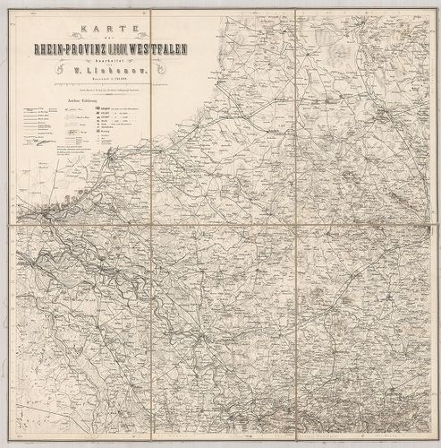
| Title | Karte der Rhein-Provinz und. Prov.[inz] Westfalen. |
| Main title | A Rajna-vidék és Vesztfália tartomány térképe. |
173. Accurate Geographische Delineation des Stiffts Naumburg und ... [B IV a 282]
Institute and Museum of Military History •
B IV a
•
B IV Német birodalom
•
B I–XV. Európa
| Title | Accurate Geographische Delineation des Stiffts Naumburg und Zeitz mit denen Churfürstl. Sächsl. |
| Main title | Naumburg és Zeitz tartományok térképe 1749-ben. |
174. Theatrum Belli in Saxonia Inferiori… [B IV a 283]
Institute and Museum of Military History •
B IV a
•
B IV Német birodalom
•
B I–XV. Európa
| Title | Theatrum Belli in Saxonia Inferiori… |
| Main title | Alsó-Szászország térképe. |
175. Circulus Saxoniae Inferioris in omnes suos Status et Princip... [B IV a 284]
Institute and Museum of Military History •
B IV a
•
B IV Német birodalom
•
B I–XV. Európa
| Title | Circulus Saxoniae Inferioris in omnes suos Status et Principatus Accurate divisus. |
| Main title | Alsó-Szászország térképe. |
176. Saxoniae Tractus Ducatum Magdeburgensem … [B IV a 285]
Institute and Museum of Military History •
B IV a
•
B IV Német birodalom
•
B I–XV. Európa
| Title | Saxoniae Tractus Ducatum Magdeburgensem … |
| Main title | A Magdeburg-i hercegség és a környező tartományok térképe. |
177. Circuli Super. Saxoniae Pars Meridionalis sive Ducatus. Elec... [B IV a 286]
Institute and Museum of Military History •
B IV a
•
B IV Német birodalom
•
B I–XV. Európa
| Title | Circuli Super. Saxoniae Pars Meridionalis sive Ducatus. Electoratus et Principatus Ducum Saxoniae. |
| Main title | Felső-Szászország térképe. |
178. Ducatus Magdeburgensis et Halensis… [B IV a 287]
Institute and Museum of Military History •
B IV a
•
B IV Német birodalom
•
B I–XV. Európa
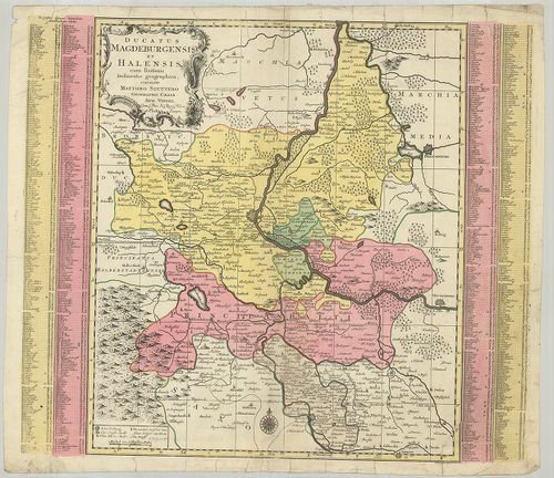
| Title | Ducatus Magdeburgensis et Halensis… |
| Main title | Magdeburg hercegség és Halle térképe. |
179. Principatus Halberstadiensis. [B IV a 289]
Institute and Museum of Military History •
B IV a
•
B IV Német birodalom
•
B I–XV. Európa
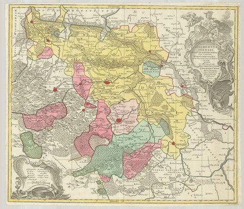
| Title | Principatus Halberstadiensis. |
| Main title | Halberstadt porosz hercegség térképe. |
180. Marchionatus Lusatiae Superioris Felicissimo Poloniae Regis,... [B IV a 290]
Institute and Museum of Military History •
B IV a
•
B IV Német birodalom
•
B I–XV. Európa
| Title | Marchionatus Lusatiae Superioris Felicissimo Poloniae Regis, Elektoris Saxoniae… |
| Main title | Lausitz őrgrófság, Felső-Szilézia és a Szász választófejedelemség térképe. |
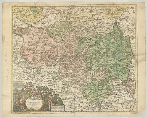
181. Karte von Fürstenthum Halberstadt, den Grafschaften Werniger... [B IV a 293]
Institute and Museum of Military History •
B IV a
•
B IV Német birodalom
•
B I–XV. Európa
| Title | Karte von Fürstenthum Halberstadt, den Grafschaften Wernigerode u. Hohenstein und der Abtey Quedlinburg. |
| Main title | Halberstadt hercegség, Wernigerode, Hohnstein grófság porosz tartományok és a Quedlinburg apátság általános térképe 1788-ban |
182. Special Karte vom Herzogthum Magdeburg der Grafschaft Mansfe... [B IV a 295]
Institute and Museum of Military History •
B IV a
•
B IV Német birodalom
•
B I–XV. Európa
| Title | Special Karte vom Herzogthum Magdeburg der Grafschaft Mansfeld, den Fürstenthümern Anhalt und Blankenburg, und der Abtey Quedlinburg… |
| Main title | Magdeburg hercegség és környező tartományok részletes térképe 1800-ban. |
183. Karte vom Erfurtischen Gebiete nebst der Herrschaft Blankenh... [B IV a 298]
Institute and Museum of Military History •
B IV a
•
B IV Német birodalom
•
B I–XV. Európa
| Title | Karte vom Erfurtischen Gebiete nebst der Herrschaft Blankenhayn, und Unter Gleichen. |
| Main title | Erfurt porosz kerület és Blankenhain térképe 1803-ban. |
184. Die Königl.[iche] Preussische Provinz Sachsen nebst den Herz... [B IV a 304]
Institute and Museum of Military History •
B IV a
•
B IV Német birodalom
•
B I–XV. Európa
| Title | Die Königl.[iche] Preussische Provinz Sachsen nebst den Herzogl.[ichen] Anhaltischen Laendern. |
| Main title | Mt.: [Magdeburg és környéke.] |
| Subject | Alsó-Szászország és Anhalt porosz hercegség térképe 1844-ben. |
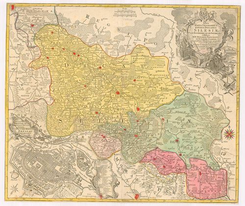
185. Silesia Ducatus tam Superior quam Inferior, juxta suos XVII.... [B IV a 313]
Institute and Museum of Military History •
B IV a
•
B IV Német birodalom
•
B I–XV. Európa
| Title | Silesia Ducatus tam Superior quam Inferior, juxta suos XVII. Minorea Principatus et VI. Libera Dominia Disterminat… |
| Main title | Mt.: Breslaw. (Wrocław város térképe.) |
| Subject | A Szilézia-i hercegség térképe. |
186. [Szilézia.] [B IV a 314]
Institute and Museum of Military History •
B IV a
•
B IV Német birodalom
•
B I–XV. Európa
| Title | [Szilézia.] |
187. Principatus Silesiae Wolani… [B IV a 323]
Institute and Museum of Military History •
B IV a
•
B IV Német birodalom
•
B I–XV. Európa
| Title | Principatus Silesiae Wolani… |
| Main title | Wohlau (Wołow) sziléziai hercegség általános térképe 1736-ban. |
188. Novissimum Silesiae Theatrum… [B IV a 324]
Institute and Museum of Military History •
B IV a
•
B IV Német birodalom
•
B I–XV. Európa
| Title | Novissimum Silesiae Theatrum… |
| Main title | Szilézia térképe. |
189. Novissimum Silesiae Theatrum id est Exactissimus Superioris ... [B IV a 325]
Institute and Museum of Military History •
B IV a
•
B IV Német birodalom
•
B I–XV. Európa
| Title | Novissimum Silesiae Theatrum id est Exactissimus Superioris et Inferioris Silesiae Comitatus Glacensis. |
| Main title | Szilézia és Glatz grófság térképe 1748-ban. |
190. Nova Mappa Geographica Totius Ducatus Silesiae tam Superiori... [B IV a 329]
Institute and Museum of Military History •
B IV a
•
B IV Német birodalom
•
B I–XV. Európa
| Title | Nova Mappa Geographica Totius Ducatus Silesiae tam Superioris quam Inferioris… |
| Main title | Mt.: Prospeckt der Hauptstadt Breslau in Schlesien. (Wrocław város térképe.)A Szilézia-i hercegség térképe 1758-ban. |
191. Provinz Niederschlesien. [B IV a 336]
Institute and Museum of Military History •
B IV a
•
B IV Német birodalom
•
B I–XV. Európa
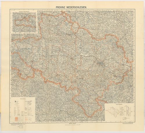
| Title | Provinz Niederschlesien. |
| Main title | Mt.: Politische Übersicht. (Közigazgatási áttekintőlap.) |
| Subject | Alsó-Szilézia térképe 1932–1935-ben. |
192. Karte von Schlesien… [B IV a 351]
Institute and Museum of Military History •
B IV a
•
B IV Német birodalom
•
B I–XV. Európa
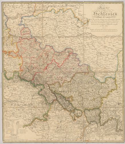
| Title | Karte von Schlesien… |
| Main title | Szilézia térképe közigazgatási határokkal 1804-ben. |
193. Principatus Silesiae Schwidnicensis… [B IV a 355]
Institute and Museum of Military History •
B IV a
•
B IV Német birodalom
•
B I–XV. Európa
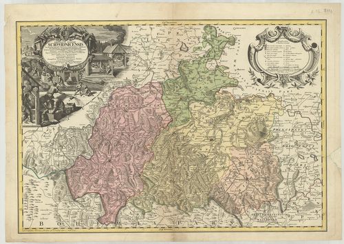
| Title | Principatus Silesiae Schwidnicensis… |
| Main title | Schweidnitz sziléziai hercegség (Swidnica) térképe 1736-ban. |
194. Principatus Silesiae Lignicensis… [B IV a 357]
Institute and Museum of Military History •
B IV a
•
B IV Német birodalom
•
B I–XV. Európa
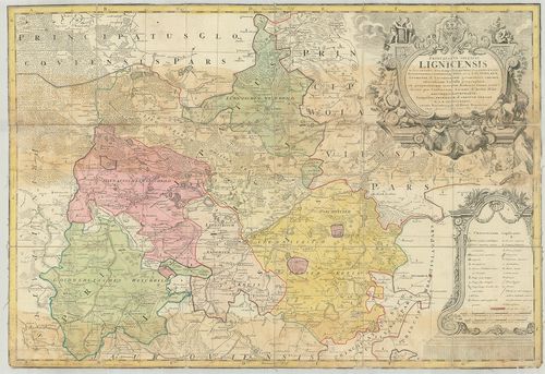
| Title | Principatus Silesiae Lignicensis… |
| Main title | Liegnitz sziléziai hercegség (Legnica) térképe 1736-ban. |
195. Principatus Silesiae Oelsnensis… [B IV a 358]
Institute and Museum of Military History •
B IV a
•
B IV Német birodalom
•
B I–XV. Európa
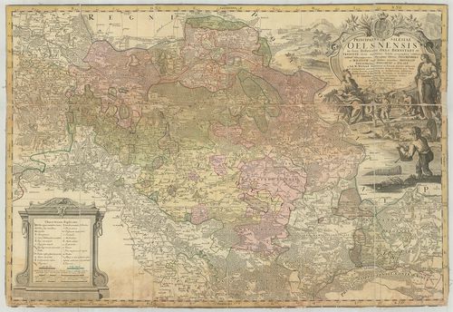
| Title | Principatus Silesiae Oelsnensis… |
| Main title | Ohlau sziléziai hercegség általános térképe 1739-ben. |
196. Principatus Silesiae Saganensis… [B IV a 359]
Institute and Museum of Military History •
B IV a
•
B IV Német birodalom
•
B I–XV. Európa
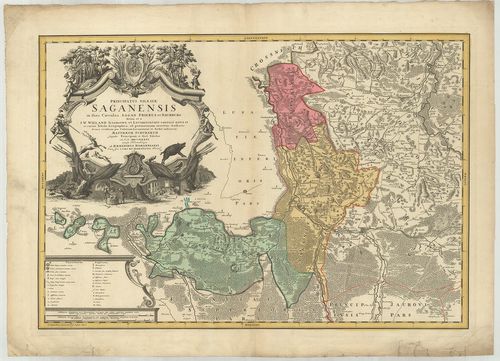
| Title | Principatus Silesiae Saganensis… |
| Main title | Sagan sziléziai hercegség térképe 1736-ban. |
197. Speciel Karte der Königlich Preussischen Provinz Schlesien u... [B IV a 360]
Institute and Museum of Military History •
B IV a
•
B IV Német birodalom
•
B I–XV. Európa
| Title | Speciel Karte der Königlich Preussischen Provinz Schlesien und der Grafschaft Glaz. |
| Main title | Mt.: Breslau mit seiner nächsten Umgebung. (Wrocław és környékének térképe.) |
| Subject | Szilézia porosz tartomány és Glatz grófság területének térképe 1845-ben. |
198. Preussische Provinz Schlesien. [B IV a 361]
Institute and Museum of Military History •
B IV a
•
B IV Német birodalom
•
B I–XV. Európa
| Title | Preussische Provinz Schlesien. |
| Main title | Weimar, [18??] Geographisches Institut. |
| Subject | Szilézia porosz tartomány térképe. |
199. Koenigl.[iche] Preuss.[ische] Prov.[inz] Schlesien. [B IV a 362]
Institute and Museum of Military History •
B IV a
•
B IV Német birodalom
•
B I–XV. Európa
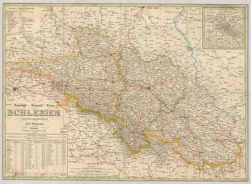
| Title | Koenigl.[iche] Preuss.[ische] Prov.[inz] Schlesien. |
| Main title | Mt.: Die nächste Umgebung vom Breslau. (Wrocław és környéke.) |
| Subject | Szilézia porosz tartomány térképe 1844-ben. |
200. Plan der Manöver Gegend in Schlesien 1835. [B IV a 363]
Institute and Museum of Military History •
B IV a
•
B IV Német birodalom
•
B I–XV. Európa
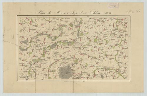
| Title | Plan der Manöver Gegend in Schlesien 1835. |
| Main title | Szilézia térképe 1835-ben. |