121. Charte von der Neumarck. [B IV a 152]
Institute and Museum of Military History •
B IV a
•
B IV Német birodalom
•
B I–XV. Európa
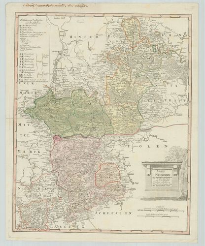
| Title | Charte von der Neumarck. |
| Main title | Neumark porosz terület térképe 1789-ben. |
122. Special Karte von der Ukermark. [B IV a 155]
Institute and Museum of Military History •
B IV a
•
B IV Német birodalom
•
B I–XV. Európa
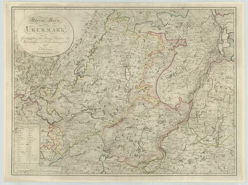
| Title | Special Karte von der Ukermark. |
| Main title | Uckermark porosz terület részletes térképe 1796-ban. |
123. Special Karte von der Neumark und den angrenzenden Ländern. [B IV a 161]
Institute and Museum of Military History •
B IV a
•
B IV Német birodalom
•
B I–XV. Európa
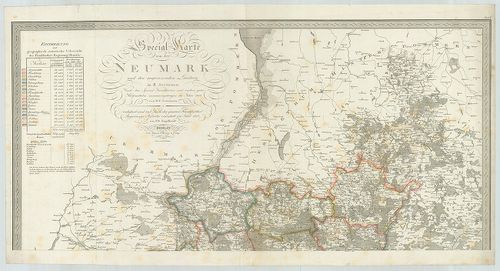
| Title | Special Karte von der Neumark und den angrenzenden Ländern. |
| Main title | Neumark porosz terület részletes térképe a szomszédos tartományok egy részével 1818-ban. |
124. Electoratus sive Marchia Brandenburgensis juxta novissimam D... [B IV a 165]
Institute and Museum of Military History •
B IV a
•
B IV Német birodalom
•
B I–XV. Európa
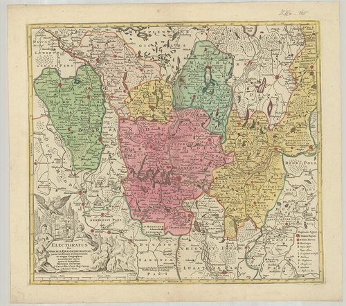
| Title | Electoratus sive Marchia Brandenburgensis juxta novissimam Delineationem in mappa geographica. |
| Main title | A Brandenburg-i grófság térképe. |
125. Brandenburg. [B IV a 166]
Institute and Museum of Military History •
B IV a
•
B IV Német birodalom
•
B I–XV. Európa
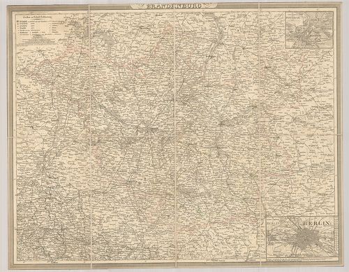
| Title | Brandenburg. |
| Main title | 2 mt.: 1. Die nächste Umgebung von Potsdam. (Potsdam és környéke.) 2. Die nächste Umgebung von Berlin. (Berlin és környéke.) |
| Subject | Brandenburg tartomány térképe. |
126. Topographische Karte der Provinz Brandenburg. [B IV a 170]
Institute and Museum of Military History •
B IV a
•
B IV Német birodalom
•
B I–XV. Európa
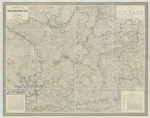
| Title | Topographische Karte der Provinz Brandenburg. |
| Main title | Brandenburg tartomány térképe 1861-ben. |
127. S. R. Imp. Comitatus Hanau proprie sic dictus, cum singulis ... [B IV a 177]
Institute and Museum of Military History •
B IV a
•
B IV Német birodalom
•
B I–XV. Európa
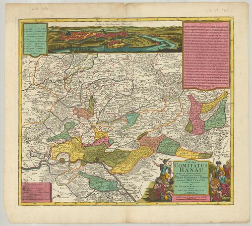
| Title | S. R. Imp. Comitatus Hanau proprie sic dictus, cum singulis suis Praefecturis, ut et Comitatus Solms. Budingen et Nidda cumrelique Wetteravia et vicinis Regionibus. |
| Main title | A Hanau-i grófság térképe 1728-ban. |
128. Episcopatus Hildesiensis… [B IV a 178]
Institute and Museum of Military History •
B IV a
•
B IV Német birodalom
•
B I–XV. Európa
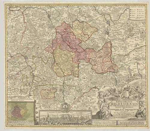
| Title | Episcopatus Hildesiensis… |
| Main title | Mt.: Ichnographia Hildesiae. (Hildesheim város térképe és látképe.)A Hildesheim-i püspökség térképe. |
129. Territorium Seculare Episcopatus Monasterii Munster Germanis... [B IV a 182]
Institute and Museum of Military History •
B IV a
•
B IV Német birodalom
•
B I–XV. Európa
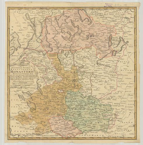
| Title | Territorium Seculare Episcopatus Monasterii Munster Germanis dicti. |
| Main title | A Münster-i püspökség térképe. |
130. Territorii Episcopatus Osnabrugensis Tabula geographica. [B IV a 183]
Institute and Museum of Military History •
B IV a
•
B IV Német birodalom
•
B I–XV. Európa
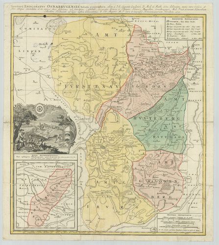
| Title | Territorii Episcopatus Osnabrugensis Tabula geographica. |
| Main title | Mt.: Ditio Reckenbergensis. (Reckenberg tartomány.)Az Osnabrück-i püspökség földrajzi térképe 1631-ben. |
131. Special Karte vom Fürstenthum Hildesheim. [B IV a 184]
Institute and Museum of Military History •
B IV a
•
B IV Német birodalom
•
B I–XV. Európa
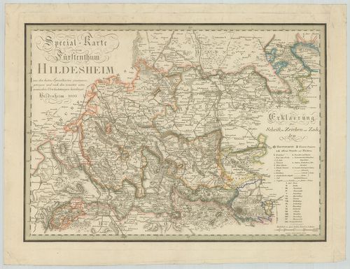
| Title | Special Karte vom Fürstenthum Hildesheim. |
| Main title | A Hildesheim-i hercegség részletes térképe 1803-ban. |
132. Topographische Karte des Fürstenthums Hildesheim. [B IV a 191]
Institute and Museum of Military History •
B IV a
•
B IV Német birodalom
•
B I–XV. Európa
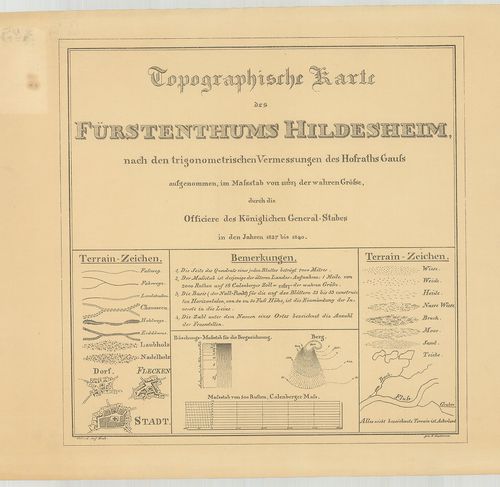
| Title | Topographische Karte des Fürstenthums Hildesheim. |
| Main title | A Hildesheim hercegség topográfiai térképe 1840-ben. |
133. Das Königreich Hannover nebst dem Grossherzogthume Holstein-... [B IV a 193]
Institute and Museum of Military History •
B IV a
•
B IV Német birodalom
•
B I–XV. Európa
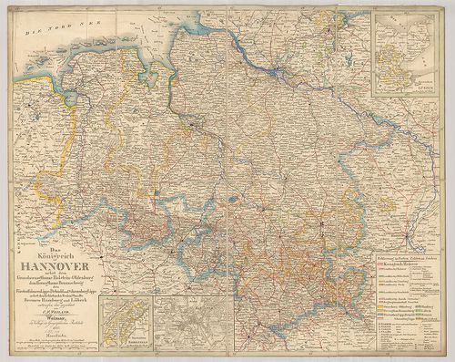
| Title | Das Königreich Hannover nebst dem Grossherzogthume Holstein-Oldenburg dem Herzogthume Braunschweig den Fürstenthümern Lippe-Detmold und Schauenburg Lippe nebst Gebieten der Freien Staedte Bremen Hamburg und Lübeck. |
| Main title | 3 mt.: 1. Fürstenthum Lübeck. 2. Fürstenthum Birkenfeld. 3. Hannover |
| Subject | Hannover és környező hercegi tartományok térképe a határos szabad Bréma, Hamburg és Lübeck városokkal 1845-ben. |
134. Topographische Karte des Amtes Hunnesrück. [B IV a 194]
Institute and Museum of Military History •
B IV a
•
B IV Német birodalom
•
B I–XV. Európa
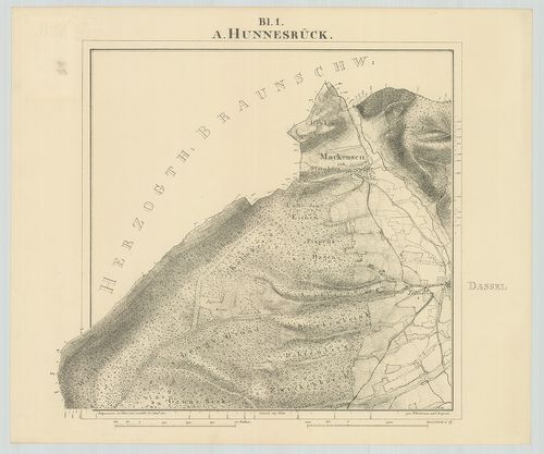
| Title | Topographische Karte des Amtes Hunnesrück. |
| Main title | A Hunsrück-hegyvidék topográfiai térképe 1841-ben. |
135. Topographische Karte der Herrschaft Plesse, der Gerichte Alt... [B IV a 195]
Institute and Museum of Military History •
B IV a
•
B IV Német birodalom
•
B I–XV. Európa
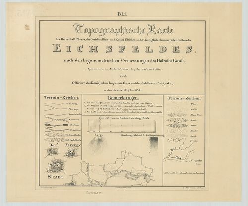
| Title | Topographische Karte der Herrschaft Plesse, der Gerichte Alten- und Neuen Gleichen und des Königlich Hannoverschen Antheils des Eichfeldes. |
| Main title | Az Eichsfeld-i hegyvidék topográfiai térképe 1842-ben. |
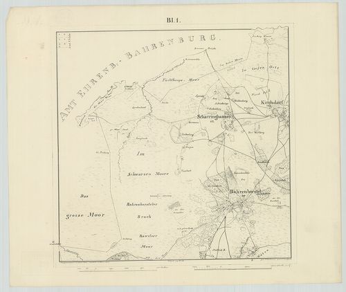
136. Topographische Karte der Vogtei Auburg Amt Diepholz. [B IV a 197]
Institute and Museum of Military History •
B IV a
•
B IV Német birodalom
•
B I–XV. Európa
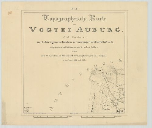
| Title | Topographische Karte der Vogtei Auburg Amt Diepholz. |
| Main title | Diepholz környékének topográfiai térképe 1846-ban. |
137. Topographische Karte des Amtes Uchte. [B IV a 198]
Institute and Museum of Military History •
B IV a
•
B IV Német birodalom
•
B I–XV. Európa
| Title | Topographische Karte des Amtes Uchte. |
| Main title | Uchte környékének topográfiai térképe 1846-ban. |
138. Hannover Braunschweig Oldenburg und die Hansestädte. [B IV a 200]
Institute and Museum of Military History •
B IV a
•
B IV Német birodalom
•
B I–XV. Európa
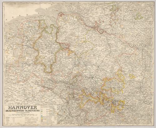
| Title | Hannover Braunschweig Oldenburg und die Hansestädte. |
| Main title | Mt.: Holstein. (A szabad Lübeck várossal.) |
| Subject | A Hanza-szövetséghez tartozó városok és Hannover, Braunschweig, Oldenburg térképe. |
139. Topographische Karte der Landrostei Osnabrück. [B IV a 201]
Institute and Museum of Military History •
B IV a
•
B IV Német birodalom
•
B I–XV. Európa
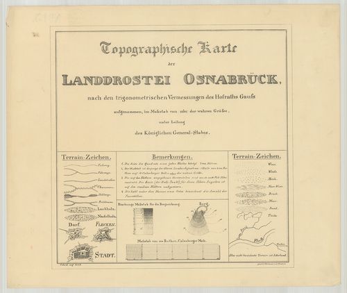
| Title | Topographische Karte der Landrostei Osnabrück. |
| Main title | Az Osnabrück-i porosz kerület topográfiai térképe 1852-ben. |
140. [Lingen, Bentheim grófság és Arenberg-Meppen hercegség topog... [B IV a 202]
Institute and Museum of Military History •
B IV a
•
B IV Német birodalom
•
B I–XV. Európa
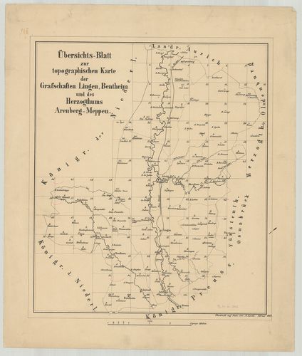
| Title | [Lingen, Bentheim grófság és Arenberg-Meppen hercegség topográfiai térképe.] |