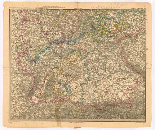
401. Deutschland. Flemmings Generalkarten. [B IV a 915]
Institute and Museum of Military History •
B IV a
•
B IV Német birodalom
•
B I–XV. Európa
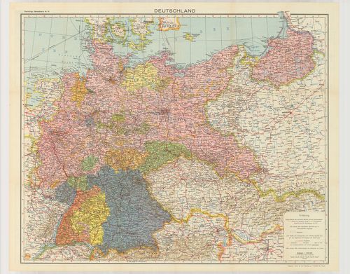
| Title | Deutschland. Flemmings Generalkarten. |
| Main title | 15 mt. a hátold.: 1. Schiffbare Flüsse und Kanäle Mittel-Europas. (Közép-Európa hajózható folyói és csatornái.) 2. Rheinisch-Westfälisches Industrigebiet. (Rajna-Wesztfália iparterülete.) 3. Deutschland-Niederschläge und Temperaturen. (Németország hőmérséklete és csapadék térképe.) 4. Der deutsche Rundfunkverkehr und die Entfernungen von Berlin. (Rádióközvetítő távolság Berlinből.) 5. Deutsche Stämme und Hauptmundarten. (Német nyelvjárás térképe.) 6. Deutschland-Bodenerhebungen. (Németország talajszint emelkedései.) 7. Deutschland-Erdgeschichte. (Geologie.) Németország geológia térképe.) 8. Deutschland-Bodennutzung. (Németország földhasználata.) 9. Deutschland-Waldungen. (Németország erdőségei.) 10. Deutschland Landwirtschaft: Weizen. (Németország mezőgazdasága: Búza.) 11. Gerste (Árpa.) 12. Roggen. (Rozs.) 13. Kartoffeln. (Burgonya.) 14. Deutschland-Bodenschätze. (Németország természeti kincsei.) 15. Deutschland-Industrie. (Németország ipara.) |
| Subject | Németország politikai és közlekedési térképe . |
402. Ravenstein-Karte von Deutschland mit politischer Gliederung. [B IV a 916]
Institute and Museum of Military History •
B IV a
•
B IV Német birodalom
•
B I–XV. Európa
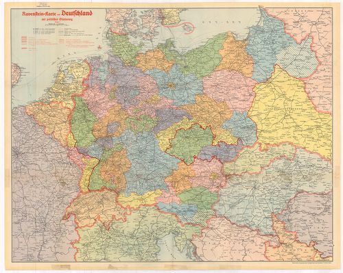
| Title | Ravenstein-Karte von Deutschland mit politischer Gliederung. |
| Main title | Németország politikai és közlekedési térképe kerületi beosztással 1942. novemberében. |
403. Das Deutsche Reich seit dem 13. März 1938. [B IV a 918]
Institute and Museum of Military History •
B IV a
•
B IV Német birodalom
•
B I–XV. Európa
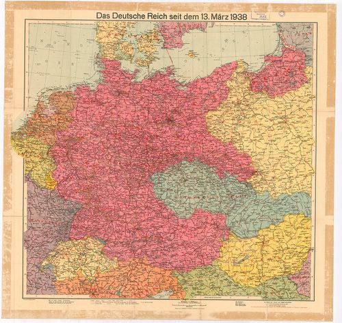
| Title | Das Deutsche Reich seit dem 13. März 1938. |
| Main title | A Német Birodalom térképe 1938. március 13-án. |
404. Das Grossdeutsche Reich und seine Nachbargebiete. [B IV a 919]
Institute and Museum of Military History •
B IV a
•
B IV Német birodalom
•
B I–XV. Európa
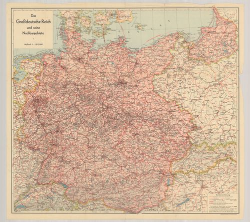
| Title | Das Grossdeutsche Reich und seine Nachbargebiete. |
| Main title | A Német Birodalom térképe 1939 végén. |
405. Sudetenland in 2 Blättern. [B IV a 920]
Institute and Museum of Military History •
B IV a
•
B IV Német birodalom
•
B I–XV. Európa
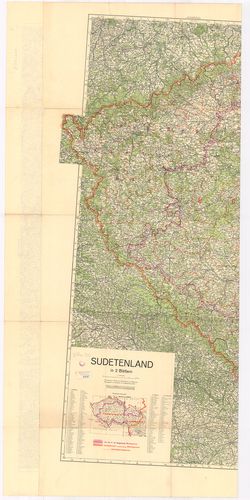
| Title | Sudetenland in 2 Blättern. |
| Main title | Mt.: Politische Grenzen. (Politikai határ.) |
| Subject | Szudétaföld térképe (NY-i rész) 1938. november 20-án. Altenburg–Vöcklaburg–Baden–Freiburg kivágat. |
406. [Kelet-Poroszország, a Visztulától K-re.] [B IV a 921]
Institute and Museum of Military History •
B IV a
•
B IV Német birodalom
•
B I–XV. Európa
| Title | [Kelet-Poroszország, a Visztulától K-re.] |
407. Vogels Karte des Deutschen Reichs und der Alpenländer. Nr. 1... [B IV a 923]
Institute and Museum of Military History •
B IV a
•
B IV Német birodalom
•
B I–XV. Európa
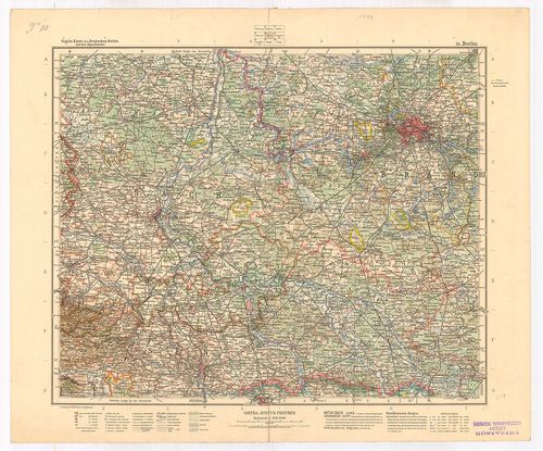
| Title | Vogels Karte des Deutschen Reichs und der Alpenländer. Nr. 14. Blatt Berlin. |
| Main title | A Német Birodalom: Berlin környékének térképe. |
408. Vogels Karte des Deutschen Reichs und der Alpenländer Nr. 15... [B IV a 924]
Institute and Museum of Military History •
B IV a
•
B IV Német birodalom
•
B I–XV. Európa
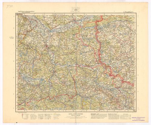
| Title | Vogels Karte des Deutschen Reichs und der Alpenländer Nr. 15. Blatt Frankfurt a. O. M. |
| Main title | A Német Birodalom: Frankfurt am Odera és környékének térképe. |
409. Vogels Karte des Deutschen Reichs und der Alpenländer Nr. 19... [B IV a 925]
Institute and Museum of Military History •
B IV a
•
B IV Német birodalom
•
B I–XV. Európa
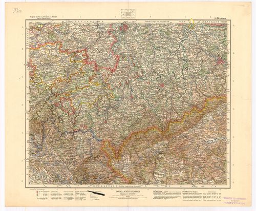
| Title | Vogels Karte des Deutschen Reichs und der Alpenländer Nr. 19. Blatt Dresden. |
| Main title | A Német Birodalom: Drezda környékének térképe. |
410. Deutsches Reich. [B IV a 926]
Institute and Museum of Military History •
B IV a
•
B IV Német birodalom
•
B I–XV. Európa
| Title | Deutsches Reich. |
| Main title | Dél-Németország térképe 1895-ben. |
411. General Map. Bavaria. [B IV a 927]
Institute and Museum of Military History •
B IV a
•
B IV Német birodalom
•
B I–XV. Európa
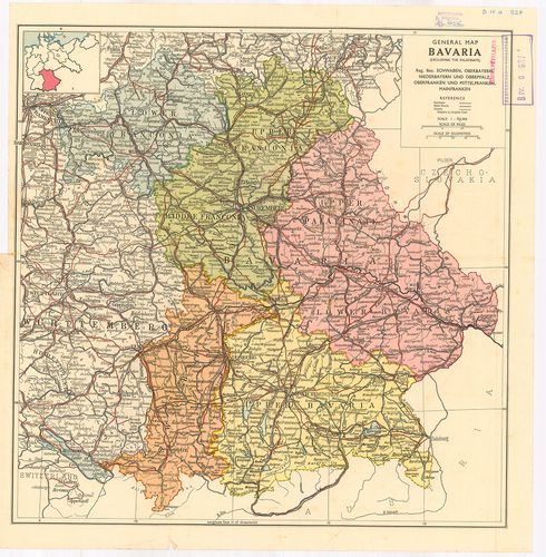
| Title | General Map. Bavaria. |
| Main title | Bajorország általános térképe 1920 után. |
412. Németország. [B IV a 930]
Institute and Museum of Military History •
B IV a
•
B IV Német birodalom
•
B I–XV. Európa
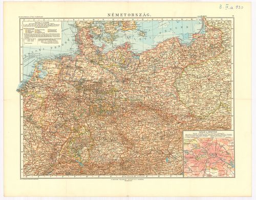
| Title | Németország. |
| Main title | Mt.: Berlin és környéke. |
413. Germany and its approaches… – Occupation Zones Germany and A... [B IV a 931]
Institute and Museum of Military History •
B IV a
•
B IV Német birodalom
•
B I–XV. Európa
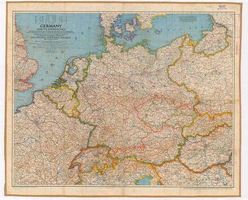
| Title | Germany and its approaches… – Occupation Zones Germany and Austria. |
| Main title | Németország: megszállási zónák 1945-ből. |
414. Nord und Mittelbayern. [B IV a 958]
Institute and Museum of Military History •
B IV a
•
B IV Német birodalom
•
B I–XV. Európa
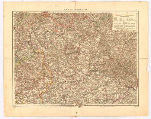
| Title | Nord und Mittelbayern. |
| Main title | Észak- és Közép-Bajorország térképe. |
415. Nordwest-Deutschland. [B IV a 959]
Institute and Museum of Military History •
B IV a
•
B IV Német birodalom
•
B I–XV. Európa
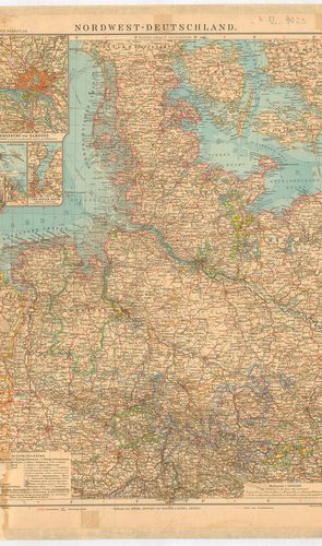
| Title | Nordwest-Deutschland. |
| Main title | 5 mt.: 1. Umgebung von Hamburg. (Hamburg és környéke.) 2. Helgoland. (Helgoland porosz sziget térképe.) 3. Bremer-Haven–Lehe város térkép. 4. Cux Haven várostérkép. 5. Der Kieler Hafen (Kiel kikötő.) |
| Subject | Németország ÉNY-i részének térképe. |
416. Nordwest-Deutschland. (Nordwestlicher Teil.) [B IV a 960]
Institute and Museum of Military History •
B IV a
•
B IV Német birodalom
•
B I–XV. Európa
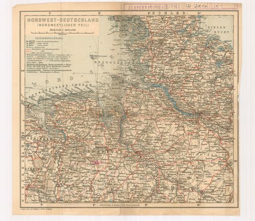
| Title | Nordwest-Deutschland. (Nordwestlicher Teil.) |
| Main title | Németország ÉNY-i részének térképe. |
417. Südost-Deutschland. [B IV a 961]
Institute and Museum of Military History •
B IV a
•
B IV Német birodalom
•
B I–XV. Európa
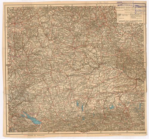
| Title | Südost-Deutschland. |
| Main title | Németország DK-i részének térképe (Bajorország). |
418. Mittel-Deutschland. [B IV a 964]
Institute and Museum of Military History •
B IV a
•
B IV Német birodalom
•
B I–XV. Európa
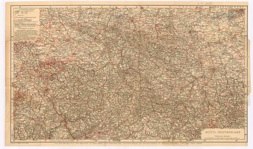
| Title | Mittel-Deutschland. |
| Main title | Közép-Németország térképe. |
419. Nord-Deutschland. (Südostlicher Teil) [B IV a 965]
Institute and Museum of Military History •
B IV a
•
B IV Német birodalom
•
B I–XV. Európa
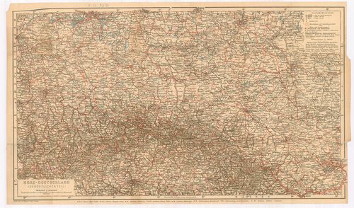
| Title | Nord-Deutschland. (Südostlicher Teil) |
| Main title | Észak-Németország térképe. |
420. Karte der Fränkischen Schweiz. [B IV a 966]
Institute and Museum of Military History •
B IV a
•
B IV Német birodalom
•
B I–XV. Európa
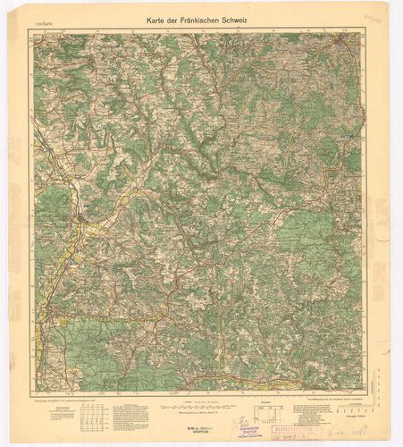
| Title | Karte der Fränkischen Schweiz. |
| Main title | Frank-Svájc térképe 1933-ban. |
421. Topographische Übersichtskarte von Südwestdeutschland in 6 B... [B IV a 967]
Institute and Museum of Military History •
B IV a
•
B IV Német birodalom
•
B I–XV. Európa
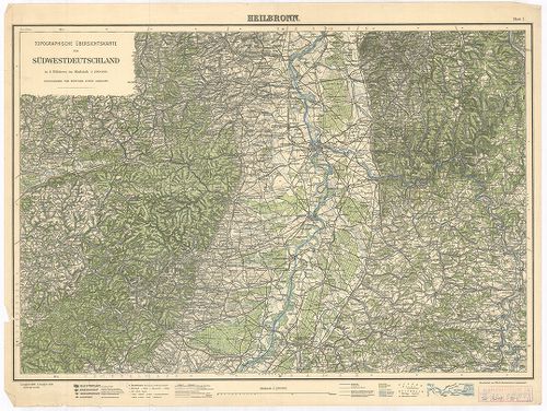
| Title | Topographische Übersichtskarte von Südwestdeutschland in 6 Blättern. Blatt I. Heilbronn. Blatt II. Hall. Blatt III. Stuttgart. |
| Main title | Németország DNY-i részének topográfiai térképe 1925–1928-ban. |
422. Füssen, Germany. [B IV a 968]
Institute and Museum of Military History •
B IV a
•
B IV Német birodalom
•
B I–XV. Európa
| Title | Füssen, Germany. |
| Main title | Németország: Füssen és környékének (Bajor Alpok) térképe 1943-ban. |
423. Standortkarte von Deggendorf. [B IV a 969]
Institute and Museum of Military History •
B IV a
•
B IV Német birodalom
•
B I–XV. Európa
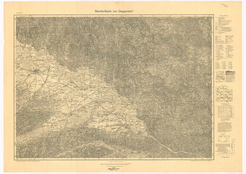
| Title | Standortkarte von Deggendorf. |
| Main title | Deggendorf és környékének topográfiai térképe 1934-ben. |
424. Karte der Pfalz. [B IV a 970]
Institute and Museum of Military History •
B IV a
•
B IV Német birodalom
•
B I–XV. Európa
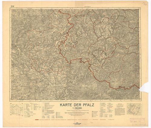
| Title | Karte der Pfalz. |
| Main title | Pfalz kerület térképe 1935-ben az akkori határ kijelölésével. |
425. Solling-Karte. [B IV a 990]
Institute and Museum of Military History •
B IV a
•
B IV Német birodalom
•
B I–XV. Európa
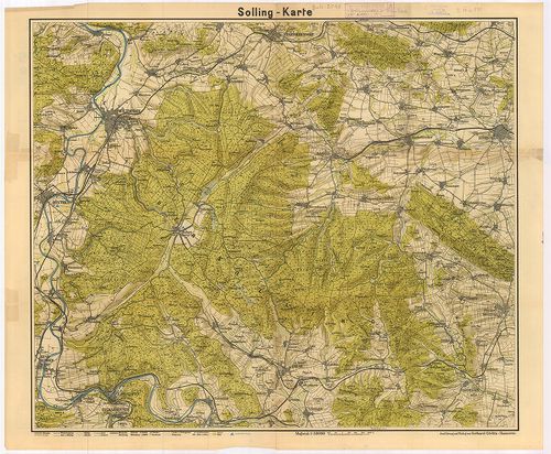
| Title | Solling-Karte. |
| Main title | A Solling-hegység (Németo.) topográfiai térképe. |
426. Kreis Angermünden. [B IV a 999]
Institute and Museum of Military History •
B IV a
•
B IV Német birodalom
•
B I–XV. Európa
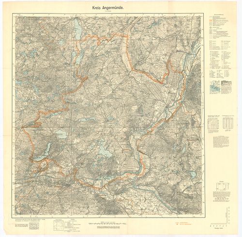
| Title | Kreis Angermünden. |
| Main title | Angermünden-kerület (Németo.) topográfiai térképe 1939-ben. |
427. Oberamtskarte Blaubeuren. [B IV a 1000]
Institute and Museum of Military History •
B IV a
•
B IV Német birodalom
•
B I–XV. Európa
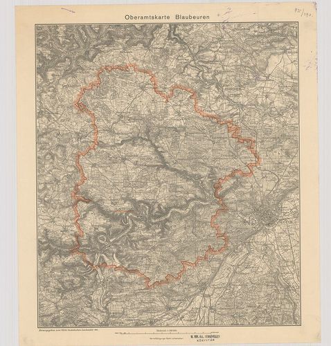
| Title | Oberamtskarte Blaubeuren. |
| Main title | Blaubeuren-kerület (Németo.) topográfiai térképe 1934-ben. |
428. Oberamtskarte Ehingen. [B IV a 1001]
Institute and Museum of Military History •
B IV a
•
B IV Német birodalom
•
B I–XV. Európa
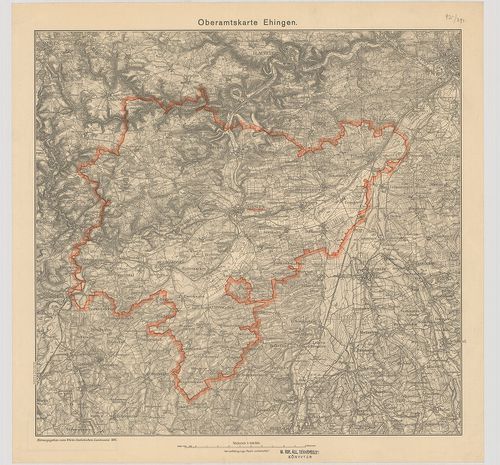
| Title | Oberamtskarte Ehingen. |
| Main title | Ehingen-kerület (Németo.) topográfiai térképe 1934-ben. |
429. Oberamtskarte Geislingen. [B IV a 1002]
Institute and Museum of Military History •
B IV a
•
B IV Német birodalom
•
B I–XV. Európa
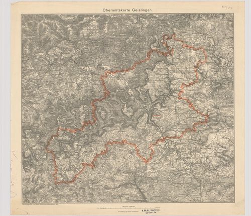
| Title | Oberamtskarte Geislingen. |
| Main title | Geislingen-kerület ((Németo.) topográfiai térképe 1934-ben. |
430. Oberamtskarte Heidenheim. [B IV a 1003]
Institute and Museum of Military History •
B IV a
•
B IV Német birodalom
•
B I–XV. Európa
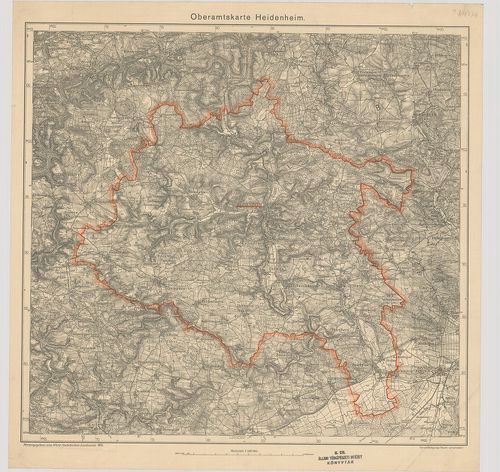
| Title | Oberamtskarte Heidenheim. |
| Main title | Heidenheim-kerület (Németo.) topográfiai térképe 1935-ben. |
431. Oberamtskarte Heilbronn. [B IV a 1004]
Institute and Museum of Military History •
B IV a
•
B IV Német birodalom
•
B I–XV. Európa
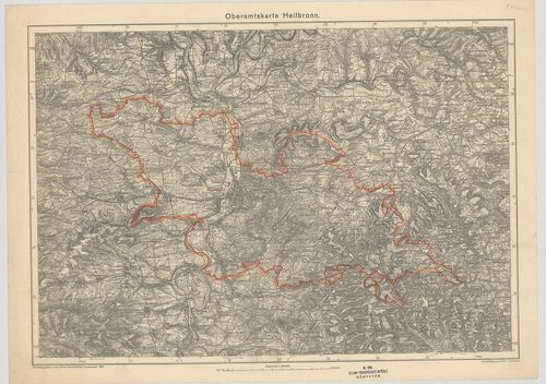
| Title | Oberamtskarte Heilbronn. |
| Main title | Heilbronn-kerület (Németo.) topográfiai térképe 1935-ben. |
432. Oberamtskarte Laupheim. [B IV a 1005]
Institute and Museum of Military History •
B IV a
•
B IV Német birodalom
•
B I–XV. Európa
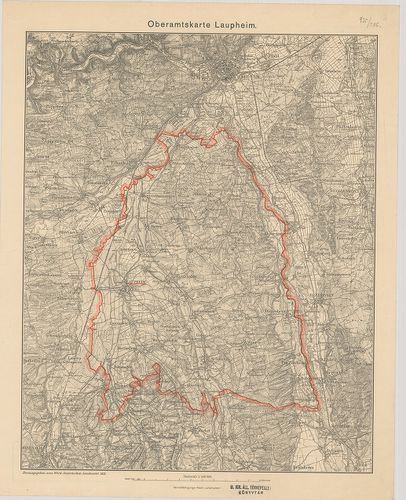
| Title | Oberamtskarte Laupheim. |
| Main title | Laupheim-kerület topográfiai térképe 1933-ban. |
433. Oberamt Leonberg. Archasologische Fundkarte. [B IV a 1006]
Institute and Museum of Military History •
B IV a
•
B IV Német birodalom
•
B I–XV. Európa
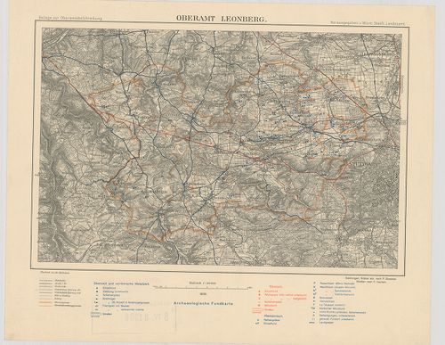
| Title | Oberamt Leonberg. Archasologische Fundkarte. |
| Main title | Leonberg-kerület (Németo.) régészetilelet térképe 1930-ban. |
434. Oberamtskarte Münsingen. [B IV a 1007]
Institute and Museum of Military History •
B IV a
•
B IV Német birodalom
•
B I–XV. Európa
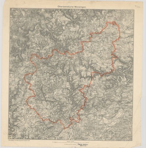
| Title | Oberamtskarte Münsingen. |
| Main title | Münsingen-kerület (Németo.) topográfiai térképe 1934-ben. |
435. Oberamtskarte Ulm. [B IV a 1008]
Institute and Museum of Military History •
B IV a
•
B IV Német birodalom
•
B I–XV. Európa
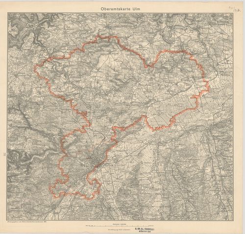
| Title | Oberamtskarte Ulm. |
| Main title | Ulm-kerület (Németo.) topográfiai térképe 1934-ben. |
436. Oberamtskarte Urach. [B IV a 1009]
Institute and Museum of Military History •
B IV a
•
B IV Német birodalom
•
B I–XV. Európa
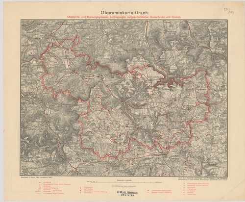
| Title | Oberamtskarte Urach. |
| Main title | Oberamts und Markungsgrenzen Eintragungen vorgeschtlicher Bodenfunde und Strassen. |
| Subject | Urach-kerület (Németo.) térképe a régészeti lelőhelyek és utak berajzolásával 1932-ben. |
437. Heilbronn – Hall – Mergentheim. Blatt I. [B IV a 1011]
Institute and Museum of Military History •
B IV a
•
B IV Német birodalom
•
B I–XV. Európa
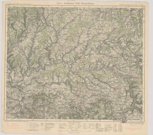
| Title | Heilbronn – Hall – Mergentheim. Blatt I. |
| Main title | Heilbronn–Hall–Mergentheim közötti terület (Németo.) térképe 1928-ban. |
438. Langenburg–Crailsheim–Rothenburg. Blatt 2. [B IV a 1012]
Institute and Museum of Military History •
B IV a
•
B IV Német birodalom
•
B I–XV. Európa
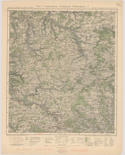
| Title | Langenburg–Crailsheim–Rothenburg. Blatt 2. |
| Main title | Langenburg–Crailsheim–Rothenburg közötti terület (Németo.) topográfiai térképe 1932-ben. |
439. Heilbronn–Stuttgart–Maulbronn. Blatt 3. [B IV a 1013]
Institute and Museum of Military History •
B IV a
•
B IV Német birodalom
•
B I–XV. Európa
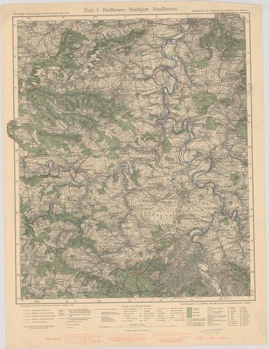
| Title | Heilbronn–Stuttgart–Maulbronn. Blatt 3. |
| Main title | Heiilbronn–Stuttgart–Maulbronn közötti terület (Németo.) topográfiai térképe 1931-ben. |
440. Hall–Löwenstein–Gmünd. Blatt 4. [B IV a 1014]
Institute and Museum of Military History •
B IV a
•
B IV Német birodalom
•
B I–XV. Európa
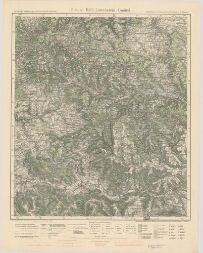
| Title | Hall–Löwenstein–Gmünd. Blatt 4. |
| Main title | Hall–Löwenstein–Gmünd közötti terület (Németo.) topográfiai térképe 1930-ban. |
441. Crailsheim–Gmünd–Nördlingen. Blatt 5. [B IV a 1015]
Institute and Museum of Military History •
B IV a
•
B IV Német birodalom
•
B I–XV. Európa
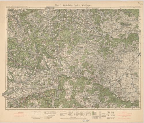
| Title | Crailsheim–Gmünd–Nördlingen. Blatt 5. |
| Main title | Crailsheim–Gmünd–Nördlingen közötti terület (Németo.) topográfiai térképe 1933-ban. |
442. Stuttgart–Herrenberg–Reutlingen. Blatt 7. [B IV a 1017]
Institute and Museum of Military History •
B IV a
•
B IV Német birodalom
•
B I–XV. Európa
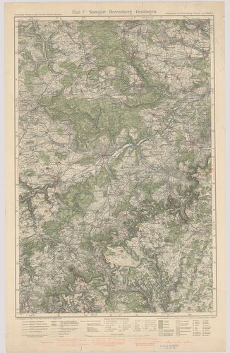
| Title | Stuttgart–Herrenberg–Reutlingen. Blatt 7. |
| Main title | Stuttgart–Herrenberg–Reutlingen közötti terület (Németo.) topográfiai térképe 1930-ban. |
443. Göppingen–Urach–Blaubeuren. Blatt 8. [B IV a 1018]
Institute and Museum of Military History •
B IV a
•
B IV Német birodalom
•
B I–XV. Európa
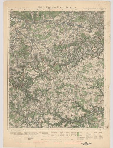
| Title | Göppingen–Urach–Blaubeuren. Blatt 8. |
| Main title | Göppingen–Urach–Blaubeuren közötti terület (Németo.) topográfiai térképe 1934-ben. |
444. Neresheim–Geislingen–Ulm. Blatt 9. [B IV a 1019]
Institute and Museum of Military History •
B IV a
•
B IV Német birodalom
•
B I–XV. Európa
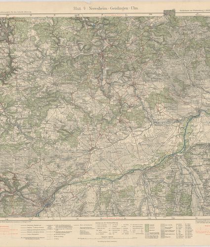
| Title | Neresheim–Geislingen–Ulm. Blatt 9. |
| Main title | Neresheim–Geislingen–Ulm közötti terület (Németo.) topográfiai térképe 1929-ben. |
445. Sulz–Schramberg–Tuttlingen. Blatt 10. [B IV a 1020]
Institute and Museum of Military History •
B IV a
•
B IV Német birodalom
•
B I–XV. Európa
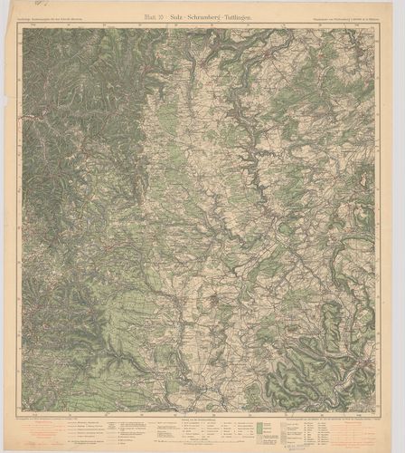
| Title | Sulz–Schramberg–Tuttlingen. Blatt 10. |
| Main title | Sulz–Schramberg–Tuttlingen közötti terület (Németo.) topográfiai térképe 1931-ben. |
446. Hechingen–Tuttlingen–Sigmaringen. Blatt 11. [B IV a 1021]
Institute and Museum of Military History •
B IV a
•
B IV Német birodalom
•
B I–XV. Európa
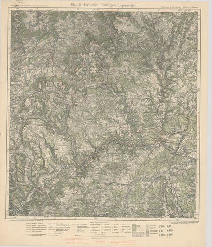
| Title | Hechingen–Tuttlingen–Sigmaringen. Blatt 11. |
| Main title | Hechingen–Tuttlingen–Sigmaringen közötti terület (Németo.) topográfiai térképe 1929-ben. |
447. Ehingen–Riedlingen–Biberach. Blatt 12. [B IV a 1022]
Institute and Museum of Military History •
B IV a
•
B IV Német birodalom
•
B I–XV. Európa
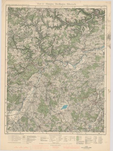
| Title | Ehingen–Riedlingen–Biberach. Blatt 12. |
| Main title | Ehingen–Riedlingen–Biberach közötti terület (Németo.) topográfiai térképe 1934-ben. |
448. Ulm–Laupheim–Memmingen. Blatt 13. [B IV a 1023]
Institute and Museum of Military History •
B IV a
•
B IV Német birodalom
•
B I–XV. Európa
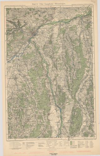
| Title | Ulm–Laupheim–Memmingen. Blatt 13. |
| Main title | Ulm–Laupheim–Memmingen közötti terület (Németo.) topográfiai térképe 1933-ban. |
449. Waldsee–Friedrichshafen–Bregenz. Blatt 14. [B IV a 1024]
Institute and Museum of Military History •
B IV a
•
B IV Német birodalom
•
B I–XV. Európa
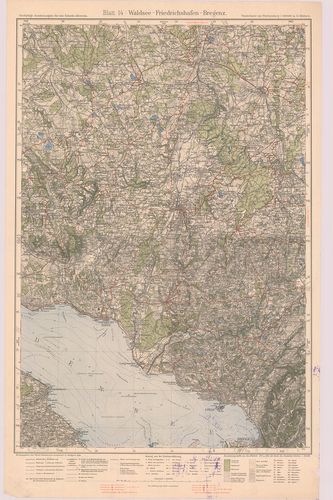
| Title | Waldsee–Friedrichshafen–Bregenz. Blatt 14. |
| Main title | Waldsee–Friedrichshafen–Bregenz közötti terület (Németo.) topográfiai térképe 1928-ban. |
450. Memmingen–Wangen–Kempten. Blatt 15. [B IV a 1025]
Institute and Museum of Military History •
B IV a
•
B IV Német birodalom
•
B I–XV. Európa
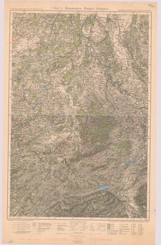
| Title | Memmingen–Wangen–Kempten. Blatt 15. |
| Main title | Memmingen–Wangen–Kempten közötti terület (Németo.) topográfiai térképe 1932-ben. |