451. Unterland I. Heilbronn–Heidelberg. Unterland II. Ellwagen–Ha... [B IV a 1026]
Institute and Museum of Military History •
B IV a
•
B IV Német birodalom
•
B I–XV. Európa
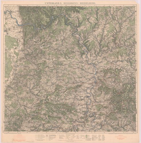
| Title | Unterland I. Heilbronn–Heidelberg. Unterland II. Ellwagen–Hall–Rothenburg o. d. t. |
| Main title | Heilbronn–Heidelberg és Ellwagen–Hall–Rothenburg o.d.t. közötti terület (Németo.) topográfiai térképe 1927-ben. |
452. Topogr.[aphische] Übersichtskarte des Deutschen Reiches. Bam... [B IV a 1050]
Institute and Museum of Military History •
B IV a
•
B IV Német birodalom
•
B I–XV. Európa
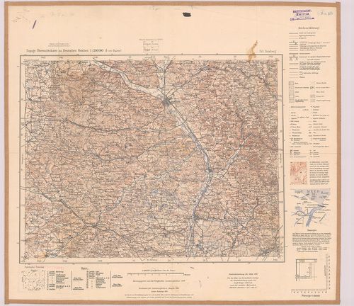
| Title | Topogr.[aphische] Übersichtskarte des Deutschen Reiches. Bamberg 153. |
| Main title | Németország: Bamberg környékének topográfiai áttekintő térképe 1940-ben. |
453. Germany. Salzburg Sheet N. 48. – Köln Sheet K. 51. [B IV a 1051]
Institute and Museum of Military History •
B IV a
•
B IV Német birodalom
•
B I–XV. Európa
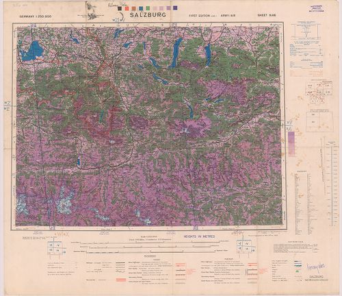
| Title | Germany. Salzburg Sheet N. 48. – Köln Sheet K. 51. |
| Main title | Németország: Salzburg (48.) és Köln (51) 1:250 000 ma. lapok. |
454. Germany. Salzburg. Sheet X–7, Wels. Sheet X–8. [B IV a 1052]
Institute and Museum of Military History •
B IV a
•
B IV Német birodalom
•
B I–XV. Európa
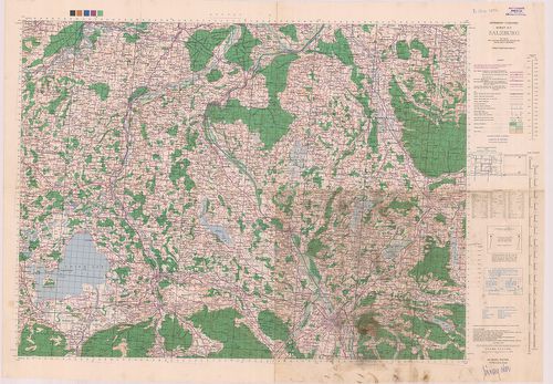
| Title | Germany. Salzburg. Sheet X–7, Wels. Sheet X–8. |
| Main title | Németország: Salzburg és Wels 1:100 000 ma. lapok. |
455. Germany. Nürnberg Sheet M 50, Pilsen Sheet N 50, Prag Sheet ... [B IV a 1053]
Institute and Museum of Military History •
B IV a
•
B IV Német birodalom
•
B I–XV. Európa
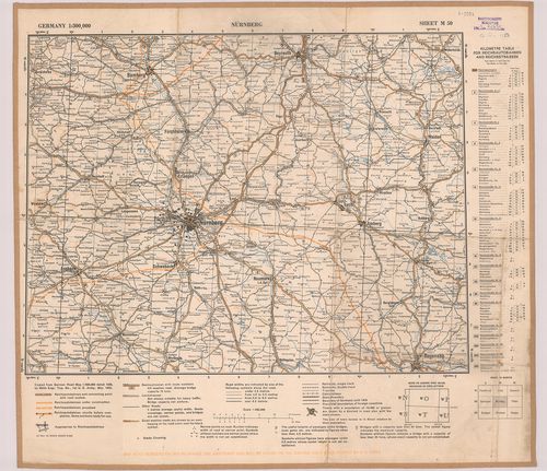
| Title | Germany. Nürnberg Sheet M 50, Pilsen Sheet N 50, Prag Sheet 0 50. |
| Main title | Németország: Nürnberg, Pilsen és Prága 1:300 000 ma. lapok. |
456. Übersichtskarte-Deutsches Reich. Westhälfte-Osthälfte. [B IV a 1054]
Institute and Museum of Military History •
B IV a
•
B IV Német birodalom
•
B I–XV. Európa
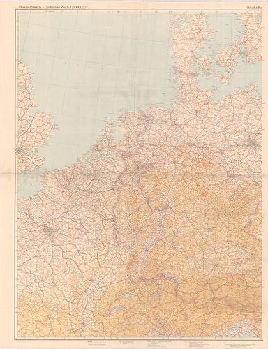
| Title | Übersichtskarte-Deutsches Reich. Westhälfte-Osthälfte. |
| Main title | A Német Birodalom térképe 1944-ben. |
457. Mansfeldiae Comitatus Descriptio. [B IV a 1056]
Institute and Museum of Military History •
B IV a
•
B IV Német birodalom
•
B I–XV. Európa
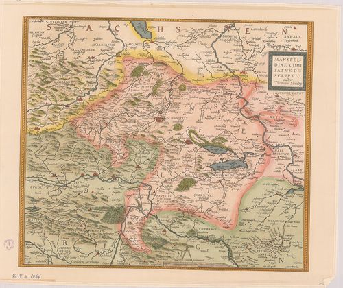
| Title | Mansfeldiae Comitatus Descriptio. |
| Main title | Mansfelt tartomány (Németo.) térképe a XVI. sz.-ból. |
458. Berlin. [B IV a 1058]
Institute and Museum of Military History •
B IV a
•
B IV Német birodalom
•
B I–XV. Európa
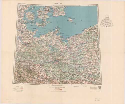
| Title | Berlin. |
459. Neu Hand- und Wandkarte des Deutschlen Reich und der nachbar... [B IV a 1059]
Institute and Museum of Military History •
B IV a
•
B IV Német birodalom
•
B I–XV. Európa
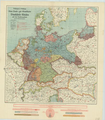
| Title | Neu Hand- und Wandkarte des Deutschlen Reich und der nachbargebirte … |
| Main title | A Német Birodalom és környezete a békeszerződések után 1919 júniusában. A határok tervezete. |
460. Bavariae… [B IV a 1063]
Institute and Museum of Military History •
B IV a
•
B IV Német birodalom
•
B I–XV. Európa
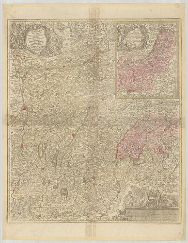
| Title | Bavariae… |
| Main title | Bajorország térképe. |
461. Bavariae Pars Inferior tam in sua Regimina Generalia quam in... [B IV a 1066]
Institute and Museum of Military History •
B IV a
•
B IV Német birodalom
•
B I–XV. Európa
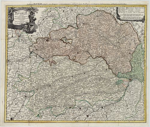
| Title | Bavariae Pars Inferior tam in sua Regimina Generalia quam in eorundem Praefecturas Particulares… |
| Main title | Bajorország térképe (Straubing és Landhut, német kormányzóságok) a 18. században. |