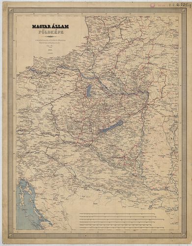
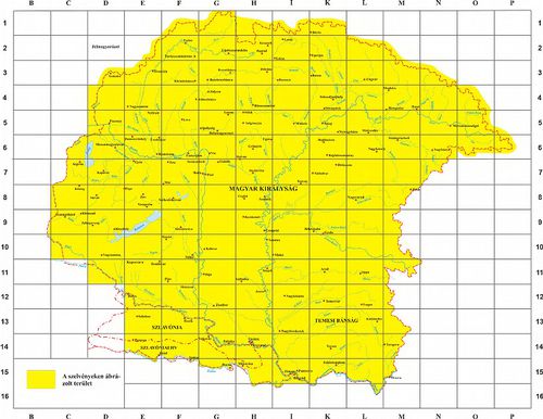
361. A Magyar Állam közigazgatási térképe. [B IX a 525]
Institute and Museum of Military History •
B IX a
•
B IX Ausztria–Magyarország
•
B I–XV. Európa
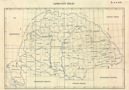
| Title | A Magyar Állam közigazgatási térképe. |
| Main title | Mt. Budapest. |
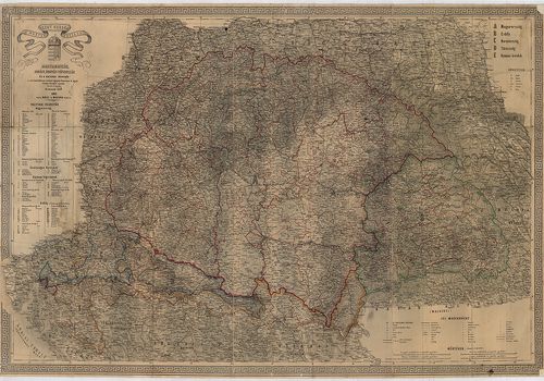
362. A Magyar Sz.[ent] Korona országainak térképe. [B IX a 525/3]
Institute and Museum of Military History •
B IX a
•
B IX Ausztria–Magyarország
•
B I–XV. Európa
| Title | A Magyar Sz.[ent] Korona országainak térképe. |
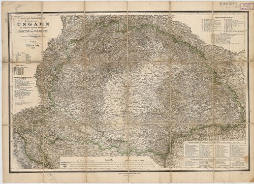
363. Ungarn mit seiner Nebenländern und Galizien. [B IX a 525/4]
Institute and Museum of Military History •
B IX a
•
B IX Ausztria–Magyarország
•
B I–XV. Európa
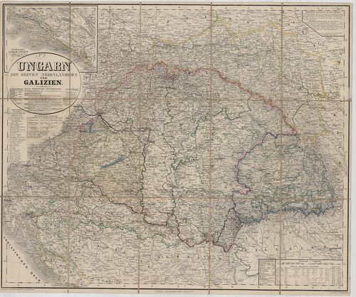
| Title | Ungarn mit seiner Nebenländern und Galizien. |
| Main title | Mt. Südliches Dalmatien. (Dalmácia D-i része.) |
| Subject | Magyarország, a társországok és Galícia térképe 1855-ben. |
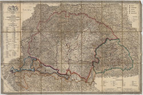
364. Ungarn mit seinen Nebenländern und Galizien. [B IX a 525/4]
Institute and Museum of Military History •
B IX a
•
B IX Ausztria–Magyarország
•
B I–XV. Európa
| Title | Ungarn mit seinen Nebenländern und Galizien. |
| Main title | Mt. Südlichen Dalmatien. (Dalmácia D-i része.) |
| Subject | Magyarország, a társországok és Galícia térképe 1862-ben. |
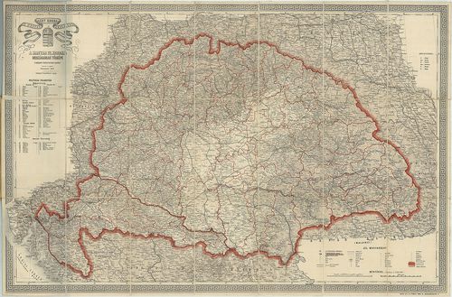
365. Ungarn, Siebenbürgen, Croatien, Slavonien und die Militär-Gr... [B IX a 525/5]
Institute and Museum of Military History •
B IX a
•
B IX Ausztria–Magyarország
•
B I–XV. Európa
| Title | Ungarn, Siebenbürgen, Croatien, Slavonien und die Militär-Grenze… |
| Main title | Magyarország, Erdély , Horvát-Szlavónia és a szomszédos államok térképe 1863-ban. |
366. A Magyar Szent Korona országai: Magyarország, Erdély, Horvát... [B IX a 525/6]
Institute and Museum of Military History •
B IX a
•
B IX Ausztria–Magyarország
•
B I–XV. Európa
| Title | A Magyar Szent Korona országai: Magyarország, Erdély, Horvát-Tótország és a katonai végvidék. |
367. Orts und Strassen-Karte der Königreiche Ungarn, Croatien und... [B IX a 525/7]
Institute and Museum of Military History •
B IX a
•
B IX Ausztria–Magyarország
•
B I–XV. Európa
| Title | Orts und Strassen-Karte der Königreiche Ungarn, Croatien und Slavonien, des Grossfürstenthums Siebenbürgen, und der k. k. Militair Graenze. |
| Main title | A Magyar Királyság, Horvát-Szlavónia, Erdély és a katonai határőrvidék térképe 1865-ben, úthálózattal. |
368. Orts und Strassenkarte des Königreiches Ungarn (Mit Inbegrif... [B IX a 525/7]
Institute and Museum of Military History •
B IX a
•
B IX Ausztria–Magyarország
•
B I–XV. Európa
| Title | Orts und Strassenkarte des Königreiches Ungarn (Mit Inbegriff des Ehehmaligen Siebenbürgen) nebst Kroatien und Slavonien. |
| Main title | A Magyar Királyság, Horvát-Szlavónia, Erdély és a katonai határőrvidék térképe 1882-ben, úthálózattal. |
369. General Karte von Königreiche Ungarn und Königreich Kroatien... [B IX a 525/8]
Institute and Museum of Military History •
B IX a
•
B IX Ausztria–Magyarország
•
B I–XV. Európa
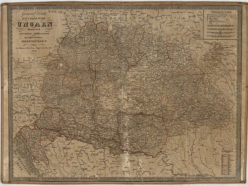
| Title | General Karte von Königreiche Ungarn und Königreich Kroatien Sclavonien samt Grossfürstenthum Sibenbürgen. |
| Main title | A Magyar Királyság, Horvát-Szlavónia, Erdély térképe 1833-ban. |
370. Magyar Állam földképe. [B IX a 525/9]
Institute and Museum of Military History •
B IX a
•
B IX Ausztria–Magyarország
•
B I–XV. Európa
| Title | Magyar Állam földképe. |
371. Magyar Birodalom iskolai faltérképe. Schulwandkarte des Unga... [B IX a 525/10]
Institute and Museum of Military History •
B IX a
•
B IX Ausztria–Magyarország
•
B I–XV. Európa
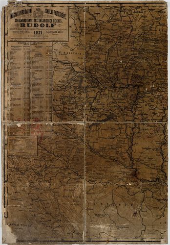
| Title | Magyar Birodalom iskolai faltérképe. Schulwandkarte des Ungarischen Reiches. |
| Main title | Mt. Dalmácia déli része. |
372. Magyarország és Horvát-Szlavonország. [B IX a 525/11]
Institute and Museum of Military History •
B IX a
•
B IX Ausztria–Magyarország
•
B I–XV. Európa
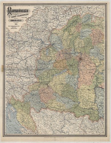
| Title | Magyarország és Horvát-Szlavonország. |
373. Magyarország politikai térképe. [B IX a 525/12]
Institute and Museum of Military History •
B IX a
•
B IX Ausztria–Magyarország
•
B I–XV. Európa
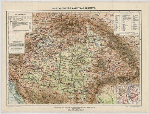
| Title | Magyarország politikai térképe. |
| Main title | Mt. Budapest pályaudvarai. |
374. Kleine Charte des Königreiches Hungarn. [B IX a 528/1a]
Institute and Museum of Military History •
B IX a
•
B IX Ausztria–Magyarország
•
B I–XV. Európa
| Title | Kleine Charte des Königreiches Hungarn. |
| Main title | A Magyar Királyság részletes térképe 1785-ben, az I. katonai felmérés alapján. |
375. Specialkarte des Königreiches Ungarn. [B IX a 531/1]
Institute and Museum of Military History •
B IX a
•
B IX Ausztria–Magyarország
•
B I–XV. Európa
| Title | Specialkarte des Königreiches Ungarn. |
| Main title | Magyarország részletes térképe a II. katonai felmérés alapján.. |
376. [Magyarország megyéinek (20 vármegye) átnézeti (részletes) t... [B IX a 532]
Institute and Museum of Military History •
B IX a
•
B IX Ausztria–Magyarország
•
B I–XV. Európa
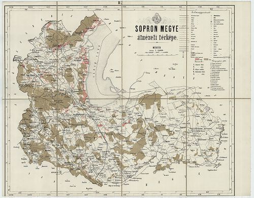
| Title | [Magyarország megyéinek (20 vármegye) átnézeti (részletes) térképe: Sopron, Győr, Veszprém, Vas, Zala, Somogy, Tolna, Baranya, Nógrád, Zólyom, Liptó, Gömör és Kishont, Torna, Abauj, Zemplén, Ung, Beregh (Bereg), Máramaros, Ugocsa, Moson.] |
377. Das Pacshalik von Ofen im Jahre 1650 nach Hadschi Chalfa. [B IX a 535]
Institute and Museum of Military History •
B IX a
•
B IX Ausztria–Magyarország
•
B I–XV. Európa
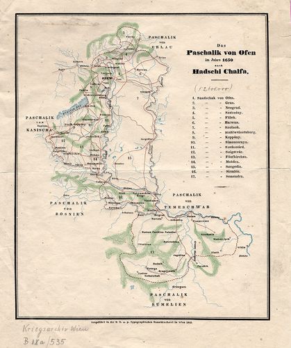
| Title | Das Pacshalik von Ofen im Jahre 1650 nach Hadschi Chalfa. |
| Main title | Magyarország: A budai Ejalet pontos határa, szandzsákok határai és neveik felsorolása 1650-ben. |
378. Tabula Geographica Ungariae Veteris ex Historia Anonym Belae... [B IX a 536]
Institute and Museum of Military History •
B IX a
•
B IX Ausztria–Magyarország
•
B I–XV. Európa
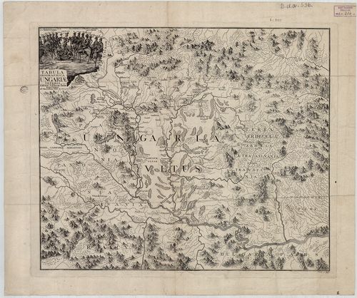
| Title | Tabula Geographica Ungariae Veteris ex Historia Anonym Belae Regis Notarii, 1772. |
| Main title | Magyarország térképe a honfoglalás idején Anonymus leírása alapján. |
379. Mappa Hungariae Inferioris Districtus Cisdanubiani… [B IX a 537]
Institute and Museum of Military History •
B IX a
•
B IX Ausztria–Magyarország
•
B I–XV. Európa
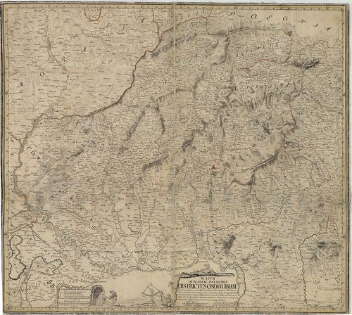
| Title | Mappa Hungariae Inferioris Districtus Cisdanubiani… |
| Main title | É-Magyarország Ny-i részének térképe 1739-ben (pestisjárvány térkép). (Littau, Litovel – Késmárk, Kežmarok – Kapuvár – Jászberény kivágat.) |
380. Mappa Generalis Omnium Inferioris Hungariae Liberarum Regiar... [B IX a 538]
Institute and Museum of Military History •
B IX a
•
B IX Ausztria–Magyarország
•
B I–XV. Európa
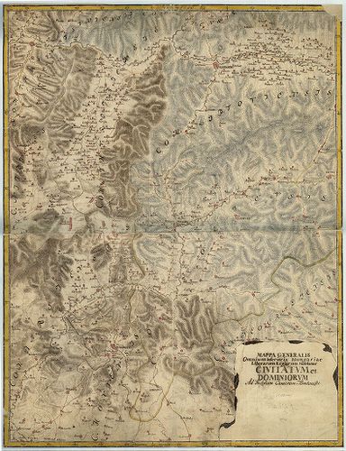
| Title | Mappa Generalis Omnium Inferioris Hungariae Liberarum Regiarum Montanar civitatum et dominiorum ad Inclytam Cameram Montanisti. |
| Main title | Felső-Magyarország általános térképe. |