2301. Magyarország népessége anyanyelv szerint. – Ungarn’s Bevölke... [B IX c 1347]
Institute and Museum of Military History •
B IX c
•
B IX Ausztria–Magyarország
•
B I–XV. Európa

| Title | Magyarország népessége anyanyelv szerint. – Ungarn’s Bevölkerung nach Muttersprache. |
| Main title | 6 térk. 1. Magyar. – Ungarn. 2. Német. – Deutsch. 3. Tót. – Slovaken. 4. Szerb. – Serben. 5. Vend. Wenden. – Oláh. – Walachen. 6. Horvát. – Kroaten. – Ruthén. – Ruthenen. |
2302. [Magyarország]: Ipari segédszemélyzet. A vállalatok nagyság ... [B IX c 1348]
Institute and Museum of Military History •
B IX c
•
B IX Ausztria–Magyarország
•
B I–XV. Európa
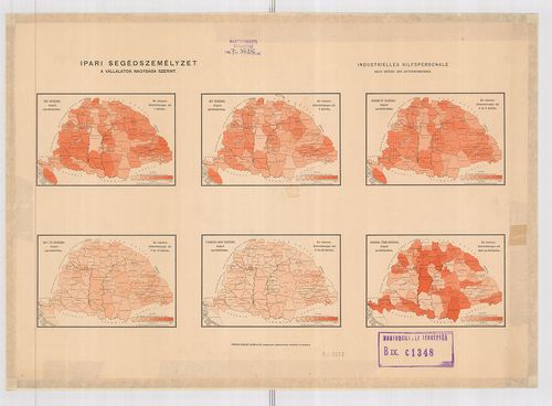
| Title | [Magyarország]: Ipari segédszemélyzet. A vállalatok nagyság szerint. – Industrielles Hilfspersonale. Nach grösse der Unternehmenugen. |
| Main title | 6 térk. 1. Egy segéddel dolgozó iparvállalatokban. – … mit 1 Gehilfen. 2. Segéddel dolgozó iparvállalatokban. – … mit 2 Gehilfen. 3. Három-öt segéddel dolgozó iparvállalatokban. – … mit 3 bis 5 Gehilfen. 4. Hat-tíz segéddel dolgozó iparvállalatokban. – … mit 6 bis 10 Gehilfen. 5. Tizenegy-húsz segéddel dolgozó iparvállalatokban. – … mit 11 bis 20 Gehilfen. 6. Húsznál több segéddel dolgozó iparvállalatokban. – … mit mehr als 20 Gehilfen. |
2303. [Magyarország]: (Fontosabb iparágak. – Wichtigere Industriez... [B IX c 1349]
Institute and Museum of Military History •
B IX c
•
B IX Ausztria–Magyarország
•
B I–XV. Európa
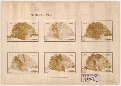
| Title | [Magyarország]: (Fontosabb iparágak. – Wichtigere Industriezweige. |
| Main title | 2 tl. 12 térk. I. 1. 1. Faipar. – Holz Industrie. 2. Malomipar. – Mühlen-Industrie. 3. Lábbeli ipar. – Fussbekleidigungens-Industrie. 4. Ruházati ipar. – Bekleidigungs-Industrie. 5. Vas- és fémipar. – Eisen und Metail-Industrie. 6. Üdítő- és elszállásolási ipar. – Erquickungs- und Beherbergungs-Gewerbe. II. 1. 7. Agyag és üvegipar – Thon- und Glas-Industrie. 8. Bőripar. – Leder-Industrie. 9. Fonó és szövőipar. – Textil Industrie. 10. Hentes és Mészárosipar. – Selcher und Fleischhauer-Gewerbe. 11. Szeszipar. – Spiritus-Industrie. 12. Vegyészetiipar. – Chemische-Industrie. |
2304. [Magyarország]: A nemek aránya. – Geschletsgliederung de Bev... [B IX c 1350]
Institute and Museum of Military History •
B IX c
•
B IX Ausztria–Magyarország
•
B I–XV. Európa
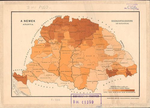
| Title | [Magyarország]: A nemek aránya. – Geschletsgliederung de Bevölkerung. |
2305. [Magyarország]: Segédekkel dolgozó iparvállalatok. [Az össze... [B IX c 1351]
Institute and Museum of Military History •
B IX c
•
B IX Ausztria–Magyarország
•
B I–XV. Európa
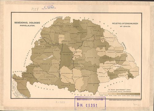
| Title | [Magyarország]: Segédekkel dolgozó iparvállalatok. [Az összes iparvállalatok százalékában megyénként.] – Industrie-Unternehmungen mit Gehilfen. |
2306. [Magyarország]: Napszámosok. [Az össznépesség százalékában.]... [B IX c 1352]
Institute and Museum of Military History •
B IX c
•
B IX Ausztria–Magyarország
•
B I–XV. Európa
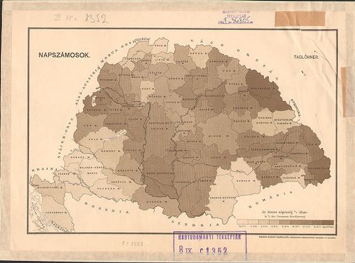
| Title | [Magyarország]: Napszámosok. [Az össznépesség százalékában.] – Taglöhner. |
2307. [Magyarország]: Értelmiség. [Az össznépesség százalékában] –... [B IX c 1353]
Institute and Museum of Military History •
B IX c
•
B IX Ausztria–Magyarország
•
B I–XV. Európa
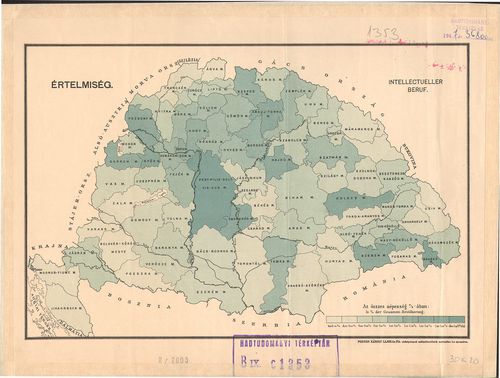
| Title | [Magyarország]: Értelmiség. [Az össznépesség százalékában] – Intellectueller beruf. |
2308. [Magyarország]: A népesség megoszlása korcsoportok szerint. ... [B IX c 1354]
Institute and Museum of Military History •
B IX c
•
B IX Ausztria–Magyarország
•
B I–XV. Európa
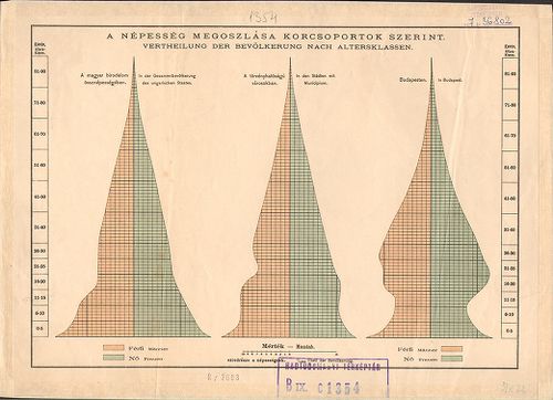
| Title | [Magyarország]: A népesség megoszlása korcsoportok szerint. – Vertheilung der Bevölkerung nach Alterklassen. |
2309. [Magyarország]: Népnövekedés. – Zunahme der Bevölkerung. [B IX c 1355]
Institute and Museum of Military History •
B IX c
•
B IX Ausztria–Magyarország
•
B I–XV. Európa
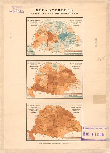
| Title | [Magyarország]: Népnövekedés. – Zunahme der Bevölkerung. |
| Main title | 3. térk. 1. Évi átlagos szaporodás 1869–1880. a népszámlálások adatai szerint – Jährliche durchschnittliche Zunahme 1869–1880. Laut Angaben der Volkszählungen. 2. Évi átlagos szaporodás 1880–1890. a népszámlálások adatai szerint. – Jähriche durchschnittliche Zunahme 1880–1890. laut Angaben der Volkszählungen. 3. Évi átlagos szaporodás 1880–1890. a születések és halálozások alapján kimutatva. – Jährliche durchschnittliche Zunahme 1880–1890. berechnet nach den Geburten und Sterbefällen. |
2310. Der Küsten-Karst im croatischen Militär-Grenzgebiethe. – Pri... [B IX c 1356]
Institute and Museum of Military History •
B IX c
•
B IX Ausztria–Magyarország
•
B I–XV. Európa
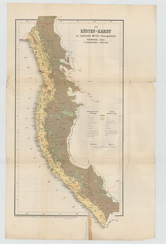
| Title | Der Küsten-Karst im croatischen Militär-Grenzgebiethe. – Primorski Kras u Hrvatskoj Krajni. |
| Main title | A Horvát Határőrvidék tengerparti karszttérképe 1875-ben. |
2311. Postkarte von Ungarn und Siebenbürgen. [B IX c 1380]
Institute and Museum of Military History •
B IX c
•
B IX Ausztria–Magyarország
•
B I–XV. Európa
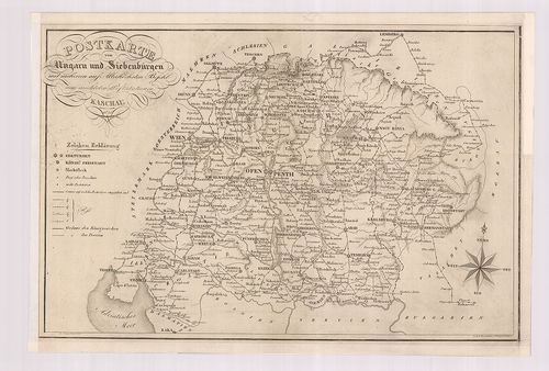
| Title | Postkarte von Ungarn und Siebenbürgen. |
| Main title | Magyarország és Erdély postatérképe 1826-ban. |
2312. Planum exhibens postali districtui Cassoviensi incorportarum... [B IX c 1381]
Institute and Museum of Military History •
B IX c
•
B IX Ausztria–Magyarország
•
B I–XV. Európa
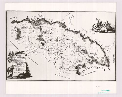
| Title | Planum exhibens postali districtui Cassoviensi incorportarum, incorporandarum, item et projectatarum stationum situm. |
| Main title | A kassai postakerület áttekintő térképe. |
2313. Delinatio ductum neo-st ruendae commercialis viae in Gallici... [B IX c 1382]
Institute and Museum of Military History •
B IX c
•
B IX Ausztria–Magyarország
•
B I–XV. Európa
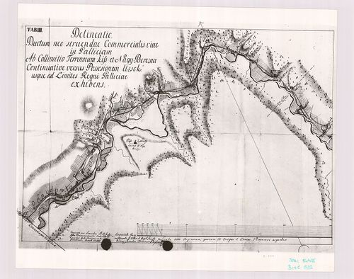
| Title | Delinatio ductum neo-st ruendae commercialis viae in Galliciam ab regiocamreli oppido Unghvar usque ad collimititum terrenorum Kis et Nagy Berezna re monstrans. Tab III. |
| Main title | A Galliciába vezető kereskedelmi út Ungvár és Nagybrezna közti szakaszának térképének a harmadik szelvénye. |
2314. Galizien (Karpathen), Bukowina nebst anschiesendem Ungarn, R... [B IX c 1383]
Institute and Museum of Military History •
B IX c
•
B IX Ausztria–Magyarország
•
B I–XV. Európa
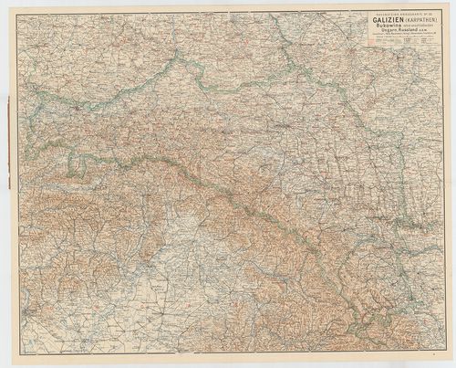
| Title | Galizien (Karpathen), Bukowina nebst anschiesendem Ungarn, Russland U. s. w. (Ludwig Ravensteins Kriegskarte N. 26.) |
| Main title | Galícia, Bukovina, Magyarország, Oroszország csatlakozó részeinek térképe az I. Világháborús frontvonalak, csaták, erődök jelölésével. |
2315. Übersichtskarte der Grandmessungs-Arbeiten in der Oesterreic... [B IX c 1384]
Institute and Museum of Military History •
B IX c
•
B IX Ausztria–Magyarország
•
B I–XV. Európa
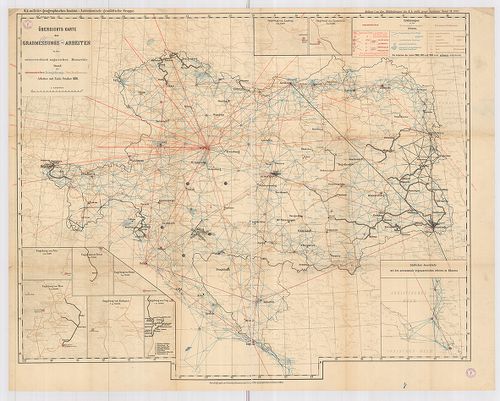
| Title | Übersichtskarte der Grandmessungs-Arbeiten in der Oesterreichisch–Ungarischen Monarchie. Stau der astronomischen, Triangularungs-Präc. Nivellements. |
| Main title | 9 mt.: 1–8.: Umgebung von Lemberg; Czernowitz; Pola; Triest; Fiume; Wien; Budapest; Prag. 9.) Südlicher Anscluss mit den astronomisch-trigonometrischen Arbeiten in Albenien. (Csillagászati-trigonometriai munkák Albániában.) Az Osztrák–Magyar Monarchia fokmérési-munkálatainak áttekintő térképe. Csillagászati, háromszögelési, szabatos szintezési munkálatok. |
2316. Militärterritorial Ergänzungsbezirkseinteilung. [B IX c 1388]
Institute and Museum of Military History •
B IX c
•
B IX Ausztria–Magyarország
•
B I–XV. Európa
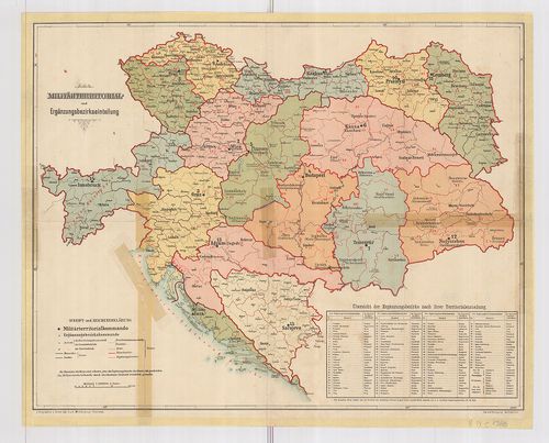
| Title | Militärterritorial Ergänzungsbezirkseinteilung. |
| Main title | Az Osztrák–Magyar Monarchia katonai területi és hadkiegészítő kerület beosztási térképe. |
2317. Eisenbahn-Karte der Österreichisch–Ungarischen Monarchie. [B IX c 1389]
Institute and Museum of Military History •
B IX c
•
B IX Ausztria–Magyarország
•
B I–XV. Európa
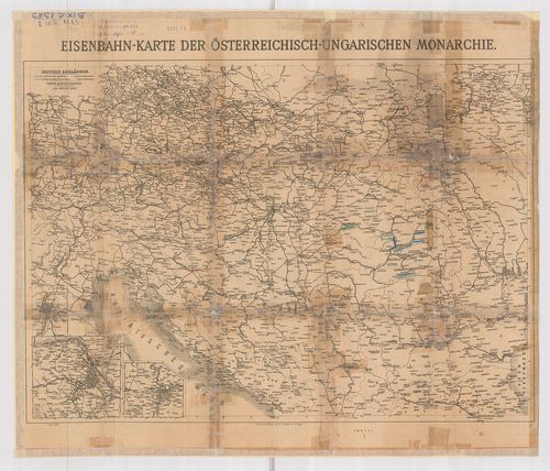
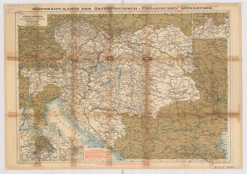
| Title | Eisenbahn-Karte der Österreichisch–Ungarischen Monarchie. |
| Main title | 2 mt.: 1.) Bezirke de Stadt Wien. 2.) Prager Stadtviertel. A hátoldalon: Eisenbahn-Karte von Mittel-Europa. |
| Subject | Az Osztrák–Magyar Monarchia és Közép-Európa vasúti térképe. |
2318. Eisenbahnkarte der Österreichisch–Ungarischen Monarchie. [B IX c 1390]
Institute and Museum of Military History •
B IX c
•
B IX Ausztria–Magyarország
•
B I–XV. Európa
| Title | Eisenbahnkarte der Österreichisch–Ungarischen Monarchie. |
| Main title | 2 mt.: 1.) Bezirke der Stadt Wien. 2.) Prager Stadtviertel. A hátoldalon: Eisenbahn-routen-karte von Mittel-Europa. |
| Subject | Az Osztrák–Magyar Monarchia és Közép-Európa vasúti térképe. |
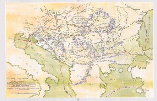
2319. Mappa Lineae Limitaneae Utriusq Imperiy Caesarei et Ottomani... [B IX c 1392]
Institute and Museum of Military History •
B IX c
•
B IX Ausztria–Magyarország
•
B I–XV. Európa
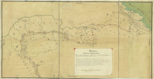
| Title | Mappa Lineae Limitaneae Utriusq Imperiy Caesarei et Ottomanici juxta Instrumentum Pacis Statuum in Conventu Carlovitzensi, Valachis et Venetis. |
| Main title | A karlócai békeszerződés határvonala a Császári Birodalom és a Török Birodalom között. |
2320. Festungs Sections Plan: 1.) von Raibl. [B IX c 1393]
Institute and Museum of Military History •
B IX c
•
B IX Ausztria–Magyarország
•
B I–XV. Európa
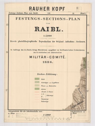
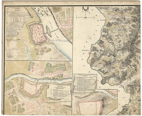
| Title | Festungs Sections Plan: 1.) von Raibl. |
| Main title | 2.) der Sperre Flitsch |
| Subject | 3.) von Predil. |
2321. Tabula Generalis Universa Regni Hungariae, Slavoniae ac S˙rm... [B IX c 1395]
Institute and Museum of Military History •
B IX c
•
B IX Ausztria–Magyarország
•
B I–XV. Európa
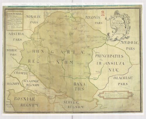
| Title | Tabula Generalis Universa Regni Hungariae, Slavoniae ac S˙rmü Salis Officia… |
| Main title | A Magyar Királyság, Szlavónia általános térképe, jelölve a sószállító útvonalakat. |
2322. Exhibeus partem Fluvy Tübisci ... [B IX c 1396]
Institute and Museum of Military History •
B IX c
•
B IX Ausztria–Magyarország
•
B I–XV. Európa
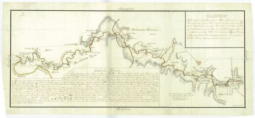
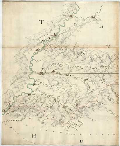
| Title | Exhibeus partem Fluvy Tübisci ... |
| Main title | A Tisza Bocskó és Tiszaújlak közötti szakasza a folyó menti betelepülések jelölésével. A sószállítóútvonalak átrakodóhelyek jelölve. (eredeti térkép OL) |
2323. Dislocations Karte der im Königreich Hungarn bequartirten K.... [B IX c 1397]
Institute and Museum of Military History •
B IX c
•
B IX Ausztria–Magyarország
•
B I–XV. Európa
| Title | Dislocations Karte der im Königreich Hungarn bequartirten K. Königleichen Truppen. |
| Main title | A Magyar Királyság diszlokációs térképe a királyi csapatok szálláshelyeivel. |
2324. General-Charte des Königreich Hungarn min Einbegriß des Teme... [B IX c 1398]
Institute and Museum of Military History •
B IX c
•
B IX Ausztria–Magyarország
•
B I–XV. Európa
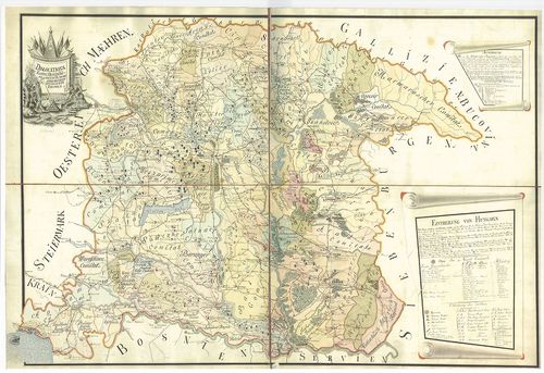
| Title | General-Charte des Königreich Hungarn min Einbegriß des Temeswarer Banat, des Königreich Slavonien und Croatien in 54 Comitate ... |
| Main title | A Magyar Királyság általános térképe a Temesi-Bánsággal, Szlavóniával és Horvátországgal, 54 megyére osztva. A területek mozgósítási táblázata. |
2325. Militär-Territorial-Benörden und Dislokation des Heeresim Fe... [B IX c 1399]
Institute and Museum of Military History •
B IX c
•
B IX Ausztria–Magyarország
•
B I–XV. Európa
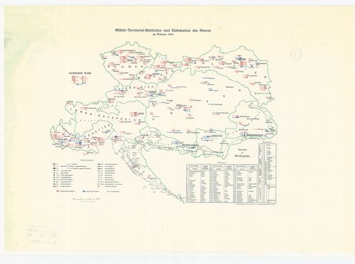
| Title | Militär-Territorial-Benörden und Dislokation des Heeresim Februar 1848. |
| Main title | A csapatok diszlokációja és az elhelyezési körzetek. |
2326. Ergänzungsbezirks-Eintheilung der Jäger-Truppen. [B IX c 1400]
Institute and Museum of Military History •
B IX c
•
B IX Ausztria–Magyarország
•
B I–XV. Európa
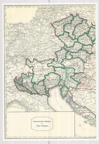
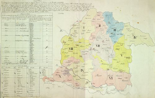
| Title | Ergänzungsbezirks-Eintheilung der Jäger-Truppen. |
| Main title | A vadász-csapatok területi elhelyezkedése. |
2327. Aufnahmskarte der wirklichen Grenzen zwischen dem Königreic... [B IX c 1402]
Institute and Museum of Military History •
B IX c
•
B IX Ausztria–Magyarország
•
B I–XV. Európa
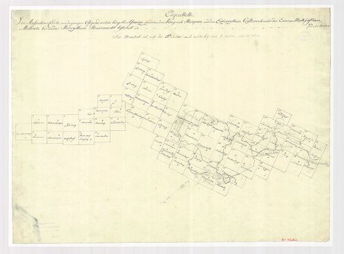
| Title | Aufnahmskarte der wirklichen Grenzen zwischen dem Königreich Ungarn u. dem Erzherzoghtum Österreich unter der Ens.... |
| Main title | A Magyar Királyság határtérképe Alsó-Ausztria felé. |
2328. Mappa Geographica Transylvaniam a Banatu Temisvariensi Separ... [B IX c 1404]
Institute and Museum of Military History •
B IX c
•
B IX Ausztria–Magyarország
•
B I–XV. Európa
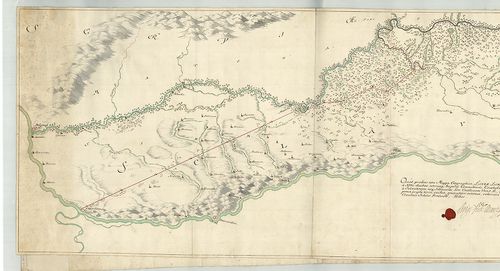
| Title | Mappa Geographica Transylvaniam a Banatu Temisvariensi Separantes Limites... |
| Main title | Erdély és a Temesi Bánság földrajzi térképe a határok feltüntetésével. Határtérkép. |
2329. [A törökellenes magyarországi határvédelem térképe.] [B IX c 1407]
Institute and Museum of Military History •
B IX c
•
B IX Ausztria–Magyarország
•
B I–XV. Európa
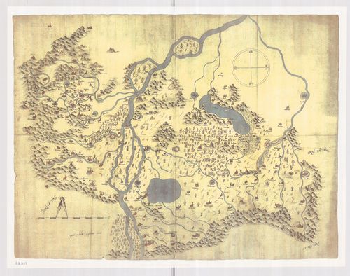
| Title | [A törökellenes magyarországi határvédelem térképe.] |
2330. [Mappa Mercantilis] - Mappa Geographica facta in usum Commer... [B IX c 1408]
Institute and Museum of Military History •
B IX c
•
B IX Ausztria–Magyarország
•
B I–XV. Európa
| Title | [Mappa Mercantilis] - Mappa Geographica facta in usum Commerciorum. |
| Main title | Földrajzi térkép, amely kereskedők használatára készült.[Kereskedelmi térkép]. |
2331. Magyarország vízierői 1897–1903. évi fölvételének körébe von... [B IX c 1412]
Institute and Museum of Military History •
B IX c
•
B IX Ausztria–Magyarország
•
B I–XV. Európa
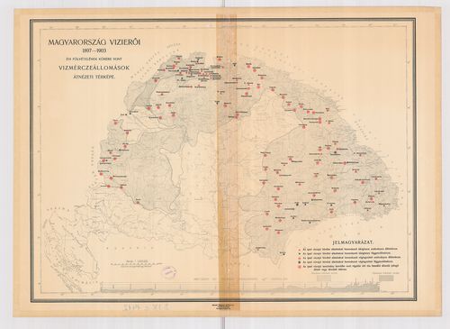
| Title | Magyarország vízierői 1897–1903. évi fölvételének körébe vont vízmérceállomások átnézeti térképe. |
2332. A Pilis és Dobogókő környéke [B IX c 1418]
Institute and Museum of Military History •
B IX c
•
B IX Ausztria–Magyarország
•
B I–XV. Európa
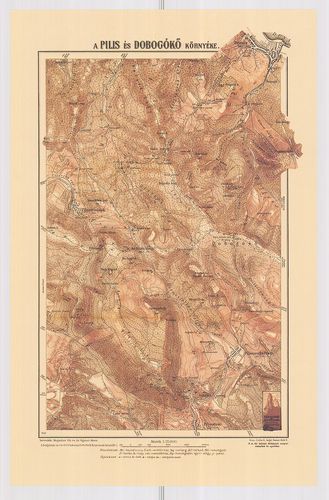
| Title | A Pilis és Dobogókő környéke |
2333. A gazdaságok területének megoszlása nagyságkategóriák szerin... [B IX c 1419]
Institute and Museum of Military History •
B IX c
•
B IX Ausztria–Magyarország
•
B I–XV. Európa
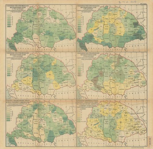
| Title | A gazdaságok területének megoszlása nagyságkategóriák szerint. 6 térkép, statisztikai adatokkal. |
2334. Magyarország gazdaságföldrajzi térképe. [B IX c 1420]
Institute and Museum of Military History •
B IX c
•
B IX Ausztria–Magyarország
•
B I–XV. Európa
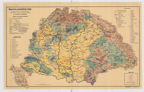
| Title | Magyarország gazdaságföldrajzi térképe. |
2335. Limitum post Pacem Carlovitcensem A MDCXCVIII. Mappa Geograp... [B IX c 1421]
Institute and Museum of Military History •
B IX c
•
B IX Ausztria–Magyarország
•
B I–XV. Európa
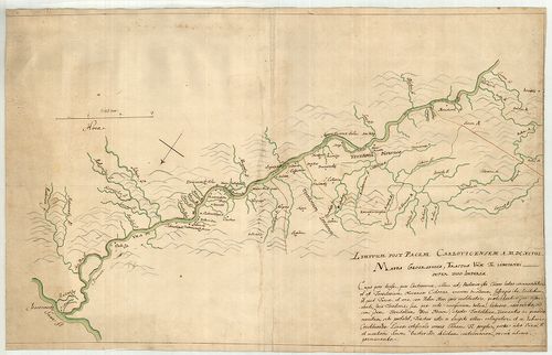
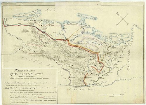
| Title | Limitum post Pacem Carlovitcensem A MDCXCVIII. Mappa Geographica, Tractus Unnae fl. Limitanei inter duo Imperia. |
| Main title | Az 1698. (sic!) évi Karlócai békeszerződés utáni határok földrajzi térképe, amely az Una folyónak a két birodalom közötti határszakaszát ábrázolja. Határtérkép. |
2336. Mappa Geographica; Lineam, inter utrumque Imperium, Limitane... [B IX c 1423]
Institute and Museum of Military History •
B IX c
•
B IX Ausztria–Magyarország
•
B I–XV. Európa
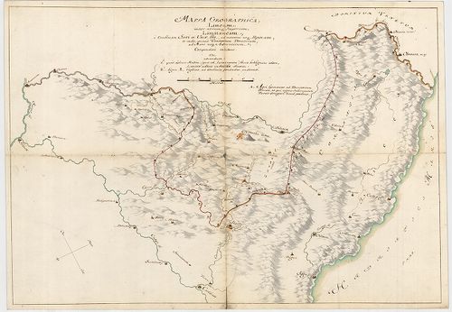
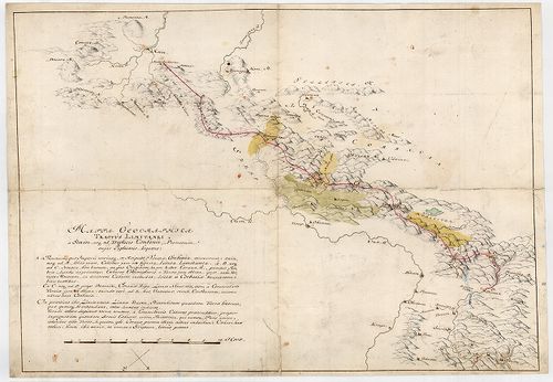
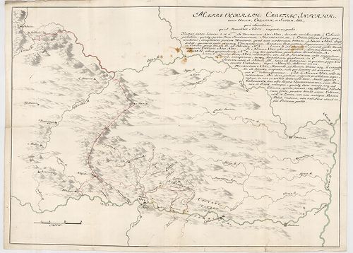
| Title | Mappa Geographica; Lineam, inter utrumque Imperium, Limitaneam, a Confluxu Savi et Unae ffl., ad montem usque Popinam, ad Mare usque Adriaticum; Compendiose exhibens |
| Main title | Földrajzi térkép, amely a két birodalom határvonalát a Száva és az Una folyók torkolatától a Popina hegyig, és innen a velencei fennhatóságú területekig, egészen az Adriai tengerig, vázlatosan bemutatja. Határtérkép. |
2337. Mappa Geographica Tractus Unae fl. Limitanei inter Duo imper... [B IX c 1424]
Institute and Museum of Military History •
B IX c
•
B IX Ausztria–Magyarország
•
B I–XV. Európa
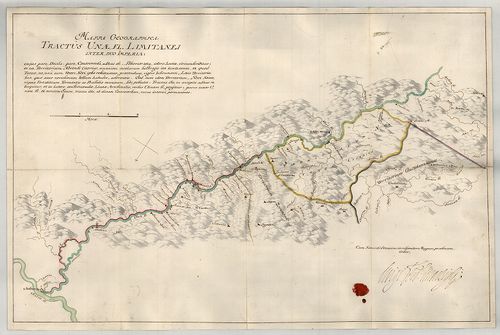
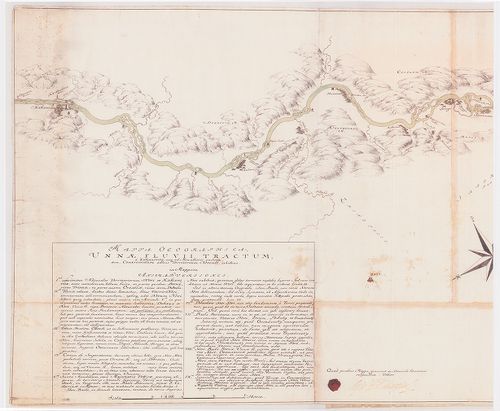
| Title | Mappa Geographica Tractus Unae fl. Limitanei inter Duo imperia... |
| Main title | Földrajzi térkép, amely az Una folyónak a két birodalom közötti szakaszát ábrázolja. Határtérkép. |
2338. Mappa Geographica Tractus Limitanei a Sluin, usque ad, Tripl... [B IX c 1425]
Institute and Museum of Military History •
B IX c
•
B IX Ausztria–Magyarország
•
B I–XV. Európa
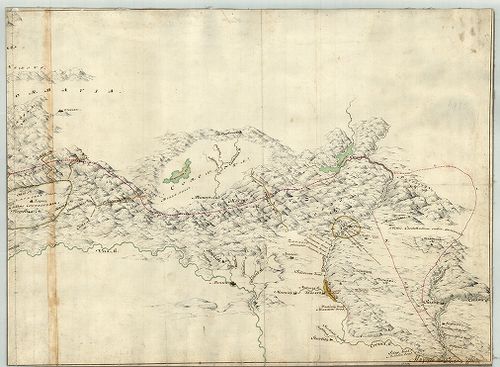
| Title | Mappa Geographica Tractus Limitanei a Sluin, usque ad, Triplicis Confinii, Punctum... |
| Main title | Szluintól a hármas határ pontjáig terjedő határszakasz geográfiai térképe... Határtérkép. |
2339. Mappa Geographica, qua Praecautio contra Pestem instituenda ... [B IX c 1426]
Institute and Museum of Military History •
B IX c
•
B IX Ausztria–Magyarország
•
B I–XV. Európa
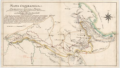
| Title | Mappa Geographica, qua Praecautio contra Pestem instituenda [...] ostenditur... |
| Main title | Földrajzi térkép, amelyen a pestis terjedésének megelőzésére hozandó intézkedéseket mutatjuk meg. Határtérkép. |
2340. Mappa Geographica Lineae, ad Coranam, fl. Limitaneae, usque ... [B IX c 1428]
Institute and Museum of Military History •
B IX c
•
B IX Ausztria–Magyarország
•
B I–XV. Európa
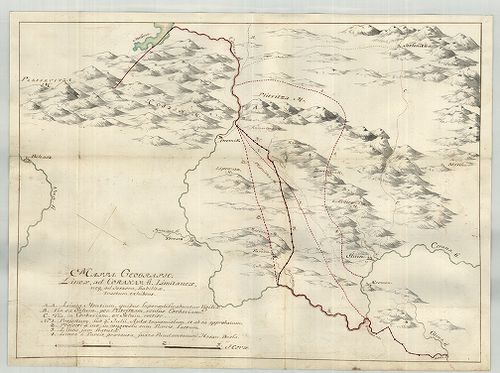
| Title | Mappa Geographica Lineae, ad Coranam, fl. Limitaneae, usque ad Jeszera [sic], stabilitae, tractum exhibens... |
| Main title | Földrajzi térkép, amely a Corana folyó mentén Jeszeraig futó végleges határszakaszt ábrázolja. Határtérkép. |
2341. Mappa Limitanea Regni Croatiae... [B IX c 1429]
Institute and Museum of Military History •
B IX c
•
B IX Ausztria–Magyarország
•
B I–XV. Európa
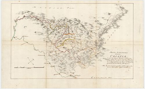
| Title | Mappa Limitanea Regni Croatiae... |
| Main title | Horvátország határtérképe... |
2342. Mappa Generalis Regni Croatiae Totius. [B IX c 1430]
Institute and Museum of Military History •
B IX c
•
B IX Ausztria–Magyarország
•
B I–XV. Európa
| Title | Mappa Generalis Regni Croatiae Totius. |
| Main title | Horvátország térképe..Határtérkép. |
2343. Mappa, qua ostenduntur difficultates communicationis Sclavon... [B IX c 1431]
Institute and Museum of Military History •
B IX c
•
B IX Ausztria–Magyarország
•
B I–XV. Európa
| Title | Mappa, qua ostenduntur difficultates communicationis Sclavoniae et Croatiae evacuatis Jeszenovitz et Dubitza |
| Main title | Azon térkép, amelyen bemutatjuk, milyen közlekedési nehézségekkel kell szembenézni Jeszenovitz és Dubitza kiürítése után.Határtérkép. |
2344. Mappa Geographica Unnae Fluvii Tractum, a Kastanovitz...Terr... [B IX c 1433]
Institute and Museum of Military History •
B IX c
•
B IX Ausztria–Magyarország
•
B I–XV. Európa
| Title | Mappa Geographica Unnae Fluvii Tractum, a Kastanovitz...Territorium Novense... |
| Main title | Az Una folyó térképe Kastanovitz-től Novi-ig. Határtérkép. |
2345. Mappa Geographica Lineae inter utrumque Imperium, Limitaneae... [B IX c 1434]
Institute and Museum of Military History •
B IX c
•
B IX Ausztria–Magyarország
•
B I–XV. Európa
| Title | Mappa Geographica Lineae inter utrumque Imperium, Limitaneae [...] a Confinio Triplici, usque ad Szluin [...] exhibens |
| Main title | Földrajzi térkép, amely a két birodalom között húzódó [...] határokat a hármas határtól Szluinig... mutatja. Határtérkép. |
2346. Situations Karte der Kaiser Königlich und Türkisch Croatisch... [B IX c 1435]
Institute and Museum of Military History •
B IX c
•
B IX Ausztria–Magyarország
•
B I–XV. Európa
| Title | Situations Karte der Kaiser Königlich und Türkisch Croatischen Grenze im Karlstaedter Warasdiner Generalat ... |
| Main title | A császári-királyi és török Horvátország határa a Károlyvárosi és a Varasdi Határőrvidékek területén az I. katonai felmérés alapján. Határtérkép. |
2347. Mappa Geographica Lineae Limitaneae Particularis utriusque S... [B IX c 1436]
Institute and Museum of Military History •
B IX c
•
B IX Ausztria–Magyarország
•
B I–XV. Európa
| Title | Mappa Geographica Lineae Limitaneae Particularis utriusque Sirmiensis a Salankemen usque ad Confluxum Bozut fl.; et Savensis, inde ad Confluxum Unnae fl. |
| Main title | Földrajzi térkép, amely részletesen ábrázolja egyrészt Salankementől a Bozut folyó torkolatáig a szerémségi, másrészt innen az Una torkolatáig a szávai határvonalat. Határtérkép. |
2348. Etnographische Landkarte von Ungarn im Jahre 1910. [B IX c 1438]
Institute and Museum of Military History •
B IX c
•
B IX Ausztria–Magyarország
•
B I–XV. Európa

| Title | Etnographische Landkarte von Ungarn im Jahre 1910. |
| Main title | Magyarország néprajzi térképe 1910-ből. 1940-es kiadás. |
2349. Die in Ausssicht genommene Dislokation der ung. Landwehr gle... [B IX c 1439]
Institute and Museum of Military History •
B IX c
•
B IX Ausztria–Magyarország
•
B I–XV. Európa
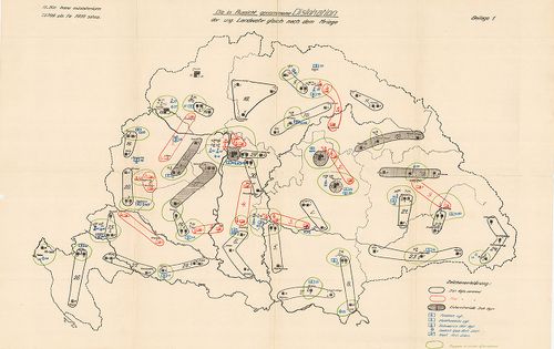
| Title | Die in Ausssicht genommene Dislokation der ung. Landwehr gleich nach dem Kriege. |
| Main title | A Magyar fegyveres erők diszlokációs térképe. |
2350. A magyar szent korona állam-területének honvédségi tekintetb... [B IX c 1440]
Institute and Museum of Military History •
B IX c
•
B IX Ausztria–Magyarország
•
B I–XV. Európa
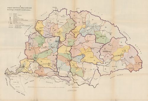
| Title | A magyar szent korona állam-területének honvédségi tekintetből való felosztása |