2081. Mappa derjenigen Gränzen Linie, welche zwischen dem Königrei... [B IX c 642]
Institute and Museum of Military History •
B IX c
•
B IX Ausztria–Magyarország
•
B I–XV. Európa
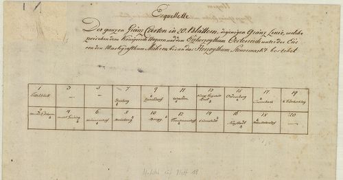
| Title | Mappa derjenigen Gränzen Linie, welche zwischen dem Königreich Hungarn und dem Erzherzogthum Österreich unter der Enns bestehet… |
| Main title | A Magyar Királyság és Alsó-Ausztria határvidékének térképe 1754–1755-ben. |
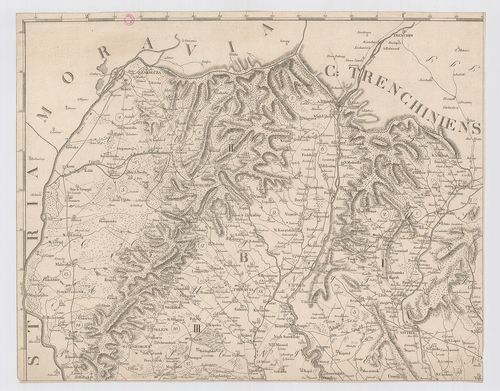
2082. Plan der Ungarischen Mährischen und Schlesischen Granitz. [B IX c 662]
Institute and Museum of Military History •
B IX c
•
B IX Ausztria–Magyarország
•
B I–XV. Európa
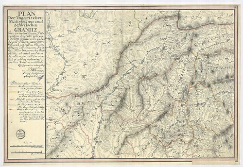
| Title | Plan der Ungarischen Mährischen und Schlesischen Granitz. |
| Main title | Magyar-morva, magyar-sziléziai határ térképe. [Határtérkép] |
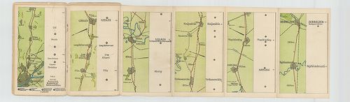
2083. Magyarország vasúti térképe 1913. okt. 1. [B IX c 663]
Institute and Museum of Military History •
B IX c
•
B IX Ausztria–Magyarország
•
B I–XV. Európa
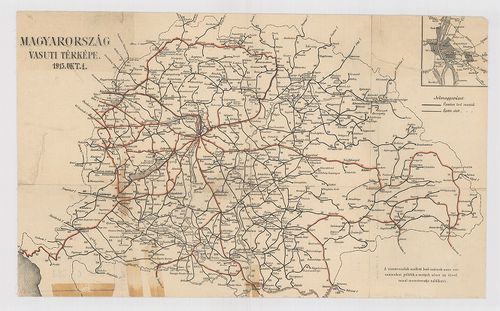
| Title | Magyarország vasúti térképe 1913. okt. 1. |
| Main title | Mt. [Budapest pályaudvarai.] |
2084. Magyarország úthálózatának távolsági térképe. – Carte Routié... [B IX c 664]
Institute and Museum of Military History •
B IX c
•
B IX Ausztria–Magyarország
•
B I–XV. Európa
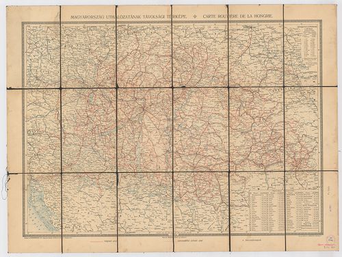
| Title | Magyarország úthálózatának távolsági térképe. – Carte Routiéres de la Hongrie. |
2085. A Magyar Automobil-Club Hivatalos Túratérképei. – Carte rout... [B IX c 665]
Institute and Museum of Military History •
B IX c
•
B IX Ausztria–Magyarország
•
B I–XV. Európa
| Title | A Magyar Automobil-Club Hivatalos Túratérképei. – Carte routiére offic. de l’Automibile Club de Hongrie. – Offiz. Touren-Karten des Ungaricshen Automobil-Clubs. |
| Main title | 9. Budapest–Cegléd–Szolnok–Debrecen. 10. Budapest–Kecskemét–Szeged. 11. Budapest–Szolnok, Békéscsaba–Arad. 14. Debreczen–Nagyvárad–Királyhágó–Kolozsvár 15. Kolozsvár–Marosvásárhely –Brassó. 16. Szeged–Temesvár–Lugus–Orsova. 19. Debreczen–Nagyvárad–Arad–Temesvár. |
2086. Magyarország és Horvát-Szlavonország úthálózati térképe. – C... [B IX c 666]
Institute and Museum of Military History •
B IX c
•
B IX Ausztria–Magyarország
•
B I–XV. Európa
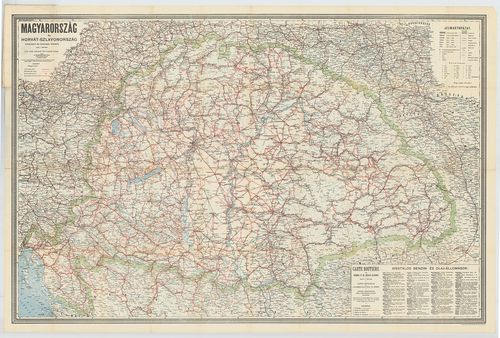
| Title | Magyarország és Horvát-Szlavonország úthálózati térképe. – Carte Routiére de Hongrie et Croatie-Slavonie. |
2087. Theatre de la Guerre dans le Bannat de Temesvár. [B IX c 677]
Institute and Museum of Military History •
B IX c
•
B IX Ausztria–Magyarország
•
B I–XV. Európa
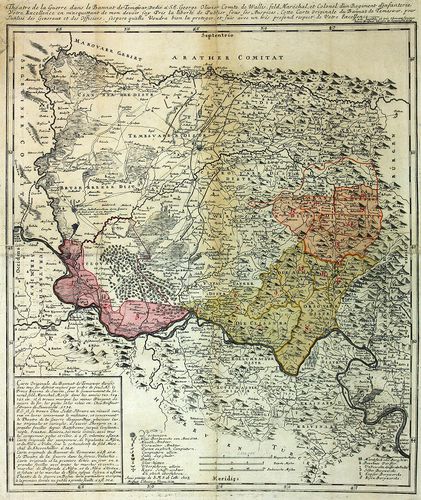
| Title | Theatre de la Guerre dans le Bannat de Temesvár. |
| Main title | A Temesi-Bánság hadszíntere 1738-ban. |
2088. Dislocations Carte von Ungarn de Anno 1781. [B IX c 685]
Institute and Museum of Military History •
B IX c
•
B IX Ausztria–Magyarország
•
B I–XV. Európa
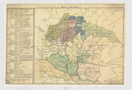
| Title | Dislocations Carte von Ungarn de Anno 1781. |
| Main title | Magyarország diszlokációs térképe 1781-ben. |
2089. Strassen-Karte des Königreiches Ungarn. [B IX c 690]
Institute and Museum of Military History •
B IX c
•
B IX Ausztria–Magyarország
•
B I–XV. Európa
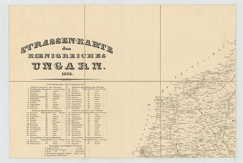
| Title | Strassen-Karte des Königreiches Ungarn. |
| Main title | Magyarország úttérképe 1832-ben. |
2090. [Magyarország.] Magyar-Ország és a hozzá kapcsolt Részek Had... [B IX c 691]
Institute and Museum of Military History •
B IX c
•
B IX Ausztria–Magyarország
•
B I–XV. Európa
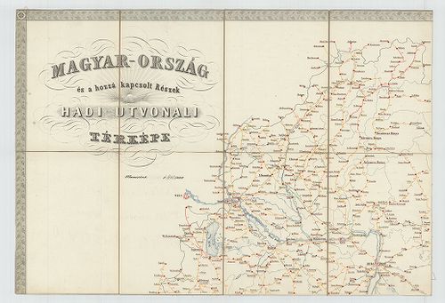
| Title | [Magyarország.] Magyar-Ország és a hozzá kapcsolt Részek Hadi-Útvonali térképe. |
2091. Marschrouten-Karte des Königreiches Ungarn nach den neuesten... [B IX c 696]
Institute and Museum of Military History •
B IX c
•
B IX Ausztria–Magyarország
•
B I–XV. Európa
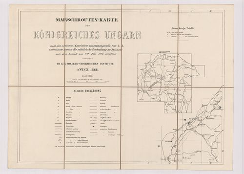
| Title | Marschrouten-Karte des Königreiches Ungarn nach den neuesten Materialien zusammengestellt… vom 1-ten Juli. 1868. |
| Main title | Magyarország menettérképe 1868-ban. |
2092. Marschrouten-Karte des Königreichs Ungarn nach den neuesten ... [B IX c 697]
Institute and Museum of Military History •
B IX c
•
B IX Ausztria–Magyarország
•
B I–XV. Európa
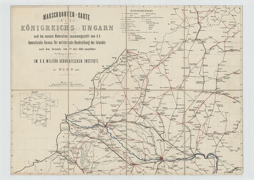
| Title | Marschrouten-Karte des Königreichs Ungarn nach den neuesten Materialien zusammengestellt… vom 1-ten Juli 1869. |
| Main title | Magyarország menettérképe 1869-ben. Az úttávolságok bejelölve. |
2093. [Magyarország.] A Magyar Korona államterületének honvédségi ... [B IX c 698]
Institute and Museum of Military History •
B IX c
•
B IX Ausztria–Magyarország
•
B I–XV. Európa
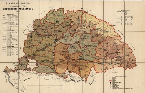
| Title | [Magyarország.] A Magyar Korona államterületének honvédségi felosztása. |
2094. [Magyarország.] A Magyar Korona Államterületének közigazgatá... [B IX c 698/1]
Institute and Museum of Military History •
B IX c
•
B IX Ausztria–Magyarország
•
B I–XV. Európa
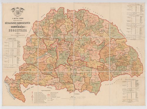
| Title | [Magyarország.] A Magyar Korona Államterületének közigazgatási Hadkiegészítési és Honvédségi beosztása. |
2095. [Magyarország.] A Magyar Korona Országainak Hadkiegészítési ... [B IX c 699]
Institute and Museum of Military History •
B IX c
•
B IX Ausztria–Magyarország
•
B I–XV. Európa
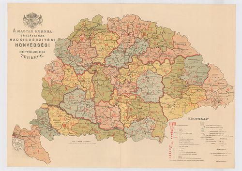
| Title | [Magyarország.] A Magyar Korona Országainak Hadkiegészítési és Honvédségi térképe. |
2096. Marsch und Reise Karte des Oesterreichishcen Kaiserstaates. [B IX c 700]
Institute and Museum of Military History •
B IX c
•
B IX Ausztria–Magyarország
•
B I–XV. Európa
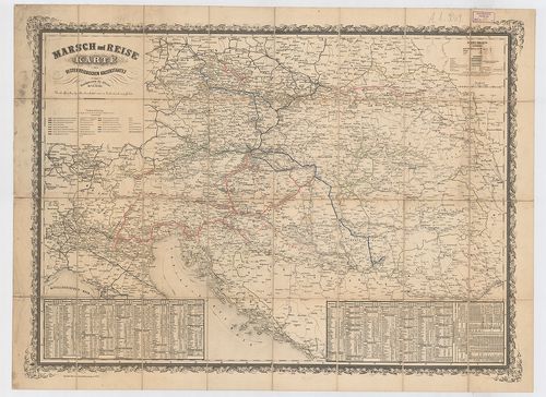
| Title | Marsch und Reise Karte des Oesterreichishcen Kaiserstaates. |
| Main title | Az Osztrák Császárság közlekedési térképe. |
2097. Magyarország Egyházi közigazgatási térképe. [B IX c 704/3]
Institute and Museum of Military History •
B IX c
•
B IX Ausztria–Magyarország
•
B I–XV. Európa
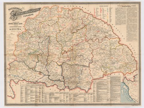
| Title | Magyarország Egyházi közigazgatási térképe. |
2098. Az Erdélyi ev.[angélikus] ref.[ormátus] egyházkerület térkép... [B IX c 704/4]
Institute and Museum of Military History •
B IX c
•
B IX Ausztria–Magyarország
•
B I–XV. Európa
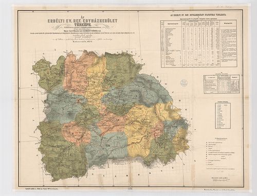
| Title | Az Erdélyi ev.[angélikus] ref.[ormátus] egyházkerület térképe. |
| Main title | Az „Erdélyi prot[estáns] Közlöny” 1877-i évi folyamának mell. |
2099. Magyarország Erdélyi részének turista térképe. [B IX c 704/5]
Institute and Museum of Military History •
B IX c
•
B IX Ausztria–Magyarország
•
B I–XV. Európa
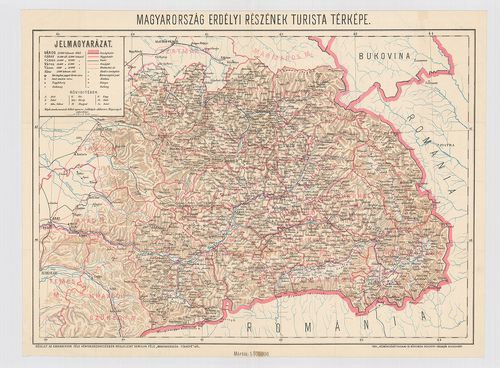
| Title | Magyarország Erdélyi részének turista térképe. |
| Main title | Homolka-féle „Magyarország Térképe” részlete. |
2100. Mappa Archi Dioecesis Strigoniensis, in Vicariatus. [B IX c 705]
Institute and Museum of Military History •
B IX c
•
B IX Ausztria–Magyarország
•
B I–XV. Európa
| Title | Mappa Archi Dioecesis Strigoniensis, in Vicariatus. |
| Main title | Mt. Az Esztergomi püspöki palota látképe. |
| Subject | Az Esztergomi egyházkerület térképe 1822-ben. |