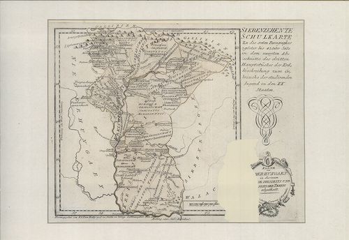
621. Principauté de Transilvanie Divisée en Cinq Nations Subdivis... [B IX a 1090]
Institute and Museum of Military History •
B IX a
•
B IX Ausztria–Magyarország
•
B I–XV. Európa
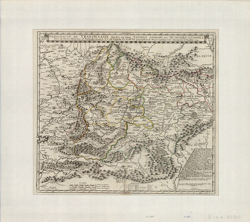
| Title | Principauté de Transilvanie Divisée en Cinq Nations Subdivisée en Quartiers et Comtez. |
| Main title | Az Erdélyi Nagyfejedelemség térképe közigazgatási beosztással. |
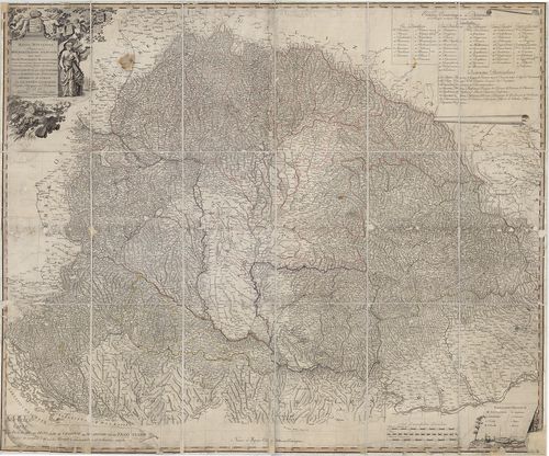
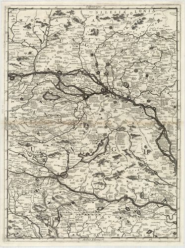
622. Le Royaume de Hongrie divisé en Haute et basse Hongrie, Tran... [B IX a 1091]
Institute and Museum of Military History •
B IX a
•
B IX Ausztria–Magyarország
•
B I–XV. Európa
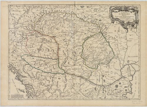
| Title | Le Royaume de Hongrie divisé en Haute et basse Hongrie, Transilvanie, Esclavonie et Croatie. |
| Main title | Magyarország, Erdély, Horvát-Szlavónia térképe. |
623. Le Royaume de Hongrie et les Estats qui ont este … [B IX a 1092]
Institute and Museum of Military History •
B IX a
•
B IX Ausztria–Magyarország
•
B I–XV. Európa
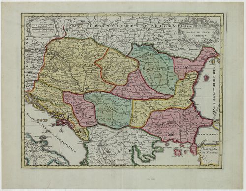
| Title | Le Royaume de Hongrie et les Estats qui ont este … |
| Main title | Magyarország és a Balkán-félsziget északi államainak térképe, határvonal színezéssel. |
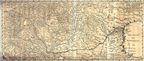
624. Territorio di Naiasel, e Grau siu’ a Comora, Pescritto, e De... [B IX a 1093]
Institute and Museum of Military History •
B IX a
•
B IX Ausztria–Magyarország
•
B I–XV. Európa
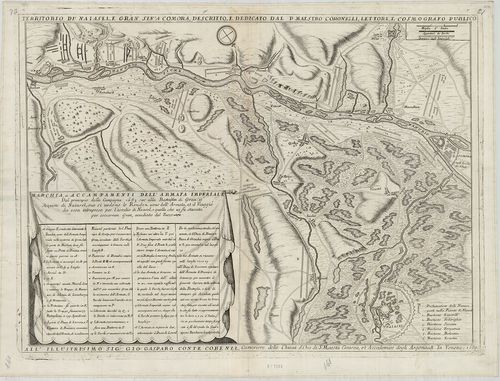
| Title | Territorio di Naiasel, e Grau siu’ a Comora, Pescritto, e Dedicatio dal P. Maestro Coronelli, Lettore, e Casmografico Publico. |
| Main title | Az Esztergom, Érsekújvár és Komárom közötti terület a visszafoglaló háborúban a párkányi csata és az érsekújvári ostromzár ábrázolásával. |
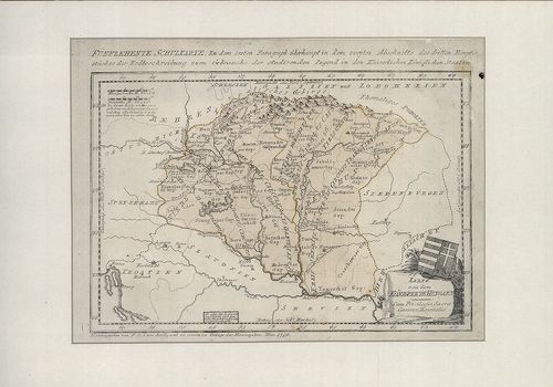
625. Transylvania. [B IX a 1095]
Institute and Museum of Military History •
B IX a
•
B IX Ausztria–Magyarország
•
B I–XV. Európa
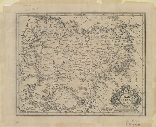
| Title | Transylvania. |
| Main title | Erdély térképe a XVII. sz. elején. |
626. Abbildung des Königreichs Ungarn durch Türckey biss nach Con... [B IX a 1099]
Institute and Museum of Military History •
B IX a
•
B IX Ausztria–Magyarország
•
B I–XV. Európa
| Title | Abbildung des Königreichs Ungarn durch Türckey biss nach Constantinopel und zufinden bey Paulus Fürst Kunst und Buchändlern in Nürnberg. |
| Main title | A Magyar Királyság és a Török Birodalom (a Fekete-tengerig). |
627. Theatre de la Guerre d’Hongrie et Lieux Circonvoisins, selon... [B IX a 1100]
Institute and Museum of Military History •
B IX a
•
B IX Ausztria–Magyarország
•
B I–XV. Európa
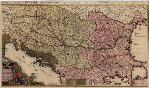
| Title | Theatre de la Guerre d’Hongrie et Lieux Circonvoisins, selon les plus Exacts Auteurs Geographiques Nouvellement Represente par Joachim Ottens. Novissima Tabula Regni Hungariae et Regio quondam ei unitarum ut Transilvaniae, Valachiae, Moldaviae, Serviae … |
| Main title | A Magyar Királyság és a környező országok. |
628. A New and Accurate Map of the Kingdom of Hungary and Princip... [B IX a 1101]
Institute and Museum of Military History •
B IX a
•
B IX Ausztria–Magyarország
•
B I–XV. Európa
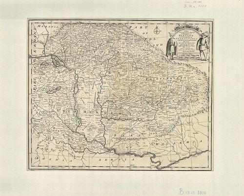
| Title | A New and Accurate Map of the Kingdom of Hungary and Principality of Transilvania with the bordering countries. In.: Bowen: A Complet Atlas or distinct wiew of the Know wWorld. London, 1752. |
| Main title | A Magyar Királyság, az Erdélyi Nagyfejedelemség és a környező országok térképe. |
629. Fines Hungariae Caroli VI. Caes. Aug. et Pace Pasarovicensi ... [B IX a 1103]
Institute and Museum of Military History •
B IX a
•
B IX Ausztria–Magyarország
•
B I–XV. Európa
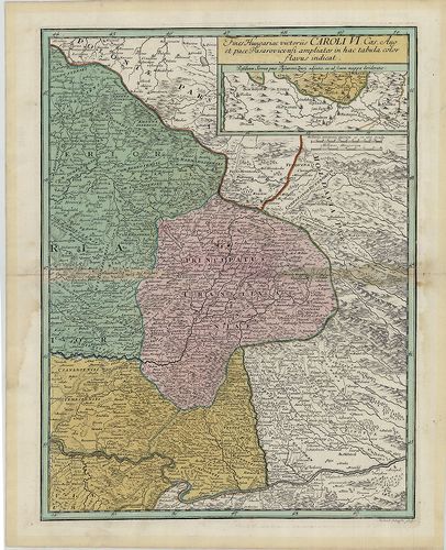
| Title | Fines Hungariae Caroli VI. Caes. Aug. et Pace Pasarovicensi ampliatos in hactabula Color Havus indicat. |
| Main title | A pozsareváci békekötéssel VI. Károly Habsburg uralkodó uralma alá került területek.(Magyarország keleti része, Erdély és a Temesi Bánság területe.) |
630. Mappa Novissima Regnorum Hungariae Croatiae, Slavoniae nec n... [B IX a 1105]
Institute and Museum of Military History •
B IX a
•
B IX Ausztria–Magyarország
•
B I–XV. Európa
| Title | Mappa Novissima Regnorum Hungariae Croatiae, Slavoniae nec non Magni Principatus Transilvaniae… – Novelle Carte du Royaume de Hongrie de Croatie de Slavonie et de Transylvanie… |
| Main title | A Magyar Királyság, Horvát-Szlavónia és Erdély térképe a 19. század elején. |
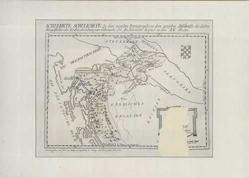
631. Karte von dem Königreiche Hungarn. [B IX a 1106]
Institute and Museum of Military History •
B IX a
•
B IX Ausztria–Magyarország
•
B I–XV. Európa
| Title | Karte von dem Königreiche Hungarn. |
| Main title | A Magyar Királyság térképe. Reilly által készített iskolai térképek 15. lapja. |
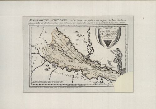
632. Karte von Niederhungarn … [B IX a 1107]
Institute and Museum of Military History •
B IX a
•
B IX Ausztria–Magyarország
•
B I–XV. Európa

| Title | Karte von Niederhungarn … |
| Main title | Alsó-Magyarország térképe. Reilly által készített iskolai térképek 16. lapja. |
633. Karte von Oberhungarn … [B IX a 1108]
Institute and Museum of Military History •
B IX a
•
B IX Ausztria–Magyarország
•
B I–XV. Európa
| Title | Karte von Oberhungarn … |
| Main title | Felső-Magyarország térképe. Reilly által készített iskolai térképek 17. lapja. |
634. Karte von Croatien … [B IX a 1109]
Institute and Museum of Military History •
B IX a
•
B IX Ausztria–Magyarország
•
B I–XV. Európa
| Title | Karte von Croatien … |
| Main title | Horvátország térképe. Reilly által készített iskolai térképek 18. lapja. |
635. Karte vn dem Königreiche Slavonie. [B IX a 1110]
Institute and Museum of Military History •
B IX a
•
B IX Ausztria–Magyarország
•
B I–XV. Európa
| Title | Karte vn dem Königreiche Slavonie. |
| Main title | A Szlavón Királyság térképe Reilly által készített iskolai térképek 19. lapja. |
636. Uibersichts-Karte der Erzherzoglichen Herrschaft Ungarisch A... [B IX a 1111]
Institute and Museum of Military History •
B IX a
•
B IX Ausztria–Magyarország
•
B I–XV. Európa
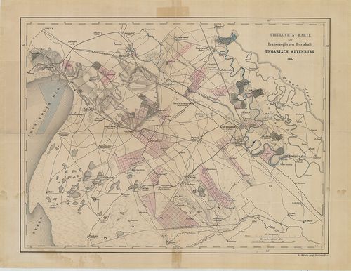
| Title | Uibersichts-Karte der Erzherzoglichen Herrschaft Ungarisch Altenburg. |
| Main title | Magyaróvár (Mosonmagyaróvár) és környékének térképe. |
637. [A Magyar királyság nyugati felének térképe.] [B IX a 1112]
Institute and Museum of Military History •
B IX a
•
B IX Ausztria–Magyarország
•
B I–XV. Európa
| Title | [A Magyar királyság nyugati felének térképe.] |
| Main title | Magyarország nyugati felének térképe, többnyelvű névírás, ostromok és csaták évszámai. |
638. Carte de la Hungrie, de la Transilvanie… [B IX a 1113]
Institute and Museum of Military History •
B IX a
•
B IX Ausztria–Magyarország
•
B I–XV. Európa
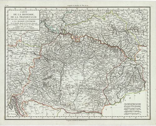
| Title | Carte de la Hungrie, de la Transilvanie… |
| Main title | Magyarország és Erdély térképe. |
639. Plan von einem Theil der Gegend beiden Papagej zwischen dem ... [B IX a 1114]
Institute and Museum of Military History •
B IX a
•
B IX Ausztria–Magyarország
•
B I–XV. Európa
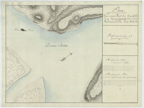
| Title | Plan von einem Theil der Gegend beiden Papagej zwischen dem Dorf Moldowa und dem Berg Alibeck. |
| Main title | A Papagáj-sziget (tört. Mo. déli határa) és környékének térképe. |
640. Plan vortheilhaften Truppen-Aufstellungen zwischen der Dunau... [B IX a 1117]
Institute and Museum of Military History •
B IX a
•
B IX Ausztria–Magyarország
•
B I–XV. Európa

| Title | Plan vortheilhaften Truppen-Aufstellungen zwischen der Dunau, der Raab und dem Blatten See. |
| Main title | A csapatok mozgása a Duna, Rába és a Balaton között. |