641. Übersichts-Karte von der südlichen u. grösseren Hälfte des T... [B IX a 1118]
Institute and Museum of Military History •
B IX a
•
B IX Ausztria–Magyarország
•
B I–XV. Európa
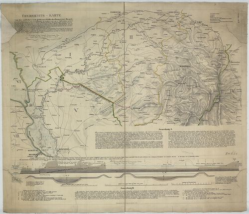
| Title | Übersichts-Karte von der südlichen u. grösseren Hälfte des Temesvarer Banat’s. |
| Main title | A Temesi Bánság déli részének térképe. |
642. General Karte des Grossfürstenthurms Siebenbürgen. [B IX a 1119]
Institute and Museum of Military History •
B IX a
•
B IX Ausztria–Magyarország
•
B I–XV. Európa
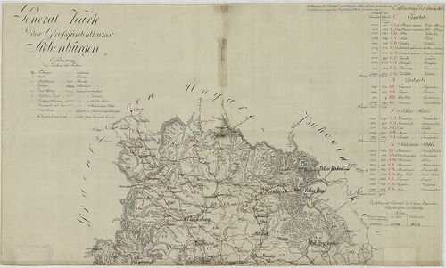
| Title | General Karte des Grossfürstenthurms Siebenbürgen. |
| Main title | Az Erdélyi Nagyhercegség általános térképe népességi adatokkal. |
643. Geographische Charte des Königreichs Hungaria [B IX a 1120]
Institute and Museum of Military History •
B IX a
•
B IX Ausztria–Magyarország
•
B I–XV. Európa
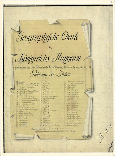
| Title | Geographische Charte des Königreichs Hungaria |
| Main title | Magyarország földrajzi (általános) térképe az I. katonai felmérés alapján. |
644. Theatre de la Guerre ouvert en Hongrie dans la tartarie crim... [B IX a 1122]
Institute and Museum of Military History •
B IX a
•
B IX Ausztria–Magyarország
•
B I–XV. Európa
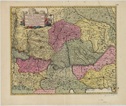
| Title | Theatre de la Guerre ouvert en Hongrie dans la tartarie crimée... |
| Main title | A Duna medencéje Pesttől a Fekete-tengerig. |
645. Magyar Ország és Erdély földabrosza. [B IX a 1125]
Institute and Museum of Military History •
B IX a
•
B IX Ausztria–Magyarország
•
B I–XV. Európa
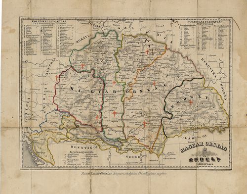
| Title | Magyar Ország és Erdély földabrosza. |
| Main title | Tartományi és megyehatárok. |
646. Carte des Broder Gräntz Regiments. [B IX a 1126]
Institute and Museum of Military History •
B IX a
•
B IX Ausztria–Magyarország
•
B I–XV. Európa
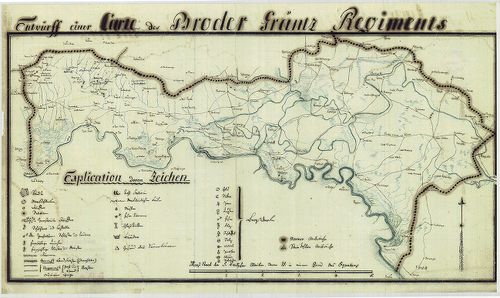
| Title | Carte des Broder Gräntz Regiments. |
| Main title | A Brodi határőrezred területének térképe a XIX. sz. elejéről. |
647. Carte des Gradiscaner Gräntz Regiments. [B IX a 1127]
Institute and Museum of Military History •
B IX a
•
B IX Ausztria–Magyarország
•
B I–XV. Európa
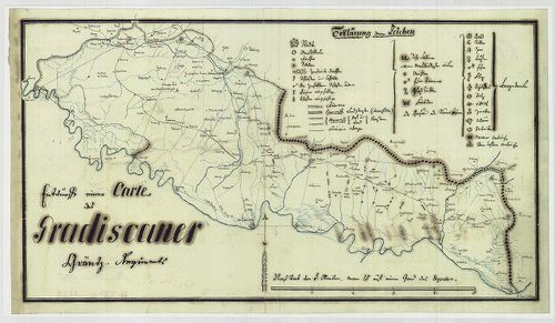
| Title | Carte des Gradiscaner Gräntz Regiments. |
| Main title | A Gradiscai határőrezred területének térképe a XIX. sz. elejéről. |
648. Carte des Warasdiner Gräntz Regiments. [B IX a 1128]
Institute and Museum of Military History •
B IX a
•
B IX Ausztria–Magyarország
•
B I–XV. Európa
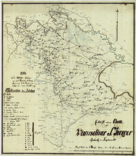
| Title | Carte des Warasdiner Gräntz Regiments. |
| Main title | A Varasdi határőrezred területének térképe a XIX. sz. elejéről. |
649. Carte des Peterwardeiner Gränz Regiments. [B IX a 1129]
Institute and Museum of Military History •
B IX a
•
B IX Ausztria–Magyarország
•
B I–XV. Európa
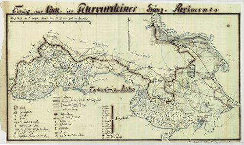
| Title | Carte des Peterwardeiner Gränz Regiments. |
| Main title | A Péterváradi határőrezred területének térképe a XIX. sz. elejéről. |
650. Carte des ersten Banal Regiments. [B IX a 1130]
Institute and Museum of Military History •
B IX a
•
B IX Ausztria–Magyarország
•
B I–XV. Európa
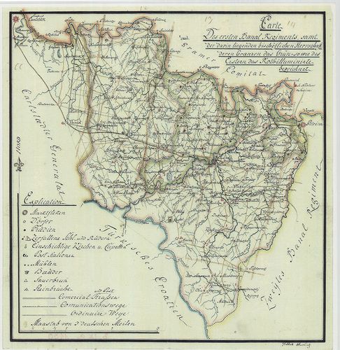
| Title | Carte des ersten Banal Regiments. |
| Main title | Az Első Bánáti Regiment (Báni határőrezred) területének térképe a XIX. sz. elején. |
651. Eigentlicher Entwurff des zwischen Ungarn und Schlesien gele... [B IX a 1131]
Institute and Museum of Military History •
B IX a
•
B IX Ausztria–Magyarország
•
B I–XV. Európa
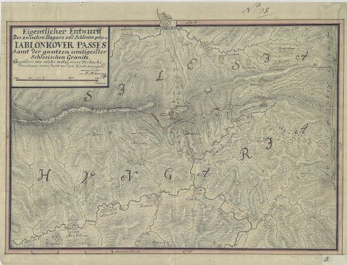
| Title | Eigentlicher Entwurff des zwischen Ungarn und Schlesien gelegene Iablonkover Passes... |
| Main title | A Jablunkai-hágó térképe a magyar-sziléziai határon. |
652. Royaume de Hongrie; Avec la Partie la plus Septentrionale de... [B IX a 1133]
Institute and Museum of Military History •
B IX a
•
B IX Ausztria–Magyarország
•
B I–XV. Európa
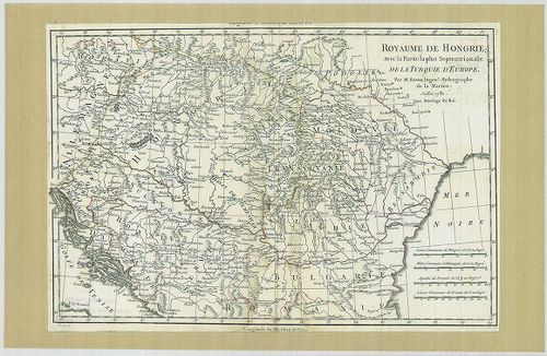
| Title | Royaume de Hongrie; Avec la Partie la plus Septentrionale de la Turquie D'Europe. |
| Main title | A Magyar Királyság; a Török Birodalom északi része Európában. |
653. La Hongrie. [B IX a 1135]
Institute and Museum of Military History •
B IX a
•
B IX Ausztria–Magyarország
•
B I–XV. Európa
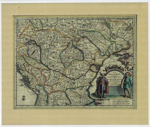
| Title | La Hongrie. |
| Main title | Magyarország 1713-ból. |
654. Totius Regni Hungariae Maximaeque Partis Danubii Fluminis un... [B IX a 1137]
Institute and Museum of Military History •
B IX a
•
B IX Ausztria–Magyarország
•
B I–XV. Európa
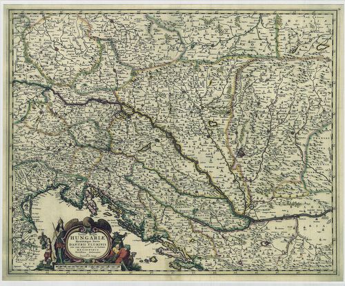
| Title | Totius Regni Hungariae Maximaeque Partis Danubii Fluminis una cum adjacentibus et finitimis Regionibus. |
| Main title | A Magyar Királyság térképe a környező Duna menti részekkel. |
655. Totius Regni Hungariae Maximae que Partis Danubii Fluminis ... [B IX a 1138]
Institute and Museum of Military History •
B IX a
•
B IX Ausztria–Magyarország
•
B I–XV. Európa
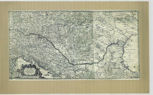
| Title | Totius Regni Hungariae Maximae que Partis Danubii Fluminis una cum adjacentibus et finitimis Regionibus. |
| Main title | A Magyar Királyság térképe a környező Duna menti részekkel. |
656. Hungaria, (Hongheren), Transylvania. [B IX a 1139]
Institute and Museum of Military History •
B IX a
•
B IX Ausztria–Magyarország
•
B I–XV. Európa
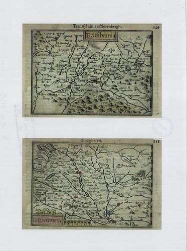
| Title | Hungaria, (Hongheren), Transylvania. |
| Main title | A Magyar Királyság és Erdély térképe. |
657. [Ungariae et omnium partium eius universalis descriptio.] [B IX a 1140]
Institute and Museum of Military History •
B IX a
•
B IX Ausztria–Magyarország
•
B I–XV. Európa
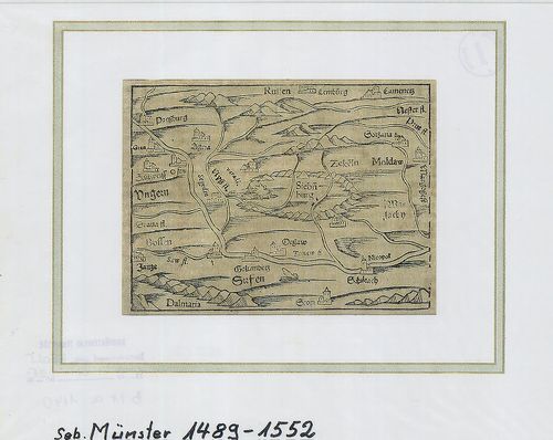
| Title | [Ungariae et omnium partium eius universalis descriptio.] |
| Main title | Magyarország és környéke. |
658. Österreich-Ungarn. Übersicht. [B IX a 1141]
Institute and Museum of Military History •
B IX a
•
B IX Ausztria–Magyarország
•
B I–XV. Európa
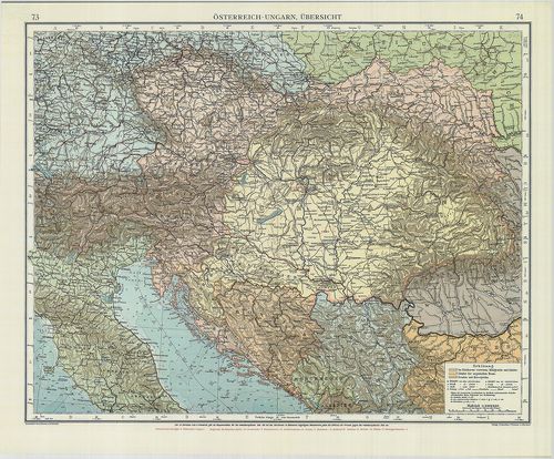
| Title | Österreich-Ungarn. Übersicht. |
| Main title | Az Osztrák-Magyar Monarchia áttekintő térképe. |
659. Ungarn, Galizien, Bukowina, Croatien, Slavonien, Wojwodina, ... [B IX a 1142]
Institute and Museum of Military History •
B IX a
•
B IX Ausztria–Magyarország
•
B I–XV. Európa
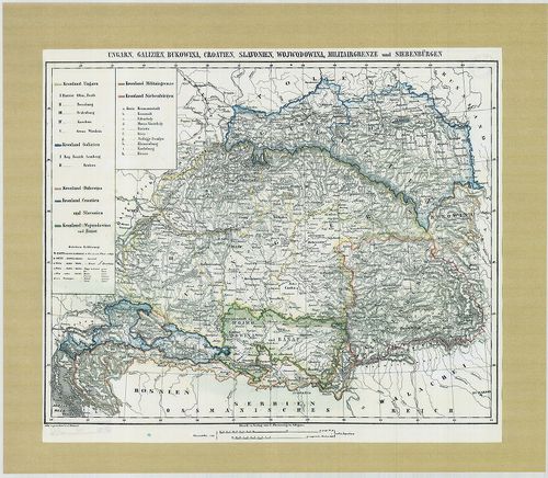
| Title | Ungarn, Galizien, Bukowina, Croatien, Slavonien, Wojwodina, Militairgrenze und Siebenbürgen. |
| Main title | Magyarország, Galícia, Bukovina, Horvátország, a Vajdaság, a Határőrvidékek és Erdély térképe 1840-ből. |
660. Hungaria Utraque... [B IX a 1143]
Institute and Museum of Military History •
B IX a
•
B IX Ausztria–Magyarország
•
B I–XV. Európa
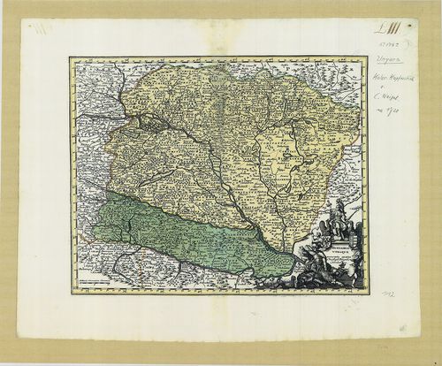
| Title | Hungaria Utraque... |
| Main title | Magyarország térképe. |