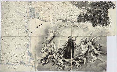
661. Novissima et Accuratissima totius Hungariae tabula... [B IX a 1144]
Institute and Museum of Military History •
B IX a
•
B IX Ausztria–Magyarország
•
B I–XV. Európa
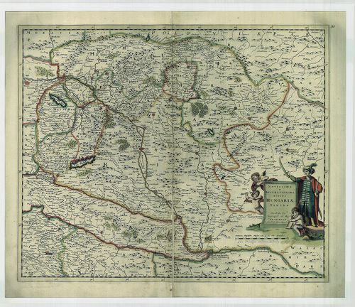
| Title | Novissima et Accuratissima totius Hungariae tabula... |
| Main title | Magyarország térképe. |
662. Transylvania. [B IX a 1145]
Institute and Museum of Military History •
B IX a
•
B IX Ausztria–Magyarország
•
B I–XV. Európa
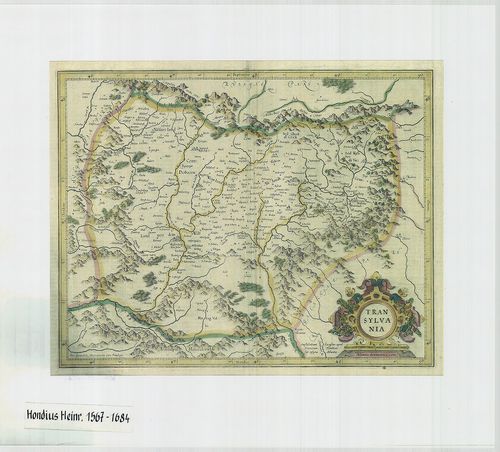
| Title | Transylvania. |
| Main title | Erdély térképe. |
663. Karte von Innerösterreich, oder das Herzogthum Steyermark, K... [B IX a 1146]
Institute and Museum of Military History •
B IX a
•
B IX Ausztria–Magyarország
•
B I–XV. Európa
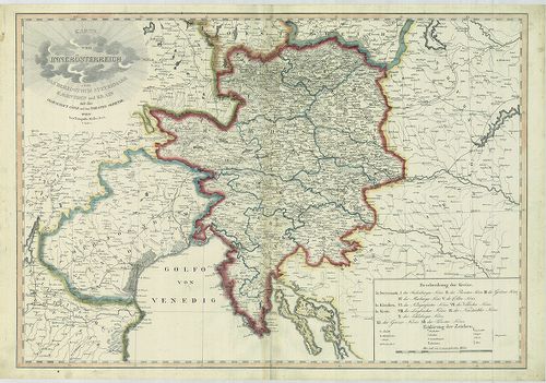
| Title | Karte von Innerösterreich, oder das Herzogthum Steyermark, Kaernthen und Krain mit der Grafschaft Görz und dem Triester Gebiethe. |
| Main title | Belső-Ausztria (A Stájer Hercegség, Karintia, Krajna, a Görz-i Hercegség és a Trieszti terület) térképe. |
664. Karte der Österreichischen Monarchie. [B IX a 1147]
Institute and Museum of Military History •
B IX a
•
B IX Ausztria–Magyarország
•
B I–XV. Európa
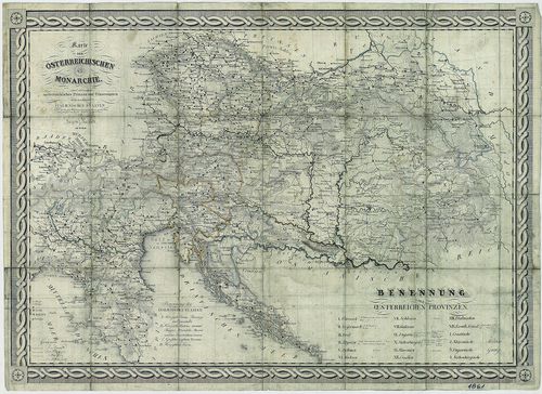
| Title | Karte der Österreichischen Monarchie. |
| Main title | Az Osztrák Monarchia térképe 1861-ből. |
665. Österreich-Ungarn. [B IX a 1148]
Institute and Museum of Military History •
B IX a
•
B IX Ausztria–Magyarország
•
B I–XV. Európa
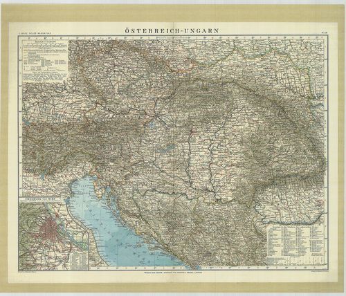
| Title | Österreich-Ungarn. |
| Main title | Az Osztrák-Magyar Monarchia térképe 1912-ből. |
666. Mappa Chorographica per quam Communicatio Sclavoniae... [B IX a 1149]
Institute and Museum of Military History •
B IX a
•
B IX Ausztria–Magyarország
•
B I–XV. Európa
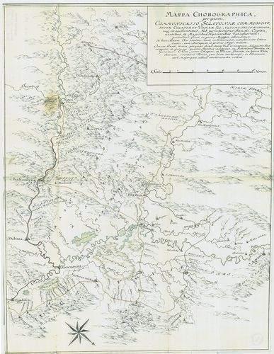
| Title | Mappa Chorographica per quam Communicatio Sclavoniae... |
| Main title | Földrajzi térkép, amelynek segítségével Szlavónia közlekedését ábrázolják. |
667. Mappa Lineae Limitaneae Particularis, Sirmiensis. [B IX a 1150]
Institute and Museum of Military History •
B IX a
•
B IX Ausztria–Magyarország
•
B I–XV. Európa
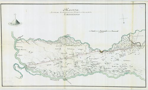
| Title | Mappa Lineae Limitaneae Particularis, Sirmiensis. |
| Main title | A szerémségi határszakasz résztérképe. |
668. Mappa Geographica, Lineae Limitaneae partem Szluinensem comp... [B IX a 1151]
Institute and Museum of Military History •
B IX a
•
B IX Ausztria–Magyarország
•
B I–XV. Európa
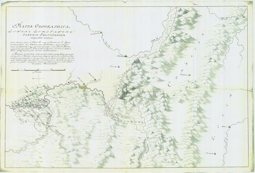
| Title | Mappa Geographica, Lineae Limitaneae partem Szluinensem compendiose exhibens... |
| Main title | Geográfiai térkép, amely a szluini határrészt ábrázolja. |
669. Tractus Unnae fl. inter Novi et Asperkanova Kula, Burgar, Tu... [B IX a 1152]
Institute and Museum of Military History •
B IX a
•
B IX Ausztria–Magyarország
•
B I–XV. Európa
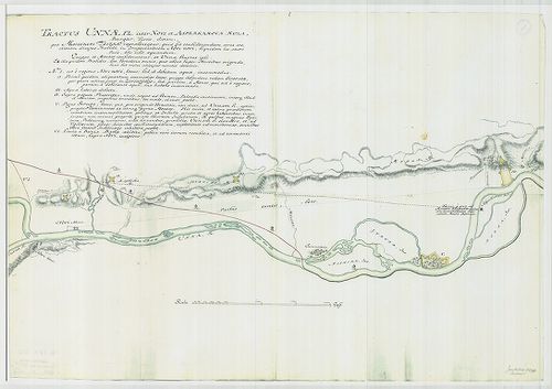
| Title | Tractus Unnae fl. inter Novi et Asperkanova Kula, Burgar, Turcis, dictam... |
| Main title | Az Una folyó Novi és a törökök által Burgar-nak nevezett Asperkanova Kula között. |
670. [Az Una folyó egy szakasza, Novi és környéke.] [B IX a 1153]
Institute and Museum of Military History •
B IX a
•
B IX Ausztria–Magyarország
•
B I–XV. Európa
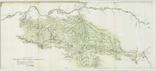
| Title | [Az Una folyó egy szakasza, Novi és környéke.] |
671. Le Grand Royaume de Hongrie… [B IX a 1154]
Institute and Museum of Military History •
B IX a
•
B IX Ausztria–Magyarország
•
B I–XV. Európa
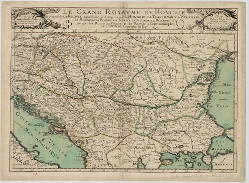
| Title | Le Grand Royaume de Hongrie… |
| Main title | A Magyar Királyság térképe. |
672. Regnum Hungariae cum consignis regionibus. [B IX a 1156]
Institute and Museum of Military History •
B IX a
•
B IX Ausztria–Magyarország
•
B I–XV. Európa
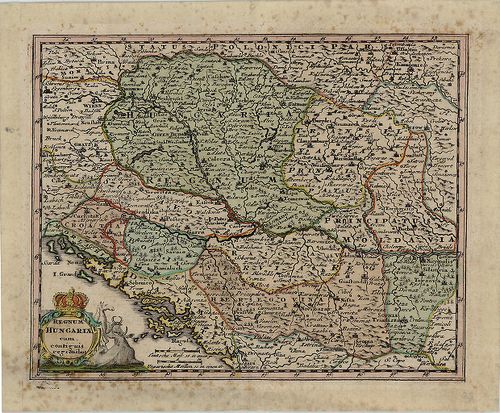
| Title | Regnum Hungariae cum consignis regionibus. |
| Main title | A Magyar Királyság a szomszédos területekkel. |
673. Karte von Hungarn. [B IX a 1159]
Institute and Museum of Military History •
B IX a
•
B IX Ausztria–Magyarország
•
B I–XV. Európa
| Title | Karte von Hungarn. |
| Main title | Magyarország térképe az I. katonai felmérés alapján, a Neu térképhez hasonló. |
674. Karte des Königreiches Galizien. [B IX a 1160]
Institute and Museum of Military History •
B IX a
•
B IX Ausztria–Magyarország
•
B I–XV. Európa
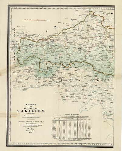
| Title | Karte des Königreiches Galizien. |
| Main title | A Galíciai Királyság térképe. |
675. [A Magyar Királyság és a határoló országok térképe. Az I. ka... [B IX a 1161]
Institute and Museum of Military History •
B IX a
•
B IX Ausztria–Magyarország
•
B I–XV. Európa
| Title | [A Magyar Királyság és a határoló országok térképe. Az I. kat. felm. alapján készült térkép, befejezetlen.] |
676. Der Temesvarer Bannat. [B IX a 1166]
Institute and Museum of Military History •
B IX a
•
B IX Ausztria–Magyarország
•
B I–XV. Európa
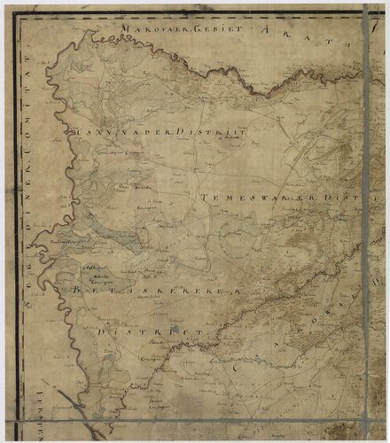
| Title | Der Temesvarer Bannat. |
| Main title | A Temesi Bánság térképe, melynek felmérését Szavoyai Jenő irányította. |
677. Österreich–Ungarn, Übersicht. [B IX a 1167]
Institute and Museum of Military History •
B IX a
•
B IX Ausztria–Magyarország
•
B I–XV. Európa
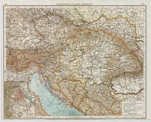
| Title | Österreich–Ungarn, Übersicht. |
| Main title | Az Osztrák–Magyar Monarchia áttekintő térképe. Az „Andrees Allgemeines Handatlas” 69–70. o. nagyítva. |
678. Geographische Charte des Neutraer Bezirkes. [B IX a 1168]
Institute and Museum of Military History •
B IX a
•
B IX Ausztria–Magyarország
•
B I–XV. Európa
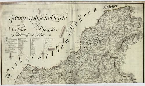
| Title | Geographische Charte des Neutraer Bezirkes. |
| Main title | A Nyitrai kerület földrajzi térképe az I. katonai felmérés alapján. |
679. Charten des Warasdiner Generalats. [B IX a 1169]
Institute and Museum of Military History •
B IX a
•
B IX Ausztria–Magyarország
•
B I–XV. Európa
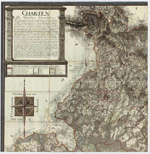
| Title | Charten des Warasdiner Generalats. |
| Main title | A Varasdi Határőrvidék levezetett térképe az I. katonai felmérés alapján. |
680. Geographische Charte des Neusoller Bezirks. [B IX a 1170]
Institute and Museum of Military History •
B IX a
•
B IX Ausztria–Magyarország
•
B I–XV. Európa
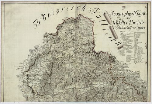
| Title | Geographische Charte des Neusoller Bezirks. |
| Main title | A Besztercebányai kerület földrajzi térképe az I. katonai felmérés alapján. |