741. Reducirte Bannal-Grenz Charte. [B IX a 1252]
Institute and Museum of Military History •
B IX a
•
B IX Ausztria–Magyarország
•
B I–XV. Európa
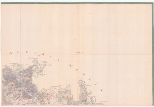
| Title | Reducirte Bannal-Grenz Charte. |
| Main title | A Báni Határőrvidék térképe az I. katonai felmérés alapján. |
742. Charte von Temeswarer Bannat. [B IX a 1253]
Institute and Museum of Military History •
B IX a
•
B IX Ausztria–Magyarország
•
B I–XV. Európa
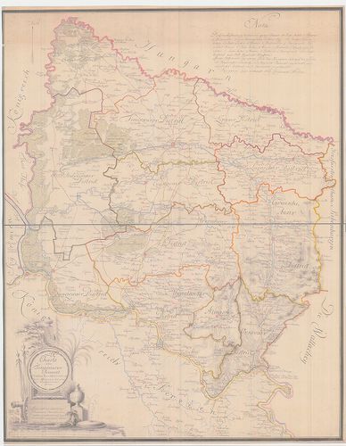
| Title | Charte von Temeswarer Bannat. |
| Main title | A Temesi Bánság térképe az I. katonai felmérés alapján. |
743. Plan des Rothen Thurner Passes. [B IX a 1254]
Institute and Museum of Military History •
B IX a
•
B IX Ausztria–Magyarország
•
B I–XV. Európa
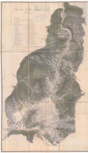
| Title | Plan des Rothen Thurner Passes. |
| Main title | A Vöröstorony-hágó térképe. |
744. Originale der Generalkarte von Siebenbürgen. [B IX a 1255]
Institute and Museum of Military History •
B IX a
•
B IX Ausztria–Magyarország
•
B I–XV. Európa
| Title | Originale der Generalkarte von Siebenbürgen. |
| Main title | Erdély általános térképének (1:288 000) eredetije. |
745. Varasdiner Generalat... [B IX a 1256]
Institute and Museum of Military History •
B IX a
•
B IX Ausztria–Magyarország
•
B I–XV. Európa
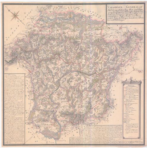
| Title | Varasdiner Generalat... |
| Main title | A Varasdi Határőrvidék térképe az I. katonai felmérés alapján. |
746. A habsburgi monarkia triásztérképe. [B IX a 1257]
Institute and Museum of Military History •
B IX a
•
B IX Ausztria–Magyarország
•
B I–XV. Európa
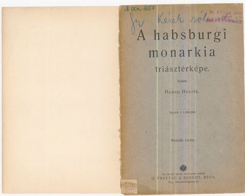
| Title | A habsburgi monarkia triásztérképe. |
| Main title | Német kiadást lásd a B IX a 30/11 jelzet alatt. |
747. Hungariae totius vit ex compluribus aliorum geographicis Cha... [B IX a 1258]
Institute and Museum of Military History •
B IX a
•
B IX Ausztria–Magyarország
•
B I–XV. Európa
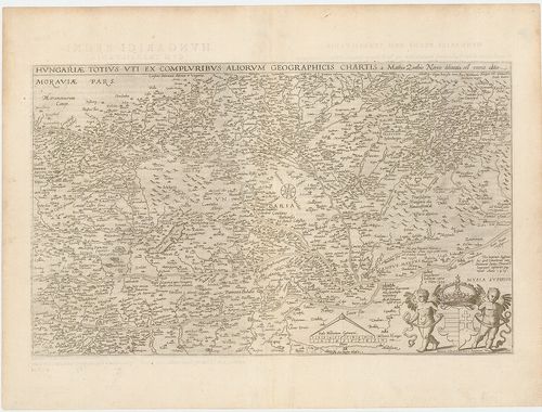
| Title | Hungariae totius vit ex compluribus aliorum geographicis Chartis. |
| Main title | Magyarország térképe. |
748. Partie meridionale du Rme de Hongrie. [B IX a 1259]
Institute and Museum of Military History •
B IX a
•
B IX Ausztria–Magyarország
•
B I–XV. Európa

| Title | Partie meridionale du Rme de Hongrie. |
| Main title | A Magyar Királyság déli részének térképe. |
749. Wien. XV. 13. Az 1:75 000 ma. szelvény 1:100 000 ma.- ra k... [B IX a 1260]
Institute and Museum of Military History •
B IX a
•
B IX Ausztria–Magyarország
•
B I–XV. Európa
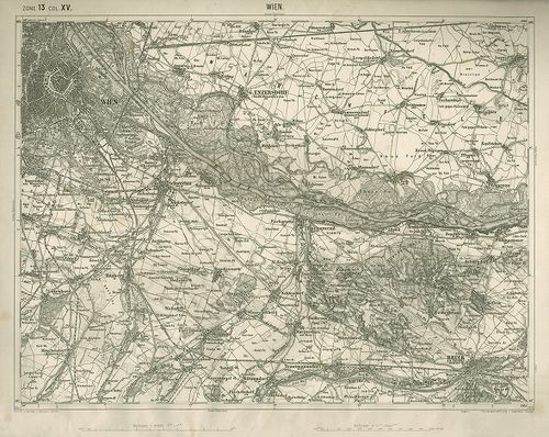
| Title | Wien. XV. 13. Az 1:75 000 ma. szelvény 1:100 000 ma.- ra kicsinyítése. |
750. Tulln. XIV. 12. Az 1:75 000 ma. szelvény 1:100 000 ma.- ra... [B IX a 1261]
Institute and Museum of Military History •
B IX a
•
B IX Ausztria–Magyarország
•
B I–XV. Európa
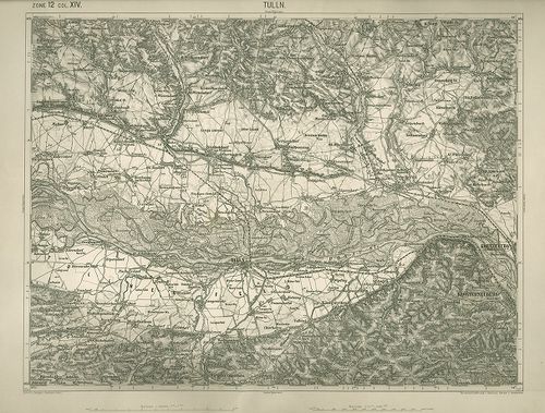
| Title | Tulln. XIV. 12. Az 1:75 000 ma. szelvény 1:100 000 ma.- ra kicsinyítése. |
751. Stuhl Mühlenbach in dem Grosfürstenthum Siebenbürgen. Geomet... [B IX a 1262]
Institute and Museum of Military History •
B IX a
•
B IX Ausztria–Magyarország
•
B I–XV. Európa
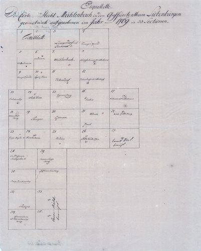
| Title | Stuhl Mühlenbach in dem Grosfürstenthum Siebenbürgen. Geometrisch aufgenohmen im Jahr 1769 in 33 Sectionen. |
| Main title | A szászsebesi Mühlenbach szék gazdasági felmérése (I. kat. felm. előzménye.) |
752. Plan des löbl. Kaiserl. Königl. Ansiedlenden Banater Deutsch... [B IX a 1263]
Institute and Museum of Military History •
B IX a
•
B IX Ausztria–Magyarország
•
B I–XV. Európa
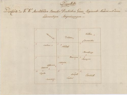
| Title | Plan des löbl. Kaiserl. Königl. Ansiedlenden Banater Deutschen Graenz Regiments.... |
| Main title | A Német Bánsági 12. határezred térképe. |
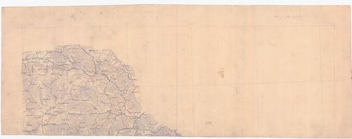
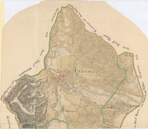
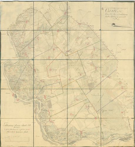
753. [Karánsebes, Slatina és Teregova felmérési térképei.] [B IX a 1264]
Institute and Museum of Military History •
B IX a
•
B IX Ausztria–Magyarország
•
B I–XV. Európa
| Title | [Karánsebes, Slatina és Teregova felmérési térképei.] |
754. Kriegs Carte in 93 Brouillons Sectionen von Ober Ungarn... [B IX a 1265]
Institute and Museum of Military History •
B IX a
•
B IX Ausztria–Magyarország
•
B I–XV. Európa
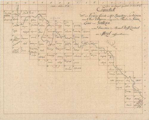
| Title | Kriegs Carte in 93 Brouillons Sectionen von Ober Ungarn... |
| Main title | Felső-Magyarország felmérési térképei. (I. kat. felm. előzménye.) |
755. Banater Generalat. [B IX a 1266]
Institute and Museum of Military History •
B IX a
•
B IX Ausztria–Magyarország
•
B I–XV. Európa
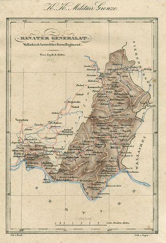
| Title | Banater Generalat. |
| Main title | Az Oláh Bánsági határezred térképe. |
756. Situations Plan des Wallach Illirisch Granz Infanterie Reg. ... [B IX a 1267]
Institute and Museum of Military History •
B IX a
•
B IX Ausztria–Magyarország
•
B I–XV. Európa
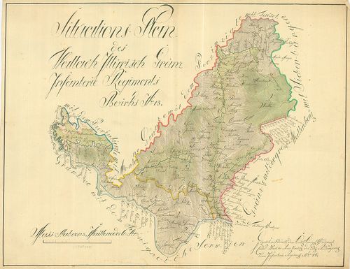
| Title | Situations Plan des Wallach Illirisch Granz Infanterie Reg. Bezirks No. 13. |
| Main title | A Oláh-Illír 13. határezred térképe. |
757. Carte des Löbl. Wallach-Illyrischen Granz Regiment No. 13. [B IX a 1269]
Institute and Museum of Military History •
B IX a
•
B IX Ausztria–Magyarország
•
B I–XV. Európa
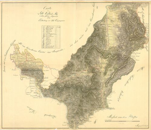
| Title | Carte des Löbl. Wallach-Illyrischen Granz Regiment No. 13. |
| Main title | A Oláh-Illír 13. határezred térképe. |
758. Übersichts Carte des Illyrisch Banater Grenz Bataillons. [B IX a 1270]
Institute and Museum of Military History •
B IX a
•
B IX Ausztria–Magyarország
•
B I–XV. Európa
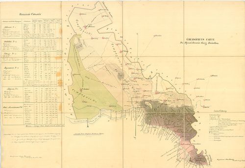
| Title | Übersichts Carte des Illyrisch Banater Grenz Bataillons. |
| Main title | Az Illír-Bánsági 14. határezred áttekintő térképe. |
759. Illirischbanater Grenz-Regiment No. 14. [B IX a 1272]
Institute and Museum of Military History •
B IX a
•
B IX Ausztria–Magyarország
•
B I–XV. Európa

| Title | Illirischbanater Grenz-Regiment No. 14. |
| Main title | Az Illír-Bánsági 14. határezred térképe. |
760. Carte des K. k. Deutsbanatischen Granz Regimenst No. 12. [B IX a 1273]
Institute and Museum of Military History •
B IX a
•
B IX Ausztria–Magyarország
•
B I–XV. Európa
| Title | Carte des K. k. Deutsbanatischen Granz Regimenst No. 12. |
| Main title | A Német-Bánsági 12. határezred térképe. |