1601. Karte des Ortlergebietes. [B IX b 56]
Institute and Museum of Military History •
B IX b
•
B IX Ausztria–Magyarország
•
B I–XV. Európa
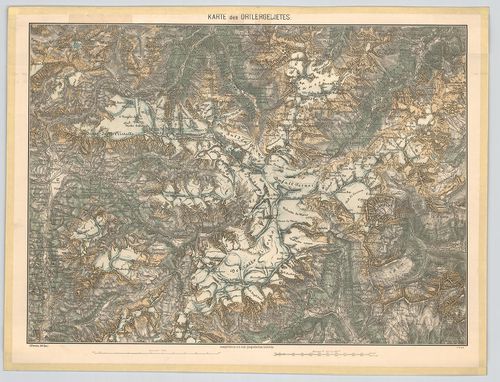
| Title | Karte des Ortlergebietes. |
| Main title | Az Ortler- hegység (Ortles, Ol.) részletes térképe 1876-ban. |
1602. Spezial-Karte der Ortler-Gruppe. [B IX b 56/1]
Institute and Museum of Military History •
B IX b
•
B IX Ausztria–Magyarország
•
B I–XV. Európa
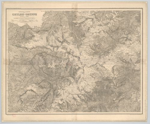
| Title | Spezial-Karte der Ortler-Gruppe. |
| Main title | Ortler-hegycsoport (Ortles, Ol.) térképe 1913-ban. |
1603. Karte der Dolomit-Gruppen. [B IX b 57]
Institute and Museum of Military History •
B IX b
•
B IX Ausztria–Magyarország
•
B I–XV. Európa
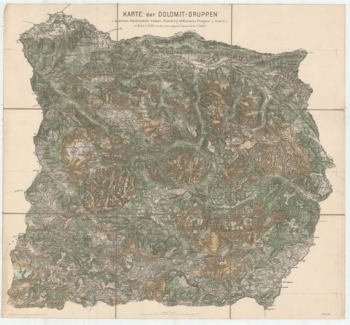
| Title | Karte der Dolomit-Gruppen. |
| Main title | A Dolomit- hegycsoport 1876-ban. |
1604. Turisten-Wanderkarte der Dolomiten. [B IX b 58]
Institute and Museum of Military History •
B IX b
•
B IX Ausztria–Magyarország
•
B I–XV. Európa
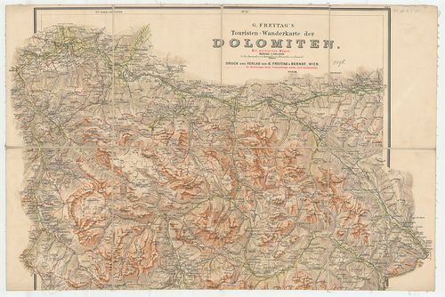
| Title | Turisten-Wanderkarte der Dolomiten. |
| Main title | A Dolomitok turistaúttérképe 1896 körül. |
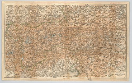
1605. Österreichische Alpenländer. [B IX b 59]
Institute and Museum of Military History •
B IX b
•
B IX Ausztria–Magyarország
•
B I–XV. Európa
| Title | Österreichische Alpenländer. |
| Main title | Az osztrák Alpok térképe. |
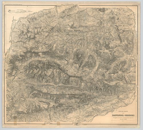
1606. Special-Karte des Karwendel Gebirges. [B IX b 60]
Institute and Museum of Military History •
B IX b
•
B IX Ausztria–Magyarország
•
B I–XV. Európa
| Title | Special-Karte des Karwendel Gebirges. |
| Main title | A Karwendel-hegység térképe 1888-ban. |
1607. Karte der Schneeberg-Raxalpe-Hochschwab und Ötscher-Gruppe. [B IX b 61]
Institute and Museum of Military History •
B IX b
•
B IX Ausztria–Magyarország
•
B I–XV. Európa
| Title | Karte der Schneeberg-Raxalpe-Hochschwab und Ötscher-Gruppe. |
| Main title | A Schneeberg, Raxalpe, Hochschwab és az Ötscher hegységek részletes térképe 1882-ben. |
1608. Topographische detailkarte der Hochschwab-Gruppe. [B IX b 62]
Institute and Museum of Military History •
B IX b
•
B IX Ausztria–Magyarország
•
B I–XV. Európa
| Title | Topographische detailkarte der Hochschwab-Gruppe. |
| Main title | A Hochschwab-hegycsoport egy részének topográfiai térképe. |
1609. Karte der Lechtaler-Alpen. [B IX b 63]
Institute and Museum of Military History •
B IX b
•
B IX Ausztria–Magyarország
•
B I–XV. Európa
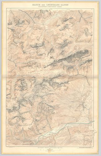
| Title | Karte der Lechtaler-Alpen. |
| Main title | I. Karte der Lechtaler-Alpen. |
| Subject | II. Karte der Lechtaler-Alpen. Heiterwand und Muttekopf-Gebiet. |
1610. Special Karte der Gross-Golckner-Gruppe. [B IX b 63/1]
Institute and Museum of Military History •
B IX b
•
B IX Ausztria–Magyarország
•
B I–XV. Európa
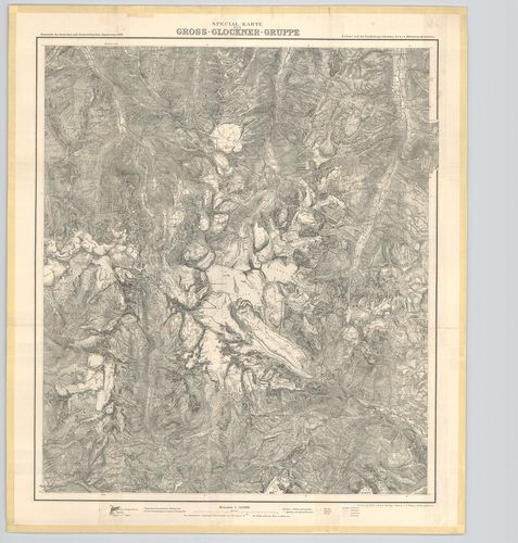
| Title | Special Karte der Gross-Golckner-Gruppe. |
| Main title | A Gross-Glockner- hegycsoport és környékének hegyrajzi térképe 1890-ben. |
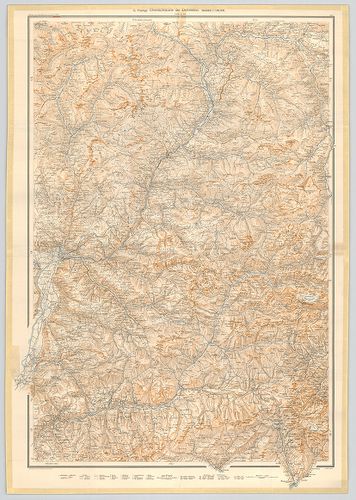
1611. Ostalpen. [B IX b 64]
Institute and Museum of Military History •
B IX b
•
B IX Ausztria–Magyarország
•
B I–XV. Európa
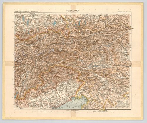
| Title | Ostalpen. |
| Main title | A Keleti-Alpok térképe 1901-ben. |
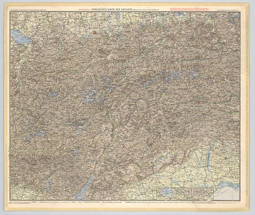
1612. Uebersichts-Karte der Ostalpen, westliches Blatt. [B IX b 65]
Institute and Museum of Military History •
B IX b
•
B IX Ausztria–Magyarország
•
B I–XV. Európa
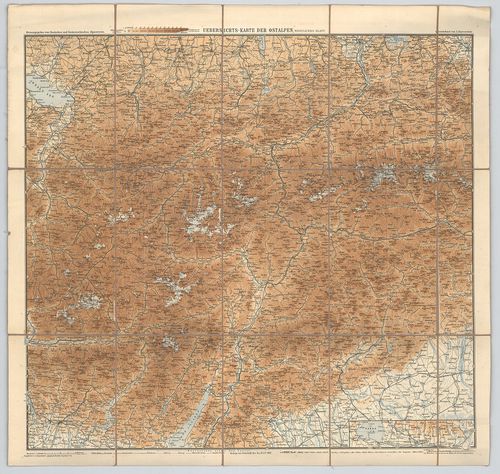
| Title | Uebersichts-Karte der Ostalpen, westliches Blatt. |
| Main title | A Keleti-Alpok nyugati részének áttekintő térképe 1892-ben. |
1613. Uebersichts-Karte der Ostalpen, westliches Blatt. (Neue-Ausg... [B IX b 65/1]
Institute and Museum of Military History •
B IX b
•
B IX Ausztria–Magyarország
•
B I–XV. Európa
| Title | Uebersichts-Karte der Ostalpen, westliches Blatt. (Neue-Ausgabe 1900) |
| Main title | A Keleti-Alpok nyugati részének áttekintő térképe 1900-ban. |
1614. Karte der Adamello – und Presanella – Gruppe. [B IX b 69/1]
Institute and Museum of Military History •
B IX b
•
B IX Ausztria–Magyarország
•
B I–XV. Európa
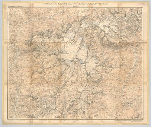
| Title | Karte der Adamello – und Presanella – Gruppe. |
| Main title | Az Adamello és Presanella hegycsoportok (Ol.) térképe 1903-ban. |
1615. Karte der Langkofel- und Sellagruppe. [B IX b 70/5]
Institute and Museum of Military History •
B IX b
•
B IX Ausztria–Magyarország
•
B I–XV. Európa
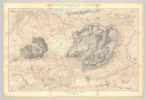
| Title | Karte der Langkofel- und Sellagruppe. |
| Main title | A Langkofel és a Sella hegycsoport (Ol.) térképe 1904-ben. |
1616. Das Semmeringgebiet mit Rax und Schneeberg. [B IX b 72/2]
Institute and Museum of Military History •
B IX b
•
B IX Ausztria–Magyarország
•
B I–XV. Európa
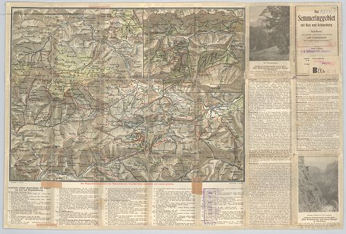
| Title | Das Semmeringgebiet mit Rax und Schneeberg. |
| Main title | Hátlapon: [A Semmering és a Schneeberg hegységek turistaútjai.] |
| Subject | Mt. [A Semmering turistaútjai.] |
1617. Übersichtskarte der Dolomiten. [B IX b 72/7]
Institute and Museum of Military History •
B IX b
•
B IX Ausztria–Magyarország
•
B I–XV. Európa
| Title | Übersichtskarte der Dolomiten. |
| Main title | A Dolomitok hegyrajzi áttekintő térképe 1903-ban. |
1618. Karte des Riesen-Gebirgs. [B IX b 77]
Institute and Museum of Military History •
B IX b
•
B IX Ausztria–Magyarország
•
B I–XV. Európa
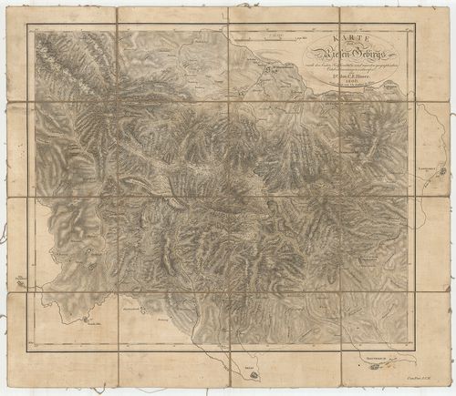
| Title | Karte des Riesen-Gebirgs. |
| Main title | A Karkonosze (Riesen-Gebirgs) hegység térképe 1806-ban. |
1619. Situation und Längenprofil der dammherstellung im Laibacher ... [B IX b 78]
Institute and Museum of Military History •
B IX b
•
B IX Ausztria–Magyarország
•
B I–XV. Európa
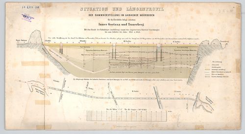
| Title | Situation und Längenprofil der dammherstellung im Laibacher Moorboden. |
| Main title | A ljubljanai lápos talaj gáthelyreállítási helyzetképe és hosszanti keresztmetszete 1855–1856-ban. (Vasútépítési munkálatokhoz.) |
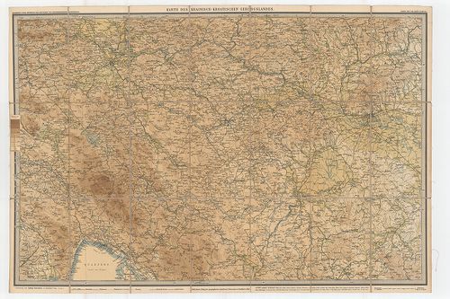
1620. Karte der Ost-Alpen. [B IX b 79]
Institute and Museum of Military History •
B IX b
•
B IX Ausztria–Magyarország
•
B I–XV. Európa
| Title | Karte der Ost-Alpen. |
| Main title | Blatt: 1. Karte der Bayerischen u. Algäuer-Alpen. 2. Karte der Salzburger Alpen u. des Salzkammergutes. 3. Karte des Oesterreichischen Alpen u. des Winer-Waldes. 4. Karte der West-Tiroler u. Engadiner-Alpen. 5. Karte der Ost-Tiroler Alpen, Tauern- u. Dolomiten. 6. Karte der Steierischen Alpen u. der Karawanken. 7. Karte der Lombardischen u. Süd-Tiroler Alpen. 8. Karte der Südvenetianischen Alpen u. Karst. 9. Karte des Krainisch-Kroatischen Gebirgs Landes. |
| Subject | Az Alpok keleti részének hipszometrikus térképe 1880–1893-ban. |