1641. Die Donau vom Ursprung bis Ulm. Der schiffbare Donau-Strom v... [B IX b 116]
Institute and Museum of Military History •
B IX b
•
B IX Ausztria–Magyarország
•
B I–XV. Európa

| Title | Die Donau vom Ursprung bis Ulm. Der schiffbare Donau-Strom von Ulm bis Pressburg. |
| Main title | A Duna eredetétől Ulmig, valamint a hajózható szakasz Ulmtól Pozsonyig. |
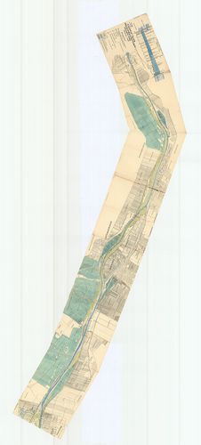
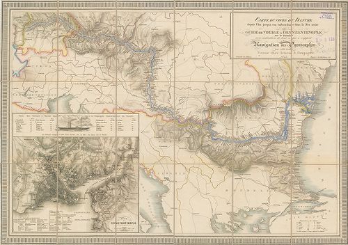
1642. Carte du cours du Danube depuis Ulm jusqua son embouchure da... [B IX b 118]
Institute and Museum of Military History •
B IX b
•
B IX Ausztria–Magyarország
•
B I–XV. Európa
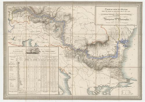
| Title | Carte du cours du Danube depuis Ulm jusqua son embouchure dans la Mer noire ou guide de voyage a Constantinople… |
| Main title | A Duna Ulmtól a Fekete-tengerig 1839 körül a folyómenti települések feltüntetésével. |
1643. Panorama der Donau von Linz bis Wien. [B IX b 120]
Institute and Museum of Military History •
B IX b
•
B IX Ausztria–Magyarország
•
B I–XV. Európa
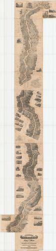
| Title | Panorama der Donau von Linz bis Wien. |
| Main title | A Duna madártávlati képe Linz és Bécs között 1839-ben. |
1644. Panorama der Donau von Regensburg bis Linz in Vogelperspecti... [B IX b 121]
Institute and Museum of Military History •
B IX b
•
B IX Ausztria–Magyarország
•
B I–XV. Európa
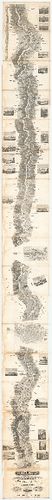
| Title | Panorama der Donau von Regensburg bis Linz in Vogelperspective. |
| Main title | A Duna madártávlati képe Regensburg és Linz között 1840-ben. |
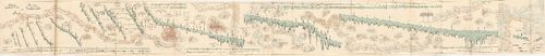
1645. Panorama der Donau von Wien bis Pesth. [B IX b 122]
Institute and Museum of Military History •
B IX b
•
B IX Ausztria–Magyarország
•
B I–XV. Európa
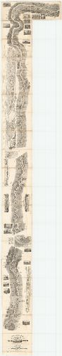
| Title | Panorama der Donau von Wien bis Pesth. |
| Main title | A Duna madártávlati képe Bécs és Pest között 1842-ben. |
1646. A Duna Ulmtól a torkolatig. – Die Donau von Ulm bis zur Münd... [B IX b 122/1]
Institute and Museum of Military History •
B IX b
•
B IX Ausztria–Magyarország
•
B I–XV. Európa
| Title | A Duna Ulmtól a torkolatig. – Die Donau von Ulm bis zur Mündung átnézeti térképe |
1647. Topographisch hydrometrischen Donau Strom Karte von Petronel... [B IX b 122/2]
Institute and Museum of Military History •
B IX b
•
B IX Ausztria–Magyarország
•
B I–XV. Európa
| Title | Topographisch hydrometrischen Donau Strom Karte von Petronell… |
| Main title | A Duna topográfiai térképe Petronelltől (Alsó-Ausztria) Csernetzig (Vaskapu-szoros). |
1648. [Topographisch hydrometrischen Donau Strom Karte von Petrone... [B IX b 122/3]
Institute and Museum of Military History •
B IX b
•
B IX Ausztria–Magyarország
•
B I–XV. Európa
| Title | [Topographisch hydrometrischen Donau Strom Karte von Petronell… |
| Main title | A Duna topográfiai térképe 1890 körül. |
1649. [A Duna térképe Lindentől-Kaltenbachig.] [B IX b 122/12]
Institute and Museum of Military History •
B IX b
•
B IX Ausztria–Magyarország
•
B I–XV. Európa
| Title | [A Duna térképe Lindentől-Kaltenbachig.] |
1650. Preliminaire Donau Karte. [B IX b 123]
Institute and Museum of Military History •
B IX b
•
B IX Ausztria–Magyarország
•
B I–XV. Európa
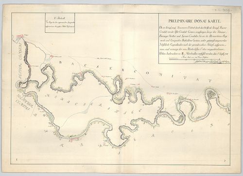
| Title | Preliminaire Donau Karte. |
| Main title | A Duna térképe Bajától Péterváradig 1788 szeptemberben. |
1651. A Soroksári Dunaág helyszínrajza a Tassi zsiliptől a Gubacsi... [B IX b 124]
Institute and Museum of Military History •
B IX b
•
B IX Ausztria–Magyarország
•
B I–XV. Európa
| Title | A Soroksári Dunaág helyszínrajza a Tassi zsiliptől a Gubacsi hídig. |
1652. [A Kazán-szoros és környékének szintvonalas kéziratos térkép... [B IX b 125]
Institute and Museum of Military History •
B IX b
•
B IX Ausztria–Magyarország
•
B I–XV. Európa
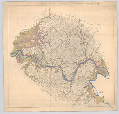
| Title | [A Kazán-szoros és környékének szintvonalas kéziratos térképe. |
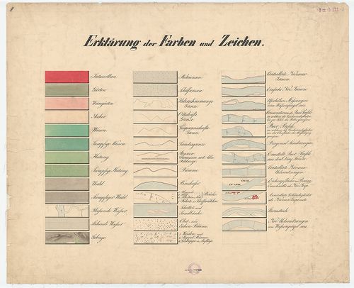
1653. Berzaszka und Ó-Ogradina. [B IX b 125/1]
Institute and Museum of Military History •
B IX b
•
B IX Ausztria–Magyarország
•
B I–XV. Európa
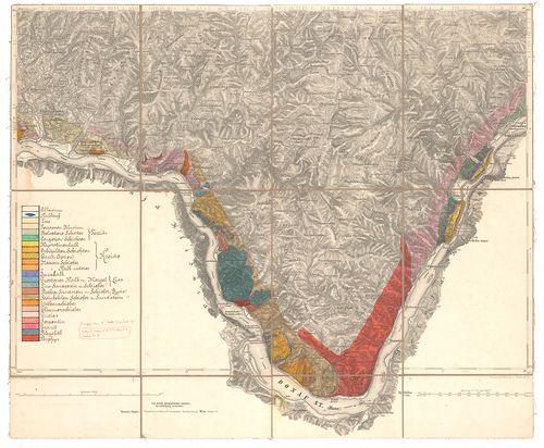
| Title | Berzaszka und Ó-Ogradina. |
| Main title | Az Al-Duna partvidékének 1:75 000 ma. alaptérképére (6168 sz.) rajzolt geológiai térképe Berzaszka (Berzasca) és Ó-Ogradina (Ogradena-Veche) között. |
1654. [Vaskapu] 1879-ik évi bizottság. A Dunán Moldova és Turn[u]-... [B IX b 125/2]
Institute and Museum of Military History •
B IX b
•
B IX Ausztria–Magyarország
•
B I–XV. Európa
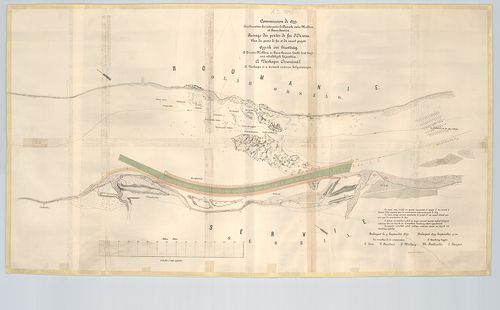
| Title | [Vaskapu] 1879-ik évi bizottság. A Dunán Moldova és Turn[u]-Severin között levő hajózási akadályok kijavítása. A Vaskapu Orsovánál. A Vaskapu és a tervezett csatorna helyszínrajza. – Commission de 1879. Amélioration des cataractes du Danube entre Moldova et Turn[u]-Severin. Panoge des portes de fer et du canal projeté. |
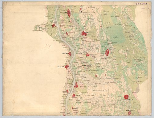
1655. A Duna folyam Ó-Moldova (Moldova-Veche) – Turn[u]-Szeverini ... [B IX b 125/3]
Institute and Museum of Military History •
B IX b
•
B IX Ausztria–Magyarország
•
B I–XV. Európa

| Title | A Duna folyam Ó-Moldova (Moldova-Veche) – Turn[u]-Szeverini (Turnu Severin) zuhatagos szakaszának átnézeti térképe. – Map of the cataracts of the lower Danube between Moldova and Turn[u]-Severin. |
1656. Plan général des cataractes du Bas-Danube. D’aprés la 4-e ed... [B IX b 125/6]
Institute and Museum of Military History •
B IX b
•
B IX Ausztria–Magyarország
•
B I–XV. Európa
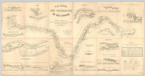
| Title | Plan général des cataractes du Bas-Danube. D’aprés la 4-e edition du plan. Dressé en 1896 par la direction royale hongroise des travaux de regularisation. |
| Main title | Az Al-Duna hajózási térképe 1896-ban. |
1657. Übersichtskarte der Bertiebslinien der Ersten k. k. priv. Do... [B IX b 125/7]
Institute and Museum of Military History •
B IX b
•
B IX Ausztria–Magyarország
•
B I–XV. Európa
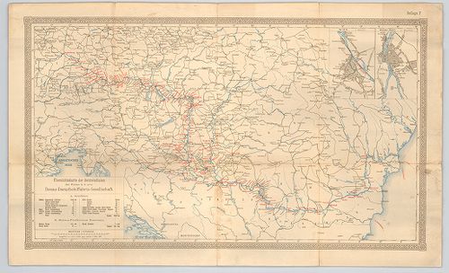
| Title | Übersichtskarte der Bertiebslinien der Ersten k. k. priv. Donau-Dampfschiffahrts-Gesellschaft. |
| Main title | 2 mt. 1. Wien. 2. Buda-Pest. |
| Subject | A Duna hajózható szakaszának áttekintő térképe 1891-ben. |
1658. Az Alduna hajózási akadályainak átnézete. Készítette 1896. é... [B IX b 125/8]
Institute and Museum of Military History •
B IX b
•
B IX Ausztria–Magyarország
•
B I–XV. Európa
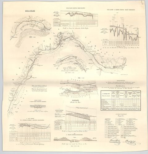
| Title | Az Alduna hajózási akadályainak átnézete. Készítette 1896. évben az Aldunai Vaskapuszabályozási M. Kir. művezetőség. – Plan général des cataractes du Bas-Danube. Dressé en 1896 par la Direction royale hongroise des travaux de regularisation. |
1659. Carte du cours du Danube depuis Ulm jusqu’a son embouchure d... [B IX b 126]
Institute and Museum of Military History •
B IX b
•
B IX Ausztria–Magyarország
•
B I–XV. Európa
| Title | Carte du cours du Danube depuis Ulm jusqu’a son embouchure dans La Mer noire ou Guide de Voyage a Constantinople sur le Danube avec indication de tout ce qui a rapport Navigation des ála Piroscaphes sur cette route. |
| Main title | Mt: Plan de Constantinople (Konstantinápoly térképe) |
| Subject | A Duna térképe Ulmtól a torkolatig, a parti települések feltüntetésével. |
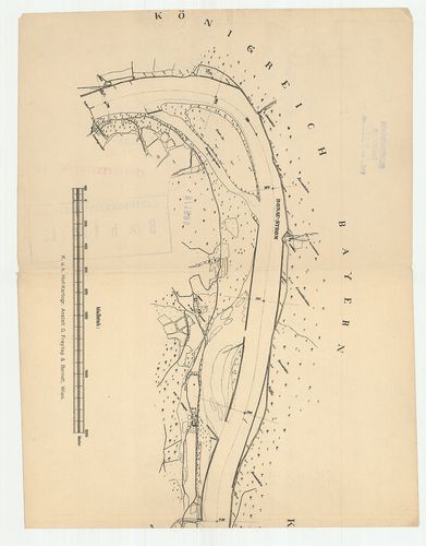
1660. Copia. Der von Löbl Bacser Comitat dem Slavonischen General ... [B IX b 128]
Institute and Museum of Military History •
B IX b
•
B IX Ausztria–Magyarország
•
B I–XV. Európa
| Title | Copia. Der von Löbl Bacser Comitat dem Slavonischen General Commando zugemittelten Strohm Charte der Donau von Baja bis Carlovitz; der Theiss von Martonyos bis Csurugh und des Franz Canals von Monostorszegh bis Földvár. |
| Main title | A Duna és a Tisza Bács megyei szakaszának térképe a Ferenc-csatornával 1811-ben. |