161. Európa rádióadó-állomásainak hullámhossz, kilowatt- és távol... [B I c 103]
Institute and Museum of Military History •
B I c
•
B I Európa
•
B I–XV. Európa
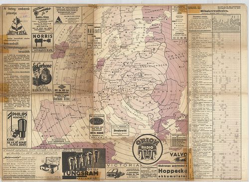
| Title | Európa rádióadó-állomásainak hullámhossz, kilowatt- és távolsági térképe. |
162. Übersichtskarte der Breiten- und Azimutbestimmungen. Carte d... [B I c 120]
Institute and Museum of Military History •
B I c
•
B I Európa
•
B I–XV. Európa
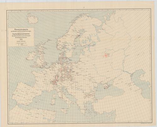
| Title | Übersichtskarte der Breiten- und Azimutbestimmungen. Carte demonstrative des déterminations astronomiques de latitude et d’azimut. 1904. |
| Main title | Európa térképe a földr. szélesség és azimut meghatározásokkal 1904-ben. |
163. Übersichtskarte der telegraphischen Längenbestimmungen. Cart... [B I c 121]
Institute and Museum of Military History •
B I c
•
B I Európa
•
B I–XV. Európa
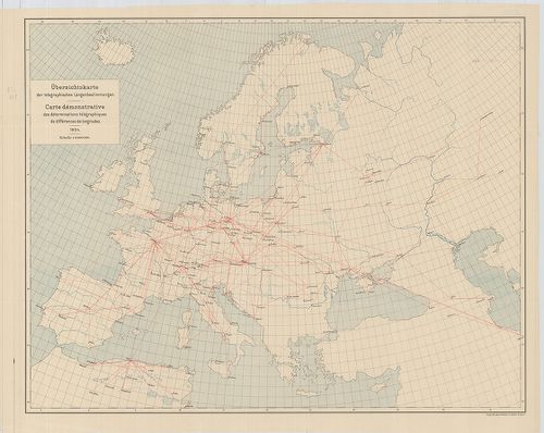
| Title | Übersichtskarte der telegraphischen Längenbestimmungen. Carte démonstrative des déterminations télégraphiques dex différences de longitudes. 1904. |
| Main title | Európa távíró vonalai 1904-ben. |
164. Übersichtskarte der Bestimmungen der Schwerkraft. Carte demo... [B I c 122]
Institute and Museum of Military History •
B I c
•
B I Európa
•
B I–XV. Európa
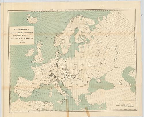
| Title | Übersichtskarte der Bestimmungen der Schwerkraft. Carte demonstrative des déterminations de lintensité de la pesanteur. |
| Main title | Európa térképe a meghatározott nehézségi erővel 1900-ban. |
165. Übersichtskarte für den Stand der Trigonometrischen Arbeiten... [B I c 123]
Institute and Museum of Military History •
B I c
•
B I Európa
•
B I–XV. Európa
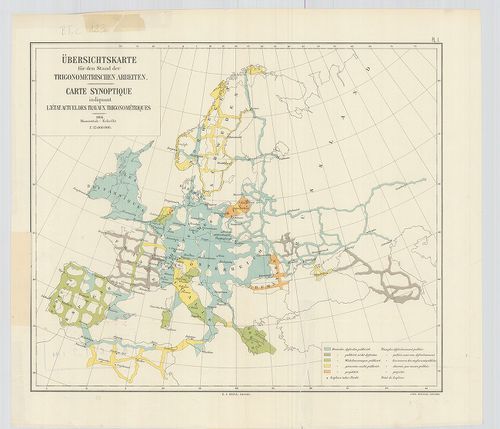
| Title | Übersichtskarte für den Stand der Trigonometrischen Arbeiten. Carte synoptique indiquant l’état actuel des travaux trigonométriques. |
| Main title | Európa térképe a háromszögelési munkák állásáról 1904-ben. |
166. [Európa állatföldrajzi térképe.] [B I c 133]
Institute and Museum of Military History •
B I c
•
B I Európa
•
B I–XV. Európa
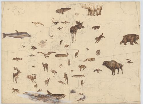
| Title | [Európa állatföldrajzi térképe.] |
167. Politisch-Geographische Grundlagen Europas-Flemming Friedens... [B I c 142]
Institute and Museum of Military History •
B I c
•
B I Európa
•
B I–XV. Európa
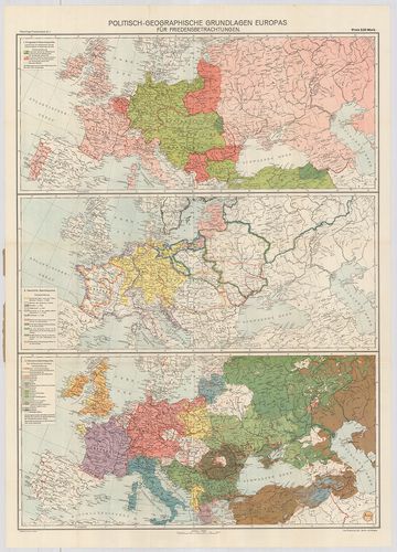
| Title | Politisch-Geographische Grundlagen Europas-Flemming Friedenskarten |
| Main title | 3 térk. 1. Európa háborús térkép 2. Európa történelmi térkép 3. Európa népességi térkép. |
| Subject | Európa politikai-földrajzi térképe 1917-ben. |
168. Európai háború kis térképe. [B I c 143]
Institute and Museum of Military History •
B I c
•
B I Európa
•
B I–XV. Európa
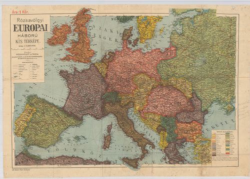
| Title | Európai háború kis térképe. |
169. Flemmings Übersichtskarte für den europäischen Kriegsschaupa... [B I c 144]
Institute and Museum of Military History •
B I c
•
B I Európa
•
B I–XV. Európa
| Title | Flemmings Übersichtskarte für den europäischen Kriegsschaupaltz. |
| Main title | Az európai hadszíntér áttekintő térképe az első világháborúban. |
170. Ravensteins Karte des Deutschen Sperrgebietes für den uneing... [B I c 145]
Institute and Museum of Military History •
B I c
•
B I Európa
•
B I–XV. Európa
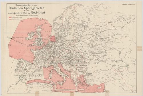
| Title | Ravensteins Karte des Deutschen Sperrgebietes für den uneingeschkränkten „U” Boot-Krieg. Ravensteins Kriegskarte. |
| Main title | Európa térképe. Tengeralattjáró háború a németek által korlátlanul lezárt Európa NY-i és D-i területein. |
171. Europa világháború térképe. [B I c 146]
Institute and Museum of Military History •
B I c
•
B I Európa
•
B I–XV. Európa
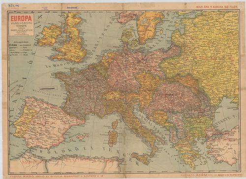
| Title | Europa világháború térképe. |
172. Mittelbach’s Billige Kriegskarte von Europa mit den angrenze... [B I c 147]
Institute and Museum of Military History •
B I c
•
B I Európa
•
B I–XV. Európa
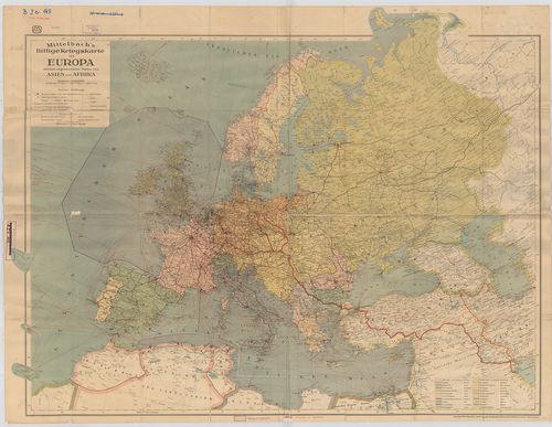
| Title | Mittelbach’s Billige Kriegskarte von Europa mit den angrenzenden Teilen von Asien und Afrika. |
| Main title | Európa háború tárképe Ázsia és Afrika határterületeivel. |
173. Staaten und Verkehrskarte von Europa. [B I c 148]
Institute and Museum of Military History •
B I c
•
B I Európa
•
B I–XV. Európa
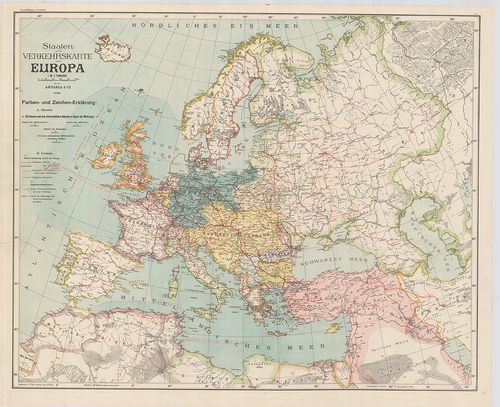
| Title | Staaten und Verkehrskarte von Europa. |
| Main title | Az európai államok közlekedési térképe. |
174. Osnovni projekt buduce Evrope prema politickom stanju i naci... [B I c 149]
Institute and Museum of Military History •
B I c
•
B I Európa
•
B I–XV. Európa
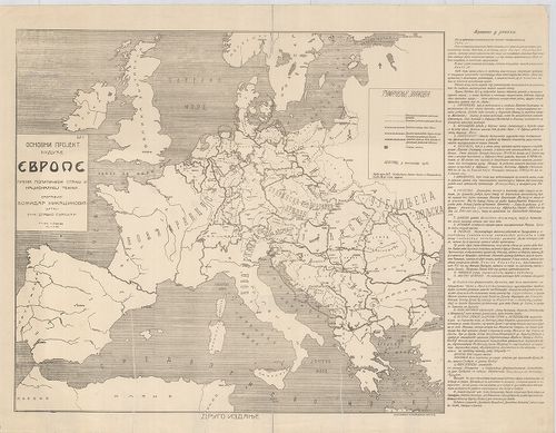
| Title | Osnovni projekt buduce Evrope prema politickom stanju i nacionalnoj teznji. |
| Main title | Tervezet Európa jövőjéről, politikai helyzet és nemzetiségi megosztás. |
175. Karte des Weltkrieges. Europäischer Kriegsschauplatz. [B I c 150]
Institute and Museum of Military History •
B I c
•
B I Európa
•
B I–XV. Európa
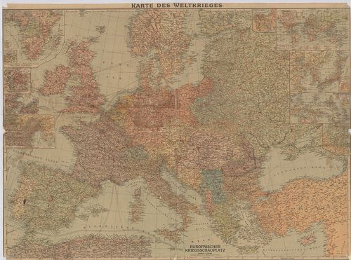
| Title | Karte des Weltkrieges. Europäischer Kriegsschauplatz. |
| Main title | 9 mt.: 1.) Die Deutschen Kolonien in Afrika, and ihre Umwelt. (Német gyarmatok Afrikában.) |
| Subject | 2.) Paris mit seinen Festungswerken. (Páris és erődítései.) |
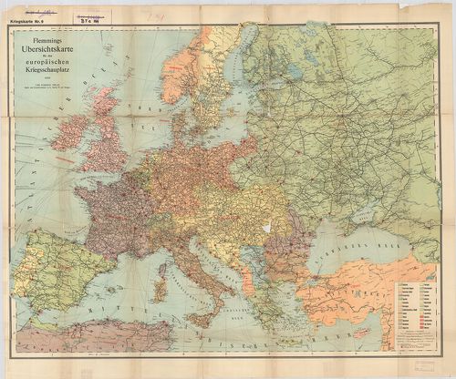
176. Flemmongs Übersichtskarte für den europäischen Kriegsschaupl... [B I c 151]
Institute and Museum of Military History •
B I c
•
B I Európa
•
B I–XV. Európa
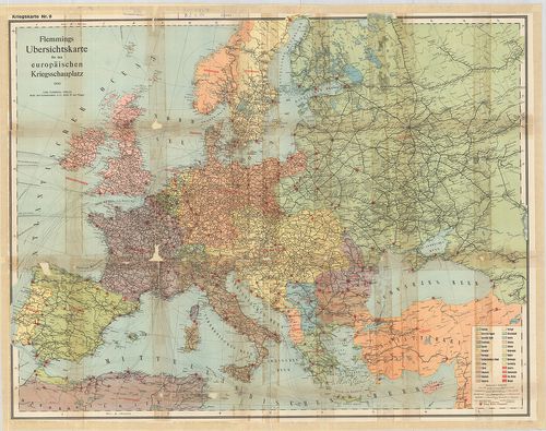
| Title | Flemmongs Übersichtskarte für den europäischen Kriegsschauplatz. No. 9. |
| Main title | Az európai hadszíntér átnézeti térképe. |
177. Navigationskarte für Luftfahrzenge. [B I c 152]
Institute and Museum of Military History •
B I c
•
B I Európa
•
B I–XV. Európa
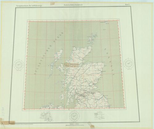
| Title | Navigationskarte für Luftfahrzenge. |
| Main title | Fokhálózatos navigációs térkép légi járművek számára Európa fölött Angliától a Közel-Keletig terjedő térségben. |
178. Humorist. Darstellung der Wappen unserer Feinde 1914. [B I c 153]
Institute and Museum of Military History •
B I c
•
B I Európa
•
B I–XV. Európa

| Title | Humorist. Darstellung der Wappen unserer Feinde 1914. |
| Main title | Az ellenséges hatalmak arcképcímereinek karikatúra-vázlatai. |
179. A háborús európa térkép-karikatúrája. [B I c 154]
Institute and Museum of Military History •
B I c
•
B I Európa
•
B I–XV. Európa
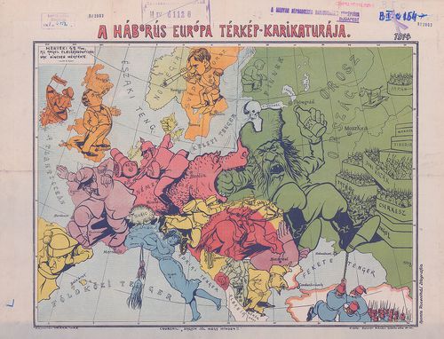
| Title | A háborús európa térkép-karikatúrája. |
180. Szimbolicseszkaja karta Evropi. [B I c 155]
Institute and Museum of Military History •
B I c
•
B I Európa
•
B I–XV. Európa
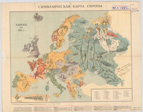
| Title | Szimbolicseszkaja karta Evropi. |
| Main title | Jelképes karikatúra-térképe a háborús Európáról. |