241. Puszta Sz.[ent] Lőrincz vidékének földtani talajtérképe. Ráh... [B IX b 395]
Institute and Museum of Military History •
B IX b
•
B IX Ausztria–Magyarország
•
B I–XV. Európa
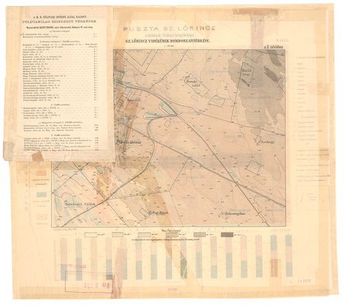
| Title | Puszta Sz.[ent] Lőrincz vidékének földtani talajtérképe. Ráhelyezett oleátán Szentlőrinc vidékének domborzati térképe, hipsz., magassági adatok. |
| Main title | Geológiai térkép. |
242. Az Aranyidai keleti bányamező. – Das oestliche Bergrevier vo... [B IX b 396]
Institute and Museum of Military History •
B IX b
•
B IX Ausztria–Magyarország
•
B I–XV. Európa
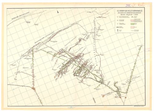
| Title | Az Aranyidai keleti bányamező. – Das oestliche Bergrevier von Aranyida. |
243. Aranyida környékének földtani térképe. – Geologsiche Karte d... [B IX b 397]
Institute and Museum of Military History •
B IX b
•
B IX Ausztria–Magyarország
•
B I–XV. Európa
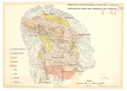
| Title | Aranyida környékének földtani térképe. – Geologsiche Karte der Umgebung von Aranyida. |
244. A Baradla, az Aggteleki cseppkőbarlang alaprajza. [B IX b 398]
Institute and Museum of Military History •
B IX b
•
B IX Ausztria–Magyarország
•
B I–XV. Európa
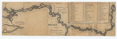
| Title | A Baradla, az Aggteleki cseppkőbarlang alaprajza. |
245. Plan von Tappe ober Szegedin bis zur Donau bei Slankamen. [B IX b 399]
Institute and Museum of Military History •
B IX b
•
B IX Ausztria–Magyarország
•
B I–XV. Európa
| Title | Plan von Tappe ober Szegedin bis zur Donau bei Slankamen. |
| Main title | 2 mt.: 1. Plan von der Festung Segedin. (A szegedi erődítmény kétféle alaprajza.) 2. A Tisza Tápétól Szegeden át a Dunáig Slankamenig. |
246. Carte géologique de la Hongrie et de la Trynsylvanie ... [B IX b 400]
Institute and Museum of Military History •
B IX b
•
B IX Ausztria–Magyarország
•
B I–XV. Európa
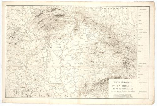
| Title | Carte géologique de la Hongrie et de la Trynsylvanie ... |
| Main title | Magyarország és Erdély geológiai térképe. |
247. A la vui Aufnahme der Donau von Presburg bis Komorn. [B IX b 401]
Institute and Museum of Military History •
B IX b
•
B IX Ausztria–Magyarország
•
B I–XV. Európa
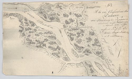
| Title | A la vui Aufnahme der Donau von Presburg bis Komorn. |
| Main title | A Duna Pozsony és Komárom között. |
248. A la vui Aufnahme des Blatten-See. [B IX b 402]
Institute and Museum of Military History •
B IX b
•
B IX Ausztria–Magyarország
•
B I–XV. Európa
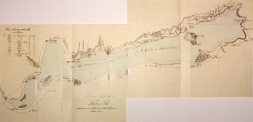
| Title | A la vui Aufnahme des Blatten-See. |
| Main title | A Balaton „a la vue” felmérési térképe 1809-ből. |
249. Plan der Donau Strecke von Semlin bis zu der Passage Eiserne... [B IX b 403]
Institute and Museum of Military History •
B IX b
•
B IX Ausztria–Magyarország
•
B I–XV. Európa
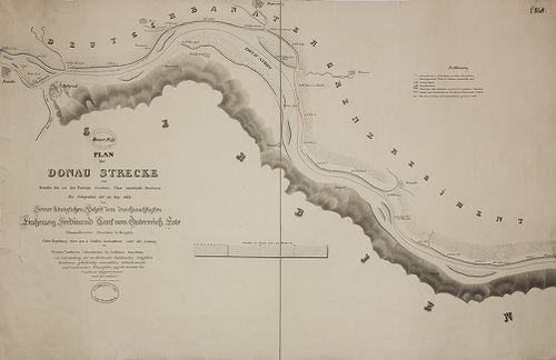
| Title | Plan der Donau Strecke von Semlin bis zu der Passage Eisernes Thor unterhalb Orschowa... |
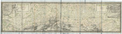
| Main title | A Duna Zemlintől Orsováig a Vaskapu-szoroson át. |
250. Plan der Donau Passage Kazan oberhalb der veteranischen Höhl... [B IX b 404]
Institute and Museum of Military History •
B IX b
•
B IX Ausztria–Magyarország
•
B I–XV. Európa
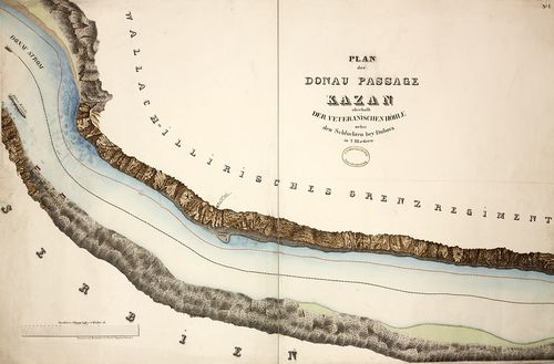
| Title | Plan der Donau Passage Kazan oberhalb der veteranischen Höhle nebst den Schluchten bey Dubova... |
| Main title | A Duna a Kazán-szorosnál. |
251. Plan der Donau Passage Babakay unterhalb Moldawa... [B IX b 405]
Institute and Museum of Military History •
B IX b
•
B IX Ausztria–Magyarország
•
B I–XV. Európa
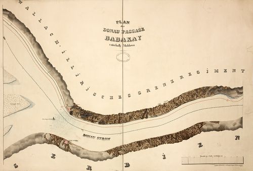
| Title | Plan der Donau Passage Babakay unterhalb Moldawa... |
| Main title | A Duna a Babakay -szorosnál. |
252. Plan der Donau Passage Izlaz oberhalb Swinitza... [B IX b 406]
Institute and Museum of Military History •
B IX b
•
B IX Ausztria–Magyarország
•
B I–XV. Európa
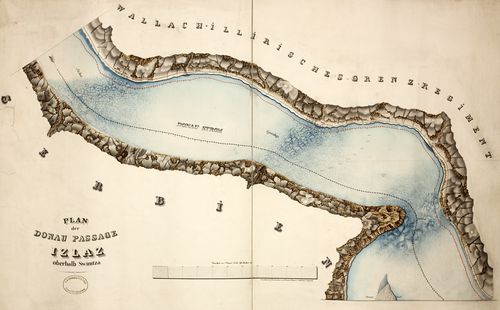
| Title | Plan der Donau Passage Izlaz oberhalb Swinitza... |
| Main title | A Duna az Izlaz-i-szorosnál. |
253. Plan der Donau Passage Eisernes Thor unterhalb Orschowa... [B IX b 407]
Institute and Museum of Military History •
B IX b
•
B IX Ausztria–Magyarország
•
B I–XV. Európa
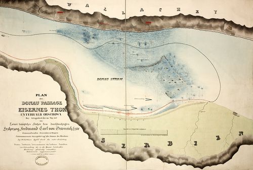
| Title | Plan der Donau Passage Eisernes Thor unterhalb Orschowa... |
| Main title | A Duna a Vaskapu-szorosnál. |
254. A Magyar Korona országainak hegy- és vízrajzi térképe. [B IX b 410]
Institute and Museum of Military History •
B IX b
•
B IX Ausztria–Magyarország
•
B I–XV. Európa
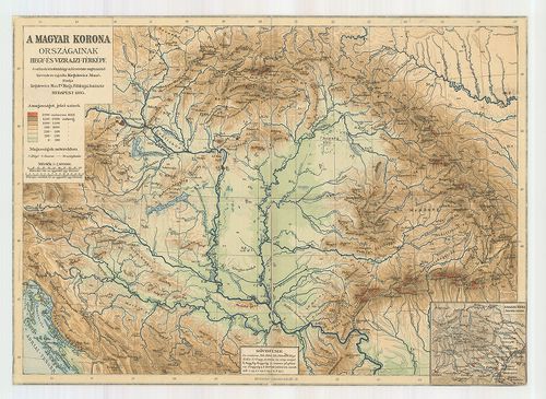
| Title | A Magyar Korona országainak hegy- és vízrajzi térképe. |
| Main title | 1 mt. A Magas-Tátra. |
255. Magyarország hegy- és vízrajzi térképe. [B IX b 414]
Institute and Museum of Military History •
B IX b
•
B IX Ausztria–Magyarország
•
B I–XV. Európa
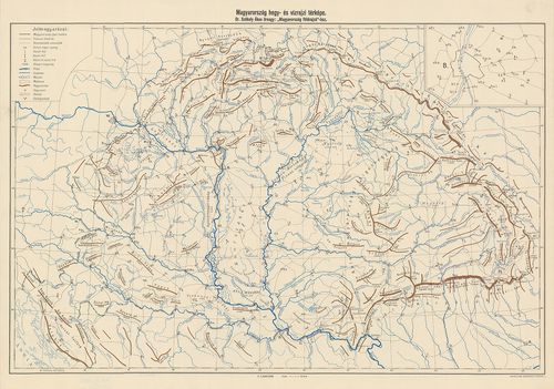
| Title | Magyarország hegy- és vízrajzi térképe. |
256. Geometrische Aufnahme...Maros-Flusses... [B IX b 415]
Institute and Museum of Military History •
B IX b
•
B IX Ausztria–Magyarország
•
B I–XV. Európa
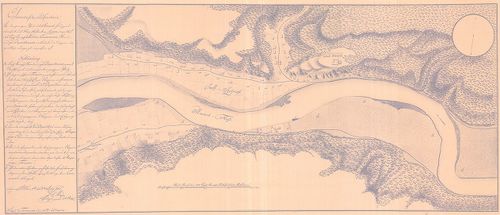
| Title | Geometrische Aufnahme...Maros-Flusses... |
| Main title | A Maros folyó részletes térképe Solymos falu környékén. |