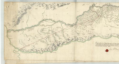
521. Mappa Geographica Tractus Limitanei a Sluin, usque ad, Tripl... [B IX c 1425]
Institute and Museum of Military History •
B IX c
•
B IX Ausztria–Magyarország
•
B I–XV. Európa
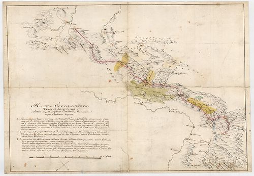
| Title | Mappa Geographica Tractus Limitanei a Sluin, usque ad, Triplicis Confinii, Punctum... |
| Main title | Szluintól a hármas határ pontjáig terjedő határszakasz geográfiai térképe... Határtérkép. |
522. Mappa Geographica, qua Praecautio contra Pestem instituenda ... [B IX c 1426]
Institute and Museum of Military History •
B IX c
•
B IX Ausztria–Magyarország
•
B I–XV. Európa
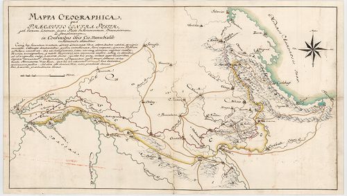
| Title | Mappa Geographica, qua Praecautio contra Pestem instituenda [...] ostenditur... |
| Main title | Földrajzi térkép, amelyen a pestis terjedésének megelőzésére hozandó intézkedéseket mutatjuk meg. Határtérkép. |
523. Mappa Geographica Lineae, ad Coranam, fl. Limitaneae, usque ... [B IX c 1428]
Institute and Museum of Military History •
B IX c
•
B IX Ausztria–Magyarország
•
B I–XV. Európa
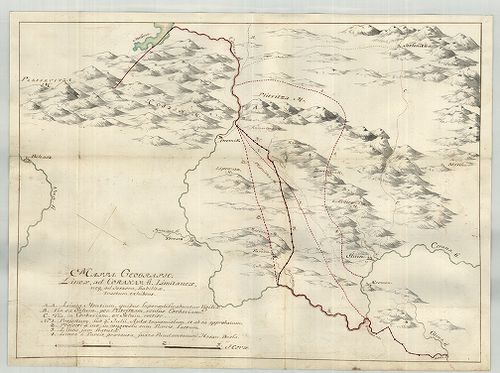
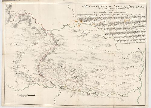
| Title | Mappa Geographica Lineae, ad Coranam, fl. Limitaneae, usque ad Jeszera [sic], stabilitae, tractum exhibens... |
| Main title | Földrajzi térkép, amely a Corana folyó mentén Jeszeraig futó végleges határszakaszt ábrázolja. Határtérkép. |
524. Mappa Limitanea Regni Croatiae... [B IX c 1429]
Institute and Museum of Military History •
B IX c
•
B IX Ausztria–Magyarország
•
B I–XV. Európa
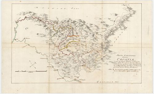
| Title | Mappa Limitanea Regni Croatiae... |
| Main title | Horvátország határtérképe... |
525. Mappa Generalis Regni Croatiae Totius. [B IX c 1430]
Institute and Museum of Military History •
B IX c
•
B IX Ausztria–Magyarország
•
B I–XV. Európa
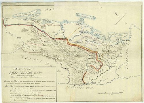
| Title | Mappa Generalis Regni Croatiae Totius. |
| Main title | Horvátország térképe..Határtérkép. |
526. Mappa, qua ostenduntur difficultates communicationis Sclavon... [B IX c 1431]
Institute and Museum of Military History •
B IX c
•
B IX Ausztria–Magyarország
•
B I–XV. Európa
| Title | Mappa, qua ostenduntur difficultates communicationis Sclavoniae et Croatiae evacuatis Jeszenovitz et Dubitza |
| Main title | Azon térkép, amelyen bemutatjuk, milyen közlekedési nehézségekkel kell szembenézni Jeszenovitz és Dubitza kiürítése után.Határtérkép. |
527. Mappa Geographica Unnae Fluvii Tractum, a Kastanovitz...Terr... [B IX c 1433]
Institute and Museum of Military History •
B IX c
•
B IX Ausztria–Magyarország
•
B I–XV. Európa
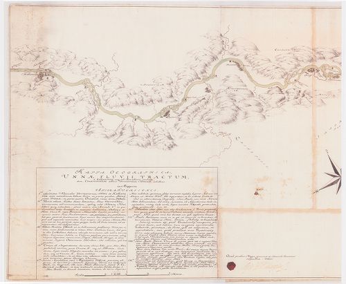
| Title | Mappa Geographica Unnae Fluvii Tractum, a Kastanovitz...Territorium Novense... |
| Main title | Az Una folyó térképe Kastanovitz-től Novi-ig. Határtérkép. |
528. Mappa Geographica Lineae inter utrumque Imperium, Limitaneae... [B IX c 1434]
Institute and Museum of Military History •
B IX c
•
B IX Ausztria–Magyarország
•
B I–XV. Európa
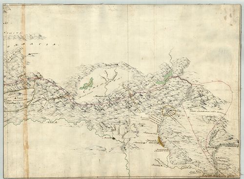
| Title | Mappa Geographica Lineae inter utrumque Imperium, Limitaneae [...] a Confinio Triplici, usque ad Szluin [...] exhibens |
| Main title | Földrajzi térkép, amely a két birodalom között húzódó [...] határokat a hármas határtól Szluinig... mutatja. Határtérkép. |
529. Situations Karte der Kaiser Königlich und Türkisch Croatisch... [B IX c 1435]
Institute and Museum of Military History •
B IX c
•
B IX Ausztria–Magyarország
•
B I–XV. Európa
| Title | Situations Karte der Kaiser Königlich und Türkisch Croatischen Grenze im Karlstaedter Warasdiner Generalat ... |
| Main title | A császári-királyi és török Horvátország határa a Károlyvárosi és a Varasdi Határőrvidékek területén az I. katonai felmérés alapján. Határtérkép. |
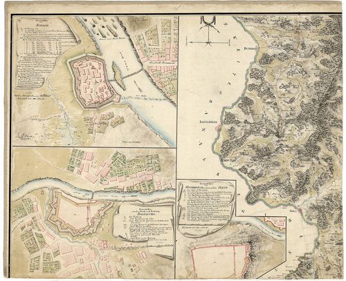
530. Mappa Geographica Lineae Limitaneae Particularis utriusque S... [B IX c 1436]
Institute and Museum of Military History •
B IX c
•
B IX Ausztria–Magyarország
•
B I–XV. Európa
| Title | Mappa Geographica Lineae Limitaneae Particularis utriusque Sirmiensis a Salankemen usque ad Confluxum Bozut fl.; et Savensis, inde ad Confluxum Unnae fl. |
| Main title | Földrajzi térkép, amely részletesen ábrázolja egyrészt Salankementől a Bozut folyó torkolatáig a szerémségi, másrészt innen az Una torkolatáig a szávai határvonalat. Határtérkép. |
531. Etnographische Landkarte von Ungarn im Jahre 1910. [B IX c 1438]
Institute and Museum of Military History •
B IX c
•
B IX Ausztria–Magyarország
•
B I–XV. Európa

| Title | Etnographische Landkarte von Ungarn im Jahre 1910. |
| Main title | Magyarország néprajzi térképe 1910-ből. 1940-es kiadás. |
532. Die in Ausssicht genommene Dislokation der ung. Landwehr gle... [B IX c 1439]
Institute and Museum of Military History •
B IX c
•
B IX Ausztria–Magyarország
•
B I–XV. Európa
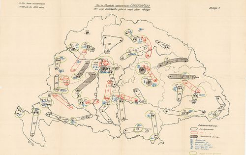
| Title | Die in Ausssicht genommene Dislokation der ung. Landwehr gleich nach dem Kriege. |
| Main title | A Magyar fegyveres erők diszlokációs térképe. |
533. A magyar szent korona állam-területének honvédségi tekintetb... [B IX c 1440]
Institute and Museum of Military History •
B IX c
•
B IX Ausztria–Magyarország
•
B I–XV. Európa
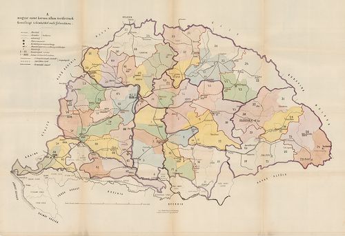
| Title | A magyar szent korona állam-területének honvédségi tekintetből való felosztása |
534. A magyar honfoglalás utjának térképe a névtelen jegyző szeri... [B IX c 1441]
Institute and Museum of Military History •
B IX c
•
B IX Ausztria–Magyarország
•
B I–XV. Európa
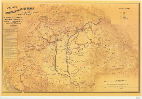
| Title | A magyar honfoglalás utjának térképe a névtelen jegyző szerint. |
535. Schubplan des kais. könig. Gensdarmerie Regiments N 7. [B IX c 1443]
Institute and Museum of Military History •
B IX c
•
B IX Ausztria–Magyarország
•
B I–XV. Európa
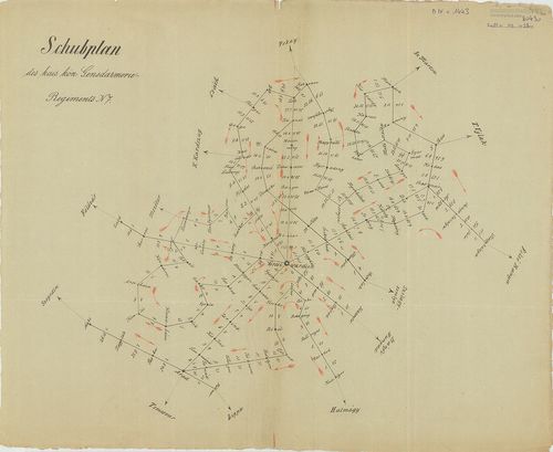
| Title | Schubplan des kais. könig. Gensdarmerie Regiments N 7. |
| Main title | A Nagyváradról kiinduló menetvonalak távolságának térképe a menetidő bejelölésével a 7. csendőrezred működési területén. (1856-1867.) |
536. Herzogtum Salzburg und das Salzkammergut mit den Grenzgebiet... [B IX c 1444]
Institute and Museum of Military History •
B IX c
•
B IX Ausztria–Magyarország
•
B I–XV. Európa
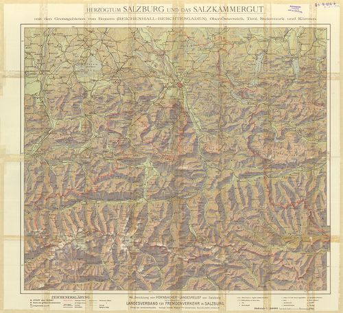
| Title | Herzogtum Salzburg und das Salzkammergut mit den Grenzgebieten von Bayern (Reichenhall – Berchtesgaden), Ober-Österreich Tirol, Steiermark und Kärnten. |
| Main title | Salzburg és környékének térképe. |
537. Magyarország. [B IX c 1445]
Institute and Museum of Military History •
B IX c
•
B IX Ausztria–Magyarország
•
B I–XV. Európa
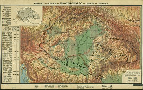
| Title | Magyarország. |
| Main title | A magyarság területeinek elhelyezkedése és táblázat a trianoni szerződés következményiről. |
538. Magyar korona országai kézi abrosza. [B IX c 1446]
Institute and Museum of Military History •
B IX c
•
B IX Ausztria–Magyarország
•
B I–XV. Európa
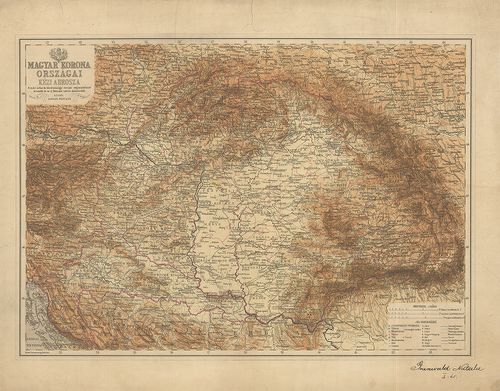
| Title | Magyar korona országai kézi abrosza. |
539. Die Oesterreich.-Ungarischen Eisenbahnen der Gegenwart und Z... [B IX c 1447]
Institute and Museum of Military History •
B IX c
•
B IX Ausztria–Magyarország
•
B I–XV. Európa
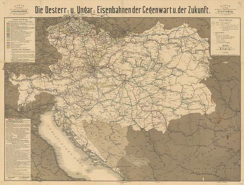
| Title | Die Oesterreich.-Ungarischen Eisenbahnen der Gegenwart und Zukunft. |
| Main title | Az Osztrák-Magyar Monarchia vasúttérképe a jelen- és a jővő időben. |
540. G. Freytags neue Verkehrskarte von Österreich-Ungarn. [B IX c 1448]
Institute and Museum of Military History •
B IX c
•
B IX Ausztria–Magyarország
•
B I–XV. Európa
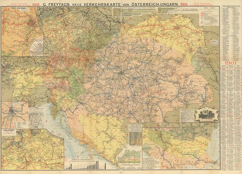
| Title | G. Freytags neue Verkehrskarte von Österreich-Ungarn. |
| Main title | Az Osztrák-Magyar Monarchia új közelekedési térképe 1901-ből. |