21. Neuestes Karte von Ireland. [B VI a 28]
Institute and Museum of Military History •
B VI a
•
B VI Anglia, Skócia és Írország
•
B I–XV. Európa
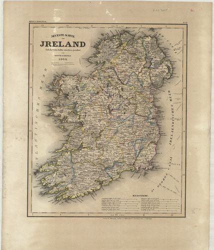
| Title | Neuestes Karte von Ireland. |
| Main title | Írország térképe 1844-ben. |
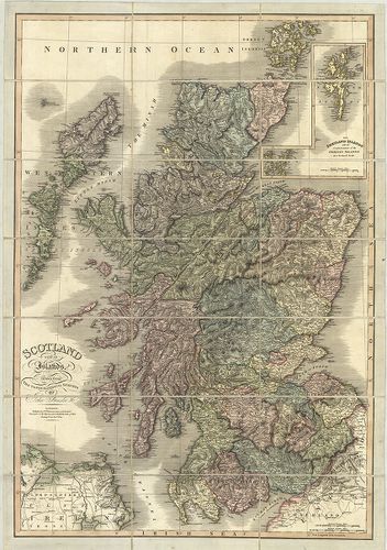
22. Map of Scotland. [B VI a 30]
Institute and Museum of Military History •
B VI a
•
B VI Anglia, Skócia és Írország
•
B I–XV. Európa
| Title | Map of Scotland. |
| Main title | Skócia térképe 1810-ben. |
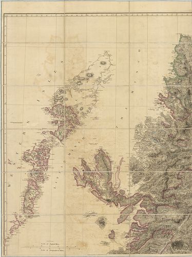
23. Scotland with its Islands. [B VI a 31]
Institute and Museum of Military History •
B VI a
•
B VI Anglia, Skócia és Írország
•
B I–XV. Európa
| Title | Scotland with its Islands. |
| Main title | Mt.: The Shetland Islands. (Shetland szk.) |
| Subject | Skócia és szigeteinek térképe 1824-ben. |
24. Grossbritannien und Irland. – Velhagen und Klasings Karte. [B VI a 34]
Institute and Museum of Military History •
B VI a
•
B VI Anglia, Skócia és Írország
•
B I–XV. Európa
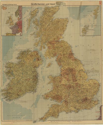
| Title | Grossbritannien und Irland. – Velhagen und Klasings Karte. |
| Main title | Mt.: [Ny-Európa.] A hátoldalon: [Nagy-Britannia gyarmatai.] |
| Subject | Nagy-Britannia és Írország térképe 1940-ben. |
25. [Nagy-Britannia–Írország.] [B VI a 38]
Institute and Museum of Military History •
B VI a
•
B VI Anglia, Skócia és Írország
•
B I–XV. Európa
| Title | [Nagy-Britannia–Írország.] |
26. [Skócia.] [B VI a 38/1]
Institute and Museum of Military History •
B VI a
•
B VI Anglia, Skócia és Írország
•
B I–XV. Európa
| Title | [Skócia.] |
27. Scozia. [B VI a 40]
Institute and Museum of Military History •
B VI a
•
B VI Anglia, Skócia és Írország
•
B I–XV. Európa
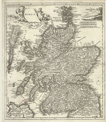
| Title | Scozia. |
| Main title | Skócia térképe a 18. században. |
28. Irlanda. [B VI a 41]
Institute and Museum of Military History •
B VI a
•
B VI Anglia, Skócia és Írország
•
B I–XV. Európa
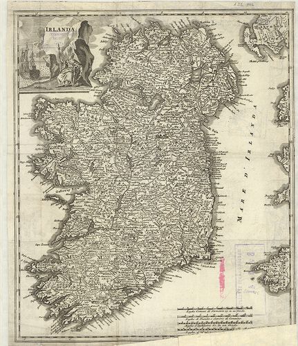
| Title | Irlanda. |
| Main title | Írország térképe a 18. században. |
29. Ireland. [B VI a 42]
Institute and Museum of Military History •
B VI a
•
B VI Anglia, Skócia és Írország
•
B I–XV. Európa
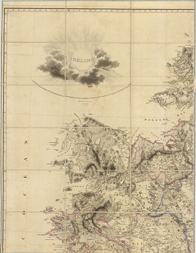
| Title | Ireland. |
| Main title | Írország térképe 1811-ben. |
30. Ireland. [B VI a 45]
Institute and Museum of Military History •
B VI a
•
B VI Anglia, Skócia és Írország
•
B I–XV. Európa
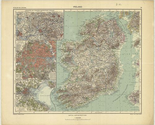
| Title | Ireland. |
| Main title | 3 mt. 1. Lancashire and Yorkshire Manufacturing. (Lancashire és Yorkshire ipari körzetei.) 2. London. 3. Dublin and Suburs. (Dublin és külvárosa.) |
| Subject | Írország térképe 1935-ben. |
31. Regionis qvae est circa Londinvm. – Ausführliche Geographisc... [B VI a 46]
Institute and Museum of Military History •
B VI a
•
B VI Anglia, Skócia és Írország
•
B I–XV. Európa
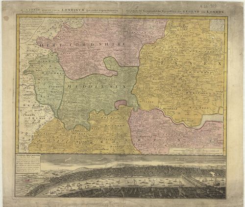
| Title | Regionis qvae est circa Londinvm. – Ausführliche Geographische Vorstellung der Gegend um London. |
| Main title | London és környékének térképe 1742-ben. |
32. Mogg’s New Map of England and Wales with part of Scotland. [B VI a 48]
Institute and Museum of Military History •
B VI a
•
B VI Anglia, Skócia és Írország
•
B I–XV. Európa
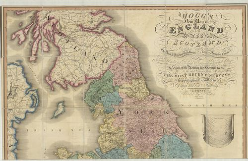
| Title | Mogg’s New Map of England and Wales with part of Scotland. |
| Main title | Anglia, Wales és Skócia egy részének térképe 1823-ban. |
33. Brit-szigetek. [B VI a 52]
Institute and Museum of Military History •
B VI a
•
B VI Anglia, Skócia és Írország
•
B I–XV. Európa
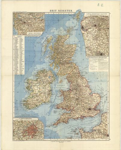
| Title | Brit-szigetek. |
| Main title | 3 mt. 1. Közép-Skótország. 2. Anglia legfontosabb iparvidéke. 3. London környéke. |
34. Brit-szigetek. [B VI a 53]
Institute and Museum of Military History •
B VI a
•
B VI Anglia, Skócia és Írország
•
B I–XV. Európa
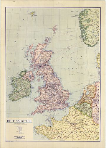
| Title | Brit-szigetek. |
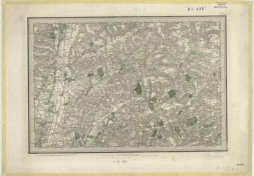
35. Index to the Ordnance Survey of Yorkshire. [B VI a 61]
Institute and Museum of Military History •
B VI a
•
B VI Anglia, Skócia és Írország
•
B I–XV. Európa
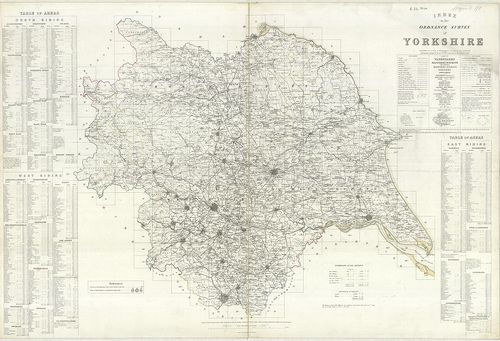
| Title | Index to the Ordnance Survey of Yorkshire. |
| Main title | Yorkshire topográfiai térképeinek áttekintő és csatlakozó térképlapjai 1854–56-ban. |
36. The Border – Administrative Areas Edition. [B VI a 63]
Institute and Museum of Military History •
B VI a
•
B VI Anglia, Skócia és Írország
•
B I–XV. Európa
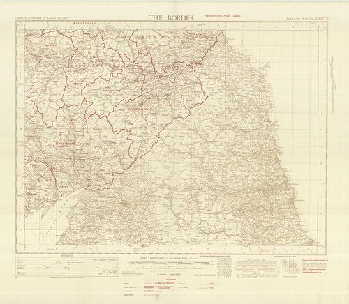
| Title | The Border – Administrative Areas Edition. |
| Main title | Közép-Anglia közigazgatási térképe, autóutakkal 1950-ből. |
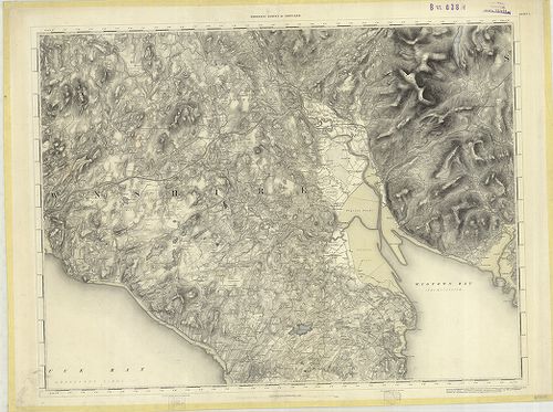
37. Index to the Ordnance Survey of the County of Durham. [B VI a 64]
Institute and Museum of Military History •
B VI a
•
B VI Anglia, Skócia és Írország
•
B I–XV. Európa
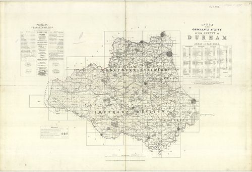
| Title | Index to the Ordnance Survey of the County of Durham. |
| Main title | Durham-grófság topográfiai térképeinek áttekintő lapja 1878-ban. |
38. Ten-Mile Aviation Map of Great Britain. – Ten Mile Map of Gr... [B VI a 75]
Institute and Museum of Military History •
B VI a
•
B VI Anglia, Skócia és Írország
•
B I–XV. Európa
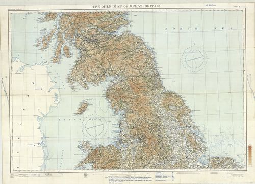
| Title | Ten-Mile Aviation Map of Great Britain. – Ten Mile Map of Great Britain. Sheet 2. |
| Main title | Nagy-Britannia középső részének térképe 1930-ban. |
39. Contoured Road Map of East Kent. – East Kent. Sheet 117. [B VI a 77]
Institute and Museum of Military History •
B VI a
•
B VI Anglia, Skócia és Írország
•
B I–XV. Európa
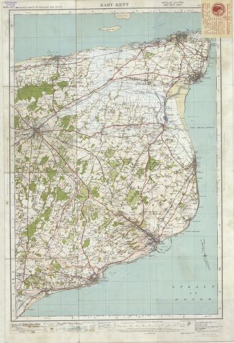
| Title | Contoured Road Map of East Kent. – East Kent. Sheet 117. |
| Main title | Kent-tartomány K-i részének térképe 1928-ban. |
40. Map of Barnard Castle and District. – Barnard Castle and Kir... [B VI a 78]
Institute and Museum of Military History •
B VI a
•
B VI Anglia, Skócia és Írország
•
B I–XV. Európa
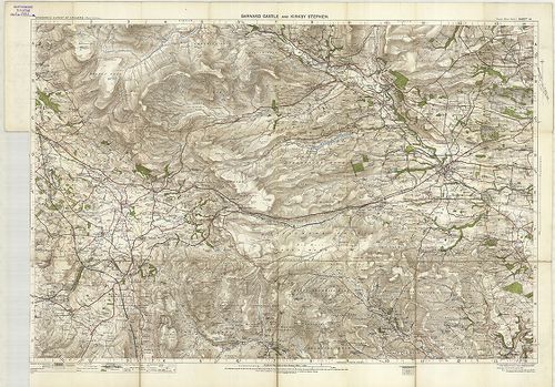
| Title | Map of Barnard Castle and District. – Barnard Castle and Kirk by Stephen. Sheet 14. |
| Main title | Barnard Castle és környékének térképe 1907-ben. |