301. Zusammendruck Mitau. [B XI c 119]
Institute and Museum of Military History •
B XI c
•
B XI Oroszország
•
B I–XV. Európa

| Title | Zusammendruck Mitau. |
| Main title | Mitau (Jelgava) és környékéről készült össznyomat az 1800-as évek végén. |
302. Dantzig. Carte No 3. Gdánsko. Mapa Č. 3. [B XI c 120]
Institute and Museum of Military History •
B XI c
•
B XI Oroszország
•
B I–XV. Európa

| Title | Dantzig. Carte No 3. Gdánsko. Mapa Č. 3. |
| Main title | Danzig (Gdańsk) és környékéről készült össznyomat a tervezett határok kijelölésével 1919-ben. |
303. Europäisches Russland: Bewachsung. Anlage 2 zu kapitel 2 b. [B XI c 123]
Institute and Museum of Military History •
B XI c
•
B XI Oroszország
•
B I–XV. Európa

| Title | Europäisches Russland: Bewachsung. Anlage 2 zu kapitel 2 b. |
| Main title | Az Európai Oroszország növénytakarója 1941-ben. |
304. Ukraine: Industrie und Kraftwerke. [B XI c 126]
Institute and Museum of Military History •
B XI c
•
B XI Oroszország
•
B I–XV. Európa
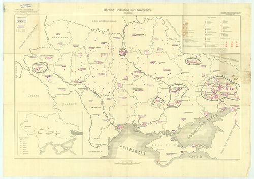
| Title | Ukraine: Industrie und Kraftwerke. |
| Main title | Mt.: Bodenschätze (Ásványkincsek) |
| Subject | Ukrajna iparvidékei és erőművei 1941-ben. |
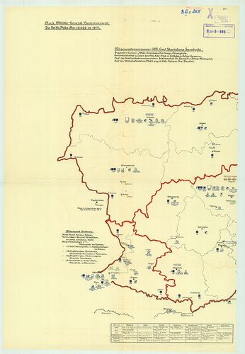
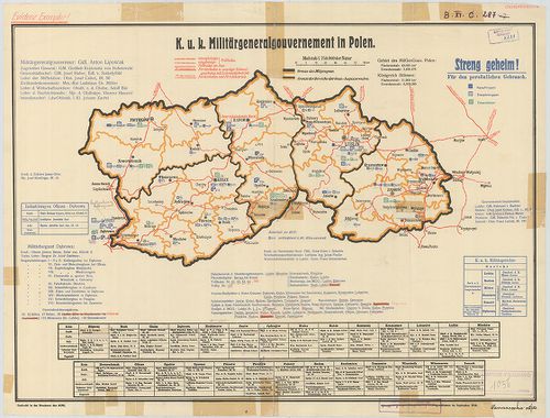
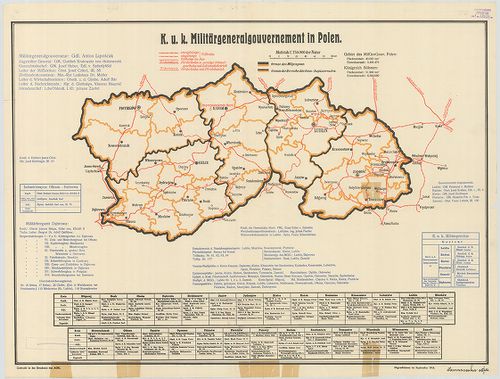
305. K. u. K. Militärgeneralgouvernement in Polen. [B XI c 127]
Institute and Museum of Military History •
B XI c
•
B XI Oroszország
•
B I–XV. Európa
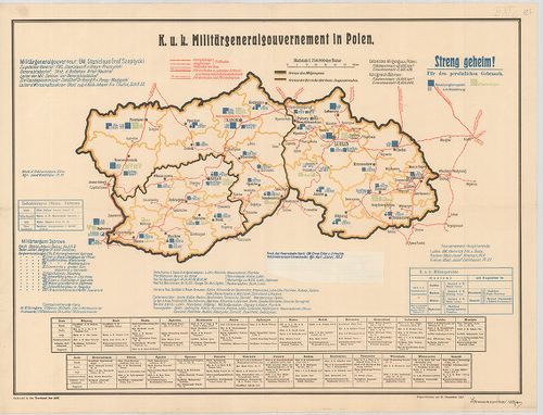
| Title | K. u. K. Militärgeneralgouvernement in Polen. |
| Main title | A császári és királyi Katonai Főkormányzóság Lengyelországban 1917. XII. 31. |
306. Ekonomicseszkaja karta Altajszkogo kraja. [B XI c 128]
Institute and Museum of Military History •
B XI c
•
B XI Oroszország
•
B I–XV. Európa
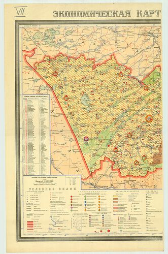
| Title | Ekonomicseszkaja karta Altajszkogo kraja. |
| Main title | Mt.: Poszevnüe ploscsadi Altajszkogo kraja. (Az Altájvidék vetésterülete 1937-ben.) |
| Subject | Az Altáj-vidék gazdasági térképe 1939-ben. |
307. Ravensteins Deutsche Kriegskarten No 7. Polen. Nördliche häl... [B XI c 131]
Institute and Museum of Military History •
B XI c
•
B XI Oroszország
•
B I–XV. Európa
| Title | Ravensteins Deutsche Kriegskarten No 7. Polen. Nördliche hälfte gegen Posen und Westpreussen. |
| Main title | Lengyelország háborús térképe az I. világháborúban. |
308. Poland. [B XI c 134]
Institute and Museum of Military History •
B XI c
•
B XI Oroszország
•
B I–XV. Európa
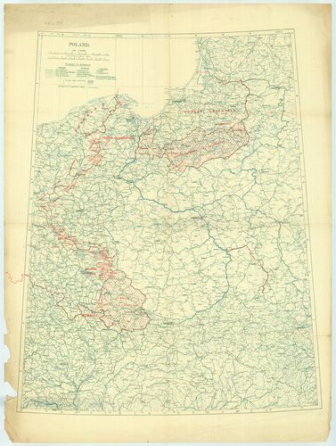
| Title | Poland. |
| Main title | Lengyelország 1920-ban a népszavazás területeinek feltüntetésével. |
309. Dyslokacja pokojowa sil zbrojnych Polski w dniu 15. III. 193... [B XI c 136]
Institute and Museum of Military History •
B XI c
•
B XI Oroszország
•
B I–XV. Európa
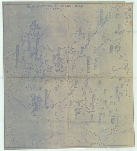
| Title | Dyslokacja pokojowa sil zbrojnych Polski w dniu 15. III. 1939. r. |
| Main title | A Lengyelország fegyveres erőinek béke-diszlokációs térképe 1939. III. 15-én. |
310. Pokojowa organizacja marynarki wojennej (wc stanu z dn. 1. V... [B XI c 136/1]
Institute and Museum of Military History •
B XI c
•
B XI Oroszország
•
B I–XV. Európa
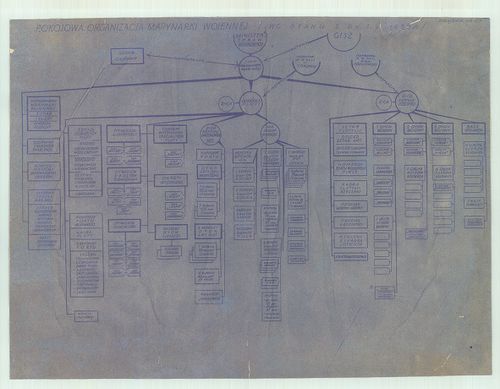
| Title | Pokojowa organizacja marynarki wojennej (wc stanu z dn. 1. V. 1939. r.) Zalacznik Nr. 20. |
| Main title | Lengyelország haditengerészetének szervezési táblája 1939. V. 1-jén. |
311. Mapa samochodowa i stanu dróg w Polsce na rok 1939/40. Polsk... [B XI c 138/1]
Institute and Museum of Military History •
B XI c
•
B XI Oroszország
•
B I–XV. Európa
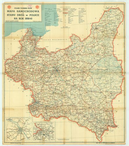
| Title | Mapa samochodowa i stanu dróg w Polsce na rok 1939/40. Polski Touring Klub. |
| Main title | 2 mt.: 1. Warszawa i okolice (Varsó környéke.) 2. Zaglebie weglowe. (Szénmedence.)Lengyelország autó- és útállapottérképe 1939–40-ben. |
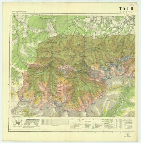
312. Fotogrametryczna mapa parku narodowego Tatry (część Polska).... [B XI c 145]
Institute and Museum of Military History •
B XI c
•
B XI Oroszország
•
B I–XV. Európa
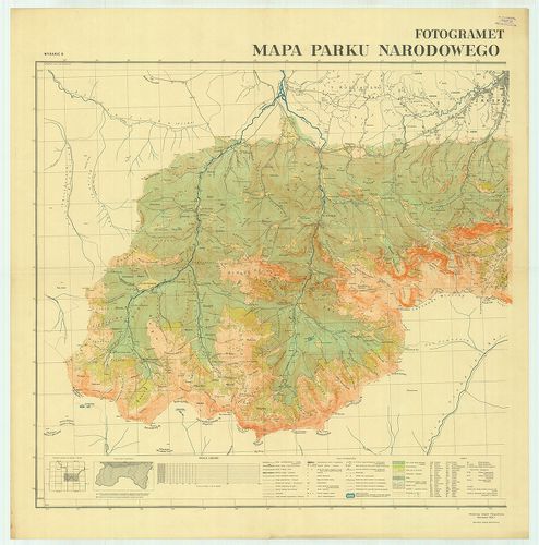
| Title | Fotogrametryczna mapa parku narodowego Tatry (część Polska). Widania B. |
| Main title | A lengyel Tátra nemzeti parkjának légifénykép után készült térképe 1934-ben. |
313. Tatry Polskie. Mapa šrodkowey częšci Tatr. [B XI c 146]
Institute and Museum of Military History •
B XI c
•
B XI Oroszország
•
B I–XV. Európa
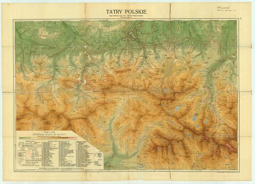
| Title | Tatry Polskie. Mapa šrodkowey częšci Tatr. |
| Main title | A lengyel Tátra térképe az 1930-as években. |
314. Uebersicht über die Stabquartiere der Russischen Armee in Eu... [B XI c 150]
Institute and Museum of Military History •
B XI c
•
B XI Oroszország
•
B I–XV. Európa
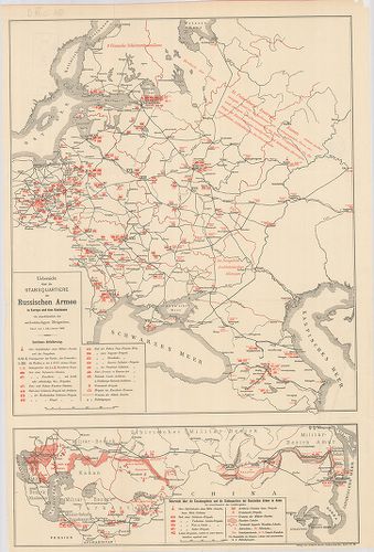
| Title | Uebersicht über die Stabquartiere der Russischen Armee in Europa und dem Kaukasus bis einschliesslich der selbständigen Brigaden. Stand vom 1. (13.) Januar 1898. |
| Main title | Mt.: Uebersicht über die Kasakengebiete und die Stabsquartiere der Russischen Armee in Asien bis einschliesslich der lokalbrigaden. (Áttekintés a kozák területekről és az orosz hadsereg törzseiről Ázsiában beleértve a helyi dandárokat is.)Áttekintés az Orosz hadsereg törzseiről Európában és a Kaukázusban beleértve az önálló dandárokat is 1898. január 1-jén. |
315. Industrieübersicht Polen. [B XI c 151]
Institute and Museum of Military History •
B XI c
•
B XI Oroszország
•
B I–XV. Európa
| Title | Industrieübersicht Polen. |
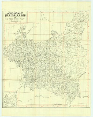
| Main title | 6 mt.: 1. Gdingener Hafen. (Gdyniai-öböl.) 2. Danziger Hafen. (Danzig, Gdański-öböl.) 3. Übersicht der Industrieverteilung. (Iparvidékek áttekintése.) 4. Bodenschätze. (Ásványkincsek.) 5. Industriebezirk Kattowitz, Krakau, Kielce. (Ipari kerületek, Katowice, Kraków és Kielce.) 6. Kohlenbecken Świętochlowice-Kattowitz (Katowice) – Sosnowiec – Dabrowa Górnicza. (Szénmedencék.) 1 táblázat: 1. Grössenordnung nach Zahl der beschäftigten Arbeiter. (A munkaerő számokban és nagyságrendben kifejezve.) hátl.: Gemeindekarte der Republik Polen. (Lengyel Köztársaság közigazgatási térképe 1938. 4. l.). |
| Subject | Lengyelország ipari áttekintő térképe 1939-ben. |
316. Eisenbahnkarte von Polen. [B XI c 152]
Institute and Museum of Military History •
B XI c
•
B XI Oroszország
•
B I–XV. Európa
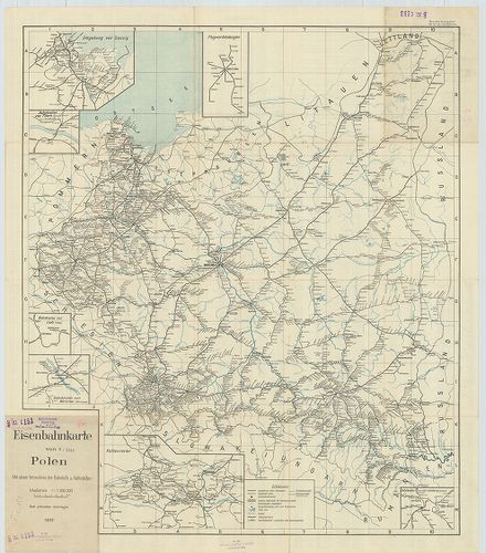
| Title | Eisenbahnkarte von Polen. |
| Main title | 7 mt.: 1. Flugverbindungen. (Légi összeköttetés.) 2. Umgebung von Danzig. (Danzig-Gdańsk környéke.) 3. Bahnknoten von Thořn. (Toruń vasútvonalai.) 4. Bahnknoten von Lodz. (Lódz vasútvonalai.) 5. Bahnknoten von Warschau. (Warszawa vasútvonalai.) 6. Kohlenrevier. (Szénvidék.) 7. Bahnknoten von Lemberg. (Lvov, SzU vasútvonalai.) hátl.: vasútvonal névj.Lengyelország vasúttérképe 1939-ben. |
317. Strassenzustand in Polen. 1939. [B XI c 153]
Institute and Museum of Military History •
B XI c
•
B XI Oroszország
•
B I–XV. Európa
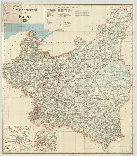
| Title | Strassenzustand in Polen. 1939. |
| Main title | 2 mt.: 1. Warschau und Umgebung. (Varsó és környéke.) 2. Industriegebiet. (Iparvidék.)Lengyelország úttérképe 1939-ben. |
318. Republique Polonaise. – Republic of Poland. [B XI c 154]
Institute and Museum of Military History •
B XI c
•
B XI Oroszország
•
B I–XV. Európa
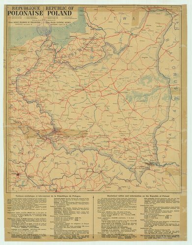
| Title | Republique Polonaise. – Republic of Poland. |
| Main title | A Lengyel Köztársaság közlekedési térképe 1930 körül. |
319. Der Kriegsschauplatz in Polen. Flemmings Kriegskarte. Nr. 15... [B XI c 155]
Institute and Museum of Military History •
B XI c
•
B XI Oroszország
•
B I–XV. Európa
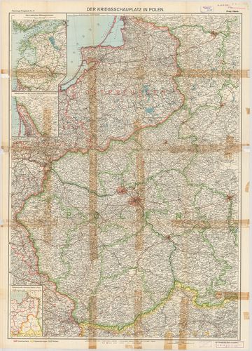
| Title | Der Kriegsschauplatz in Polen. Flemmings Kriegskarte. Nr. 15. |
| Main title | 3 mt.: 1. Die Russischen Ostseeprovinzen. (Az orosz Keleti-tenger tartományai.) 2. Nördlichster Teil der Provinz Ostpreussen. (Kreis Memel im Anschluss an die Hauptkarte.) Kelet-Poroszország északi tartománya (Memel kerület) csatlakozva a főtérképhez. 3. Früheres preuss und österreich, Gebiet in Polen. (Korábbi porosz és osztrák területek Lengyelországban.) hátl.: Umgebung der Festungen Warschau und Nowo-Georgiewsk. (Varsó és Nowo-Georgiewsk környéke a rövidítésekkel.)A lengyelországi hadszíntér az erődítések rajzával. |
320. Les nivellements de precision dans la Russie d’Europe et d’A... [B XI c 166]
Institute and Museum of Military History •
B XI c
•
B XI Oroszország
•
B I–XV. Európa
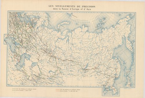
| Title | Les nivellements de precision dans la Russie d’Europe et d’Asie. |
| Main title | Az Európai és Ázsiai Oroszország pontos felmérés szerint. |
321. Triangulation en Russie d’Europe. [B XI c 167]
Institute and Museum of Military History •
B XI c
•
B XI Oroszország
•
B I–XV. Európa
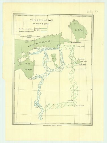
| Title | Triangulation en Russie d’Europe. |
| Main title | Északnyugat-Oroszország háromszögelési pontjai 1890 körül. |
322. Triangulation le long de la Riviére Irtych. (Siberie Occiden... [B XI c 168]
Institute and Museum of Military History •
B XI c
•
B XI Oroszország
•
B I–XV. Európa
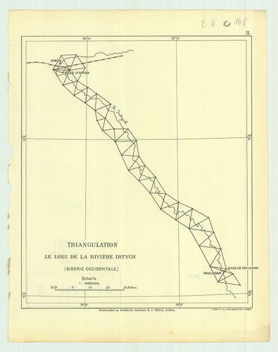
| Title | Triangulation le long de la Riviére Irtych. (Siberie Occidentale.) II. |
| Main title | Háromszögelési pontok az Irtis folyó mentén 1890 körül (Nyugat-Szibéria.) |
323. Triangulation de la contrée Transbaicalienne. III. [B XI c 169]
Institute and Museum of Military History •
B XI c
•
B XI Oroszország
•
B I–XV. Európa
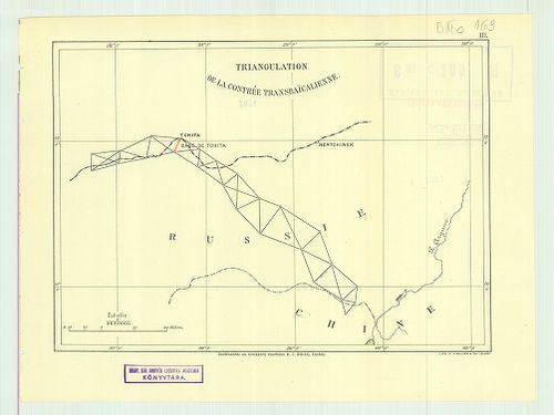
| Title | Triangulation de la contrée Transbaicalienne. III. |
| Main title | A Bajkálon túli terület háromszögelési pontjai 1890 körül. |
324. Triangulation pour relier le réseau Russe de Turkestan avec ... [B XI c 170]
Institute and Museum of Military History •
B XI c
•
B XI Oroszország
•
B I–XV. Európa

| Title | Triangulation pour relier le réseau Russe de Turkestan avec le réseau des Indes. IV. |
| Main title | Oroszország és Turkesztán háromszögelési pontjai 1890 körül. |
325. Carte des environs de la station astronomique de Tchardiui. [B XI c 171]
Institute and Museum of Military History •
B XI c
•
B XI Oroszország
•
B I–XV. Európa
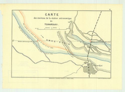
| Title | Carte des environs de la station astronomique de Tchardiui. |
| Main title | Csardzsou város környékén lévő csillagászati állomások térképe 1890 körül. |
326. Carte des environs de la station astronomique de Tchardjui. ... [B XI c 172]
Institute and Museum of Military History •
B XI c
•
B XI Oroszország
•
B I–XV. Európa

| Title | Carte des environs de la station astronomique de Tchardjui. I. |
| Main title | Plan de la station astronomique de Tchardjui. II. |
| Subject | Csardzsou város környékén lévő csillagászati állomás és környéke 1890 körül. |
327. Northern trans-frontier. Parts of Russian, Turkistán, Afghán... [B XI c 173]
Institute and Museum of Military History •
B XI c
•
B XI Oroszország
•
B I–XV. Európa
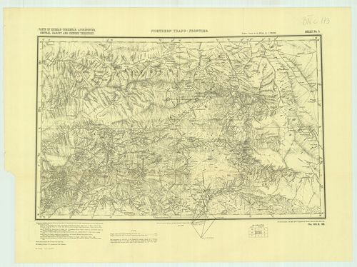
| Title | Northern trans-frontier. Parts of Russian, Turkistán, Afghánistán, Chitrál, Kanjut and Chinese territory. Sheet No. 2. – No. 69. S. 98. |
| Main title | A Pamír-fennsík környéke az Oroszország, Afganisztán, Nyugat-Pakisztán, Kína és India közötti határvidék térképe 1898-ban. |
328. Kievszkoe goszudarsztvo-ego szoszedi v IX–XI vekah. [B XI c 178]
Institute and Museum of Military History •
B XI c
•
B XI Oroszország
•
B I–XV. Európa
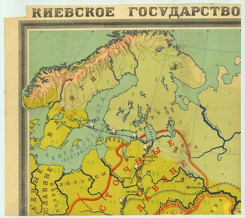
| Title | Kievszkoe goszudarsztvo-ego szoszedi v IX–XI vekah. |
| Main title | Kijev és a szomszédos államok a IX–XI. században. |
329. Orosz fogolytáborok. [B XI c 183]
Institute and Museum of Military History •
B XI c
•
B XI Oroszország
•
B I–XV. Európa

| Title | Orosz fogolytáborok. |
| Main title | A Szovjetunió területén lévő fogolytáborok az I. Világháború után. |
330. Tatry. (Część polska.) mapa fotogrametryczna. Widanie Narcia... [B XI c 236]
Institute and Museum of Military History •
B XI c
•
B XI Oroszország
•
B I–XV. Európa
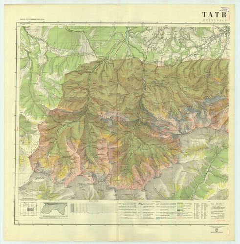
| Title | Tatry. (Część polska.) mapa fotogrametryczna. Widanie Narciarskie. |
| Main title | A Lengyel Tátra télisport térképe 1938-ban. |
331. Tatry. (Część polska.) Mapa fotogrametryczna. Wydanie turyst... [B XI c 237]
Institute and Museum of Military History •
B XI c
•
B XI Oroszország
•
B I–XV. Európa
| Title | Tatry. (Część polska.) Mapa fotogrametryczna. Wydanie turystyczne. |
| Main title | A Lengyel Tátra turistatérképe 1938-ban. |
332. Dislokation der Truppen und Anstalten im Gouvernementbereich... [B XI c 265]
Institute and Museum of Military History •
B XI c
•
B XI Oroszország
•
B I–XV. Európa
| Title | Dislokation der Truppen und Anstalten im Gouvernementbereiche. |
| Main title | A csapatok és intézmények diszlokációja. |
333. Westrussland. [B XI c 267]
Institute and Museum of Military History •
B XI c
•
B XI Oroszország
•
B I–XV. Európa
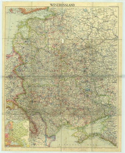
| Title | Westrussland. |
| Main title | 1 mt.: Európai Oroszország.Nyugat-Oroszország térképe. |
334. Etnographisch-geographische Karte des Nördlichen Ural Gebiet... [B XI c 268]
Institute and Museum of Military History •
B XI c
•
B XI Oroszország
•
B I–XV. Európa
| Title | Etnographisch-geographische Karte des Nördlichen Ural Gebietes |
| Main title | Az Észak-Ural néprajzi és földrajzi térképe. |
335. [Odessa, (Odessza) térségének hajózási és vasútvonalai.] [B XI c 270]
Institute and Museum of Military History •
B XI c
•
B XI Oroszország
•
B I–XV. Európa
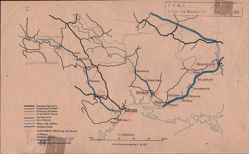
| Title | [Odessa, (Odessza) térségének hajózási és vasútvonalai.] |
336. Eisenbahnkarte v.[on] Russland u.[nd] Ukraine. Aufgelegt im ... [B XI c 271]
Institute and Museum of Military History •
B XI c
•
B XI Oroszország
•
B I–XV. Európa
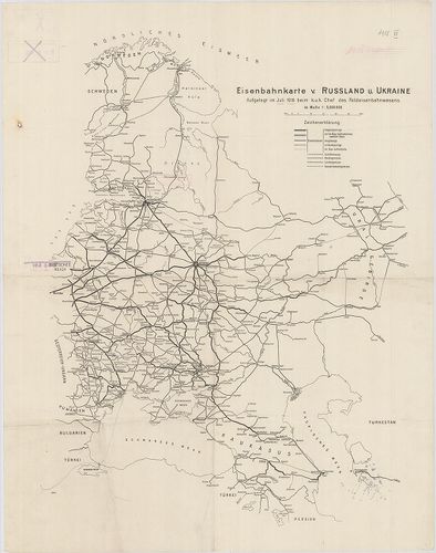
| Title | Eisenbahnkarte v.[on] Russland u.[nd] Ukraine. Aufgelegt im Juli 1918. beim K. u. k. Chef des Feldeisenbahnwesens. |
| Main title | Oroszország és Ukrajna vasúti térképe, Norvégia-Perzsia (Irán) Keleti-tenger–Ural-hegység közötti térségben. |
337. Karta Bachmutszkago uezda, Jekaterinoszalvszkoj gubernii. Sz... [B XI c 272]
Institute and Museum of Military History •
B XI c
•
B XI Oroszország
•
B I–XV. Európa
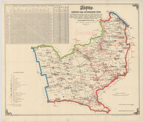
| Title | Karta Bachmutszkago uezda, Jekaterinoszalvszkoj gubernii. Szoszt.: –, 1891. Iszpravl. i dopoln. v. 1915. godu. Izd. 5. |
| Main title | A Bachmuti járás térképe Jekaterinoszlav kormányzóságban. Közigazgatási, iskolai, egyházi, egészségügyi, posta és távirodai, vasúti hálózat. Távolságok jegyz. |
338. Russich–Ponisches Industriegebiet. [B XI c 273]
Institute and Museum of Military History •
B XI c
•
B XI Oroszország
•
B I–XV. Európa
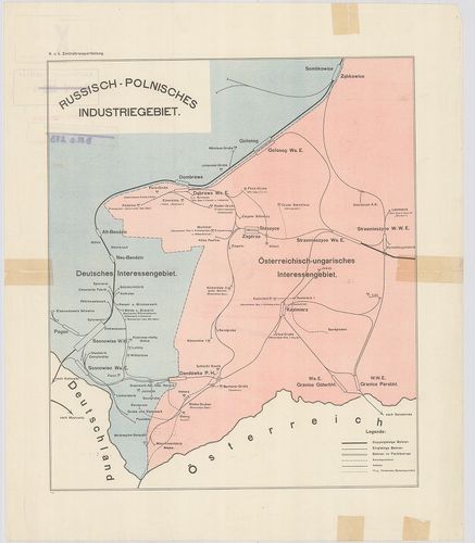
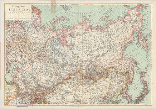
| Title | Russich–Ponisches Industriegebiet. |
| Main title | Az orosz–lengyel iparvidék vázlatos térképe. |
339. Die Ausgestaltung des russischen Eisenbahnnetzes Während des... [B XI c 274]
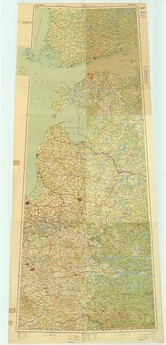
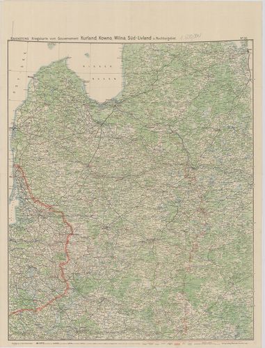
Institute and Museum of Military History •
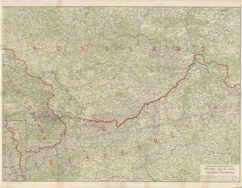
B XI c
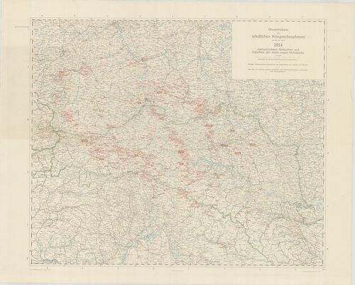
•
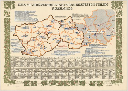
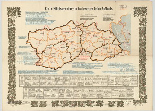
B XI Oroszország
•
B I–XV. Európa
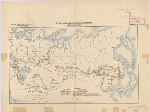
| Title | Die Ausgestaltung des russischen Eisenbahnnetzes Während des Krieges Karte 3. |
| Main title | Az orosz vasúthálózat térképe az első világháború idején. |
340. Das Radiotelegraphennetz Russlands Ende 1911. Beilage 10. [B XI c 275]
Institute and Museum of Military History •
B XI c
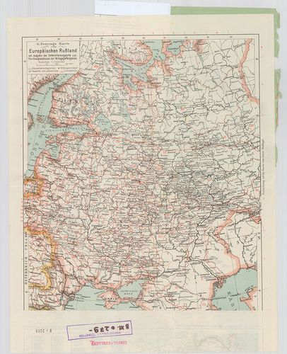
•
B XI Oroszország
•
B I–XV. Európa
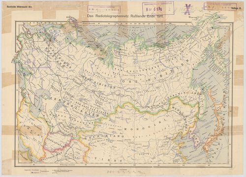
| Title | Das Radiotelegraphennetz Russlands Ende 1911. Beilage 10. |
| Main title | Oroszország rádiótelefon-hálózata 1911 végén. |
341. Südwestrussland. Flemmings Kriegskarte Nr. 41. [B XI c 276]
Institute and Museum of Military History •
B XI c
•
B XI Oroszország
•
B I–XV. Európa
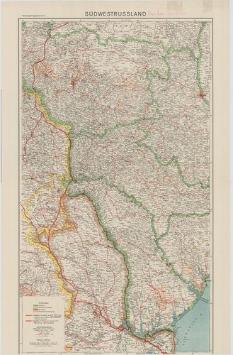
| Title | Südwestrussland. Flemmings Kriegskarte Nr. 41. |
| Main title | Oroszország DNy-i része |
342. Westliches Russland mit den deutschen, österreichisch–ungari... [B XI c 277]
Institute and Museum of Military History •
B XI c
•
B XI Oroszország
•
B I–XV. Európa
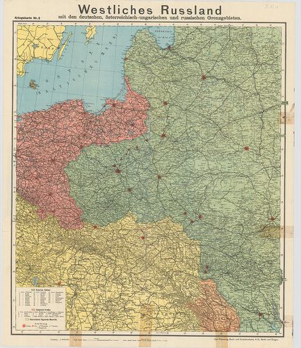
| Title | Westliches Russland mit den deutschen, österreichisch–ungarischen und russischen Grenzgebieten. Kriegskarte Nr. 2. |
| Main title | Oroszország Ny-i része az osztrák–magyar, német és orosz határvidék térképe. |
343. G. Freytags Karte von Sibirien. Mit Angabe der Krigsgefangen... [B XI c 278]
Institute and Museum of Military History •
B XI c
•
B XI Oroszország
•
B I–XV. Európa
| Title | G. Freytags Karte von Sibirien. Mit Angabe der Krigsgefangenenlager. |
| Main title | Mt.: (Összehasonlító térképrészlet.) |
| Subject | A borítólap belső oldalán a hadifogolytáborok helynévmutatója, 1915. ápr. 20. helyzet. |
344. Két térképlap: I. G. Freytags Karte vom Asiatischen Russland... [B XI c 279]
Institute and Museum of Military History •
B XI c
•
B XI Oroszország
•
B I–XV. Európa
| Title | Két térképlap: I. G. Freytags Karte vom Asiatischen Russland … |
| Main title | II. G. Freytags Karte vom Europäischen Russland. … |
| Subject | Mt.: (Összehasonlító térképrészlet.) |
345. Die im Friedensvertrag von Brest-Litovsk Festgesetzte deutsc... [B XI c 280]
Institute and Museum of Military History •
B XI c
•
B XI Oroszország
•
B I–XV. Európa
| Title | Die im Friedensvertrag von Brest-Litovsk Festgesetzte deutsch–russische Grenze. |
| Main title | 1. Abo (Turku). 2. Helsingfors (Helsinki). 3. Königsberg (Kalinyingrad). 4. Wilna (Vilnius). 5. Warschau (Varsó). 6. Pinszk. |
| Subject | A brest–litovski békeszerződésben megállapított német–orosz határvidékének áttekintő térképe. Az új határ felülnyomásával Finnországtól–Galíciáig. |
346. Ravensteins Kriegskarte vom Gouvernement Kurland, Kowno, Wil... [B XI c 281]
Institute and Museum of Military History •
B XI c
•
B XI Oroszország
•
B I–XV. Európa
| Title | Ravensteins Kriegskarte vom Gouvernement Kurland, Kowno, Wilna, Süd-Livland u. Nachbargebiet. No. 30. |
| Main title | Az ÉK-Oroszország-i hadszíntér áttekintő térképe. Kurland (Kurzeme), Kowno (Kaunas), Wilna (Vilnius), Süd-Livland (Vidzeme). |
347. Ravensteins Kriegskarte Nr. 8. Polen, Südliche Hälfte gegen ... [B XI c 282]
Institute and Museum of Military History •
B XI c
•
B XI Oroszország
•
B I–XV. Európa
| Title | Ravensteins Kriegskarte Nr. 8. Polen, Südliche Hälfte gegen Schlesien u. Oesterreich. |
| Main title | A Dél-Lengyelország-i hadszíntér, a sziléziai és osztrák határterületek térképe. |
348. Übersichtskarte des nördlichen Kriegsschauplatzes mit den im... [B XI c 283]
Institute and Museum of Military History •
B XI c
•
B XI Oroszország
•
B I–XV. Európa
| Title | Übersichtskarte des nördlichen Kriegsschauplatzes mit den im Jahre 1914. stattgefundenen Schlachten und Gefechten der Österr.–ungar. Wehrmacht. |
| Main title | Az északi hadszíntér áttekintő térképe. |
349. K.[aiserliche] u.[nd] K.[önigliche] Militärverwaltung in den... [B XI c 284]
Institute and Museum of Military History •
B XI c
•
B XI Oroszország
•
B I–XV. Európa
| Title | K.[aiserliche] u.[nd] K.[önigliche] Militärverwaltung in den besetzten Teilen Russlands. |
| Main title | Az oroszországi megszállott területek katonai közigazgatásának területi beosztása. |
350. K.[aiserliche] u.[nd] K.[önigliche] Militärverwaltung in den... [B XI c 285]
Institute and Museum of Military History •
B XI c
•
B XI Oroszország
•
B I–XV. Európa
| Title | K.[aiserliche] u.[nd] K.[önigliche] Militärverwaltung in den besetzten Teilen Russlands. |
| Main title | Az oroszországi megszállott megszállott területek katonai közigazgatásának területi beosztása. |
351. K.[aiserliche] u.[nd] K.[önigliche] Militärverwaltung in den... [B XI c 286]
Institute and Museum of Military History •
B XI c
•
B XI Oroszország
•
B I–XV. Európa

| Title | K.[aiserliche] u.[nd] K.[önigliche] Militärverwaltung in den besetzten Teilen Russlands. |
| Main title | Az oroszországi megszállott területek katonai közigazgatásának területi beosztása. |
352. K.[aiserliche] u.[nd] K.[önigliche] Militärgeneralgouverneme... [B XI c 287]
Institute and Museum of Military History •
B XI c
•
B XI Oroszország
•
B I–XV. Európa
| Title | K.[aiserliche] u.[nd] K.[önigliche] Militärgeneralgouvernement in Polen. |
| Main title | A lengyelországi katonai főkormányzóság területi beosztása 1918-ban. |
353. K.[aiserliche] u.[nd] K.[önigliche] Militärgeneralgouverneme... [B XI c 288]
Institute and Museum of Military History •
B XI c
•
B XI Oroszország
•
B I–XV. Európa
| Title | K.[aiserliche] u.[nd] K.[önigliche] Militärgeneralgouvernement in Polen. |
| Main title | A lengyelországi katonai főkormányzóság területi beosztása 1918-ban. |
354. Plan golodnoj sztyepi v gorizontaljah. Szamarkandszkaja obla... [B XI c 296]
Institute and Museum of Military History •
B XI c
•
B XI Oroszország
•
B I–XV. Európa
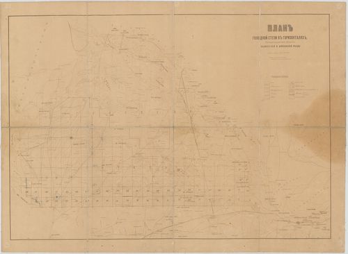
| Title | Plan golodnoj sztyepi v gorizontaljah. Szamarkandszkaja oblaszty. |
| Main title | A terméketlen területek térképe magasság szerint. Szamarkandi terület. |
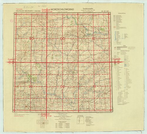
355. Deutsche Weltkarte. Fliyerausgabe. [B XI c 298]
Institute and Museum of Military History •
B XI c
•
B XI Oroszország
•
B I–XV. Európa
| Title | Deutsche Weltkarte. Fliyerausgabe. |
| Main title | Német repülő világtérképesorozat, 1:500 000 méretarányú. Kijew M–36–NW. Ssumy M–36–NO. Kirowgrad M–36–SW. Anepropetrousok M–36–30. Kursk: M–37–NW Woroschilowgrad M–37–SO. |
356. Lietuvos kalnuotumo ir nootakumo Zem e lapis. [B XI c 299]
Institute and Museum of Military History •
B XI c
•
B XI Oroszország
•
B I–XV. Európa
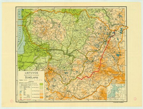
| Title | Lietuvos kalnuotumo ir nootakumo Zem e lapis. |
| Main title | Litvánia topográfiai térképe 1939-ből, közigazgatási beosztással. |
357. [Európai Oroszország.] [B XI c 300]
Institute and Museum of Military History •
B XI c
•
B XI Oroszország
•
B I–XV. Európa
| Title | [Európai Oroszország.] |
| Main title | A német, osztrák–magyar csapatok előrenyomulása, a frontvonal helyzete az I. világháborúban. |
358. Friedensdislokation im europäischen Russland (Zentrales Gebi... [B XI c 301]
Institute and Museum of Military History •
B XI c
•
B XI Oroszország
•
B I–XV. Európa
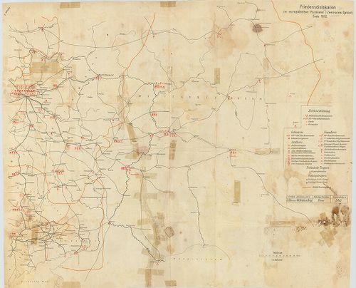
| Title | Friedensdislokation im europäischen Russland (Zentrales Gebiet) Ende 1912.. |
| Main title | A cári Oroszország európai központi részének diszlokációja békében. |
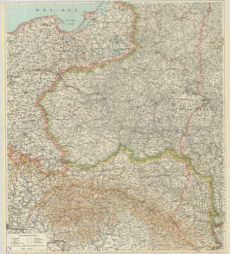
359. Königreich Pohlen samt den angräzenden Provinzen. [B XI c 302]
Institute and Museum of Military History •
B XI c
•
B XI Oroszország
•
B I–XV. Európa
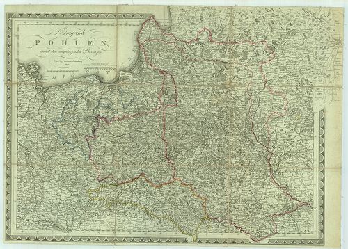
| Title | Königreich Pohlen samt den angräzenden Provinzen. |
| Main title | Lengyelország és a vele határos államok térképe. |
360. Baku. K–39. [B XI c 305]
Institute and Museum of Military History •
B XI c
•
B XI Oroszország
•
B I–XV. Európa
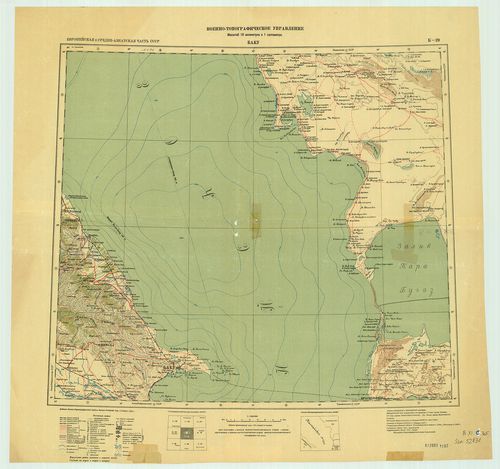
| Title | Baku. K–39. |
| Main title | Az 1:1 000 000 világtérkép Baku. K–39 szelvénye. |
361. Zsitonir. M–35. [B XI c 306]
Institute and Museum of Military History •
B XI c
•
B XI Oroszország
•
B I–XV. Európa
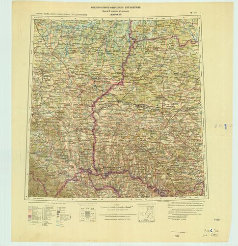
| Title | Zsitonir. M–35. |
| Main title | Az 1:1 000 000 világtérkép Zsitonir. M–35. szelvénye. |
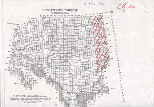
362. Owrutsch-Tscherkassy (V52–W50) [B XI c 307]
Institute and Museum of Military History •
B XI c
•
B XI Oroszország
•
B I–XV. Európa
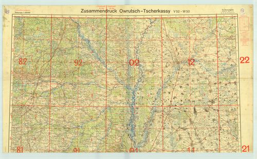
| Title | Owrutsch-Tscherkassy (V52–W50) |
| Main title | 6 db (V52–W50) 1:300 000 ma. össznyomat, repülőhálóval ellátva. |
363. 1920A. Eesti-Wene Piiri K. [B XI c 310]
Institute and Museum of Military History •
B XI c
•
B XI Oroszország
•
B I–XV. Európa
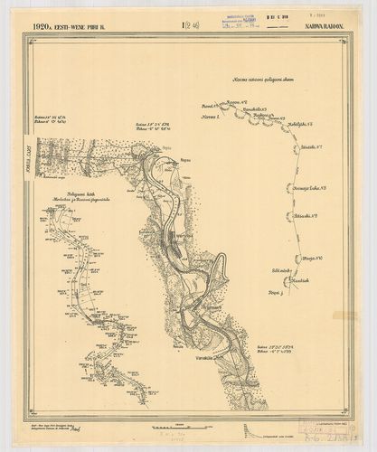
| Title | 1920A. Eesti-Wene Piiri K. |
| Main title | Az Észtország és Szovjet-oroszország közötti határvonal térképe. |
364. Arbeitskarte Charkow-Rostow. [B XI c 321]
Institute and Museum of Military History •
B XI c
•
B XI Oroszország
•
B I–XV. Európa
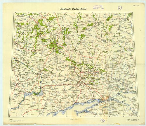
| Title | Arbeitskarte Charkow-Rostow. |
| Main title | Harkov-Rosztov -munkatérkép. |
365. Das Russische Kriegsgebiet. [B XI c 324]
Institute and Museum of Military History •
B XI c
•
B XI Oroszország
•
B I–XV. Európa
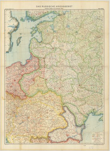
| Title | Das Russische Kriegsgebiet. |
| Main title | Az orosz háború területe. |
366. Ucsebnaja Karta. [B XI c 325]
Institute and Museum of Military History •
B XI c
•
B XI Oroszország
•
B I–XV. Európa
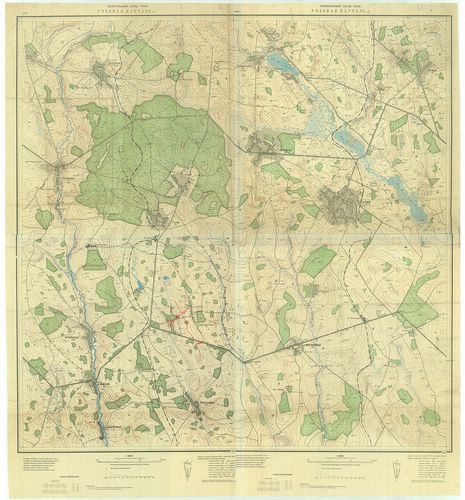
| Title | Ucsebnaja Karta. |
| Main title | Oktatótérkép. |
367. Ucsebnaja Karta. [B XI c 326]
Institute and Museum of Military History •
B XI c
•
B XI Oroszország
•
B I–XV. Európa
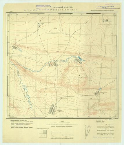
| Title | Ucsebnaja Karta. |
| Main title | Oktatótérkép. |
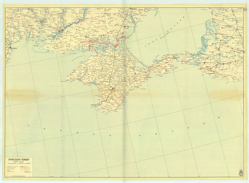
368. Krím úthálózati térkép. [54.sz.] [B XI c 332]
Institute and Museum of Military History •
B XI c
•
B XI Oroszország
•
B I–XV. Európa
| Title | Krím úthálózati térkép. [54.sz.] |
369. Dislokation der russischen Armee april 1903. [B XI c 337]
Institute and Museum of Military History •
B XI c
•
B XI Oroszország
•
B I–XV. Európa
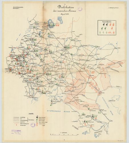
| Title | Dislokation der russischen Armee april 1903. |
| Main title | Az európai orosz haderő diszlokációja 1903-ban. |
370. [Az orosz, lengyel sereg ideiglenes határral.](Ideiglenes ha... [B XI c 338]
Institute and Museum of Military History •
B XI c
•
B XI Oroszország
•
B I–XV. Európa
| Title | [Az orosz, lengyel sereg ideiglenes határral.](Ideiglenes határelképzelés rányomtatva). |
371. Operationen auf dem Polisch-Ukrainischen Kriegschauplatz. [B XI c 339]
Institute and Museum of Military History •
B XI c
•
B XI Oroszország
•
B I–XV. Európa
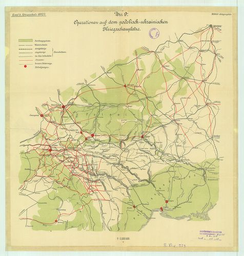
| Title | Operationen auf dem Polisch-Ukrainischen Kriegschauplatz. |
| Main title | A lengyel-ukrán hadszíntér. |
372. Operationen aus Nordost-Galizien nach Wolhgnien. [B XI c 340]
Institute and Museum of Military History •
B XI c
•
B XI Oroszország
•
B I–XV. Európa
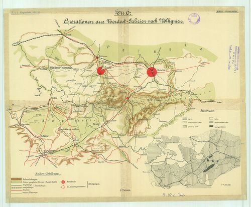
| Title | Operationen aus Nordost-Galizien nach Wolhgnien. |
| Main title | ÉK-Galicia és Volkinia katonaföldrajzi vázlata |
373. Europaischen Russland mit Angabe der Internierungsorte und D... [B XI c 343]
Institute and Museum of Military History •
B XI c
•
B XI Oroszország
•
B I–XV. Európa
| Title | Europaischen Russland mit Angabe der Internierungsorte und Durchzugsstationen der Kriegsgefangennen. |
| Main title | Az Európai Oroszország elosztótáborai település szerint. |
374. Asiatischen Rußland. [B XI c 345]
Institute and Museum of Military History •
B XI c
•
B XI Oroszország
•
B I–XV. Európa
| Title | Asiatischen Rußland. |
| Main title | Melléktérkép: Hadifogolytáborok és elosztóállomások Nyugat-Szibériában, Méretarány-érzékeltető térképrészlet: Monarchia/Deutsches Reich. Oroszország ázsiai része. |
375. Brest-Litowsk. Gürtelfestung und doppelter Brückenkopf. [B XI c 347]
Institute and Museum of Military History •
B XI c
•
B XI Oroszország
•
B I–XV. Európa
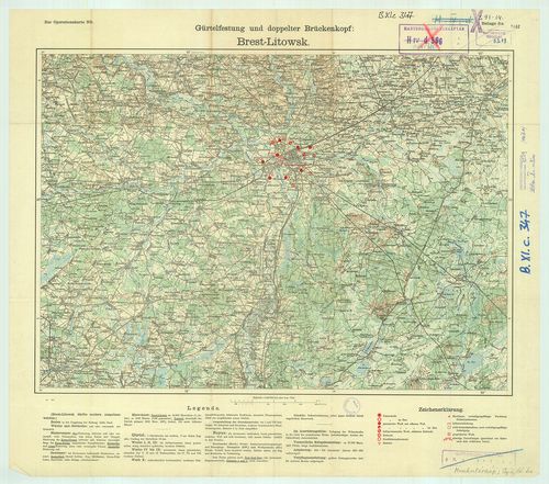
| Title | Brest-Litowsk. Gürtelfestung und doppelter Brückenkopf. |
| Main title | Breszt-Litowsk. Erődöv és kettős hídfő. |
376. Wolhynische Befestigungsgruppe. [B XI c 348]
Institute and Museum of Military History •
B XI c
•
B XI Oroszország
•
B I–XV. Európa
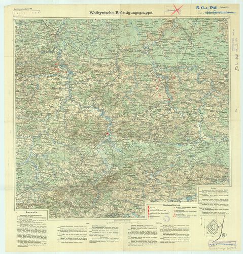
| Title | Wolhynische Befestigungsgruppe. |
| Main title | A Wolhynia-i erődcsoport. |
377. Befestigter Raum von Warschau. [B XI c 349]
Institute and Museum of Military History •
B XI c
•
B XI Oroszország
•
B I–XV. Európa
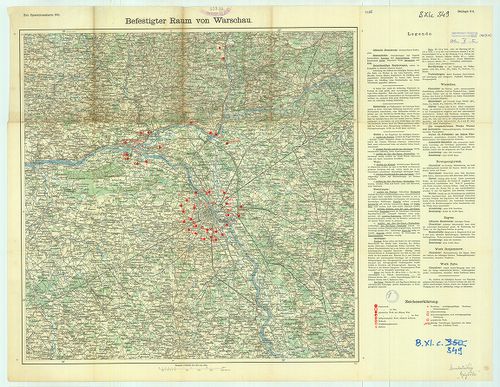
| Title | Befestigter Raum von Warschau. |
| Main title | Erődítések Varsó térségében. |
378. Kijew. Depotfestung. [B XI c 350]
Institute and Museum of Military History •
B XI c
•
B XI Oroszország
•
B I–XV. Európa
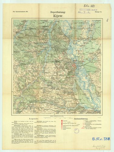
| Title | Kijew. Depotfestung. |
| Main title | Kijev. Raktárerőd. |
379. Iwangorod. Gürtelfestung und doppelter Brückenkopf. [B XI c 351]
Institute and Museum of Military History •
B XI c
•
B XI Oroszország
•
B I–XV. Európa
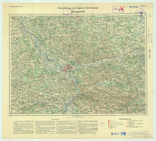
| Title | Iwangorod. Gürtelfestung und doppelter Brückenkopf. |
| Main title | Iwangorod. Erődöv és kettős hídfő. |
380. Provisorische Operationskarte. [B XI c 352]
Institute and Museum of Military History •
B XI c
•
B XI Oroszország
•
B I–XV. Európa
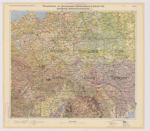
| Title | Provisorische Operationskarte. |
| Main title | 1. Warschau. 2. Brest-Litowsk. 3. Kijew. 4. Krakau. 5. Lemberg. 6. Berdyczew. |
| Subject | Oroszország és Lengyelország hadműveleti térképe, a városok körüli védelmi vonalak, erődítések jelölésével. Az áttekintő szelvényen a talajokat ábrázolják. |
381. Észak-keleti hadszíntér. [B XI c 353]
Institute and Museum of Military History •
B XI c
•
B XI Oroszország
•
B I–XV. Európa
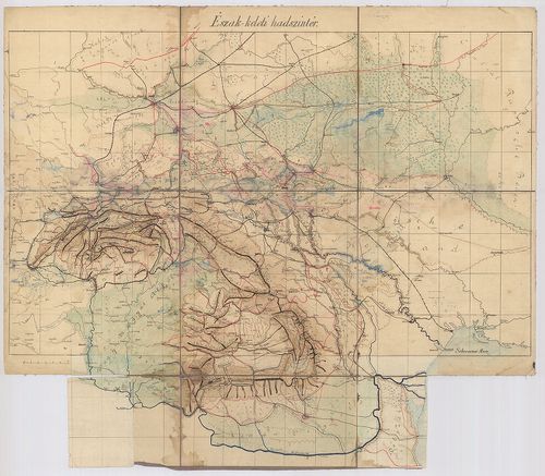
| Title | Észak-keleti hadszíntér. |