341. Südwestrussland. Flemmings Kriegskarte Nr. 41. [B XI c 276]
Institute and Museum of Military History •
B XI c
•
B XI Oroszország
•
B I–XV. Európa
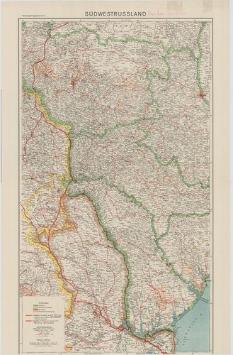
| Title | Südwestrussland. Flemmings Kriegskarte Nr. 41. |
| Main title | Oroszország DNy-i része |
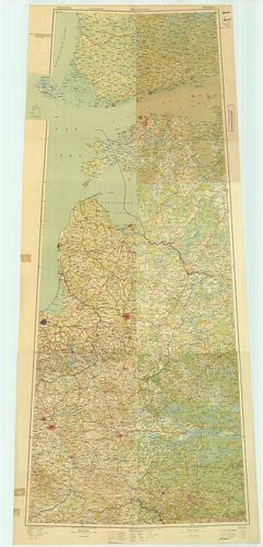
342. Westliches Russland mit den deutschen, österreichisch–ungari... [B XI c 277]
Institute and Museum of Military History •
B XI c
•
B XI Oroszország
•
B I–XV. Európa
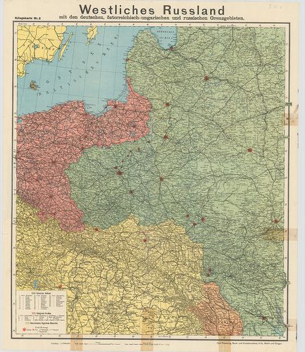
| Title | Westliches Russland mit den deutschen, österreichisch–ungarischen und russischen Grenzgebieten. Kriegskarte Nr. 2. |
| Main title | Oroszország Ny-i része az osztrák–magyar, német és orosz határvidék térképe. |
343. G. Freytags Karte von Sibirien. Mit Angabe der Krigsgefangen... [B XI c 278]
Institute and Museum of Military History •
B XI c
•
B XI Oroszország
•
B I–XV. Európa
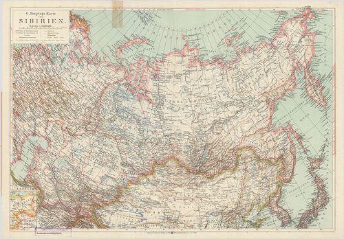
| Title | G. Freytags Karte von Sibirien. Mit Angabe der Krigsgefangenenlager. |
| Main title | Mt.: (Összehasonlító térképrészlet.) |
| Subject | A borítólap belső oldalán a hadifogolytáborok helynévmutatója, 1915. ápr. 20. helyzet. |
344. Két térképlap: I. G. Freytags Karte vom Asiatischen Russland... [B XI c 279]
Institute and Museum of Military History •
B XI c
•
B XI Oroszország
•
B I–XV. Európa
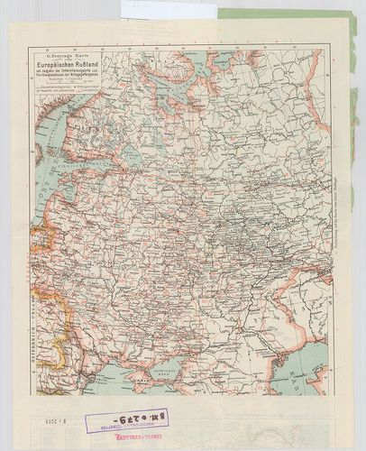
| Title | Két térképlap: I. G. Freytags Karte vom Asiatischen Russland … |
| Main title | II. G. Freytags Karte vom Europäischen Russland. … |
| Subject | Mt.: (Összehasonlító térképrészlet.) |
345. Die im Friedensvertrag von Brest-Litovsk Festgesetzte deutsc... [B XI c 280]
Institute and Museum of Military History •
B XI c
•
B XI Oroszország
•
B I–XV. Európa
| Title | Die im Friedensvertrag von Brest-Litovsk Festgesetzte deutsch–russische Grenze. |
| Main title | 1. Abo (Turku). 2. Helsingfors (Helsinki). 3. Königsberg (Kalinyingrad). 4. Wilna (Vilnius). 5. Warschau (Varsó). 6. Pinszk. |
| Subject | A brest–litovski békeszerződésben megállapított német–orosz határvidékének áttekintő térképe. Az új határ felülnyomásával Finnországtól–Galíciáig. |
346. Ravensteins Kriegskarte vom Gouvernement Kurland, Kowno, Wil... [B XI c 281]
Institute and Museum of Military History •
B XI c
•
B XI Oroszország
•
B I–XV. Európa
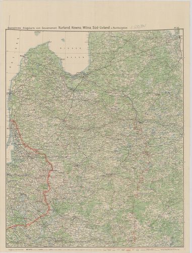
| Title | Ravensteins Kriegskarte vom Gouvernement Kurland, Kowno, Wilna, Süd-Livland u. Nachbargebiet. No. 30. |
| Main title | Az ÉK-Oroszország-i hadszíntér áttekintő térképe. Kurland (Kurzeme), Kowno (Kaunas), Wilna (Vilnius), Süd-Livland (Vidzeme). |
347. Ravensteins Kriegskarte Nr. 8. Polen, Südliche Hälfte gegen ... [B XI c 282]
Institute and Museum of Military History •
B XI c
•
B XI Oroszország
•
B I–XV. Európa
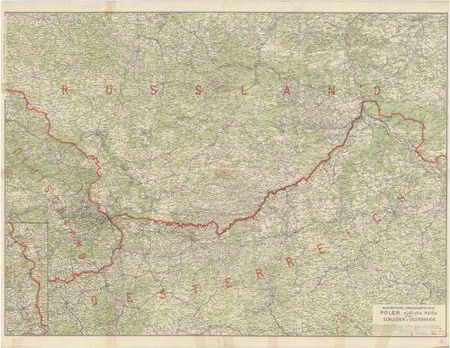
| Title | Ravensteins Kriegskarte Nr. 8. Polen, Südliche Hälfte gegen Schlesien u. Oesterreich. |
| Main title | A Dél-Lengyelország-i hadszíntér, a sziléziai és osztrák határterületek térképe. |
348. Übersichtskarte des nördlichen Kriegsschauplatzes mit den im... [B XI c 283]
Institute and Museum of Military History •
B XI c
•
B XI Oroszország
•
B I–XV. Európa
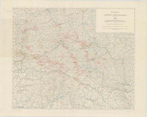
| Title | Übersichtskarte des nördlichen Kriegsschauplatzes mit den im Jahre 1914. stattgefundenen Schlachten und Gefechten der Österr.–ungar. Wehrmacht. |
| Main title | Az északi hadszíntér áttekintő térképe. |
349. K.[aiserliche] u.[nd] K.[önigliche] Militärverwaltung in den... [B XI c 284]
Institute and Museum of Military History •
B XI c
•
B XI Oroszország
•
B I–XV. Európa
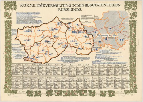
| Title | K.[aiserliche] u.[nd] K.[önigliche] Militärverwaltung in den besetzten Teilen Russlands. |
| Main title | Az oroszországi megszállott területek katonai közigazgatásának területi beosztása. |
350. K.[aiserliche] u.[nd] K.[önigliche] Militärverwaltung in den... [B XI c 285]
Institute and Museum of Military History •
B XI c
•
B XI Oroszország
•
B I–XV. Európa
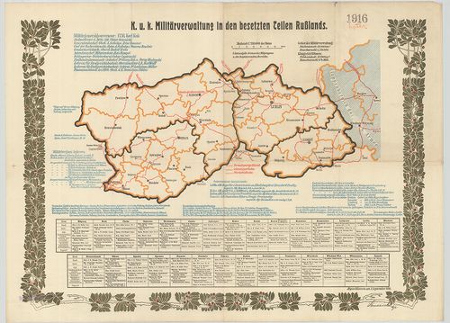
| Title | K.[aiserliche] u.[nd] K.[önigliche] Militärverwaltung in den besetzten Teilen Russlands. |
| Main title | Az oroszországi megszállott megszállott területek katonai közigazgatásának területi beosztása. |
351. K.[aiserliche] u.[nd] K.[önigliche] Militärverwaltung in den... [B XI c 286]
Institute and Museum of Military History •
B XI c
•
B XI Oroszország
•
B I–XV. Európa

| Title | K.[aiserliche] u.[nd] K.[önigliche] Militärverwaltung in den besetzten Teilen Russlands. |
| Main title | Az oroszországi megszállott területek katonai közigazgatásának területi beosztása. |
352. K.[aiserliche] u.[nd] K.[önigliche] Militärgeneralgouverneme... [B XI c 287]
Institute and Museum of Military History •
B XI c
•
B XI Oroszország
•
B I–XV. Európa
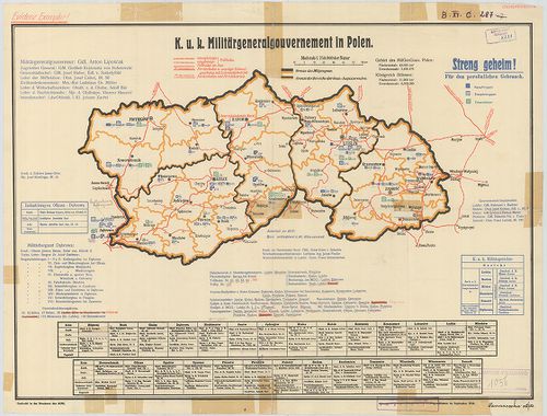
| Title | K.[aiserliche] u.[nd] K.[önigliche] Militärgeneralgouvernement in Polen. |
| Main title | A lengyelországi katonai főkormányzóság területi beosztása 1918-ban. |
353. K.[aiserliche] u.[nd] K.[önigliche] Militärgeneralgouverneme... [B XI c 288]
Institute and Museum of Military History •
B XI c
•
B XI Oroszország
•
B I–XV. Európa
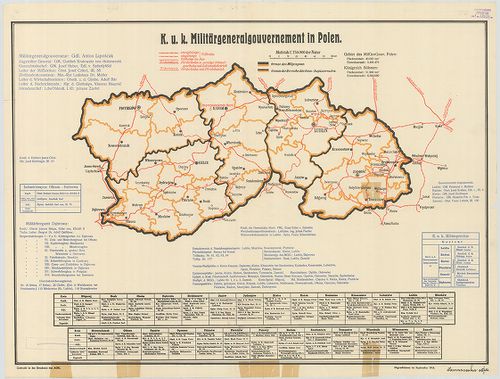
| Title | K.[aiserliche] u.[nd] K.[önigliche] Militärgeneralgouvernement in Polen. |
| Main title | A lengyelországi katonai főkormányzóság területi beosztása 1918-ban. |
354. Plan golodnoj sztyepi v gorizontaljah. Szamarkandszkaja obla... [B XI c 296]
Institute and Museum of Military History •
B XI c
•
B XI Oroszország
•
B I–XV. Európa
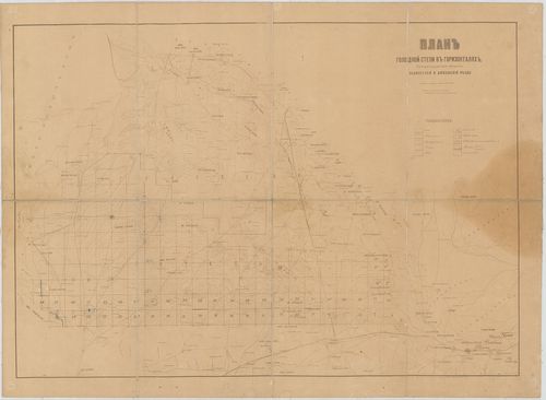
| Title | Plan golodnoj sztyepi v gorizontaljah. Szamarkandszkaja oblaszty. |
| Main title | A terméketlen területek térképe magasság szerint. Szamarkandi terület. |
355. Deutsche Weltkarte. Fliyerausgabe. [B XI c 298]
Institute and Museum of Military History •
B XI c
•
B XI Oroszország
•
B I–XV. Európa
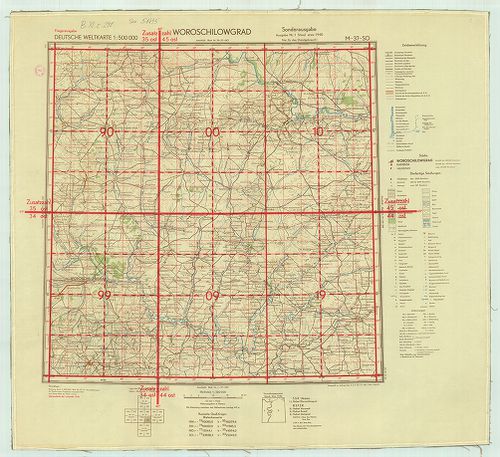
| Title | Deutsche Weltkarte. Fliyerausgabe. |
| Main title | Német repülő világtérképesorozat, 1:500 000 méretarányú. Kijew M–36–NW. Ssumy M–36–NO. Kirowgrad M–36–SW. Anepropetrousok M–36–30. Kursk: M–37–NW Woroschilowgrad M–37–SO. |
356. Lietuvos kalnuotumo ir nootakumo Zem e lapis. [B XI c 299]
Institute and Museum of Military History •
B XI c
•
B XI Oroszország
•
B I–XV. Európa
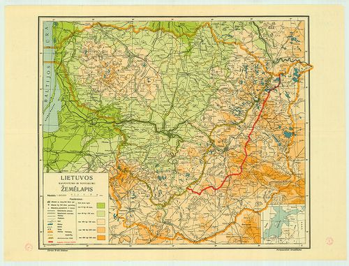
| Title | Lietuvos kalnuotumo ir nootakumo Zem e lapis. |
| Main title | Litvánia topográfiai térképe 1939-ből, közigazgatási beosztással. |
357. [Európai Oroszország.] [B XI c 300]
Institute and Museum of Military History •
B XI c
•
B XI Oroszország
•
B I–XV. Európa
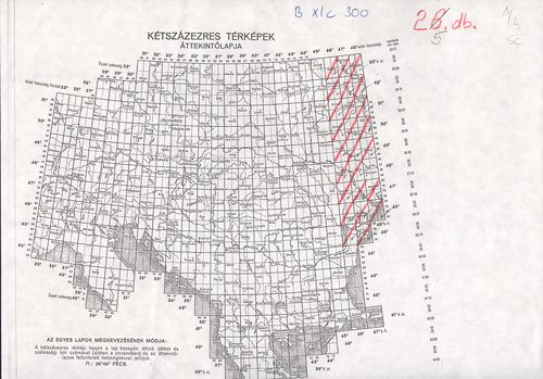
| Title | [Európai Oroszország.] |
| Main title | A német, osztrák–magyar csapatok előrenyomulása, a frontvonal helyzete az I. világháborúban. |
358. Friedensdislokation im europäischen Russland (Zentrales Gebi... [B XI c 301]
Institute and Museum of Military History •
B XI c
•
B XI Oroszország
•
B I–XV. Európa
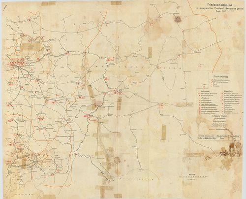
| Title | Friedensdislokation im europäischen Russland (Zentrales Gebiet) Ende 1912.. |
| Main title | A cári Oroszország európai központi részének diszlokációja békében. |
359. Königreich Pohlen samt den angräzenden Provinzen. [B XI c 302]
Institute and Museum of Military History •
B XI c
•
B XI Oroszország
•
B I–XV. Európa
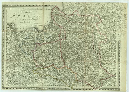
| Title | Königreich Pohlen samt den angräzenden Provinzen. |
| Main title | Lengyelország és a vele határos államok térképe. |
360. Baku. K–39. [B XI c 305]
Institute and Museum of Military History •
B XI c
•
B XI Oroszország
•
B I–XV. Európa
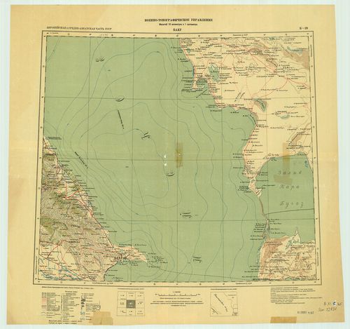
| Title | Baku. K–39. |
| Main title | Az 1:1 000 000 világtérkép Baku. K–39 szelvénye. |