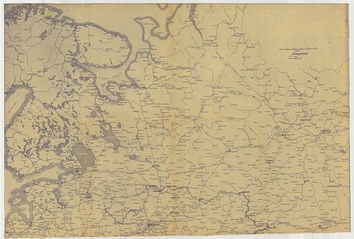
141. Übersichtskarte von Livland, Estland und St. Petersburg. 728... [B XI a 165]
Institute and Museum of Military History •
B XI a
•
B XI Oroszország
•
B I–XV. Európa
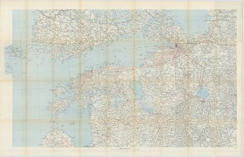
| Title | Übersichtskarte von Livland, Estland und St. Petersburg. 728/I. Lechners Kriegskarte XXVII. |
| Main title | Lettország, Észtország és Szentpétervár környékének áttekintő térképe. |
142. Carta topografica militare della Crimea. [B XI a 166]
Institute and Museum of Military History •
B XI a
•
B XI Oroszország
•
B I–XV. Európa
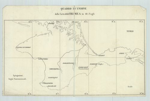
| Title | Carta topografica militare della Crimea. |
| Main title | A Krím-félsziget katonai topográfiai térképe 1855-ben. |
143. Karte der Russischen Ostsee-Provinzen. Nr. I–II. [B XI a 167]
Institute and Museum of Military History •
B XI a
•
B XI Oroszország
•
B I–XV. Európa

| Title | Karte der Russischen Ostsee-Provinzen. Nr. I–II. |
| Main title | Oroszország, a Keleti-tenger tartományai 19. század közepén a főbb közlekedési utak feltüntetésével. |
144. Magni Ducatus Litvaniae in svos Palatinatus et Districtus Di... [B XI a 168]
Institute and Museum of Military History •
B XI a
•
B XI Oroszország
•
B I–XV. Európa
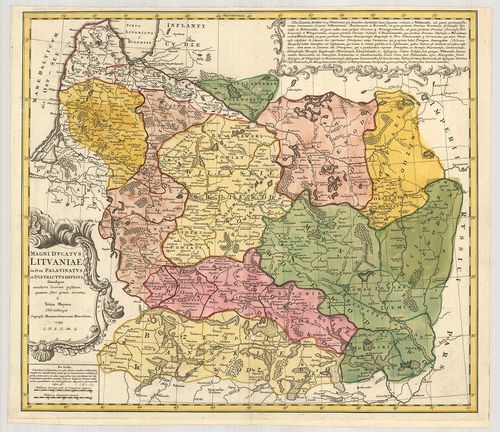
| Title | Magni Ducatus Litvaniae in svos Palatinatus et Districtus Divisus … |
| Main title | Litvánia térképe 1749-ben a tartományi beosztások feltüntetésével. |
145. Generaljnaja Karta Vilenszkoj Gubernii. – Mappa Generalna Gu... [B XI a 169]
Institute and Museum of Military History •
B XI a
•
B XI Oroszország
•
B I–XV. Európa
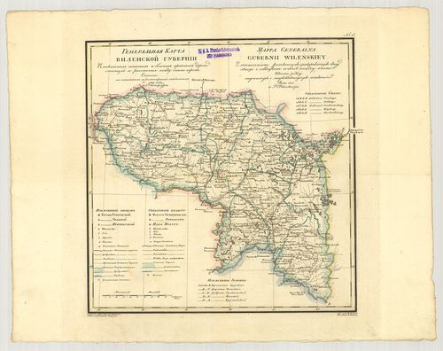
| Title | Generaljnaja Karta Vilenszkoj Gubernii. – Mappa Generalna Gubernii Wileńskiey. |
| Main title | A Vilnius-i Kormányzóság általános térképe 1820-ban. |
146. Lietuvos Keliu žemelapis su atstumais. [B XI a 170]
Institute and Museum of Military History •
B XI a
•
B XI Oroszország
•
B I–XV. Európa
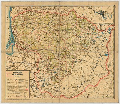
| Title | Lietuvos Keliu žemelapis su atstumais. |
| Main title | Mt.: Kaunas. |
| Subject | Litvánia földrajzi térképe 1929-ben a vasúthálózat feltüntetésével. |
147. Generaljnaja Karta Volünszkoj Gubernii. – Mappa Generalna Gu... [B XI a 171]
Institute and Museum of Military History •
B XI a
•
B XI Oroszország
•
B I–XV. Európa
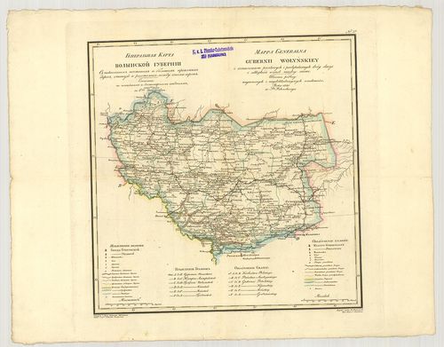
| Title | Generaljnaja Karta Volünszkoj Gubernii. – Mappa Generalna Gubernii Wołyńskiey. Nr. 3. |
| Main title | A Volinszki (Novograd-Volinszki) Kormányzóság általános térképe 1820-ban. |
148. Nova totius Livoniae accurata descriptio. [B XI a 172]
Institute and Museum of Military History •
B XI a
•
B XI Oroszország
•
B I–XV. Európa
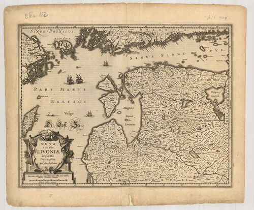
| Title | Nova totius Livoniae accurata descriptio. |
| Main title | Livonia, Lettország térképe 1636-ban. |
149. Karta Volünszkoj Gubernii. [B XI a 173]
Institute and Museum of Military History •
B XI a
•
B XI Oroszország
•
B I–XV. Európa
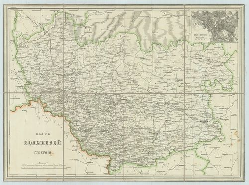
| Title | Karta Volünszkoj Gubernii. |
| Main title | Mt.: Plan G. Zsitomira (Zsitomir). |
| Subject | A Volinszki (Novorgrad-Volinszki) Kormányzóság térképe. |
150. Mapa Królestwa Polskiego. [B XI a 174]
Institute and Museum of Military History •
B XI a
•
B XI Oroszország
•
B I–XV. Európa
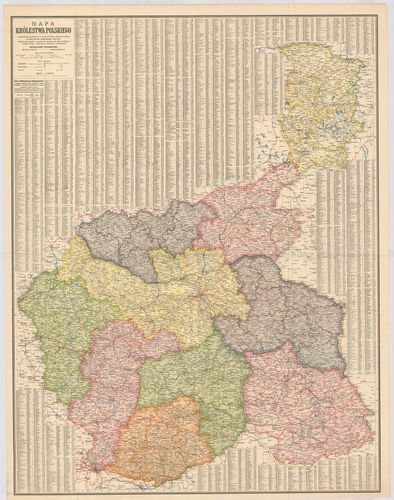
| Title | Mapa Królestwa Polskiego. |
| Main title | A Lengyel Királyság általános térképe az 1900-as évek elején. |
151. Union of Soviet Socialist Republies… [B XI a 175/2]
Institute and Museum of Military History •
B XI a
•
B XI Oroszország
•
B I–XV. Európa
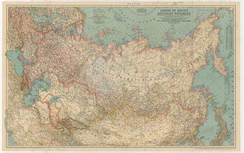
| Title | Union of Soviet Socialist Republies… |
| Main title | A Szovjetunió nemzetközi határai (piros vonal) 1938. január 1-jén. A „National Geographic Magazin” melléklete. |
152. SzSzSzR. Politiko-adminisztrativnaja karta. [B XI a 185]
Institute and Museum of Military History •
B XI a
•
B XI Oroszország
•
B I–XV. Európa
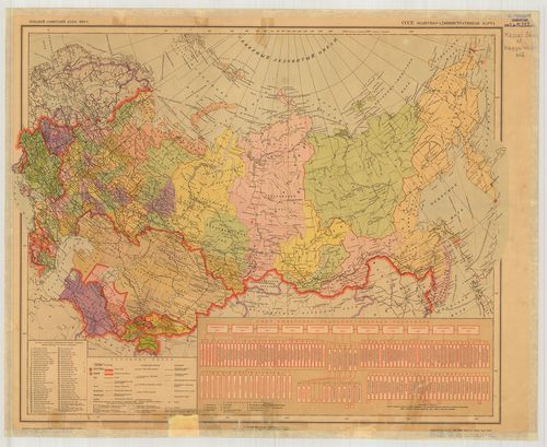
| Title | SzSzSzR. Politiko-adminisztrativnaja karta. |
| Main title | A Szovjetunió politikai és közigazgatási térképe 1939-ben. |
153. Európai Oroszország, [B XI a 186]
Institute and Museum of Military History •
B XI a
•
B XI Oroszország
•
B I–XV. Európa
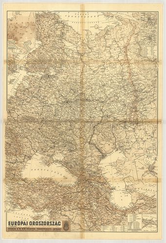
| Title | Európai Oroszország, |
| Main title | 4 mt.: 1. [Baku] 2. [Moszkva]. 3. [Leningrád]. 4. Népsűrűség és Nemzetiségek. |
154. [A Szovjetunió európai részének térképe 1939 végén.] [B XI a 187]
Institute and Museum of Military History •
B XI a
•
B XI Oroszország
•
B I–XV. Európa
| Title | [A Szovjetunió európai részének térképe 1939 végén.] |
155. Ukraine: Übersichtskarte. [B XI a 188]
Institute and Museum of Military History •
B XI a
•
B XI Oroszország
•
B I–XV. Európa
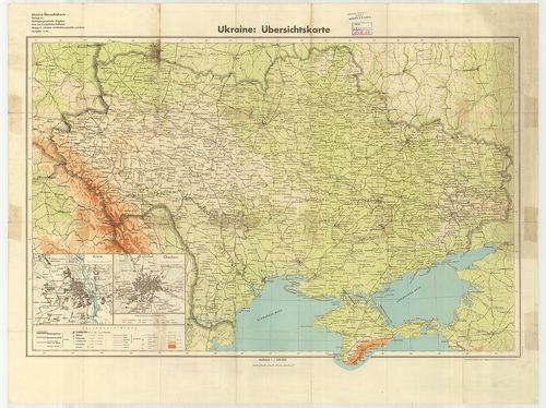
| Title | Ukraine: Übersichtskarte. |
| Main title | 2 mt.: 1. Kiew. (Kijev) 2. Charkow (Harkov.) |
| Subject | Ukrajna áttekintő térképe az 1941-ben. |
156. Das Europäische Russland. [B XI a 189]
Institute and Museum of Military History •
B XI a
•
B XI Oroszország
•
B I–XV. Európa
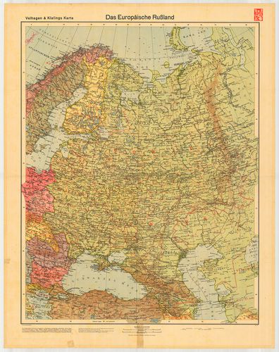
| Title | Das Europäische Russland. |
| Main title | Az Európai Oroszország térképe 1942-ben. |
157. USSR and adjacent countries. [B XI a 190]
Institute and Museum of Military History •
B XI a
•
B XI Oroszország
•
B I–XV. Európa
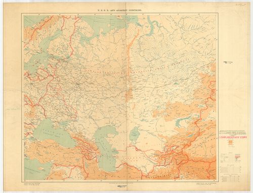
| Title | USSR and adjacent countries. |
| Main title | Geographical Section, General Staff, No. 3953. |
| Subject | A Szovjetunió és a szomszédos országok 1935-ben. |
158. Politiko-adminisztrativnaja karta SzSzSzR. [B XI a 193]
Institute and Museum of Military History •
B XI a
•
B XI Oroszország
•
B I–XV. Európa
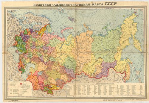
| Title | Politiko-adminisztrativnaja karta SzSzSzR. |
| Main title | A Szovjetunió politikai és közigazgatási térképe 1941-ben. |
159. Kirovszkaja oblaszt. Adminisztrativnaja karta. [B XI a 194]
Institute and Museum of Military History •
B XI a
•
B XI Oroszország
•
B I–XV. Európa
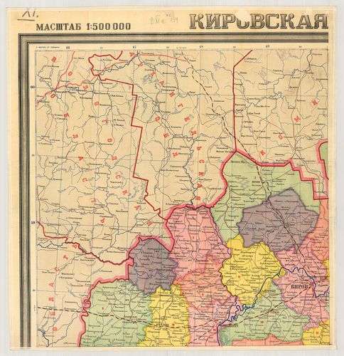
| Title | Kirovszkaja oblaszt. Adminisztrativnaja karta. |
| Main title | A Kirovi terület közigazgatási térképe 1940-ben. |
160. A Szovjetunió. Karta SzSzSzR. [B XI a 197]
Institute and Museum of Military History •
B XI a
•
B XI Oroszország
•
B I–XV. Európa
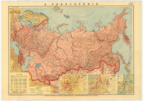
| Title | A Szovjetunió. Karta SzSzSzR. |
| Main title | 4 mt.: 1. Sztálin szülőföldje. 2. Moszkva forradalmi eseményei 1917. X. 25.–XI. 2-ig. 3. Petrográd (Leningrád) forradalmi eseményei 1917. X. 25-én. 4. A Kara-Kum sivatag megtermékenyítése (Davidov szerint.) |