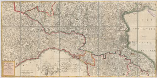
201. Gea-Karte von Oberitalien und den Nachbargebieten. [B VII c 129]
Institute and Museum of Military History •
B VII c
•
B VII Olaszország
•
B I–XV. Európa

| Title | Gea-Karte von Oberitalien und den Nachbargebieten. |
| Main title | Felső-Olaszország a szomszédos országokkal 1910 körül úthálózattal. |
202. Olasz–francia határvidék. [B VII c 140]
Institute and Museum of Military History •
B VII c
•
B VII Olaszország
•
B I–XV. Európa

| Title | Olasz–francia határvidék. |
203. Italienisch-österreichisches Grenzgebiet. Flemmings Kriegska... [B VII c 141]
Institute and Museum of Military History •
B VII c
•
B VII Olaszország
•
B I–XV. Európa

| Title | Italienisch-österreichisches Grenzgebiet. Flemmings Kriegskarte No. 21. |
| Main title | Az olasz–osztrák határvidék. |
204. Nuova Carta del teatro della guerra in Italia. [B VII c 176]
Institute and Museum of Military History •
B VII c
•
B VII Olaszország
•
B I–XV. Európa
| Title | Nuova Carta del teatro della guerra in Italia. |
| Main title | Észak-Olaszországi hadszíntér térképe 1813-ban. |
205. Carta delle Stazioni militari i Italia. [B VII c 179]
Institute and Museum of Military History •
B VII c
•
B VII Olaszország
•
B I–XV. Európa
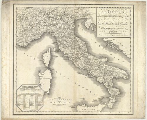
| Title | Carta delle Stazioni militari i Italia. |
| Main title | Olaszország katonai állomáshelyeinek térképe 1804-ben. |
206. Circoscrizione militare territoriale del Regno d’Italia. [B VII c 191]
Institute and Museum of Military History •
B VII c
•
B VII Olaszország
•
B I–XV. Európa

| Title | Circoscrizione militare territoriale del Regno d’Italia. |
| Main title | Az Olasz Királyság katonai körzeti beosztása 1877 márciusában. |
207. Carta dimostrativa delle circoscrizioni militari del regno D... [B VII c 192]
Institute and Museum of Military History •
B VII c
•
B VII Olaszország
•
B I–XV. Európa

| Title | Carta dimostrativa delle circoscrizioni militari del regno D’Italia. |
| Main title | Az Olasz Királyság katonai körzeti beosztása 1879-ben. |
208. Carta delle circoscrizioni militari del Regno d’Italia… [B VII c 193]
Institute and Museum of Military History •
B VII c
•
B VII Olaszország
•
B I–XV. Európa
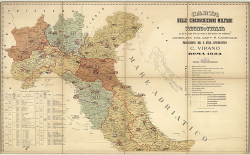
| Title | Carta delle circoscrizioni militari del Regno d’Italia… |
| Main title | Az Olasz Királyság katonai körzeteinek térképe 1883-ban. |
209. Carte de la Lombardie et de la Province de Novare (Piémont) ... [B VII c 195]
Institute and Museum of Military History •
B VII c
•
B VII Olaszország
•
B I–XV. Európa
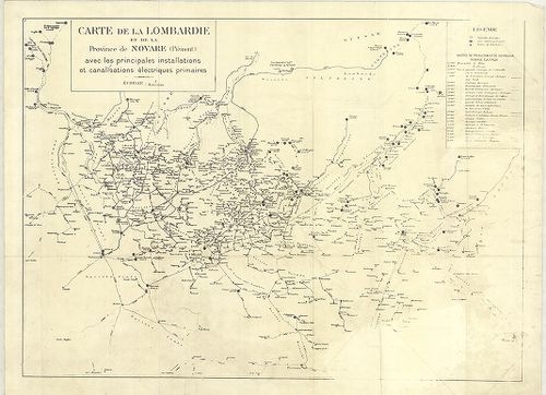
| Title | Carte de la Lombardie et de la Province de Novare (Piémont) avec les principales installations et canalisations électriques primaires. |
| Main title | Lombardia és Novara (Piemonte) tartomány elektromos vezetékhálózata 1930 körül. |
210. Dislocations-Karte der Italienischen Armee… im Frieden und i... [B VII c 196]
Institute and Museum of Military History •
B VII c
•
B VII Olaszország
•
B I–XV. Európa
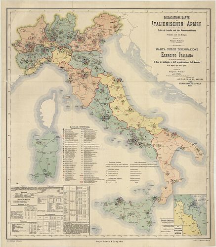
| Title | Dislocations-Karte der Italienischen Armee… im Frieden und im Kriege. – Karta delle dislocazioni dell’ Esercito Italiano … sia in tempo di pace che di guerra. |
| Main title | Mt.: Die Italienischen Besitzungen in Afrika (Massaua: olasz telepek Afrikában). |
| Subject | Az olasz hadsereg diszlokációs térképe háborúban és békében 1891-ben. |
211. Italien. Friedens-Dislocation der Italienischen Armee 1893. [B VII c 196/1]
Institute and Museum of Military History •
B VII c
•
B VII Olaszország
•
B I–XV. Európa
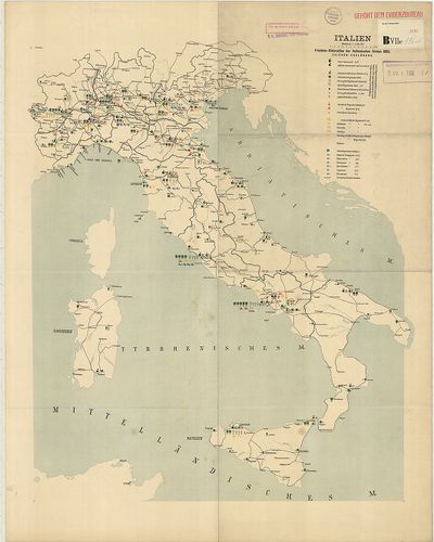
| Title | Italien. Friedens-Dislocation der Italienischen Armee 1893. |
| Main title | Olaszország: az olasz hadsereg békeidőbeli diszlokációs térképe 1893-ban. |
212. Dislokation der italienischen Gebirgstruppen im Sommer 1909. [B VII c 196/4]
Institute and Museum of Military History •
B VII c
•
B VII Olaszország
•
B I–XV. Európa
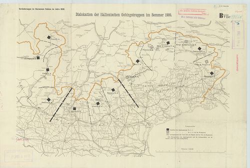
| Title | Dislokation der italienischen Gebirgstruppen im Sommer 1909. |
| Main title | Észak-Olaszország: a hegyi alakulatok diszlokációs térképe 1909 nyarán. |
213. Friedensdislokation der italienischen Armee. Frühjahr 1912. [B VII c 196/5]
Institute and Museum of Military History •
B VII c
•
B VII Olaszország
•
B I–XV. Európa
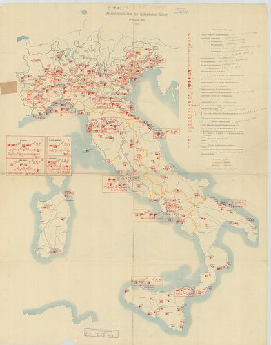
| Title | Friedensdislokation der italienischen Armee. Frühjahr 1912. |
| Main title | Olaszország: az olasz hadsereg békebeli elhelyezésének térképe 1912. tavaszán. |
214. Diocesi Padovana con tutta la sua estensione ne vicini terri... [B VII c 197]
Institute and Museum of Military History •
B VII c
•
B VII Olaszország
•
B I–XV. Európa

| Title | Diocesi Padovana con tutta la sua estensione ne vicini territori. |
| Main title | A Padovai egyházmegye és a szomszédos területek egy részének térképe 1720-ban. |
215. Carta della diocesi di Milano. Divisa in Regioni e Pievi. [B VII c 197/1]
Institute and Museum of Military History •
B VII c
•
B VII Olaszország
•
B I–XV. Európa
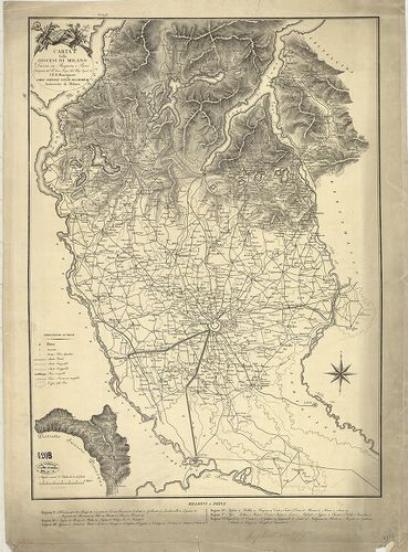
| Title | Carta della diocesi di Milano. Divisa in Regioni e Pievi. |
| Main title | A Milánói egyházmegye térképe 1800 körül. |
216. Rivista Mensile del Touring Club Italiano. Carta della guerr... [B VII c 198]
Institute and Museum of Military History •
B VII c
•
B VII Olaszország
•
B I–XV. Európa
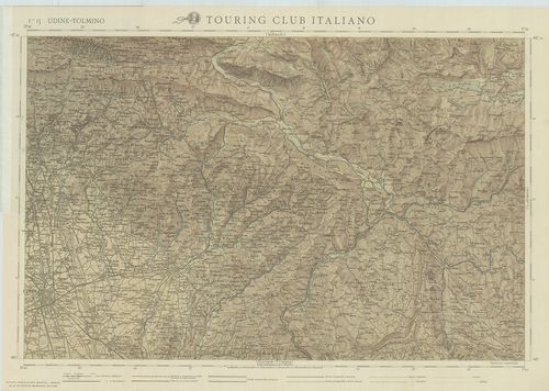
| Title | Rivista Mensile del Touring Club Italiano. Carta della guerra. Febbraio 1917. |
| Main title | F. 15. Udine-Tolmino. F. 16. Lubiana. F. 19. Gorozia-Trieste. F. 20. Adelsberg (Postojna). |
| Subject | Olaszország úthálózati térképe 1917-ben. |
217. Carte générale d’Italie pour servir á l’intelligence des opé... [B VII c 199]
Institute and Museum of Military History •
B VII c
•
B VII Olaszország
•
B I–XV. Európa
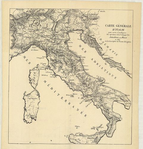
| Title | Carte générale d’Italie pour servir á l’intelligence des opérations de la Campagne des Autrichiens contre Murat en 1815 et á la description du Théatre de la guerre. |
| Main title | Olaszországi általános térképe úthálózattal, és az 1815. évi osztrák csapatok és Murat nápolyi király között lezajlott csata színhelye. |
218. Tirol u[nd] Oberitalien. Ravensteins Kriegskarte. Nr. 45. [B VII c 200]
Institute and Museum of Military History •
B VII c
•
B VII Olaszország
•
B I–XV. Európa
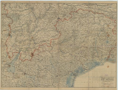
| Title | Tirol u[nd] Oberitalien. Ravensteins Kriegskarte. Nr. 45. |
| Main title | Tirol és Felső-Olaszország általános térképe 1910 körül, úthálózattal. |
219. Italienisch-Oesterreichischer Kriegsschauplatz. Flemmings Kr... [B VII c 200/1]
Institute and Museum of Military History •
B VII c
•
B VII Olaszország
•
B I–XV. Európa
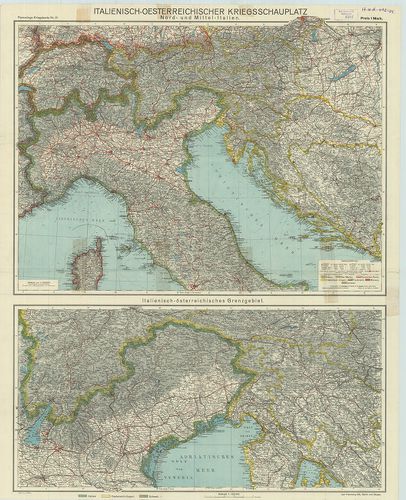
| Title | Italienisch-Oesterreichischer Kriegsschauplatz. Flemmings Kriegskarte Nr. 21. 2 térk. egy lapon: 1. Nord- und Mittel-Italien. |
| Main title | (Észak- és Közép-Olaszország.) 2. Italienisch-österreichisches Grenzgebiet. |
| Subject | Olasz–osztrák határvidék.) |
220. Operationskarte von Oberitalien zum Feldzuge 1866. [B VII c 201]
Institute and Museum of Military History •
B VII c
•
B VII Olaszország
•
B I–XV. Európa
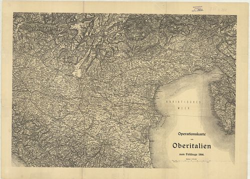
| Title | Operationskarte von Oberitalien zum Feldzuge 1866. |
| Main title | Felső-Olaszország hadműveleti térképe az 1866. évi hadjárathoz. |
221. Hadműveleti térkép Felső-Olaszországról az 1866. évi hadjára... [B VII c 201/1]
Institute and Museum of Military History •
B VII c
•
B VII Olaszország
•
B I–XV. Európa
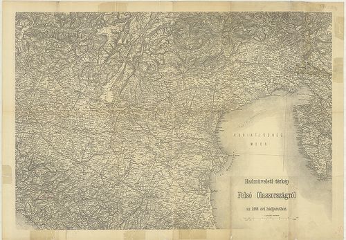
| Title | Hadműveleti térkép Felső-Olaszországról az 1866. évi hadjárathoz. |
222. G. Freytags Karte der Isonzofront. – Tiroler, Kärntner und I... [B VII c 202]
Institute and Museum of Military History •
B VII c
•
B VII Olaszország
•
B I–XV. Európa
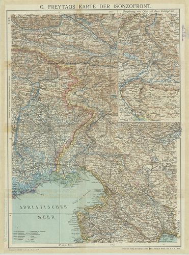
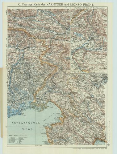
| Title | G. Freytags Karte der Isonzofront. – Tiroler, Kärntner und Isonzo-Front. |
| Main title | Mt.: Umgebung von Görz mit dem Karstgebiet (Gorizia környéke a Karszt vidékkel). |
| Subject | Karintiai és az Isonzo front térképe 1916 körül. |
223. G. Freytags Karte des Italienischen Kriegsschauplatzes. [B VII c 202/1]
Institute and Museum of Military History •
B VII c
•
B VII Olaszország
•
B I–XV. Európa
| Title | G. Freytags Karte des Italienischen Kriegsschauplatzes. |
| Main title | Az olasz hadszíntér térképe. |
224. G. Freytags Karte der Tiroler Front. [B VII c 202/2]
Institute and Museum of Military History •
B VII c
•
B VII Olaszország
•
B I–XV. Európa
| Title | G. Freytags Karte der Tiroler Front. |
| Main title | Olaszország: a tiroli hadszíntér térképe 1916 körül. |
225. Neue Generalkarte des südwestlichen Kriegsschauplatzes. West... [B VII c 203]
Institute and Museum of Military History •
B VII c
•
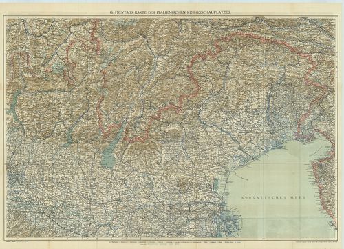
B VII Olaszország
•
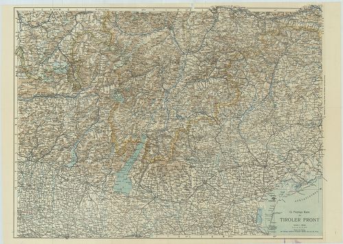
B I–XV. Európa
| Title | Neue Generalkarte des südwestlichen Kriegsschauplatzes. Westliches Blatt. (Tiroler-Front). Lechners Kriegskarten XVIII. |
| Main title | A délnyugati hadszíntér - tiroli hadszíntér - térképe 1916–17-ben. |
226. Neu Generalkarte des südwestlichen Kriegsschauplatzes. Östli... [B VII c 203/1]
Institute and Museum of Military History •
B VII c
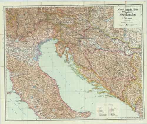
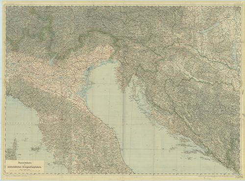
•
B VII Olaszország
•
B I–XV. Európa
| Title | Neu Generalkarte des südwestlichen Kriegsschauplatzes. Östliches Blatt. (Isonzo-Front.) Lechners Kriegskarten XIX. |
| Main title | A Délnyugati hadszíntér - Isonzo-front térképe 1916–17-ben. |
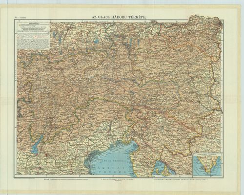
227. Az olasz háború térképe. [B VII c 203/2]
Institute and Museum of Military History •
B VII c
•
B VII Olaszország
•
B I–XV. Európa
| Title | Az olasz háború térképe. |
228. Italienischer Kriegsschauplatz. [B VII c 205]
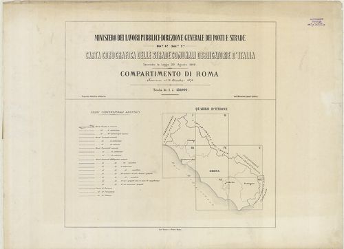
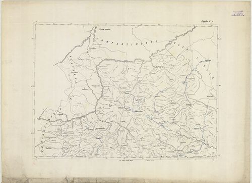
Institute and Museum of Military History •
B VII c
•
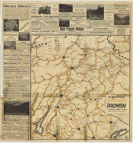
B VII Olaszország
•
B I–XV. Európa
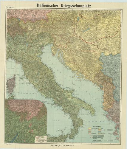
| Title | Italienischer Kriegsschauplatz. |
| Main title | Mt.: Sprachenkarte von Südtirol (Dél-Tirol nyelvjárásai). |
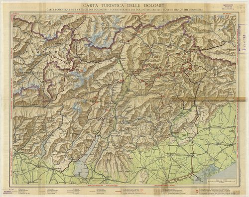
| Subject | Az olasz hadszíntér térképe 1917 körül. |
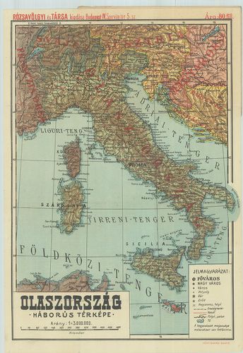
229. Olaszország háborús térképe. Rózsavölgyi térképek. 9. [B VII c 206]
Institute and Museum of Military History •
B VII c
•
B VII Olaszország
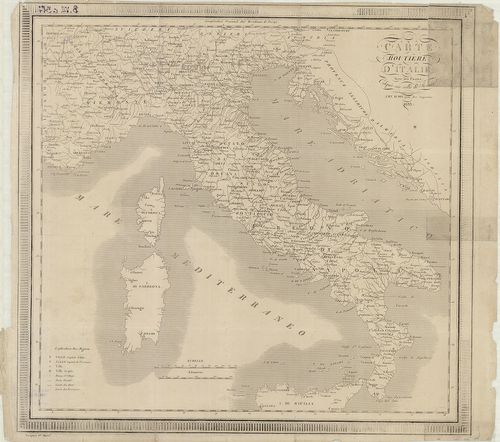
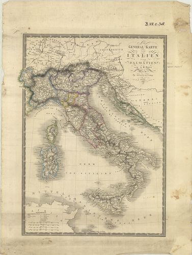
•
B I–XV. Európa
| Title | Olaszország háborús térképe. Rózsavölgyi térképek. 9. |
230. Lechner’s Übersichtskarte des südwestlichen Kriegsschauplatz... [B VII c 207]
Institute and Museum of Military History •
B VII c
•
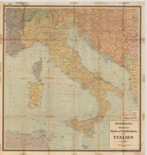
B VII Olaszország
•
B I–XV. Európa
| Title | Lechner’s Übersichtskarte des südwestlichen Kriegsschauplatzes. – Lechners Kriegskarte XI. |
| Main title | A délnyugati hadszíntér áttekintő térképe 1915-ben. |
231. G. Freytag Karte der Kärntner und Isonzo-Front. – Karte der ... [B VII c 208]
Institute and Museum of Military History •
B VII c
•
B VII Olaszország
•
B I–XV. Európa
| Title | G. Freytag Karte der Kärntner und Isonzo-Front. – Karte der Isonzo-Front. |
| Main title | Mt.: Umgebung von Görz mit dem Karstgebiet. (Gorizia és a Karszt-vidék térképe.)Az Isonzo-front és Karintia térképe úthálózattal 1917 körül. |
232. Übersichtskarte des südwestlichen Kriegsschauplatzes. – Über... [B VII c 209]
Institute and Museum of Military History •
B VII c
•
B VII Olaszország
•
B I–XV. Európa
| Title | Übersichtskarte des südwestlichen Kriegsschauplatzes. – Übersichtskarte der österreich–italienischen Grenzgebiete. Lechners Kriegskarten X. |
| Main title | A délnyugati hadszíntér – osztrák–olasz határvidék - térképe 1915-ben. |
233. G. Freytags Karte des Österreichisch–Italienischen Grenzgebi... [B VII c 209/1]
Institute and Museum of Military History •
B VII c
•
B VII Olaszország
•
B I–XV. Európa
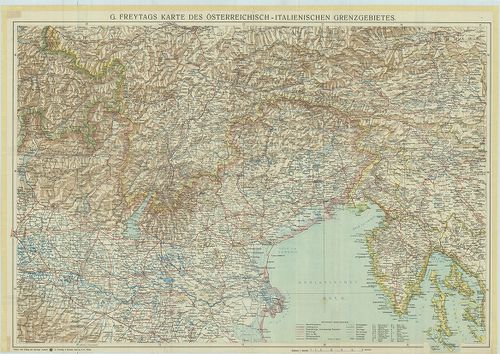
| Title | G. Freytags Karte des Österreichisch–Italienischen Grenzgebietes. |
| Main title | Az osztrák–olasz határvidék térképe 1917 körül. |
234. Ravensteins Kriegskarte. 1. No. 16. – Süd-Tirol („Trentin”) ... [B VII c 226]
Institute and Museum of Military History •
B VII c
•
B VII Olaszország
•
B I–XV. Európa
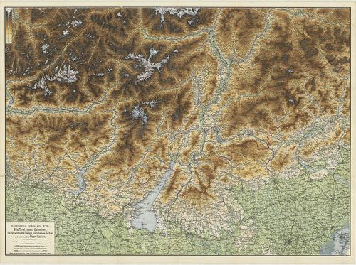
| Title | Ravensteins Kriegskarte. 1. No. 16. – Süd-Tirol („Trentin”) Dolomiten, Lombardische Berge, Gardasee-Gebiet und Angrenzendes Ober-Italien. 2. No. 17. Oestl. Dolomiten, Karnische- u. Julische Alpen, Gönz, Küstenland, Friaul und oberitalienische Venezianische Ebene. |
| Main title | Dél-Tirol, Dolomitok, Garda-tó, Felső-Olaszországi határvidék, K.-Dolomitok, Karni-Juliai Alpok, Görz, Tengermellék Frianli és Felső-Olaszország-i Velencei-síkság térképe 1880 körül. |
235. La Sicilia. – Sicilia preistorica. [B VII c 233]
Institute and Museum of Military History •
B VII c
•
B VII Olaszország
•
B I–XV. Európa
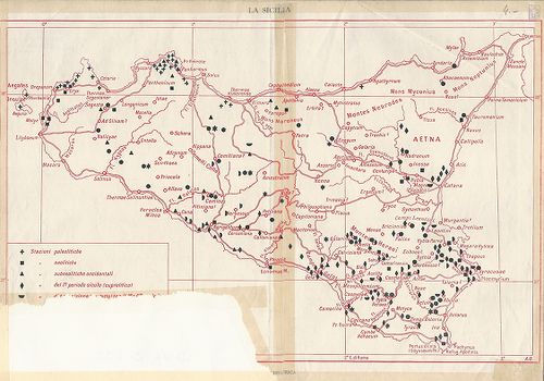
| Title | La Sicilia. – Sicilia preistorica. |
| Main title | Szicília őskori térképe. |
236. Carta ferroviaria d’Italia e linee di navigazione. [B VII c 234]
Institute and Museum of Military History •
B VII c
•
B VII Olaszország
•
B I–XV. Európa
| Title | Carta ferroviaria d’Italia e linee di navigazione. |
| Main title | 1. Firenze. 2. Trieste e dintorni. [Trieszt környéke.] 3. Genova. 4. Napoli (Nápoly) 5. Roma e dintorni. [Róma környéke.] 6. Milano. 7. Milano-laghi e linee affluenti (Milanó környéki tavak és mellékfolyók.] 8. Torino. |
| Subject | Carta ferroviaria dell’ Europa. [Európa vasútvonalainak térképe.] |
237. [Olaszország repülőtérkép.] [B VII c 239]
Institute and Museum of Military History •
B VII c
•
B VII Olaszország
•
B I–XV. Európa
| Title | [Olaszország repülőtérkép.] |
| Main title | Mt.: [A svájci–olasz határvidék.] |
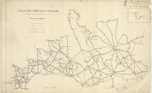
238. Livellazione geometrica di precisione. [B VII c 240]
Institute and Museum of Military History •
B VII c
•
B VII Olaszország
•
B I–XV. Európa
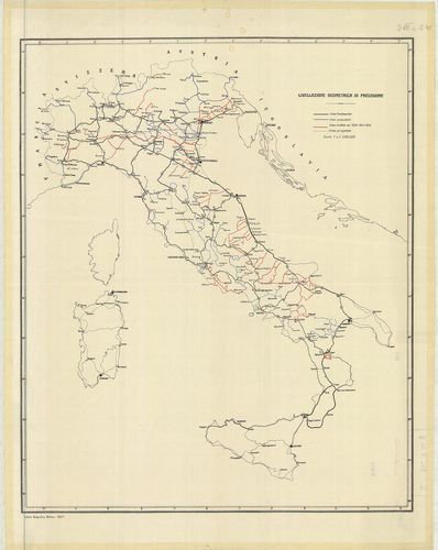
| Title | Livellazione geometrica di precisione. |
| Main title | Olaszország: felsőrendű szintezési vonalak 1924–26-ban. |
239. Livellazione geometrica di precisione. [B VII c 242]
Institute and Museum of Military History •
B VII c
•
B VII Olaszország
•
B I–XV. Európa
| Title | Livellazione geometrica di precisione. |
| Main title | Mt.: Linea Palazzolo–Chiari–Coccaglio. (Szintezési vonal.) |
| Subject | Felső-Olaszország: Torino és Miláno környékének felsőrendű szintezési vonalai 1930 körül. |
240. [Olaszország pontos geodéziai meghatározása 1900 szeptemberb... [B VII c 243]
Institute and Museum of Military History •
B VII c
•
B VII Olaszország
•
B I–XV. Európa
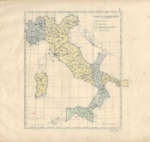
| Title | [Olaszország pontos geodéziai meghatározása 1900 szeptemberben.] |
| Main title | I. Lavori di triangulazione. (Háromszögelési hálózat.) II. Livellazione geometrica di precisione. (Felsőrendű szintezési vonalak.) III. Lavori astronomico-geodetici. (Csillagászati alappontok.) |
241. Rete geodetica Italiana. [B VII c 244]
Institute and Museum of Military History •
B VII c
•
B VII Olaszország
•
B I–XV. Európa
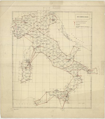
| Title | Rete geodetica Italiana. |
| Main title | Olaszország geodéziai meghatározása 1922-ben. |
242. Carta corografica delle strade comunali obbligatorie d’Itali... [B VII c 245]
Institute and Museum of Military History •
B VII c
•
B VII Olaszország
•
B I–XV. Európa

| Title | Carta corografica delle strade comunali obbligatorie d’Italia. Secondo la legge 30 Agosto 1868. Compartimento di Sardegna. Situazione al 1°. Gennaio 1874. |
| Main title | Az 1868-i törvény alapján megállapított közutak térképe.Szardinia úthálózatának térképe 1874-ben. |
243. Carta Corografica delle strade comunali obbligatorie d’Itali... [B VII c 247]
Institute and Museum of Military History •
B VII c
•
B VII Olaszország
•
B I–XV. Európa
| Title | Carta Corografica delle strade comunali obbligatorie d’Italia. Secondo la Legge 30 Agosto 1868. Compartimento di Sicilia. Situazione al 1° Gennaio 1874. |
| Main title | Az 1868-i törvény alapján megállapított közutak térképe.Szicília úthálózatának térképe 1874-ben. |
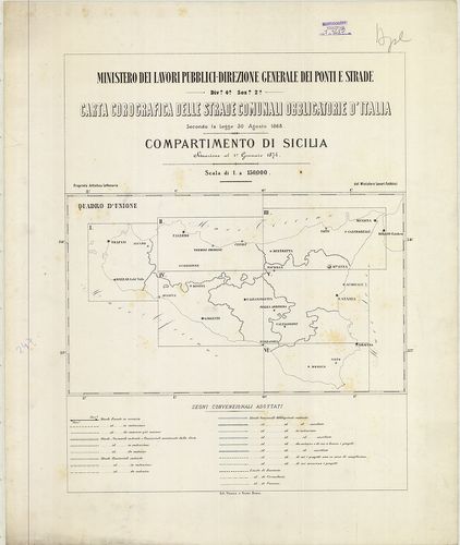
244. Carta corografica delle strade comunali obbligatorie d’Itali... [B VII c 248]
Institute and Museum of Military History •
B VII c
•
B VII Olaszország
•
B I–XV. Európa

| Title | Carta corografica delle strade comunali obbligatorie d’Italia. Secondo la Legge 30 Agosto 1868. Compartimento delle Puglie. Situazione al 31 Dicember 1876. |
| Main title | Az 1868-i törvény alapján megállapított közutak térképe.Puglia tartomány úthálózatának térképe 1876-ban. |
245. Carta corografica delle strade comunali obbligatorie d’Itali... [B VII c 249]
Institute and Museum of Military History •
B VII c
•
B VII Olaszország
•
B I–XV. Európa
| Title | Carta corografica delle strade comunali obbligatorie d’Italia. Secondo la Legge 30 Agosto 1868. Compartimento di Roma. Situazione al 31 Dicembre 1876. |
| Main title | Az 1868-i törvény alapján megállapított közutak térképe.Róma körzetének úthálózati térképe 1876-ban. |
246. Carta corografica dalle strade comunali obbligatorie d’Itali... [B VII c 250]
Institute and Museum of Military History •
B VII c
•
B VII Olaszország
•
B I–XV. Európa

| Title | Carta corografica dalle strade comunali obbligatorie d’Italia. Secondo la Legge 30 Agosto 1868. Compartimento de Calabria. Situazione al 31 Dicembre 1875. |
| Main title | Az 1868-i törvény alapján megállapított közutak térképe.Calabria tartomány úthálózatának térképe 1875-ben. |
247. Compartimento della Basilicata. [B VII c 251]
Institute and Museum of Military History •
B VII c
•
B VII Olaszország
•
B I–XV. Európa
| Title | Compartimento della Basilicata. |
| Main title | Basilicata tartomány úthálózatának térképe 1875 körül. |
248. Meran und die Dolomiten. – Dr. Brünner’s Dolomiten Auto- und... [B VII c 260]
Institute and Museum of Military History •
B VII c
•
B VII Olaszország
•
B I–XV. Európa
| Title | Meran und die Dolomiten. – Dr. Brünner’s Dolomiten Auto- und Wander-Karte. |
| Main title | 1. Autokarte Dolomiten. |
| Subject | Merano és a Dolomitok autó- és turistatérképe 1930 körül. |
249. Welschnofen mit Rosengarten und Latemar. [B VII c 262]
Institute and Museum of Military History •
B VII c
•
B VII Olaszország
•
B I–XV. Európa

| Title | Welschnofen mit Rosengarten und Latemar. |
| Main title | Nova Levante – Catinaccio – Latemar környéki hegyi-utak térképe 1900 körül. |
250. Carta del Cadore, Agordino e Zoldano. [B VII c 264]
Institute and Museum of Military History •
B VII c
•
B VII Olaszország
•
B I–XV. Európa

| Title | Carta del Cadore, Agordino e Zoldano. |
| Main title | Cadore–Agordo–Zoldo–Alto vidék térképe 1910-ben vasút és úthálózattal. |
251. Val Gardena, Marmolada, Catinaccio, Gruppo di Sella. [B VII c 265]
Institute and Museum of Military History •
B VII c
•
B VII Olaszország
•
B I–XV. Európa

| Title | Val Gardena, Marmolada, Catinaccio, Gruppo di Sella. |
| Main title | A Gardena-völgy, Marmolada, Catinaccio és Sella szirtcsoportok turista térképe 1900 körül. |
252. Il Cervino e il Monte Rosa. [B VII c 266]
Institute and Museum of Military History •
B VII c
•
B VII Olaszország
•
B I–XV. Európa

| Title | Il Cervino e il Monte Rosa. |
| Main title | A Cervino és a Monte Rosa szirtek környékének turistatérképe 1900 körül. |
253. Carta Turistica delle Dolomiti. – Carte touristique de la ré... [B VII c 268]
Institute and Museum of Military History •
B VII c
•
B VII Olaszország
•
B I–XV. Európa
| Title | Carta Turistica delle Dolomiti. – Carte touristique de la région des Dolomites. – Touristenkarte des Dolomitengebietes. – Tourist map of the Dolomites. |
| Main title | A Dolomitok turistatérképe 1930 körül. |
254. La Riviera di Levante da Genova a Sestri. [B VII c 269]
Institute and Museum of Military History •
B VII c
•
B VII Olaszország
•
B I–XV. Európa
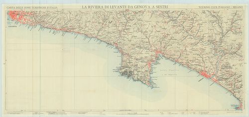
| Title | La Riviera di Levante da Genova a Sestri. |
| Main title | A Genova és Sestri közötti tengerpart térképe az 1900-as évek elején. |
255. Monte Cervino e conca del Breil. [B VII c 272]
Institute and Museum of Military History •
B VII c
•
B VII Olaszország
•
B I–XV. Európa
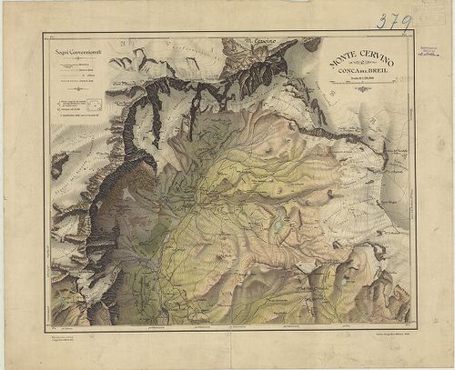
| Title | Monte Cervino e conca del Breil. |
| Main title | A Cervino hegycsúcs és a Breil völgy térképe 1922-ben. |
256. [Olaszország katonaföldrajzi leírása.] [B VII c 280]
Institute and Museum of Military History •
B VII c
•
B VII Olaszország
•
B I–XV. Európa
| Title | [Olaszország katonaföldrajzi leírása.] |
| Main title | 12 tl. mell. |
| Subject | 1. Olaszország közigazgatási beosztása. 2. Olaszország hegy és vízrajza. 3. Olaszország talajtérképe. 4. Olaszország nyersanyaglelőhelyei. 5. Olaszország elektromos energiahálózata. 6. Olaszország könnyűipara. 7. Olaszország nehéz- és hadiipara. 8. Olaszország vasúti hálózata. 9. Olaszország közúti hálózata. 10. Olaszország repülőtér-hálózata és kikötői. 11. Olaszország vezetékes hálózata. 12. a., b., c., d. Hőmérsékleti és csapadék adatok. |
257. Carta della circoscrizione elettorale politica dell’ Italia. [B VII c 302]
Institute and Museum of Military History •
B VII c
•
B VII Olaszország
•
B I–XV. Európa
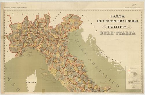
| Title | Carta della circoscrizione elettorale politica dell’ Italia. |
| Main title | Mt.: Provincia di Napoli e parte di quelle di Caserta Avellino e Salerno. (A nápolyi körzet Caserta, Avellino és Salerno egy részével.) |
| Subject | Olaszország közigazgatási térképe választókörzetek szerinti felosztással 1880-ban. |
258. Carte routiere d’Italie. Avec les Postes. [B VII c 317]
Institute and Museum of Military History •
B VII c
•
B VII Olaszország
•
B I–XV. Európa
| Title | Carte routiere d’Italie. Avec les Postes. |
| Main title | Itália úttérképe 1833-ban. |
259. General Karte von Italien und Dalmatien [B VII c 318]
Institute and Museum of Military History •
B VII c
•
B VII Olaszország
•
B I–XV. Európa
| Title | General Karte von Italien und Dalmatien |
| Main title | Itália és Dalmácia általános térképe 1848-ban. |
260. Carta logistica. Foglio: Adelsberg. [B VII c 319]
Institute and Museum of Military History •
B VII c
•
B VII Olaszország
•
B I–XV. Európa
| Title | Carta logistica. Foglio: Adelsberg. |
| Main title | Adelsberg (Postojna) és környékének logisztikai térképe. |
261. Dietrich Reimer’s Kriegsstandskarten XI. Die Offensive gegen... [B VII c 320]
Institute and Museum of Military History •
B VII c
•
B VII Olaszország
•
B I–XV. Európa
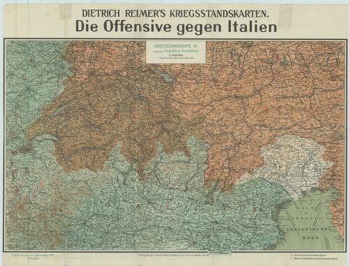
| Title | Dietrich Reimer’s Kriegsstandskarten XI. Die Offensive gegen Italien. |
| Main title | Az olasz ellentámadás térképe 1917. nov. 17-én. |
262. Das italienisch–österreichische Grenzgebiet. [B VII c 321]
Institute and Museum of Military History •
B VII c
•
B VII Olaszország
•
B I–XV. Európa
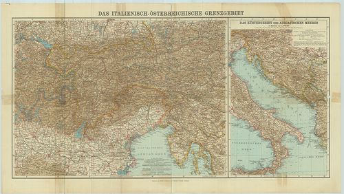
| Title | Das italienisch–österreichische Grenzgebiet. |
| Main title | Mt.: Das Küstengebiet des Adriatischen Meeres (Az Adria-tenger partvidéke.) |
| Subject | Az olasz–osztrák határvidék térképe. |
263. Süditalien und die Adriaküsten. [B VII c 322]
Institute and Museum of Military History •
B VII c
•
B VII Olaszország
•
B I–XV. Európa
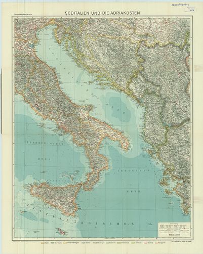
| Title | Süditalien und die Adriaküsten. |
| Main title | Dél-Olaszország és a Balkán-fsz. adriai partvidékének térképe. |
264. Carta logistica. F.-o 9. Udine, F.-o 10. Laibach, F.-o 15. T... [B VII c 325]
Institute and Museum of Military History •
B VII c
•
B VII Olaszország
•
B I–XV. Európa
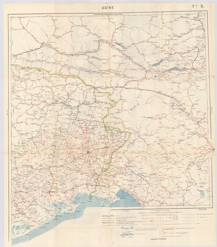
| Title | Carta logistica. F.-o 9. Udine, F.-o 10. Laibach, F.-o 15. Trieste. |
| Main title | Udine, Ljubljana és Trieszt logisztikai térképe. |
265. Carta logistica. Foglió–Pola. [B VII c 326]
Institute and Museum of Military History •
B VII c
•
B VII Olaszország
•
B I–XV. Európa
| Title | Carta logistica. Foglió–Pola. |
| Main title | Katonai utánpótlási vonalak Adelsberg (Postumia) és Pola térségében. |
266. Neueste Hand- und Verkehrskarte von Italien. [B VII c 327]
Institute and Museum of Military History •
B VII c
•
B VII Olaszország
•
B I–XV. Európa
| Title | Neueste Hand- und Verkehrskarte von Italien. |
| Main title | Olaszország közlekedési térképe. |
267. Detailbeschreibung des Österreichischen Grenzgebietes Plöcke... [B VII c 332]
Institute and Museum of Military History •
B VII c
•
B VII Olaszország
•
B I–XV. Európa

| Title | Detailbeschreibung des Österreichischen Grenzgebietes Plöcken-Isonzo. |
| Main title | 10 kül. tl.: |
| Subject | 1. Bodengestaltung und Gewässer. |
268. Übersicht der Minenlangen im italienischen Grenzgebiete. [B VII c 334]
Institute and Museum of Military History •
B VII c
•
B VII Olaszország
•
B I–XV. Európa
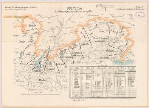
| Title | Übersicht der Minenlangen im italienischen Grenzgebiete. |
| Main title | Az olasz határhegyvidék aknatelepítési áttekintő térképe. |
269. Die Befestigungen am Idrosee. Befestigungsgruppe Rivoli-Cera... [B VII c 335]
Institute and Museum of Military History •
B VII c
•
B VII Olaszország
•
B I–XV. Európa
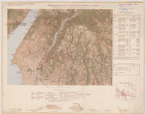
| Title | Die Befestigungen am Idrosee. Befestigungsgruppe Rivoli-Ceraino u. die Nordfront von Verona. Befestigungen dei Agordo, bei Pieve di Cadore. |
| Main title | Idrosee, Verona, Agordo és Pieve di Cadore erődítési térképei. |
270. Sperrfortslinien am Tagliamento. [B VII c 336]
Institute and Museum of Military History •
B VII c
•
B VII Olaszország
•
B I–XV. Európa
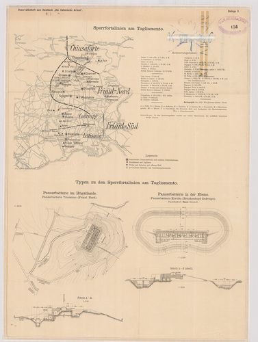
| Title | Sperrfortslinien am Tagliamento. |
| Main title | A Tagliamento folyó környékének erődítési vonalai. |