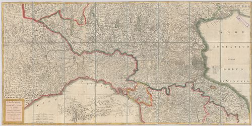
201. Gea-Karte von Oberitalien und den Nachbargebieten. [B VII c 129]
Institute and Museum of Military History •
B VII c
•
B VII Olaszország
•
B I–XV. Európa

| Title | Gea-Karte von Oberitalien und den Nachbargebieten. |
| Main title | Felső-Olaszország a szomszédos országokkal 1910 körül úthálózattal. |
202. Olasz–francia határvidék. [B VII c 140]
Institute and Museum of Military History •
B VII c
•
B VII Olaszország
•
B I–XV. Európa

| Title | Olasz–francia határvidék. |
203. Italienisch-österreichisches Grenzgebiet. Flemmings Kriegska... [B VII c 141]
Institute and Museum of Military History •
B VII c
•
B VII Olaszország
•
B I–XV. Európa

| Title | Italienisch-österreichisches Grenzgebiet. Flemmings Kriegskarte No. 21. |
| Main title | Az olasz–osztrák határvidék. |
204. Nuova Carta del teatro della guerra in Italia. [B VII c 176]
Institute and Museum of Military History •
B VII c
•
B VII Olaszország
•
B I–XV. Európa
| Title | Nuova Carta del teatro della guerra in Italia. |
| Main title | Észak-Olaszországi hadszíntér térképe 1813-ban. |
205. Carta delle Stazioni militari i Italia. [B VII c 179]
Institute and Museum of Military History •
B VII c
•
B VII Olaszország
•
B I–XV. Európa
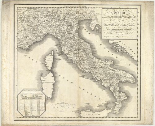
| Title | Carta delle Stazioni militari i Italia. |
| Main title | Olaszország katonai állomáshelyeinek térképe 1804-ben. |
206. Circoscrizione militare territoriale del Regno d’Italia. [B VII c 191]
Institute and Museum of Military History •
B VII c
•
B VII Olaszország
•
B I–XV. Európa

| Title | Circoscrizione militare territoriale del Regno d’Italia. |
| Main title | Az Olasz Királyság katonai körzeti beosztása 1877 márciusában. |
207. Carta dimostrativa delle circoscrizioni militari del regno D... [B VII c 192]
Institute and Museum of Military History •
B VII c
•
B VII Olaszország
•
B I–XV. Európa

| Title | Carta dimostrativa delle circoscrizioni militari del regno D’Italia. |
| Main title | Az Olasz Királyság katonai körzeti beosztása 1879-ben. |
208. Carta delle circoscrizioni militari del Regno d’Italia… [B VII c 193]
Institute and Museum of Military History •
B VII c
•
B VII Olaszország
•
B I–XV. Európa
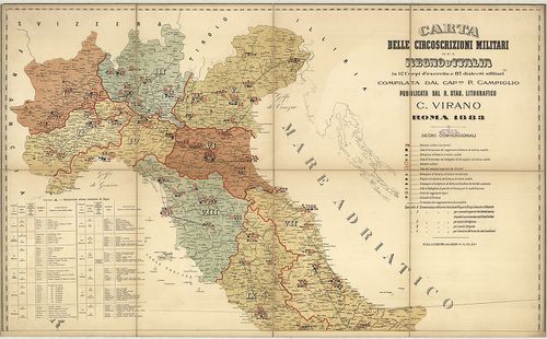
| Title | Carta delle circoscrizioni militari del Regno d’Italia… |
| Main title | Az Olasz Királyság katonai körzeteinek térképe 1883-ban. |
209. Carte de la Lombardie et de la Province de Novare (Piémont) ... [B VII c 195]
Institute and Museum of Military History •
B VII c
•
B VII Olaszország
•
B I–XV. Európa
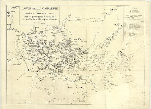
| Title | Carte de la Lombardie et de la Province de Novare (Piémont) avec les principales installations et canalisations électriques primaires. |
| Main title | Lombardia és Novara (Piemonte) tartomány elektromos vezetékhálózata 1930 körül. |
210. Dislocations-Karte der Italienischen Armee… im Frieden und i... [B VII c 196]
Institute and Museum of Military History •
B VII c
•
B VII Olaszország
•
B I–XV. Európa
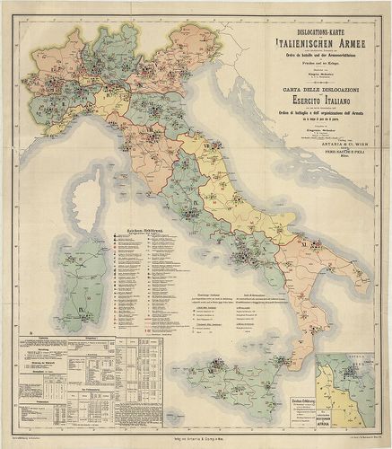
| Title | Dislocations-Karte der Italienischen Armee… im Frieden und im Kriege. – Karta delle dislocazioni dell’ Esercito Italiano … sia in tempo di pace che di guerra. |
| Main title | Mt.: Die Italienischen Besitzungen in Afrika (Massaua: olasz telepek Afrikában). |
| Subject | Az olasz hadsereg diszlokációs térképe háborúban és békében 1891-ben. |
211. Italien. Friedens-Dislocation der Italienischen Armee 1893. [B VII c 196/1]
Institute and Museum of Military History •
B VII c
•
B VII Olaszország
•
B I–XV. Európa
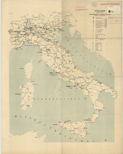
| Title | Italien. Friedens-Dislocation der Italienischen Armee 1893. |
| Main title | Olaszország: az olasz hadsereg békeidőbeli diszlokációs térképe 1893-ban. |
212. Dislokation der italienischen Gebirgstruppen im Sommer 1909. [B VII c 196/4]
Institute and Museum of Military History •
B VII c
•
B VII Olaszország
•
B I–XV. Európa
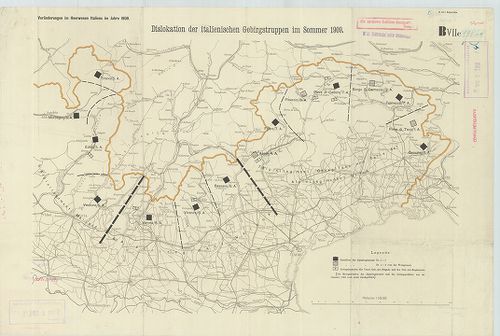
| Title | Dislokation der italienischen Gebirgstruppen im Sommer 1909. |
| Main title | Észak-Olaszország: a hegyi alakulatok diszlokációs térképe 1909 nyarán. |
213. Friedensdislokation der italienischen Armee. Frühjahr 1912. [B VII c 196/5]
Institute and Museum of Military History •
B VII c
•
B VII Olaszország
•
B I–XV. Európa
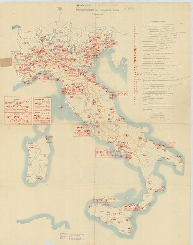
| Title | Friedensdislokation der italienischen Armee. Frühjahr 1912. |
| Main title | Olaszország: az olasz hadsereg békebeli elhelyezésének térképe 1912. tavaszán. |
214. Diocesi Padovana con tutta la sua estensione ne vicini terri... [B VII c 197]
Institute and Museum of Military History •
B VII c
•
B VII Olaszország
•
B I–XV. Európa

| Title | Diocesi Padovana con tutta la sua estensione ne vicini territori. |
| Main title | A Padovai egyházmegye és a szomszédos területek egy részének térképe 1720-ban. |
215. Carta della diocesi di Milano. Divisa in Regioni e Pievi. [B VII c 197/1]
Institute and Museum of Military History •
B VII c
•
B VII Olaszország
•
B I–XV. Európa
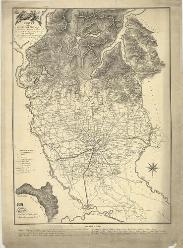
| Title | Carta della diocesi di Milano. Divisa in Regioni e Pievi. |
| Main title | A Milánói egyházmegye térképe 1800 körül. |
216. Rivista Mensile del Touring Club Italiano. Carta della guerr... [B VII c 198]
Institute and Museum of Military History •
B VII c
•
B VII Olaszország
•
B I–XV. Európa
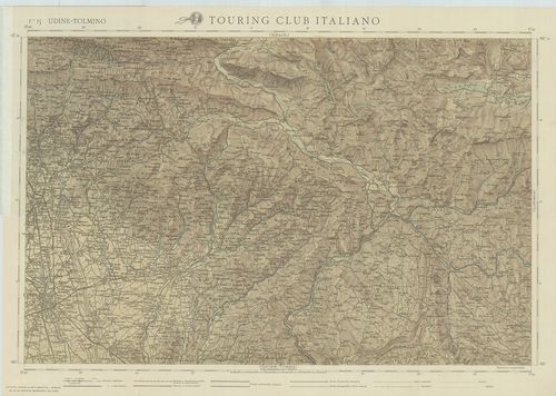
| Title | Rivista Mensile del Touring Club Italiano. Carta della guerra. Febbraio 1917. |
| Main title | F. 15. Udine-Tolmino. F. 16. Lubiana. F. 19. Gorozia-Trieste. F. 20. Adelsberg (Postojna). |
| Subject | Olaszország úthálózati térképe 1917-ben. |
217. Carte générale d’Italie pour servir á l’intelligence des opé... [B VII c 199]
Institute and Museum of Military History •
B VII c
•
B VII Olaszország
•
B I–XV. Európa
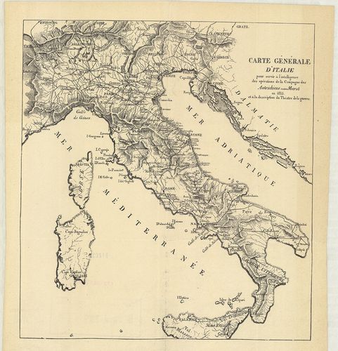
| Title | Carte générale d’Italie pour servir á l’intelligence des opérations de la Campagne des Autrichiens contre Murat en 1815 et á la description du Théatre de la guerre. |
| Main title | Olaszországi általános térképe úthálózattal, és az 1815. évi osztrák csapatok és Murat nápolyi király között lezajlott csata színhelye. |
218. Tirol u[nd] Oberitalien. Ravensteins Kriegskarte. Nr. 45. [B VII c 200]
Institute and Museum of Military History •
B VII c
•
B VII Olaszország
•
B I–XV. Európa
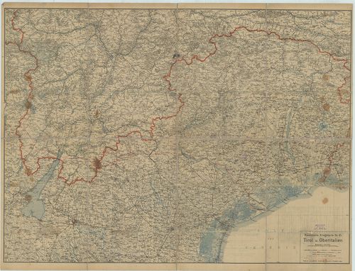
| Title | Tirol u[nd] Oberitalien. Ravensteins Kriegskarte. Nr. 45. |
| Main title | Tirol és Felső-Olaszország általános térképe 1910 körül, úthálózattal. |
219. Italienisch-Oesterreichischer Kriegsschauplatz. Flemmings Kr... [B VII c 200/1]
Institute and Museum of Military History •
B VII c
•
B VII Olaszország
•
B I–XV. Európa
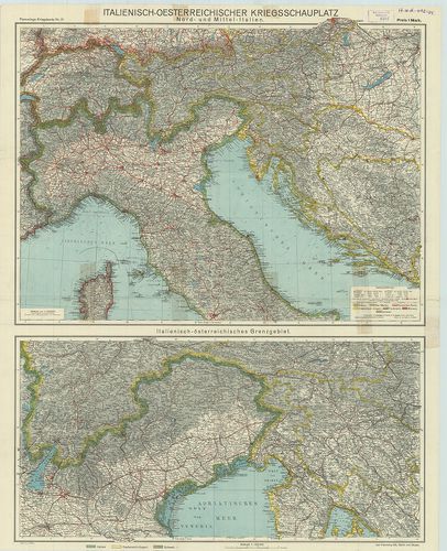
| Title | Italienisch-Oesterreichischer Kriegsschauplatz. Flemmings Kriegskarte Nr. 21. 2 térk. egy lapon: 1. Nord- und Mittel-Italien. |
| Main title | (Észak- és Közép-Olaszország.) 2. Italienisch-österreichisches Grenzgebiet. |
| Subject | Olasz–osztrák határvidék.) |
220. Operationskarte von Oberitalien zum Feldzuge 1866. [B VII c 201]
Institute and Museum of Military History •
B VII c
•
B VII Olaszország
•
B I–XV. Európa
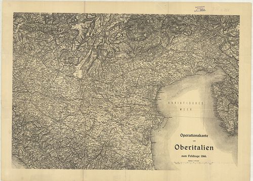
| Title | Operationskarte von Oberitalien zum Feldzuge 1866. |
| Main title | Felső-Olaszország hadműveleti térképe az 1866. évi hadjárathoz. |