81. Principauté de Transilvanie Divisée en Cinq Nations Subdivis... [B IX a 703]
Institute and Museum of Military History •
B IX a
•
B IX Ausztria–Magyarország
•
B I–XV. Európa
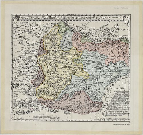
| Title | Principauté de Transilvanie Divisée en Cinq Nations Subdivisée en Qartiers et Comtez. |
| Main title | Erdély térképe 1691-ben, faximile kiadás. |
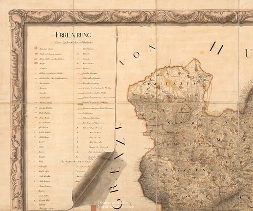
82. Generalkarte von Siebenbürgen… [B IX a 704]
Institute and Museum of Military History •
B IX a
•
B IX Ausztria–Magyarország
•
B I–XV. Európa
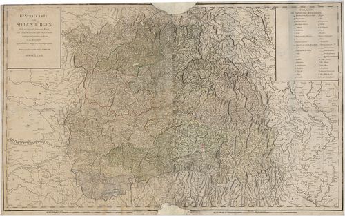
| Title | Generalkarte von Siebenbürgen… |
| Main title | Erdély általános térképe 1789-ben. |
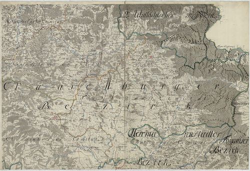
83. Siebenbürgen Nach einer Karte… [B IX a 705]
Institute and Museum of Military History •
B IX a
•
B IX Ausztria–Magyarország
•
B I–XV. Európa
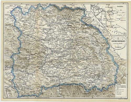
| Title | Siebenbürgen Nach einer Karte… |
| Main title | Mt. [Magyarország vasúthálózata.] |
| Subject | Erdély térképe a 1868 körül. |
84. Principatus Transilvaniae in suas quosque Nationes earumque ... [B IX a 706]
Institute and Museum of Military History •
B IX a
•
B IX Ausztria–Magyarország
•
B I–XV. Európa
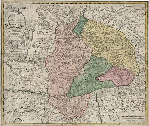
| Title | Principatus Transilvaniae in suas quosque Nationes earumque Sedes et Regiones cum finitimis vicinorum Statuum provinciis accurate divisus… |
| Main title | Erdély térképe a 18. század elején. |
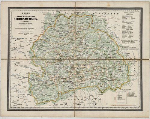
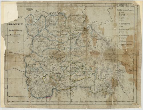
85. Karte des Grossfürstenthums Siebenbürgen. [B IX a 708]
Institute and Museum of Military History •
B IX a
•
B IX Ausztria–Magyarország
•
B I–XV. Európa
| Title | Karte des Grossfürstenthums Siebenbürgen. |
| Main title | Erdély térképe 1854-ben. |
86. Karte des Grossfürstenthumes Siebenbürgen. [B IX a 709]
Institute and Museum of Military History •
B IX a
•
B IX Ausztria–Magyarország
•
B I–XV. Európa
| Title | Karte des Grossfürstenthumes Siebenbürgen. |
| Main title | Erdély térképe 1841-ben. |
87. Topographische Special- und Post-Karte des Grossfürstenthums... [B IX a 710]
Institute and Museum of Military History •
B IX a
•
B IX Ausztria–Magyarország
•
B I–XV. Európa
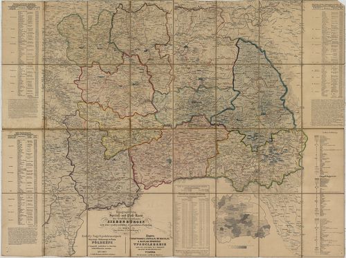
| Title | Topographische Special- und Post-Karte des Grossfürstenthums Siebenbürgen nach seiner neuesten politischen und gerichtlichen Eintheilung. – Erdély Nagyfejedelemségnek Helyszinű-Különnemű és Posta Földképe. A’ legújabb politikai és törvény széki felosztás szerint. – Kartă topografică specială si spostală a marelui Principat Transilvania după cea mai noua asaîm părtire politică si iudectorescă. |
88. General-Karte des Grossfürstenthums Siebenbürgen. [B IX a 711]
Institute and Museum of Military History •
B IX a
•
B IX Ausztria–Magyarország
•
B I–XV. Európa
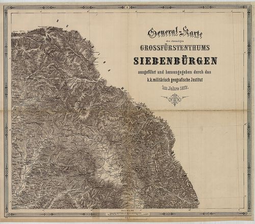
| Title | General-Karte des Grossfürstenthums Siebenbürgen. |
| Main title | Erdély általános térképe 1863-ban, a II. katonai felmérés alapján. |
89. Neue Situations Charte Gros Fürstenthums Siebenbürgen nebst ... [B IX a 715/1]
Institute and Museum of Military History •
B IX a
•
B IX Ausztria–Magyarország
•
B I–XV. Európa
| Title | Neue Situations Charte Gros Fürstenthums Siebenbürgen nebst angraenzenden Theilen der Moldau und Walachey. |
| Main title | Az Erdélyi Nagyfejedelemség, valamint Moldva és Havasalföld vele határos részeinek térképe 1775 körül, az I. katonai felmérés alapján. |
90. Reducierte Karte des Grossfürstenthums Siebenbürgen. [B IX a 718]
Institute and Museum of Military History •
B IX a
•
B IX Ausztria–Magyarország
•
B I–XV. Európa
| Title | Reducierte Karte des Grossfürstenthums Siebenbürgen. |
| Main title | Erdély általános térképe a 18. század végén az I. katonai felmérés alapján. |
91. Administrativ Karte des Grossfürstenthums Siebenbürgen nach ... [B IX a 719]
Institute and Museum of Military History •
B IX a
•
B IX Ausztria–Magyarország
•
B I–XV. Európa
| Title | Administrativ Karte des Grossfürstenthums Siebenbürgen nach der neuesten Landeseintheilung 1859. |
| Main title | Erdély közigazgatási beosztásagának térképe térképe 1861-ben, részben a II. katonai felmérés alapján. |
92. …Karte von Siebenbürgen. [B IX a 720]
Institute and Museum of Military History •
B IX a
•
B IX Ausztria–Magyarország
•
B I–XV. Európa
| Title | …Karte von Siebenbürgen. |
| Main title | Erdély térképe. |
93. Az Erdélyi részek kézi térképe. [B IX a 722]
Institute and Museum of Military History •
B IX a
•
B IX Ausztria–Magyarország
•
B I–XV. Európa
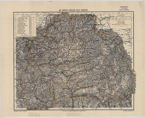
| Title | Az Erdélyi részek kézi térképe. |
94. Galizien, Nord Ungarn und ein Theil von Siebenbürgen. [B IX a 722/1]
Institute and Museum of Military History •
B IX a
•
B IX Ausztria–Magyarország
•
B I–XV. Európa
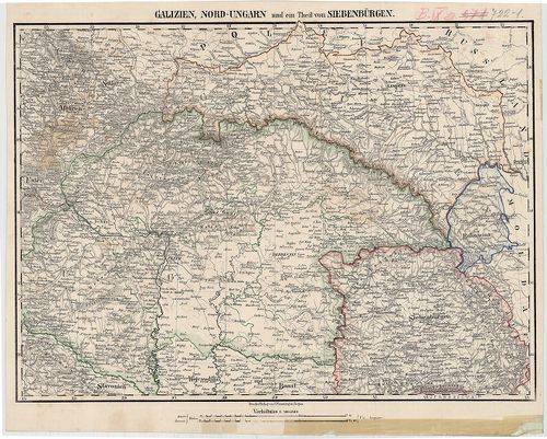
| Title | Galizien, Nord Ungarn und ein Theil von Siebenbürgen. |
| Main title | Észak-Magyarország, Galícia és Erdély egy részének térképe 1850 körül. |
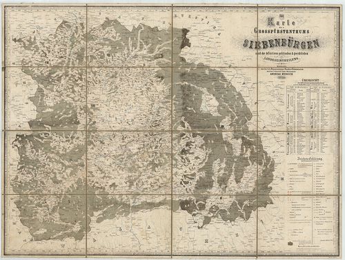
95. Uebersichts-Karte des Grossfürstenthums Siebenbürgen nach de... [B IX a 722/2]
Institute and Museum of Military History •
B IX a
•
B IX Ausztria–Magyarország
•
B I–XV. Európa
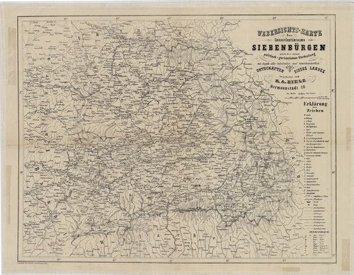
| Title | Uebersichts-Karte des Grossfürstenthums Siebenbürgen nach der neuen politisch-gerichtlichen Eintheilung… |
| Main title | Az Erdélyi Nagyfejedelemség áttekintő térképe a 19. század közepén. |
96. Geographische Mappe des Gross-Fürstenthums Siebenbürgen. [B IX a 722/3]
Institute and Museum of Military History •
B IX a
•
B IX Ausztria–Magyarország
•
B I–XV. Európa
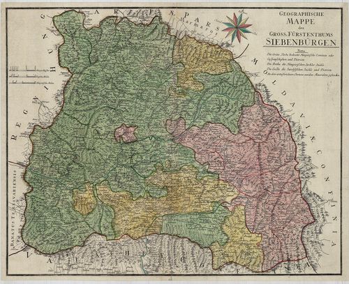
| Title | Geographische Mappe des Gross-Fürstenthums Siebenbürgen. |
| Main title | Az Erdélyi Nagyfejedelemség földrajzi térképe 1784-ben. |
97. Nova Principatus Transilvaniae Tabula … [B IX a 722/4]
Institute and Museum of Military History •
B IX a
•
B IX Ausztria–Magyarország
•
B I–XV. Európa
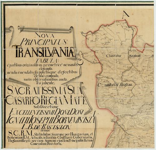
| Title | Nova Principatus Transilvaniae Tabula … |
| Main title | Erdély térképe. |
98. Ost-Ungarn Siebenbürgisch-Rumänische Grenze. – Bukovina bis ... [B IX a 723/1]
Institute and Museum of Military History •
B IX a
•
B IX Ausztria–Magyarország
•
B I–XV. Európa
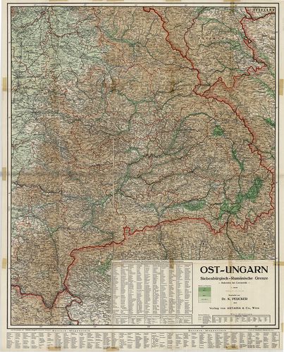
| Title | Ost-Ungarn Siebenbürgisch-Rumänische Grenze. – Bukovina bis Czernowitz. |
| Main title | Kelet-Magyarország, erdélyi-román határ. |
99. 2 térkép: 1.Erdély közigazgatási térképe 1847-ben. – Carte A... [B IX a 724]
Institute and Museum of Military History •
B IX a
•
B IX Ausztria–Magyarország
•
B I–XV. Európa
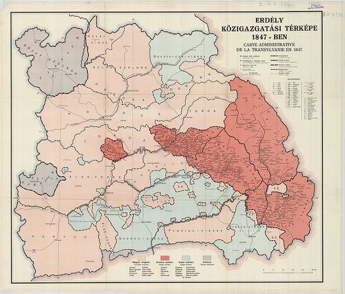
| Title | 2 térkép: 1.Erdély közigazgatási térképe 1847-ben. – Carte Administrative de la Transylvanie en 1847. |
| Main title | 2. térkép: Erdély közigazgatási térképe 1847-ben. – Carte de l’Administration de la Transilvanie en 1847. – Map of Transylvania According to her Administrative Structure in 1847. |
100. Regiones Danubianae Pannoniae Dacia, Moesiae. [B IX a 741]
Institute and Museum of Military History •
B IX a
•
B IX Ausztria–Magyarország
•
B I–XV. Európa
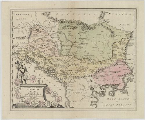
| Title | Regiones Danubianae Pannoniae Dacia, Moesiae. |
| Main title | Duna menti Magyarország, Erdély, Észak-Balkán területe. |