161. Orts- und Strassenkarte des Königreiches Ungarn (mit inbegri... [B IX c 620/1]
Institute and Museum of Military History •
B IX c
•
B IX Ausztria–Magyarország
•
B I–XV. Európa
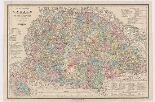
| Title | Orts- und Strassenkarte des Königreiches Ungarn (mit inbegriff des ehemaligen Siebenbürgen) nebst Kroatien und Slavonien. |
| Main title | Magyarország, Erdély, Horvát-Szlavónia település és úttérképe 1887-ben. |
162. Új Posta Mappája Magyar és Erdély Országoknak a’ posták legú... [B IX c 625]
Institute and Museum of Military History •
B IX c
•
B IX Ausztria–Magyarország
•
B I–XV. Európa
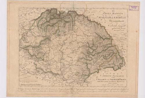
| Title | Új Posta Mappája Magyar és Erdély Országoknak a’ posták legújabb elintézések szerént. – Neueste Postkarte von Ungarn und Siebenbürgen nach dem genau revidierten Postwesen dieser Länder. |
163. General-Post- und Strassen-Karte des Königreichs Ungarn und ... [B IX c 628]
Institute and Museum of Military History •
B IX c
•
B IX Ausztria–Magyarország
•
B I–XV. Európa
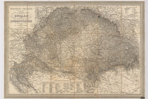
| Title | General-Post- und Strassen-Karte des Königreichs Ungarn und des Grossfürstenthums Siebenbürgen. |
| Main title | A Magyar Királyság és Erdély út- és postatérképe 1848-ban. |
164. Magyar Ország, Erdély, Horvát és Tót országok, s’ a Határőrv... [B IX c 630]
Institute and Museum of Military History •
B IX c
•
B IX Ausztria–Magyarország
•
B I–XV. Európa
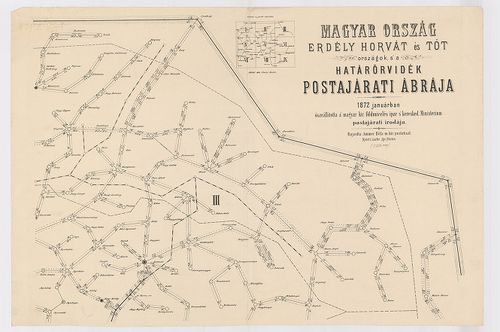
| Title | Magyar Ország, Erdély, Horvát és Tót országok, s’ a Határőrvidék Postajárati ábrája. |
165. Az Erdélyi ev.[angélikus] ref.[ormátus] egyházkerület térkép... [B IX c 704/4]
Institute and Museum of Military History •
B IX c
•
B IX Ausztria–Magyarország
•
B I–XV. Európa
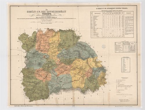
| Title | Az Erdélyi ev.[angélikus] ref.[ormátus] egyházkerület térképe. |
| Main title | Az „Erdélyi prot[estáns] Közlöny” 1877-i évi folyamának mell. |
166. Magyarország Erdélyi részének turista térképe. [B IX c 704/5]
Institute and Museum of Military History •
B IX c
•
B IX Ausztria–Magyarország
•
B I–XV. Európa
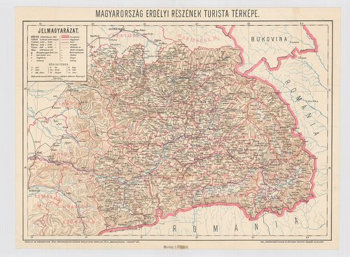
| Title | Magyarország Erdélyi részének turista térképe. |
| Main title | Homolka-féle „Magyarország Térképe” részlete. |
167. Slovakien, Galizien, Bukowina, Siebenbürgen. [B IX c 710/2]
Institute and Museum of Military History •
B IX c
•
B IX Ausztria–Magyarország
•
B I–XV. Európa
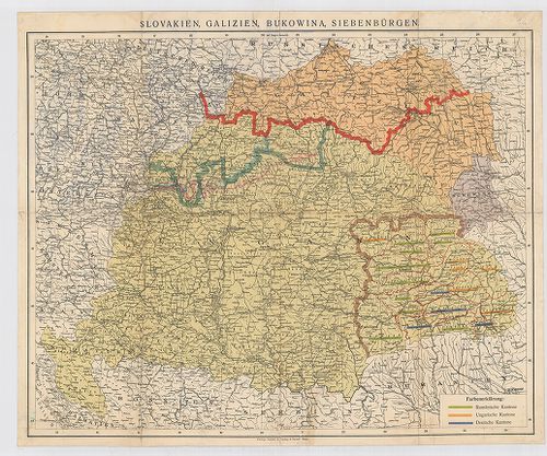
| Title | Slovakien, Galizien, Bukowina, Siebenbürgen. |
| Main title | Magyarország, Szlovákia, Galícia, Bukovina, Erdély néprajzi térképe 1920 körül, nemzetiségi többség alapján osztályozva. |
168. Strassen Karte des Grossfürstenthums Siebenbürgen. [B IX c 736/1]
Institute and Museum of Military History •
B IX c
•
B IX Ausztria–Magyarország
•
B I–XV. Európa

| Title | Strassen Karte des Grossfürstenthums Siebenbürgen. |
| Main title | Erdély úttérképe 1828 körül. |
169. Copie einer türkischen Karte, wo die Gränzen Siebenbürgens, ... [B IX c 756]
Institute and Museum of Military History •
B IX c
•
B IX Ausztria–Magyarország
•
B I–XV. Európa
| Title | Copie einer türkischen Karte, wo die Gränzen Siebenbürgens, gegen die Bukowina, Moldau und Wallachey illuminirt, wie auch alle – an der alten und gegen die Moldau und Wallachey vorgerückten Gränzen aufgesellte Kais. österreichischen Adlerspuncte bezeichnet sind. |
| Main title | Erdély határának térképe Bukovina, Moldva és Havasalföld felé. Török térkép másolata 1775-ből. |
170. Marschrouten-Karte des Grossfürstenthums Siebenbürgen. [B IX c 775]
Institute and Museum of Military History •
B IX c
•
B IX Ausztria–Magyarország
•
B I–XV. Európa
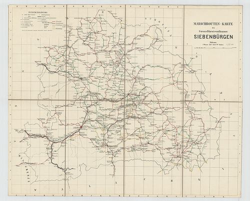
| Title | Marschrouten-Karte des Grossfürstenthums Siebenbürgen. |
| Main title | Erdély menettérképe 1868-ban. |
171. [Keletmagyarország és Erdély vasúti térképe.] [B IX c 1072]
Institute and Museum of Military History •
B IX c
•
B IX Ausztria–Magyarország
•
B I–XV. Európa
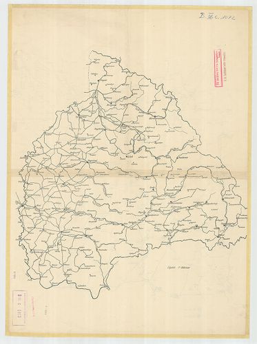
| Title | [Keletmagyarország és Erdély vasúti térképe.] |
172. Schiţa cu împărţirea administrativă în ţinuturile Ungariei l... [B IX c 1073]
Institute and Museum of Military History •
B IX c
•
B IX Ausztria–Magyarország
•
B I–XV. Európa
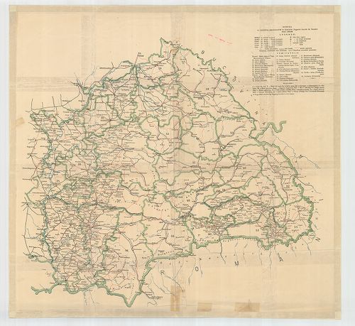
| Title | Schiţa cu împărţirea administrativă în ţinuturile Ungariei locuite de Români. |
| Main title | Kelet-Magyarország és Erdély közigazgatási térképe 1900 körül. |
173. Magyarország néprajzi térképe. – Carte Ethnographique de la ... [B IX c 1074/1]
Institute and Museum of Military History •
B IX c
•
B IX Ausztria–Magyarország
•
B I–XV. Európa
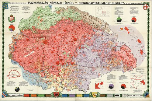
| Title | Magyarország néprajzi térképe. – Carte Ethnographique de la Hongrie. |
| Main title | 4 mt.: 1. A magyar szent korona országai. 2. [Magyarország elhelyezkedése Európába.] 3. K-Poroszország. 4. Erdély. |
174. Postkarte von Ungarn und Siebenbürgen. [B IX c 1380]
Institute and Museum of Military History •
B IX c
•
B IX Ausztria–Magyarország
•
B I–XV. Európa
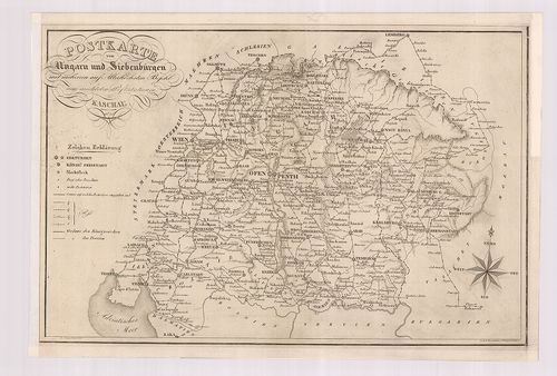
| Title | Postkarte von Ungarn und Siebenbürgen. |
| Main title | Magyarország és Erdély postatérképe 1826-ban. |
175. Mappa Geographica Transylvaniam a Banatu Temisvariensi Separ... [B IX c 1404]
Institute and Museum of Military History •
B IX c
•
B IX Ausztria–Magyarország
•
B I–XV. Európa
| Title | Mappa Geographica Transylvaniam a Banatu Temisvariensi Separantes Limites... |
| Main title | Erdély és a Temesi Bánság földrajzi térképe a határok feltüntetésével. Határtérkép. |
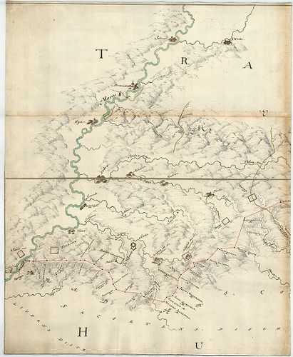
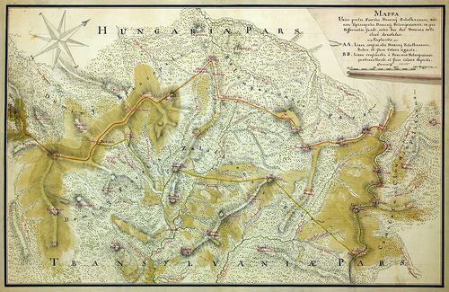
176. Mappa unius partis Fiscalis Dominij Halmagiensis et Comitatu... [B IX c 1464]
Institute and Museum of Military History •
B IX c
•
B IX Ausztria–Magyarország
•
B I–XV. Európa
| Title | Mappa unius partis Fiscalis Dominij Halmagiensis et Comitatus Zarandiensis, nec non Episcopatus Dominij Belenyesiensis, in qua Differentia fundi, inter haec duo Dominia orta clare denotatur. |
| Main title | Zaránd megye egy részének térképe a belényesi járás területével, a Magyar Királyság-Erdély határát jelölve 1850-ben. |
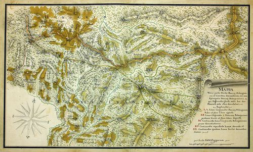
177. Mappa unius partis Fiscalis Dominij Zalathnensis, nec non Ep... [B IX c 1465]
Institute and Museum of Military History •
B IX c
•
B IX Ausztria–Magyarország
•
B I–XV. Európa
| Title | Mappa unius partis Fiscalis Dominij Zalathnensis, nec non Episcopatus Dominij Belenyesiensis, in qua Differentia fundi, inter haec duo Dominia orta clare denotatur. |
| Main title | A belényesi járás területe a Magyar Királyság-Erdély határát jelölve 1850-ben. |
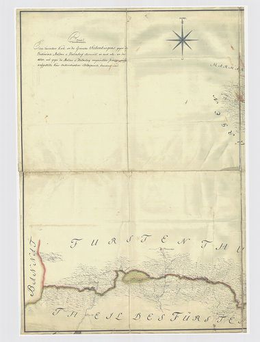
178. Aufnahme der neu erbauten Franzens-Strasse von Fontine Janku... [B IX c 1489]
Institute and Museum of Military History •
B IX c
•
B IX Ausztria–Magyarország
•
B I–XV. Európa
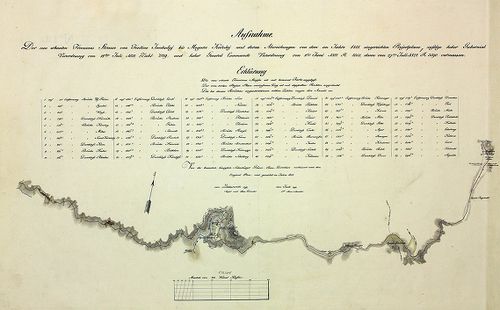
| Title | Aufnahme der neu erbauten Franzens-Strasse von Fontine Jankuluj bis Mogura Kaluluj und deren Abweichungen... |
| Main title | Az újonnan épített "francia út" (Erdély határa) egy részének térképe. |
179. „Erdély” térképe. [B XV a 316]
Institute and Museum of Military History •
B XV a
•
B XV Magyarország (1920 után)
•
B I–XV. Európa
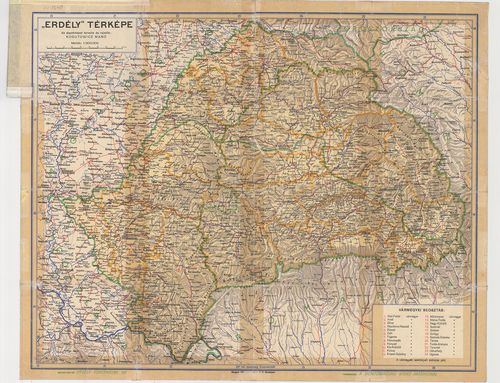
| Title | „Erdély” térképe. |
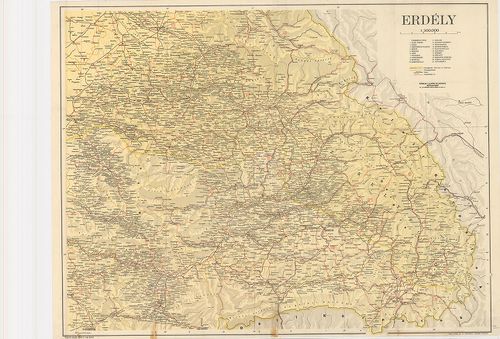
180. Erdély. (Országhatár 1914-ben és 1943-ban.) [B XV a 317]
Institute and Museum of Military History •
B XV a
•
B XV Magyarország (1920 után)
•
B I–XV. Európa
| Title | Erdély. (Országhatár 1914-ben és 1943-ban.) |