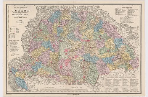
1241. Orts- und Strassenkarte des Königreiches Ungarn (mit inbegri... [B IX c 620/1]
Institute and Museum of Military History •
B IX c
•
B IX Ausztria–Magyarország
•
B I–XV. Európa
| Title | Orts- und Strassenkarte des Königreiches Ungarn (mit inbegriff des ehemaligen Siebenbürgen) nebst Kroatien und Slavonien. |
| Main title | Magyarország, Erdély, Horvát-Szlavónia település és úttérképe 1887-ben. |
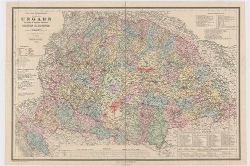
1242. Orts- und Strassenkarte des Königreiches Ungarn (mit inbegri... [B IX c 620]
Institute and Museum of Military History •
B IX c
•
B IX Ausztria–Magyarország
•
B I–XV. Európa
| Title | Orts- und Strassenkarte des Königreiches Ungarn (mit inbegriff des ehemaligen Siebenbürgen) nebst Kroatien und Slavonien. |
| Main title | Magyarország, Erdély, Horvát-Szlavónia település és úttérképe 1882-ben. |
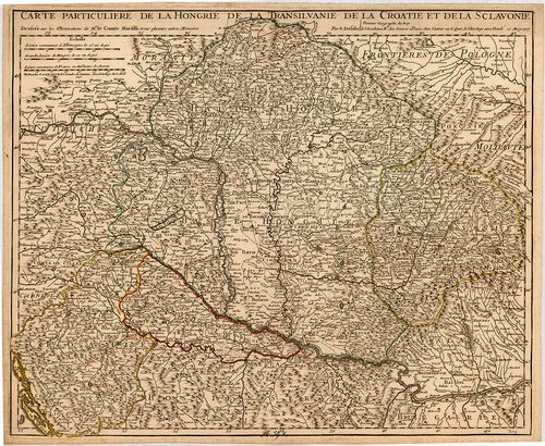
1243. Carte Particuliere de la Hongrie de la Transilvanie de la Cr... [B IX a 539/1]
Institute and Museum of Military History •
B IX a
•
B IX Ausztria–Magyarország
•
B I–XV. Európa
| Title | Carte Particuliere de la Hongrie de la Transilvanie de la Croatie et de la Sclavonie. |
| Main title | Magyarország, Erdély, Horvát-Szlavónia térképe 1717-ben, tartományi határszínezés. |
1244. Carte de la Valachie et de la Moldavie comprenant aussi la B... [B III a 160]
Institute and Museum of Military History •
B III a
•
B III Balkán-félsziget
•
B I–XV. Európa
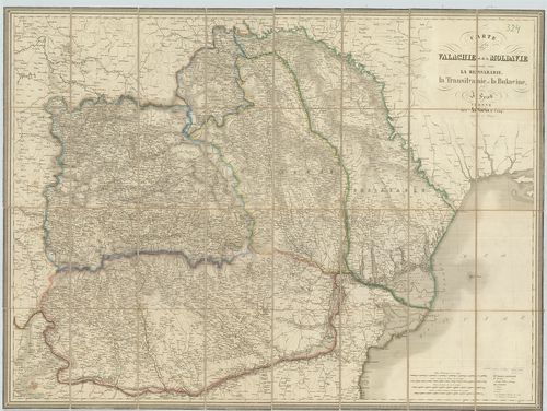
| Title | Carte de la Valachie et de la Moldavie comprenant aussi la Bessarabie, la Transilvanie et la Bukovine. |
| Main title | Havasalföld, Moldva, Besszarábia, Erdély és Bukovina térképe. |
1245. Magni Principatus Transylvaniae... [B IX a 1219]
Institute and Museum of Military History •
B IX a
•
B IX Ausztria–Magyarország
•
B I–XV. Európa
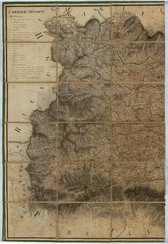
| Title | Magni Principatus Transylvaniae... |
| Main title | Az Erdélyi Nagyfejedelemség térképe az I. kat. felm. nyomán, a Jeney-féle térkép alapján - B IX a 715/1 - harmadára kicsinyítve. |
1246. Nova Magni Principatus Transilvaniae... [B IX a 1220]
Institute and Museum of Military History •
B IX a
•
B IX Ausztria–Magyarország
•
B I–XV. Európa
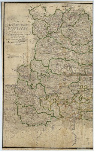
| Title | Nova Magni Principatus Transilvaniae... |
| Main title | Az Erdélyi Nagyfejedelemség "új" térképe, Bukovina és Moldva területével, Jeney-féle térkép alapján - B IX a 715/1 - negyedére kicsinyítve. |
1247. Transylvaniae, Moldaviae, Walachiae, Bulgariae nova et accur... [S 68 - X. - No. 74.]
National Archives of Hungary •
S 68 Festetics család (1645-1943)
•
S Családi fondokból kiemelt térképek (17. sz.-20. sz.)
•
S – Térképtár
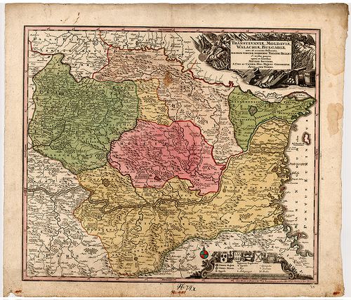
| Main title | Transylvaniae, Moldaviae, Walachiae, Bulgariae nova et accurata delineatio, magnam partem hodierni theatri bellici ob oculos ponens |
| Subject | X. - No. 74. Erdély, Moldva, Havasalföld, Bulgária |
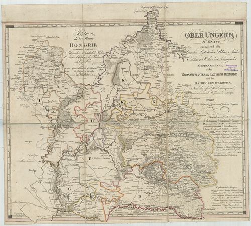
1248. Special-Karte von Burzen Lande, oder dem Kronstadter Distric... [B IX a 1224]
Institute and Museum of Military History •
B IX a
•
B IX Ausztria–Magyarország
•
B I–XV. Európa
| Title | Special-Karte von Burzen Lande, oder dem Kronstadter District, in Siebenbürgen... |
| Main title | Az erdélyi Brassói Körzet topográfiai térképe az I. kat. felm. alapján (hatodára kics. ) |
1249. Esquelette sammtlicher kk. Militair Graenzen reduciert aus v... [B IX a 1250]
Institute and Museum of Military History •
B IX a
•
B IX Ausztria–Magyarország
•
B I–XV. Európa
| Title | Esquelette sammtlicher kk. Militair Graenzen reduciert aus verschiedenen Kriegs Karten. |
| Main title | A Katonai Határőrvidékek (Horvát, Szlavón, Erdélyi Határőrvidékek) áttekintő térképe a különböző katonai felmérések alapján. |
1250. Le Royaume de Hongrie divisé en Haute et Basse Hongrie, Tran... [B IX a 490/2]
Institute and Museum of Military History •
B IX a
•
B IX Ausztria–Magyarország
•
B I–XV. Európa
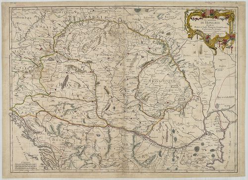
| Title | Le Royaume de Hongrie divisé en Haute et Basse Hongrie, Transilvanie, Esclavonie et Croatie. |
| Main title | A Magyar Királyság, Erdély és Horvát-Szlavónia térképe 1759-ben. |
1251. Carte particuliere de la Hongrie de la Transilvanie de la Cr... [S 68 - X. - No. 59.]
National Archives of Hungary •
S 68 Festetics család (1645-1943)
•
S Családi fondokból kiemelt térképek (17. sz.-20. sz.)
•
S – Térképtár
| Main title | Carte particuliere de la Hongrie de la Transilvanie de la Croatie et de la Sclavonie |
| Subject | X. - No. 59. Magyarország, Erdély, Horvátország és Szlavónia |
1252. Copia plani Partem Territorii Civici Varasdiensis exhibentis... [S 11 - No. 1333.]
National Archives of Hungary •
S 11 Kamarai térképek (1747-1882)
•
S Kormányhatósági fondokból kiemelt térképek (17. sz.-20. sz.)
•
S – Térképtár
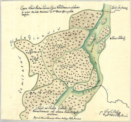
| Main title | Copia plani Partem Territorii Civici Varasdiensis exhibentis ... |
| Subject | No. 1333. Varasd külterülete egy részének térképe |
Contributor: Erdélyi Josephus dirig Cittis Geometra
1253. Post Karte der Kronländer Ungarn, Siebenbürgen, Croatien. Sl... [B IX c 40]
Institute and Museum of Military History •
B IX c
•
B IX Ausztria–Magyarország
•
B I–XV. Európa
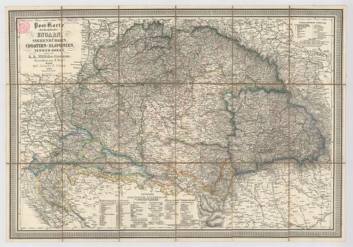
| Title | Post Karte der Kronländer Ungarn, Siebenbürgen, Croatien. Slavonien, Serbien-Banat nebst der k. k. Militär-Grenze. |
| Main title | Magyarország, Erdély, Horvát-Szlavonia, Szerb Bánság, Katonai Határőrvidék postatérképe. |
1254. Tabula generalis Regni Hungariae, Croatiae et Slavoniae nec ... [B IX a 500]
Institute and Museum of Military History •
B IX a
•
B IX Ausztria–Magyarország
•
B I–XV. Európa
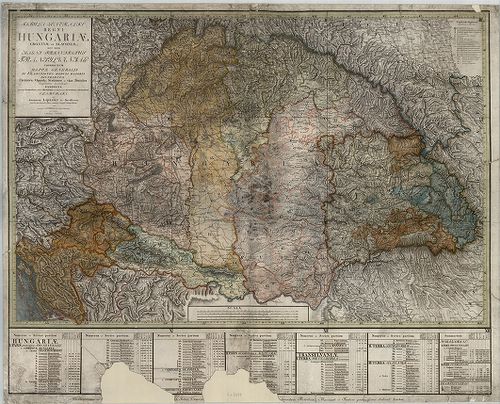
| Title | Tabula generalis Regni Hungariae, Croatiae et Slavoniae nec non Magni Principatus Transylvaniae… |
| Main title | A Magyar Királyság, Horvát-Szlavónia és Erdély általános térképe 1810-ben. Tartományi színezés. |
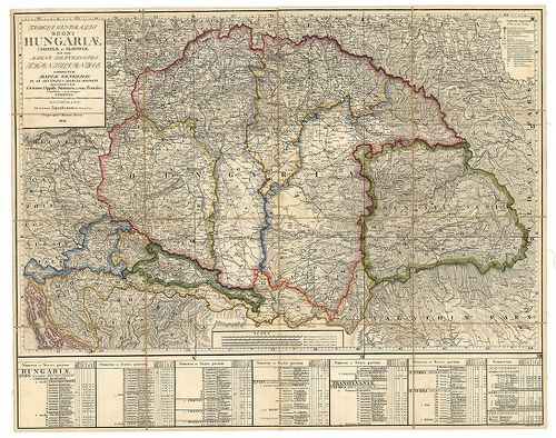
1255. Tabula generalis Regni Hungariae Croatiae et Slavoniae nec n... [S 12 - Div. X. - No. 41.]
National Archives of Hungary •
S 12 Helytartótanácsi térképek (1738-1875)
•
S Kormányhatósági fondokból kiemelt térképek (17. sz.-20. sz.)
•
S – Térképtár
| Main title | Tabula generalis Regni Hungariae Croatiae et Slavoniae nec non Magni Principatus Transylvanias conspectum ... |
| Subject | Div. X. - No. 41. Magyarország, Horvátország és Szlavónia, valamint Erdély térképe |
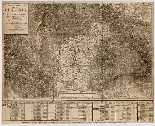
1256. Tabula generalis Regni Hungariae, Croatiae et Slavoniae nec ... [B IX a 1205]
Institute and Museum of Military History •
B IX a
•
B IX Ausztria–Magyarország
•
B I–XV. Európa
| Title | Tabula generalis Regni Hungariae, Croatiae et Slavoniae nec non Magni Principatus Transylvaniae… |
| Main title | A Magyar Királyság, Horvát-Szlavónia és Erdély általános térképe 1848-ban. Tartományi színezés. |
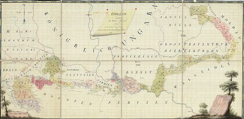
1257. Politische Einteilung, Städte, Märkte, Bevölkerungsdichte un... [B IX c 422]
Institute and Museum of Military History •
B IX c
•
B IX Ausztria–Magyarország
•
B I–XV. Európa
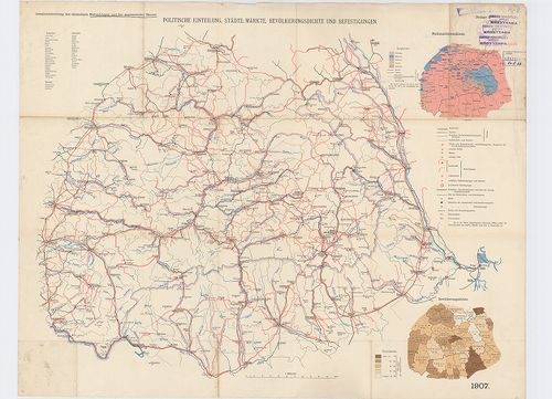
| Title | Politische Einteilung, Städte, Märkte, Bevölkerungsdichte und Befestigungen. |
| Main title | 2 mt. 1. Nationalitätenskizze. (Nemzetiségi vázlat.) 2. Bevölkerungsdichte. (Népsűrűség.) |
| Subject | Erdély politikai beosztása, települései, erődített helyei 1907-ben. |
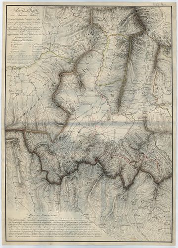
1258. Aufnahme der neu erbauten Franzens-Strasse von Fontine Janku... [B IX c 1489]
Institute and Museum of Military History •
B IX c
•
B IX Ausztria–Magyarország
•
B I–XV. Európa
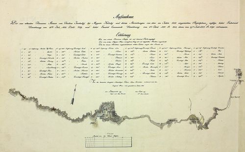
| Title | Aufnahme der neu erbauten Franzens-Strasse von Fontine Jankuluj bis Mogura Kaluluj und deren Abweichungen... |
| Main title | Az újonnan épített "francia út" (Erdély határa) egy részének térképe. |
1259. Strassen Karte des Grossfürstenthums Siebenbürgen. Die zur M... [B IX c 420]
Institute and Museum of Military History •
B IX c
•
B IX Ausztria–Magyarország
•
B I–XV. Európa
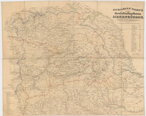
| Title | Strassen Karte des Grossfürstenthums Siebenbürgen. Die zur Militair Grenze Siebenbürgens gehőrigen Ortschaften sind mit einer andern Schiftgattung beschrieben. |
| Main title | Erdély úttérképe az oda tartozó katonai határőrvidékkel. |
1260. Magyarország néprajzi térképe. – Carte Ethnographique de la ... [B IX c 1074/1]
Institute and Museum of Military History •
B IX c
•
B IX Ausztria–Magyarország
•
B I–XV. Európa
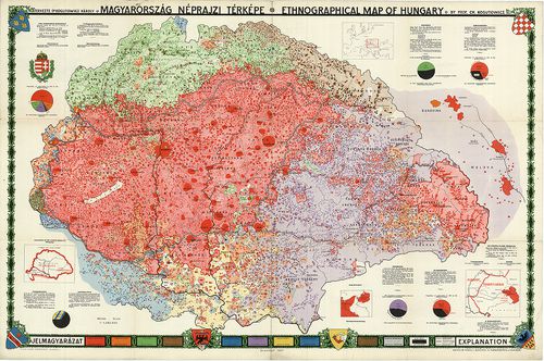
| Title | Magyarország néprajzi térképe. – Carte Ethnographique de la Hongrie. |
| Main title | 4 mt.: 1. A magyar szent korona országai. 2. [Magyarország elhelyezkedése Európába.] 3. K-Poroszország. 4. Erdély. |