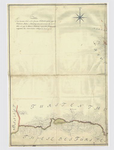
1321. Magyar ország', Horvát, Tót, Dalmát és Erdély országok', a' ... [S 73 - No. 209.]
National Archives of Hungary •
S 73 Új szerzeményű térképek (1701-1940)
•
S – Térképtár

| Main title | Magyar ország', Horvát, Tót, Dalmát és Erdély országok', a' tenger mellék' és a' végőri vidékek' közönséges pósták' és útak földabrosza, az Austriai tsászárság' határos tartomány részeivel együtt...; Vollstaendige general Posten- und Strassen-Karte des Kön |
| Subject | No. 209. Magyarország |
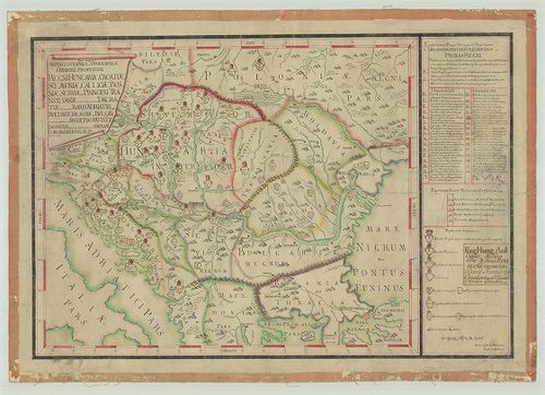
1322. Royaume de Hongrie, Principauté de Transilvanie, Sclavonie, ... [B IX a 539/16]
Institute and Museum of Military History •
B IX a
•
B IX Ausztria–Magyarország
•
B I–XV. Európa
| Title | Royaume de Hongrie, Principauté de Transilvanie, Sclavonie, Croatie, et partie de la Principauté de Valaquie, de la Bosnie, de la Servie et de la Bulgarie. |
| Main title | A Magyar Királyság, Erdély, Horvát-Szlavónia és a Balkán É-i részének térképe 1751-ben. |
1323. Magyar Országnak és a hozzá kaptsoltatott Horváth és Tóth or... [B IX b 16]
Institute and Museum of Military History •
B IX b
•
B IX Ausztria–Magyarország
•
B I–XV. Európa
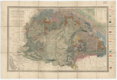
| Title | Magyar Országnak és a hozzá kaptsoltatott Horváth és Tóth országnak, ’s határőrző katonai vidékeknek nem különben az Erdélyi Fejedelemségnek Vármegyékre és Szabad Kerületekre osztatott ’s a’ legjobb mappák szerént készitetett közönséges táblája… |
| Main title | Karacs térképére Beudant rárajzolta Magyarország geológiai térképét 1818-ban. |
1324. Mappa unius partis Fiscalis Dominij Halmagiensis et Comitatu... [B IX c 1464]
Institute and Museum of Military History •
B IX c
•
B IX Ausztria–Magyarország
•
B I–XV. Európa
| Title | Mappa unius partis Fiscalis Dominij Halmagiensis et Comitatus Zarandiensis, nec non Episcopatus Dominij Belenyesiensis, in qua Differentia fundi, inter haec duo Dominia orta clare denotatur. |
| Main title | Zaránd megye egy részének térképe a belényesi járás területével, a Magyar Királyság-Erdély határát jelölve 1850-ben. |
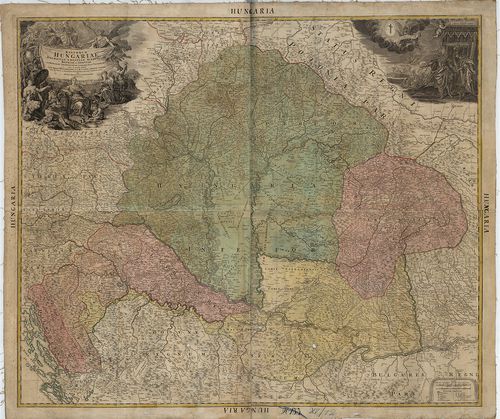
1325. Augustissimo Romanor Imperatori Iosepho I. Hungariae Regni i... [B IX a 491]
Institute and Museum of Military History •
B IX a
•
B IX Ausztria–Magyarország
•
B I–XV. Európa
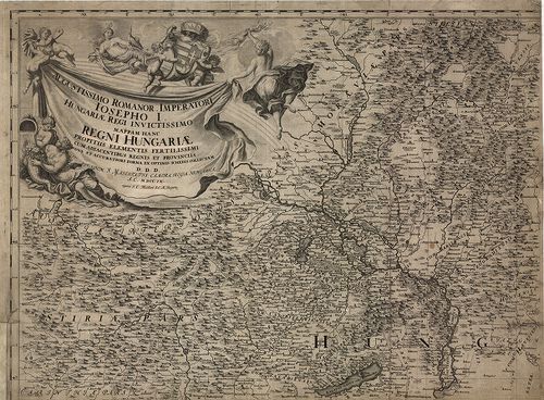
| Title | Augustissimo Romanor Imperatori Iosepho I. Hungariae Regni invictissimo Mappam Hanc Regni Hungariae propitiis elementis fertilissimi cum adjacentibus regnis et Provinciis nova et accuratiori forma ex optimis schedis collectam D. D. D. … |
| Main title | A Magyar Királyság, Horvátország, Szlavónia, Erdély, Ausztria, Karintia, Stájerország térképe 1709-ben. |
1326. A New and Accurate Map of the Kingdom of Hungary and Princip... [B IX a 1101]
Institute and Museum of Military History •
B IX a
•
B IX Ausztria–Magyarország
•
B I–XV. Európa
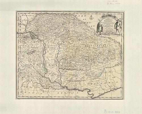
| Title | A New and Accurate Map of the Kingdom of Hungary and Principality of Transilvania with the bordering countries. In.: Bowen: A Complet Atlas or distinct wiew of the Know wWorld. London, 1752. |
| Main title | A Magyar Királyság, az Erdélyi Nagyfejedelemség és a környező országok térképe. |
1327. Mappa unius partis sylvae Plescu dictae vicinitate Caeo. Reg... [S 70 - No. 86.]
National Archives of Hungary •
S 70 Vegyes kéziratos térképek (1669-1942)
•
S – Térképtár
| Main title | Mappa unius partis sylvae Plescu dictae vicinitate Caeo. Regio Kapnikiensis Manipulations et in incl. Districtu Kővariensis stue et ad. ill. d. comitem Paulus Teleky, ejusdemque Annam Kornis pertinentem, ... |
| Subject | No. 86. Pleskai erdők térképe /Máramaros m., Erdély/ - Teleki Pál Gróf és Kornis-féle birtokból |
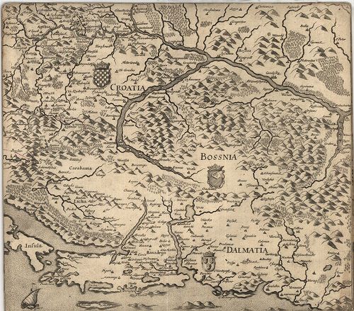
1328. Regnorum Hungariae Dalmatiae, Croatiae, Sclavoniae, Bosniae ... [S 68 - XV. - No. 12.]
National Archives of Hungary •
S 68 Festetics család (1645-1943)
•
S Családi fondokból kiemelt térképek (17. sz.-20. sz.)
•
S – Térképtár
| Main title | Regnorum Hungariae Dalmatiae, Croatiae, Sclavoniae, Bosniae et Serviae cum principatu Transylvaniae, maxima'qua parte Valachiae nova et exacta tabula ex archetypo Mülleriano, S. C. M. capit. i et ingen. i desumta viisq. veredariis, ac novissimae pacis Passa |
| Subject | XV. - No. 12. Magyarország és Erdély |
1329. Mappa della Transilvaniae che dimastre il suo stato e passi ... [B IX a 691]
Institute and Museum of Military History •
B IX a
•
B IX Ausztria–Magyarország
•
B I–XV. Európa
| Title | Mappa della Transilvaniae che dimastre il suo stato e passi ove puo entrare l’inimico dalla parte di Moldavia, Valachia, é Temesvarer Frontiere á queste Provincia. Marca in altre l’ingressi dalia partre dell’Ongaria communicationi dun luogho all’altro… |
| Main title | Erdély térképe a 18. században. |
1330. Ober Ungern II-tes Blatt enthaltend die Hevescher Szaboltsch... [S 11 - No. 667:2.]
National Archives of Hungary •
S 11 Kamarai térképek (1747-1882)
•
S Kormányhatósági fondokból kiemelt térképek (17. sz.-20. sz.)
•
S – Térképtár
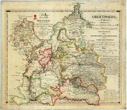
| Main title | Ober Ungern II-tes Blatt enthaltend die Hevescher Szaboltscher, Biharer, Arader, Csanader, Bekescher und Csongrader Gespannschaft nebst Grosskumanien dem Iazyger Bezirke und den Haiducken Staedten; Partie II.me de la Haute Hongrie ... |
| Subject | No. 667:2. Magyarország Tiszától keletre terjedő részének közigazgatási térképe Erdéllyel együtt |
1331. Mappa Generalis Regni Hungariae parti umque adnexarum Croati... [B IX a 518]
Institute and Museum of Military History •
B IX a
•
B IX Ausztria–Magyarország
•
B I–XV. Európa
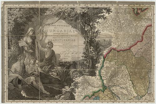
| Title | Mappa Generalis Regni Hungariae parti umque adnexarum Croatiae, Slavoniae et Confiniorum Militarium Magni item Principatus Transylvaniae. |
| Main title | Repertorium locorum Objectorumque in XII. tabulis Mappae Regnorum Hungariae Slavoniae, Croatiae, et Confiniorum Militarium Magni item Principatus Transylvaniae… |
| Subject | A Magyar Királyság, Horvát–Szlavonia és Erdély általános térképe 1806-ban. |
1332. Topographische Special- und Post-Karte des Grossfürstenthums... [B IX a 710]
Institute and Museum of Military History •
B IX a
•
B IX Ausztria–Magyarország
•
B I–XV. Európa
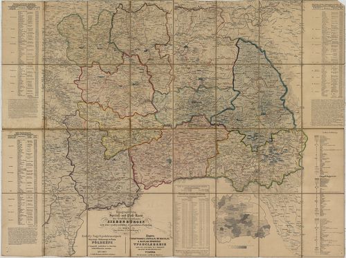
| Title | Topographische Special- und Post-Karte des Grossfürstenthums Siebenbürgen nach seiner neuesten politischen und gerichtlichen Eintheilung. – Erdély Nagyfejedelemségnek Helyszinű-Különnemű és Posta Földképe. A’ legújabb politikai és törvény széki felosztás szerint. – Kartă topografică specială si spostală a marelui Principat Transilvania după cea mai noua asaîm părtire politică si iudectorescă. |
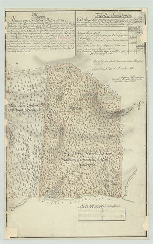
1333. Delineatio objectorum Marusianorum in Terreno et Dominio Kon... [S 12 - Div. XIII. - No. 300.]
National Archives of Hungary •
S 12 Helytartótanácsi térképek (1738-1875)
•
S Kormányhatósági fondokból kiemelt térképek (17. sz.-20. sz.)
•
S – Térképtár
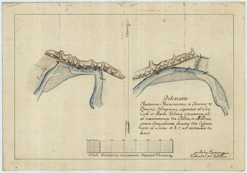
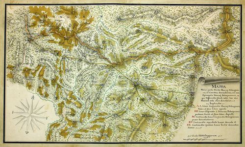
| Main title | Delineatio objectorum Marusianorum in Terreno et Dominio Konopiensi, signanter ad Loca Csolt et Rivum Kalátsa situatorum ubi ad conservationem Via Publicae in M. Principatum Transsylvaniae ducentis Octo Calcaria, ... exstruenda veniunt |
| Subject | Div. XIII. - No. 300. A Maros Csolt és Konop /Arad m./ határában, az erdélyi országút közelében |
1334. Copie einer türkischen Karte, wo die Gränzen Siebenbürgens, ... [B IX c 756]
Institute and Museum of Military History •
B IX c
•
B IX Ausztria–Magyarország
•
B I–XV. Európa
| Title | Copie einer türkischen Karte, wo die Gränzen Siebenbürgens, gegen die Bukowina, Moldau und Wallachey illuminirt, wie auch alle – an der alten und gegen die Moldau und Wallachey vorgerückten Gränzen aufgesellte Kais. österreichischen Adlerspuncte bezeichnet sind. |
| Main title | Erdély határának térképe Bukovina, Moldva és Havasalföld felé. Török térkép másolata 1775-ből. |
1335. Mappa geographica et topographica omnium episcopatuum Regni ... [S 70 - No. 5.]
National Archives of Hungary •
S 70 Vegyes kéziratos térképek (1669-1942)
•
S – Térképtár
| Main title | Mappa geographica et topographica omnium episcopatuum Regni Hungariae, Croatiae, Sclavoniae, Galliciae, Bosniae, Serviae, et Principat Transylvaniae, nec non eorum et sunt Dalmatiae, cum parte Maria Adriatici, item Moldaviae, Volachiae et Bulgariu quibus |
| Subject | No. 5. Magyarország, Kroatia, Szlavónia, Galícia, Bosznia, Szerbia, Erdély, Moldavia, Valachia és Bulgária földrajzi és egyházkörzeti térképe |
1336. Allgemeine Charte vom Königreiche Ungarn mit Einschluss der ... [B IX a 498/a]
Institute and Museum of Military History •
B IX a
•
B IX Ausztria–Magyarország
•
B I–XV. Európa
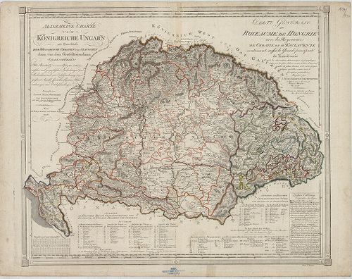
| Title | Allgemeine Charte vom Königreiche Ungarn mit Einschluss der Königreiche Croatien und Slavonien dann von dem Grossfürstenthum Siebenbürgen… – Carte Générale du Royeaume de Hongrie avec les Royaeumes de Croatie et d’Esclavonie contenant aussi le Grand – principauté de Transilvanie… |
| Main title | A Magyar Királyság, Horvátország, Szlavónia, és Erdély térképe 1805-ben, kerületi beosztással. |
1337. Vermehrte und verbesserte Landkarten des Königreichs Ungarn ... [B IX a 487/1]
Institute and Museum of Military History •
B IX a
•
B IX Ausztria–Magyarország
•
B I–XV. Európa
| Title | Vermehrte und verbesserte Landkarten des Königreichs Ungarn und deren andern angrentzenden Königreiche Fürstenthumen und Landschafften samt denen Grentz, Posten, … Ertzhaus Oesterreich von dem Adriatischen Meer an bis in Siebenbürgen vor Verstungen und Plätze gegen dem Erbfeind zu Nutz der gantzen Christenheit… |
| Main title | A Magyar Királyság,, Ausztria, Horvátország és Erdély, térképe 1684-ben. |
1338. Csonka-Magyarország áttekintő térképe. (1939. április 4-i ha... [B XV c 357]
Institute and Museum of Military History •
B XV c
•
B XV Magyarország (1920 után)
•
B I–XV. Európa
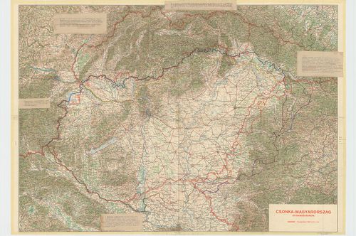
| Title | Csonka-Magyarország áttekintő térképe. (1939. április 4-i határ.) Ez a térkép a nemzetiségi viszonyokat az 1939. évi Szlovákia, Erdély, a Vajdaság és Nyugat-Magyarország (Burgenland) területén az 1930. évi cseh; 1931. évi jugoszláv és az 1934. évi osztrák hivatalos népszámlálások adatai alapján tünteti fel. A revízióra vonatkozó különböző elképzelések térképi ábrázolása. |
1339. Mappa Geographica novissima Regni Hungariae divisi in suos C... [B IX a 513]
Institute and Museum of Military History •
B IX a
•
B IX Ausztria–Magyarország
•
B I–XV. Európa
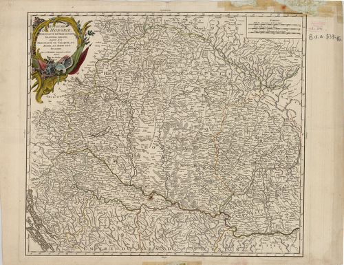
| Title | Mappa Geographica novissima Regni Hungariae divisi in suos Comitatus cum Districtibus Iazygum et Cumanorum Banatus Temesiensis ejusque Districtuum nec non Regnorum Croatiae, Sclavoniae, Dalmatiae, Magni Principatus Transilvaniae partis Bosniae Serviai Bulgariae et Walachiae… |
| Main title | A Magyar Királyság, Horvát-Szlavónia, Dalmácia, Erdély, valamint Bosznia, Szerbia, Bulgária és Havasalföld egy részének térképe 1769-ben. |
1340. Statistische Karte des Groswardeiner Districts [S 12 - Div. XI. - No. 123.]
National Archives of Hungary •
S 12 Helytartótanácsi térképek (1738-1875)
•
S Kormányhatósági fondokból kiemelt térképek (17. sz.-20. sz.)
•
S – Térképtár
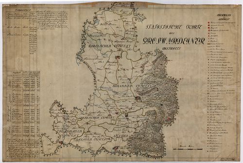
| Main title | Statistische Karte des Groswardeiner Districts |
| Subject | Div. XI. - No. 123. A nagyváradi közigazgatási kerület közigazgatási térképe |
Content: országrészhatár Erdély határa kerülethatár a nagyváradi kerület [...]