21. Carte du Diocese de Montpellier. [B V c 61/8]
Institute and Museum of Military History •
B V c
•
B V Franciaország
•
B I–XV. Európa
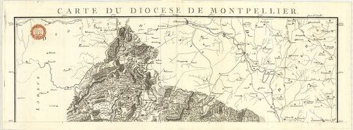
| Title | Carte du Diocese de Montpellier. |
| Main title | Franciaország: Montpellier egyházi kerület térképe 1814 körül. |
22. Carte du Diocese D’Agde. [B V c 61/9]
Institute and Museum of Military History •
B V c
•
B V Franciaország
•
B I–XV. Európa
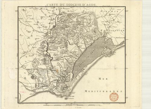
| Title | Carte du Diocese D’Agde. |
| Main title | Franciaország: Agde egyházi kerület térképe 1814 körül. |
23. Carte du Diocese de Nismes. [B V c 61/11]
Institute and Museum of Military History •
B V c
•
B V Franciaország
•
B I–XV. Európa
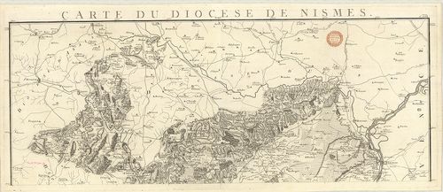
| Title | Carte du Diocese de Nismes. |
| Main title | Franciaország: Nimes egyházi kerület térképe 1814 körül. |
24. Carte du Diocese du Puy. [B V c 61/14]
Institute and Museum of Military History •
B V c
•
B V Franciaország
•
B I–XV. Európa
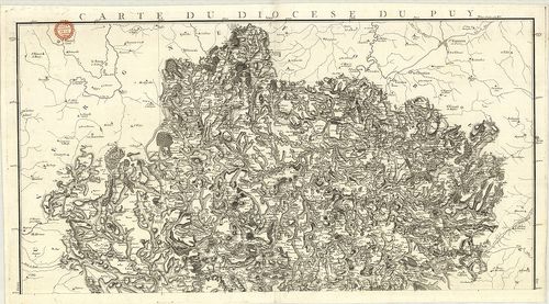
| Title | Carte du Diocese du Puy. |
| Main title | Franciaország: Le Puy egyházi kerület térképe 1814 körül. |
25. Carte du Diocese de Rieux. [B V c 61/15]
Institute and Museum of Military History •
B V c
•
B V Franciaország
•
B I–XV. Európa
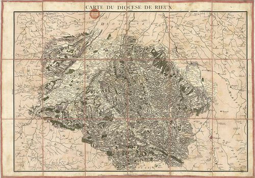
| Title | Carte du Diocese de Rieux. |
| Main title | Franciaország: Rieumes egyházi kerüelt térképe 1814 körül. |
26. Carte du Réseau des Chemins de Fer du Midi. [B V c 62]
Institute and Museum of Military History •
B V c
•
B V Franciaország
•
B I–XV. Európa
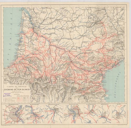
| Title | Carte du Réseau des Chemins de Fer du Midi. |
| Main title | 7 mt.: 1. Bordeaux, 2. Bayonne, 3. Montauban, 4. Toulouse, 5. Narbonne, 6. Béziers, 7. Albi városok közlekedési térképe. |
| Subject | Franciaország DNY-i részének vasúthálózati térképe 1911-ben. |
27. Supplement zur Strassen-Karte der Westlichen Alpen. 1832. [B V c 62/1]
Institute and Museum of Military History •
B V c
•
B V Franciaország
•
B I–XV. Európa
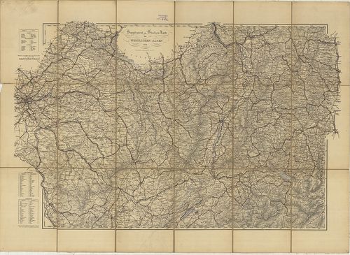
| Title | Supplement zur Strassen-Karte der Westlichen Alpen. 1832. |
| Main title | A Nyugati-Alpok úthálózati térképe 1832-ből, a vasúthálózat 1870-ig helyesbítve. |
28. Supplement zur Strassen-Karte der Westlichen Alpen. [B V c 62/2]
Institute and Museum of Military History •
B V c
•
B V Franciaország
•
B I–XV. Európa
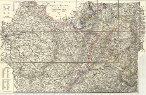
| Title | Supplement zur Strassen-Karte der Westlichen Alpen. |
| Main title | A Nyugati-Alpok úthálózati térképe 1832-ben. |
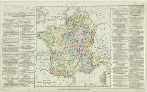
29. Tableau Statistique et Géographique de l’Espéce Chevaline en... [B V c 63]
Institute and Museum of Military History •
B V c
•
B V Franciaország
•
B I–XV. Európa
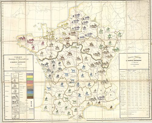
| Title | Tableau Statistique et Géographique de l’Espéce Chevaline en France. |
| Main title | Franciaország földrajzi és statisztikai térképe a lóállományról 1834-ben. |
30. Plan de L’innondation de la Ville de Condé du coste’ de L’es... [B V c 65]
Institute and Museum of Military History •
B V c
•
B V Franciaország
•
B I–XV. Európa
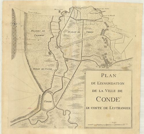
| Title | Plan de L’innondation de la Ville de Condé du coste’ de L’estranges. |
| Main title | Franciaország: Condé sur Escaut környékének vízborította területei és csatornái a 18. században. |
31. Carte de la Gaule, divisée en 17 Grandes Provinces Romaines… [B V c 67]
Institute and Museum of Military History •
B V c
•
B V Franciaország
•
B I–XV. Európa
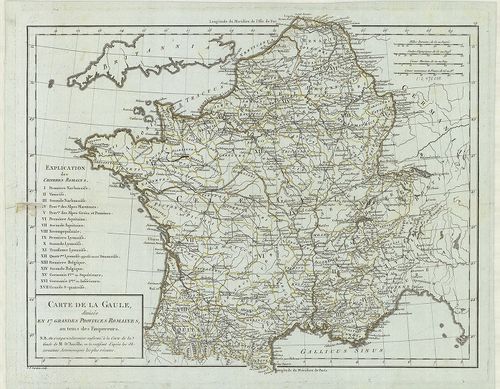
| Title | Carte de la Gaule, divisée en 17 Grandes Provinces Romaines… |
| Main title | Franciaország: Gallia történelmi térképe a 17 római tartomány jelölésével. |
32. Carte Syntétique des accroissements successifs de la puissan... [B V c 68]
Institute and Museum of Military History •
B V c
•
B V Franciaország
•
B I–XV. Európa
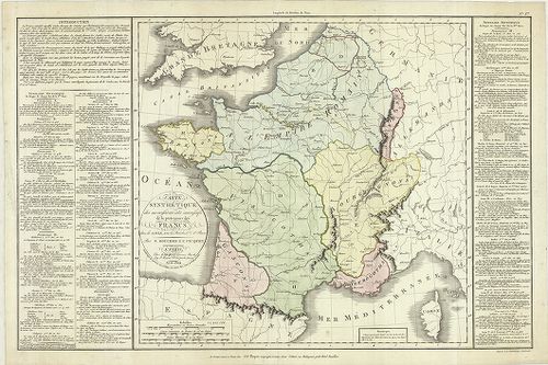
| Title | Carte Syntétique des accroissements successifs de la puissance des Francs. |
| Main title | Franciaország összefoglaló történelmi térképe 420–986. között. |
33. Carte Syintétique… la monarchie Francaise… le Consulat de Bo... [B V c 69]
Institute and Museum of Military History •
B V c
•
B V Franciaország
•
B I–XV. Európa
| Title | Carte Syintétique… la monarchie Francaise… le Consulat de Bonaparte. |
| Main title | Franciaország összefoglaló történelmi térképe 987-től 1800-ig, Bonaparte konzulságáig. |
34. Paralléle de Paris. [B V c 70]
Institute and Museum of Military History •
B V c
•
B V Franciaország
•
B I–XV. Európa
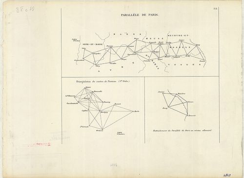
| Title | Paralléle de Paris. |
35. Triangulation du département de la Somme. (I.re Ordre.) [B V c 70/1]
Institute and Museum of Military History •
B V c
•
B V Franciaország
•
B I–XV. Európa
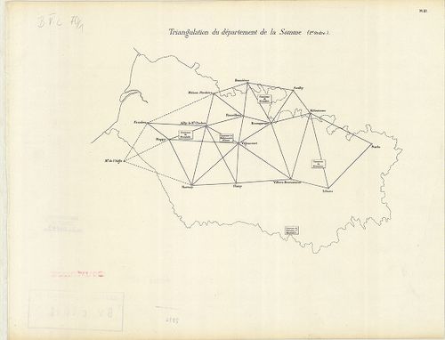
| Title | Triangulation du département de la Somme. (I.re Ordre.) |
| Main title | Franciaország: A Somme megye trigonometriai felmérési hálózata, a 19. században. |
36. Nivellement Général de la France. [B V c 70/2]
Institute and Museum of Military History •
B V c
•
B V Franciaország
•
B I–XV. Európa
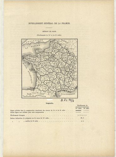
| Title | Nivellement Général de la France. |
| Main title | Franciaország általános szintezés-hálózati térképe 1880 körül megyei beosztással. |
37. Nivellement Général de la France. [B V c 70/3]
Institute and Museum of Military History •
B V c
•
B V Franciaország
•
B I–XV. Európa
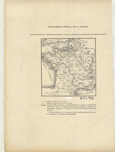
| Title | Nivellement Général de la France. |
| Main title | Franciaország szintezés-hálózat térképe 1880 körül. |
38. Prof. W. Liebenows Karte für das Gebiet zwischen Metz u. Rei... [B V c 81]
Institute and Museum of Military History •
B V c
•
B V Franciaország
•
B I–XV. Európa
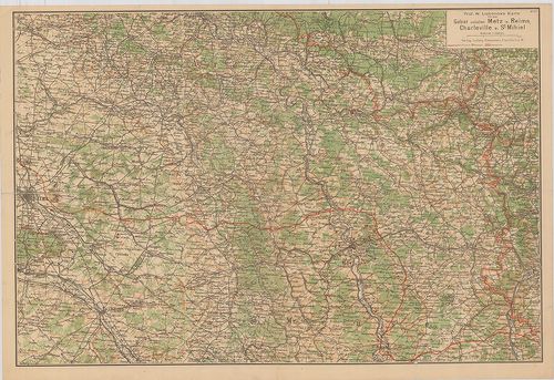
| Title | Prof. W. Liebenows Karte für das Gebiet zwischen Metz u. Reims, Charleville u. St. Mihiel. No. 47. |
| Main title | Franciaország: Metz–Reims–Charleville és St. Mihiel közötti terület úthálózati térképe az 1918-as frontvonal jelöléssel. |
39. Übersichtskarte des deutsch-Französischen Kriegsschauplatzes... [B V c 82]
Institute and Museum of Military History •
B V c
•
B V Franciaország
•
B I–XV. Európa
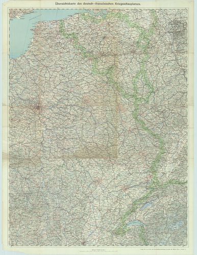
| Title | Übersichtskarte des deutsch-Französischen Kriegsschauplatzes. Lechners Kriegskarte VII. |
| Main title | A német–francia hadszíntér térképe az I. világháborúban. |
40. Paris, westlicher Teil. [B V c 83]
Institute and Museum of Military History •
B V c
•
B V Franciaország
•
B I–XV. Európa
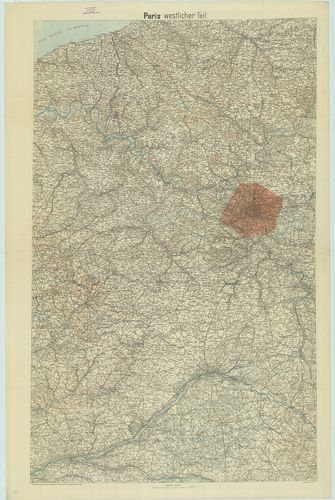
| Title | Paris, westlicher Teil. |
| Main title | Franciaország: Páris környékének topográfiai térképe 1918-ban. |