1. Novissima et Accuratissima Totius Russiae Vulgo Muscoviae Ta... [B XI a 2]
Institute and Museum of Military History •
B XI a
•
B XI Oroszország
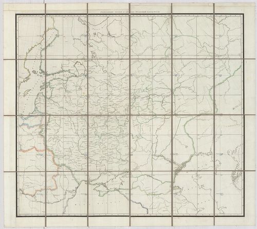
•
B I–XV. Európa
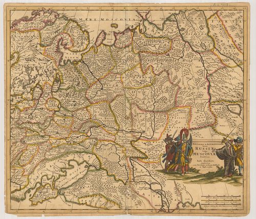
| Title | Novissima et Accuratissima Totius Russiae Vulgo Muscoviae Tabula. |
| Main title | Oroszország térképe a 17. század végén tartományi beosztással. |
2. Charte das Russische Reich und die von den Tatarn. [B XI a 6]
Institute and Museum of Military History •
B XI a
•
B XI Oroszország
•
B I–XV. Európa
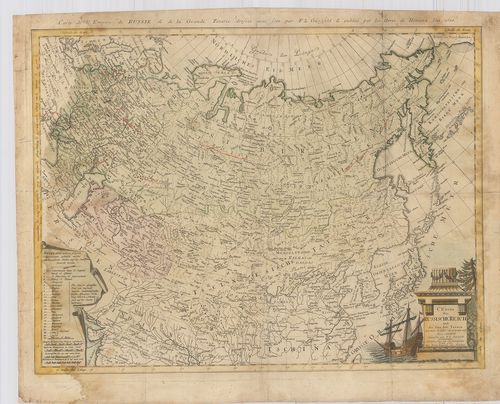
| Title | Charte das Russische Reich und die von den Tatarn. |
| Main title | Az Orosz és Tatár Birodalom 1786-ban. |
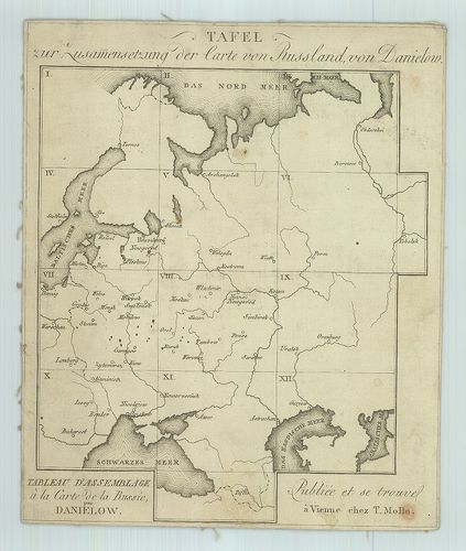
3. [Oroszországi kormányzóságok térképei 1786 körül.] [B XI a 7]
Institute and Museum of Military History •
B XI a
•
B XI Oroszország
•
B I–XV. Európa
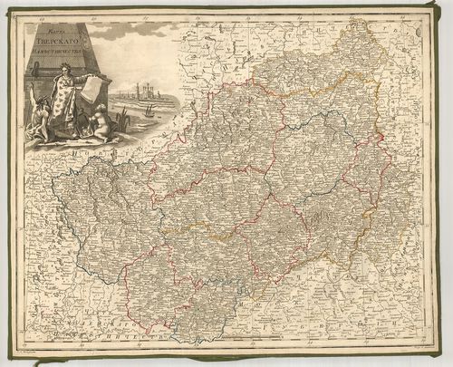
| Title | [Oroszországi kormányzóságok térképei 1786 körül.] |
| Main title | 1. Karta Revel’szkago namesztnicsesztva. |
| Subject | A revali (Tallini) korm. 2. Karta Rizsszkago namesztnicsesztva. |
4. Generalkarte des Russischen Reichs… nach der zur Petersburg ... [B XI a 8]
Institute and Museum of Military History •
B XI a
•
B XI Oroszország
•
B I–XV. Európa
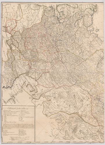
| Title | Generalkarte des Russischen Reichs… nach der zur Petersburg 1787 verfertigten Karte und des Herra von Lesseps Reise durch Kamtschatka und Sibirien verbessert. |
| Main title | Az Orosz Birodalom általános térképe 1792-ben a helytartóságok és körzetek feltüntetésével. |
5. Podrobnaja Karta Roszszijszkoj Imperii i bliz lezsascsih zag... [B XI a 10]
Institute and Museum of Military History •
B XI a
•
B XI Oroszország
•
B I–XV. Európa
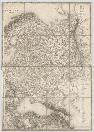
| Title | Podrobnaja Karta Roszszijszkoj Imperii i bliz lezsascsih zagramicsnih vladenij. |
| Main title | Európai Oroszország térképe 1801–1804-ben. |
6. Karte des Europaeisch und eines Theils des asiatisch–russisc... [B XI a 13]
Institute and Museum of Military History •
B XI a
•
B XI Oroszország
•
B I–XV. Európa
| Title | Karte des Europaeisch und eines Theils des asiatisch–russischen Reichs… |
| Main title | Oroszország térképe 1812-ben. |
7. Russland. [B XI a 14]
Institute and Museum of Military History •
B XI a
•
B XI Oroszország
•
B I–XV. Európa
| Title | Russland. |
| Main title | Európai Oroszország térképe a 19. század közepén. |
8. G. Freytags Karte der Österreichisch–Russischen und Deutsch–... [B XI a 15]
Institute and Museum of Military History •
B XI a
•
B XI Oroszország
•
B I–XV. Európa
| Title | G. Freytags Karte der Österreichisch–Russischen und Deutsch–Russischen Grenzgebiete. |
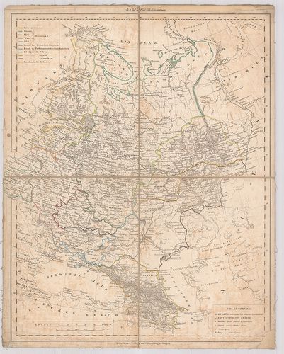
9. General Karte von Europaeischen Russland. [B XI a 18]
Institute and Museum of Military History •
B XI a
•
B XI Oroszország
•
B I–XV. Európa
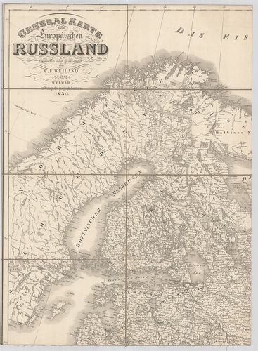
| Title | General Karte von Europaeischen Russland. |
| Main title | Mt.: Grundriss von St. Petersburg. (Szentpétervár–Leningrád) |
| Subject | Európai Oroszország általános térképe 1854-ben. |
10. Európai Orosz-álladalom. [B XI a 20]
Institute and Museum of Military History •
B XI a
•
B XI Oroszország
•
B I–XV. Európa
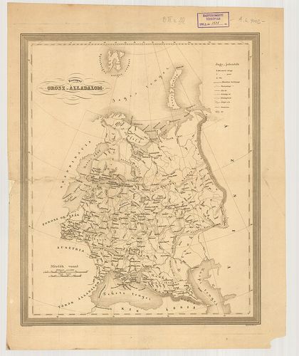
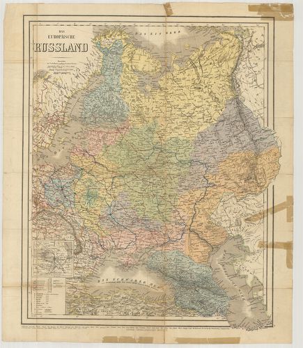
| Title | Európai Orosz-álladalom. |
| Main title | Európai Oroszország térképe az 1840-es évekből a kormányzóságok feltüntetésével. |
11. Europaeisches Russland. [B XI a 21]
Institute and Museum of Military History •
B XI a
•
B XI Oroszország
•
B I–XV. Európa
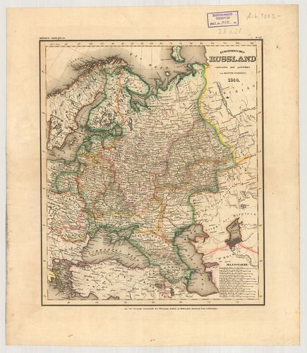
| Title | Europaeisches Russland. |
| Main title | Európai Oroszország 1844-es térképe közigazgatási beosztással. |
12. Az orosz háború térképe. [B XI a 22]
Institute and Museum of Military History •
B XI a
•
B XI Oroszország
•
B I–XV. Európa
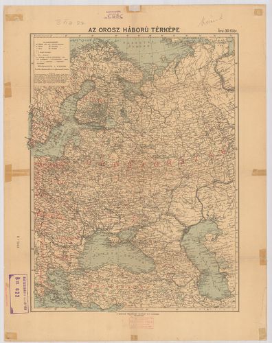
| Title | Az orosz háború térképe. |
13. Az európai és ásiai Orosz Birodalom földképe. [B XI a 22/1]
Institute and Museum of Military History •
B XI a
•
B XI Oroszország
•
B I–XV. Európa
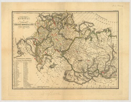
| Title | Az európai és ásiai Orosz Birodalom földképe. |
14. Europäisches Russland. [B XI a 24]
Institute and Museum of Military History •
B XI a
•
B XI Oroszország
•
B I–XV. Európa

| Title | Europäisches Russland. |
| Main title | Mt.: St. Petersburg und Umgebung. (Szentpétervár–Leningrád és környéke. 2. mell.: I. West-Russland. (Nyugat-Oroszország-Lengyelország.) |
| Subject | Mt.: Warschau. II. Galizien und die Bukovina. (Galícia és Bukovina) |
15. Europäisches Russland. [B XI a 24/1]
Institute and Museum of Military History •
B XI a
•
B XI Oroszország
•
B I–XV. Európa
| Title | Europäisches Russland. |
| Main title | Az Európai Oroszország 1910 körül, közigazgatási határokkal. |
16. Europäisches Russland und Nord-Skandinavien in 6 Blättern. –... [B XI a 25]
Institute and Museum of Military History •
B XI a
•
B XI Oroszország
•
B I–XV. Európa
| Title | Europäisches Russland und Nord-Skandinavien in 6 Blättern. – Karte von Russland mit Namenverzeichnis aus Stielers Handatlas. |
| Main title | Európai Oroszország és Észak-Skandinávia térképe. |
17. Karte des Russischen Reichs in Europa. in 6 Blättern. [B XI a 26]
Institute and Museum of Military History •
B XI a
•
B XI Oroszország
•
B I–XV. Európa
| Title | Karte des Russischen Reichs in Europa. in 6 Blättern. |
| Main title | Európai Oroszország közigazgatási térképe. |
18. Europäisches Russland. [B XI a 28]
Institute and Museum of Military History •
B XI a
•
B XI Oroszország
•
B I–XV. Európa
| Title | Europäisches Russland. |
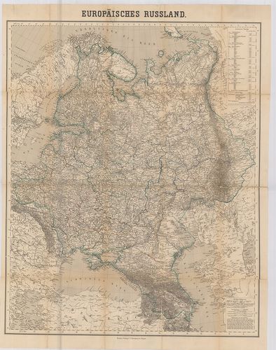
| Main title | Az Európai Oroszország általános térképe 1871-ben. |
19. Das Europaeische Russland und die Statthalterschaft Kaukásus... [B XI a 30]
Institute and Museum of Military History •
B XI a
•
B XI Oroszország
•
B I–XV. Európa

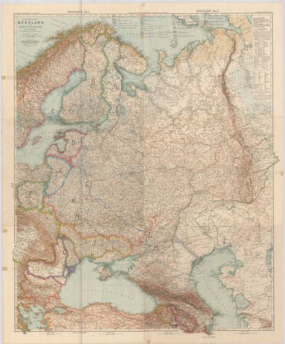
| Title | Das Europaeische Russland und die Statthalterschaft Kaukásus. |
| Main title | Európai Oroszország és a Kaukázusi Helytartóság 1883-ban. |
20. Das Europäische Russland. [B XI a 31]
Institute and Museum of Military History •
B XI a
•
B XI Oroszország
•
B I–XV. Európa
| Title | Das Europäische Russland. |
| Main title | Mt.: [Petersburg (Leningrád) környéke.] |
| Subject | Az Európai Oroszország térképe 1862-ben. |