251. Cartoguide Shell Berre. [B V c 133]
Institute and Museum of Military History •
B V c
•
B V Franciaország
•
B I–XV. Európa
| Title | Cartoguide Shell Berre. |
| Main title | 1. Nord. (Franciaország É-i része) 2. Bretagne. 3. Normandie (Normandia). 4. Ile de France. 5. Est (Franciaország K-i része). 6. Val de Loire (Loire völgye). 7. Centre (Közép-Franciaország). 8. Jura, Savoie. 9. Périgord Atlantique. 10. Auvergne Cévennes. 11. Provence Côte d’Azur (Azur-part). 12. Pyrénées (Pireneusok). Côte Basque (Baszk-tengerpart). 13. Languedoc Roussillon. 14. Corse (Korzika). |
252. France. Cartoguide. Shell. [B V c 134]
Institute and Museum of Military History •
B V c
•
B V Franciaország
•
B I–XV. Európa
| Title | France. Cartoguide. Shell. |
| Main title | 1. Nord (Észak-Franciaország.). 2. Bretagne. 3. Normandie. 4. Ile de France. 5. Rhin et Meuse (A Rajna és Maas-folyók). 6. Val de Loire (A Loir-folyó völgye). 7. Centre (Közép-Franciaország.). 8. Bourgogne Rhône-Alpes. 10. Auvergne-Cévennes. 11. Provence-Cote d’Azur. 12. Pyrénées Cote Basque. (A Piréneusok és a Baszk-tengerpart.) 13. Languedoc-Roussillon. 14. Corse (Korzika). |
253. Pneu Michelin Carte. [B V c 135]
Institute and Museum of Military History •
B V c
•
B V Franciaország
•
B I–XV. Európa
| Title | Pneu Michelin Carte. |
| Main title | 51. Boulogne–Lille. 52. La Havre–Amiens. 53. Arras–Méziéres. 54. Cherbourg–Rouen. 55. Caen–Paris. 56. Paris–Reims. 57. Verdun–Wissembourg. 60. Le Mans–Paris. 61. Paris–Chaumont. 62. Chaumont–Strasbourg. 64. Angers–Orleans. 65. Auxerre–Dijon. 66. Dijon–Mulhouse. 68. Niort–Châteauroux. 69. Bourges–Macon. 70. Beaune–Evian. 72. Angauleme–Limoges. |
254. Reisekarte Frankreich Polyglott. [B V c 136]
Institute and Museum of Military History •
B V c
•
B V Franciaország
•
B I–XV. Európa
| Title | Reisekarte Frankreich Polyglott. |
255. France… Carte Automobile [B V c 137]
Institute and Museum of Military History •
B V c
•
B V Franciaország
•
B I–XV. Európa
| Title | France… Carte Automobile |
| Main title | Mt.: (Cannes, Nice, Monaco) |
256. A Traveler’s Map of France. [B V c 138]
Institute and Museum of Military History •
B V c
•
B V Franciaország
•
B I–XV. Európa
| Title | A Traveler’s Map of France. |
| Main title | 7 mt.: 1. Paris. 2. Rouen. 3. Lyon. 4. Strasbourg. 5. Tours. 6. Bordeaux. 7. Nice. |
257. Franreich. Grosse Autokarte. No. 89. [B V c 140]
Institute and Museum of Military History •
B V c
•
B V Franciaország
•
B I–XV. Európa
| Title | Franreich. Grosse Autokarte. No. 89. |
| Main title | 11 mt.: 1. Rouen. 2. Reims 3. Orléans. 4. Strasbourg. 5. Nancy. 6. Lyon. 7. Bordeaux 8. Toulouse. 9. Nice (Nizza). 10. Marseille. 11. Paris. |
258. Ost Frankreich. Grosse Autokarte. No. 890. [B V c 141]
Institute and Museum of Military History •
B V c
•
B V Franciaország
•
B I–XV. Európa
| Title | Ost Frankreich. Grosse Autokarte. No. 890. |
259. L’Ile de France. Carte routiére, et touristique. [B V c 142]
Institute and Museum of Military History •
B V c
•
B V Franciaország
•
B I–XV. Európa
| Title | L’Ile de France. Carte routiére, et touristique. |
260. Franciaország autótérképe [B V c 143]
Institute and Museum of Military History •
B V c
•
B V Franciaország
•
B I–XV. Európa
| Title | Franciaország autótérképe |
261. Das Frankreich 486–911. [B V c 144]
Institute and Museum of Military History •
B V c
•
B V Franciaország
•
B I–XV. Európa
| Title | Das Frankreich 486–911. |
| Main title | 3 mt.: 1. Ausbreitung der fränkischen Heerschaft bis Mitte 6. Jh. (A francia uralom kibontakozása a 6. század közepéig.) 2. Die fränkischen Teilreiche im 7. Jh. (Franciaország a 7. században.) 3. Reichsteilungen und Teilreiches 843–888. (Birodalom helyzete és része 843–888-ig.) |
262. Provence Cote d’Azur. Carte routiére et touristique. [B V c 145]
Institute and Museum of Military History •
B V c
•
B V Franciaország
•
B I–XV. Európa
| Title | Provence Cote d’Azur. Carte routiére et touristique. |
| Main title | Mt.: Riviéra Italienne. (Az olasz Riviéra.) |
263. Sud-Ouest-Carte routiére et touristique. [B V c 145/1]
Institute and Museum of Military History •
B V c
•
B V Franciaország
•
B I–XV. Európa
| Title | Sud-Ouest-Carte routiére et touristique. |
264. Normandie. (Haute Normandie–Basse Normandie.) Carte routiére... [B V c 145/2]
Institute and Museum of Military History •
B V c
•
B V Franciaország
•
B I–XV. Európa
| Title | Normandie. (Haute Normandie–Basse Normandie.) Carte routiére et touristique. |
265. Bretagne. Carte routiére et touristique. [B V c 145/3]
Institute and Museum of Military History •
B V c
•
B V Franciaország
•
B I–XV. Európa
| Title | Bretagne. Carte routiére et touristique. |
266. Rhone Alpes. Savoie–Dauphiné–Lyonnais. Carte routiéres et to... [B V c 145/4]
Institute and Museum of Military History •
B V c
•
B V Franciaország
•
B I–XV. Európa
| Title | Rhone Alpes. Savoie–Dauphiné–Lyonnais. Carte routiéres et touristique. |
267. Région Parisienne. Routiére touristique administrative. [B V c 146]
Institute and Museum of Military History •
B V c
•
B V Franciaország
•
B I–XV. Európa
| Title | Région Parisienne. Routiére touristique administrative. |
268. Languedoc Roussillon. Routiére touristique administrative. [B V c 146/1]
Institute and Museum of Military History •
B V c
•
B V Franciaország
•
B I–XV. Európa
| Title | Languedoc Roussillon. Routiére touristique administrative. |
269. France. Bretagne. [B V c 161]
Institute and Museum of Military History •
B V c
•
B V Franciaország
•
B I–XV. Európa
| Title | France. Bretagne. |
270. Pyrénées. France. [B V c 162]
Institute and Museum of Military History •
B V c
•
B V Franciaország
•
B I–XV. Európa
| Title | Pyrénées. France. |
271. France, Provence Côte d’Azur. [B V c 164]
Institute and Museum of Military History •
B V c
•
B V Franciaország
•
B I–XV. Európa
| Title | France, Provence Côte d’Azur. |
272. France. Corse. [B V c 165]
Institute and Museum of Military History •
B V c
•
B V Franciaország
•
B I–XV. Európa
| Title | France. Corse. |
273. Ravensteins Kriegskarte no. 42. – Gebiet zwischen Charleroy,... [B V c 166]
Institute and Museum of Military History •
B V c
•
B V Franciaország
•
B I–XV. Európa
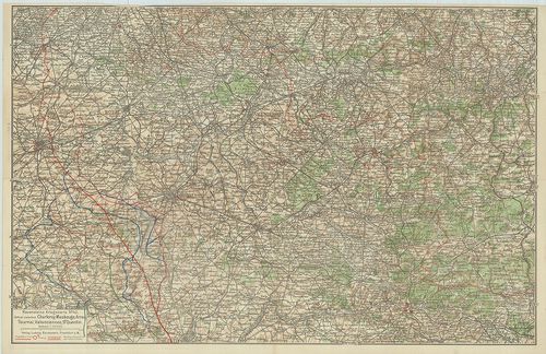
| Title | Ravensteins Kriegskarte no. 42. – Gebiet zwischen Charleroy, Maubeuge, Arras, Tournai, Valenciennes, St. Quentin |
| Main title | Charleroy, Maubeuge, Arras, Tournai, Valenciennes, St. Quentin városok és környékük az I- világháború alatt. |
274. Ravensteins Kriegskarte No. 32 – Maasgebiet, Verdun, Argonne... [B V c 167]
Institute and Museum of Military History •
B V c
•
B V Franciaország
•
B I–XV. Európa
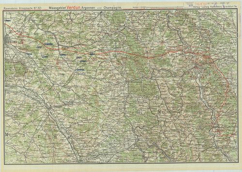
| Title | Ravensteins Kriegskarte No. 32 – Maasgebiet, Verdun, Argonnen und Champagne. |
| Main title | Verdun, Argonnen és Champagne városok környéke az I- világháború alatt. |
275. Namenverzeichnis zu den Karten des Französisch-belgischen Kr... [B V c 168]
Institute and Museum of Military History •
B V c
•
B V Franciaország
•
B I–XV. Európa
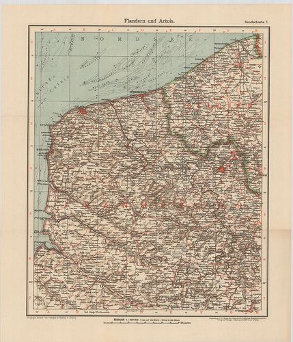
| Title | Namenverzeichnis zu den Karten des Französisch-belgischen Kriegshauplatzes. |
| Main title | 8 térkép (5 lapon). l. Flandern und Artois (Flandria és Artois). |
| Subject | 2. Champagne und Französisch-Lothringen (Champagne és Francia-Lotharingia). |
276. Deutsch–Französischer Krieg 1914. Belfort und die Vogesen au... [B V c 173]
Institute and Museum of Military History •
B V c
•
B V Franciaország
•
B I–XV. Európa
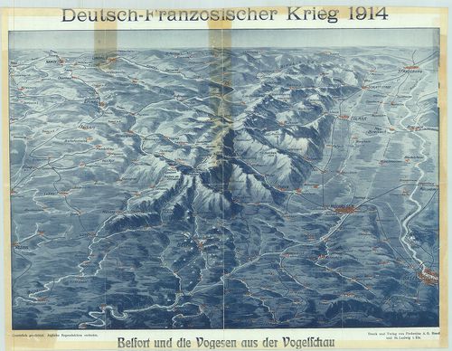
| Title | Deutsch–Französischer Krieg 1914. Belfort und die Vogesen aus der Vogelscheu |
| Main title | Német–francia háború 1914. Belfort és a Vogézek madártávlatból. Német, francia, svájci határvidék, plasztikus rálátásban. |
277. A Nyugati Hadszíntér. A Maginot és a Siegfried vonal tájékoz... [B V c 174]
Institute and Museum of Military History •
B V c
•
B V Franciaország
•
B I–XV. Európa
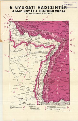
| Title | A Nyugati Hadszíntér. A Maginot és a Siegfried vonal tájékoztató vázlata. |
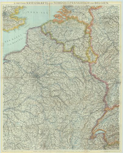
278. G. Freytags Kriegskarte von Nordost-Frankreich und Belgien. [B V c 175]
Institute and Museum of Military History •
B V c
•
B V Franciaország
•
B I–XV. Európa
| Title | G. Freytags Kriegskarte von Nordost-Frankreich und Belgien. |
| Main title | Franciaország ÉK-i része és Belgium hadszíntér térképe az 1918. márc. 21–27. offenzíva megindulásakor. |
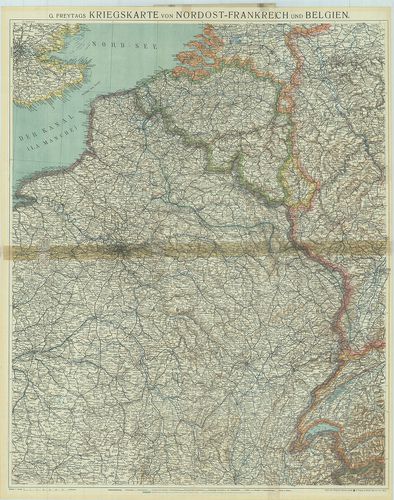
279. G. Freytags Kriegskarte von Nordost-Frankreich und Belgien. [B V c 176]
Institute and Museum of Military History •
B V c
•
B V Franciaország
•
B I–XV. Európa
| Title | G. Freytags Kriegskarte von Nordost-Frankreich und Belgien. |
| Main title | Franciaország ÉK-i része és Belgium hadszíntér térképe az 1916. febr.-ban. |
280. Franciaország – autótérkép. [B V c 177]
Institute and Museum of Military History •
B V c
•
B V Franciaország
•
B I–XV. Európa
| Title | Franciaország – autótérkép. |
281. Carte Michelin de la France. [B V c 178]
Institute and Museum of Military History •
B V c
•
B V Franciaország
•
B I–XV. Európa
| Title | Carte Michelin de la France. |
282. Carte Michelin de la France, Normandie. [B V c 179]
Institute and Museum of Military History •
B V c
•
B V Franciaország
•
B I–XV. Európa
| Title | Carte Michelin de la France, Normandie. |
283. Carte Michelin de la France Nord, Flandre, Artois, Picardie. [B V c 180]
Institute and Museum of Military History •
B V c
•
B V Franciaország
•
B I–XV. Európa
| Title | Carte Michelin de la France Nord, Flandre, Artois, Picardie. |
284. France, Carte routiére et touristique. [B V c 181]
Institute and Museum of Military History •
B V c
•
B V Franciaország
•
B I–XV. Európa
| Title | France, Carte routiére et touristique. |
285. France routiére départementale. [B V c 182]
Institute and Museum of Military History •
B V c
•
B V Franciaország
•
B I–XV. Európa
| Title | France routiére départementale. |
| Main title | 2 mt.: Relief de la France. Sorties de Paris. (Franviaország domborzata. Párizs környéke. |
286. Provence. [B V c 183]
Institute and Museum of Military History •
B V c
•
B V Franciaország
•
B I–XV. Európa
| Title | Provence. |
| Main title | Franciaország áttek. térképe. |
287. Corse-du Sud, Haute Corse. [B V c 184]
Institute and Museum of Military History •
B V c
•
B V Franciaország
•
B I–XV. Európa
| Title | Corse-du Sud, Haute Corse. |
288. France. [B V c 185]
Institute and Museum of Military History •
B V c
•
B V Franciaország
•
B I–XV. Európa
| Title | France. |
| Main title | Franciaország autótérképe |
289. France Direct route map. [B V c 186]
Institute and Museum of Military History •
B V c
•
B V Franciaország
•
B I–XV. Európa
| Title | France Direct route map. |
290. Carte Nautique & touristique de la vallée de l´Ardéche [B V c 187]
Institute and Museum of Military History •
B V c
•
B V Franciaország
•
B I–XV. Európa
| Title | Carte Nautique & touristique de la vallée de l´Ardéche |
291. Territorial Eintheilungs u. Dislokations Karte. (+1 mellékté... [B V c 188]
Institute and Museum of Military History •
B V c
•
B V Franciaország
•
B I–XV. Európa
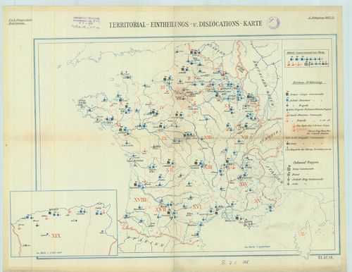
| Title | Territorial Eintheilungs u. Dislokations Karte. (+1 melléktérkép Algéria). |
| Main title | A francia hadsereg diszlokációs térképe. |