201. Triangulation du département de la Somme. (I.re Ordre.) [B V c 70/1]
Institute and Museum of Military History •
B V c
•
B V Franciaország
•
B I–XV. Európa
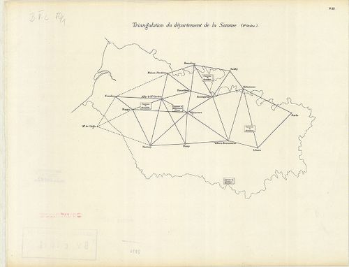
| Title | Triangulation du département de la Somme. (I.re Ordre.) |
| Main title | Franciaország: A Somme megye trigonometriai felmérési hálózata, a 19. században. |
202. Nivellement Général de la France. [B V c 70/2]
Institute and Museum of Military History •
B V c
•
B V Franciaország
•
B I–XV. Európa
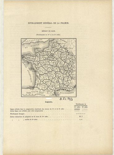
| Title | Nivellement Général de la France. |
| Main title | Franciaország általános szintezés-hálózati térképe 1880 körül megyei beosztással. |
203. Nivellement Général de la France. [B V c 70/3]
Institute and Museum of Military History •
B V c
•
B V Franciaország
•
B I–XV. Európa
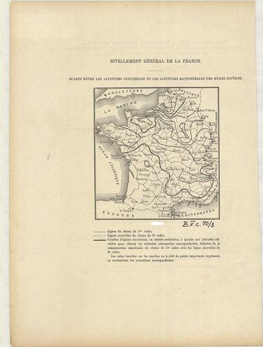
| Title | Nivellement Général de la France. |
| Main title | Franciaország szintezés-hálózat térképe 1880 körül. |
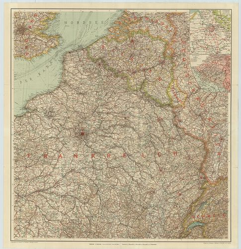
204. Prof. W. Liebenows Karte für das Gebiet zwischen Metz u. Rei... [B V c 81]
Institute and Museum of Military History •
B V c
•
B V Franciaország
•
B I–XV. Európa
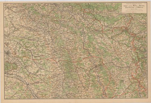
| Title | Prof. W. Liebenows Karte für das Gebiet zwischen Metz u. Reims, Charleville u. St. Mihiel. No. 47. |
| Main title | Franciaország: Metz–Reims–Charleville és St. Mihiel közötti terület úthálózati térképe az 1918-as frontvonal jelöléssel. |
205. Übersichtskarte des deutsch-Französischen Kriegsschauplatzes... [B V c 82]
Institute and Museum of Military History •
B V c
•
B V Franciaország
•
B I–XV. Európa
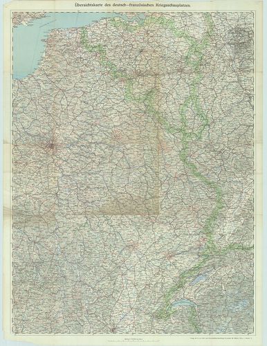
| Title | Übersichtskarte des deutsch-Französischen Kriegsschauplatzes. Lechners Kriegskarte VII. |
| Main title | A német–francia hadszíntér térképe az I. világháborúban. |
206. Paris, westlicher Teil. [B V c 83]
Institute and Museum of Military History •
B V c
•
B V Franciaország
•
B I–XV. Európa
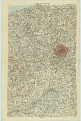
| Title | Paris, westlicher Teil. |
| Main title | Franciaország: Páris környékének topográfiai térképe 1918-ban. |
207. Metz–Belfort. [B V c 85]
Institute and Museum of Military History •
B V c
•
B V Franciaország
•
B I–XV. Európa
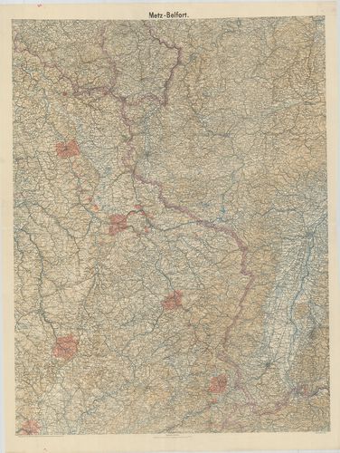
| Title | Metz–Belfort. |
| Main title | Franciaország: Metz–Belfört környékének topográfiai térképe 1918-ban. |
208. A Mosel és Marne közötti terület általános térképe. [B V c 87]
Institute and Museum of Military History •
B V c
•
B V Franciaország
•
B I–XV. Európa
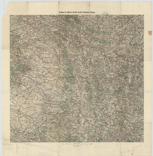
| Title | A Mosel és Marne közötti terület általános térképe. |
209. Der deutsch-französische Kriegsschauplatz. – Specialkarte de... [B V c 89]
Institute and Museum of Military History •
B V c
•
B V Franciaország
•
B I–XV. Európa
| Title | Der deutsch-französische Kriegsschauplatz. – Specialkarte des Kriegsschauplatzes. Der deutsch-Französische Krieg. No. 1. |
210. Spezialkarte der Nördlichen Westfront. – Spezialkarte der Sü... [B V c 90]
Institute and Museum of Military History •
B V c
•
B V Franciaország
•
B I–XV. Európa
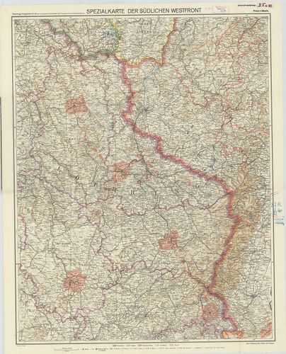
| Title | Spezialkarte der Nördlichen Westfront. – Spezialkarte der Südlichen Westfront. Flemmings Kriegskarte No. 23. |
| Main title | A német–francia hadszíntér térképe az I. világháborúban. |
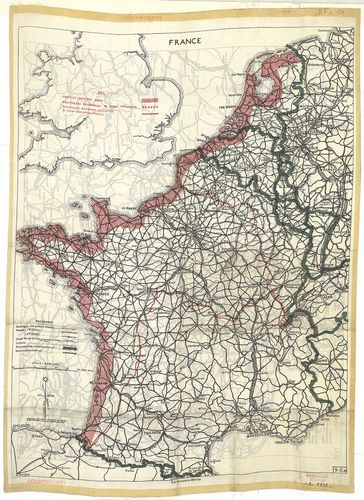
211. Deutsch-französische Grenzgebiet. Mit den französischen Befe... [B V c 91]
Institute and Museum of Military History •
B V c
•
B V Franciaország
•
B I–XV. Európa
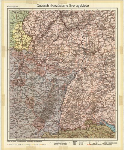
| Title | Deutsch-französische Grenzgebiet. Mit den französischen Befestigungen „Maginot-Linie.” Flemmings Karten, Sonderausgabe. |
| Main title | A német–francia határ a francia erődítések és a Maginot-vonal térképe. |
212. A Nyugati Hadszíntér. [B V c 94]
Institute and Museum of Military History •
B V c
•
B V Franciaország
•
B I–XV. Európa
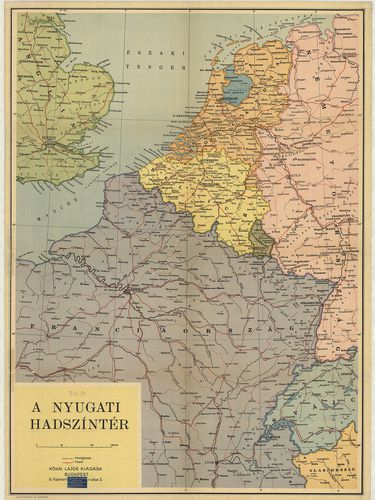
| Title | A Nyugati Hadszíntér. |
213. Karte des Kriegsschauplatzes in Frankreich. [B V c 95]
Institute and Museum of Military History •
B V c
•
B V Franciaország
•
B I–XV. Európa
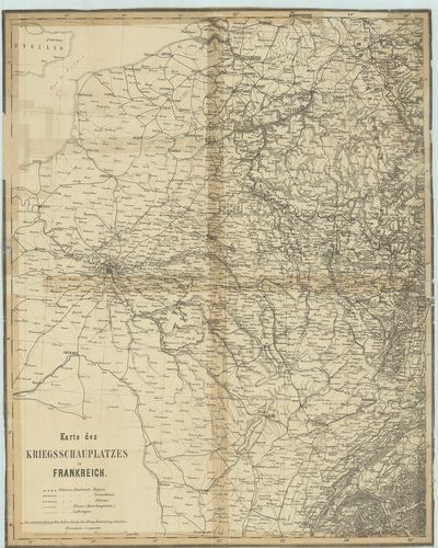
| Title | Karte des Kriegsschauplatzes in Frankreich. |
| Main title | A francia hadszíntér térképe az első világháborúban. |
214. Karte zu den Operationen auf dem südöstlichen Kriegsschaupla... [B V c 96]
Institute and Museum of Military History •
B V c
•
B V Franciaország
•
B I–XV. Európa
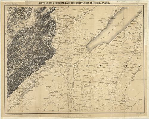
| Title | Karte zu den Operationen auf dem südöstlichen Kriegsschauplatzes. |
| Main title | A német–francia háború térképe 1870–71-ben, a délkeleti hadszíntér. |
215. Karten des französisch-belgischen Kriegsschauplatzes. Nordös... [B V c 97]
Institute and Museum of Military History •
B V c
•
B V Franciaország
•
B I–XV. Európa
| Title | Karten des französisch-belgischen Kriegsschauplatzes. Nordöstliches Frankreich und Belgien. |
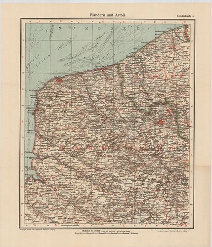
| Main title | 2 mt.: 1. Antwerpen und Umgebung (Antverpen és környéke). 2. Sprachen-Karte von Belgien. (Belgium nyelv-térképe.) |
| Subject | 2 old. térk.: 1. Flandern und Artois. (Flandria és Artois térképe.) |
216. Carte des opérations su le front Français. Bale- (Basel) Méz... [B V c 99]
Institute and Museum of Military History •
B V c
•
B V Franciaország
•
B I–XV. Európa
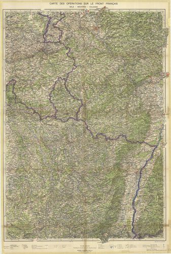
| Title | Carte des opérations su le front Français. Bale- (Basel) Méziéres-Cologne. (Köln.) |
| Main title | Franciaország ÉK-i részének hadműveleti térképe a II. világháborúban. |
217. Frontiére Franco-Allemande. [B V c 100]
Institute and Museum of Military History •
B V c
•
B V Franciaország
•
B I–XV. Európa
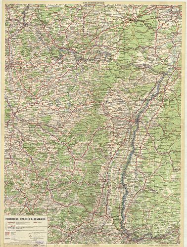
| Title | Frontiére Franco-Allemande. |
| Main title | A francia–német határtérkép 1939-ben. |
218. Carte aéronautique de la France. [B V c 101]
Institute and Museum of Military History •
B V c
•
B V Franciaország
•
B I–XV. Európa
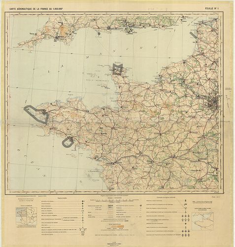
| Title | Carte aéronautique de la France. |
| Main title | Franciaország általános térképe. |
219. Reliefkarte des Argonnen Waldes und der Gegend von Verdun. N... [B V c 102]
Institute and Museum of Military History •
B V c
•
B V Franciaország
•
B I–XV. Európa
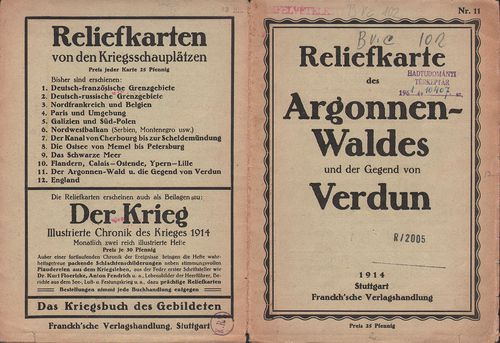
| Title | Reliefkarte des Argonnen Waldes und der Gegend von Verdun. Nr. 11. |
| Main title | Verdun és környékének madártávlati térképe 1914-ben. |
220. Übersicht Befestigungen und des Eisenbahnnetzes von Ost-Fran... [B V c 103]
Institute and Museum of Military History •
B V c
•
B V Franciaország
•
B I–XV. Európa
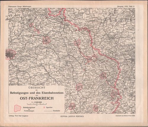
| Title | Übersicht Befestigungen und des Eisenbahnnetzes von Ost-Frankreich. |
| Main title | Kelet-Franciaország erődítéseinek és vasúthálózatának térképe 1909-ben. |
221. I. France. 9. C.(a) [B V c 104]
Institute and Museum of Military History •
B V c
•
B V Franciaország
•
B I–XV. Európa
| Title | I. France. 9. C.(a) |
| Main title | Franciaország út és vasúthálózati térképe a II. világháború idején 1942 körül.II. [Németország.] 2. B. |
| Subject | Németország út és vasúttérképe a II. világháború idején 1942 körül. (Genf-Amsterdam -Vilnius-Cluj közötti terület. |
222. Stuttgarter Reliefkarten Nordost-Frankreich und Belgien. – R... [B V c 105]
Institute and Museum of Military History •
B V c
•
B V Franciaország
•
B I–XV. Európa
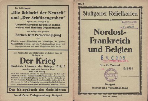
| Title | Stuttgarter Reliefkarten Nordost-Frankreich und Belgien. – Reliefkarte von Nordost-Frankreich. Nr. 3. |
| Main title | Franciaország ÉK-i része és Belgium madártávlati képe 1910 körül. |
223. Reliefkarte vom Ober-Elsass Belfort bis Mülhausen. – Reliefk... [B V c 106]
Institute and Museum of Military History •
B V c
•
B V Franciaország
•
B I–XV. Európa
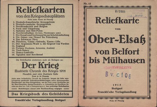
| Title | Reliefkarte vom Ober-Elsass Belfort bis Mülhausen. – Reliefkarte vom Oberelsass (Belfort–Mülhausen) Nr. 17. |
| Main title | Felső Elszász (Belfort–Mulhouse) környékének madártávlati képe 1915-ben. |
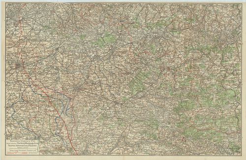
224. Stuttgarter Reliefkarten Woevregebiet und Priesterwald. – Re... [B V c 107]
Institute and Museum of Military History •
B V c
•
B V Franciaország
•
B I–XV. Európa
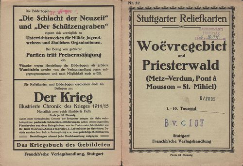
| Title | Stuttgarter Reliefkarten Woevregebiet und Priesterwald. – Reliefkarte vom Woëvre-Gebiet und Priesterwald. (Metz–Verdun und Pont-á-Mousson–St. Mihiel.) Nr. 27. |
| Main title | Metz–Verdun–Pont-á-Mousson és St. Mihiel környékének madártávlati képe 1910 körül. |
225. Tracé de l’autoroute A9 entre Béziers–Narbonne. [B V c 108]
Institute and Museum of Military History •
B V c
•
B V Franciaország
•
B I–XV. Európa
| Title | Tracé de l’autoroute A9 entre Béziers–Narbonne. |
226. Zones de peuplement industriel ou urbain. [B V c 111]
Institute and Museum of Military History •
B V c
•
B V Franciaország
•
B I–XV. Európa
| Title | Zones de peuplement industriel ou urbain. |
227. Carte de la répartition de la population de la France [–1962... [B V c 112]
Institute and Museum of Military History •
B V c
•
B V Franciaország
•
B I–XV. Európa
| Title | Carte de la répartition de la population de la France [–1962.] |
228. Carte de la variation de population de la France par Cantons... [B V c 113]
Institute and Museum of Military History •
B V c
•
B V Franciaország
•
B I–XV. Európa
| Title | Carte de la variation de population de la France par Cantons 1806–1962. |
229. Carte des variations de la population des villes de plus de ... [B V c 114/a]
Institute and Museum of Military History •
B V c
•
B V Franciaország
•
B I–XV. Európa
| Title | Carte des variations de la population des villes de plus de 8000 habitans entre 1936–1954. |
230. Carte des variations de la population des villes de plus de ... [B V c 114/b]
Institute and Museum of Military History •
B V c
•
B V Franciaország
•
B I–XV. Európa
| Title | Carte des variations de la population des villes de plus de 8000 habitans entre 1954–1962. |
231. Francija. Ekonomicseszkaja ucsebnaja karta. [B V c 115/a]
Institute and Museum of Military History •
B V c
•
B V Franciaország
•
B I–XV. Európa
| Title | Francija. Ekonomicseszkaja ucsebnaja karta. |
| Main title | Mt.: O. Korszika. (Korzika.) |
232. Francija. Ekonomicseszkaja ucsebnaja karta. [B V c 115/b]
Institute and Museum of Military History •
B V c
•
B V Franciaország
•
B I–XV. Európa
| Title | Francija. Ekonomicseszkaja ucsebnaja karta. |
233. Aménagement de l’Arc superieur chute du Mont-Cenis. [B V c 116]
Institute and Museum of Military History •
B V c
•
B V Franciaország
•
B I–XV. Európa
| Title | Aménagement de l’Arc superieur chute du Mont-Cenis. |
234. Fond de carte routier de la France. [B V c 117]
Institute and Museum of Military History •
B V c
•
B V Franciaország
•
B I–XV. Európa
| Title | Fond de carte routier de la France. |
| Main title | 5 mt.: 1. Lyon környéke. 2. Marseille környéke. 3. Nice körny. 4. Lille körny. 5. Párizs környéke. |
235. [Franciaország.] Cartoguide Nautique 1963–64. [B V c 118]
Institute and Museum of Military History •
B V c
•
B V Franciaország
•
B I–XV. Európa
| Title | [Franciaország.] Cartoguide Nautique 1963–64. |
236. France Grandes Routes. Carte Michelin les Grandes Routes mai... [B V c 119]
Institute and Museum of Military History •
B V c
•
B V Franciaország
•
B I–XV. Európa
| Title | France Grandes Routes. Carte Michelin les Grandes Routes main Roads. |
237. Frankreich. France. Francia. Carte Automobile. [B V c 120]
Institute and Museum of Military History •
B V c
•
B V Franciaország
•
B I–XV. Európa
| Title | Frankreich. France. Francia. Carte Automobile. |
| Main title | Mt.: Paris. |
238. Carte Michelin de la France. [B V c 121]
Institute and Museum of Military History •
B V c
•
B V Franciaország
•
B I–XV. Európa
| Title | Carte Michelin de la France. |
| Main title | No. 51. Boulogne–Lille. No. 55. Paris–Caen. No. 57. Verdun–Saarebruck (Saarbrücken). No. 61. Paris–Chaumont. No. 62. Chaumont–Strasbourg. No. 74. Lyon–Geneve (Genf). |
239. Frankreich. Shell Reisekarte. Carte automobile Shell Road Ma... [B V c 122]
Institute and Museum of Military History •
B V c
•
B V Franciaország
•
B I–XV. Európa
| Title | Frankreich. Shell Reisekarte. Carte automobile Shell Road Map France. |
| Main title | 6 mt.: 1. Paris. |
| Subject | 2. [Páris környéke.] 3. [Strassbourg–Basel közötti terület.] 4. [Tours–Orleans környéke.] 6. [Genf–Torino környéke.] 6. [Marseille–Nice környéke.] |
240. France Grandes Routes. – Carte Michelin les Grandes Routes M... [B V c 123]
Institute and Museum of Military History •
B V c
•
B V Franciaország
•
B I–XV. Európa
| Title | France Grandes Routes. – Carte Michelin les Grandes Routes Main Roads. |
241. Atlas Grandes Routes France. [B V c 123/1]
Institute and Museum of Military History •
B V c
•
B V Franciaország
•
B I–XV. Európa
| Title | Atlas Grandes Routes France. |
242. Atlas Simca des Routes de France. [B V c 124]
Institute and Museum of Military History •
B V c
•
B V Franciaország
•
B I–XV. Európa
| Title | Atlas Simca des Routes de France. |
243. Atlas Azur. [B V c 125]
Institute and Museum of Military History •
B V c
•
B V Franciaország
•
B I–XV. Európa
| Title | Atlas Azur. |
244. France Routiere. Esso. [B V c 126]
Institute and Museum of Military History •
B V c
•
B V Franciaország
•
B I–XV. Európa
| Title | France Routiere. Esso. |
| Main title | Mt.: [Franciaország úthálózata km-távolságban légvonalban.] |
245. France sud-est. – Carte Esso Routiére et Touristique. [B V c 127]
Institute and Museum of Military History •
B V c
•
B V Franciaország
•
B I–XV. Európa
| Title | France sud-est. – Carte Esso Routiére et Touristique. |
| Main title | 9 térk. Városok áthajtási térképe. 1. Corse. 2. Lyon. 3. Marseille. 4. Sant-Etienne. 5. Toulon. 6. Chambery. 7. Grenoble. 8. Nice. 9. Monaco. |
246. Frankreichs Strassen. 2 térk. egy oldalon: 1. Frankreich Aut... [B V c 128]
Institute and Museum of Military History •
B V c
•
B V Franciaország
•
B I–XV. Európa
| Title | Frankreichs Strassen. 2 térk. egy oldalon: 1. Frankreich Autokarte. 2. Frankreich Allgemeine Karte. |
247. Motoring in France. 2 térk. egy oldalon: 1. Road Map. 2. Gen... [B V c 129]
Institute and Museum of Military History •
B V c
•
B V Franciaország
•
B I–XV. Európa
| Title | Motoring in France. 2 térk. egy oldalon: 1. Road Map. 2. General Map. |
248. France. [B V c 130]
Institute and Museum of Military History •
B V c
•
B V Franciaország
•
B I–XV. Európa
| Title | France. |
249. Cartoguide France Camping. [B V c 131]
Institute and Museum of Military History •
B V c
•
B V Franciaország
•
B I–XV. Európa
| Title | Cartoguide France Camping. |
250. Édition France Internationale. [B V c 132]
Institute and Museum of Military History •
B V c
•
B V Franciaország
•
B I–XV. Európa
| Title | Édition France Internationale. |
| Main title | 6 mt.: 1. Lille. 2. Strasbourg. 3. Rouen. 4. Lyon. 5. Bordeaux. 6. Marseille. – város áthajtási térképek. |
251. Cartoguide Shell Berre. [B V c 133]
Institute and Museum of Military History •
B V c
•
B V Franciaország
•
B I–XV. Európa
| Title | Cartoguide Shell Berre. |
| Main title | 1. Nord. (Franciaország É-i része) 2. Bretagne. 3. Normandie (Normandia). 4. Ile de France. 5. Est (Franciaország K-i része). 6. Val de Loire (Loire völgye). 7. Centre (Közép-Franciaország). 8. Jura, Savoie. 9. Périgord Atlantique. 10. Auvergne Cévennes. 11. Provence Côte d’Azur (Azur-part). 12. Pyrénées (Pireneusok). Côte Basque (Baszk-tengerpart). 13. Languedoc Roussillon. 14. Corse (Korzika). |
252. France. Cartoguide. Shell. [B V c 134]
Institute and Museum of Military History •
B V c
•
B V Franciaország
•
B I–XV. Európa
| Title | France. Cartoguide. Shell. |
| Main title | 1. Nord (Észak-Franciaország.). 2. Bretagne. 3. Normandie. 4. Ile de France. 5. Rhin et Meuse (A Rajna és Maas-folyók). 6. Val de Loire (A Loir-folyó völgye). 7. Centre (Közép-Franciaország.). 8. Bourgogne Rhône-Alpes. 10. Auvergne-Cévennes. 11. Provence-Cote d’Azur. 12. Pyrénées Cote Basque. (A Piréneusok és a Baszk-tengerpart.) 13. Languedoc-Roussillon. 14. Corse (Korzika). |
253. Pneu Michelin Carte. [B V c 135]
Institute and Museum of Military History •
B V c
•
B V Franciaország
•
B I–XV. Európa
| Title | Pneu Michelin Carte. |
| Main title | 51. Boulogne–Lille. 52. La Havre–Amiens. 53. Arras–Méziéres. 54. Cherbourg–Rouen. 55. Caen–Paris. 56. Paris–Reims. 57. Verdun–Wissembourg. 60. Le Mans–Paris. 61. Paris–Chaumont. 62. Chaumont–Strasbourg. 64. Angers–Orleans. 65. Auxerre–Dijon. 66. Dijon–Mulhouse. 68. Niort–Châteauroux. 69. Bourges–Macon. 70. Beaune–Evian. 72. Angauleme–Limoges. |
254. Reisekarte Frankreich Polyglott. [B V c 136]
Institute and Museum of Military History •
B V c
•
B V Franciaország
•
B I–XV. Európa
| Title | Reisekarte Frankreich Polyglott. |
255. France… Carte Automobile [B V c 137]
Institute and Museum of Military History •
B V c
•
B V Franciaország
•
B I–XV. Európa
| Title | France… Carte Automobile |
| Main title | Mt.: (Cannes, Nice, Monaco) |
256. A Traveler’s Map of France. [B V c 138]
Institute and Museum of Military History •
B V c
•
B V Franciaország
•
B I–XV. Európa
| Title | A Traveler’s Map of France. |
| Main title | 7 mt.: 1. Paris. 2. Rouen. 3. Lyon. 4. Strasbourg. 5. Tours. 6. Bordeaux. 7. Nice. |
257. Franreich. Grosse Autokarte. No. 89. [B V c 140]
Institute and Museum of Military History •
B V c
•
B V Franciaország
•
B I–XV. Európa
| Title | Franreich. Grosse Autokarte. No. 89. |
| Main title | 11 mt.: 1. Rouen. 2. Reims 3. Orléans. 4. Strasbourg. 5. Nancy. 6. Lyon. 7. Bordeaux 8. Toulouse. 9. Nice (Nizza). 10. Marseille. 11. Paris. |
258. Ost Frankreich. Grosse Autokarte. No. 890. [B V c 141]
Institute and Museum of Military History •
B V c
•
B V Franciaország
•
B I–XV. Európa
| Title | Ost Frankreich. Grosse Autokarte. No. 890. |
259. L’Ile de France. Carte routiére, et touristique. [B V c 142]
Institute and Museum of Military History •
B V c
•
B V Franciaország
•
B I–XV. Európa
| Title | L’Ile de France. Carte routiére, et touristique. |
260. Franciaország autótérképe [B V c 143]
Institute and Museum of Military History •
B V c
•
B V Franciaország
•
B I–XV. Európa
| Title | Franciaország autótérképe |
261. Das Frankreich 486–911. [B V c 144]
Institute and Museum of Military History •
B V c
•
B V Franciaország
•
B I–XV. Európa
| Title | Das Frankreich 486–911. |
| Main title | 3 mt.: 1. Ausbreitung der fränkischen Heerschaft bis Mitte 6. Jh. (A francia uralom kibontakozása a 6. század közepéig.) 2. Die fränkischen Teilreiche im 7. Jh. (Franciaország a 7. században.) 3. Reichsteilungen und Teilreiches 843–888. (Birodalom helyzete és része 843–888-ig.) |
262. Provence Cote d’Azur. Carte routiére et touristique. [B V c 145]
Institute and Museum of Military History •
B V c
•
B V Franciaország
•
B I–XV. Európa
| Title | Provence Cote d’Azur. Carte routiére et touristique. |
| Main title | Mt.: Riviéra Italienne. (Az olasz Riviéra.) |
263. Sud-Ouest-Carte routiére et touristique. [B V c 145/1]
Institute and Museum of Military History •
B V c
•
B V Franciaország
•
B I–XV. Európa
| Title | Sud-Ouest-Carte routiére et touristique. |
264. Normandie. (Haute Normandie–Basse Normandie.) Carte routiére... [B V c 145/2]
Institute and Museum of Military History •
B V c
•
B V Franciaország
•
B I–XV. Európa
| Title | Normandie. (Haute Normandie–Basse Normandie.) Carte routiére et touristique. |
265. Bretagne. Carte routiére et touristique. [B V c 145/3]
Institute and Museum of Military History •
B V c
•
B V Franciaország
•
B I–XV. Európa
| Title | Bretagne. Carte routiére et touristique. |
266. Rhone Alpes. Savoie–Dauphiné–Lyonnais. Carte routiéres et to... [B V c 145/4]
Institute and Museum of Military History •
B V c
•
B V Franciaország
•
B I–XV. Európa
| Title | Rhone Alpes. Savoie–Dauphiné–Lyonnais. Carte routiéres et touristique. |
267. Région Parisienne. Routiére touristique administrative. [B V c 146]
Institute and Museum of Military History •
B V c
•
B V Franciaország
•
B I–XV. Európa
| Title | Région Parisienne. Routiére touristique administrative. |
268. Languedoc Roussillon. Routiére touristique administrative. [B V c 146/1]
Institute and Museum of Military History •
B V c
•
B V Franciaország
•
B I–XV. Európa
| Title | Languedoc Roussillon. Routiére touristique administrative. |
269. France. Bretagne. [B V c 161]
Institute and Museum of Military History •
B V c
•
B V Franciaország
•
B I–XV. Európa
| Title | France. Bretagne. |
270. Pyrénées. France. [B V c 162]
Institute and Museum of Military History •
B V c
•
B V Franciaország
•
B I–XV. Európa
| Title | Pyrénées. France. |
271. France, Provence Côte d’Azur. [B V c 164]
Institute and Museum of Military History •
B V c
•
B V Franciaország
•
B I–XV. Európa
| Title | France, Provence Côte d’Azur. |
272. France. Corse. [B V c 165]
Institute and Museum of Military History •
B V c
•
B V Franciaország
•
B I–XV. Európa
| Title | France. Corse. |
273. Ravensteins Kriegskarte no. 42. – Gebiet zwischen Charleroy,... [B V c 166]
Institute and Museum of Military History •
B V c
•
B V Franciaország
•
B I–XV. Európa
| Title | Ravensteins Kriegskarte no. 42. – Gebiet zwischen Charleroy, Maubeuge, Arras, Tournai, Valenciennes, St. Quentin |
| Main title | Charleroy, Maubeuge, Arras, Tournai, Valenciennes, St. Quentin városok és környékük az I- világháború alatt. |
274. Ravensteins Kriegskarte No. 32 – Maasgebiet, Verdun, Argonne... [B V c 167]
Institute and Museum of Military History •
B V c
•
B V Franciaország
•
B I–XV. Európa
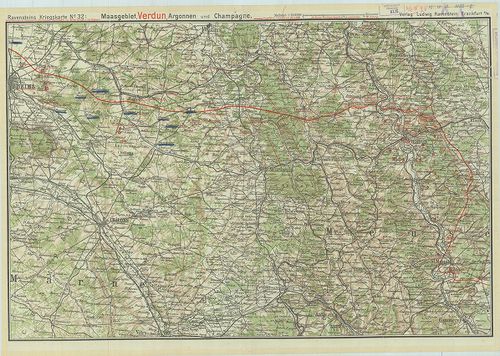
| Title | Ravensteins Kriegskarte No. 32 – Maasgebiet, Verdun, Argonnen und Champagne. |
| Main title | Verdun, Argonnen és Champagne városok környéke az I- világháború alatt. |
275. Namenverzeichnis zu den Karten des Französisch-belgischen Kr... [B V c 168]
Institute and Museum of Military History •
B V c
•
B V Franciaország
•
B I–XV. Európa
| Title | Namenverzeichnis zu den Karten des Französisch-belgischen Kriegshauplatzes. |
| Main title | 8 térkép (5 lapon). l. Flandern und Artois (Flandria és Artois). |
| Subject | 2. Champagne und Französisch-Lothringen (Champagne és Francia-Lotharingia). |
276. Deutsch–Französischer Krieg 1914. Belfort und die Vogesen au... [B V c 173]
Institute and Museum of Military History •
B V c
•
B V Franciaország
•
B I–XV. Európa
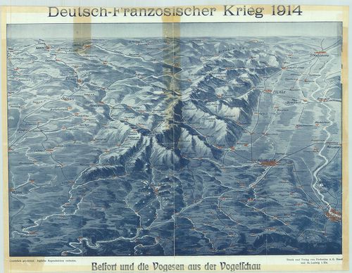
| Title | Deutsch–Französischer Krieg 1914. Belfort und die Vogesen aus der Vogelscheu |
| Main title | Német–francia háború 1914. Belfort és a Vogézek madártávlatból. Német, francia, svájci határvidék, plasztikus rálátásban. |
277. A Nyugati Hadszíntér. A Maginot és a Siegfried vonal tájékoz... [B V c 174]
Institute and Museum of Military History •
B V c
•
B V Franciaország
•
B I–XV. Európa
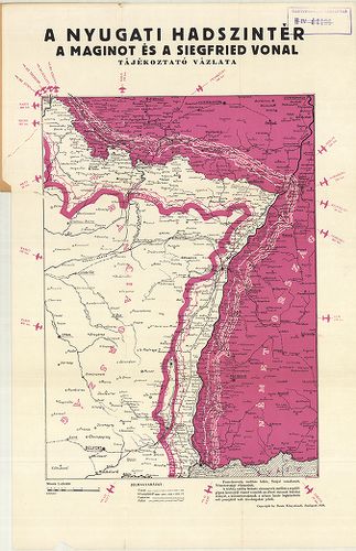
| Title | A Nyugati Hadszíntér. A Maginot és a Siegfried vonal tájékoztató vázlata. |
278. G. Freytags Kriegskarte von Nordost-Frankreich und Belgien. [B V c 175]
Institute and Museum of Military History •
B V c
•
B V Franciaország
•
B I–XV. Európa
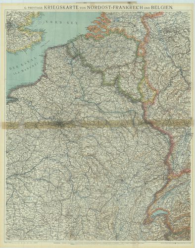
| Title | G. Freytags Kriegskarte von Nordost-Frankreich und Belgien. |
| Main title | Franciaország ÉK-i része és Belgium hadszíntér térképe az 1918. márc. 21–27. offenzíva megindulásakor. |
279. G. Freytags Kriegskarte von Nordost-Frankreich und Belgien. [B V c 176]
Institute and Museum of Military History •
B V c
•
B V Franciaország
•
B I–XV. Európa
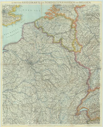
| Title | G. Freytags Kriegskarte von Nordost-Frankreich und Belgien. |
| Main title | Franciaország ÉK-i része és Belgium hadszíntér térképe az 1916. febr.-ban. |
280. Franciaország – autótérkép. [B V c 177]
Institute and Museum of Military History •
B V c
•
B V Franciaország
•
B I–XV. Európa
| Title | Franciaország – autótérkép. |
281. Carte Michelin de la France. [B V c 178]
Institute and Museum of Military History •
B V c
•
B V Franciaország
•
B I–XV. Európa
| Title | Carte Michelin de la France. |
282. Carte Michelin de la France, Normandie. [B V c 179]
Institute and Museum of Military History •
B V c
•
B V Franciaország
•
B I–XV. Európa
| Title | Carte Michelin de la France, Normandie. |
283. Carte Michelin de la France Nord, Flandre, Artois, Picardie. [B V c 180]
Institute and Museum of Military History •
B V c
•
B V Franciaország
•
B I–XV. Európa
| Title | Carte Michelin de la France Nord, Flandre, Artois, Picardie. |
284. France, Carte routiére et touristique. [B V c 181]
Institute and Museum of Military History •
B V c
•
B V Franciaország
•
B I–XV. Európa
| Title | France, Carte routiére et touristique. |
285. France routiére départementale. [B V c 182]
Institute and Museum of Military History •
B V c
•
B V Franciaország
•
B I–XV. Európa
| Title | France routiére départementale. |
| Main title | 2 mt.: Relief de la France. Sorties de Paris. (Franviaország domborzata. Párizs környéke. |
286. Provence. [B V c 183]
Institute and Museum of Military History •
B V c
•
B V Franciaország
•
B I–XV. Európa
| Title | Provence. |
| Main title | Franciaország áttek. térképe. |
287. Corse-du Sud, Haute Corse. [B V c 184]
Institute and Museum of Military History •
B V c
•
B V Franciaország
•
B I–XV. Európa
| Title | Corse-du Sud, Haute Corse. |
288. France. [B V c 185]
Institute and Museum of Military History •
B V c
•
B V Franciaország
•
B I–XV. Európa
| Title | France. |
| Main title | Franciaország autótérképe |
289. France Direct route map. [B V c 186]
Institute and Museum of Military History •
B V c
•
B V Franciaország
•
B I–XV. Európa
| Title | France Direct route map. |
290. Carte Nautique & touristique de la vallée de l´Ardéche [B V c 187]
Institute and Museum of Military History •
B V c
•
B V Franciaország
•
B I–XV. Európa
| Title | Carte Nautique & touristique de la vallée de l´Ardéche |
291. Territorial Eintheilungs u. Dislokations Karte. (+1 mellékté... [B V c 188]
Institute and Museum of Military History •
B V c
•
B V Franciaország
•
B I–XV. Európa
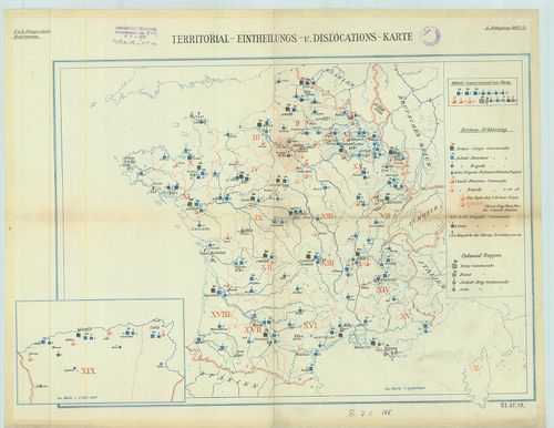
| Title | Territorial Eintheilungs u. Dislokations Karte. (+1 melléktérkép Algéria). |
| Main title | A francia hadsereg diszlokációs térképe. |