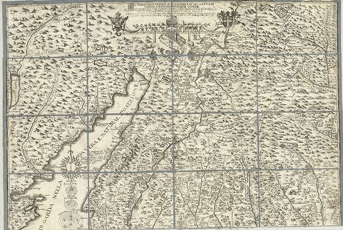
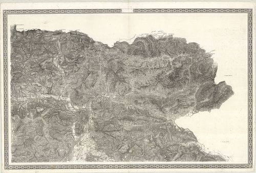
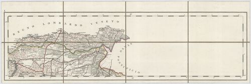
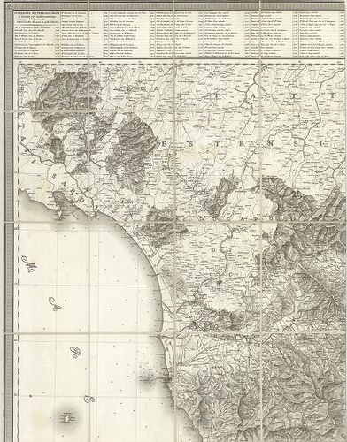
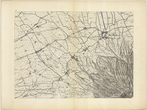
101. [Észak-Olaszország: a Piave és Livenza folyók környékének ka... [B VII a 138]
Institute and Museum of Military History •
B VII a
•
B VII Olaszország
•
B I–XV. Európa
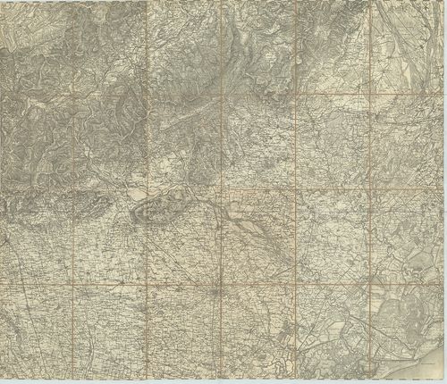
| Title | [Észak-Olaszország: a Piave és Livenza folyók környékének katonai térképe.] |
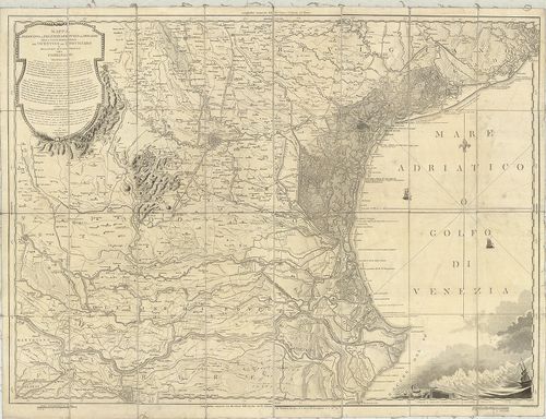
102. Charte von der Provinz Venedig und den Oesterreichischen Küs... [B VII a 141]
Institute and Museum of Military History •
B VII a
•
B VII Olaszország
•
B I–XV. Európa
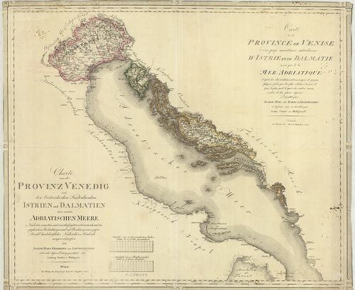
| Title | Charte von der Provinz Venedig und den Oesterreichischen Küstenlaendern Istrien und Dalmatien… Adriatischen Meere… – Carte de la Province de Venise… d’Istrie et de Dalmatie… Mer Adriatique… |
| Main title | Velence tartomány, az Osztrák-tengerpart, az Isztriai-fsz., Dalmácia és az Adriai-tenger térképe 1805-ben. |
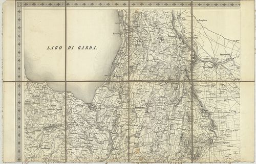
103. Mappa Generale delle Lagune di Venezia. Dalla Joce dell’Adig... [B VII a 141/2]
Institute and Museum of Military History •
B VII a
•
B VII Olaszország
•
B I–XV. Európa
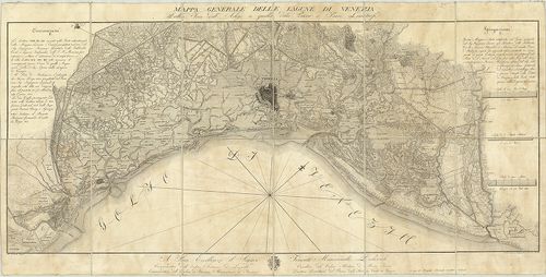
| Title | Mappa Generale delle Lagune di Venezia. Dalla Joce dell’Adige a quella della Piave e Paesi Limitrofi. |
| Main title | Velence térképe a tervezett kikötővel, csatornákkal 1818-ban. |
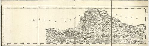
104. Special-Karte des Lombardo-Venezianischen Königreichs. – Bor... [B VII a 141/4]
Institute and Museum of Military History •
B VII a
•
B VII Olaszország
•
B I–XV. Európa
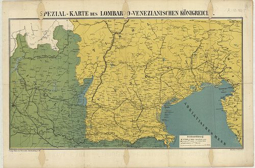
| Title | Special-Karte des Lombardo-Venezianischen Königreichs. – Borítócím: … Triest und Südtirols sowie der italienischen Gebietscheile bis Mailand… Nr. 2. |
| Main title | A Lombard-Velencei Királyság általános térképe 1866-ban. |
105. Veneto. [B VII a 141/7]
Institute and Museum of Military History •
B VII a
•
B VII Olaszország
•
B I–XV. Európa
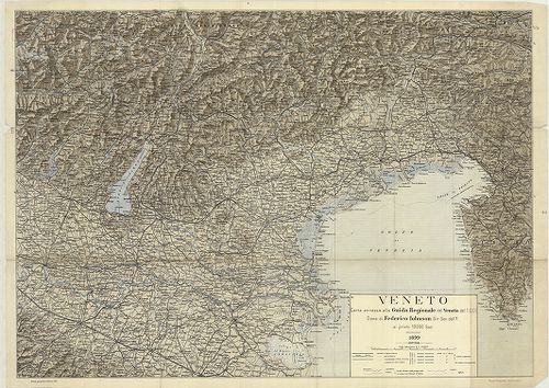
| Title | Veneto. |
| Main title | Velence és környékének térképe 1899-ben. |
106. [Velence tartomány közigazgatási és vasúthálózati térképe.] [B VII a 141/10]
Institute and Museum of Military History •
B VII a
•
B VII Olaszország
•
B I–XV. Európa
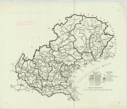
| Title | [Velence tartomány közigazgatási és vasúthálózati térképe.] |
107. Les Provinces du Veronese du Vicentin, du Padovan, de Polesi... [B VII a 142]
Institute and Museum of Military History •
B VII a
•
B VII Olaszország
•
B I–XV. Európa
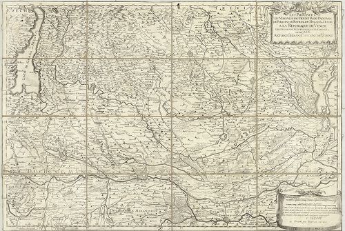
| Title | Les Provinces du Veronese du Vicentin, du Padovan, de Polesine de Rovigo et du Dogado ou Duché a la Republique de Venise… |
| Main title | Verona tartomány (Ol.) és a környező területek általános térképe 1736 körül. |
108. Das Herzogthum Venedig. – Il Ducato di Venezia. [B VII a 143/1]
Institute and Museum of Military History •
B VII a
•
B VII Olaszország
•
B I–XV. Európa
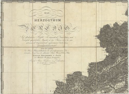
| Title | Das Herzogthum Venedig. – Il Ducato di Venezia. |
| Main title | A Velencei Hercegség térképe 1805-ben. |
109. Carta corografica delle Provincie Venete… [B VII a 143/3]
Institute and Museum of Military History •
B VII a
•
B VII Olaszország
•
B I–XV. Európa
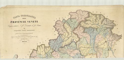
| Title | Carta corografica delle Provincie Venete… |
| Main title | Velence tartomány térképe 1853 körül. |
110. Carta Corografica d’Italia. [B VII a 144]
Institute and Museum of Military History •
B VII a
•
B VII Olaszország
•
B I–XV. Európa
| Title | Carta Corografica d’Italia. |
111. Le Bellunése le Feltrin, et le Cadorin. P II 14 [B VII a 152]
Institute and Museum of Military History •
B VII a
•
B VII Olaszország
•
B I–XV. Európa
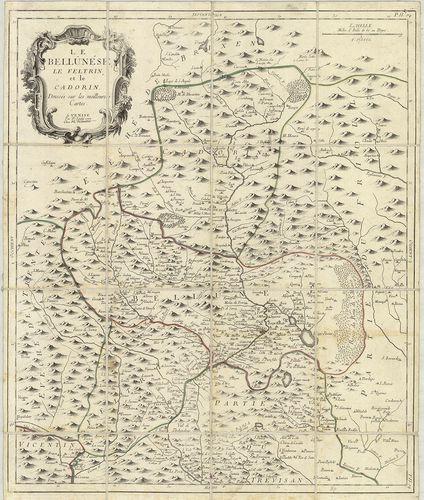
| Title | Le Bellunése le Feltrin, et le Cadorin. P II 14 |
| Main title | Észak-Olaszország: Belluno, Feltre és Piave di Cadore környékének térképe 1777-ben. |
112. Carte du Padouan, du Dogado, et de la plus grande partie du ... [B VII a 156]
Institute and Museum of Military History •
B VII a
•
B VII Olaszország
•
B I–XV. Európa
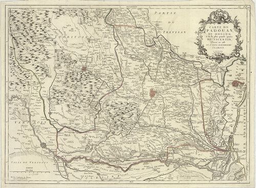
| Title | Carte du Padouan, du Dogado, et de la plus grande partie du Vicentin… P. II. 12. |
| Main title | Padova tartomány térképe 1776-ban. |
113. Mappa del Padovano del Polesine di Rovigo del Dogado della p... [B VII a 158]
Institute and Museum of Military History •
B VII a
•
B VII Olaszország
•
B I–XV. Európa
| Title | Mappa del Padovano del Polesine di Rovigo del Dogado della parte meridionale del Vicentino del Trevigiano e della parte settentrionale del Ferrarese. |
| Main title | Padova, Polesine, Ferrara közötti terület általános térképe 1801-ben. |
114. Nouvelle carte du Territoire de Polesine. [B VII a 160/1]
Institute and Museum of Military History •
B VII a
•
B VII Olaszország
•
B I–XV. Európa
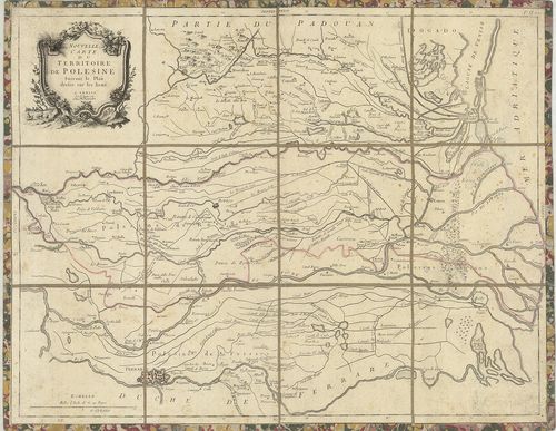
| Title | Nouvelle carte du Territoire de Polesine. |
| Main title | Polesine vidékének térképe 1780-ban. |
115. Topografia del Polesine di Rovigo… [B VII a 161]
Institute and Museum of Military History •
B VII a
•
B VII Olaszország
•
B I–XV. Európa
| Title | Topografia del Polesine di Rovigo… |
| Main title | 1 mt.: Propetto della cittá di Rovigo e sua Pianta (Rovigo látképe és alaprajza). |
| Subject | Polesine és Rivogo környékének topográfiai térképe 1786-ban. |
116. Il Polesine di Rovigo il ducato di Ferrara e la parte meridi... [B VII a 161/1]
Institute and Museum of Military History •
B VII a
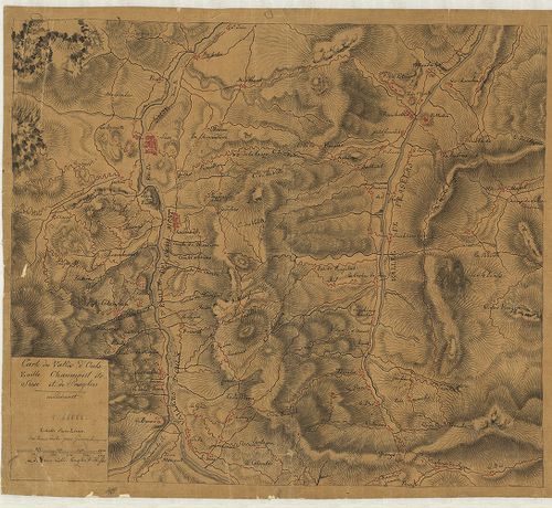
•
B VII Olaszország
•
B I–XV. Európa
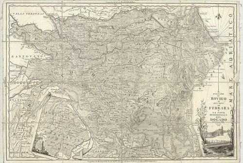
| Title | Il Polesine di Rovigo il ducato di Ferrara e la parte meridionale del Dogado. |
| Main title | 1 mt.: Parte la piu meridionale del ducato di Ferrara… (Ferrara hercegség D-i része.) |
| Subject | Polesine vidéke Rovigo, Ferrara és Dogago egy részének térképe 1793-ban. |
117. Polesine di Rovigo. [B VII a 161/2]
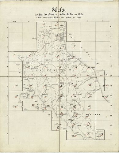
Institute and Museum of Military History •
B VII a
•
B VII Olaszország
•
B I–XV. Európa
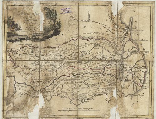
| Title | Polesine di Rovigo. |
| Main title | Polesine és Rivogo környékének térképe 1782-ben. |
118. Carte du Trevisan. P. II. J. 3. [B VII a 165]
Institute and Museum of Military History •
B VII a
•
B VII Olaszország
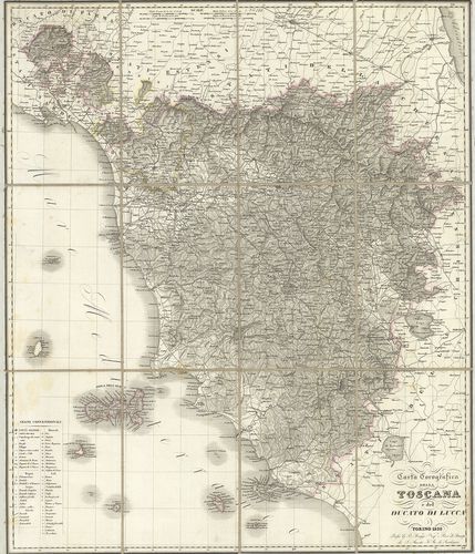
•
B I–XV. Európa

| Title | Carte du Trevisan. P. II. J. 3. |
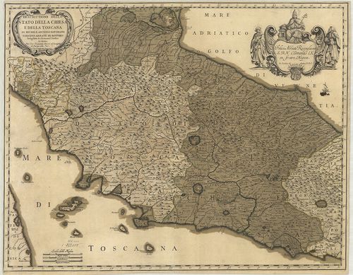
| Main title | Treviso tartomány térképe 1776-ban. |
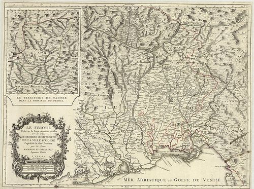
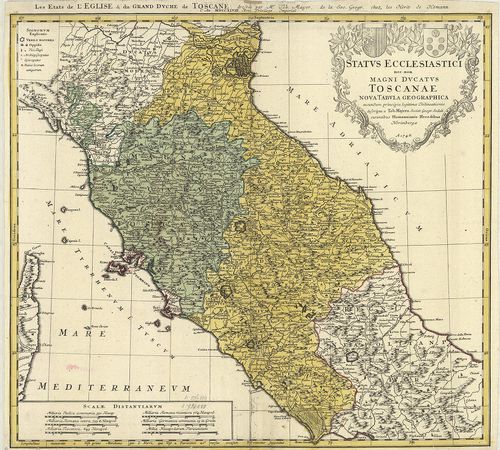
119. Le Friaul. P. II. J. 5. [B VII a 169]
Institute and Museum of Military History •
B VII a
•
B VII Olaszország
•
B I–XV. Európa
| Title | Le Friaul. P. II. J. 5. |
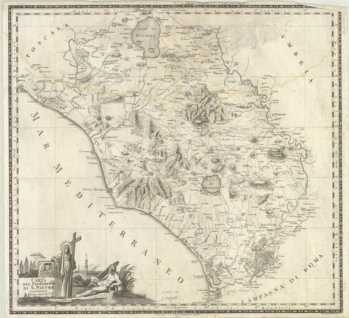
| Main title | Mt.: Le Territoire de Cadore dans la Province du Frioul. (Cadore környéke.)Friuli tartomány térképe 1778-ban. |
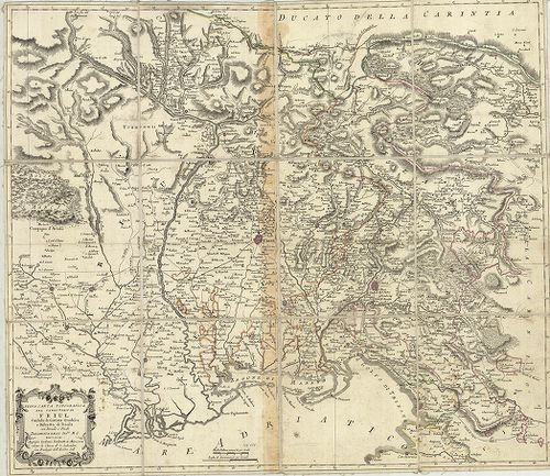
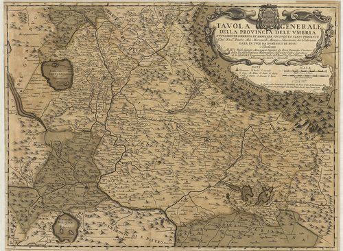
120. Nuova carta topografica del territorio di Friul, Contado di ... [B VII a 171]
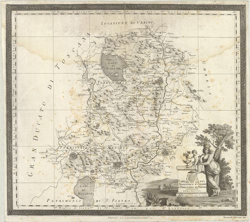
Institute and Museum of Military History •
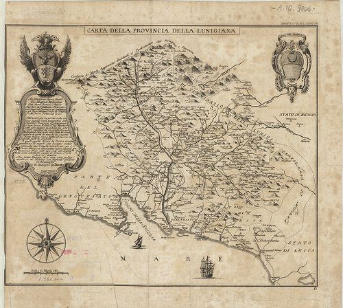
B VII a
•
B VII Olaszország
•
B I–XV. Európa
| Title | Nuova carta topografica del territorio di Friul, Contado di Gorizia, Gradisca e Distretto di Trieste con Strade e Posté. |
| Main title | Friuli terület Görz, Gradiska vidékével és Trieste kerület topográfiai térképe út és postahálózattal 1793-ban. |
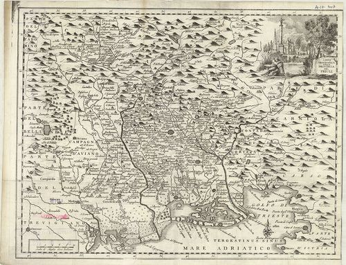
121. Carta Geografica della Provincia del Friuli. [B VII a 172]
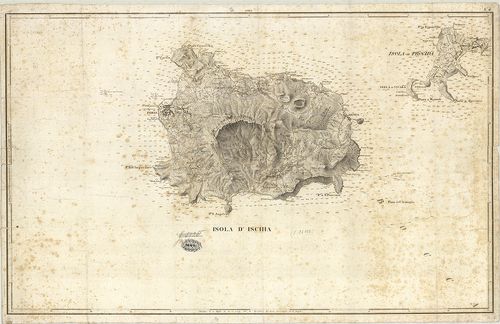
Institute and Museum of Military History •
B VII a
•
B VII Olaszország
•
B I–XV. Európa
| Title | Carta Geografica della Provincia del Friuli. |
| Main title | Friuli tartomány földrajzi térképe a 18. században. |
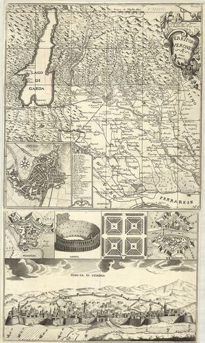
122. Territorio Veronese. Tom. I. p. I. [B VII a 175]
Institute and Museum of Military History •
B VII a
•
B VII Olaszország
•
B I–XV. Európa
| Title | Territorio Veronese. Tom. I. p. I. |
| Main title | 3 mt.: 1. Verona. 2. Peschiera. 3. Legnano-várostérk. 3 kép. 1. Arena. 2. Fiera. (Vásártér.) 3. Veduta di Verona. (Verona látképe.) |
| Subject | Verona tartomány térképe 1745-ben. |
123. Il territorio Veronese e sua Diocese nei suo veri confini co... [B VII a 176]
Institute and Museum of Military History •
B VII a
•
B VII Olaszország
•
B I–XV. Európa
| Title | Il territorio Veronese e sua Diocese nei suo veri confini coi posti di publiche guardie… |
| Main title | Verona terület térképe az egyházmegye határával 1747 körül. |
124. Le Territoire de Verone. P. II. J. O. [B VII a 178]
Institute and Museum of Military History •
B VII a
•
B VII Olaszország
•
B I–XV. Európa

| Title | Le Territoire de Verone. P. II. J. O. |
| Main title | Verona tartomány térképe 1776-ban. |
125. Provincia di Verona Divisa nei 13 Distretti… [B VII a 180]
Institute and Museum of Military History •
B VII a
•
B VII Olaszország
•
B I–XV. Európa
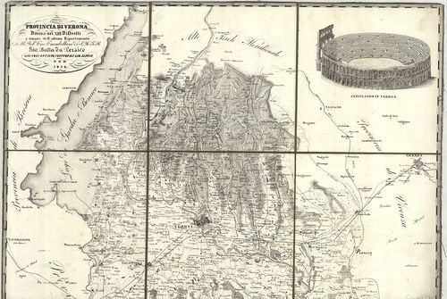
| Title | Provincia di Verona Divisa nei 13 Distretti… |
| Main title | Verona tartomány térképe 1838-ban. |
126. [Verona és környékének 3 kül. tartalmú térképe.] [B VII a 181]
Institute and Museum of Military History •
B VII a
•
B VII Olaszország
•
B I–XV. Európa
| Title | [Verona és környékének 3 kül. tartalmú térképe.] |
| Main title | „Fortificatorische Detailbeschreibung von Verona” mellékletei. Lásd: L J 31 jelzet alatt. |
127. Carta del Dipartimento de Bacchiglione… [B VII a 183]
Institute and Museum of Military History •
B VII a
•
B VII Olaszország
•
B I–XV. Európa
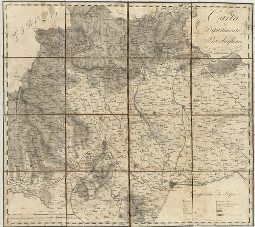
| Title | Carta del Dipartimento de Bacchiglione… |
| Main title | Bacchiglione megye térképe 1802 körül. |
128. Plan der Gegend zwischen Belluno und Feltre. [B VII a 185]
Institute and Museum of Military History •
B VII a
•
B VII Olaszország
•
B I–XV. Európa
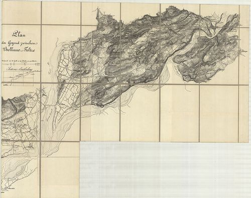
| Title | Plan der Gegend zwischen Belluno und Feltre. |
| Main title | Belluno és Feltre közti terület térképe 1850 körül. |
129. Manoeuvre-Terrain am Mincio. Detailkarte des Landestriches z... [B VII a 195]
Institute and Museum of Military History •
B VII a
•
B VII Olaszország
•
B I–XV. Európa
| Title | Manoeuvre-Terrain am Mincio. Detailkarte des Landestriches zwischen Brescia, Verona u. Illasi. |
| Main title | Mincio melletti hadgyakorlati terület térképe, Brescia, Verona és Illasi között 1840–41-ben. |
130. Manövre Terrain am Mincio, reambulirten Detailkarte. [B VII a 195/1]
Institute and Museum of Military History •
B VII a
•
B VII Olaszország
•
B I–XV. Európa
| Title | Manövre Terrain am Mincio, reambulirten Detailkarte. |
| Main title | Mincio melletti hadgyakorlati terület térképe Brescia, Verona és Illasti között 1859-ben. |
131. Plan des Manövrir-Terrains naechts Monselice. [B VII a 195/2]
Institute and Museum of Military History •
B VII a
•
B VII Olaszország
•
B I–XV. Európa
| Title | Plan des Manövrir-Terrains naechts Monselice. |
| Main title | A Monselice melletti gyakorlótértérképe a 19. század végén. |
132. [Északkelet-Olaszország: a Rigolato-Pontebba-Tarvisio és Tol... [B VII a 200/5]
Institute and Museum of Military History •
B VII a
•
B VII Olaszország
•
B I–XV. Európa
| Title | [Északkelet-Olaszország: a Rigolato-Pontebba-Tarvisio és Tolmezzo-Gemona közti terület általános térképe.] |
133. Gegend zwischen Verona, Peschiera und Mantova. [B VII a 202]
Institute and Museum of Military History •
B VII a
•
B VII Olaszország
•
B I–XV. Európa
| Title | Gegend zwischen Verona, Peschiera und Mantova. |
| Main title | Verona, Peschiera és Mantova közti terület térképe a 19. század közepén. |
134. Nuova Carta Corografica, o sia centro del gran teatro di gue... [B VII a 212]
Institute and Museum of Military History •
B VII a
•
B VII Olaszország
•
B I–XV. Európa
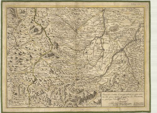
| Title | Nuova Carta Corografica, o sia centro del gran teatro di guerra in Piemonte, e Savoya. |
| Main title | Piemonte és Savoja tartomány földrajzi térképe 1744-ben. |
135. Piemonte diviso in quattro dipartiment [B VII a 213]
Institute and Museum of Military History •
B VII a
•
B VII Olaszország
•
B I–XV. Európa
| Title | Piemonte diviso in quattro dipartiment |
| Main title | Piemonte tartomány térképe négy kerületre osztva 1799-ben. |
136. Carte des Vallées d’Oulx Exille Chaumont etc. Suse et de Pra... [B VII a 218]
Institute and Museum of Military History •
B VII a
•
B VII Olaszország
•
B I–XV. Európa
| Title | Carte des Vallées d’Oulx Exille Chaumont etc. Suse et de Pragelas en Piedmont. |
| Main title | Piemonte tartomány (Susa-Exilles-Ulzip-Pragetato környékének) térképe a 18. században. |
137. Carta de la Rivera de Genova con sus Verdaderos Confines y C... [B VII a 261]
Institute and Museum of Military History •
B VII a
•
B VII Olaszország
•
B I–XV. Európa
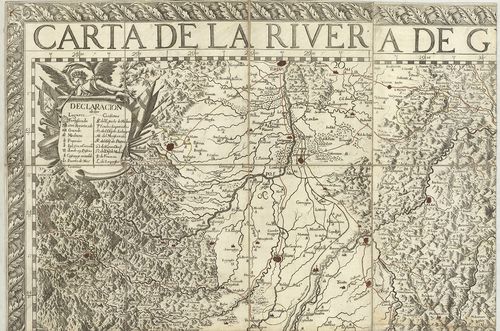
| Title | Carta de la Rivera de Genova con sus Verdaderos Confines y Caminos. – Topographia de la Liguria… |
| Main title | Liguria tartomány térképe 1685-ben. |
138. Karte von der Republik Genua. [B VII a 264]
Institute and Museum of Military History •
B VII a
•
B VII Olaszország
•
B I–XV. Európa
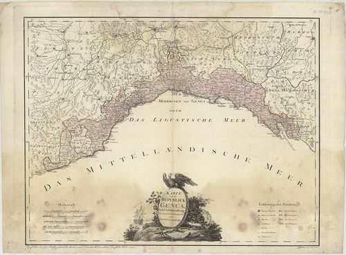
| Title | Karte von der Republik Genua. |
| Main title | A Genovai Köztársaság térképe 1796-ban. |
139. Carta topografica degli stati della Republica di Genova, sec... [B VII a 265]
Institute and Museum of Military History •
B VII a
•
B VII Olaszország
•
B I–XV. Európa
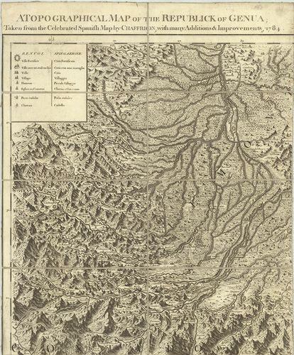
| Title | Carta topografica degli stati della Republica di Genova, secondo l’Originale del famoso Chaffrion con molte aumentazioni e Correzioni, 1784. – A topographical map of the Republick of Genua. – Carte topographique des Etats de la Republique de Genes. – Topographische charte sämbtlichen Länder, der Republic Genua. |
| Main title | 3 mt.: 1. Carte de l’Isle de Corse… (Korzika). 2. Carte de l’Isle de Sardaigne (Szardinia). 3. Isola di Caprara(Capraia-sz.). |
| Subject | A Genovai Köztársaság topográfiai térképe 1784-ben. |
140. Stato della Republica di Lucca. [B VII a 271]
Institute and Museum of Military History •
B VII a
•
B VII Olaszország
•
B I–XV. Európa
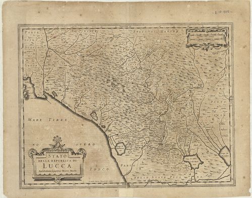
| Title | Stato della Republica di Lucca. |
| Main title | Lucca tartomány térképe 1642-ben. |
141. Legazione di Bologna. [B VII a 277]
Institute and Museum of Military History •
B VII a
•
B VII Olaszország
•
B I–XV. Európa
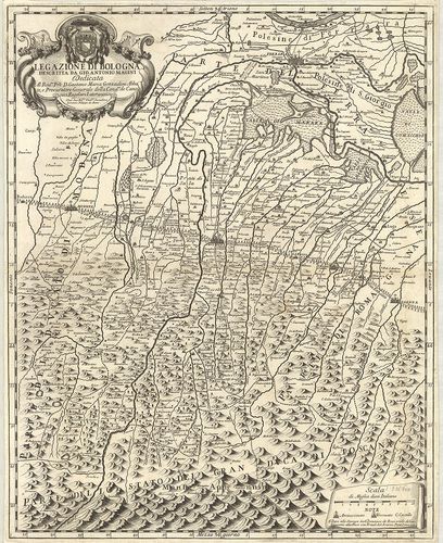
| Title | Legazione di Bologna. |
| Main title | Bologna tartomány térképe 1710-ben. |
142. Pianta del Dipartimento del Reno… [B VII a 279/2]
Institute and Museum of Military History •
B VII a
•
B VII Olaszország
•
B I–XV. Európa
| Title | Pianta del Dipartimento del Reno… |
| Main title | Reno körzetének - Bologna és környéke térképe 1810 körül. |
143. Corografia del Ducato di Ferrara… 1758. [B VII a 284]
Institute and Museum of Military History •
B VII a
•
B VII Olaszország
•
B I–XV. Európa
| Title | Corografia del Ducato di Ferrara… 1758. |
| Main title | Ferrara hercegség földrajzi térképe 1758–1782-ben. |
144. Gran Ducato di Toscana stato vecchio o dominio Fiorentina, s... [B VII a 284/2]
Institute and Museum of Military History •
B VII a
•
B VII Olaszország
•
B I–XV. Európa
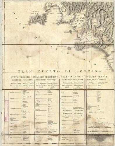
| Title | Gran Ducato di Toscana stato vecchio o dominio Fiorentina, stato nuova, o dominio senese. |
| Main title | A Toscana-i Nagyhercegség térképe 1730–40 körül. |
145. Topografia della Provincia Ferrarese della Pianura Bolognese... [B VII a 285]
Institute and Museum of Military History •
B VII a
•
B VII Olaszország
•
B I–XV. Európa
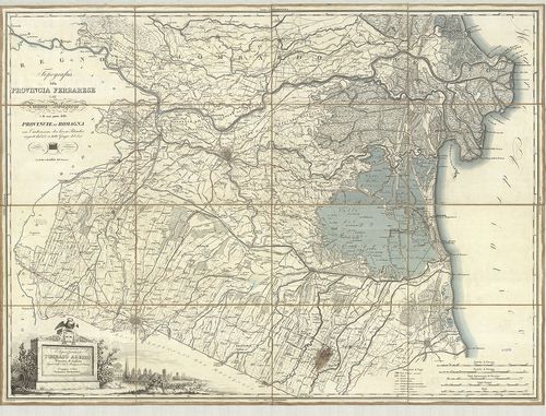
| Title | Topografia della Provincia Ferrarese della Pianura Bolognese e di una parte delle Provincie di Romagna con l’indicazione dei lavori Idraulici eseguiti dal 1767 a tutto Giugno del 1825. |
| Main title | Ferrara tartomány a Bolognai-síkság és a Romagna tartomány egy részének térképe 1825-ben. |
146. Legatione della Romagna. [B VII a 285/1]
Institute and Museum of Military History •
B VII a
•
B VII Olaszország
•
B I–XV. Európa
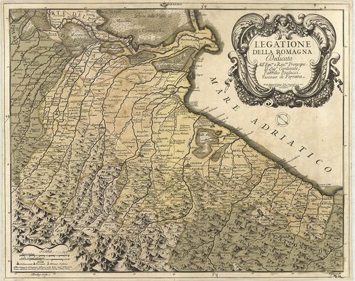
| Title | Legatione della Romagna. |
| Main title | Romagna tartomány térképe 1699-ben. |
147. Territorivm Bononiense il Bolognese. [B VII a 306]
Institute and Museum of Military History •
B VII a
•
B VII Olaszország
•
B I–XV. Európa
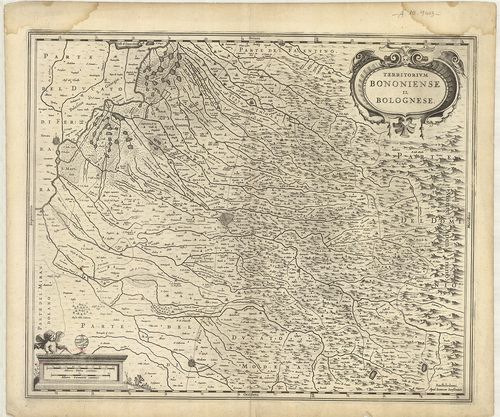
| Title | Territorivm Bononiense il Bolognese. |
| Main title | Bologna tartomány térképe 1642-ben. |
148. Carta topografica del Ducato di Modena… [B VII a 313]
Institute and Museum of Military History •
B VII a
•
B VII Olaszország
•
B I–XV. Európa
| Title | Carta topografica del Ducato di Modena… |
| Main title | Modena hercegség topográfiai térképe 1842-ben. |
149. Carta topografica del Ducato di Modena… [B VII a 314]
Institute and Museum of Military History •
B VII a
•
B VII Olaszország
•
B I–XV. Európa
| Title | Carta topografica del Ducato di Modena… |
| Main title | Modena hercegség topográfiai térképe 1849-ben. |
150. Status Parmanensis sive Dvcatvs Parmanensis et Placentinus u... [B VII a 316]
Institute and Museum of Military History •
B VII a
•
B VII Olaszország
•
B I–XV. Európa
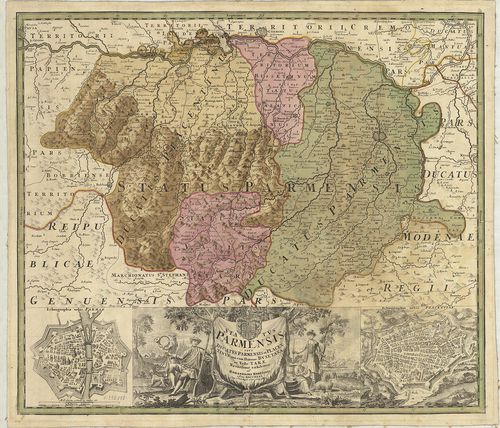
| Title | Status Parmanensis sive Dvcatvs Parmanensis et Placentinus una cum Ditione Bvxetana et Valle Tarae. |
| Main title | 2 mt.: 1. Ichnographia urbis Parmae. (Parma várostérképe.) 2. Ichnographia urbis Placentiae. (Piacenza várostérképe.) |
| Subject | Parma hercegség és Piacenza hercegség térképe 1731-ben. |
151. Carta topografica degli Stati di Parma. [B VII a 318]
Institute and Museum of Military History •
B VII a
•
B VII Olaszország
•
B I–XV. Európa
| Title | Carta topografica degli Stati di Parma. |
| Main title | Parma hercegség topográfiai térképe 1820–1823-ban. |
152. Carta topografica dei ducati di Parma, Piacenza e Guastalla ... [B VII a 319]
Institute and Museum of Military History •
B VII a
•
B VII Olaszország
•
B I–XV. Európa
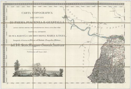
| Title | Carta topografica dei ducati di Parma, Piacenza e Guastalla levata dietro misure trigonometriche negli anni 1821–1822… |
| Main title | 2 mt.: 1. Villa ducale di Sala detta Casino di Boschi. 2. Villa e parco ducale di Colorno. |
| Subject | Parma, Piacenza és Guastalla hercegség topográfiai térképe 1828-ban. |
153. Carta topografica dei ducati di Parma, Piacenza e Guastalla ... [B VII a 321]
Institute and Museum of Military History •
B VII a
•
B VII Olaszország
•
B I–XV. Európa
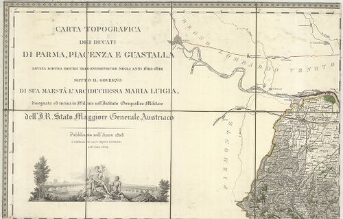
| Title | Carta topografica dei ducati di Parma, Piacenza e Guastalla levata dietro misure trigonometriche negli anni 1821–1822… |
| Main title | 2 mt.: 1. Villa ducale di Sala detta Casino di Boschi. 2. Villa e parco ducale di Colorno. |
| Subject | Parma Piacenza és Guastalla hercegségek általános térképe 1849-ben. |
154. Carta Corografica dei Ducati di Parma, Piacenza e Guastalla… [B VII a 322]
Institute and Museum of Military History •
B VII a
•
B VII Olaszország
•
B I–XV. Európa
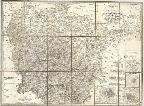
| Title | Carta Corografica dei Ducati di Parma, Piacenza e Guastalla… |
| Main title | 4 mt.: 1. Parma, 2. Piacenza, 3. Guastalla, 4. Villa e Parco Ducale di Colorno. |
| Subject | Parma, Piacenze és Guastalla hercegségek topográfiai térképe 1831 körül. |
155. Carta Generale del Grandvcato di Toscana… [B VII a 330]
Institute and Museum of Military History •
B VII a
•
B VII Olaszország
•
B I–XV. Európa
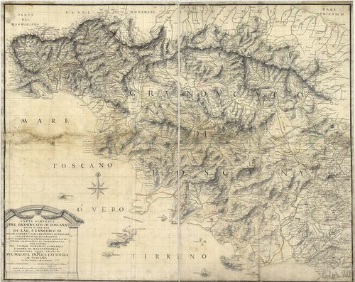
| Title | Carta Generale del Grandvcato di Toscana… |
| Main title | A Toscana-i Nagyhercegség általános térképe 1738-ban. |
156. Carta Geometrica della Toscana… [B VII a 331]
Institute and Museum of Military History •
B VII a
•
B VII Olaszország
•
B I–XV. Európa
| Title | Carta Geometrica della Toscana… |
| Main title | A Toscana-i Nagyhercegség térképe 1830-ban. |
157. Carta Corografica della Toscana e del Ducato di Lucca. [B VII a 333]
Institute and Museum of Military History •
B VII a
•
B VII Olaszország
•
B I–XV. Európa
| Title | Carta Corografica della Toscana e del Ducato di Lucca. |
| Main title | A Toscana-i Nagyhercegség és Lucca hercegség topográfiai térképe 1838-ban. |
158. Carte de L’Isle d’Elbe. [B VII a 341]
Institute and Museum of Military History •
B VII a
•
B VII Olaszország
•
B I–XV. Európa
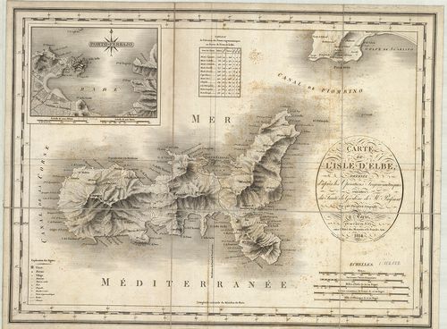
| Title | Carte de L’Isle d’Elbe. |
| Main title | Mt.: Porto Ferrajo. (Portoferraio.) |
| Subject | Elba sziget térképe 1814-ben. |
159. Carte Topographique del’ Archipel Toscanou de L’Ile D’Elbe e... [B VII a 342]
Institute and Museum of Military History •
B VII a
•
B VII Olaszország
•
B I–XV. Európa
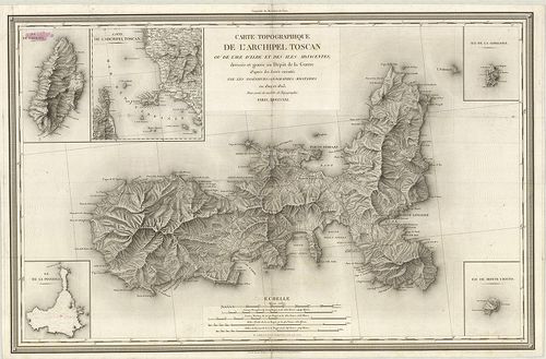
| Title | Carte Topographique del’ Archipel Toscanou de L’Ile D’Elbe et des Iles Adjacentes. |
| Main title | 5 mt.: Ile de Capriai. (Capraia sz.) 2. Carte de l’Archipel Toscan. (Toscanai szigetcsoport.) 3. Ile de la Pianosa. (Pianosa sz.) 5. Ile de Monte Cristo. (Montecristo sz.)A Toscana-i-szigetcsoport: Elba sziget és a környező szigetek topográfiai térképe 1821-ben. |
160. Descrittione delle Stato della Chiesa e della Toscana… [B VII a 366]
Institute and Museum of Military History •
B VII a
•
B VII Olaszország
•
B I–XV. Európa
| Title | Descrittione delle Stato della Chiesa e della Toscana… |
| Main title | Az Egyházi Állam és a Toscana-i Nagyhercegség térképe 1763 körül. |
161. Statvs Ecclesiastici nec non Magni Dvcatvs Toscanae nova Tab... [B VII a 373]
Institute and Museum of Military History •
B VII a
•
B VII Olaszország
•
B I–XV. Európa
| Title | Statvs Ecclesiastici nec non Magni Dvcatvs Toscanae nova Tabvla Geographica. – Les Etats de l’Eglise et du Grand Dvche de Toscane… |
| Main title | Az Egyházi Állam és Toscana-i Nagyhercegség térképe 1748-ban. |
162. Nuova Carta Geografica dello Stato Ecclesiastico… [B VII a 377/1]
Institute and Museum of Military History •
B VII a
•
B VII Olaszország
•
B I–XV. Európa
| Title | Nuova Carta Geografica dello Stato Ecclesiastico… |
| Main title | Az Egyházi Állam földrajzi térképe 1750 körül. |
163. Lo Stato Ecclesiastico diviso nelle sue Provincie con le Reg... [B VII a 378]
Institute and Museum of Military History •
B VII a
•
B VII Olaszország
•
B I–XV. Európa
| Title | Lo Stato Ecclesiastico diviso nelle sue Provincie con le Regioni adiacenti… |
| Main title | Az Egyházi Állam térképe 1805-ben. |
164. Nuova Carta degli Stati Pontifici Meridionali. [B VII a 382]
Institute and Museum of Military History •
B VII a
•
B VII Olaszország
•
B I–XV. Európa
| Title | Nuova Carta degli Stati Pontifici Meridionali. |
| Main title | 2 mt.: 1. [Róma és környéke hegyrajza.] 2. Tavola Peutingeriana.] |
| Subject | A Pápai Állam térképe 1820-ban. |
165. Carta topografica dello Stato Pontificio e del Gran-Ducato d... [B VII a 385]
Institute and Museum of Military History •
B VII a
•
B VII Olaszország
•
B I–XV. Európa
| Title | Carta topografica dello Stato Pontificio e del Gran-Ducato di Toscana construtta sopra misure astronomico trigonometriche ed incisa sopra pietra… Topographische Karte des Kirchenstaates und des Grossherzogthunes Toscana… |
| Main title | Az Egyházi Állam és a Toscana-i Nagyhercegség topográfiai térképe 1851-ben. |
166. Legatione del Dvcato d’Vrbino con la Diocesi, e Governo di C... [B VII a 386]
Institute and Museum of Military History •
B VII a
•
B VII Olaszország
•
B I–XV. Európa
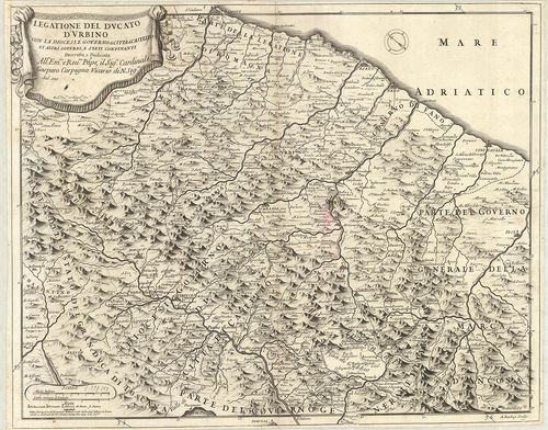
| Title | Legatione del Dvcato d’Vrbino con la Diocesi, e Governo di Citta di Castello et Attri Governi e Stati Confinanti. |
| Main title | Urbino hercegség és a környező egyházmegyék térképe 1697-ben. |
167. La Marca Anconitana, e Fermana… [B VII a 388]
Institute and Museum of Military History •
B VII a
•
B VII Olaszország
•
B I–XV. Európa
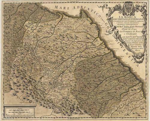
| Title | La Marca Anconitana, e Fermana… |
| Main title | Le Marche tartomány: Ancona és Fermo megyék térképe a határos részekkel 1711-ben. |
168. Il Lazio con le sue piu Cospicue Strade Antiche e Moderne e ... [B VII a 391]
Institute and Museum of Military History •
B VII a
•
B VII Olaszország
•
B I–XV. Európa
| Title | Il Lazio con le sue piu Cospicue Strade Antiche e Moderne e principali Casali, e Tenute di esso… |
| Main title | Lazio tartomány térképe 1693-ban hálózattal. |
169. Carta del Patrimonio de S.[an] Pietro. [B VII a 394/2]
Institute and Museum of Military History •
B VII a
•
B VII Olaszország
•
B I–XV. Európa
| Title | Carta del Patrimonio de S.[an] Pietro. |
| Main title | Az Egyházi Állam térképe 1802-ben. |
170. Tavola generale della Provincia dell’ Umbria… [B VII a 397]
Institute and Museum of Military History •
B VII a
•
B VII Olaszország
•
B I–XV. Európa
| Title | Tavola generale della Provincia dell’ Umbria… |
| Main title | Umbria tartomány általános térképe 1712-ben. |
171. Carta del Territorio d’Orvieto e Territorio di Pervgia [B VII a 397/2]
Institute and Museum of Military History •
B VII a
•
B VII Olaszország
•
B I–XV. Európa
| Title | Carta del Territorio d’Orvieto e Territorio di Pervgia |
| Main title | Orvieto járás és Perugia tartomány környékének térképe 1803-ban. |
172. Carta della provincia della Lunigiana. B. A. W. H. XLV. Th. ... [B VII a 398]
Institute and Museum of Military History •
B VII a
•
B VII Olaszország
•
B I–XV. Európa
| Title | Carta della provincia della Lunigiana. B. A. W. H. XLV. Th. N. Z. XXVII. Th. |
| Main title | Lunigiana tartomány térképe 1759-ben. |
173. Carta del Regno di Napoli. [B VII a 403/2]
Institute and Museum of Military History •
B VII a
•
B VII Olaszország
•
B I–XV. Európa
| Title | Carta del Regno di Napoli. |
| Main title | Nápoly Királyság térképe 1807-ben. |
174. Carta topografica del Monte Vesuvio. [B VII a 404/5]
Institute and Museum of Military History •
B VII a
•
B VII Olaszország
•
B I–XV. Európa
| Title | Carta topografica del Monte Vesuvio. |
| Main title | Vezúv és környékének topográfiai térképe 1875–76-ban. |
175. General-Karte von dem Koenigreiche Neapel, … [B VII a 406]
Institute and Museum of Military History •
B VII a
•
B VII Olaszország
•
B I–XV. Európa
| Title | General-Karte von dem Koenigreiche Neapel, … |
| Main title | A Nápolyi Királyság általános térképe 1806 körül. |
176. General-Karte von dem Koenigreiche Neapel, in 4 Blättern… mi... [B VII a 406]
Institute and Museum of Military History •
B VII a
•
B VII Olaszország
•
B I–XV. Európa
| Title | General-Karte von dem Koenigreiche Neapel, in 4 Blättern… mit Vermehrung der Strassen und Anzeige der Posten… |
| Main title | A Nápolyi Királyság általános térképe 1820-ban. |
177. Atlante del Regno di Napoli. [B VII a 407]
Institute and Museum of Military History •
B VII a
•
B VII Olaszország
•
B I–XV. Európa
| Title | Atlante del Regno di Napoli. |
| Main title | A Nápolyi Királyság általános térképe 1821 körül. |
178. Carta delle Province Napolitane in Fogli 25 Fotoincisa col p... [B VII a 407/1]
Institute and Museum of Military History •
B VII a
•
B VII Olaszország
•
B I–XV. Európa
| Title | Carta delle Province Napolitane in Fogli 25 Fotoincisa col procedimento del generale Avet. |
| Main title | Nápoly tartomány térképe 1874-ben. |
179. [A Nápolyi Királyság térképe.] [B VII a 408]
Institute and Museum of Military History •
B VII a
•
B VII Olaszország
•
B I–XV. Európa
| Title | [A Nápolyi Királyság térképe.] |
180. Isola d’Ischia, Procida, Vivara. Nr. 4. [B VII a 409]
Institute and Museum of Military History •
B VII a
•
B VII Olaszország
•
B I–XV. Európa
| Title | Isola d’Ischia, Procida, Vivara. Nr. 4. |
| Main title | Ischia, Procida és Vivara szigetek térképe 1820 körül. |
181. Isola d’Ischia. [B VII a 410]
Institute and Museum of Military History •
B VII a
•
B VII Olaszország
•
B I–XV. Európa
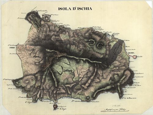
| Title | Isola d’Ischia. |
| Main title | Ischia sziget térképe 1822 körül. |
182. [Szardinia sziget D-i része.] [B VII a 411]
Institute and Museum of Military History •
B VII a
•
B VII Olaszország
•
B I–XV. Európa
| Title | [Szardinia sziget D-i része.] |
| Main title | Mt.: Carta dimostrativa della riunione dei triangoli della Sardegna con quelli del Continente, nassando per quei di Corsica. |
| Subject | (Szardinia és Korzika háromszögelési hálózata.) |
183. Sargedna ed Isola aggiacenti secondo lo Stato presente. A. A... [B VII a 412]
Institute and Museum of Military History •
B VII a
•
B VII Olaszország
•
B I–XV. Európa
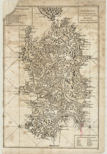
| Title | Sargedna ed Isola aggiacenti secondo lo Stato presente. A. A. W. H. XLV. Th. N. Z. XXVII. Th. |
| Main title | Szardinia sziget és a környező szigetek általános térképe 1773-ban. |
184. Nuova Carta Geografica, Statistica e Stradale degli Stati di... [B VII a 415/a]
Institute and Museum of Military History •
B VII a
•
B VII Olaszország
•
B I–XV. Európa
| Title | Nuova Carta Geografica, Statistica e Stradale degli Stati di Terraferma S. M. il Re di Sardegna. 1818. Nov. 10. – Helyesb.: 1830. |
| Main title | 2 mt.: 1. Topografia di Genova. 2. Topografia della Citta di Torino e suoi Contorni. |
| Subject | A Szardiniai Királyság (Piemonte és a határos területek) földrajzi, statisztikai és úttérképe 1830-ban. |
185. Nuova Nuova Carta Geografica, Statistica e Stradale degli St... [B VII a 415/b]
Institute and Museum of Military History •
B VII a
•
B VII Olaszország
•
B I–XV. Európa
| Title | Nuova Nuova Carta Geografica, Statistica e Stradale degli Stati di Terraferma S. M. il Re di Sardegna. |
| Main title | 2 mt.: 1. Topografia di Genova. 2. Topografia della Citta di Torino e suoi Contorni. |
| Subject | A Szardiniai Királyság (Piemonte és a határos területek) földrajzi, statisztikai és úttérképe 1851-ben. |
186. Nuova Nuova Carta Geografica, Statistica e Stradale degli St... [B VII a 415/c]
Institute and Museum of Military History •
B VII a
•
B VII Olaszország
•
B I–XV. Európa
| Title | Nuova Nuova Carta Geografica, Statistica e Stradale degli Stati di Terraferma S. M. il Re di Sardegna… 1839. nov. Helyesb. 1849. |
| Main title | 2 mt.: 1. Topografia di Genova. 2. Topografia della Citta di Torino. |
| Subject | A Szardiniai Királyság (Piemonte és a határos területek) földrajzi, statisztikai és úttérképe 1849-ben. |
187. Carta Corografica degli Stati di S. M. il Re di Sardegna… 16... [B VII a 416]
Institute and Museum of Military History •
B VII a
•
B VII Olaszország
•
B I–XV. Európa
| Title | Carta Corografica degli Stati di S. M. il Re di Sardegna… 1683. Helyesb. és bővítve: 1772. |
| Main title | A Szardiniai Királyság Piemonte és a határos területek általános térképe 1772-ben. |
188. Carta Corografica degli Stati di Terra Ferma di S. M. Il Re ... [B VII a 417]
Institute and Museum of Military History •
B VII a
•
B VII Olaszország
•
B I–XV. Európa
| Title | Carta Corografica degli Stati di Terra Ferma di S. M. Il Re di Sardegna… |
| Main title | Szárdiniai királyság: (Ol.) Piemonte részének általános térképe a határos területekkel 1809-ben. |
189. Carta Corografica della Divisione di Genova… [B VII a 418]
Institute and Museum of Military History •
B VII a
•
B VII Olaszország
•
B I–XV. Európa
| Title | Carta Corografica della Divisione di Genova… |
| Main title | 7 mt.: 1. Babbio, 2. Albenga, 3. Savona, 4. Genova, 5. Chiavari, 6. Novi (Novi Ligure) 7. Spezia (La Spezia) |
| Subject | Genova tartomány földrajzi térképe 1830-as években. |
190. Carta Corografica delle Divisioni di Cuneo e di Nizza… [B VII a 419]
Institute and Museum of Military History •
B VII a
•
B VII Olaszország
•
B I–XV. Európa
| Title | Carta Corografica delle Divisioni di Cuneo e di Nizza… |
| Main title | 7 mt.: 1. Cuneo, 2. Saluzzo. 3. Mondovi, 4. Alba, 5. Nizza. 6. Oneglia (Imperia) 7. S. Remo. |
| Subject | Cuneo és Nizza tartományok földrajzi térképe 1830-as években. |
191. Carta Corografica della Divisione di Savoja… [B VII a 420]
Institute and Museum of Military History •
B VII a
•
B VII Olaszország
•
B I–XV. Európa
| Title | Carta Corografica della Divisione di Savoja… |
| Main title | 8 mt.: 1. S. Julien (Fr.) 2. Anneci (Fr.) 3. L’Hopital ora Albert-Ville (Fr.) 4. Thonon (Fr.) 5. Bonnerville (Fr.) 6. S. Jean de Maurienne (Fr.) 7. Chambery (Fr.) 8. Moutiers (Fr.) |
| Subject | Savoja tartomány és a környező részek földrajzi térképe 1830-as években. |
192. Carta Corografica delle Divisioni di Tornio e di Aosta… [B VII a 421]
Institute and Museum of Military History •
B VII a
•
B VII Olaszország
•
B I–XV. Európa
| Title | Carta Corografica delle Divisioni di Tornio e di Aosta… |
| Main title | 6 mt.: 1. Aosta. 2. Pinerolo. 3. Susa. 4. Ivrea. 5. Biella. 6. Torino. |
| Subject | Torino és Aosta tartományok földrajzi térképe 1830-as években. |
193. Carta Corografica della Divisione di Novara… [B VII a 422]
Institute and Museum of Military History •
B VII a
•
B VII Olaszország
•
B I–XV. Európa
| Title | Carta Corografica della Divisione di Novara… |
| Main title | 6 mt.: 1. Domo d’Ossola 2. Varallo ed il Sacro Monte. 3. Novara. 4. Vercelli. 5. Mortara. 6. Pallanza. |
| Subject | Novara tartomány földrajzi térképe 1830-as években. |
194. Carta degli Stati di Sua Maestá Sarda in Terraferma… [B VII a 427]
Institute and Museum of Military History •
B VII a
•
B VII Olaszország
•
B I–XV. Európa
| Title | Carta degli Stati di Sua Maestá Sarda in Terraferma… |
| Main title | Mt.: Isola di Capraia. (Capraia sz.) |
| Subject | A Szardiniai Királyság Piemonte részének térképe a határos területekkel 1841–46-ban. |
195. Carta degli Stati di S. M. Sarda in Terraferma… [B VII a 431/1]
Institute and Museum of Military History •
B VII a
•
B VII Olaszország
•
B I–XV. Európa
| Title | Carta degli Stati di S. M. Sarda in Terraferma… |
| Main title | A Szardíniai Királyság Piemonte részének térképe a határos területekkel. |
196. Carta Topografica degli Stati in Terraferma di S.[uo] M.[aes... [B VII a 433]
Institute and Museum of Military History •
B VII a
•
B VII Olaszország
•
B I–XV. Európa
| Title | Carta Topografica degli Stati in Terraferma di S.[uo] M.[aes.] il Re di Sardegna. |
| Main title | Mt.: Nozioni particolari all’ Isola di Capraja. |
| Subject | (Capraia-sz.) |
197. Carta della Sardegna. – Carte de la Sardaigne… [B VII a 437]
Institute and Museum of Military History •
B VII a
•
B VII Olaszország
•
B I–XV. Európa
| Title | Carta della Sardegna. – Carte de la Sardaigne… |
| Main title | Szardínia térképe 1839-ben. |
198. Malta, Gozo. [B VII a 455]
Institute and Museum of Military History •
B VII a
•
B VII Olaszország
•
B I–XV. Európa
| Title | Malta, Gozo. |
| Main title | 3 mt.: 1. Valetta. |
| Subject | Modina. |
199. Carta del Teatro Della Guerra in Italia. [B VII a 456]
Institute and Museum of Military History •
B VII a
•
B VII Olaszország
•
B I–XV. Európa
| Title | Carta del Teatro Della Guerra in Italia. |
| Main title | Az olasz hadszíntér térképe. |
200. Status Mutinensis in suas ditiones utpote ducatum, mutinense... [B VII a 457]
Institute and Museum of Military History •
B VII a
•
B VII Olaszország
•
B I–XV. Európa
| Title | Status Mutinensis in suas ditiones utpote ducatum, mutinensem, reginensem Mirandulanum, principatum Carpiensem et Corregiensem. |
| Main title | Modena és környékének térképe. |