41. General-Karte von Westlichen Russland nebst Preussen, Posen ... [B XI a 45]
Institute and Museum of Military History •
B XI a
•
B XI Oroszország
•
B I–XV. Európa
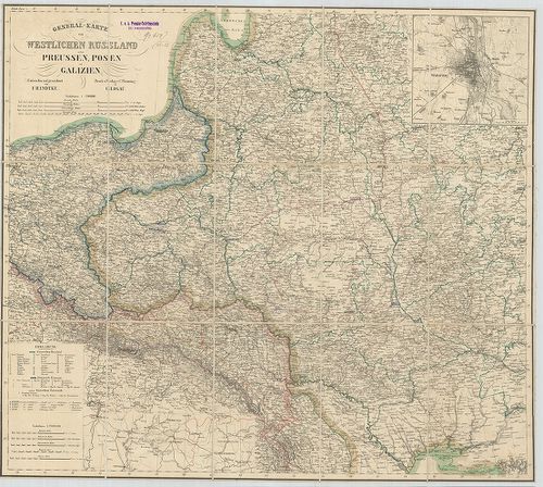
| Title | General-Karte von Westlichen Russland nebst Preussen, Posen und Galizien. |
| Main title | Mt.: [Varsó ]. |
| Subject | Nyugat-Oroszország, Poroszország, Poznan és Galícia általános térképe 1854 körül. |
42. Koenigreich Galizien und Lodomerien herausgegeben im Jahre 1... [B IX a 382]
Institute and Museum of Military History •
B IX a
•
B IX Ausztria–Magyarország
•
B I–XV. Európa
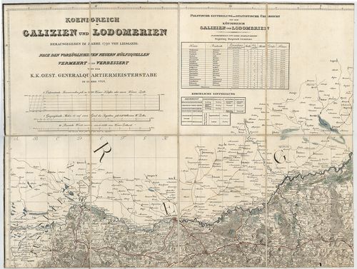
| Title | Koenigreich Galizien und Lodomerien herausgegeben im Jahre 1790 von Liesganig. |
| Main title | Galícia és Lodoméria (Volhínia) térképe, amely Liesganig 1790-es térképének 1824-ben történő felújítása. |
43. General-Karte vom Westlichen Russland nebst Preussen, Posen ... [B XI c 56/1]
Institute and Museum of Military History •
B XI c
•
B XI Oroszország
•
B I–XV. Európa

| Title | General-Karte vom Westlichen Russland nebst Preussen, Posen und Galizien. |
| Main title | Mt.: Warschau (Varsó). |
| Subject | Nyugat-Oroszország, Poroszország, Lengyelország és Galícia általános térképe 1868-ban. |
44. [Európa egyes részeinek vasúti térképe 1914–1918 között.] [B II c 50]
Institute and Museum of Military History •
B II c
•
B II Európa, nagyobb részek és országcsoportok
•
B I–XV. Európa
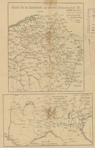
| Title | [Európa egyes részeinek vasúti térképe 1914–1918 között.] |
| Main title | 4 térk. egy lapon: 1. Übersicht über das Eisenbahnnetz auf dem Westl. Kriegsschauplatz 1914. |
| Subject | (Nyugati hadszíntér vasúti térképe 1914-ben. 2. Eisenbahnkarte von Ober-Italien 1918. |
Content: [...] Oroszország és Kelet Poroszország és Galícia vasúti térképe 1914 ben 4 [...]
45. Atlas Geologiczny Galicyi. [B XI b 29]
Institute and Museum of Military History •
B XI b
•
B XI Oroszország
•
B I–XV. Európa
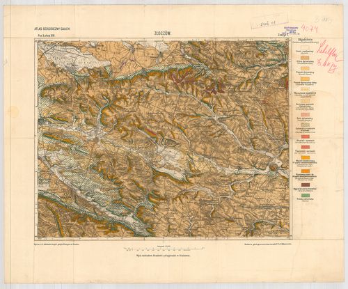
| Title | Atlas Geologiczny Galicyi. |
| Main title | 1 Pas 5, słup XII. Busk i Krasne Zeszyt 7. 2. Pas 5, słup XIII. Złoczów. Zeszyt 7. (Zolocsev). |
| Subject | Galícia geológiai térképrészletei 1900 után. |
46. Uibersichts Karte der neu organisirten Gerichts und Verwaltu... [B IX c 564]
Institute and Museum of Military History •
B IX c
•
B IX Ausztria–Magyarország
•
B I–XV. Európa
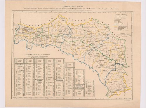
| Title | Uibersichts Karte der neu organisirten Gerichts und Verwaltungs Bezirke der Kronländer Königreich Galizien und Lodomerien und des Herzogthums Bukowina. |
| Main title | Galícia-Lodoméria és Bukovina új kerületi beosztási térképe 1850-ben. |
47. Galizien (Karpathen), Bukowina nebst anschiesendem Ungarn, R... [B IX c 1383]
Institute and Museum of Military History •
B IX c
•
B IX Ausztria–Magyarország
•
B I–XV. Európa
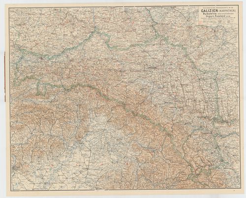
| Title | Galizien (Karpathen), Bukowina nebst anschiesendem Ungarn, Russland U. s. w. (Ludwig Ravensteins Kriegskarte N. 26.) |
| Main title | Galícia, Bukovina, Magyarország, Oroszország csatlakozó részeinek térképe az I. Világháborús frontvonalak, csaták, erődök jelölésével. |
48. Europäisches Russland. [B XI a 24]
Institute and Museum of Military History •
B XI a
•
B XI Oroszország
•
B I–XV. Európa

| Title | Europäisches Russland. |
| Main title | Mt.: St. Petersburg und Umgebung. (Szentpétervár–Leningrád és környéke. 2. mell.: I. West-Russland. (Nyugat-Oroszország-Lengyelország.) |
| Subject | Mt.: Warschau. II. Galizien und die Bukovina. (Galícia és Bukovina) |
49. Charte von Ungarn, Siebenburgen, Slavonien, einem Theil von ... [B IX a 1030]
Institute and Museum of Military History •
B IX a
•
B IX Ausztria–Magyarország
•
B I–XV. Európa
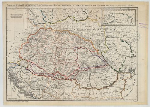
| Title | Charte von Ungarn, Siebenburgen, Slavonien, einem Theil von Croatien u. Ost-Galizien nebst der Moldau, Wallachey, und andern angrenzenden Ländern. |
| Main title | Magyarország, Erdély, Szlavónia-Horvátország, Kelet-Galícia, Moldva, Havasalföld térképe az 1770-es években. |
50. Oesterreichischer Post und Reise-Atlas. – Atlas Itinéraire d... [B IX c 38]
Institute and Museum of Military History •
B IX c
•
B IX Ausztria–Magyarország
•
B I–XV. Európa
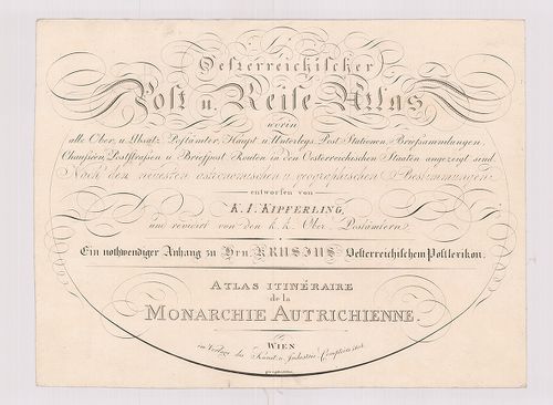
| Title | Oesterreichischer Post und Reise-Atlas. – Atlas Itinéraire de la Monarchie Autrichienne. |
| Main title | 1. Címlap. 2. Áttekintő lap. 3. Post-Karte von Böhmen. (Csehország postatérképe.) 4. Post-Karte von Maehren und Oesterreichisch Schlesien. (Morvaország és az osztrák Szilézia postatérképe.) 5. Post-Karte von Westgalizien. (Ny-Galícia.) 6. Post Karte des Nordwestlichen Theils von Ostgalizien. (K-Galícia ÉNy-i része.) 7. Post Karte des Südlichen Theils von Ostgalizien. (K-Galícia D-i része.) 8. Post Karte von Salzburg, Passau und Berchtesgaden. (Salzburg, Passau és Berchtesgaden postatérképe.) 9. Post Karte von Tirol. (Tirol postatérképe.) 10. Post Karte von dem Osterreichisch-Venetianischen Gebiethe. (Az osztrák Velence környékének postatérképe. 11. Post Karte von Kroatien. (Horvátország.) 12. Post Karte von Inner-Oesterreich. (Belső-Ausztria.) 13. Post Karte von Nieder-Oesterreich ob und unter der Ens. (Alsó-Ausztria.) 14. Post Charte von Siebenbürgen. (Erdély postatérképe.) 15. Post Charte von Ungarn. (Magyarország postatérképe.) 4 csatl. tl. Crusius’s Lexikon után.Az Osztrák Monarchia postatérképe 1804-ben. |
51. Ost Galizien. Zweites Blatt enthaltend den Zamoscer, Zolkiew... [B IX a 416]
Institute and Museum of Military History •
B IX a
•
B IX Ausztria–Magyarország
•
B I–XV. Európa
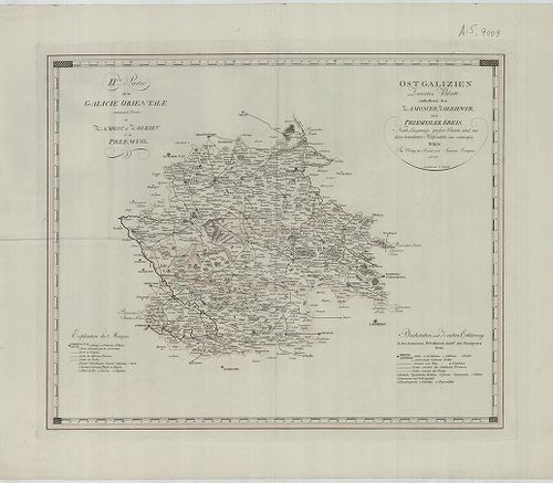
| Title | Ost Galizien. Zweites Blatt enthaltend den Zamoscer, Zolkiewer und Przemysler Kreis. – II. de Partie de la Galicie Orientale contenant les Cercles de Zamosc, de Zolkiev, et de Przemysl. |
| Main title | Kelet-Galícia térképe 1803-ban, 3 ker. megjelölésével. |
52. Ost-Galizien. IV.-es Blatt enthaltend den Sanislawoner, Zale... [B IX a 419]
Institute and Museum of Military History •
B IX a
•
B IX Ausztria–Magyarország
•
B I–XV. Európa
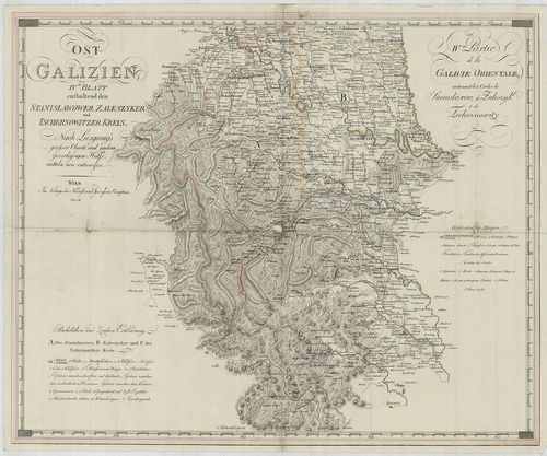
| Title | Ost-Galizien. IV.-es Blatt enthaltend den Sanislawoner, Zaleszyker und Tschernowitzer Kreis. – IV.-eme Partie de la Galicie Orientale, contenant les Cercles de Stanislawow, de Zaleszyk, et de Tschernowitz. |
| Main title | Kelet-Galícia térképe 1803-ban, 3 kerület megjelölésével. |
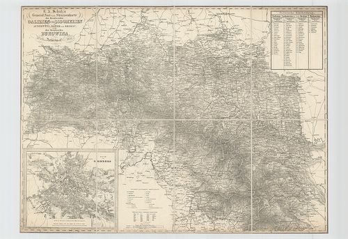
53. General Post- und Strassenkarte des Kronlandes Galizien und ... [B IX a 390]
Institute and Museum of Military History •
B IX a
•
B IX Ausztria–Magyarország
•
B I–XV. Európa
| Title | General Post- und Strassenkarte des Kronlandes Galizien und Lodomerien Ausschwitz, (Ošviecim) Zator, und Krakau, (Kraków) so wie des Kronlandes Bukowina. |
| Main title | Mt. Plan von Lemberg. (Lvov várostérk.) |
| Subject | Galícia, Volhínia és Bukovina általános térképe 1874-ben, posta és úthálózattal. |
54. Ost-Galizien, Erstes Blatt enthaltend den Tarnower, Rzeszowe... [B IX a 415]
Institute and Museum of Military History •
B IX a
•
B IX Ausztria–Magyarország
•
B I–XV. Európa
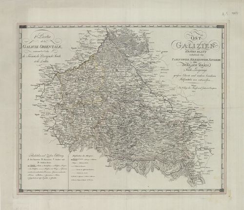
| Title | Ost-Galizien, Erstes Blatt enthaltend den Tarnower, Rzeszower, Sanoker, und Duklaer Kreis. – I. re Partie de la Galicie Orientale: Contenant les Cercles de Tarnow, de Rzeszow, de Sanok et de Dukla. |
| Main title | Kelet-Galícia térképe 1803-ban, 4 ker. megjelölésével. |
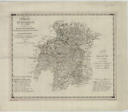
55. West Galizien. II-tes Blatt enthaltend den Konskier, Radomer... [B IX a 417]
Institute and Museum of Military History •
B IX a
•
B IX Ausztria–Magyarország
•
B I–XV. Európa
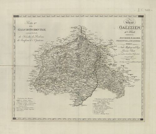
| Title | West Galizien. II-tes Blatt enthaltend den Konskier, Radomer, Jozefower und Opatower Kreis. – Partie II.-me de la Galicie Occidentale, contenant les Cercles de Konskie, de Radome, de Jozefowe et d’Opatowe. |
| Main title | Nyugat-Galícia térképe 1803-ban, 4 kerület megjelölésével. |
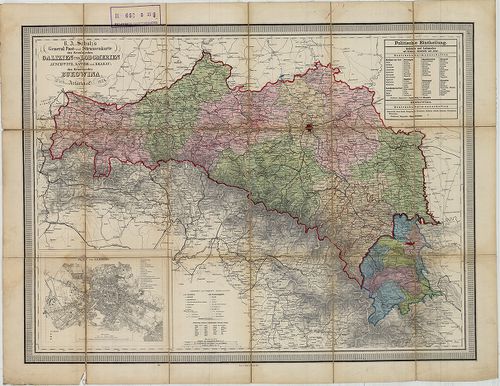
56. Die Forste der in Verwaltung des k. k. Ackerbau-Ministeriums... [B IX c 132]
Institute and Museum of Military History •
B IX c
•
B IX Ausztria–Magyarország
•
B I–XV. Európa
| Title | Die Forste der in Verwaltung des k. k. Ackerbau-Ministeriums Stehenden Staats- und Fondsgüter. |
| Main title | Az Osztrák–Magyar Monarchia egyes részeinek Földművelésügyi Minisztériuma állami és alapítványi erdőinek térképe 1885-ben. |
Technical features: [...] Istrien Isztria Böhmen Csehország Galicien Galícia Bukovina részeiről 1 áttekintőtérk a [...]
57. General Charte des Atlasses von Galizien und Lodomerien nach... [B IX a 379]
Institute and Museum of Military History •
B IX a
•
B IX Ausztria–Magyarország
•
B I–XV. Európa
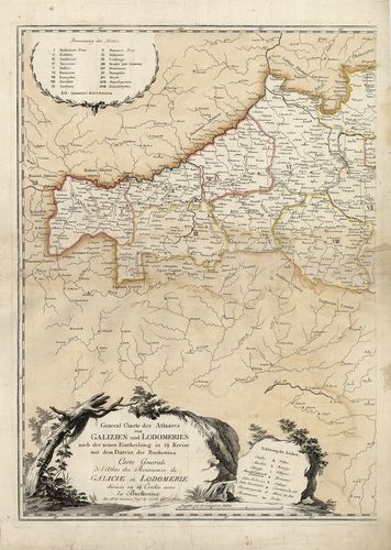
| Title | General Charte des Atlasses von Galizien und Lodomerien nach der neuen Eintheilung in 19. Kreise mit dem District der Buckovina. – Varte Generale de l’Atlas des Roiaumes de Galicie et Lodomerie… |
| Main title | Galícia és Volhínia általános térképe 1786-ban, a 19 ker. jelölésével. |
58. West Galizien. III.-tes Blatt enthaltend den Wiazowner, Sied... [B IX a 418]
Institute and Museum of Military History •
B IX a
•
B IX Ausztria–Magyarország
•
B I–XV. Európa
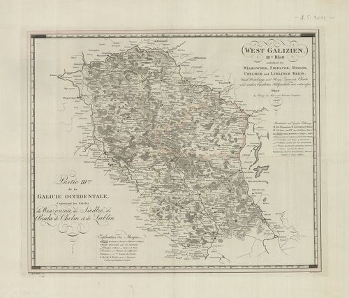
| Title | West Galizien. III.-tes Blatt enthaltend den Wiazowner, Siedlcer, Bialer, Chelmer und Lubliner Kreis. – Partie III.-me de la Galicie Occidentale, contenant les Cercles de Wiazowna, de Siedlze, de Biala, de Chelm, et de Lublin. |
| Main title | Nyugat-Galícia térképe 1803-ban, 5 kerület megjelölésével. |
59. General Post- und Strassenkarte des Kronlandes Galizien und ... [B IX c 502]
Institute and Museum of Military History •
B IX c
•
B IX Ausztria–Magyarország
•
B I–XV. Európa
| Title | General Post- und Strassenkarte des Kronlandes Galizien und Lodomerien mit Auschwitz (Oswiecim), Zator und Krakau (Krakow) sie wie des Kronlandes Bukowina. |
| Main title | Mt. Plan von Lemberg. (Lvov térképe. Lak.: 65 978, ház: 2524 az 1843. évben.) |
| Subject | Galícia, Lodoméria és Bukowina posta- és úttérképe 1851-ben. |
60. West Galizien. I.-tes Blatt enthaltend den Krakauer, Slomnik... [B IX a 414]
Institute and Museum of Military History •
B IX a
•
B IX Ausztria–Magyarország
•
B I–XV. Európa
| Title | West Galizien. I.-tes Blatt enthaltend den Krakauer, Slomniker, Stopnicer, Sandecer, Bochnier und Myslenicer Kreis. – Partie I.-re de la Galicie Occidentale contenant les Cercles de Krakovie, de Slomnik de Stopnic, de Sandec, de Bochnia et de Myslenic. |
| Main title | Nyugat-Galícia térképe 1803-ban, 6 kerület megjelölésével. |