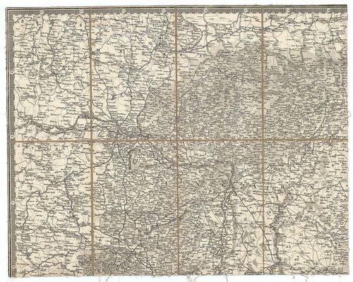
81. Karte von Ungarn und Galizien [S 68 - XIII. - No. 61.]
National Archives of Hungary •
S 68 Festetics család (1645-1943)
•
S Családi fondokból kiemelt térképek (17. sz.-20. sz.)
•
S – Térképtár
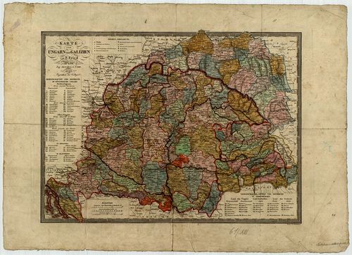
| Main title | Karte von Ungarn und Galizien |
| Subject | XIII. - No. 61. Magyarország, Galícia |
82. Dorf Sachsenfeld in Ungarn Ofen Pesther District [Budapest térképeinek katalógusa 2220]
Budapest City Archives •
Peremtelepülések
•
Az 1873 előtti időszakra vonatkozó térképek leírása
•
Budapest térképeinek katalógusa
| Main title | Dorf Sachsenfeld in Ungarn Ofen Pesther District |
| Subject | Albertfalva kataszteri térképe |
83. Strassen-Karte des Koenigreiches Ungarn [S 75 - No. 1/1.]
National Archives of Hungary •
S 75 Nyomtatott térképek (19. sz.-20. sz.)
•
S – Térképtár
| Main title | Strassen-Karte des Koenigreiches Ungarn |
| Subject | No. 1/1. Magyarország úttérképe |
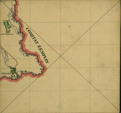
84. Kronland Ungarn Comitat Zemplén [S 78 - Zemplén m. - 001-118.]
National Archives of Hungary •
S 78 Térképek (1786-1948)
•
S Kataszteri-gyűjtemény (1786-1948)
•
S – Térképtár
| Main title | Kronland Ungarn Comitat Zemplén |
| Subject | Zemplén m. - 001-118. Zemplén m. |
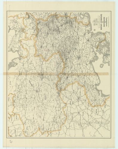
85. Eisenbahnkarte von Österreich–Ungarn. [B IX c 21/1]
Institute and Museum of Military History •
B IX c
•
B IX Ausztria–Magyarország
•
B I–XV. Európa
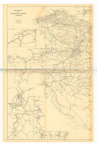
| Title | Eisenbahnkarte von Österreich–Ungarn. |
| Main title | Az Osztrák–Magyar Monarchia vasúttérképe 1914-ben. |
86. Aufnahmskarte des Königreiches Ungarn. [B IX a 530]
Institute and Museum of Military History •
B IX a
•
B IX Ausztria–Magyarország
•
B I–XV. Európa
| Title | Aufnahmskarte des Königreiches Ungarn. |
| Main title | A II. katonai felmérés szelvényei egyszínű másolatban. |
87. Carte von Ungarn und Siebenbürgen. [B IX a 1201]
Institute and Museum of Military History •
B IX a
•
B IX Ausztria–Magyarország
•
B I–XV. Európa
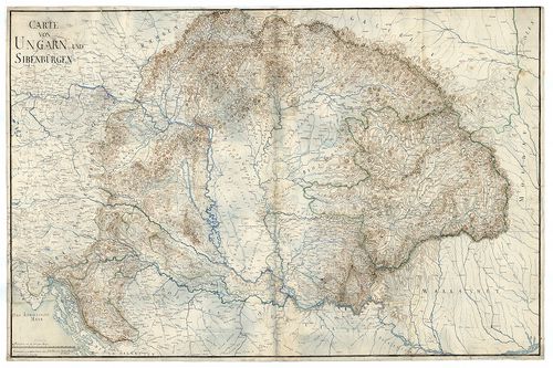
| Title | Carte von Ungarn und Siebenbürgen. |
| Main title | A Magyar Királyság és Erdély térképe. |
88. Carte von Ungarn und Siebenbürgen. [B IX a 1202]
Institute and Museum of Military History •
B IX a
•
B IX Ausztria–Magyarország
•
B I–XV. Európa
| Title | Carte von Ungarn und Siebenbürgen. |
| Main title | A Magyar Királyság és Erdély térképe. |
89. Catastral Gemeinde Szentlőrinczi in Ungarn Ofen Pesther Dist... [Budapest térképeinek katalógusa 4175]
Budapest City Archives •
Peremtelepülések
•
Az 1873–1949 közötti időszakra vonatkozó térképek leírása
•
Budapest térképeinek katalógusa
| Main title | Catastral Gemeinde Szentlőrinczi in Ungarn Ofen Pesther District |
| Subject | Pestszentlőrinc birtokvázlata |
90. Kronland Ungarn Comitat Abauj [S 78 - Abaúj m. - 001-004.]
National Archives of Hungary •
S 78 Térképek (1786-1948)
•
S Kataszteri-gyűjtemény (1786-1948)
•
S – Térképtár
| Main title | Kronland Ungarn Comitat Abauj |
| Subject | Abaúj m. - 001-004. Abaúj m. |
91. Dorf Kleindolincz in Ungarn, Oedenburger Distrikt Eisenburge... [VAML T 77 NSZ]
Vas County Archives •
Törzsanyag
•
Vas megye kéziratos térképei
| Main title | Dorf Kleindolincz in Ungarn, Oedenburger Distrikt Eisenburger Comitat |
| Subject | Kis-Dolány |
92. Strassen-Karte des Koenigreiches Ungarn [S 67 - No. 21,28.]
National Archives of Hungary •
S 67 Falitérképek (1782-1940)
•
S – Térképtár
| Main title | Strassen-Karte des Koenigreiches Ungarn |
| Subject | No. 21,28. Magyarország Erdély nélkül |
93. Spezialkarte des Königreiches Ungarn. [B IX a 531]
Institute and Museum of Military History •
B IX a
•
B IX Ausztria–Magyarország
•
B I–XV. Európa
| Title | Spezialkarte des Königreiches Ungarn. |
| Main title | Magyarország részletes térképe a II. katonai felmérés alapján. |
94. Dorf Alt Beznócz hiezu einverleibt Neu Beznócz in Ungarn Eis... [TK 440]
National Széchényi Library •
OSZK kéziratos térképek
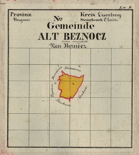
| Title | Dorf Alt Beznócz hiezu einverleibt Neu Beznócz in Ungarn Eisenburger Comitat Steueramt Olsnitz |
95. Eisenbahnkarte von Deutschland und Österreich–Ungarn. [B II c 156]
Institute and Museum of Military History •
B II c
•
B II Európa, nagyobb részek és országcsoportok
•
B I–XV. Európa
| Title | Eisenbahnkarte von Deutschland und Österreich–Ungarn. |
| Main title | Németország és Ausztria–Magyarország vasúti térképe. |
96. Gemeinde Gerde in Ungarn... [S 78 - 017. téka - Gerde - 1.]
National Archives of Hungary •
S 78 Térképek (1786-1948)
•
S Kataszteri-gyűjtemény (1786-1948)
•
S – Térképtár
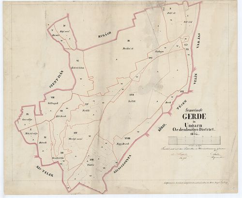
| Main title | Gemeinde Gerde in Ungarn... |
| Subject | 017. téka - Gerde - 1. Gerde (Baranya m.) |
97. Strassen-Karte des Koenigreiches Ungarn [S 75 - No. 1/2-4.]
National Archives of Hungary •
S 75 Nyomtatott térképek (19. sz.-20. sz.)
•
S – Térképtár
| Main title | Strassen-Karte des Koenigreiches Ungarn |
| Subject | No. 1/2-4. Magyarország úttérképe |
98. Dorf Stefansdorf ungarisch Istvánfalva in Ungarn Oedenburger... [VAML T 75 NSZ]
Vas County Archives •
Törzsanyag
•
Vas megye kéziratos térképei
| Main title | Dorf Stefansdorf ungarisch Istvánfalva in Ungarn Oedenburger Distrikt Eisenburger Comitat |
| Subject | Apátistvánfalva |
99. Dislocations Carte von Ungarn de Anno 1781. [B IX c 685]
Institute and Museum of Military History •
B IX c
•
B IX Ausztria–Magyarország
•
B I–XV. Európa
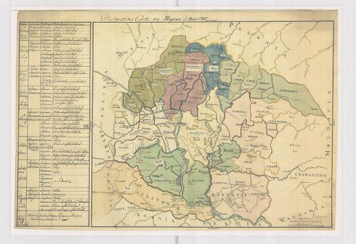
| Title | Dislocations Carte von Ungarn de Anno 1781. |
| Main title | Magyarország diszlokációs térképe 1781-ben. |
100. Aufnahme von der Marmorosch in Ober Ungarn. [B IX a 1340]
Institute and Museum of Military History •
B IX a
•
B IX Ausztria–Magyarország
•
B I–XV. Európa
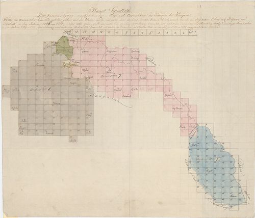
| Title | Aufnahme von der Marmorosch in Ober Ungarn. |
| Main title | Máramaros I. katonai felmérése (részfelmérés). |