541. Moson megye közigazgatási és kultúrtérképe és statisztikája. [B IX a 635]
Institute and Museum of Military History •
B IX a
•
B IX Ausztria–Magyarország
•
B I–XV. Európa
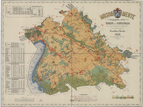
| Title | Moson megye közigazgatási és kultúrtérképe és statisztikája. |
542. Geographische Charte des Munkatser Bezirks im Koenigreich Hu... [B IX a 636]
Institute and Museum of Military History •
B IX a
•
B IX Ausztria–Magyarország
•
B I–XV. Európa
| Title | Geographische Charte des Munkatser Bezirks im Koenigreich Hungarn. Aufgenommen unter der Direction des Herrn Obrist von Neu im Jahre 1782–83–84. |
| Main title | A Munkácsi Kerület általános térképe az I. katonai felmérés alapján. |
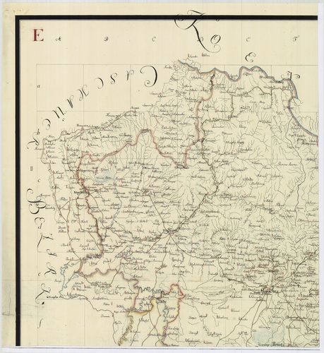
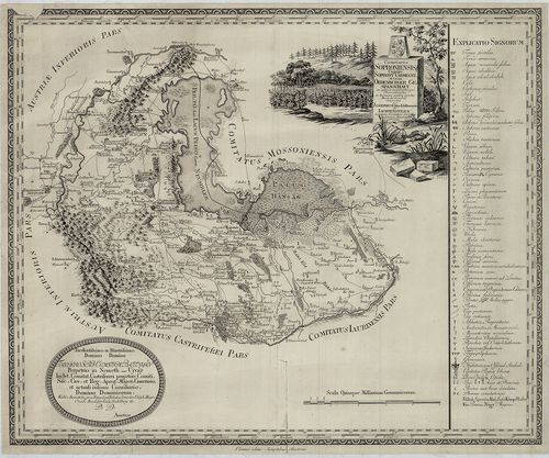
543. Geographische Charte des Groswardeiner Bezirks im Königreich... [B IX a 637]
Institute and Museum of Military History •
B IX a
•
B IX Ausztria–Magyarország
•
B I–XV. Európa
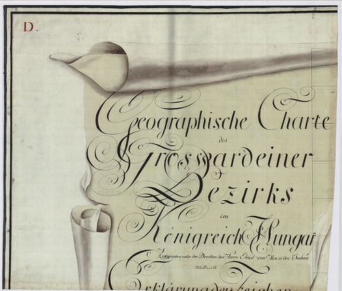
| Title | Geographische Charte des Groswardeiner Bezirks im Königreich Hungarn. Aufgenommen unter der Direction des Herrn Obrist von Neu in den Jahren 1782–83–84. |
| Main title | A Nagyváradi Kerület általános térképe az I. katonai felmérés alapján. |
544. Karte des Grosvardeiner Steuer Distriktes im Kronlande Ungar... [B IX a 637/2]
Institute and Museum of Military History •
B IX a
•
B IX Ausztria–Magyarország
•
B I–XV. Európa
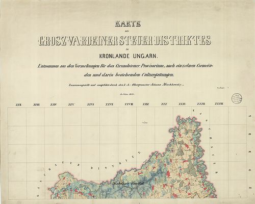
| Title | Karte des Grosvardeiner Steuer Distriktes im Kronlande Ungarn. |
| Main title | A Nagyváradi Adókerület térképe 1855-ben. |
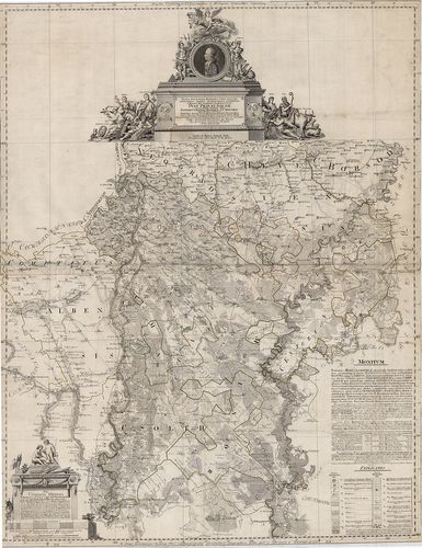
545. Nógrád megye közigazgatási és kultúrtérképe és statisztikája... [B IX a 639]
Institute and Museum of Military History •
B IX a
•
B IX Ausztria–Magyarország
•
B I–XV. Európa
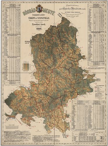
| Title | Nógrád megye közigazgatási és kultúrtérképe és statisztikája. |
546. Mappa von dem Orsovaer und Allmasser District. [B IX a 642]
Institute and Museum of Military History •
B IX a
•
B IX Ausztria–Magyarország
•
B I–XV. Európa
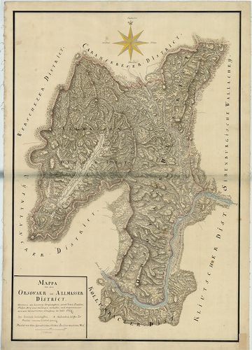
| Title | Mappa von dem Orsovaer und Allmasser District. |
| Main title | Az Orşovai és Almási Kerület térképe 1724-ben. |
547. Mappa von dem Ujpallanker District. [B IX a 643]
Institute and Museum of Military History •
B IX a
•
B IX Ausztria–Magyarország
•
B I–XV. Európa
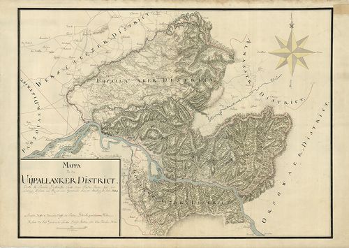
| Title | Mappa von dem Ujpallanker District. |
| Main title | Az Újpalankai Kerület térképe 1724-ben. |
548. Mappa von dem Panczowaer District. [B IX a 644]
Institute and Museum of Military History •
B IX a
•
B IX Ausztria–Magyarország
•
B I–XV. Európa
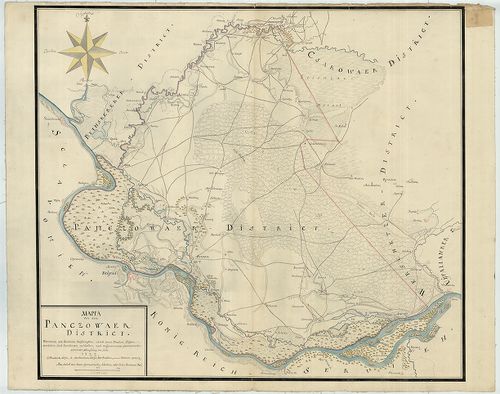
| Title | Mappa von dem Panczowaer District. |
| Main title | A Pancsovai Kerület térképe 1722-ben. |
549. Geographische Charte des Fünfkirchner Bezirks im Königreich ... [B IX a 645]
Institute and Museum of Military History •
B IX a
•
B IX Ausztria–Magyarország
•
B I–XV. Európa
| Title | Geographische Charte des Fünfkirchner Bezirks im Königreich Hungarn. Aufgenommen unter der Direction des Herrn Obrist von Neu in den Jahren 1782–83–84. |
| Main title | A Pécsi Kerület általános térképe az I. katonai felmérés alapján. |
550. Mappa Comitatus Pesthiensis. [B IX a 646]
Institute and Museum of Military History •
B IX a
•
B IX Ausztria–Magyarország
•
B I–XV. Európa
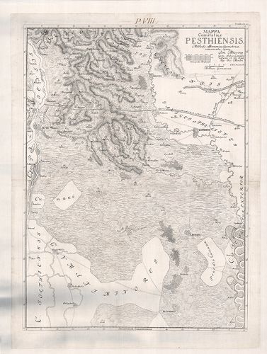
| Title | Mappa Comitatus Pesthiensis. |
| Main title | Pest vármegye térképe. |
551. Mappa Ichnographica Comitatuum Pest Pilis et Solth. [B IX a 649]
Institute and Museum of Military History •
B IX a
•
B IX Ausztria–Magyarország
•
B I–XV. Európa
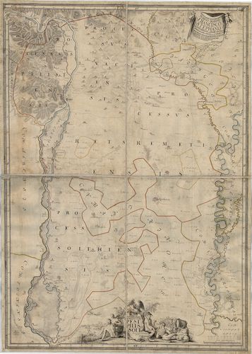
| Title | Mappa Ichnographica Comitatuum Pest Pilis et Solth. |
| Main title | Pest-Pilis-Solt vármegye és a Kiskunság térképe. |
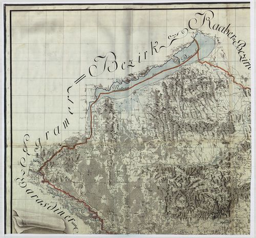
552. Geographische Charte des Pester Bezirks im Königreich Hungar... [B IX a 650]
Institute and Museum of Military History •
B IX a
•
B IX Ausztria–Magyarország
•
B I–XV. Európa
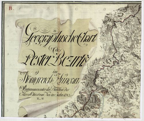
| Title | Geographische Charte des Pester Bezirks im Königreich Hungarn. Aufgenommen der Direction des Herrn Obrist Neu im Jahre 1782–83–84. |
| Main title | A Pesti Kerület általános térképe az I. katonai felmérés alapján. |
553. Mappa specialissima Regionibus Coeli juxta Recentissimas obs... [B IX a 651]
Institute and Museum of Military History •
B IX a
•
B IX Ausztria–Magyarország
•
B I–XV. Európa
| Title | Mappa specialissima Regionibus Coeli juxta Recentissimas observ. Astronomicas accommodata J. Regni Hungariae Comitatuum Pest, Pilis, Solth articulariter unitorum: Item Jazygiae, Cuminae Majoris et Minoris… |
| Main title | Pest-Pilis-Solt vármegye térképe 1793-ban. |
554. Comitatus Posoniensis Ungarice Posony-Vármegye et Germanice ... [B IX a 654]
Institute and Museum of Military History •
B IX a
•
B IX Ausztria–Magyarország
•
B I–XV. Európa
| Title | Comitatus Posoniensis Ungarice Posony-Vármegye et Germanice Pressburger Gespanschaft… |
| Main title | Pozsony vármegye térképe 1794-ben. |
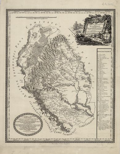
555. Comitatus Soproniensis Ungarice Soprony Vármegye et Grm. Oed... [B IX a 656]
Institute and Museum of Military History •
B IX a
•
B IX Ausztria–Magyarország
•
B I–XV. Európa
| Title | Comitatus Soproniensis Ungarice Soprony Vármegye et Grm. Oedenburger Gespanschaft… |
| Main title | Sopron vármegye térképe 1793-ban. |
556. Sopron vármegye… [B IX a 657]
Institute and Museum of Military History •
B IX a
•
B IX Ausztria–Magyarország
•
B I–XV. Európa
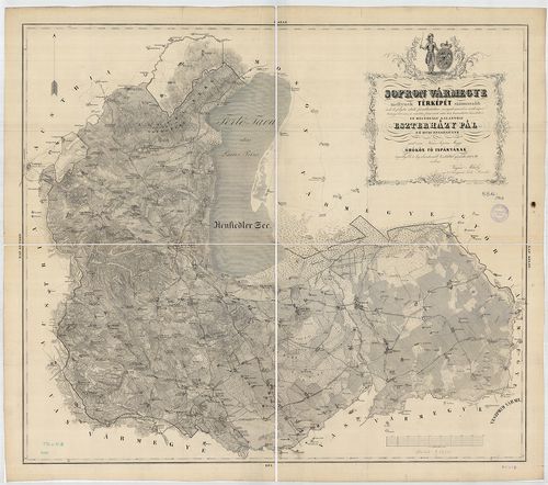
| Title | Sopron vármegye… |
557. Mappa Archi Dioecesis Strigoniensis. [B IX a 658]
Institute and Museum of Military History •
B IX a
•
B IX Ausztria–Magyarország
•
B I–XV. Európa
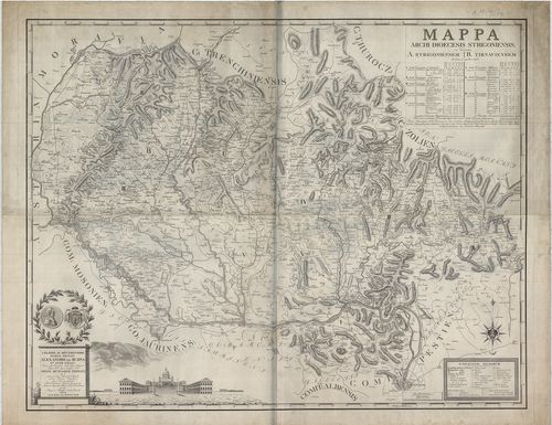
| Title | Mappa Archi Dioecesis Strigoniensis. |
| Main title | Az Esztergomi egyházmegye térképe 1822-ben. |
558. Mappa von dem Temesvaer District. [B IX a 659]
Institute and Museum of Military History •
B IX a
•
B IX Ausztria–Magyarország
•
B I–XV. Európa
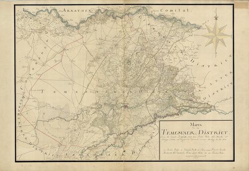
| Title | Mappa von dem Temesvaer District. |
| Main title | A Temesi Kerület térképe 1720-ban. |
559. Temes megye közigazgatási és kulturtérképe és statisztikája. [B IX a 660]
Institute and Museum of Military History •
B IX a
•
B IX Ausztria–Magyarország
•
B I–XV. Európa
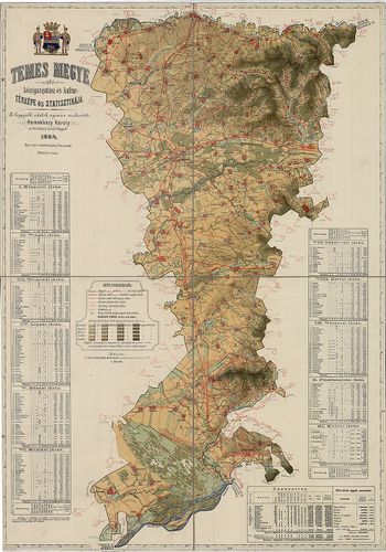
| Title | Temes megye közigazgatási és kulturtérképe és statisztikája. |
560. Comitatus Tolnensis Ungarice Tolná-Vármegye et Germanice Tol... [B IX a 661]
Institute and Museum of Military History •
B IX a
•
B IX Ausztria–Magyarország
•
B I–XV. Európa
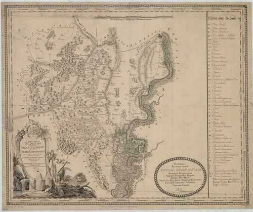
| Title | Comitatus Tolnensis Ungarice Tolná-Vármegye et Germanice Tolner Gespanschaft. |
| Main title | Tolna vármegye térképe 1795-ben. |