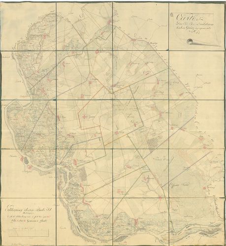
881. Stuhl Mühlenbach in dem Grosfürstenthum Siebenbürgen. Geomet... [B IX a 1262]
Institute and Museum of Military History •
B IX a
•
B IX Ausztria–Magyarország
•
B I–XV. Európa
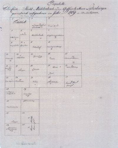
| Title | Stuhl Mühlenbach in dem Grosfürstenthum Siebenbürgen. Geometrisch aufgenohmen im Jahr 1769 in 33 Sectionen. |
| Main title | A szászsebesi Mühlenbach szék gazdasági felmérése (I. kat. felm. előzménye.) |
882. Plan des löbl. Kaiserl. Königl. Ansiedlenden Banater Deutsch... [B IX a 1263]
Institute and Museum of Military History •
B IX a
•
B IX Ausztria–Magyarország
•
B I–XV. Európa
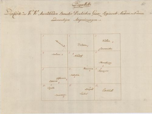
| Title | Plan des löbl. Kaiserl. Königl. Ansiedlenden Banater Deutschen Graenz Regiments.... |
| Main title | A Német Bánsági 12. határezred térképe. |
883. [Karánsebes, Slatina és Teregova felmérési térképei.] [B IX a 1264]
Institute and Museum of Military History •
B IX a
•
B IX Ausztria–Magyarország
•
B I–XV. Európa
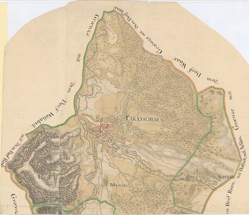
| Title | [Karánsebes, Slatina és Teregova felmérési térképei.] |
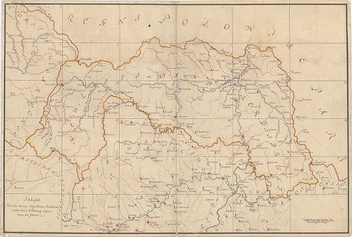
884. Kriegs Carte in 93 Brouillons Sectionen von Ober Ungarn... [B IX a 1265]
Institute and Museum of Military History •
B IX a
•
B IX Ausztria–Magyarország
•
B I–XV. Európa
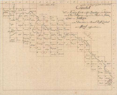
| Title | Kriegs Carte in 93 Brouillons Sectionen von Ober Ungarn... |
| Main title | Felső-Magyarország felmérési térképei. (I. kat. felm. előzménye.) |
885. Banater Generalat. [B IX a 1266]
Institute and Museum of Military History •
B IX a
•
B IX Ausztria–Magyarország
•
B I–XV. Európa
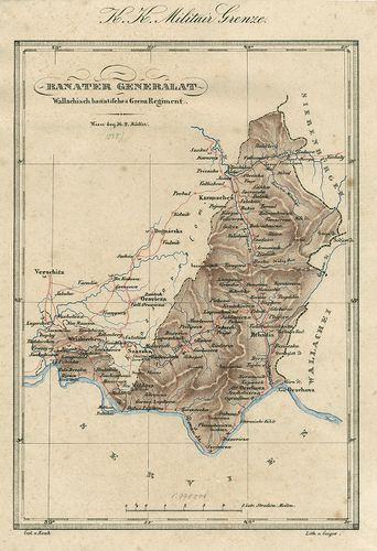
| Title | Banater Generalat. |
| Main title | Az Oláh Bánsági határezred térképe. |
886. Situations Plan des Wallach Illirisch Granz Infanterie Reg. ... [B IX a 1267]
Institute and Museum of Military History •
B IX a
•
B IX Ausztria–Magyarország
•
B I–XV. Európa
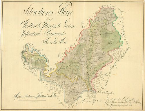
| Title | Situations Plan des Wallach Illirisch Granz Infanterie Reg. Bezirks No. 13. |
| Main title | A Oláh-Illír 13. határezred térképe. |
887. Carte des Wallach-Illirischen Grenz Regiments Bezirks No. 13... [B IX a 1268]
Institute and Museum of Military History •
B IX a
•
B IX Ausztria–Magyarország
•
B I–XV. Európa
| Title | Carte des Wallach-Illirischen Grenz Regiments Bezirks No. 13. |
888. Carte des Löbl. Wallach-Illyrischen Granz Regiment No. 13. [B IX a 1269]
Institute and Museum of Military History •
B IX a
•
B IX Ausztria–Magyarország
•
B I–XV. Európa
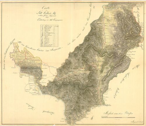
| Title | Carte des Löbl. Wallach-Illyrischen Granz Regiment No. 13. |
| Main title | A Oláh-Illír 13. határezred térképe. |
889. Übersichts Carte des Illyrisch Banater Grenz Bataillons. [B IX a 1270]
Institute and Museum of Military History •
B IX a
•
B IX Ausztria–Magyarország
•
B I–XV. Európa
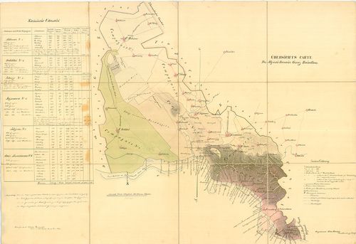
| Title | Übersichts Carte des Illyrisch Banater Grenz Bataillons. |
| Main title | Az Illír-Bánsági 14. határezred áttekintő térképe. |
890. Mappa über den Bethskereker District... [B IX a 1271]
Institute and Museum of Military History •
B IX a
•
B IX Ausztria–Magyarország
•
B I–XV. Európa
| Title | Mappa über den Bethskereker District... |
891. Illirischbanater Grenz-Regiment No. 14. [B IX a 1272]
Institute and Museum of Military History •
B IX a
•
B IX Ausztria–Magyarország
•
B I–XV. Európa

| Title | Illirischbanater Grenz-Regiment No. 14. |
| Main title | Az Illír-Bánsági 14. határezred térképe. |
892. Carte des K. k. Deutsbanatischen Granz Regimenst No. 12. [B IX a 1273]
Institute and Museum of Military History •
B IX a
•
B IX Ausztria–Magyarország
•
B I–XV. Európa
| Title | Carte des K. k. Deutsbanatischen Granz Regimenst No. 12. |
| Main title | A Német-Bánsági 12. határezred térképe. |
893. Karte der Banater Militaergraenze. [B IX a 1274]
Institute and Museum of Military History •
B IX a
•
B IX Ausztria–Magyarország
•
B I–XV. Európa

| Title | Karte der Banater Militaergraenze. |
| Main title | Az Bánsági Katonai Határőrvidék térképe. |
894. Plan der Gegent zwischen Caransebes und Fenisch im Temesware... [B IX a 1275]
Institute and Museum of Military History •
B IX a
•
B IX Ausztria–Magyarország
•
B I–XV. Európa
| Title | Plan der Gegent zwischen Caransebes und Fenisch im Temeswarer-Banat. |
| Main title | A Temesvári Bánságban található Karánsebes és Fényes környékének térképe. |
895. Carte des Deutsbanatischen Granz-Regimenst No. 12. [B IX a 1276]
Institute and Museum of Military History •
B IX a
•
B IX Ausztria–Magyarország
•
B I–XV. Európa
| Title | Carte des Deutsbanatischen Granz-Regimenst No. 12. |
| Main title | A Német-Bánsági 12. határezred térképe. |
896. Situations Plan der gegend im Ried, wo das neue Ort in alt B... [B IX a 1277]
Institute and Museum of Military History •
B IX a
•
B IX Ausztria–Magyarország
•
B I–XV. Európa

| Title | Situations Plan der gegend im Ried, wo das neue Ort in alt Bortsa... |
| Main title | Borcsa környékének térképe. |
897. [Az Oláh-Illír határezred térképe.] [B IX a 1278]
Institute and Museum of Military History •
B IX a
•
B IX Ausztria–Magyarország
•
B I–XV. Európa
| Title | [Az Oláh-Illír határezred térképe.] |
898. [A sandec-i körzet-Árva, Liptó,, Szepes, Sáros vármegyék erg... [B IX a 1279]
Institute and Museum of Military History •
B IX a
•
B IX Ausztria–Magyarország
•
B I–XV. Európa
| Title | [A sandec-i körzet-Árva, Liptó,, Szepes, Sáros vármegyék ergyes részei-felmérési szelvényeinek áttekintője (28 szelvény). Az I. katonai felmérés előzménye, részfelmérés.] |
899. Plan von dem Temesvarer Bannat wie solches im 11 Districten ... [B IX a 1280]
Institute and Museum of Military History •
B IX a
•
B IX Ausztria–Magyarország
•
B I–XV. Európa
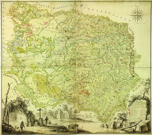
| Title | Plan von dem Temesvarer Bannat wie solches im 11 Districten eingetheilt. |
| Main title | A Temesi Bánság térképe a 11 kerületi beosztással. |
900. Temesvarer Bannat abgetheilet in Seine District und Process. [B IX a 1281]
Institute and Museum of Military History •
B IX a
•
B IX Ausztria–Magyarország
•
B I–XV. Európa
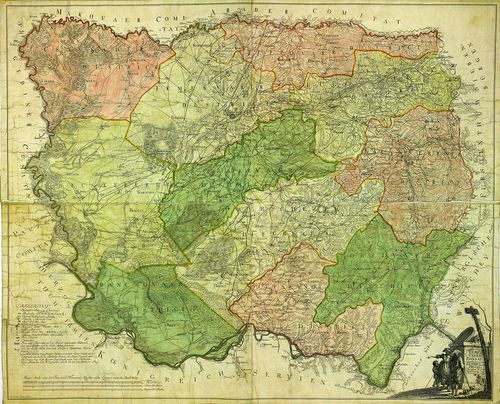
| Title | Temesvarer Bannat abgetheilet in Seine District und Process. |
| Main title | A Temesi Bánság térképe kerületi beosztással. |