941. Plan von der Laage des Kais. Königlichen Brooder Grenz Infan... [B IX a 1322]
Institute and Museum of Military History •
B IX a
•
B IX Ausztria–Magyarország
•
B I–XV. Európa
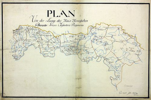
| Title | Plan von der Laage des Kais. Königlichen Brooder Grenz Infanterie Regiments. |
| Main title | A Bródi határőr gyalogezred térképe. |
942. Mappa und Territorium des k. k. Broder Gräntz Regiments No. ... [B IX a 1323]
Institute and Museum of Military History •
B IX a
•
B IX Ausztria–Magyarország
•
B I–XV. Európa
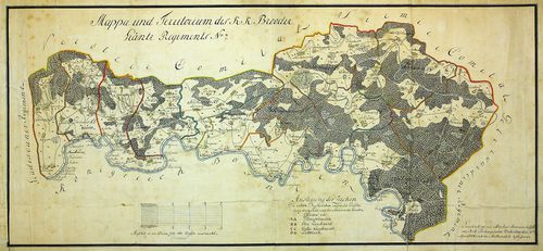
| Title | Mappa und Territorium des k. k. Broder Gräntz Regiments No. 7. |
| Main title | A Bródi 7. határőrezred térképe. |
943. Charte des löb. Gradiscaner Regiments. [B IX a 1324]
Institute and Museum of Military History •
B IX a
•
B IX Ausztria–Magyarország
•
B I–XV. Európa
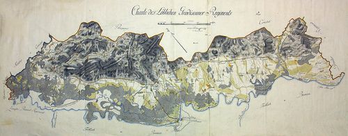
| Title | Charte des löb. Gradiscaner Regiments. |
| Main title | A Gradiscai ezred térképe. |
944. Plan des Gradiscaner Regiments No. 8. [B IX a 1325]
Institute and Museum of Military History •
B IX a
•
B IX Ausztria–Magyarország
•
B I–XV. Európa
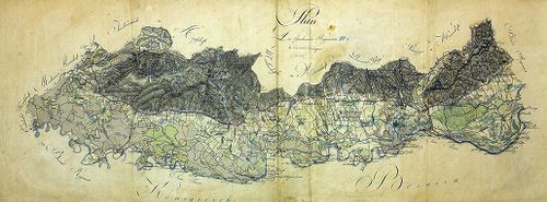
| Title | Plan des Gradiscaner Regiments No. 8. |
| Main title | A 8. Gradiscai ezred térképe. |
945. Plan der Lage von K.K. Peterwardeiner Gränz Regiment. [B IX a 1326]
Institute and Museum of Military History •
B IX a
•
B IX Ausztria–Magyarország
•
B I–XV. Európa
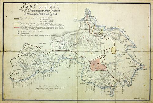
| Title | Plan der Lage von K.K. Peterwardeiner Gränz Regiment. |
| Main title | A Péterváradi határezred térképe. |
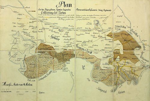
946. Plan der in Syrmien liegenden Peterwardeiner Grenz-Infanteri... [B IX a 1327]
Institute and Museum of Military History •
B IX a
•
B IX Ausztria–Magyarország
•
B I–XV. Európa
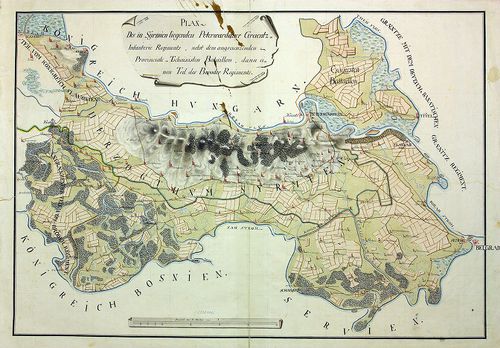
| Title | Plan der in Syrmien liegenden Peterwardeiner Grenz-Infanterie Regiments. |
| Main title | A szerémségi Péterváradi határ-gyalogezred térképe. |
947. Plan des in Syrmien liegenden Peterwardeiner Grenz-Infanteri... [B IX a 1328]
Institute and Museum of Military History •
B IX a
•
B IX Ausztria–Magyarország
•
B I–XV. Európa
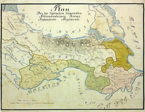
| Title | Plan des in Syrmien liegenden Peterwardeiner Grenz-Infanterie-Regiments. |
| Main title | A szerémségi Péterváradi határ-gyalogezred térképe. |
948. Plan des in Herzogthum Syrmien liegenden Peterwardeiner -Inf... [B IX a 1329]
Institute and Museum of Military History •
B IX a
•
B IX Ausztria–Magyarország
•
B I–XV. Európa
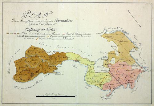
| Title | Plan des in Herzogthum Syrmien liegenden Peterwardeiner -Infanterie- Grenz -Regiments. |
| Main title | A szerémségi Péterváradi határ-gyalogezred térképe. |
949. Plan des in Herzogthum Syrmien liegenden Peterwardeiner -Inf... [B IX a 1330]
Institute and Museum of Military History •
B IX a
•
B IX Ausztria–Magyarország
•
B I–XV. Európa
| Title | Plan des in Herzogthum Syrmien liegenden Peterwardeiner -Infanterie- Grenz -Regiments. |
| Main title | A szerémségi Péterváradi határ-gyalogezred térképe. |
950. Plan des Slavonischen Peterwardeiner Gränz Regiments. [B IX a 1331]
Institute and Museum of Military History •
B IX a
•
B IX Ausztria–Magyarország
•
B I–XV. Európa
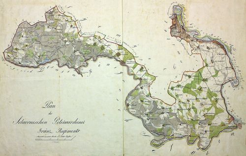
| Title | Plan des Slavonischen Peterwardeiner Gränz Regiments. |
| Main title | A szlavóniai Péterváradi határezred térképe. |
951. Carte des Kais. König. Peterwardeiner Grenz-Regiments. [B IX a 1332]
Institute and Museum of Military History •
B IX a
•
B IX Ausztria–Magyarország
•
B I–XV. Európa
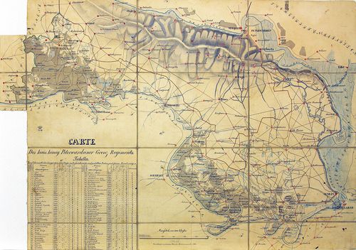
| Title | Carte des Kais. König. Peterwardeiner Grenz-Regiments. |
| Main title | A császári-királyi Péterváradi határezred térképe. |
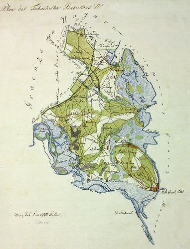
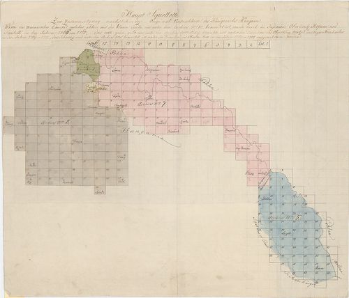
952. Plan aller Gründe des k. k. Tschaikisten Bataillons-Cantons-... [B IX a 1333]
Institute and Museum of Military History •
B IX a
•
B IX Ausztria–Magyarország
•
B I–XV. Európa
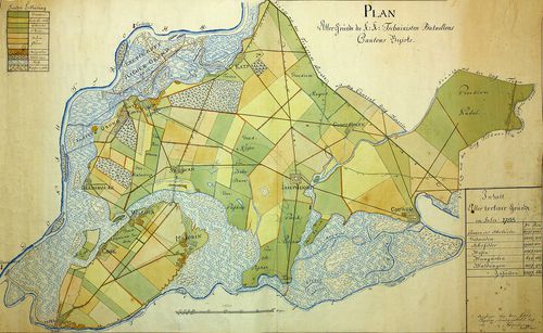
| Title | Plan aller Gründe des k. k. Tschaikisten Bataillons-Cantons-Bezirk. |
| Main title | A császári-királyi Csajkások térképe. |
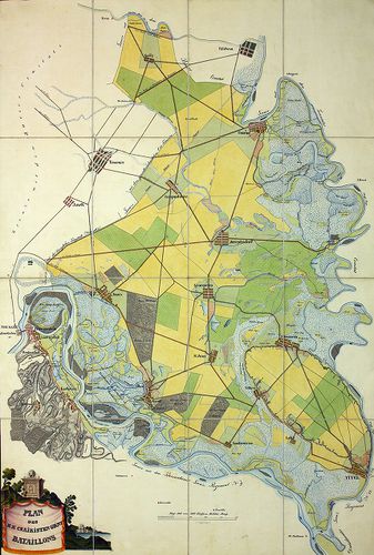
953. Plan des Tschaikisten Bataillons. [B IX a 1334]
Institute and Museum of Military History •
B IX a
•
B IX Ausztria–Magyarország
•
B I–XV. Európa
| Title | Plan des Tschaikisten Bataillons. |
| Main title | A Csajkás ezred térképe. |
954. Plan des löblichen kaiserlichen königlichen Tschaikisten Gre... [B IX a 1335]
Institute and Museum of Military History •
B IX a
•
B IX Ausztria–Magyarország
•
B I–XV. Európa
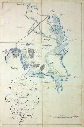
| Title | Plan des löblichen kaiserlichen königlichen Tschaikisten Grenz-Bataillons. |
| Main title | A Csajkás határezred térképe. |
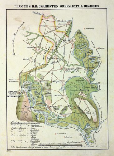
955. Plan des k. k. Czaikisten Grenz-Bataillons. [B IX a 1336]
Institute and Museum of Military History •
B IX a
•
B IX Ausztria–Magyarország
•
B I–XV. Európa
| Title | Plan des k. k. Czaikisten Grenz-Bataillons. |
| Main title | A Csajkás határezred térképe. |
956. Plan vom Syrmier Comitat. [B IX a 1337]
Institute and Museum of Military History •
B IX a
•
B IX Ausztria–Magyarország
•
B I–XV. Európa
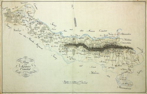
| Title | Plan vom Syrmier Comitat. |
| Main title | A Szerémség térképe. |
957. Plan des k. k. Czaikisten Grenz-Bataill. Bezirks. [B IX a 1338]
Institute and Museum of Military History •
B IX a
•
B IX Ausztria–Magyarország
•
B I–XV. Európa
| Title | Plan des k. k. Czaikisten Grenz-Bataill. Bezirks. |
| Main title | A Csajkás határezred térképe. |
958. Magyaror Szent Korona Országai. Erdély részének kézi térképe... [B IX a 1339]
Institute and Museum of Military History •
B IX a
•
B IX Ausztria–Magyarország
•
B I–XV. Európa
| Title | Magyaror Szent Korona Országai. Erdély részének kézi térképe. |
959. Aufnahme von der Marmorosch in Ober Ungarn. [B IX a 1340]
Institute and Museum of Military History •
B IX a
•
B IX Ausztria–Magyarország
•
B I–XV. Európa
| Title | Aufnahme von der Marmorosch in Ober Ungarn. |
| Main title | Máramaros I. katonai felmérése (részfelmérés). |
960. Eine newe Land Karte von Wien biss nach Constantinopel und a... [B IX a 1341]
Institute and Museum of Military History •
B IX a
•
B IX Ausztria–Magyarország
•
B I–XV. Európa
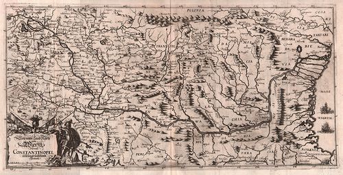
| Title | Eine newe Land Karte von Wien biss nach Constantinopel und angräntzenden Ländern. |
| Main title | Magyarország és a környező területek (Bécs-Konstantinápoly között) térképe. |