4041. Mappa von dem Lippovaer und Facseter District… [B IX a 630]
Institute and Museum of Military History •
B IX a
•
B IX Ausztria–Magyarország
•
B I–XV. Európa
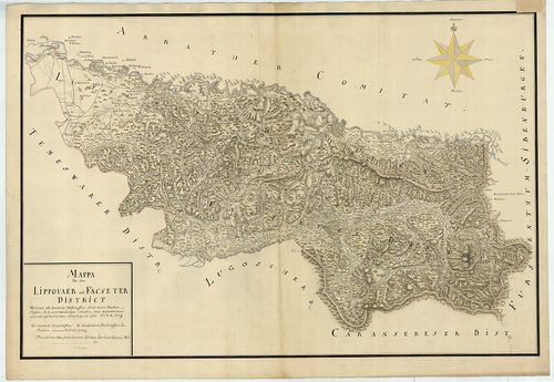
| Title | Mappa von dem Lippovaer und Facseter District… |
| Main title | A Lippai (Lipova) és Facsadi (Făget) körzet térképe 1718–1719-ben. |
4042. Mappa comitatus Liptoviensis. Accuratione Astronomico. Geome... [B IX a 631]
Institute and Museum of Military History •
B IX a
•
B IX Ausztria–Magyarország
•
B I–XV. Európa
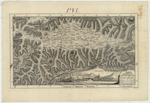
| Title | Mappa comitatus Liptoviensis. Accuratione Astronomico. Geometrice Concinnata. |
| Main title | Liptó vármegye térképe (pontos csillagászati és mértani felmérés alapján.), a Noticia 2. kötetében jelent meg. |
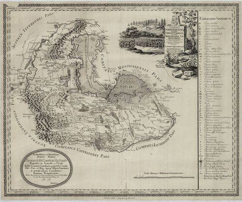
4043. Mappa Über die Sieben Nieder Hung.[arischen] Berg Städte. [B IX a 631/1]
Institute and Museum of Military History •
B IX a
•
B IX Ausztria–Magyarország
•
B I–XV. Európa
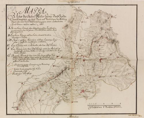
| Title | Mappa Über die Sieben Nieder Hung.[arischen] Berg Städte. |
| Main title | A hét alsómagyarországi bányaváros környékének térképe a 18. században. (Selmecbánya, Banska Štiavnica, környéke.) |
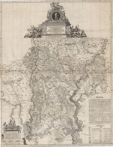
4044. Hungariae Regni, Pars Transylvaniae, Russiae et Moldaviae co... [B IX a 632]
Institute and Museum of Military History •
B IX a
•
B IX Ausztria–Magyarország
•
B I–XV. Európa
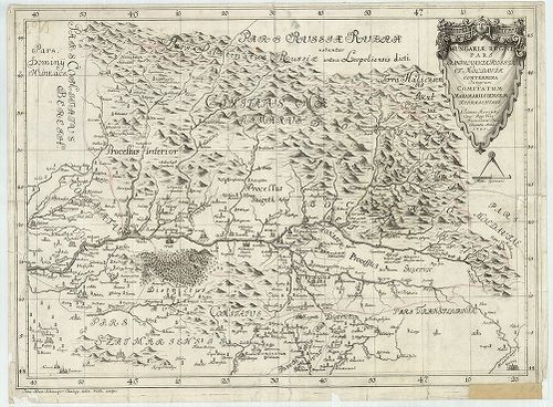
| Title | Hungariae Regni, Pars Transylvaniae, Russiae et Moldaviae contermina Integrum Comitatum Maramarusiensem Repraesentans. |
| Main title | A Felső-Tisza vidékének (Máramaros vm.) általános térképe 1725-ben. |
4045. Moson megye közigazgatási és kultúrtérképe és statisztikája. [B IX a 635]
Institute and Museum of Military History •
B IX a
•
B IX Ausztria–Magyarország
•
B I–XV. Európa
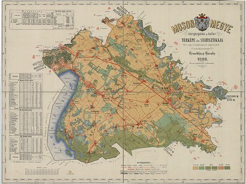
| Title | Moson megye közigazgatási és kultúrtérképe és statisztikája. |
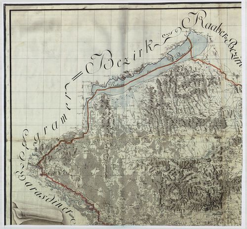
4046. Geographische Charte des Munkatser Bezirks im Koenigreich Hu... [B IX a 636]
Institute and Museum of Military History •
B IX a
•
B IX Ausztria–Magyarország
•
B I–XV. Európa
| Title | Geographische Charte des Munkatser Bezirks im Koenigreich Hungarn. Aufgenommen unter der Direction des Herrn Obrist von Neu im Jahre 1782–83–84. |
| Main title | A Munkácsi Kerület általános térképe az I. katonai felmérés alapján. |
4047. Geographische Charte des Groswardeiner Bezirks im Königreich... [B IX a 637]
Institute and Museum of Military History •
B IX a
•
B IX Ausztria–Magyarország
•
B I–XV. Európa
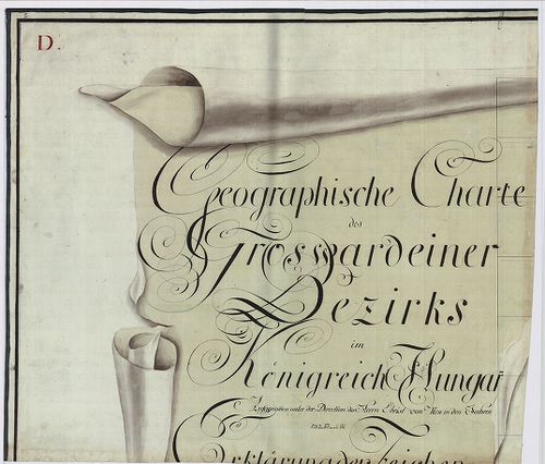
| Title | Geographische Charte des Groswardeiner Bezirks im Königreich Hungarn. Aufgenommen unter der Direction des Herrn Obrist von Neu in den Jahren 1782–83–84. |
| Main title | A Nagyváradi Kerület általános térképe az I. katonai felmérés alapján. |
4048. Karte des Grosvardeiner Steuer Distriktes im Kronlande Ungar... [B IX a 637/2]
Institute and Museum of Military History •
B IX a
•
B IX Ausztria–Magyarország
•
B I–XV. Európa
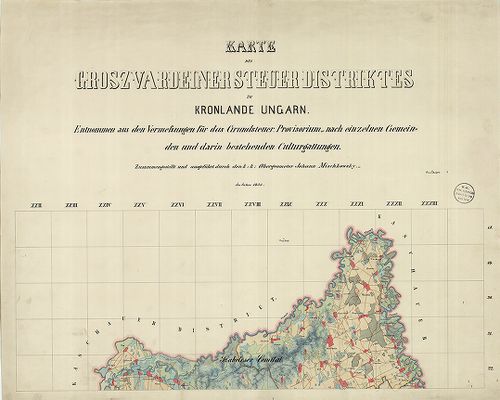
| Title | Karte des Grosvardeiner Steuer Distriktes im Kronlande Ungarn. |
| Main title | A Nagyváradi Adókerület térképe 1855-ben. |
4049. Nógrád megye közigazgatási és kultúrtérképe és statisztikája... [B IX a 639]
Institute and Museum of Military History •
B IX a
•
B IX Ausztria–Magyarország
•
B I–XV. Európa
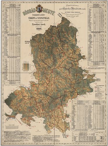
| Title | Nógrád megye közigazgatási és kultúrtérképe és statisztikája. |
4050. Mappa von dem Orsovaer und Allmasser District. [B IX a 642]
Institute and Museum of Military History •
B IX a
•
B IX Ausztria–Magyarország
•
B I–XV. Európa
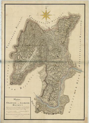
| Title | Mappa von dem Orsovaer und Allmasser District. |
| Main title | Az Orşovai és Almási Kerület térképe 1724-ben. |
4051. Mappa von dem Ujpallanker District. [B IX a 643]
Institute and Museum of Military History •
B IX a
•
B IX Ausztria–Magyarország
•
B I–XV. Európa
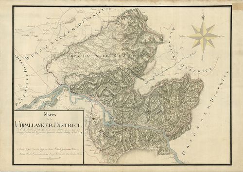
| Title | Mappa von dem Ujpallanker District. |
| Main title | Az Újpalankai Kerület térképe 1724-ben. |
4052. Mappa von dem Panczowaer District. [B IX a 644]
Institute and Museum of Military History •
B IX a
•
B IX Ausztria–Magyarország
•
B I–XV. Európa
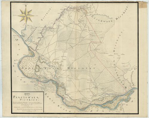
| Title | Mappa von dem Panczowaer District. |
| Main title | A Pancsovai Kerület térképe 1722-ben. |
4053. Geographische Charte des Fünfkirchner Bezirks im Königreich ... [B IX a 645]
Institute and Museum of Military History •
B IX a
•
B IX Ausztria–Magyarország
•
B I–XV. Európa
| Title | Geographische Charte des Fünfkirchner Bezirks im Königreich Hungarn. Aufgenommen unter der Direction des Herrn Obrist von Neu in den Jahren 1782–83–84. |
| Main title | A Pécsi Kerület általános térképe az I. katonai felmérés alapján. |
4054. Mappa Comitatus Pesthiensis. [B IX a 646]
Institute and Museum of Military History •
B IX a
•
B IX Ausztria–Magyarország
•
B I–XV. Európa
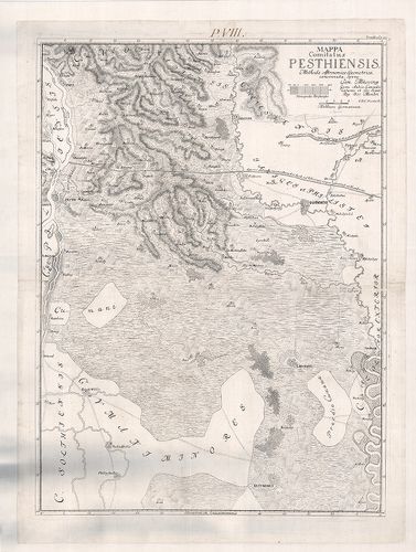
| Title | Mappa Comitatus Pesthiensis. |
| Main title | Pest vármegye térképe. |
4055. Mappa Ichnographica Comitatuum Pest Pilis et Solth. [B IX a 649]
Institute and Museum of Military History •
B IX a
•
B IX Ausztria–Magyarország
•
B I–XV. Európa
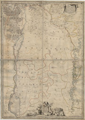
| Title | Mappa Ichnographica Comitatuum Pest Pilis et Solth. |
| Main title | Pest-Pilis-Solt vármegye és a Kiskunság térképe. |
4056. Geographische Charte des Pester Bezirks im Königreich Hungar... [B IX a 650]
Institute and Museum of Military History •
B IX a
•
B IX Ausztria–Magyarország
•
B I–XV. Európa
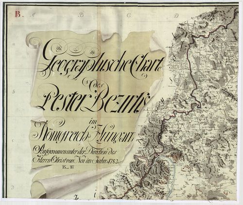
| Title | Geographische Charte des Pester Bezirks im Königreich Hungarn. Aufgenommen der Direction des Herrn Obrist Neu im Jahre 1782–83–84. |
| Main title | A Pesti Kerület általános térképe az I. katonai felmérés alapján. |
4057. Mappa specialissima Regionibus Coeli juxta Recentissimas obs... [B IX a 651]
Institute and Museum of Military History •
B IX a
•
B IX Ausztria–Magyarország
•
B I–XV. Európa
| Title | Mappa specialissima Regionibus Coeli juxta Recentissimas observ. Astronomicas accommodata J. Regni Hungariae Comitatuum Pest, Pilis, Solth articulariter unitorum: Item Jazygiae, Cuminae Majoris et Minoris… |
| Main title | Pest-Pilis-Solt vármegye térképe 1793-ban. |
4058. Comitatus Posoniensis Ungarice Posony-Vármegye et Germanice ... [B IX a 654]
Institute and Museum of Military History •
B IX a
•
B IX Ausztria–Magyarország
•
B I–XV. Európa
| Title | Comitatus Posoniensis Ungarice Posony-Vármegye et Germanice Pressburger Gespanschaft… |
| Main title | Pozsony vármegye térképe 1794-ben. |
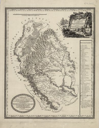
4059. Comitatus Soproniensis Ungarice Soprony Vármegye et Grm. Oed... [B IX a 656]
Institute and Museum of Military History •
B IX a
•
B IX Ausztria–Magyarország
•
B I–XV. Európa
| Title | Comitatus Soproniensis Ungarice Soprony Vármegye et Grm. Oedenburger Gespanschaft… |
| Main title | Sopron vármegye térképe 1793-ban. |
4060. Sopron vármegye… [B IX a 657]
Institute and Museum of Military History •
B IX a
•
B IX Ausztria–Magyarország
•
B I–XV. Európa
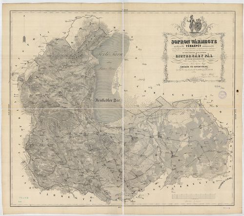
| Title | Sopron vármegye… |