1981. Der Bayrische, Schwaebische und Fraenkische Kreis. [B IV a 409]
Institute and Museum of Military History •
B IV a
•
B IV Német birodalom
•
B I–XV. Európa
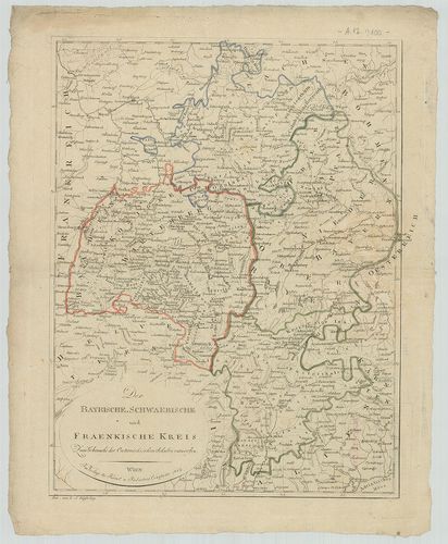
| Title | Der Bayrische, Schwaebische und Fraenkische Kreis. |
| Main title | Bajorország, Svábföld és Frankföld térképe 1807-ben. |
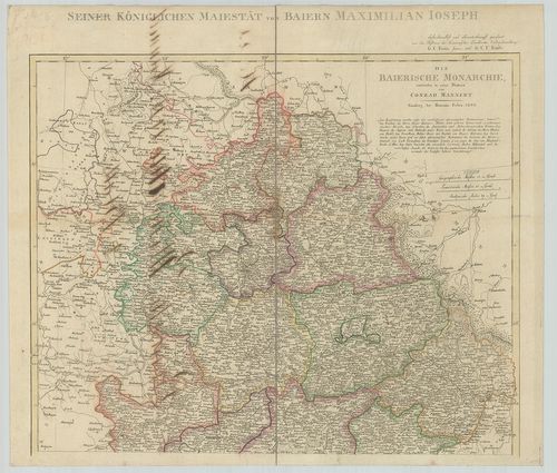
1982. Charte von dem Königreiche Bayern. [B IV a 410]
Institute and Museum of Military History •
B IV a
•
B IV Német birodalom
•
B I–XV. Európa
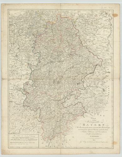
| Title | Charte von dem Königreiche Bayern. |
| Main title | A Bajor Királyság térképe 1807-ben. |
1983. Karte vom Königreich Baiern. [B IV a 411]
Institute and Museum of Military History •
B IV a
•
B IV Német birodalom
•
B I–XV. Európa
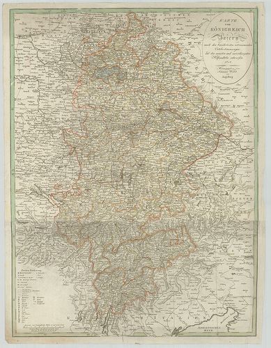
| Title | Karte vom Königreich Baiern. |
| Main title | A Bajor Királyság térképe 1808-ban. |
1984. Karte vom Königreich Baiern… [B IV a 411/1]
Institute and Museum of Military History •
B IV a
•
B IV Német birodalom
•
B I–XV. Európa
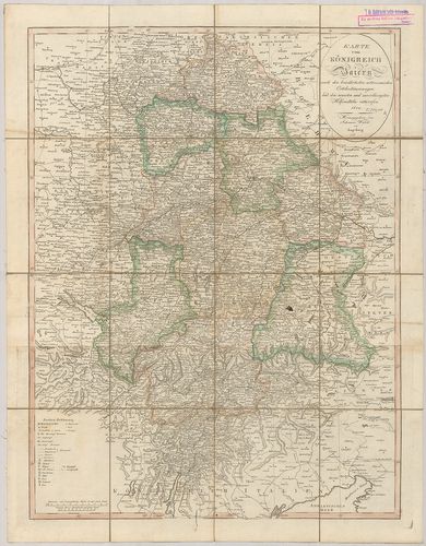
| Title | Karte vom Königreich Baiern… |
| Main title | A Bajor Királyság térképe 1812-ben, kerületi beosztással. |
1985. Militair Karte von Süd-Deutschland. [B IV a 411/2]
Institute and Museum of Military History •
B IV a
•
B IV Német birodalom
•
B I–XV. Európa
| Title | Militair Karte von Süd-Deutschland. |
| Main title | Dél-Németország katonai térképe. |
1986. Die Baierische Monarchie. [B IV a 412]
Institute and Museum of Military History •
B IV a
•
B IV Német birodalom
•
B I–XV. Európa
| Title | Die Baierische Monarchie. |
| Main title | A Bajor Királyság térképe kerületi beosztással 1808-ban. |
1987. Bayern, Württemberg und Baden. [B IV a 413]
Institute and Museum of Military History •
B IV a
•
B IV Német birodalom
•
B I–XV. Európa
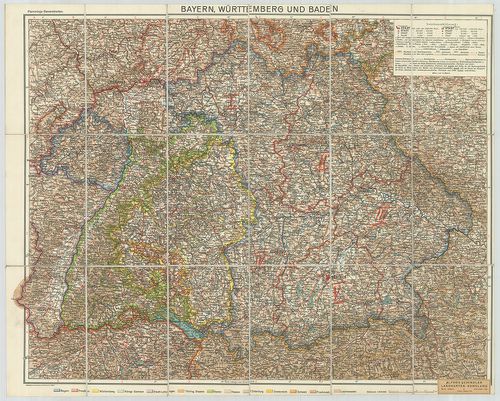
| Title | Bayern, Württemberg und Baden. |
| Main title | Bajorország, Württemberg és Baden tartományok térképe. |
1988. [Bajorország.] Haidhausen-Isen környékének topográfiai térké... [B IV a 414]
Institute and Museum of Military History •
B IV a
•
B IV Német birodalom
•
B I–XV. Európa
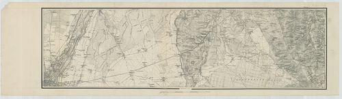
| Title | [Bajorország.] Haidhausen-Isen környékének topográfiai térképe. |
1989. Neueste Karte von Bayern, Württemberg, Baden und Hohenzoller... [B IV a 416]
Institute and Museum of Military History •
B IV a
•
B IV Német birodalom
•
B I–XV. Európa
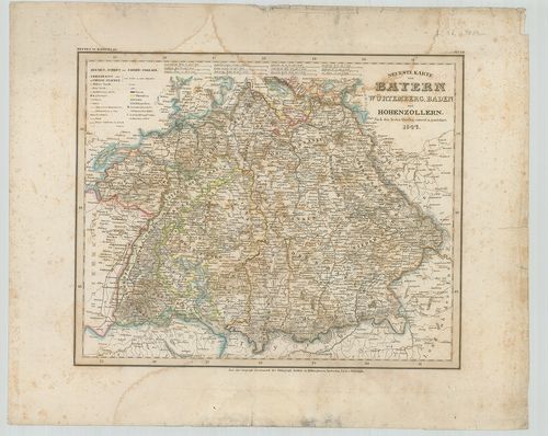
| Title | Neueste Karte von Bayern, Württemberg, Baden und Hohenzollern. |
| Main title | Bajorország, Württemberg, Baden és Hohenzollern tartományok térképe 1847-ben. |
1990. Carte del Palatinato di Baviera. [B IV a 417]
Institute and Museum of Military History •
B IV a
•
B IV Német birodalom
•
B I–XV. Európa

| Title | Carte del Palatinato di Baviera. |
| Main title | Bajorország térképe. |
1991. Das Königreich Bayern. [B IV a 420]
Institute and Museum of Military History •
B IV a
•
B IV Német birodalom
•
B I–XV. Európa
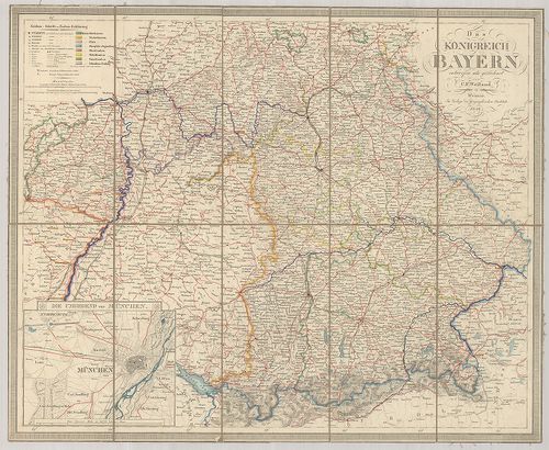
| Title | Das Königreich Bayern. |
| Main title | Mt.: Die Umgegend von München. (München és környéke.) |
| Subject | A Bajor Királyság térképe 1846-ban. |
1992. S. Rom. Imperii Circvli et Electoratvs Bavariae Tabvla Chorc... [B IV a 421]
Institute and Museum of Military History •
B IV a
•
B IV Német birodalom
•
B I–XV. Európa
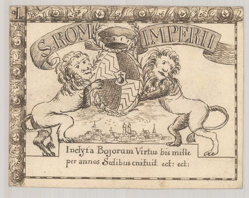
| Title | S. Rom. Imperii Circvli et Electoratvs Bavariae Tabvla Chorcographica. |
| Main title | A Bajor választófejedelemség térképe 1671-ben. |
1993. Electoratvs Bavariae Compendiosa delineato. Typvs Circuli Ba... [B IV a 421/1]
Institute and Museum of Military History •
B IV a
•
B IV Német birodalom
•
B I–XV. Európa
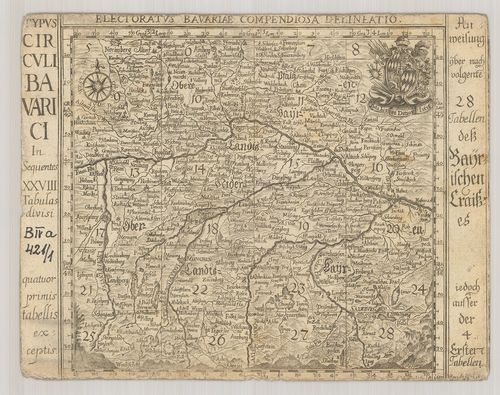
| Title | Electoratvs Bavariae Compendiosa delineato. Typvs Circuli Bavarici… |
| Main title | A Bajor választófejedelemség térképe 1684-ben. |
1994. Mappa Electoratus et Ducatus Bavariae Superioris et Inferior... [B IV a 422]
Institute and Museum of Military History •
B IV a
•
B IV Német birodalom
•
B I–XV. Európa
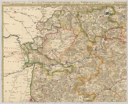
| Title | Mappa Electoratus et Ducatus Bavariae Superioris et Inferioris, Ducatus Neoburgensis cum Episcopatibus Frisingensi Ratisbonensi, Passaviensi et Praepositura Bergtolsgadensi… |
| Main title | A Bajor választófejedelemség, Neuburg hercegség, Passau püspökség, Berchtesgadeni prépostság térképe a 17. században. |
1995. Le Palatinat et Electorat du Rhein… [B IV a 423]
Institute and Museum of Military History •
B IV a
•
B IV Német birodalom
•
B I–XV. Európa
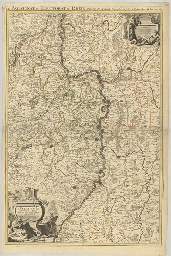
| Title | Le Palatinat et Electorat du Rhein… |
| Main title | A Rajna-Pfalz választófejedelemség térképe 1695-ben. |
1996. Partie Occidentale du Rhein le Duché de Simmeren, les Comtés... [B IV a 424]
Institute and Museum of Military History •
B IV a
•
B IV Német birodalom
•
B I–XV. Európa
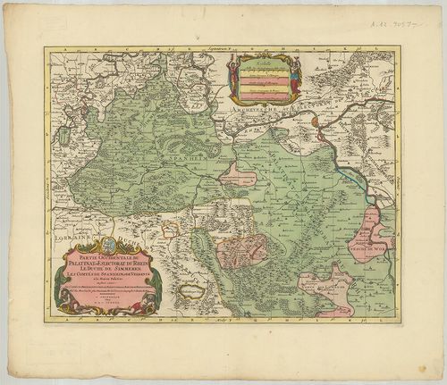
| Title | Partie Occidentale du Rhein le Duché de Simmeren, les Comtés de Spanheim et de Veldentz a la Maison Palatine. |
| Main title | A Rajna-Pfalz (Ny-i rész) választófejedelemség, Simmern hercegség. Sponheim és Veldenz grófság térképe. |
1997. Hassiae Svperioris et Wetterav… [B IV a 425]
Institute and Museum of Military History •
B IV a
•
B IV Német birodalom
•
B I–XV. Európa
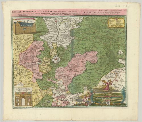
| Title | Hassiae Svperioris et Wetterav… |
| Main title | Felső-Hessen és Wetterau vidékének térképe 1746-ban. |
1998. Territorium Seculare Episcopatus Spirensis una cum terris ad... [B IV a 426]
Institute and Museum of Military History •
B IV a
•
B IV Német birodalom
•
B I–XV. Európa
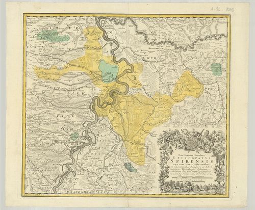
| Title | Territorium Seculare Episcopatus Spirensis una cum terris adiacentibus… |
| Main title | A Speyer-i püspökség térképe 1753-ban. |
1999. Delineatio aureae Sterilitatis Herciniensis i. e. Herciniae ... [B IV a 427]
Institute and Museum of Military History •
B IV a
•
B IV Német birodalom
•
B I–XV. Európa
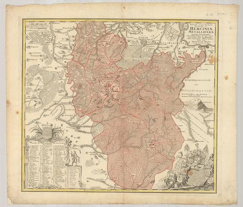
| Title | Delineatio aureae Sterilitatis Herciniensis i. e. Herciniae Metalliferae accurata Chorographia… |
| Main title | A Hercinai erdős-hegység térképe. |
2000. Territorium Seculare Episcopatvs Wormatiensis Tabula Geograp... [B IV a 428]
Institute and Museum of Military History •
B IV a
•
B IV Német birodalom
•
B I–XV. Európa
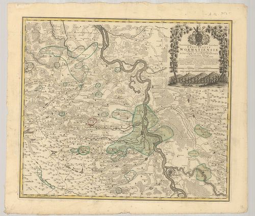
| Title | Territorium Seculare Episcopatvs Wormatiensis Tabula Geographica… |
| Main title | A Worms-i püspökség földrajzi térképe 1752-ben. |