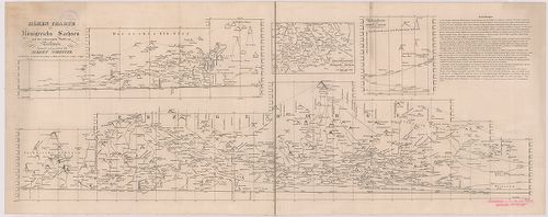
2221. Germany. Salzburg Sheet N. 48. – Köln Sheet K. 51. [B IV a 1051]
Institute and Museum of Military History •
B IV a
•
B IV Német birodalom
•
B I–XV. Európa
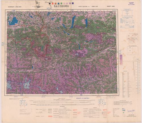
| Title | Germany. Salzburg Sheet N. 48. – Köln Sheet K. 51. |
| Main title | Németország: Salzburg (48.) és Köln (51) 1:250 000 ma. lapok. |
2222. Germany. Salzburg. Sheet X–7, Wels. Sheet X–8. [B IV a 1052]
Institute and Museum of Military History •
B IV a
•
B IV Német birodalom
•
B I–XV. Európa
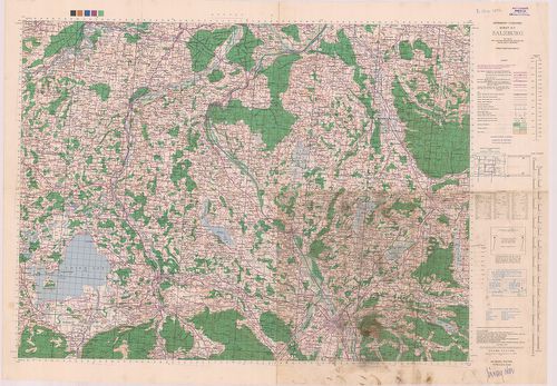
| Title | Germany. Salzburg. Sheet X–7, Wels. Sheet X–8. |
| Main title | Németország: Salzburg és Wels 1:100 000 ma. lapok. |
2223. Germany. Nürnberg Sheet M 50, Pilsen Sheet N 50, Prag Sheet ... [B IV a 1053]
Institute and Museum of Military History •
B IV a
•
B IV Német birodalom
•
B I–XV. Európa
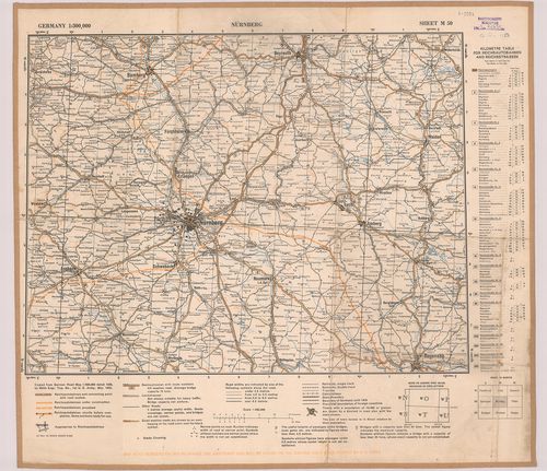
| Title | Germany. Nürnberg Sheet M 50, Pilsen Sheet N 50, Prag Sheet 0 50. |
| Main title | Németország: Nürnberg, Pilsen és Prága 1:300 000 ma. lapok. |
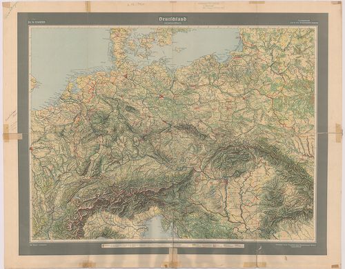
2224. Übersichtskarte-Deutsches Reich. Westhälfte-Osthälfte. [B IV a 1054]
Institute and Museum of Military History •
B IV a
•
B IV Német birodalom
•
B I–XV. Európa
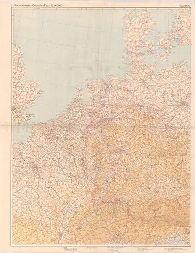
| Title | Übersichtskarte-Deutsches Reich. Westhälfte-Osthälfte. |
| Main title | A Német Birodalom térképe 1944-ben. |
2225. Topographische Karte von Bayern. [B IV a 1055]
Institute and Museum of Military History •
B IV a
•
B IV Német birodalom
•
B I–XV. Európa
| Title | Topographische Karte von Bayern. |
2226. Mansfeldiae Comitatus Descriptio. [B IV a 1056]
Institute and Museum of Military History •
B IV a
•
B IV Német birodalom
•
B I–XV. Európa
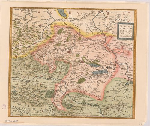
| Title | Mansfeldiae Comitatus Descriptio. |
| Main title | Mansfelt tartomány (Németo.) térképe a XVI. sz.-ból. |
2227. Die Erste Landesaufnahme der Kurfürstentums Sachsen 1586–163... [B IV a 1057]
Institute and Museum of Military History •
B IV a
•
B IV Német birodalom
•
B I–XV. Európa
| Title | Die Erste Landesaufnahme der Kurfürstentums Sachsen 1586–1633. Tafel IX., X. |
| Main title | A Szász választófejedelemségek első felmérésének részlete. IX. X. tábla. 1586–1633-ból. |
2228. Berlin. [B IV a 1058]
Institute and Museum of Military History •
B IV a
•
B IV Német birodalom
•
B I–XV. Európa
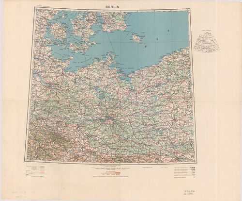
| Title | Berlin. |
2229. Neu Hand- und Wandkarte des Deutschlen Reich und der nachbar... [B IV a 1059]
Institute and Museum of Military History •
B IV a
•
B IV Német birodalom
•
B I–XV. Európa
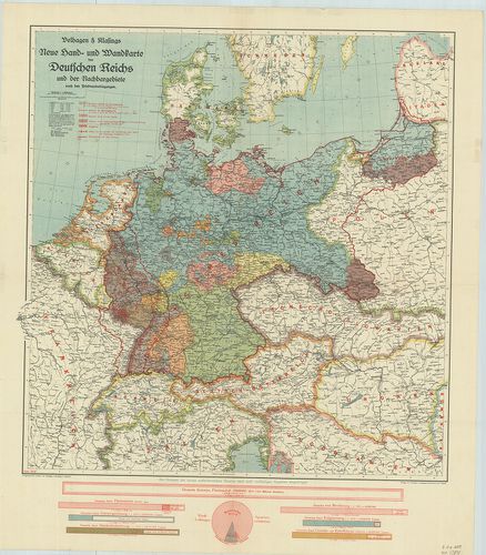
| Title | Neu Hand- und Wandkarte des Deutschlen Reich und der nachbargebirte … |
| Main title | A Német Birodalom és környezete a békeszerződések után 1919 júniusában. A határok tervezete. |
2230. [Németország.] 1:50 000 ma. UTM sorozat 8 szelvénye. [B IV a 1060]
Institute and Museum of Military History •
B IV a
•
B IV Német birodalom
•
B I–XV. Európa
| Title | [Németország.] 1:50 000 ma. UTM sorozat 8 szelvénye. |
2231. [Németország.] 1:100 000 ma. UTM sorozat 12 szelvénye. [B IV a 1061]
Institute and Museum of Military History •
B IV a
•
B IV Német birodalom
•
B I–XV. Európa
| Title | [Németország.] 1:100 000 ma. UTM sorozat 12 szelvénye. |
2232. Das Deutsche Reich nach dem Pressburger Frieden. [B IV a 1062]
Institute and Museum of Military History •
B IV a
•
B IV Német birodalom
•
B I–XV. Európa
| Title | Das Deutsche Reich nach dem Pressburger Frieden. |
| Main title | A Német Birodalom térképe a Pozsonyi béke után (1805). |
2233. Bavariae… [B IV a 1063]
Institute and Museum of Military History •
B IV a
•
B IV Német birodalom
•
B I–XV. Európa
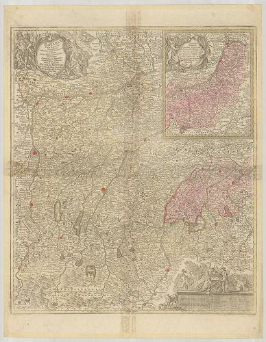
| Title | Bavariae… |
| Main title | Bajorország térképe. |
2234. Topographische Karte (Bajoro., Baden-Württemberg) [B IV a 1064]
Institute and Museum of Military History •
B IV a
•
B IV Német birodalom
•
B I–XV. Európa
| Title | Topographische Karte (Bajoro., Baden-Württemberg) |
2235. Bavariae Pars Inferior tam in sua Regimina Generalia quam in... [B IV a 1066]
Institute and Museum of Military History •
B IV a
•
B IV Német birodalom
•
B I–XV. Európa
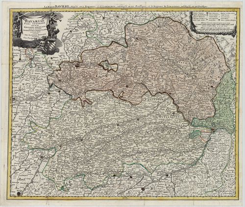
| Title | Bavariae Pars Inferior tam in sua Regimina Generalia quam in eorundem Praefecturas Particulares… |
| Main title | Bajorország térképe (Straubing és Landhut, német kormányzóságok) a 18. században. |
2236. Central Europe. U 1 szelvény. [B IV a 1067]
Institute and Museum of Military History •
B IV a
•
B IV Német birodalom
•
B I–XV. Európa
| Title | Central Europe. U 1 szelvény. |
| Main title | Közép-Európa, angol háborús térkép 1 szelvénye. |
2237. Deutschland Geländebildkarte. [B IV b 12]
Institute and Museum of Military History •
B IV b
•
B IV Német birodalom
•
B I–XV. Európa
| Title | Deutschland Geländebildkarte. |
| Main title | Németország és a környező államok áttekintő térképe 1944. VI. 29-i határokkal. |
2238. Höhen-Karte des Königreichs Sachsen und des anstossenden The... [B IV b 17]
Institute and Museum of Military History •
B IV b
•
B IV Német birodalom
•
B I–XV. Európa
| Title | Höhen-Karte des Königreichs Sachsen und des anstossenden Theiles von Böhmen. |
| Main title | 3 mt.: 1. Das rechte Elb-Ufer (Az Elba-jobbpartjának hegységei.) 2. Übersichtscharte vom Königreiche Sachsen. (A Szász Királyság áttekintő térképe.) 3. Nebencharte für das Gebiet der Neisse. (Melléktérkép a Neisse vidékről.)A Szász Királyság hegyvidékének orográfiai térképe az 1883 körül. |
2239. Karte vom Erzgebirge. [B IV b 18]
Institute and Museum of Military History •
B IV b
•
B IV Német birodalom
•
B I–XV. Európa
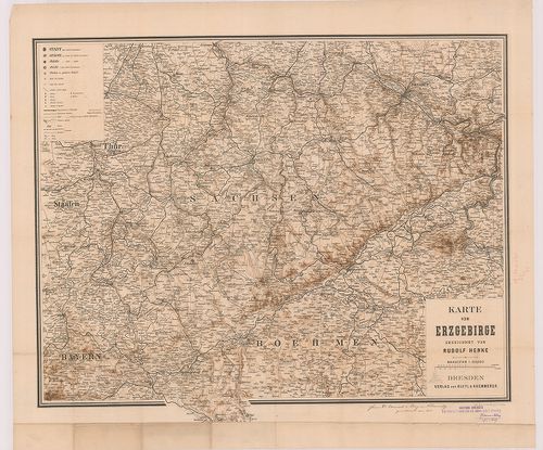
| Title | Karte vom Erzgebirge. |
| Main title | A Szász Érchegység térképe. |
2240. Harz-Gebirge. [B IV b 19]
Institute and Museum of Military History •
B IV b
•
B IV Német birodalom
•
B I–XV. Európa
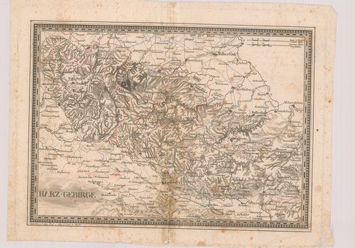
| Title | Harz-Gebirge. |
| Main title | A Harz-hegység térképe. |