2561. Bad Frankenhausen und Umgebung. Wanderkarte. Nr. 851. [B IV c 386]
Institute and Museum of Military History •
B IV c
•
B IV Német birodalom
•
B I–XV. Európa
| Title | Bad Frankenhausen und Umgebung. Wanderkarte. Nr. 851. |
2562. Mecklenburger Seenplatte mit Neubrandenburg, Neustrelitz, Wa... [B IV c 389]
Institute and Museum of Military History •
B IV c
•
B IV Német birodalom
•
B I–XV. Európa
| Title | Mecklenburger Seenplatte mit Neubrandenburg, Neustrelitz, Waren. |
2563. Bezirkskarte. Deutsche Demorkatische Republik. [B IV c 390]
Institute and Museum of Military History •
B IV c
•
B IV Német birodalom
•
B I–XV. Európa
| Title | Bezirkskarte. Deutsche Demorkatische Republik. |
2564. Wegekarte des Deutsch-Französischen Grenzgebietes. [B IV c 391]
Institute and Museum of Military History •
B IV c
•
B IV Német birodalom
•
B I–XV. Európa
| Title | Wegekarte des Deutsch-Französischen Grenzgebietes. |
2565. C. Opitz, Reise- und Eisenbahnkarte von Deutschland [B IV c 392]
Institute and Museum of Military History •
B IV c
•
B IV Német birodalom
•
B I–XV. Európa

| Title | C. Opitz, Reise- und Eisenbahnkarte von Deutschland |
| Main title | Németország vasútvonalai. |
2566. Karte des deutsch-französisch-belgischen Krieges. [B IV c 393]
Institute and Museum of Military History •
B IV c
•
B IV Német birodalom
•
B I–XV. Európa
| Title | Karte des deutsch-französisch-belgischen Krieges. |
| Main title | 2 mt.: 1. Észak-Franciaország. 2. Párizs és körny. |
2567. Öffentliche Gasversorgung – Public Gas Supply. [B IV c 394]
Institute and Museum of Military History •
B IV c
•
B IV Német birodalom
•
B I–XV. Európa
| Title | Öffentliche Gasversorgung – Public Gas Supply. |
2568. Postcurs von, Deutschland und einigen angränzenden Ländern. [B IV c 395]
Institute and Museum of Military History •
B IV c
•
B IV Német birodalom
•
B I–XV. Európa
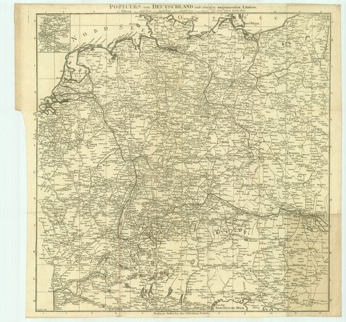
| Title | Postcurs von, Deutschland und einigen angränzenden Ländern. |
| Main title | 1 mt.: Route und Environs von Paris (Párizs környéke és útjai).. |
| Subject | Németország és a környező országok postaútjai. |
2569. Post und Strassen Karte von Deutschland und dep Nachbar Staa... [B IV c 396]
Institute and Museum of Military History •
B IV c
•
B IV Német birodalom
•
B I–XV. Európa
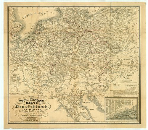
| Title | Post und Strassen Karte von Deutschland und dep Nachbar Staaten bis London Warschau und Rom. |
| Main title | Németország posta és úttérképe a környező országokkal London, Varsó és Róma vonalában. |
2570. Flemmings Spezialkarte für den Deutsch–Russischen Krieg. [B IV c 397]
Institute and Museum of Military History •
B IV c
•
B IV Német birodalom
•
B I–XV. Európa
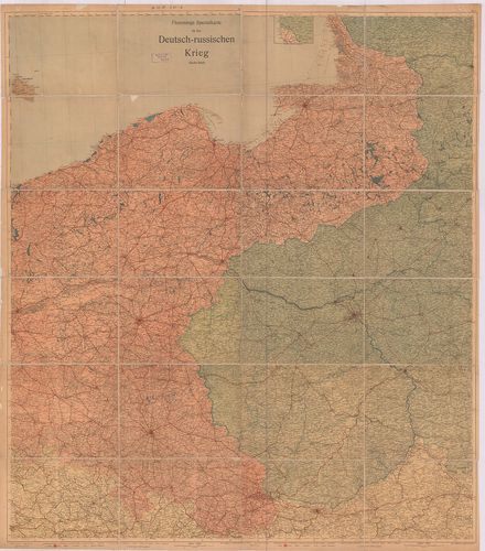
| Title | Flemmings Spezialkarte für den Deutsch–Russischen Krieg. |
| Main title | A német–orosz háború térképe. |
2571. Freytags Übersichtskarte des Deutsch–Russischen Kriegsschaup... [B IV c 398]
Institute and Museum of Military History •
B IV c
•
B IV Német birodalom
•
B I–XV. Európa
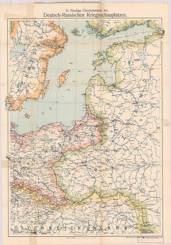
| Title | Freytags Übersichtskarte des Deutsch–Russischen Kriegsschauplatzes. |
| Main title | A német–orosz hadszíntér áttekintő térképe. |
2572. Verkehrskarte Deutsche Demokratische Republik. [B IV c 399]
Institute and Museum of Military History •
B IV c
•
B IV Német birodalom
•
B I–XV. Európa
| Title | Verkehrskarte Deutsche Demokratische Republik. |
2573. Német Demokratikus Köztársaság. Német Szövetségi Köztársaság... [B IV c 400]
Institute and Museum of Military History •
B IV c
•
B IV Német birodalom
•
B I–XV. Európa
| Title | Német Demokratikus Köztársaság. Német Szövetségi Köztársaság, Nyugat-Berlin autótérképe. |
2574. Német Demokratikus Köztársaság, Nyugat-Berlin autótérképe. [B IV c 401]
Institute and Museum of Military History •
B IV c
•
B IV Német birodalom
•
B I–XV. Európa
| Title | Német Demokratikus Köztársaság, Nyugat-Berlin autótérképe. |
| Main title | 1 mt.: Kishatárforgalom az NDK és NSZK között. |
2575. Karte der Vogesen. Blatt XII. Odilienberg-Hohwald. [B IV c 402]
Institute and Museum of Military History •
B IV c
•
B IV Német birodalom
•
B I–XV. Európa
| Title | Karte der Vogesen. Blatt XII. Odilienberg-Hohwald. |
2576. Eisenbahn Karte von Deutschland und Nachbarländern. [B IV c 403]
Institute and Museum of Military History •
B IV c
•
B IV Német birodalom
•
B I–XV. Európa
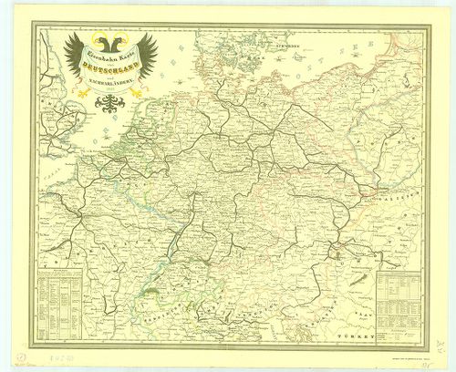
| Title | Eisenbahn Karte von Deutschland und Nachbarländern. |
| Main title | Németország és a környező területek vasúttérképe 1849-ből. |
2577. Neuste-Reise-Karte von Deutschland und der angrenzenden Länd... [B IV c 404]
Institute and Museum of Military History •
B IV c
•
B IV Német birodalom
•
B I–XV. Európa
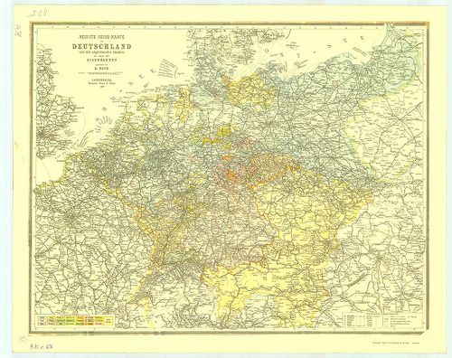
| Title | Neuste-Reise-Karte von Deutschland und der angrenzenden Ländern mit Angabe aller Eisenbahnen. |
| Main title | Németország és a környező országok útitérképe, valamennyi vasútvonal feltüntetésével 1899-ből. |
2578. Die Verwaltungsbezirke des Deutschehn Reichs nach dem Stand ... [B IV c 405]
Institute and Museum of Military History •
B IV c
•
B IV Német birodalom
•
B I–XV. Európa
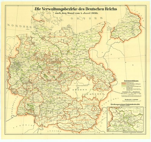
| Title | Die Verwaltungsbezirke des Deutschehn Reichs nach dem Stand vom 1. Juni 1939. |
| Main title | Németország közigazgatási beosztása 1939. jún. 1-jétől. |
2579. Luftverkehrkarte des Deutschen Reiches. [B IV c 406]
Institute and Museum of Military History •
B IV c
•
B IV Német birodalom
•
B I–XV. Európa
| Title | Luftverkehrkarte des Deutschen Reiches. |
| Main title | A Német Birodalom légiforgalmi térképe. |
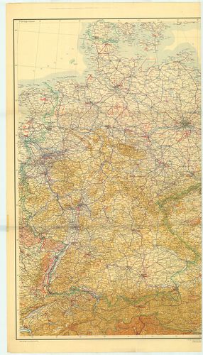
2580. Deutschland-Karte. [B IV c 407]
Institute and Museum of Military History •
B IV c
•
B IV Német birodalom
•
B I–XV. Európa
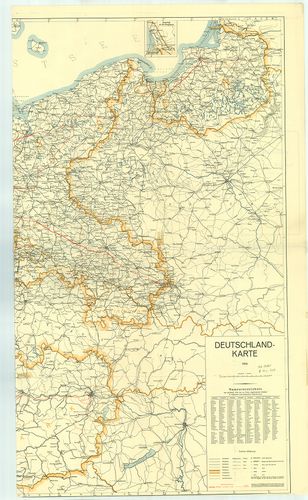
| Title | Deutschland-Karte. |
| Main title | 1 mt.: Memel vidéke. |
| Subject | Németország térképe 1939-ből. A kész és a tervezett autópályákkal. (Alaptérkép 1935. Helyesbítése 1939. január.) |